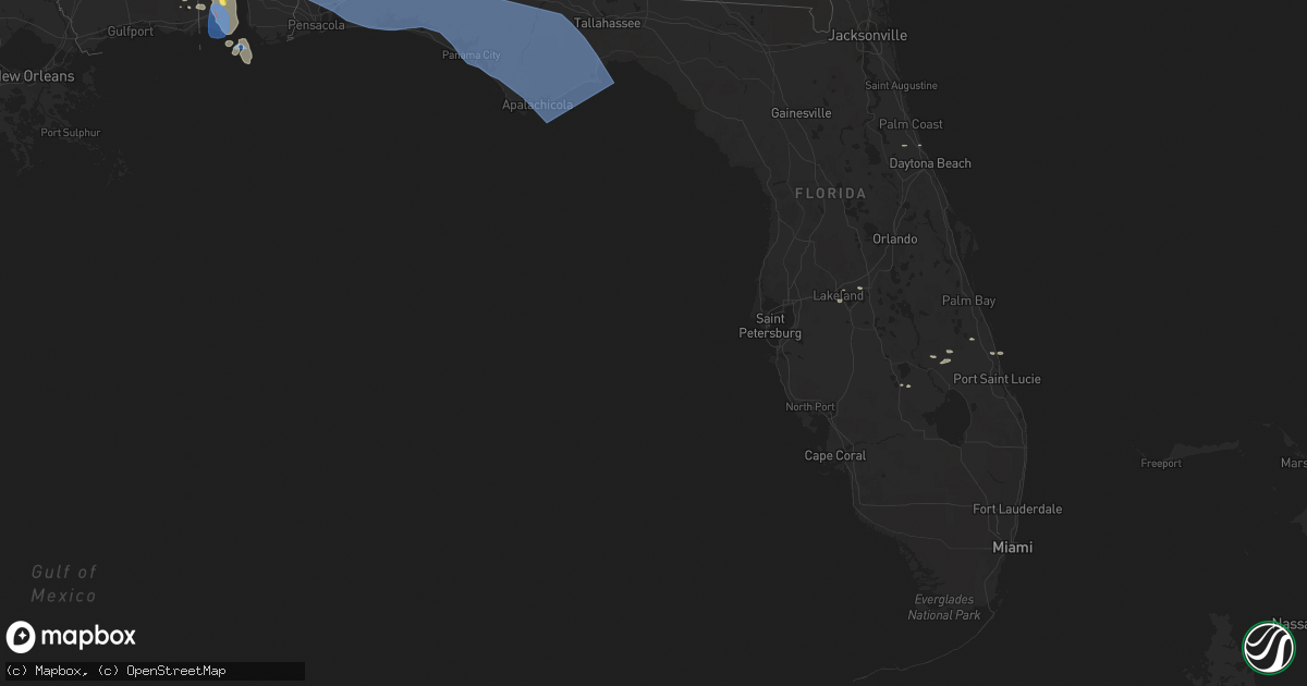
Hail Map in Florida on June 16, 2023
Get this storm
June 16 map
$229
one time, instant access
Download today. No call, no setup
Keep the $229
Bought the map and want the full workflow? Apply the entire $229 to a subscription within 7 days. None of it is wasted.
Every map, not just this one
This buys you this map. Subscription and you get every map we run, in the markets you choose from a few cities to whole states to nationwide. Plus real-time alerts the moment a storm fires.
Contact data
Name, contact info, occupancy, even credit band for addresses in the footprint. You go from where it hit to who to call.
Become the source they trust
Unlimited branding weather history reports on demand. You already have the documented answer ready for the property owner, and you are the one who showed up with it.
Property data and RoofTrace estimates
Pull up any address you have got, its value and the exact code rules for that jurisdiction, straight from One Click Code. Then RoofTrace estimates the squares, pitch, and roof value, priced the way you price.
Storm reports in Florida
Florida
| Date | Description |
|---|---|
| 06/16/20232:45 PM CDT | Tree down across sr 100 blocking traffic about 10 miles west of bunnell. |
| 06/16/20231:30 PM CDT | Corrects previous tstm wnd dmg report from 4 ssw winfield. Large tree uprooted and fell on a house along nw irene lane. Damage unknown. Photo was relayed via columbia c |
| 06/16/20231:30 PM CDT | Large tree uprooted and fell on a house. Damage unknown. Photo was relayed via columbia county fire department. Time was estimated by radar. |
| 06/16/20231:25 PM CDT | A large tree snapped and fell across sw prairie st. Photo was relayed via columbia county fire. Time was estimated by radar. |
| 06/16/20231:00 PM CDT | Power lines were down along highway 19 between old town and cross city. |
| 06/16/202312:21 PM CDT | A couple of trees were blown down along beach road. |
| 06/16/202311:30 AM CDT | Wakulla dispatch is getting reports of multiple trees and lines down across the county. |
| 06/16/202310:50 AM CDT | A few trees were blown down on highway 65. |
| 06/16/202310:48 AM CDT | Trees are on powerlines on sr71 near five acre farms in gulf county. |
| 06/16/202310:40 AM CDT | Downed trees. |
| 06/16/202310:35 AM CDT | Tree down on highway 71 near ashley shiver road. |
| 06/16/202310:30 AM CDT | Tree down on nw county road 275. |
| 06/16/202310:20 AM CDT | Window blown out in youngstown with siding damage as well. |
| 06/16/202310:19 AM CDT | Ambient station gusted to 58 mph. |
| 06/16/202310:17 AM CDT | Awos station kpam tyndall afb. |
| 06/16/202310:17 AM CDT | Ambient station gusted to 72 mph. |
| 06/16/202310:15 AM CDT | Estimated 70 mph gust with trees down. |
| 06/16/202310:15 AM CDT | Mesonet station dvi01033 panama city. |
| 06/16/202310:13 AM CDT | Roof damage in the st andrews area. |
| 06/16/202310:10 AM CDT | Lake marin ambient station gusted to 75 mph. |
| 06/16/202310:09 AM CDT | Gulf coast state college weatherstem. |
| 06/16/202310:00 AM CDT | Lots of down trees... Power lines... And a collapsed house just reported from washington county fl. |
| 06/16/20239:58 AM CDT | Asos station kecp panama city. |
| 06/16/20239:55 AM CDT | Fallen tree in vernon. |
| 06/16/20239:52 AM CDT | Numerous trees and power lines down. |
| 06/16/20239:46 AM CDT | Walton county so reports a road closure of sr-81 from the walton / holmes county line to county rd-181 in walton county... Approximately a 3 mile stretch of the roadway |
| 06/16/20239:40 AM CDT | Several trees down in the freeport area. |
| 06/16/20239:39 AM CDT | Corrects previous tstm wnd gst report from 2 ese destin. Severe wind gust at kdts in destin... Fl. |
| 06/16/20239:38 AM CDT | Walton county reports a road closure of us-98 in miramar beach between seascape dr and poinciana blvd due to traffic lights offline and powerlines down. |
| 06/16/20239:32 AM CDT | Severe wind gust at kdts in destin... Fl. |
| 06/16/20239:32 AM CDT | Numerous trees and power lines down across walton county. |
| 06/16/20239:31 AM CDT | Report from mping: 1-inch tree limbs broken; shingles blown off. |
| 06/16/20239:30 AM CDT | Severe wind gust measured at khrt. |
| 06/16/20239:22 AM CDT | Severe wind gusts of 53 kts at kvps. |
| 06/16/20239:14 AM CDT | Severe wind gust observed at kcew. |
| 06/16/20239:14 AM CDT | Severe wind gust observed at kcew. |
| 06/16/20239:10 AM CDT | Tree reported down on a house. Time estimated by radar. |
| 06/16/20238:45 AM CDT | Several snapped trees reported in berrydale on letcher lblack road... Uprooted trees as well. Time estimated by radar. |
| 06/16/20238:40 AM CDT | Trees down. |
| 06/16/20238:25 AM CDT | Multiple pine trees snapped. |
| 06/16/20237:55 AM CDT | Tempest weather station measures 73mph wind gust at 7:55am cdt. |
| 06/16/20237:55 AM CDT | Tlennan tx 3161 9725 waco asos reports 51kt/59mph wind gust as of 6:55pm. |
All States Impacted by Hail Map on June 16, 2023
Cities Impacted by Hail Map on June 16, 2023
- Nevada, TX
- Celeste, TX
- Quinlan, TX
- Farmersville, TX
- Caddo Mills, TX
- Princeton, TX
- Greenville, TX
- Lavon, TX
- Rockwall, TX
- Terrell, TX
- Royse City, TX
- Allen, TX
- Leonard, TX
- Plano, TX
- Blue Ridge, TX
- Wylie, TX
- Mckinney, TX
- Frisco, TX
- Kaufman, TX
- Wills Point, TX
- Scroggins, TX
- Lone Oak, TX
- Klondike, TX
- Como, TX
- Dike, TX
- Quitman, TX
- Emory, TX
- Yantis, TX
- Sulphur Springs, TX
- Brashear, TX
- Pickton, TX
- Point, TX
- Alba, TX
- Wolfe City, TX
- Edgewood, TX
- Mount Pleasant, TX
- Commerce, TX
- Winfield, TX
- Campbell, TX
- Saltillo, TX
- Winnsboro, TX
- Cumby, TX
- Mount Vernon, TX
- Pecan Gap, TX
- Cooper, TX
- Talco, TX
- Ladonia, TX
- Sulphur Bluff, TX
- Lake Creek, TX
- Bogata, TX
- Deport, TX
- Collinsville, TX
- Tioga, TX
- Gainesville, TX
- Muenster, TX
- Saint Jo, TX
- Pilot Point, TX
- Celina, TX
- Sanger, TX
- Gunter, TX
- Anna, TX
- Van Alstyne, TX
- Montague, TX
- Forestburg, TX
- Rosston, TX
- Aubrey, TX
- Era, TX
- Melissa, TX
- Valley View, TX
- Prosper, TX
- Lindsay, TX
- Howe, TX
- Thackerville, OK
- Bonham, TX
- Whitewright, TX
- Bailey, TX
- Ector, TX
- Tom Bean, TX
- Savoy, TX
- Whitesboro, TX
- Sadler, TX
- Randolph, TX
- Trenton, TX
- Bells, TX
- Sherman, TX
- Little Elm, TX
- Nocona, TX
- Wilburton, OK
- Quinton, OK
- Red Oak, OK
- Richton, MS
- Waynesboro, MS
- State Line, MS
- Buckatunna, MS
- Leakesville, MS
- Millry, AL
- Silas, AL
- Neely, MS
- Chatom, AL
- Gilbertown, AL
- Wister, OK
- Talihina, OK
- Heavener, OK
- Nashoba, OK
- Frankville, AL
- Deer Park, AL
- Fruitdale, AL
- Vinegar Bend, AL
- Coffeeville, AL
- Grove Hill, AL
- Jackson, AL
- Thomasville, AL
- Whatley, AL
- Saint Stephens, AL
- Mount Vernon, AL
- Little River, AL
- Stockton, AL
- Gainestown, AL
- Leroy, AL
- Uriah, AL
- Wagarville, AL
- Sunflower, AL
- Tibbie, AL
- McIntosh, AL
- Bay Minette, AL
- Chunchula, AL
- Citronelle, AL
- Axis, AL
- Creola, AL
- McDavid, FL
- Atmore, AL
- Perdido, AL
- Moss Point, MS
- Grand Bay, AL
- Coden, AL
- Bayou La Batre, AL
- Irvington, AL
- Theodore, AL
- Mobile, AL
- Robertsdale, AL
- Milton, FL
- Cantonment, FL
- Flomaton, AL
- Century, FL
- Molino, FL
- Jay, FL
- Andalusia, AL
- Holt, FL
- Brewton, AL
- Repton, AL
- Vredenburgh, AL
- Lenox, AL
- Wing, AL
- Bagdad, FL
- Evergreen, AL
- Franklin, AL
- Frisco City, AL
- Castleberry, AL
- Range, AL
- Monroeville, AL
- Baker, FL
- Florala, AL
- Crestview, FL
- Kinston, AL
- Red Level, AL
- Lockhart, AL
- Laurel Hill, FL
- Opp, AL
- Gulf Shores, AL
- Eglin Afb, FL
- Defuniak Springs, FL
- Samson, AL
- Valparaiso, FL
- Freeport, FL
- Niceville, FL
- Ponce De Leon, FL
- Ebro, FL
- Westville, FL
- Youngstown, FL
- Chipley, FL
- Fountain, FL
- Panama City, FL
- Vernon, FL
- Panama City Beach, FL
- Alford, FL
- Bonifay, FL
- Caryville, FL
- Cottondale, FL
- Lynn Haven, FL
- Wewahitchka, FL
- Port Saint Joe, FL
- Blountstown, FL
- Clarksville, FL
- Altha, FL
- Marianna, FL
- Hurlburt Field, FL
- Fort Walton Beach, FL
- Mary Esther, FL
- Navarre, FL
- Shalimar, FL
- Miramar Beach, FL
- Santa Rosa Beach, FL
- Destin, FL
- Bristol, FL
- Hosford, FL
- Quincy, FL
- Apalachicola, FL
- Telogia, FL
- Eastpoint, FL
- Panacea, FL
- Crawfordville, FL
- Tallahassee, FL
- Sopchoppy, FL
- Lanark Village, FL
- Carrabelle, FL
- New Castle, DE
- Pennsville, NJ
- Penns Grove, NJ
- Pedricktown, NJ
- Wilmington, DE
- Elmer, NJ
- Alloway, NJ
- Bridgeton, NJ
- Woodstown, NJ
- Monroeville, NJ
- Newfield, NJ
- Pemberton, NJ
- Browns Mills, NJ
- Vincentown, NJ
- Manchester Township, NJ
- Columbus, NJ
- Jobstown, NJ
- Wrightstown, NJ
- Joint Base Mdl, NJ
- Cookstown, NJ
- Chesterfield, NJ
- New Egypt, NJ
- Lakehurst, NJ
- Gloucester, VA
- Bethel, OK
- Wilmer, AL
- Semmes, AL
- Salem, NJ
- Smithville, OK
- McLain, MS
- Beaumont, MS
- Peach Bottom, PA
- Gore, OK
- Bear, DE
- Newark, DE
- Ellendale, DE
- Milford, DE
- Milton, DE
- Lincoln, DE
- Greenwood, DE
- Whiteford, MD
- Swedesboro, NJ
- Lucedale, MS
- Perkinston, MS
- Mena, AR
- Whitesboro, OK
- Clifton Forge, VA
- Broken Bow, OK
- Gibbstown, NJ
- Bridgeport, NJ
- Middletown, DE
- Williamstown, NJ
- Franklinville, NJ
- Darlington, MD
- Street, MD
- Drumore, PA
- Delta, PA
- Vandervoort, AR
- Cove, AR
- Watson, OK
- Hatfield, AR
- Dauphin Island, AL
- Conowingo, MD
- Airville, PA
- Lincoln University, PA
- Oxford, PA
- Cochranville, PA
- Eight Mile, AL
- Dozier, AL
- Nottingham, PA
- West Grove, PA
- Coatesville, PA
- Kennett Square, PA
- Kirkwood, PA
- Avondale, PA
- Quarryville, PA
- Toughkenamon, PA
- Rising Sun, MD
- Delaware City, DE
- Vineland, NJ
- Malaga, NJ
- Suffolk, VA
- Chesapeake, VA
- Portsmouth, VA
- Moseley, VA
- Midlothian, VA
- North, VA
- Chesterfield, VA
- Norfolk, VA
- Glasgow, VA
- Natural Bridge Station, VA
- Buena Vista, VA
- Lexington, VA
- Monroe, VA
- Richmond, VA
- Tyronza, AR
- Marked Tree, AR
- Petersburg, VA
- Colonial Heights, VA
- Chester, VA
- Plainview, AR
- Buckingham, VA
- Wingina, VA
- Dillwyn, VA
- Prince George, VA
- Farmville, VA
- Meherrin, VA
- Keysville, VA
- Jessieville, AR
- Fort Lee, VA
- Disputanta, VA
- Hopewell, VA
- Hot Springs Village, AR
- Green Bay, VA
- Burkeville, VA
- Lonsdale, AR
- Crewe, VA
- Victoria, VA
- Cumberland, VA
- South Boston, VA
- Halifax, VA
- Virgilina, VA
- Nelson, VA
- Buffalo Junction, VA
- Danville, VA
- Pelham, NC
- Blanch, NC
- Providence, NC
- Yanceyville, NC
- Hot Springs National Park, AR
- Benton, AR
- Semora, NC
- Leasburg, NC
- Powhatan, VA
- Amelia Court House, VA
- Rice, VA
- Jetersville, VA
- Blackstone, VA
- Malvern, AR
- Kenbridge, VA
- Spring Grove, VA
- Charles City, VA
- Winchester, VA
- Clear Brook, VA
- Stephenson, VA
- Berryville, VA
- Summit Point, WV
- Traskwood, AR
- Charles Town, WV
- Bluemont, VA
- Round Hill, VA
- Harpers Ferry, WV
- Clarksville, VA
- Church Road, VA
- Purcellville, VA
- Poyen, AR
- Prattsville, AR
- Memphis, TN
- Olive Branch, MS
- Southaven, MS
- Sheridan, AR
- Stevensburg, VA
- Elkwood, VA
- Locust Grove, VA
- Fredericksburg, VA
- Spotsylvania, VA
- Richardsville, VA
- Lignum, VA
- Sumerduck, VA
- Grapevine, AR
- Ramah, CO
- Simla, CO
- Carrollton, VA
- Agate, CO
- Limon, CO
- Fort Eustis, VA
- Newport News, VA
- Hernando, MS
- Coldwater, MS
- Aberdeen, MS
- Hamilton, MS
- New Albany, MS
- Blue Springs, MS
- Clifton, VA
- Fairfax, VA
- Centreville, VA
- Matheson, CO
- Columbus, MS
- Woodford, VA
- Caledonia, MS
- Holly Springs, MS
- Smithfield, VA
- Fort Monroe, VA
- Hampton, VA
- Senatobia, MS
- Virginia Beach, VA
- Hornersville, MO
- Arbyrd, MO
- Hugo, CO
- Genoa, CO
- Port Royal, VA
- Palmyra, VA
- Colorado Springs, CO
- Usaf Academy, CO
- Monument, CO
- Palmer Lake, CO
- Larkspur, CO
- New Augusta, MS
- Woodbridge, VA
- Steens, MS
- Fowler, CO
- Lorton, VA
- Indian Head, MD
- Fork Union, VA
- Columbia, VA
- Okolona, MS
- Houston, MS
- Amherst, NE
- Marbury, MD
- La Plata, MD
- Ethelsville, AL
- Millport, AL
- Primrose, NE
- Reform, AL
- Albion, NE
- Arriba, CO
- Model, CO
- Rocky Ford, CO
- Pomfret, MD
- Port Tobacco, MD
- Bel Alton, MD
- Champlain, VA
- Hustle, VA
- Flagler, CO
- Pueblo, CO
- La Junta, CO
- Warrior, AL
- Gardendale, AL
- Fredericksburg, TX
- Morris, AL
- Kimberly, AL
- Alpine, AL
- Talladega, AL
- Carrollton, AL
- Boone, CO
- Newman Grove, NE
- Pinson, AL
- Newellton, LA
- Port Gibson, MS
- Tappahannock, VA
- Turrell, AR
- Nettleton, MS
- Amory, MS
- Garrison, MO
- Mammoth Spring, AR
- Spalding, NE
- Ash Flat, AR
- Rogersville, MO
- Strafford, MO
- Lake George, CO
- Greeley, NE
- Lakeland, FL
- Smyrna, DE
- Byhalia, MS
- Charlottesville, VA
- Scottsville, VA
- Booneville, MS
- Baldwyn, MS
- Amherst, VA
- Holdrege, NE
- Bealeton, VA
- Goldvein, VA
- Hardy, AR
- Viola, AR
- Hamilton, AL
- Detroit, AL
- Beaverton, AL
- Sulligent, AL
- Blue Mountain, MS
- Ripley, MS
- Cordova, TN
- Manassas, VA
- Loomis, NE
- Ecru, MS
- Proctor, AR
- Kearney, NE
- Surry, VA
- Greenwood Springs, MS
- Smithville, MS
- Rockbridge Baths, VA
- Waverly, VA
- Roseland, VA
- Gladstone, VA
- Ashland, MS
- Bartlett, NE
- Ericson, NE
- Trumann, AR
- Paron, AR
- Sutherland, VA
- Natural Bridge, VA
- Mantachie, MS
- Tupelo, MS
- Guntown, MS
- Saltillo, MS
- Eads, TN
- Arlington, TN
- Germantown, TN
- Fayetteville, NC
- Bunnell, FL
- Elberon, VA
- Dendron, VA
- Eudora, AR
- Arrington, VA
- Williamsburg, VA
- Rector, AR
- Nesbit, MS
- Paragould, AR
- Chadds Ford, PA
- Sturkie, AR
- Salem, AR
- Senath, MO
- Ord, NE
- Scotia, NE
- Kaibeto, AZ
- Ava, MO
- Pontotoc, MS
- Tyro, VA
- Williford, AR
- Ravenden, AR
- Ravenden Springs, AR
- Dinwiddie, VA
- Dewitt, VA
- Funk, NE
- Clayton, NJ
- New Canton, VA
- Lake Alfred, FL
- Heth, AR
- Earle, AR
- Parkin, AR
- Crawfordsville, AR
- Shannon, MS
- Prairie, MS
- Lepanto, AR
- Moody, MO
- Caulfield, MO
- Culpeper, VA
- Elizabeth, AR
- Axtell, NE
- Ford, VA
- Collierville, TN
- West Point, MS
- Norwood, MO
- Durham, NC
- Elm Creek, NE
- Odessa, NE
- Lake Cormorant, MS
- Rehoboth Beach, DE
- Lewes, DE
- Houston, DE
- Harrington, DE
- Rapidan, VA
- Orange, VA
- Shonto, AZ
- Mason, TX
- Strathmere, NJ
- Sea Isle City, NJ
- Ocean City, NJ
- Rover, AR
- West Plains, MO
- Grand Island, NE
- Farwell, NE
- Elba, NE
- Piney River, VA
- Wilson, AR
- Marion, AR
- Drummonds, TN
- Millington, TN
- Joiner, AR
- West Memphis, AR
- Greenwich, NJ
- Berlin, MD
- Marmaduke, AR
- Windsor, VA
- Fort Pierce, FL
- Horn Lake, MS
- Hope Mills, NC
- McKenney, VA
- Hickory Flat, MS
- Big Island, VA
- Wasola, MO
- Squires, MO
- Brighton, TN
- Charlotte Court House, VA
- Foster, VA
- Vesuvius, VA
- Etta, MS
- Oxford, NE
- Prospect, VA
- Myrtle, MS
- Potts Camp, MS
- Lovingston, VA
- Guffey, CO
- Dyess, AR
- Ormond Beach, FL
- Saint Paul, NE
- Wolbach, NE
- Wilsons, VA
- Elkton, MD
- Parkdale, AR
- Birch Tree, MO
- Palmer, NE
- Petal, MS
- Ivor, VA
- Gordo, AL
- Waco, TX
- West, TX
- Eutaw, AL
- Elm Mott, TX
- Charlotte Hall, MD
- Faulkner, MD
- Warsaw, VA
- Dunnsville, VA
- Farnham, VA
- Mineral, VA
- Louisa, VA
- Kerrville, TX
- Buhl, AL
- Knoxville, AL
- Ralph, AL
- Fosters, AL
- Aliceville, AL
- Lancaster, VA
- De Kalb, MS
- Porterville, MS
- Lauderdale, MS
- Livingston, AL
- Axtell, TX
- Riesel, TX
- Gatesville, TX
- Copperas Cove, TX
- Fort Hood, TX
- Akron, AL
- Moundville, AL
- Boligee, AL
- Greensboro, AL
- York, AL
- Lorena, TX
- Chilton, TX
- Forkland, AL
- Woodway, TX
- Hewitt, TX
- Pine Hill, AL
- Arlington, AL
- Camden, AL
- Catherine, AL
- Mount Calm, TX
- Hubbard, TX
- Gillett, AR
- Tichnor, AR
- Snow Lake, AR
- Cuba, AL
- Tow, TX
- San Saba, TX
- Lampasas, TX
- Burnet, TX
- Bluffton, TX
- Buchanan Dam, TX
- Seibert, CO
- Trinidad, CO
- Arcadia, NE
- Toomsuba, MS
- Gunnison, MS
- Junction, TX
- Mountain Home, TX
- Mound Bayou, MS
- Merigold, MS
- Cleveland, MS
- Harper, TX
- Eddy, TX
- Lott, TX
- Boyle, MS
- Bruceville, TX
- Marlin, TX
- Troy, TX
- Oglesby, TX
- McGregor, TX
- Moody, TX
- Rosebud, TX
- Pine Apple, AL
- Bellamy, AL
- Silver City, MS
- Yazoo City, MS
- Louise, MS
- Shaw, MS
- Doddsville, MS
- Indianola, MS
- Sunflower, MS
- Moorhead, MS
- Burlington, TX
- Inverness, MS
- Cheyenne Wells, CO
- Arapahoe, CO
- Benton, MS
- Vaughan, MS
- Itta Bena, MS
- Bertram, TX
- Liberty Hill, TX
- Leander, TX
- Belzoni, MS
- Cruger, MS
- Tchula, MS
- Lexington, MS
- Canton, MS
- Cedar Park, TX
- Decatur, MS
- Hickory, MS
- Chunky, MS
- Meridian, MS
- Rose Hill, MS
- Louin, MS
- Austin, TX
- Round Rock, TX
- Cameron, TX
- Pritchett, CO
- Springfield, CO
- Vilas, CO
- Two Buttes, CO
- Walsh, CO
- Weskan, KS
- Grinnell, KS
- Hoxie, KS
- Sharon Springs, KS
- Wallace, KS
- Isola, MS
- Madison, MS
- Brandon, MS
- Flowood, MS
- Winona, KS
- Wiggins, MS
- London, TX
- Las Animas, CO
- Monument, KS
- Manter, KS
- Elkhart, KS
- Oakley, KS
- Pinola, MS
- Mendenhall, MS
- Magee, MS
- Hasty, CO
- Morland, KS
- Stromsburg, NE
- Bloomfield, NE
- Creighton, NE
- Pierce, NE
- Lumberton, MS
- Purvis, MS
- Woonsocket, SD
- Rexford, KS
- Brunswick, NE
- Royal, NE
- Selden, KS
- Oakdale, NE
- Elgin, NE
- Montross, VA
- Louisville, MS
- Preston, MS
- Shuqualak, MS
- Guide Rock, NE
- Ward, AL
- Jachin, AL
- Pennington, AL
- Butler, AL
- Ashland, AL
- Lineville, AL
- Vona, CO
- Pleasanton, NE
- Mason City, NE
- Miller, NE
- Tyndall, SD
- Childersburg, AL
- Union, MS
- Kempner, TX
- Comfort, TX
- Elbert, CO
- Franklin, VA
- Carrsville, VA
- Beatrice, AL
- Osmond, NE
- Emelle, AL
- Dora, AL
- Birmingham, AL
- Empire, AL
- Burlington, CO
- Unionville, VA
- Rhoadesville, VA
- Toxey, AL
- Marion, AL
- Gates, NC
- Sunbury, NC
- Corapeake, NC
- Kosciusko, MS
- Camden, MS
- Nanjemoy, MD
- Walnut Grove, MS
- Carthage, MS
- Sallis, MS
- Lisman, AL
- Needham, AL
- Marion, MS
- Kit Carson, CO
- Stratton, CO
- Karval, CO
- Hertford, NC
- Tyner, NC
- Coolidge, TX
- Llano, TX
- Anguilla, MS
- Hollandale, MS
- Mechanicsville, MD
- Sebastopol, MS
- Philadelphia, MS
- Penrose, CO
- Lometa, TX
- Ahoskie, NC
- Jasper, AL
- Cordova, AL
- Bumpass, VA
- Stuttgart, AR
- Altheimer, AR
- Rosedale, MS
- Quitman, MS
- Melvin, AL
- Shubuta, MS
- King George, VA
- Ethel, AR
- Bishopville, MD
- Showell, MD
- Whaleyville, MD
- Willards, MD
- Duncan, MS
- De Witt, AR
- Almyra, AR
- Niobrara, NE
- Chaptico, MD
- Newburg, MD
- Lake Placid, FL
- Edenton, NC
- Bethune, CO
- Okeechobee, FL
- Vero Beach, FL
- Tabor, SD
- Springfield, SD
- Ulm, AR
- Vincent, AL
- Sterrett, AL
- Minter, AL
- Greenville, AL
- Forest Home, AL
- Windsor, NC
- Beulah, MS
- Watson, AR
- Troy, VA
- Epes, AL
- Little Rock, MS
- Bremen, AL
- Welcome, MD
- Dickinson, AL
- Rush, CO
- Yoder, CO
- Partlow, VA
- Beaverdam, VA
- Alberta, AL
- Crawford, TX
- Caret, VA
- Roper, NC
- Creswell, NC
- Zuni, VA
- Laurel, MS
- Willow City, TX
- Westover, MD
- Aulander, NC
- Cofield, NC
- Alexander City, AL
- Kellyton, AL
- Hattiesburg, MS
- Saucier, MS
- Brooklyn, MS
- Callao, VA
- Hague, VA
- Newton, MS
- Conehatta, MS
- Killeen, TX
- Weems, VA
- Sylacauga, AL
- Goodwater, AL
- Poplarville, MS
- Paulding, MS
- Vossburg, MS
- Pachuta, MS
- Kinsale, VA
- Doss, TX
- Ovett, MS
- Heidelberg, MS
- Dawson, TX
- Alligator, MS
- Gattman, MS
- Fulton, MS
- North Loup, NE
- Temple, TX
- Hayden, AL
- Hazard, NE
- Briggs, TX
- Cherokee, TX
- Ruther Glen, VA
- Yorktown, VA
- Houlka, MS
- Mclean, NE
- Plymouth, NC
- Columbia, NC
- Milligan, NE
- Randolph, NE
- Plainville, KS
- Natoma, KS
- Hays, KS
- Colby, KS
- Hoskins, NE
- York, NE
- Waco, NE
- Red Cloud, NE
- Blue Hill, NE
- Kim, CO
- Wood River, NE
- Orleans, NE
- Atlanta, NE
- Penokee, KS
- Hill City, KS
- Grainfield, KS
- Bay Springs, MS
- Crystal Springs, MS
- Harrisville, MS
- Florence, MS
- Georgetown, MS
- Newhebron, MS
- Elwood, NE
- Lenora, KS
- Pearl, MS
- Orrville, AL
- Sardis, AL
- Dannebrog, NE
- Collinsville, MS
- Carson, MS
- Holly, CO
- Lexington, NE
- Soso, MS
- Pickens, MS
- Bentonia, MS
- Satsuma, AL
- Saraland, AL
- Daphne, AL
- Linden, AL
- Sweet Water, AL
- Pelahatchie, MS
- Columbia, MS
- Sumrall, MS
- Stringer, MS
- Axton, VA
- Campo, CO
- Braxton, MS
- Bassfield, MS
- Prentiss, MS
- Utica, MS
- Terry, MS
- Raymond, MS
- Enterprise, MS
- Ellisville, MS
- Park, KS
- Fort Deposit, AL
- Pelham, GA
- Rawlings, VA
- Syracuse, KS
- Flora, MS
- White Oak, NC
- Campbell, AL
- Stonewall, MS
- Ridgeland, MS
- Hazlehurst, MS
- Silver Creek, MS
- Mount Olive, MS
- Byram, MS
- Collins, MS
- Goodman, MS
- Lawrence, MS
- Moselle, MS
- McCracken, KS
- La Crosse, KS
- Liebenthal, KS
- Kismet, KS
- Smithfield, NE
- Hugoton, KS
- Overton, NE
- Great Bend, KS
- Beaver, OK
- Guymon, OK
- Hooker, OK
- Plains, KS
- Liberal, KS
- Albert, KS
- Pawnee Rock, KS
- Meade, KS
- Gate, OK
- Laverne, OK
- Pulaski, MS
- Raleigh, MS
- Morton, MS


