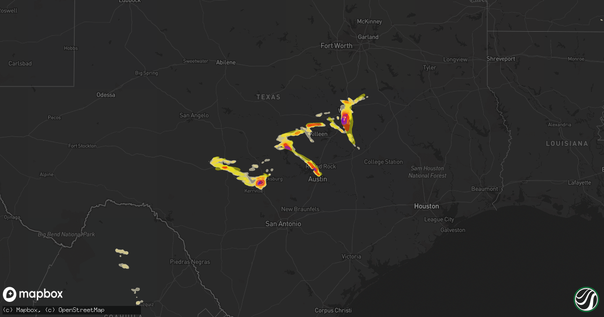
Hail Map on June 16, 2023
Get this storm
June 16 map
$229
one time, instant access
Download today. No call, no setup
Keep the $229
Bought the map and want the full workflow? Apply the entire $229 to a subscription within 7 days. None of it is wasted.
Every map, not just this one
This buys you this map. Subscription and you get every map we run, in the markets you choose from a few cities to whole states to nationwide. Plus real-time alerts the moment a storm fires.
Contact data
Name, contact info, occupancy, even credit band for addresses in the footprint. You go from where it hit to who to call.
Become the source they trust
Unlimited branding weather history reports on demand. You already have the documented answer ready for the property owner, and you are the one who showed up with it.
Property data and RoofTrace estimates
Pull up any address you have got, its value and the exact code rules for that jurisdiction, straight from One Click Code. Then RoofTrace estimates the squares, pitch, and roof value, priced the way you price.
States Impacted by Hail Map on June 16, 2023
Storm reports
Alabama
| Date | Description |
|---|---|
| 06/16/20236:59 PM CDT | Corrects previous tstm wnd dmg report from knoxville. Numerous trees were blown down on northbound and southbound i20/59. |
| 06/16/20236:58 PM CDT | Ema reports hen egg size hail in grove hill. Time using radar. |
| 06/16/20236:58 PM CDT | Ema reports windows blown out of a building due to wind driven hail. Time using radar. |
| 06/16/20236:56 PM CDT | Trees were blown down and blocking the roadway. |
| 06/16/20236:52 PM CDT | Large hardwood trees were blown down and blocking the roadway on speed mills road. |
| 06/16/20236:50 PM CDT | Tree down across i-20 near fosters. Time estimated by radar. |
| 06/16/20236:50 PM CDT | Numerous trees down on hwy 11... Some on houses and cars. Time estimated by radar. |
| 06/16/20236:27 PM CDT | Social media report of quarter size hail. |
| 06/16/20236:22 PM CDT | Ema reports 3 cars with busted windows and a home with busted windows from hail. Hail size estimated. |
| 06/16/20236:20 PM CDT | Social media photos and videos of dime to quarter size hail southwest of talladega. |
| 06/16/20236:18 PM CDT | A local report indicates 1.00 inch wind near 1 NE Palmerdale |
| 06/16/20236:09 PM CDT | A local report indicates 1.00 inch wind near 2 WNW Palmerdale |
| 06/16/20236:09 PM CDT | Corrects previous hail report from 2 wnw palmerdale. Social media photos of large hail in palmerdale. |
| 06/16/20236:06 PM CDT | Trees were blown down in gordo. At least one home sustained damage. |
| 06/16/20235:59 PM CDT | Hail up to golf ball size in ethelsville. |
| 06/16/20235:59 PM CDT | Corrects storm report type. Hail up to golf ball size in ethelsville. |
| 06/16/20235:50 PM CDT | Corrects previous hail report from 1 e morris. Quarter sized hail reported in morris. |
| 06/16/20235:50 PM CDT | Quarter sized hail reported in morris. |
| 06/16/20235:45 PM CDT | Hail up to quarter size. |
| 06/16/20235:40 PM CDT | Social media photo of baseball sized hail in the coalfire area near reform. |
| 06/16/20235:40 PM CDT | Hail up to 1 to 2 inches deep covering the ground. |
| 06/16/20235:26 PM CDT | Hail covering the ground. |
| 06/16/20235:26 PM CDT | Corrects previous hail report from forest. Hail covering the ground. |
| 06/16/20235:18 PM CDT | A few trees were blown down around sulligent. |
| 06/16/20235:18 PM CDT | A few trees were blown down around detroit. |
| 06/16/20235:12 PM CDT | A local report indicates 1.00 inch wind near Forest |
| 06/16/20235:12 PM CDT | A few trees were blown down near millport. |
| 06/16/20239:48 AM CDT | Several trees down in coffee county. |
| 06/16/20239:40 AM CDT | Several trees down in geneva county. |
| 06/16/20239:40 AM CDT | Near severe wind gusts at k0j4. |
| 06/16/20239:32 AM CDT | Near severe wind gusts at k79j. |
| 06/16/20239:17 AM CDT | Emergency manager relays widespread trees and powerlines down across the county. Time estimated by radar. |
| 06/16/20239:16 AM CDT | Public report with photo of a snapped pine tree on highway 84 between opp and andalusia. Time estimated by radar. |
| 06/16/20239:11 AM CDT | Report from em of tree falling onto a couple of cars. |
| 06/16/20238:45 AM CDT | Social media picture showing large tree fell on a church on sowell rd in brewte estimated from radar. |
| 06/16/20238:45 AM CDT | Social media picture showing large tree fell on a church on sowell rd in brewton al. Time using radar. |
| 06/16/20238:41 AM CDT | Uprooted tree and downed power line on douglas lane. Time estimated by radar. |
| 06/16/20238:40 AM CDT | Numerous trees and powerlines down. |
| 06/16/20238:40 AM CDT | Numerous trees and powerlines down. |
| 06/16/20238:40 AM CDT | Emergency manager reports widespread trees and powerlines down throughout the county. Time estimated by radar. |
| 06/16/20238:38 AM CDT | Social media report with photos of uprooted trees on appleton road. Time estimated by radar. |
| 06/16/20238:17 AM CDT | Public photo of multiple trees uprooted and some outbuilding structure damage. Time estimated by radar. |
| 06/16/20238:16 AM CDT | Trees down. |
| 06/16/20238:15 AM CDT | Measured wind gust by alabama a&m mesonet site located on perdido river farms between 90 to 100mph. Extensive damage also reported on the farms including multiple farm |
| 06/16/20238:00 AM CDT | Corrects previous tornado report from 3 e bucks. An unusual anticyclonic tornado began just west of the middle river associated with the anticyclonic bookend vortex of |
| 06/16/20238:00 AM CDT | Corrects previous tstm wnd dmg report from 4 e bucks. Report of a capsized tugboat on the mobile river with search and rescue. Time estimated by radar. |
| 06/16/20238:00 AM CDT | An unusual anticyclonic tornado began just west of the mobile river associated with the anticyclonic bookend vortex of a powerful mesoscale convective system moving acr |
| 06/16/20238:00 AM CDT | Report of a capsized barge on the mobile river with search and rescue. Possible tornado. Time estimated by radar. |
| 06/16/20238:00 AM CDT | Thunderstorm wind damage at this location including 2 vehicles with windows blown out... A small camper rolled... And tree down. Time estimated by radar. |
| 06/16/20237:55 AM CDT | Tree down on a residence centre st at irwin st in citronelle. Time using radar. |
| 06/16/20237:55 AM CDT | Broadcast media reports tress down with empty storage buildings flipped. Time estimated by radar. |
| 06/16/20237:52 AM CDT | Trees and power lines down. |
| 06/16/20237:50 AM CDT | Corrects previous tstm wnd gst report from 4 s barrytown. Clarke county ema estimates 60-70 mph winds near the intersection of u.s. Highway 43 and baugh rd. Numerous tr |
| 06/16/20237:50 AM CDT | Clarke county ema estimates 60-70 mph winds near the intersection of u.s. Highway 43 and baugh rd. Numerous tree limbs on the road. |
| 06/16/20237:42 AM CDT | Trees down and power outages south of dixons mills along hwy 43. |
| 06/16/20237:23 AM CDT | Emergency management reports roof damage to a building in the community of chatom. Time estimated from radar. |
| 06/16/202312:55 AM CDT | Tempest station recorded a wind gust of 53 knots. |
| 06/16/202312:28 AM CDT | Local chaser reports trees snapped... Powerlines down... And half of home roof missing d |
| 06/16/202312:28 AM CDT | Local chaser reports trees snapped... Powerlines down... And half of home roof missing due to possible tornado. |
| 06/16/202312:28 AM CDT | Local chaser reports trees snapped... Powerlines down... And half of home roof missing du |
| 06/16/202312:28 AM CDT | Local chaser reports trees snapped... Powerlines down... And half of home roof missing due to possible torn |
| 06/16/202312:14 AM CDT | Social media photo of hail ranging from nickel to half dollar sized. Time using radar. |
| 06/16/202312:14 AM CDT | Social media photo of hail ranging from nickel to quarter size about a mile east of kmob. |
| 06/15/202310:55 PM CDT | Ema reports trees down along i65 nb near mile marker 31. Time using radar. |
| 06/15/202310:36 PM CDT | Trees down across the northern portion of coffee county. |
| 06/15/202310:06 PM CDT | Numerous reports of trees down and various wind damage across pike county. |
| 06/15/20239:20 PM CDT | Several trees were blown down near highway 31 in southern lowndes county. |
| 06/15/20238:30 PM CDT | Trees were blown down around dixons mill. |
| 06/15/20238:25 PM CDT | Trees were blown down around thomaston. |
| 06/15/20238:12 PM CDT | Trees were blown down on highway 28. |
| 06/15/20238:06 PM CDT | Trees were blown down on west lafayette street and were blocking the roadway. |
| 06/15/20238:00 PM CDT | 30-40 trees were blown down around cuba. |
| 06/15/20237:59 PM CDT | Numerous trees were blown down on northbound and southbound i20/59. |
| 06/15/20237:56 PM CDT | Social media picture of quarter to half dollar size hail in camden. Time using radar. |
| 06/15/20237:50 PM CDT | A local report indicates 1.75 inch wind near 2 NE York |
| 06/15/20237:47 PM CDT | Trees were blown down on highway 63 north and were blocking the roadway. Two vehicles hit the downed trees. Unknown injuries occurred. |
| 06/15/20237:45 PM CDT | A local report indicates 1.50 inch wind near Livingston |
| 06/15/20237:43 PM CDT | Several trees down near forkland campground. |
| 06/15/20237:42 PM CDT | Corrects previous tstm wnd dmg report from 3 sse dixons mill. Trees down and power outages south of dixons mills along hwy 43. |
| 06/15/20237:42 PM CDT | Several trees were blown down on dejarnett road. One landed on a vehicle and produced significant damage. |
| 06/15/20237:42 PM CDT | Several trees were blown down on dejarnett road. |
| 06/15/20237:40 PM CDT | Trees were blown down on pearson chapel road. |
| 06/15/20237:40 PM CDT | Ping pong ball sized hail estimated at exit 8 on i-20/59. |
| 06/15/20237:36 PM CDT | Social media photo of large hail in forkland. |
| 06/15/20237:30 PM CDT | Trees and power lines were blown down north of greensboro. |
| 06/15/20237:20 PM CDT | Several trees blown down in akron. |
| 06/15/20237:17 PM CDT | Quarter size hail east of eutaw. Relayed through social media. |
| 06/15/20237:01 PM CDT | Numerous reports of quarter hail in grove hill per ema. |
Maryland
| Date | Description |
|---|---|
| 06/16/20236:21 PM CDT | Multiple trees blew down on hurry road near bushwood road. |
| 06/16/20235:54 PM CDT | A local report indicates 1.00 inch wind near 2 NW Wicomico |
| 06/16/20235:50 PM CDT | A local report indicates 1.00 inch wind near 1 SW Dentsville |
| 06/16/20235:44 PM CDT | Trees down near the intersection of fairground road & bel alton newtown road. |
| 06/16/20235:37 PM CDT | Q |
| 06/16/20235:33 PM CDT | A local report indicates 1.25 inch wind near 1 NW Port Tobacco Villa |
| 06/16/20235:14 PM CDT | A local report indicates 1.00 inch wind near 1 N Marbury |
Pennsylvania
| Date | Description |
|---|---|
| 06/16/202311:09 AM CDT | Report from mping: 1-inch tree limbs broken; shingles blown off. |
| 06/16/202310:55 AM CDT | A local report indicates 1.00 inch wind near 7 ENE Valley Forge |
| 06/16/202310:22 AM CDT | Severe trees with branches twisted off about 10 feet above the ground with numerous other trees down. Time estimated from radar. |
| 06/16/202310:20 AM CDT | Downed tree in wires on hibernia road. Time estimated from radar. |
| 06/16/202310:15 AM CDT | Pictures on social media shows numerous tree damage including some trees on power lines in parts of west caln township. Time estimated from radar. |
| 06/16/202310:10 AM CDT | An ef-1 tornado began in west caln township near baldwin road where a hardwood tree was uprooted and found hanging on top of downed wires. South of here... Between bald |
| 06/16/20239:52 AM CDT | Trees and wires down on a mobile home. Time estimated by radar. |
| 06/16/20239:40 AM CDT | Multiple trees and branches down on wires along lancaster pike. Time estimated by radar. |
New Jersey
| Date | Description |
|---|---|
| 06/16/202312:37 PM CDT | Trees and power lines down in brick. Time estimated from radar. |
| 06/16/202312:34 PM CDT | Report from mping: trees uprooted or snapped. Time estimated from radar. |
| 06/16/202312:25 PM CDT | Trees down in lakehurst. Time estimated from radar. |
| 06/16/202312:08 PM CDT | 61 mph thunderstorm wind gust measured at joint base. |
| 06/16/202312:05 PM CDT | Corrects previous tstm wnd gst report from 2 e fort dix. 61 mph thunderstorm wind gust measured at joint base. |
| 06/16/202311:56 AM CDT | Large tree limbs down on a powerline and powerline is smoking. Time estimated via radar. |
| 06/16/202311:55 AM CDT | Trees down on ongs hat road and stocktons bridge road just east of buddtown. Time estimated from radar. |
| 06/16/202311:55 AM CDT | An ef-0 tornado began in southampton township near burrs mill road south of ongs hat road where some minor tree damage occurred to a few properties. The tornado continu |
| 06/16/202311:53 AM CDT | Report from mping: 3-inch tree limbs broken; power poles broken. Time estimated from radar. |
| 06/16/202311:37 AM CDT | Report of tree down on old marlton pike w. Timown and multiple large limbs down. Time estimated from radar. |
| 06/16/202311:37 AM CDT | Report of tree down on old marlton pike w. Time estimated from radar. |
| 06/16/202311:18 AM CDT | Report from mping: 1-inch tree limbs broken. Time estimated from radar. |
| 06/16/202311:05 AM CDT | A local report indicates 1.00 inch wind near Pennsville |
| 06/16/202311:00 AM CDT | Lower alloways creek nj weather net station. |
Virginia
| Date | Description |
|---|---|
| 06/16/20236:25 PM CDT | A local report indicates 1.00 inch wind near MINERAL |
| 06/16/20236:24 PM CDT | Report via mping. |
| 06/16/20236:15 PM CDT | A local report indicates 1.00 inch wind near TAPPAHANNOCK |
| 06/16/20235:00 PM CDT | Photo on social media from broadcast media. |
| 06/16/20234:45 PM CDT | Mping report of 1 inch hail near lake monticello. |
| 06/16/20234:38 PM CDT | A local report indicates 1.00 inch wind near 2 NW HOLLAND |
| 06/16/20234:38 PM CDT | A local report indicates 1.00 inch wind near 4 NNW VIRGINIA BEACH OC |
| 06/16/20234:37 PM CDT | Hail lasted for 15 minutes. |
| 06/16/20234:35 PM CDT | Corrects previous tstm wnd dmg report from 1 e nahor. Multiple trees knocked down near lake monticello. Time estimated from radar. |
| 06/16/20234:32 PM CDT | Quarter size hail was reported in clifton. |
| 06/16/20234:32 PM CDT | Multiple trees knocked down near lake monticello. Time estimated from radar. |
| 06/16/20234:27 PM CDT | Inches from the caledonia area. |
| 06/16/20234:27 PM CDT | A local report indicates 1.00 inch wind near 1 WSW Brookfield |
| 06/16/20234:27 PM CDT | A local report indicates 1.00 inch wind near 1 SSE OCEAN VIEW |
| 06/16/20234:25 PM CDT | Picture of quarter sized hail in wayne creek area of norfolk. |
| 06/16/20234:25 PM CDT | A local report indicates 1.00 inch wind near 1 W Fredericksburg |
| 06/16/20234:19 PM CDT | A local report indicates 1.00 inch wind near 2 SE Centreville |
| 06/16/20234:19 PM CDT | Ngu site reported a 53kt gust. |
| 06/16/20234:18 PM CDT | Tree down on the 3000 block of plank road |
| 06/16/20234:16 PM CDT | Large branches snapped in multiple locations between centreville and clifton. Piece of fascia peeled outward from home. |
| 06/16/20234:15 PM CDT | Quarter size hail near wards corner. Video from social media. |
| 06/16/20234:10 PM CDT | Quarter size hail reported at orcutt ave. |
| 06/16/20234:03 PM CDT | Numerous trees down across southern newport news. Winds of 83 mph measured at the jrb. |
| 06/16/20234:00 PM CDT | Corrects previous tstm wnd dmg report from 3 ene carrollton -- vadot station on james river bridge reported 72kt gust. |
| 06/16/20234:00 PM CDT | Vadot station on james river bridge reported 72kt gust. |
| 06/16/20233:58 PM CDT | Trees down in hilton village. |
| 06/16/20233:55 PM CDT | Public reports rain wrapped tornado in carrolton. |
| 06/16/20233:55 PM CDT | A local report indicates 1.00 inch wind near 1 W Dunavant |
| 06/16/20233:41 PM CDT | Twitter video of half-dollar to golf ball-sized hailstones bouncing off the grass. |
| 06/16/20233:19 PM CDT | Tree tops snapped off on marina drive. Report via twitter. Time estimated from radar. |
| 06/16/20233:15 PM CDT | A local report indicates 1.25 inch wind near E SUTHERLAND |
| 06/16/20233:15 PM CDT | Picture of 2 inch hail at pipsico scout reservation. Time estimated. |
| 06/16/20233:13 PM CDT | Report via facebook. Time estimated from radar. |
| 06/16/20233:12 PM CDT | A local report indicates 1.00 inch wind near 1 WNW Round Hill |
| 06/16/20233:12 PM CDT | A local report indicates 1.50 inch wind near 1 NE Bluemont |
| 06/16/20233:05 PM CDT | Video of quarter and half dollar sized hail on social media. |
| 06/16/20233:05 PM CDT | Video of quarter and half dollar sized hail on social media. |
| 06/16/20233:00 PM CDT | Report of multiple trees down in the hungarytown road area. |
| 06/16/20232:58 PM CDT | Trees down in the vicinity of rodophil road and route 620. All lanes are closed. |
| 06/16/20232:57 PM CDT | Trees down along highway 460 at disputanta. |
| 06/16/20232:56 PM CDT | A local report indicates 1.00 inch wind near 2 NE Berryville |
| 06/16/20232:56 PM CDT | Quarter-sized hail estimated |
| 06/16/20232:50 PM CDT | Extensive tree damage off of rodophil rd. Multiple large limbs knocked down as well. Time estimated from radar. |
| 06/16/20232:48 PM CDT | Extensive wind damage including roof damage to barn/outbuildings and an overturned semi-trailer. In addition... Numerous trees and large limbs knocked down. Time estima |
| 06/16/20232:40 PM CDT | Corrects previous tstm wnd dmg report from 4 e south boston. Tree down from thunderstorm winds. Hail reported as well... But size unknown. |
| 06/16/20232:40 PM CDT | Corrects previous tstm wnd dmg report from 4 e south boston. Tree down from thunderstorm winds. Hail reported as well... But size unknown. |
| 06/16/20232:35 PM CDT | Numerous trees down along portions of route 45 from the cumberland courthouse south to farmville |
| 06/16/20232:31 PM CDT | One tree down near the intersection of berry hill road and river road on the west side of south boston. |
| 06/16/20232:31 PM CDT | One tree down near the intersection of berry hill road and river road on the west side of south boston. |
| 06/16/20232:30 PM CDT | Large tree blocking the road. |
| 06/16/20232:30 PM CDT | A few limbs down. Hail from pea size to about 1 inch. |
| 06/16/20232:29 PM CDT | Shed blown over. Time estimated from radar. |
| 06/16/20232:29 PM CDT | A local report indicates 1.00 inch wind near GREEN BAY |
| 06/16/20232:28 PM CDT | Tree down in the city of south boston. |
| 06/16/20232:28 PM CDT | Tree down on the north side of south boston. |
| 06/16/20232:28 PM CDT | Tree down in the city of south boston. |
| 06/16/20232:28 PM CDT | Tree down on the north side of south boston. |
| 06/16/20232:26 PM CDT | Corrects previous tstm wnd dmg report from 2 nne south boston. Tree down on the north side of south boston. |
| 06/16/20232:26 PM CDT | Corrects previous tstm wnd dmg report from 2 nne south boston. Tree down on the north side of south boston. |
| 06/16/20232:26 PM CDT | Corrects previous tstm wnd dmg report from 2 nne south boston. Two trees down near the intersection of hamilton boulevard and halifax road just northwest of the city of |
| 06/16/20232:23 PM CDT | Trees down along route 630 at mica dr and route 721. All lanes blocked. |
| 06/16/20232:22 PM CDT | Wset relayed a report from a viewer of considerable wind damage to trees in the westover hills area on the west side of danville. Several trees fell on homes causing st |
| 06/16/20232:22 PM CDT | Wset relayed a report from a viewer of considerable wind damage to trees in the westover hills area on the west side of danville. Several trees fell on homes causing st |
| 06/16/20232:22 PM CDT | Thunderstorm winds blew out a window at the danville regional hospital. |
| 06/16/20232:22 PM CDT | Thunderstorm winds blew out a window at the danville regional hospital. |
| 06/16/20232:21 PM CDT | A couple of trees down in ballou park. |
| 06/16/20232:21 PM CDT | A couple of trees down in ballou park. |
| 06/16/20232:20 PM CDT | Tree down blocking interstate. |
| 06/16/20232:20 PM CDT | Several trees down near w. Main street. |
| 06/16/20232:20 PM CDT | Several trees down near w. Main street. |
| 06/16/20232:18 PM CDT | Tree down across route 752 in the vicinity of river road. |
| 06/16/20232:17 PM CDT | Tree down at the intersection of e james anderson hwy and whetstone lane. |
| 06/16/20232:17 PM CDT | Tree down at the intersection of e james anderson hwy and whetstone lane. |
| 06/16/20232:15 PM CDT | Thunderstorm winds blew down a tree along the 900 block of andersonville road. |
| 06/16/20232:15 PM CDT | Thunderstorm winds blew down a tree along the 900 block of andersonville road. |
| 06/16/20232:14 PM CDT | Tree down near andersonville road. |
| 06/16/20232:14 PM CDT | Tree down near andersonville road. |
| 06/16/20232:13 PM CDT | Tree down across route 669 in the vicinity of church road. |
| 06/16/20232:08 PM CDT | A local report indicates 1.00 inch wind near 2 WNW BUCKINGHAM |
| 06/16/20232:08 PM CDT | Hail up to the size of quarters fell at the courthouse in buckingham. |
| 06/16/20232:08 PM CDT | Hail up to the size of quarters fell at the courthouse in buckingham. |
| 06/16/20232:08 PM CDT | Hail up to the size of quarters fell at the courthouse in buckingham. |
| 06/16/20232:08 PM CDT | A local report indicates 1.00 inch wind near 2 WNW Buckingham |
| 06/16/20232:08 PM CDT | Hail up to the size of quarters fell at the courthouse in buckingham. |
| 06/16/20232:07 PM CDT | Numerous trees down near matoaca. Damage was reported as intense in an isolated area. |
| 06/16/20232:06 PM CDT | Tree down along oak hill road. |
| 06/16/20232:06 PM CDT | Tree down along oak hill road. |
| 06/16/20232:05 PM CDT | Tree knocked down and multiple large limbs down. Time estimated from radar. |
| 06/16/20232:05 PM CDT | Tree knocked d nc 3639 7912 trees down on lee chambers rd. |
| 06/16/20232:04 PM CDT | Trees down along thicket lane and route 4731. All lanes blocked. |
| 06/16/20232:00 PM CDT | A local report indicates 1.00 inch wind near 1 SW Norfolk Internatio |
| 06/16/20232:00 PM CDT | Tree down across route 4731 near deer thicket lane. |
| 06/16/20231:56 PM CDT | Tree uprooted. Time estimated from radar. |
| 06/16/20231:56 PM CDT | Thunderstorm winds blew down a tree on route 58 near the intersection with mountain valley road. |
| 06/16/20231:56 PM CDT | Thunderstorm winds blew down a tree on route 58 near the intersection with mountain valley road. |
| 06/16/20231:56 PM CDT | Thunderstorm winds blew down a tree on route 58 near the intersection with mountai |
| 06/16/20231:55 PM CDT | Thunderstorm winds blew down a tree near axton school road. |
| 06/16/20231:55 PM CDT | Tree down across taylor road. |
| 06/16/20231:55 PM CDT | Thunderstorm winds blew down a tree near axton school road. |
| 06/16/20231:50 PM CDT | Picture of quarter size hail along twelveoaks rd in chesterfield on social media. |
| 06/16/20231:49 PM CDT | A local report indicates 1.25 inch wind near 6 ENE CHURCHLAND |
| 06/16/20231:45 PM CDT | Spotter reports streets blocked off by police due to large limbs in the road. |
| 06/16/20231:45 PM CDT | Power line blown down onto truck. |
| 06/16/20231:45 PM CDT | Power line blown down onto truck. |
| 06/16/20231:42 PM CDT | Measured by lafayette river wxflow station |
| 06/16/20231:42 PM CDT | A local report indicates 1.50 inch wind near 5 E MOSELEY |
| 06/16/20231:38 PM CDT | Report from tye river pottery |
| 06/16/20231:37 PM CDT | Thunderstorm winds blew down a tree near the intersection of barrows mill road and nautica way. |
| 06/16/20231:37 PM CDT | Thunderstorm winds blew down a tree near the intersection of barrows mill road and nautica way. |
| 06/16/20231:32 PM CDT | Thunderstorm winds blew down a tree at the intersection of colonial drive and plantation drive. |
| 06/16/20231:32 PM CDT | Thunderstorm winds blew down a tree at the intersection of colonial drive and plantation drive. |
| 06/16/20231:30 PM CDT | Thunderstorm winds blew down multiple trees on to seminole drive near the intersection with vinecrest court. |
| 06/16/20231:30 PM CDT | Large limbs and powerlines blocking caroline ave. |
| 06/16/20231:30 PM CDT | Thunderstorm winds blew down multiple trees on to seminole drive near the intersection with vinecrest court. |
| 06/16/20231:28 PM CDT | Multiple trees down around thomas nelson hwy & river road. |
| 06/16/20231:23 PM CDT | A tree was downed by thunderstorm winds. |
| 06/16/20231:18 PM CDT | Multiple trees downed by thunderstorm winds in glasgow. |
| 06/16/20231:13 PM CDT | Metal shed blown from concrete slab into side of house... Damaging vinyl siding and hvac unit. |
| 06/16/20231:13 PM CDT | Metal shed blown from concrete slab into side of house... Damaging vinyl siding and hvac unit. |
| 06/16/20231:13 PM CDT | Several trees down. |
| 06/16/20231:10 PM CDT | One inch hail report received via social media from the ark area of gloucester. Time estimated. |
| 06/16/20231:08 PM CDT | Tree down across route 657 near genito road. |
| 06/16/20231:05 PM CDT | Two trees down across us-60 in the vicinity of cartersville rd. |
| 06/16/202312:50 PM CDT | Tree down near us-460 and poorhouse rd. |
| 06/16/202312:36 PM CDT | Thunderstorm winds blew down a tree along the 600 block of mohele road. |
| 06/16/202312:36 PM CDT | Thunderstorm winds blew down a tree along the 600 block of mohele road. |
| 06/16/202312:34 PM CDT | Six trees blown down. |
| 06/16/202312:26 PM CDT | Tree knocked down at prince edward hwy and tuggle road. Time estimated from radar. |
| 06/15/20237:05 PM CDT | A local report indicates 1.00 inch wind near Lancaster |
Tennessee
| Date | Description |
|---|---|
| 06/16/20233:07 PM CDT | Quarter size hail fell for several minutes near general dewitt-spain airport. |
| 06/16/20233:00 PM CDT | Media reports power line fell on a car on 72 and byhailia rd. |
| 06/16/20232:22 PM CDT | Several power poles down/snapped on macon rd just west of houston levee rd in cordova. |
| 06/16/20232:05 PM CDT | Tree and power lines down at the intersection of reid hooker and monterey roads. Time is radar estimated. |
Nebraska
| Date | Description |
|---|---|
| 06/16/20236:10 PM CDT | A local report indicates 1.00 inch wind near Newman Grove |
| 06/16/20235:10 PM CDT | A local report indicates 1.00 inch wind near 2 WNW Primrose |
| 06/16/20235:10 PM CDT | A local report indicates 1.00 inch wind near 2 WNW Primrose |
| 06/16/20234:37 PM CDT | Report from local bar and grill. |
Mississippi
| Date | Description |
|---|---|
| 06/16/20236:54 PM CDT | Trees down on highway 14 near boon road. |
| 06/16/20236:40 PM CDT | One to two inch hail reported in new hope via social media. |
| 06/16/20236:35 PM CDT | Tree down on barland road. |
| 06/16/20236:30 PM CDT | Tree down near old port gibson road and rocky springs church. |
| 06/16/20236:10 PM CDT | Two trees down around west point... One on waverly mansion road. |
| 06/16/20235:20 PM CDT | At least two reports via social media of hail stones sizes estimated to be bigger than 4.5 |
| 06/16/20235:20 PM CDT | At least two reports via social media of hail stones sizes estimated to be bigger than 4.5 inches from the caledonia area. |
| 06/16/20235:03 PM CDT | A local report indicates 1.00 inch wind near Aberdeen |
| 06/16/20235:01 PM CDT | Trained spotter reports golf ball size hail on light rock road. |
| 06/16/20235:01 PM CDT | Corrects previous hail report from 6 ne aberdeen. Trained spotter reports golf ball size hail on light rock road. |
| 06/16/20234:56 PM CDT | Softball sized hail reported in columbus. |
| 06/16/20234:55 PM CDT | Trees down in ecru. |
| 06/16/20234:49 PM CDT | Social media picture of tennis ball hail in hiltonville... Ms. Time using radar. |
| 06/16/20234:45 PM CDT | Quarter sized hail reported in caledonia. |
| 06/16/20234:44 PM CDT | Ping pong to golf ball sized hail reported in caledonia. |
| 06/16/20234:43 PM CDT | Public reports a broken power pole with lines down. |
| 06/16/20234:42 PM CDT | Social media picture of tennis ball hail just outside richton... Ms city limits. Time using radar. |
| 06/16/20234:42 PM CDT | Softball to ping pong sized hail reported in the caledonia area shared. |
| 06/16/20234:35 PM CDT | Corrects previous hail report from 1 ssw new hamilton. |
| 06/16/20234:35 PM CDT | A local report indicates 1.00 inch wind near 1 SSW New Hamilton |
| 06/16/20234:30 PM CDT | Corrects previous tstm wnd dmg report from new albany. Minor roof damage to home. Also trees and powerlines down in town. |
| 06/16/20234:30 PM CDT | Corrects previous hail report from 1 w independence. |
| 06/16/20234:30 PM CDT | Photos of 3-inch hail southwest of new hamilton. Time estimated by radar. |
| 06/16/20234:25 PM CDT | A local report indicates 1.75 inch wind near 1 W Independence |
| 06/16/20234:19 PM CDT | A local report indicates 1.00 inch wind near 5 SE Hernando |
| 06/16/20234:06 PM CDT | Tree down on road. |
| 06/16/20233:46 PM CDT | A local report indicates 1.00 inch wind near 2 S Keownville |
| 06/16/20233:36 PM CDT | Large tree limbs and trees down in north haven. |
| 06/16/20233:31 PM CDT | Report from mping: half dollar |
| 06/16/20232:20 PM CDT | Quarter size hail fell in ripley. Time is radar estimated. |
| 06/16/20238:26 AM CDT | Multiple trees and power lines down throughout the county. |
| 06/16/20237:10 AM CDT | Quarter size hail reported in the community of mclain. Shared via facebook. Time estimated from radar. |
| 06/15/202311:57 PM CDT | Tree down on interstate 59 at mile marker 56. |
| 06/15/202310:47 PM CDT | Trees down on highway 28 about 3 miles outside of calhoun. |
| 06/15/202310:47 PM CDT | Trees down hwy 84 and jeffie craven road. |
| 06/15/20239:23 PM CDT | Report from mping: quarter |
| 06/15/20239:00 PM CDT | Tree down on leflore county road 269 near swiftown. |
| 06/15/20238:40 PM CDT | Golf ball sized hail reported. |
| 06/15/20238:35 PM CDT | Multiple homes and one fire station is damaged; and multiple trees and power poles are down near steiner... Linn... And roundaway areas. |
| 06/15/20238:13 PM CDT | Golf ball to tennis ball hail being reported around cleveland. |
| 06/15/20238:10 PM CDT | Softball sized hail reported in cleveland. |
| 06/15/20238:10 PM CDT | Corrects previous hail report from 1 sw cleveland. Hail near two inches reported. |
North Carolina
| Date | Description |
|---|---|
| 06/16/20236:40 PM CDT | High winds and large limbs down reported across southern perquimans. |
| 06/16/20236:23 PM CDT | A local report indicates 1.00 inch wind near Askewville |
| 06/16/20234:46 PM CDT | Power outages due to fallen trees. |
| 06/16/20234:45 PM CDT | Franklin co em reports several trees down on cars... And other misc wind damage... Such as damaged shed and playground equipment. |
| 06/16/20234:00 PM CDT | Several trees down in the efland... Mebane... And hillsborough areas... Including a tree down on a car in hillsborough... A tree down on a mobile home in efland... And |
| 06/16/20234:00 PM CDT | Several trees down in the efland... Mebane... And hillsborough areas... Including a tree down on a car in hillsborough... A tree down on a mobile home in efland... And |
| 06/16/20233:43 PM CDT | Numerous trees down around smithfield from the west side of town near mill swamp through downtown...rescue and battery park. |
| 06/16/20233:03 PM CDT | Trees down on lee chambers rd. |
| 06/16/20232:33 PM CDT | Thunderstorm winds blew down several trees in providence. |
| 06/16/20232:33 PM CDT | Thunderstorm winds blew down several trees in providence. |
| 06/16/20232:27 PM CDT | A local report indicates 1.25 inch wind near 1 ESE GATEWOOD |
| 06/16/20232:27 PM CDT | A local report indicates 1.25 inch wind near 1 ESE Gatewood |
| 06/15/20237:17 PM CDT | Mping report of dime to quarter size hail near creswell. |
Arkansas
| Date | Description |
|---|---|
| 06/16/20233:42 PM CDT | Numerous quarter size hailstones in sheridan. |
| 06/16/20233:41 PM CDT | Report from mping: quarter |
| 06/16/20233:40 PM CDT | Social media picture of baseball sized hail near the sheridan area. |
| 06/16/20233:39 PM CDT | Report from mping: half dollar |
| 06/16/20233:39 PM CDT | Report from mping: ping pong ball |
| 06/16/20233:23 PM CDT | Tree blown down on fairplay road. Report received via ham radio net control. |
| 06/16/20233:12 PM CDT | Report from mping: quarter |
| 06/16/20233:11 PM CDT | Golf ball sized hail reported at holy ridge road and house in traskwood. Report received via ham radio. |
| 06/16/20233:11 PM CDT | Golf ball size hail covering the ground at the intersection of highways 229 and 67. |
| 06/16/20233:11 PM CDT | Corrects previous hail report from 2 e traskwood. Fire department reports golf ball size hail covering the ground and continuing to fall. |
| 06/16/20233:11 PM CDT | **delayed report** corrects location from previous hail report from 2 ne haskell. Golf ball size hail covering the ground at the intersection of highways 229 and 67. |
| 06/16/20233:02 PM CDT | Report from mping: quarter |
| 06/16/20233:01 PM CDT | Report from mping: half dollar |
| 06/16/20232:53 PM CDT | A local report indicates 1.00 inch wind near Lonsdale |
| 06/16/20232:39 PM CDT | Emergency manager reports the ponce center in hot springs village as well as residential areas damaged by baseball size hail. |
| 06/16/20232:38 PM CDT | Report from mping: quarter |
| 06/16/20232:35 PM CDT | Report from mping: quarter |
| 06/16/20232:26 PM CDT | A local report indicates 1.75 inch wind near Jessieville |
| 06/16/20232:15 PM CDT | Large tree snapped. Additional reports of trees and powerlines down across the community. |
| 06/15/20237:12 PM CDT | Relayed via social media. |
Texas
| Date | Description |
|---|---|
| 06/16/20236:55 PM CDT | Waco asos reports 51kt/59mph wind gust as of 6:55pm. |
| 06/16/20236:40 PM CDT | Social media report of quarters to half dollar sized hail in elm mott. Time estimated by radar. |
| 06/16/20236:30 PM CDT | Ping pong ball sized hail reported from social media picture. Time estimated by radar. |
| 06/16/20236:29 PM CDT | Video of estimated quarter size hail 4 w fredericksburg on us 290. |
| 06/16/20236:20 PM CDT | Report from mping: half dollar |
| 06/16/20236:20 PM CDT | Report from mping of half dollar hail |
| 06/16/20236:12 PM CDT | Estimated 4 inch hail reported via twitter photo. There was an additional photo near this location with similar sized hail which corroborates this report. |
| 06/16/20235:40 PM CDT | Picture sent of measured half dollar sized hail 3 nne fredericksburg. |
| 06/15/202310:45 PM CDT | A local report indicates 1.75 inch wind near Junction |
| 06/15/202310:14 PM CDT | Spotter reports ping pong ball sized hail. |
| 06/15/202310:05 PM CDT | Report from mping: half dollar |
| 06/15/20239:49 PM CDT | *delayed report* 1/4 to 1 inch diameter hail observed from 949pm until 1004pm... Although most hailstones were 1/4 to 3/4 inch. Thunderstorm wind gusts estimated at 40 |
| 06/15/20239:42 PM CDT | Public reported quarter size hail near i-10 in the city of junction. |
| 06/15/20239:39 PM CDT | Spotter reports golf ball sized hail. |
| 06/15/20239:17 PM CDT | Report from mping: half dollar |
| 06/15/20239:15 PM CDT | *delayed report* hail up to 1.5 inches in diameter was reported to have fallen between 915-920 pm. |
| 06/15/20239:15 PM CDT | Report from mping: half dollar |
| 06/15/20239:00 PM CDT | Mostly dime size hail for two hours. |
| 06/15/20238:25 PM CDT | Media reports hail around a quarter via twitter video. |
| 06/15/20238:10 PM CDT | Ham reports golf ball hail on cr 478 in durango. |
| 06/15/20237:56 PM CDT | Spotter reports 2.25 inch hail. |
| 06/15/20237:45 PM CDT | Delayed report. Nws employee reports measured 2.5 inch hail at parents house. Time given in report. |
| 06/15/20237:45 PM CDT | Delayed report. Nws employee reports measured 2.5 inch hail at parents house. Time given in report. |
| 06/15/20237:40 PM CDT | Social media photo. |
| 06/15/20237:35 PM CDT | Quarter sized hail reported on social media - noted they have had 4 round of hail. |
| 06/15/20237:35 PM CDT | Report from mping: half dollar |
| 06/15/20237:31 PM CDT | Social media picture of larger than baseball |
| 06/15/20237:30 PM CDT | Social media report of golf ball hail in robinson... Tx. Time given in report. |
| 06/15/20237:22 PM CDT | Social media report of ping pong sized hail near lampasas. Times estimated by radar. |
| 06/15/20237:21 PM CDT | 2 inch hail seen on social media near robinson. Time estimated by radar. |
| 06/15/20237:18 PM CDT | Broadcast media reports quarter sized hail falling at news station. Time estimated by radar and report on social media. |
| 06/15/20237:00 PM CDT | Tree down in yard. Time estimated both by radar and public report. |
Florida
| Date | Description |
|---|---|
| 06/16/20232:45 PM CDT | Tree down across sr 100 blocking traffic about 10 miles west of bunnell. |
| 06/16/20231:30 PM CDT | Large tree uprooted and fell on a house. Damage unknown. Photo was relayed via columbia county fire department. Time was estimated by radar. |
| 06/16/20231:30 PM CDT | Corrects previous tstm wnd dmg report from 4 ssw winfield. Large tree uprooted and fell on a house along nw irene lane. Damage unknown. Photo was relayed via columbia c |
| 06/16/20231:25 PM CDT | A large tree snapped and fell across sw prairie st. Photo was relayed via columbia county fire. Time was estimated by radar. |
| 06/16/20231:00 PM CDT | Power lines were down along highway 19 between old town and cross city. |
| 06/16/202312:21 PM CDT | A couple of trees were blown down along beach road. |
| 06/16/202311:30 AM CDT | Wakulla dispatch is getting reports of multiple trees and lines down across the county. |
| 06/16/202310:50 AM CDT | A few trees were blown down on highway 65. |
| 06/16/202310:48 AM CDT | Trees are on powerlines on sr71 near five acre farms in gulf county. |
| 06/16/202310:40 AM CDT | Downed trees. |
| 06/16/202310:35 AM CDT | Tree down on highway 71 near ashley shiver road. |
| 06/16/202310:30 AM CDT | Tree down on nw county road 275. |
| 06/16/202310:20 AM CDT | Window blown out in youngstown with siding damage as well. |
| 06/16/202310:19 AM CDT | Ambient station gusted to 58 mph. |
| 06/16/202310:17 AM CDT | Ambient station gusted to 72 mph. |
| 06/16/202310:17 AM CDT | Awos station kpam tyndall afb. |
| 06/16/202310:15 AM CDT | Mesonet station dvi01033 panama city. |
| 06/16/202310:15 AM CDT | Estimated 70 mph gust with trees down. |
| 06/16/202310:13 AM CDT | Roof damage in the st andrews area. |
| 06/16/202310:10 AM CDT | Lake marin ambient station gusted to 75 mph. |
| 06/16/202310:09 AM CDT | Gulf coast state college weatherstem. |
| 06/16/202310:00 AM CDT | Lots of down trees... Power lines... And a collapsed house just reported from washington county fl. |
| 06/16/20239:58 AM CDT | Asos station kecp panama city. |
| 06/16/20239:55 AM CDT | Fallen tree in vernon. |
| 06/16/20239:52 AM CDT | Numerous trees and power lines down. |
| 06/16/20239:46 AM CDT | Walton county so reports a road closure of sr-81 from the walton / holmes county line to county rd-181 in walton county... Approximately a 3 mile stretch of the roadway |
| 06/16/20239:40 AM CDT | Several trees down in the freeport area. |
| 06/16/20239:39 AM CDT | Corrects previous tstm wnd gst report from 2 ese destin. Severe wind gust at kdts in destin... Fl. |
| 06/16/20239:38 AM CDT | Walton county reports a road closure of us-98 in miramar beach between seascape dr and poinciana blvd due to traffic lights offline and powerlines down. |
| 06/16/20239:32 AM CDT | Severe wind gust at kdts in destin... Fl. |
| 06/16/20239:32 AM CDT | Numerous trees and power lines down across walton county. |
| 06/16/20239:31 AM CDT | Report from mping: 1-inch tree limbs broken; shingles blown off. |
| 06/16/20239:30 AM CDT | Severe wind gust measured at khrt. |
| 06/16/20239:22 AM CDT | Severe wind gusts of 53 kts at kvps. |
| 06/16/20239:14 AM CDT | Severe wind gust observed at kcew. |
| 06/16/20239:14 AM CDT | Severe wind gust observed at kcew. |
| 06/16/20239:10 AM CDT | Tree reported down on a house. Time estimated by radar. |
| 06/16/20238:45 AM CDT | Several snapped trees reported in berrydale on letcher lblack road... Uprooted trees as well. Time estimated by radar. |
| 06/16/20238:40 AM CDT | Trees down. |
| 06/16/20238:25 AM CDT | Multiple pine trees snapped. |
| 06/16/20237:55 AM CDT | Tempest weather station measures 73mph wind gust at 7:55am cdt. |
| 06/16/20237:55 AM CDT | Tlennan tx 3161 9725 waco asos reports 51kt/59mph wind gust as of 6:55pm. |
Delaware
| Date | Description |
|---|---|
| 06/16/202310:56 AM CDT | Trained spotter relayed report of quarter sized hail near the delaware memorial bridge on the delaware side. Time estimated from radar. |
| 06/16/202310:50 AM CDT | A local report indicates 1.00 inch wind near Newport |
Kansas
| Date | Description |
|---|---|
| 06/15/202310:50 PM CDT | Trained spotter report with photo via social media of hail up to 2 inches in diameter. |
| 06/15/202310:50 PM CDT | Delayed report cocorahs observer reported 1.75 inch maximum hail size and the hail lasted for 5 minutes. 1.55 inches of rain were also reported. Station location is 7 m |
| 06/15/202310:44 PM CDT | Mesonet station cw6099 9 sse sharon springs. Possible wet microburst with station recording 0.53 inches of rain falling within 10 minutes. |
| 06/15/20239:30 PM CDT | Wallace county dispatch received numerous reports of pea to quarter size hail throughout northern portions of the county... Particularly about 10 miles north of sharon |
| 06/15/20238:59 PM CDT | Report from mping: ping pong ball |
| 06/15/20238:57 PM CDT | Storm chaser report and photo via social media of 2.25 inch hail. |
| 06/15/20238:55 PM CDT | Quarter size hail fell for 5-10 mins... Enough to cover the ground. |
| 06/15/20238:51 PM CDT | Report from mping: quarter |
| 06/15/20238:50 PM CDT | At least quarter size hail in grinnell at 850 pm cdt. Tree leaves shredded. |
Colorado
| Date | Description |
|---|---|
| 06/16/20236:54 PM CDT | Trained spotter reports hail up to golf ball size. Time estimated. |
| 06/16/20235:30 PM CDT | Corrects previous hail report from 5 s arriba. Report via spotternetwork. Time and location adjusted slightly south of sn report based on radar. |
| 06/16/20235:30 PM CDT | Report via spotternetwork. Time and location adjusted slightly south of sn report based on radar. |
| 06/16/20235:30 PM CDT | A local report indicates a tornado near 6 S Arriba |
| 06/16/20235:15 PM CDT | Up to golf ball sized hail estimated. Time estimated by radar. |
| 06/16/20235:04 PM CDT | Report via spotternetwork. |
| 06/16/20234:57 PM CDT | Report via spotternetwork. |
| 06/16/20234:47 PM CDT | A local report indicates 1.00 inch wind near Monument |
| 06/16/20234:47 PM CDT | A local report indicates 1.00 inch wind near 3 E Monument |
| 06/16/20234:45 PM CDT | Corrects previous hail report from 3 ese limon. Hail stone measured 2.60 inches in diameter three hours after the hail fell. |
| 06/16/20234:44 PM CDT | Accumulating hail. Up to 4 to 6 inches of hail just southeast of limon on highway 40/sh287. The largest hail was estimated to be quarter size. Time estimated by radar. |
| 06/16/20234:41 PM CDT | Corrects previous hail report from 6 se limon. Hail still falling at the time of report. |
| 06/16/20234:41 PM CDT | Hail still falling at the time of report. |
| 06/16/20234:28 PM CDT | Corrects previous hail report from 2 wsw limon. Report via spotternetwork of quarter size... Wind-driven hail west of limon. No estimate on wind speed provided. |
| 06/16/20234:28 PM CDT | Report via spotternetwork of quarter size... Wind-driven hail west of limon. No estimate on wind speed provided. |
| 06/16/20234:25 PM CDT | A local report indicates 1.25 inch wind near 1 W Limon |
| 06/16/20234:22 PM CDT | Report from mping: quarter |
| 06/16/20234:15 PM CDT | Falling at the time of report. |
| 06/15/20239:40 PM CDT | It is closer to 3.75 inches. |
| 06/15/20239:36 PM CDT | A local report indicates 2.75 inch wind near Springfield |
| 06/15/20239:30 PM CDT | A local report indicates 4.00 inch wind near Springfield |
| 06/15/20239:25 PM CDT | A local report indicates 2.75 inch wind near 3 N Springfield |
| 06/15/20239:00 PM CDT | A local report indicates 69 MPH wind near 4 W Lamar |
| 06/15/20237:45 PM CDT | Hail stone measured 2.60 inches in diameter three hours after the hail fell. |
Missouri
| Date | Description |
|---|---|
| 06/16/20233:59 PM CDT | Large tree branches down in senath. |
| 06/16/20233:45 PM CDT | Public reports quarter sized hail in hollywood... Mo. |
Cities Impacted by Hail Map on June 16, 2023
- Nevada, TX
- Celeste, TX
- Quinlan, TX
- Farmersville, TX
- Caddo Mills, TX
- Princeton, TX
- Greenville, TX
- Lavon, TX
- Rockwall, TX
- Terrell, TX
- Royse City, TX
- Allen, TX
- Leonard, TX
- Plano, TX
- Blue Ridge, TX
- Wylie, TX
- Mckinney, TX
- Frisco, TX
- Kaufman, TX
- Wills Point, TX
- Scroggins, TX
- Lone Oak, TX
- Klondike, TX
- Como, TX
- Dike, TX
- Quitman, TX
- Emory, TX
- Yantis, TX
- Sulphur Springs, TX
- Brashear, TX
- Pickton, TX
- Point, TX
- Alba, TX
- Wolfe City, TX
- Edgewood, TX
- Mount Pleasant, TX
- Commerce, TX
- Winfield, TX
- Campbell, TX
- Saltillo, TX
- Winnsboro, TX
- Cumby, TX
- Mount Vernon, TX
- Pecan Gap, TX
- Cooper, TX
- Talco, TX
- Ladonia, TX
- Sulphur Bluff, TX
- Lake Creek, TX
- Bogata, TX
- Deport, TX
- Collinsville, TX
- Tioga, TX
- Gainesville, TX
- Muenster, TX
- Saint Jo, TX
- Pilot Point, TX
- Celina, TX
- Sanger, TX
- Gunter, TX
- Anna, TX
- Van Alstyne, TX
- Montague, TX
- Forestburg, TX
- Rosston, TX
- Aubrey, TX
- Era, TX
- Melissa, TX
- Valley View, TX
- Prosper, TX
- Lindsay, TX
- Howe, TX
- Thackerville, OK
- Bonham, TX
- Whitewright, TX
- Bailey, TX
- Ector, TX
- Tom Bean, TX
- Savoy, TX
- Whitesboro, TX
- Sadler, TX
- Randolph, TX
- Trenton, TX
- Bells, TX
- Sherman, TX
- Little Elm, TX
- Nocona, TX
- Wilburton, OK
- Quinton, OK
- Red Oak, OK
- Richton, MS
- Waynesboro, MS
- State Line, MS
- Buckatunna, MS
- Leakesville, MS
- Millry, AL
- Silas, AL
- Neely, MS
- Chatom, AL
- Gilbertown, AL
- Wister, OK
- Talihina, OK
- Heavener, OK
- Nashoba, OK
- Frankville, AL
- Deer Park, AL
- Fruitdale, AL
- Vinegar Bend, AL
- Coffeeville, AL
- Grove Hill, AL
- Jackson, AL
- Thomasville, AL
- Whatley, AL
- Saint Stephens, AL
- Mount Vernon, AL
- Little River, AL
- Stockton, AL
- Gainestown, AL
- Leroy, AL
- Uriah, AL
- Wagarville, AL
- Sunflower, AL
- Tibbie, AL
- McIntosh, AL
- Bay Minette, AL
- Chunchula, AL
- Citronelle, AL
- Axis, AL
- Creola, AL
- McDavid, FL
- Atmore, AL
- Perdido, AL
- Moss Point, MS
- Grand Bay, AL
- Coden, AL
- Bayou La Batre, AL
- Irvington, AL
- Theodore, AL
- Mobile, AL
- Robertsdale, AL
- Milton, FL
- Cantonment, FL
- Flomaton, AL
- Century, FL
- Molino, FL
- Jay, FL
- Andalusia, AL
- Holt, FL
- Brewton, AL
- Repton, AL
- Vredenburgh, AL
- Lenox, AL
- Wing, AL
- Bagdad, FL
- Evergreen, AL
- Franklin, AL
- Frisco City, AL
- Castleberry, AL
- Range, AL
- Monroeville, AL
- Baker, FL
- Florala, AL
- Crestview, FL
- Kinston, AL
- Red Level, AL
- Lockhart, AL
- Laurel Hill, FL
- Opp, AL
- Gulf Shores, AL
- Eglin Afb, FL
- Defuniak Springs, FL
- Samson, AL
- Valparaiso, FL
- Freeport, FL
- Niceville, FL
- Ponce De Leon, FL
- Ebro, FL
- Westville, FL
- Youngstown, FL
- Chipley, FL
- Fountain, FL
- Panama City, FL
- Vernon, FL
- Panama City Beach, FL
- Alford, FL
- Bonifay, FL
- Caryville, FL
- Cottondale, FL
- Lynn Haven, FL
- Wewahitchka, FL
- Port Saint Joe, FL
- Blountstown, FL
- Clarksville, FL
- Altha, FL
- Marianna, FL
- Hurlburt Field, FL
- Fort Walton Beach, FL
- Mary Esther, FL
- Navarre, FL
- Shalimar, FL
- Miramar Beach, FL
- Santa Rosa Beach, FL
- Destin, FL
- Bristol, FL
- Hosford, FL
- Quincy, FL
- Apalachicola, FL
- Telogia, FL
- Eastpoint, FL
- Panacea, FL
- Crawfordville, FL
- Tallahassee, FL
- Sopchoppy, FL
- Lanark Village, FL
- Carrabelle, FL
- New Castle, DE
- Pennsville, NJ
- Penns Grove, NJ
- Pedricktown, NJ
- Wilmington, DE
- Elmer, NJ
- Alloway, NJ
- Bridgeton, NJ
- Woodstown, NJ
- Monroeville, NJ
- Newfield, NJ
- Pemberton, NJ
- Browns Mills, NJ
- Vincentown, NJ
- Manchester Township, NJ
- Columbus, NJ
- Jobstown, NJ
- Wrightstown, NJ
- Joint Base Mdl, NJ
- Cookstown, NJ
- Chesterfield, NJ
- New Egypt, NJ
- Lakehurst, NJ
- Gloucester, VA
- Bethel, OK
- Wilmer, AL
- Semmes, AL
- Salem, NJ
- Smithville, OK
- McLain, MS
- Beaumont, MS
- Peach Bottom, PA
- Gore, OK
- Bear, DE
- Newark, DE
- Ellendale, DE
- Milford, DE
- Milton, DE
- Lincoln, DE
- Greenwood, DE
- Whiteford, MD
- Swedesboro, NJ
- Lucedale, MS
- Perkinston, MS
- Mena, AR
- Whitesboro, OK
- Clifton Forge, VA
- Broken Bow, OK
- Gibbstown, NJ
- Bridgeport, NJ
- Middletown, DE
- Williamstown, NJ
- Franklinville, NJ
- Darlington, MD
- Street, MD
- Drumore, PA
- Delta, PA
- Vandervoort, AR
- Cove, AR
- Watson, OK
- Hatfield, AR
- Dauphin Island, AL
- Conowingo, MD
- Airville, PA
- Lincoln University, PA
- Oxford, PA
- Cochranville, PA
- Eight Mile, AL
- Dozier, AL
- Nottingham, PA
- West Grove, PA
- Coatesville, PA
- Kennett Square, PA
- Kirkwood, PA
- Avondale, PA
- Quarryville, PA
- Toughkenamon, PA
- Rising Sun, MD
- Delaware City, DE
- Vineland, NJ
- Malaga, NJ
- Suffolk, VA
- Chesapeake, VA
- Portsmouth, VA
- Moseley, VA
- Midlothian, VA
- North, VA
- Chesterfield, VA
- Norfolk, VA
- Glasgow, VA
- Natural Bridge Station, VA
- Buena Vista, VA
- Lexington, VA
- Monroe, VA
- Richmond, VA
- Tyronza, AR
- Marked Tree, AR
- Petersburg, VA
- Colonial Heights, VA
- Chester, VA
- Plainview, AR
- Buckingham, VA
- Wingina, VA
- Dillwyn, VA
- Prince George, VA
- Farmville, VA
- Meherrin, VA
- Keysville, VA
- Jessieville, AR
- Fort Lee, VA
- Disputanta, VA
- Hopewell, VA
- Hot Springs Village, AR
- Green Bay, VA
- Burkeville, VA
- Lonsdale, AR
- Crewe, VA
- Victoria, VA
- Cumberland, VA
- South Boston, VA
- Halifax, VA
- Virgilina, VA
- Nelson, VA
- Buffalo Junction, VA
- Danville, VA
- Pelham, NC
- Blanch, NC
- Providence, NC
- Yanceyville, NC
- Hot Springs National Park, AR
- Benton, AR
- Semora, NC
- Leasburg, NC
- Powhatan, VA
- Amelia Court House, VA
- Rice, VA
- Jetersville, VA
- Blackstone, VA
- Malvern, AR
- Kenbridge, VA
- Spring Grove, VA
- Charles City, VA
- Winchester, VA
- Clear Brook, VA
- Stephenson, VA
- Berryville, VA
- Summit Point, WV
- Traskwood, AR
- Charles Town, WV
- Bluemont, VA
- Round Hill, VA
- Harpers Ferry, WV
- Clarksville, VA
- Church Road, VA
- Purcellville, VA
- Poyen, AR
- Prattsville, AR
- Memphis, TN
- Olive Branch, MS
- Southaven, MS
- Sheridan, AR
- Stevensburg, VA
- Elkwood, VA
- Locust Grove, VA
- Fredericksburg, VA
- Spotsylvania, VA
- Richardsville, VA
- Lignum, VA
- Sumerduck, VA
- Grapevine, AR
- Ramah, CO
- Simla, CO
- Carrollton, VA
- Agate, CO
- Limon, CO
- Fort Eustis, VA
- Newport News, VA
- Hernando, MS
- Coldwater, MS
- Aberdeen, MS
- Hamilton, MS
- New Albany, MS
- Blue Springs, MS
- Clifton, VA
- Fairfax, VA
- Centreville, VA
- Matheson, CO
- Columbus, MS
- Woodford, VA
- Caledonia, MS
- Holly Springs, MS
- Smithfield, VA
- Fort Monroe, VA
- Hampton, VA
- Senatobia, MS
- Virginia Beach, VA
- Hornersville, MO
- Arbyrd, MO
- Hugo, CO
- Genoa, CO
- Port Royal, VA
- Palmyra, VA
- Colorado Springs, CO
- Usaf Academy, CO
- Monument, CO
- Palmer Lake, CO
- Larkspur, CO
- New Augusta, MS
- Woodbridge, VA
- Steens, MS
- Fowler, CO
- Lorton, VA
- Indian Head, MD
- Fork Union, VA
- Columbia, VA
- Okolona, MS
- Houston, MS
- Amherst, NE
- Marbury, MD
- La Plata, MD
- Ethelsville, AL
- Millport, AL
- Primrose, NE
- Reform, AL
- Albion, NE
- Arriba, CO
- Model, CO
- Rocky Ford, CO
- Pomfret, MD
- Port Tobacco, MD
- Bel Alton, MD
- Champlain, VA
- Hustle, VA
- Flagler, CO
- Pueblo, CO
- La Junta, CO
- Warrior, AL
- Gardendale, AL
- Fredericksburg, TX
- Morris, AL
- Kimberly, AL
- Alpine, AL
- Talladega, AL
- Carrollton, AL
- Boone, CO
- Newman Grove, NE
- Pinson, AL
- Newellton, LA
- Port Gibson, MS
- Tappahannock, VA
- Turrell, AR
- Nettleton, MS
- Amory, MS
- Garrison, MO
- Mammoth Spring, AR
- Spalding, NE
- Ash Flat, AR
- Rogersville, MO
- Strafford, MO
- Lake George, CO
- Greeley, NE
- Lakeland, FL
- Smyrna, DE
- Byhalia, MS
- Charlottesville, VA
- Scottsville, VA
- Booneville, MS
- Baldwyn, MS
- Amherst, VA
- Holdrege, NE
- Bealeton, VA
- Goldvein, VA
- Hardy, AR
- Viola, AR
- Hamilton, AL
- Detroit, AL
- Beaverton, AL
- Sulligent, AL
- Blue Mountain, MS
- Ripley, MS
- Cordova, TN
- Manassas, VA
- Loomis, NE
- Ecru, MS
- Proctor, AR
- Kearney, NE
- Surry, VA
- Greenwood Springs, MS
- Smithville, MS
- Rockbridge Baths, VA
- Waverly, VA
- Roseland, VA
- Gladstone, VA
- Ashland, MS
- Bartlett, NE
- Ericson, NE
- Trumann, AR
- Paron, AR
- Sutherland, VA
- Natural Bridge, VA
- Mantachie, MS
- Tupelo, MS
- Guntown, MS
- Saltillo, MS
- Eads, TN
- Arlington, TN
- Germantown, TN
- Fayetteville, NC
- Bunnell, FL
- Elberon, VA
- Dendron, VA
- Eudora, AR
- Arrington, VA
- Williamsburg, VA
- Rector, AR
- Nesbit, MS
- Paragould, AR
- Chadds Ford, PA
- Sturkie, AR
- Salem, AR
- Senath, MO
- Ord, NE
- Scotia, NE
- Kaibeto, AZ
- Ava, MO
- Pontotoc, MS
- Tyro, VA
- Williford, AR
- Ravenden, AR
- Ravenden Springs, AR
- Dinwiddie, VA
- Dewitt, VA
- Funk, NE
- Clayton, NJ
- New Canton, VA
- Lake Alfred, FL
- Heth, AR
- Earle, AR
- Parkin, AR
- Crawfordsville, AR
- Shannon, MS
- Prairie, MS
- Lepanto, AR
- Moody, MO
- Caulfield, MO
- Culpeper, VA
- Elizabeth, AR
- Axtell, NE
- Ford, VA
- Collierville, TN
- West Point, MS
- Norwood, MO
- Durham, NC
- Elm Creek, NE
- Odessa, NE
- Lake Cormorant, MS
- Rehoboth Beach, DE
- Lewes, DE
- Houston, DE
- Harrington, DE
- Rapidan, VA
- Orange, VA
- Shonto, AZ
- Mason, TX
- Strathmere, NJ
- Sea Isle City, NJ
- Ocean City, NJ
- Rover, AR
- West Plains, MO
- Grand Island, NE
- Farwell, NE
- Elba, NE
- Piney River, VA
- Wilson, AR
- Marion, AR
- Drummonds, TN
- Millington, TN
- Joiner, AR
- West Memphis, AR
- Greenwich, NJ
- Berlin, MD
- Marmaduke, AR
- Windsor, VA
- Fort Pierce, FL
- Horn Lake, MS
- Hope Mills, NC
- McKenney, VA
- Hickory Flat, MS
- Big Island, VA
- Wasola, MO
- Squires, MO
- Brighton, TN
- Charlotte Court House, VA
- Foster, VA
- Vesuvius, VA
- Etta, MS
- Oxford, NE
- Prospect, VA
- Myrtle, MS
- Potts Camp, MS
- Lovingston, VA
- Guffey, CO
- Dyess, AR
- Ormond Beach, FL
- Saint Paul, NE
- Wolbach, NE
- Wilsons, VA
- Elkton, MD
- Parkdale, AR
- Birch Tree, MO
- Palmer, NE
- Petal, MS
- Ivor, VA
- Gordo, AL
- Waco, TX
- West, TX
- Eutaw, AL
- Elm Mott, TX
- Charlotte Hall, MD
- Faulkner, MD
- Warsaw, VA
- Dunnsville, VA
- Farnham, VA
- Mineral, VA
- Louisa, VA
- Kerrville, TX
- Buhl, AL
- Knoxville, AL
- Ralph, AL
- Fosters, AL
- Aliceville, AL
- Lancaster, VA
- De Kalb, MS
- Porterville, MS
- Lauderdale, MS
- Livingston, AL
- Axtell, TX
- Riesel, TX
- Gatesville, TX
- Copperas Cove, TX
- Fort Hood, TX
- Akron, AL
- Moundville, AL
- Boligee, AL
- Greensboro, AL
- York, AL
- Lorena, TX
- Chilton, TX
- Forkland, AL
- Woodway, TX
- Hewitt, TX
- Pine Hill, AL
- Arlington, AL
- Camden, AL
- Catherine, AL
- Mount Calm, TX
- Hubbard, TX
- Gillett, AR
- Tichnor, AR
- Snow Lake, AR
- Cuba, AL
- Tow, TX
- San Saba, TX
- Lampasas, TX
- Burnet, TX
- Bluffton, TX
- Buchanan Dam, TX
- Seibert, CO
- Trinidad, CO
- Arcadia, NE
- Toomsuba, MS
- Gunnison, MS
- Junction, TX
- Mountain Home, TX
- Mound Bayou, MS
- Merigold, MS
- Cleveland, MS
- Harper, TX
- Eddy, TX
- Lott, TX
- Boyle, MS
- Bruceville, TX
- Marlin, TX
- Troy, TX
- Oglesby, TX
- McGregor, TX
- Moody, TX
- Rosebud, TX
- Pine Apple, AL
- Bellamy, AL
- Silver City, MS
- Yazoo City, MS
- Louise, MS
- Shaw, MS
- Doddsville, MS
- Indianola, MS
- Sunflower, MS
- Moorhead, MS
- Burlington, TX
- Inverness, MS
- Cheyenne Wells, CO
- Arapahoe, CO
- Benton, MS
- Vaughan, MS
- Itta Bena, MS
- Bertram, TX
- Liberty Hill, TX
- Leander, TX
- Belzoni, MS
- Cruger, MS
- Tchula, MS
- Lexington, MS
- Canton, MS
- Cedar Park, TX
- Decatur, MS
- Hickory, MS
- Chunky, MS
- Meridian, MS
- Rose Hill, MS
- Louin, MS
- Austin, TX
- Round Rock, TX
- Cameron, TX
- Pritchett, CO
- Springfield, CO
- Vilas, CO
- Two Buttes, CO
- Walsh, CO
- Weskan, KS
- Grinnell, KS
- Hoxie, KS
- Sharon Springs, KS
- Wallace, KS
- Isola, MS
- Madison, MS
- Brandon, MS
- Flowood, MS
- Winona, KS
- Wiggins, MS
- London, TX
- Las Animas, CO
- Monument, KS
- Manter, KS
- Elkhart, KS
- Oakley, KS
- Pinola, MS
- Mendenhall, MS
- Magee, MS
- Hasty, CO
- Morland, KS
- Stromsburg, NE
- Bloomfield, NE
- Creighton, NE
- Pierce, NE
- Lumberton, MS
- Purvis, MS
- Woonsocket, SD
- Rexford, KS
- Brunswick, NE
- Royal, NE
- Selden, KS
- Oakdale, NE
- Elgin, NE
- Montross, VA
- Louisville, MS
- Preston, MS
- Shuqualak, MS
- Guide Rock, NE
- Ward, AL
- Jachin, AL
- Pennington, AL
- Butler, AL
- Ashland, AL
- Lineville, AL
- Vona, CO
- Pleasanton, NE
- Mason City, NE
- Miller, NE
- Tyndall, SD
- Childersburg, AL
- Union, MS
- Kempner, TX
- Comfort, TX
- Elbert, CO
- Franklin, VA
- Carrsville, VA
- Beatrice, AL
- Osmond, NE
- Emelle, AL
- Dora, AL
- Birmingham, AL
- Empire, AL
- Burlington, CO
- Unionville, VA
- Rhoadesville, VA
- Toxey, AL
- Marion, AL
- Gates, NC
- Sunbury, NC
- Corapeake, NC
- Kosciusko, MS
- Camden, MS
- Nanjemoy, MD
- Walnut Grove, MS
- Carthage, MS
- Sallis, MS
- Lisman, AL
- Needham, AL
- Marion, MS
- Kit Carson, CO
- Stratton, CO
- Karval, CO
- Hertford, NC
- Tyner, NC
- Coolidge, TX
- Llano, TX
- Anguilla, MS
- Hollandale, MS
- Mechanicsville, MD
- Sebastopol, MS
- Philadelphia, MS
- Penrose, CO
- Lometa, TX
- Ahoskie, NC
- Jasper, AL
- Cordova, AL
- Bumpass, VA
- Stuttgart, AR
- Altheimer, AR
- Rosedale, MS
- Quitman, MS
- Melvin, AL
- Shubuta, MS
- King George, VA
- Ethel, AR
- Bishopville, MD
- Showell, MD
- Whaleyville, MD
- Willards, MD
- Duncan, MS
- De Witt, AR
- Almyra, AR
- Niobrara, NE
- Chaptico, MD
- Newburg, MD
- Lake Placid, FL
- Edenton, NC
- Bethune, CO
- Okeechobee, FL
- Vero Beach, FL
- Tabor, SD
- Springfield, SD
- Ulm, AR
- Vincent, AL
- Sterrett, AL
- Minter, AL
- Greenville, AL
- Forest Home, AL
- Windsor, NC
- Beulah, MS
- Watson, AR
- Troy, VA
- Epes, AL
- Little Rock, MS
- Bremen, AL
- Welcome, MD
- Dickinson, AL
- Rush, CO
- Yoder, CO
- Partlow, VA
- Beaverdam, VA
- Alberta, AL
- Crawford, TX
- Caret, VA
- Roper, NC
- Creswell, NC
- Zuni, VA
- Laurel, MS
- Willow City, TX
- Westover, MD
- Aulander, NC
- Cofield, NC
- Alexander City, AL
- Kellyton, AL
- Hattiesburg, MS
- Saucier, MS
- Brooklyn, MS
- Callao, VA
- Hague, VA
- Newton, MS
- Conehatta, MS
- Killeen, TX
- Weems, VA
- Sylacauga, AL
- Goodwater, AL
- Poplarville, MS
- Paulding, MS
- Vossburg, MS
- Pachuta, MS
- Kinsale, VA
- Doss, TX
- Ovett, MS
- Heidelberg, MS
- Dawson, TX
- Alligator, MS
- Gattman, MS
- Fulton, MS
- North Loup, NE
- Temple, TX
- Hayden, AL
- Hazard, NE
- Briggs, TX
- Cherokee, TX
- Ruther Glen, VA
- Yorktown, VA
- Houlka, MS
- Mclean, NE
- Plymouth, NC
- Columbia, NC
- Milligan, NE
- Randolph, NE
- Plainville, KS
- Natoma, KS
- Hays, KS
- Colby, KS
- Hoskins, NE
- York, NE
- Waco, NE
- Red Cloud, NE
- Blue Hill, NE
- Kim, CO
- Wood River, NE
- Orleans, NE
- Atlanta, NE
- Penokee, KS
- Hill City, KS
- Grainfield, KS
- Bay Springs, MS
- Crystal Springs, MS
- Harrisville, MS
- Florence, MS
- Georgetown, MS
- Newhebron, MS
- Elwood, NE
- Lenora, KS
- Pearl, MS
- Orrville, AL
- Sardis, AL
- Dannebrog, NE
- Collinsville, MS
- Carson, MS
- Holly, CO
- Lexington, NE
- Soso, MS
- Pickens, MS
- Bentonia, MS
- Satsuma, AL
- Saraland, AL
- Daphne, AL
- Linden, AL
- Sweet Water, AL
- Pelahatchie, MS
- Columbia, MS
- Sumrall, MS
- Stringer, MS
- Axton, VA
- Campo, CO
- Braxton, MS
- Bassfield, MS
- Prentiss, MS
- Utica, MS
- Terry, MS
- Raymond, MS
- Enterprise, MS
- Ellisville, MS
- Park, KS
- Fort Deposit, AL
- Pelham, GA
- Rawlings, VA
- Syracuse, KS
- Flora, MS
- White Oak, NC
- Campbell, AL
- Stonewall, MS
- Ridgeland, MS
- Hazlehurst, MS
- Silver Creek, MS
- Mount Olive, MS
- Byram, MS
- Collins, MS
- Goodman, MS
- Lawrence, MS
- Moselle, MS
- McCracken, KS
- La Crosse, KS
- Liebenthal, KS
- Kismet, KS
- Smithfield, NE
- Hugoton, KS
- Overton, NE
- Great Bend, KS
- Beaver, OK
- Guymon, OK
- Hooker, OK
- Plains, KS
- Liberal, KS
- Albert, KS
- Pawnee Rock, KS
- Meade, KS
- Gate, OK
- Laverne, OK
- Pulaski, MS
- Raleigh, MS
- Morton, MS