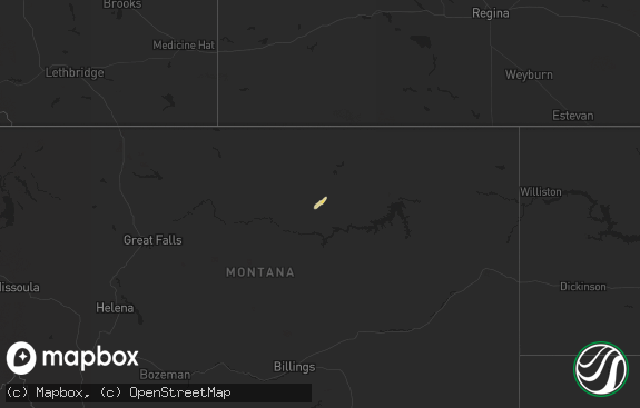
Hail Map in Montana on June 16, 2018
The weather event in Montana on June 16, 2018 includes Hail map. 23 states and 513 cities were impacted and suffered possible damage. The total estimated number of properties impacted is 1,021.

Hail
1,021
Estimated number of impacted properties by a 1.00" hail or larger0
Estimated number of impacted properties by a 1.75" hail or larger0
Estimated number of impacted properties by a 2.50" hail or largerStorm reports in Montana
Montana
| Date | Description |
|---|---|
| 06/16/20186:17 PM CDT | A local report indicates 1.00 inch wind near 2 WSW JOLIET |
| 06/16/20185:50 PM CDT | Half of roof blown off home. |
| 06/16/201812:10 AM CDT | At 509 PM MDT, a severe thunderstorm was located near Joliet, or 13 miles southeast of Columbus, moving east at 20 mph. HAZARD...Quarter size hail. SOURCE...Radar indicated. IMPACT...Damage to vehicles is expected. Locations impacted include... Joliet, Fromberg, Edgar, Rockvale and Boyd. This replaces the warning previously in effect for this area. |
| 06/15/201811:39 PM CDT | At 437 PM MDT, a severe thunderstorm was located just south of Columbus, moving southeast at 20 mph. HAZARD...60 mph wind gusts and quarter size hail. SOURCE...Radar indicated. IMPACT...Hail damage to vehicles and wind damage to trees expected. Locations impacted include... Cooney Reservoir State Park and Boyd. |
All States Impacted by Hail Map on June 16, 2018
Cities Impacted by Hail Map on June 16, 2018
- Due West, SC
- Mentone, TX
- Miller, SD
- Ree Heights, SD
- Blunt, SD
- Rockham, SD
- Holabird, SD
- Hitchcock, SD
- Frankfort, SD
- Redfield, SD
- Saint Lawrence, SD
- Tulare, SD
- Highmore, SD
- Doland, SD
- Wessington, SD
- Harrold, SD
- Shirley, IN
- Knightstown, IN
- Augusta, GA
- North Augusta, SC
- Beech Island, SC
- Elbow Lake, MN
- Brandon, MN
- Evansville, MN
- Hoffman, MN
- Kensington, MN
- Barrett, MN
- Draper, SD
- Millersport, OH
- Pleasantville, OH
- Thurston, OH
- Pickerington, OH
- Reynoldsburg, OH
- Baltimore, OH
- Pataskala, OH
- Pickens, SC
- Sabin, MN
- Rosholt, SD
- Dayton, OH
- Cleveland, ND
- Gillsville, GA
- Sandersville, GA
- Dalton, MN
- Saint Cloud, FL
- Lima, OH
- Delphos, OH
- Absarokee, MT
- McLeod, MT
- Double Springs, AL
- Haleyville, AL
- Wink, TX
- Loving, NM
- Woodruff, WI
- Minocqua, WI
- Portage, WI
- Poynette, WI
- Merrimac, WI
- Mott, ND
- New Leipzig, ND
- Ellsworth, NE
- Bingham, NE
- Park Rapids, MN
- Menahga, MN
- Reeder, ND
- Hettinger, ND
- Regent, ND
- Scranton, ND
- Osakis, MN
- Buchanan, ND
- Jamestown, ND
- Vergas, MN
- Pelican Rapids, MN
- Pecos, TX
- Whitman, NE
- Merriman, NE
- Cody, NE
- Ashby, NE
- Frazee, MN
- Detroit Lakes, MN
- Ashby, MN
- Parkers Prairie, MN
- Vining, MN
- Britton, SD
- Mission, SD
- Jacksonville, AL
- Wellington, AL
- Mooreton, ND
- Wyndmere, ND
- Barney, ND
- Mantador, ND
- Joliet, MT
- Columbus, MT
- Long Prairie, MN
- Weyauwega, WI
- Waupaca, WI
- Marcell, MN
- Dupree, SD
- Timber Lake, SD
- McLaughlin, SD
- Isabel, SD
- Wahpeton, ND
- Hephzibah, GA
- Oviedo, FL
- Geneva, FL
- Sidney, NE
- Dahlonega, GA
- Guthrie, KY
- Maysville, GA
- Covington, GA
- Sanborn, ND
- Spiritwood, ND
- Rogers, ND
- Dazey, ND
- Wimbledon, ND
- Winner, SD
- Nauvoo, AL
- Lynn, AL
- Cogswell, ND
- Cheyenne, WY
- Clayton, GA
- Nelson, MN
- Montevideo, MN
- Pierre, SD
- Lake Linden, MI
- Rumely, MI
- Chatham, MI
- Cross Hill, SC
- Ninety Six, SC
- Greenwood, SC
- Ontonagon, MI
- Cook, MN
- Forestville, WI
- Carr, CO
- Nunn, CO
- Belle Center, OH
- Hanceville, AL
- Valentine, NE
- Bigfork, MN
- Bushnell, NE
- Lakeview, OH
- Wild Rose, WI
- Pine River, WI
- New England, ND
- Rothsay, MN
- Fergus Falls, MN
- Breckenridge, MN
- Fort Ripley, MN
- Sikeston, MO
- Brainerd, MN
- Perronville, MI
- West Mansfield, OH
- Bowlus, MN
- Pardeeville, WI
- Cullman, AL
- Logan, AL
- Nenzel, NE
- Kilgore, NE
- Saint Francis, SD
- Blountsville, AL
- Menominee, MI
- Lake Norden, SD
- Arlington, SD
- Conyers, GA
- Marysville, OH
- Richwood, OH
- Raymond, OH
- Kerkhoven, MN
- Raymond, MN
- Murdock, MN
- Haubstadt, IN
- Princeton, IN
- Fort Branch, IN
- Gladstone, MI
- Rapid River, MI
- Rock, MI
- Hecla, SD
- Eatonton, GA
- Trail City, SD
- Wisconsin Dells, WI
- Sheldon, WI
- Holcombe, WI
- Gilman, WI
- Bena, MN
- Villard, MN
- Brooten, MN
- Glenwood, MN
- Roberts, MT
- Claire City, SD
- Browerville, MN
- Alexandria, MN
- Carlos, MN
- Clarissa, MN
- Eagle Bend, MN
- Miltona, MN
- Calumet, MI
- Hancock, MI
- Hubbell, MI
- Bertha, MN
- Clinton, MN
- Chokio, MN
- Rhinelander, WI
- Lake Tomahawk, WI
- Saint Germain, WI
- Eagle River, WI
- Iva, SC
- Abbeville, SC
- Cayuga, ND
- Lidgerwood, ND
- Kermit, TX
- Henning, MN
- Huntsville, OH
- Wapakoneta, OH
- New Hampshire, OH
- Waynesfield, OH
- Warthen, GA
- Chadron, NE
- White River, SD
- Milan, MN
- Okaton, SD
- Franklin, OH
- Springboro, OH
- Wautoma, WI
- Ponsford, MN
- Sauk Centre, MN
- Lebanon, OH
- Oregonia, OH
- Warsaw, OH
- Walhonding, OH
- Frazeysburg, OH
- Sterrett, AL
- Wilsonville, AL
- Chelsea, AL
- Harpersville, AL
- Bayard, NE
- Garfield, MN
- Long Valley, SD
- Sagola, MI
- Crookston, NE
- Kinards, SC
- Joanna, SC
- Clinton, SC
- Ault, CO
- Columbus, OH
- Westerville, OH
- Marine On Saint Croix, MN
- Martin, SD
- Cambridge City, IN
- Hagerstown, IN
- Kingston, GA
- Taylorsville, GA
- Baraboo, WI
- Stone Lake, WI
- Hayward, WI
- Angora, NE
- Walker, MN
- Staples, MN
- Shell Lake, WI
- Acworth, GA
- Brookville, OH
- Rutland, ND
- Havana, ND
- Germantown, OH
- Middletown, OH
- Veblen, SD
- Almond, WI
- Dalton, NE
- Benson, MN
- Hopkinsville, KY
- Trenton, KY
- Glen Flora, WI
- Hankinson, ND
- Deerton, MI
- Sunset, SC
- Pembine, WI
- Rainbow City, AL
- Hancock, MN
- Danvers, MN
- Trout Creek, MI
- Ohatchee, AL
- Bingham Lake, MN
- Sylvania, GA
- Elgin, ND
- Ideal, SD
- Rushville, NE
- Ashville, AL
- Ragland, AL
- Pendergrass, GA
- Talmo, GA
- Sisseton, SD
- Appleton, MN
- Holloway, MN
- Harrisburg, NE
- Pequot Lakes, MN
- Dalton, WI
- Osage, MN
- Redwood Falls, MN
- Easley, SC
- Cleveland, SC
- Marietta, SC
- Adger, AL
- Sanford, FL
- Carpenter, WY
- Burns, WY
- Moody, AL
- Deer River, MN
- Goodwin, SD
- Rio, WI
- Chapin, SC
- Daggett, MI
- Amberg, WI
- Newberry, SC
- Morris, MN
- Cyrus, MN
- Quincy, FL
- Nevis, MN
- Artesia, NM
- Escanaba, MI
- Wilson, MI
- Pine Bluffs, WY
- Little Falls, MN
- Aitkin, MN
- Clarksville, OH
- Fremont, WI
- Trussville, AL
- Wolverton, MN
- Christine, ND
- Walcott, ND
- Bellefontaine, OH
- Rushsylvania, OH
- Bismarck, ND
- Morrow, OH
- New Salem, ND
- Carson, ND
- Almont, ND
- Sunburg, MN
- Pleasant Plain, OH
- Elkton, KY
- Union, SC
- Blythe, GA
- Keysville, GA
- Backus, MN
- Sebeka, MN
- Ewen, MI
- Murdo, SD
- Coyanosa, TX
- Eben Junction, MI
- Trenary, MI
- McGrath, MN
- Ladysmith, WI
- Hewitt, MN
- Estelline, SD
- Buffalo, MN
- North Freedom, WI
- Balmorhea, TX
- Fort Stockton, TX
- Colfax, ND
- Kent, MN
- Lefor, ND
- Westfield, WI
- Coloma, WI
- Angora, MN
- Federal Dam, MN
- Remer, MN
- Clayton, NM
- Millersburg, OH
- Phillips, WI
- Buckhead, GA
- Greenville, SC
- Brookwood, AL
- Davisboro, GA
- Baldwin, ND
- Ludowici, GA
- Commerce, GA
- Homer, GA
- Abercrombie, ND
- Fort Pierre, SD
- Stewardson, IL
- Verndale, MN
- Bark River, MI
- Wallace, MI
- Madison, GA
- Irmo, SC
- Kennesaw, GA
- Pengilly, MN
- Centre, AL
- Piedmont, AL
- Tennille, GA
- Harrison, GA
- Rochert, MN
- Crosslake, MN
- Clontarf, MN
- Cedartown, GA
- Sparta, GA
- Aldrich, MN
- Orlando, FL
- Christmas, FL
- Chappells, SC
- Mountville, SC
- Fish Creek, WI
- Allensville, KY
- Ridgeland, SC
- Hardeeville, SC
- Motley, MN
- Bridgeport, NE
- Evansville, IN
- Liberty, SC
- Honea Path, SC
- Clear Lake, SD
- Foxhome, MN
- Elizabeth, MN
- Kennan, WI
- Hawkins, WI
- Catawba, WI
- Crofton, KY
- Clara City, MN
- Marvin, SD
- Anderson, SC
- Starr, SC
- Marietta, GA
- Cushing, MN
- Straughn, IN
- New Castle, IN
- Mountain Rest, SC
- Lakeside, NE
- Altamont, IL
- Starbuck, MN
- Cerulean, KY
- Weaver, AL
- Anniston, AL
- Alexandria, AL
- Rockmart, GA
- Galena, OH
- Spalding, MI
- Powers, MI
- Elk River, MN
- Ortley, SD
- Bowman, ND
- Glen Ullin, ND
- New Auburn, WI
- Bloomer, WI
- Highlands, NC
- Kindred, ND
- Pelkie, MI
- Osteen, FL
- Deltona, FL
- Clitherall, MN
- Farwell, MN
- Moorhead, MN
- Buford, GA
- Monticello, GA
- Pierz, MN
- Correll, MN
- Ludlow, SD
- Badger, SD
- Browns Valley, MN
- Winter, WI
- Mansfield, GA
- Fromberg, MT
- Nisswa, MN
- Burtrum, MN
- Grey Eagle, MN
- Canby, MN
- Waubay, SD
- Gering, NE
- Snellville, GA
- Lithonia, GA
- Swanville, MN
- Deer Creek, MN
- Alberta, MN
- Indianapolis, IN
- Greenfield, IN
- Gainesville, GA
- Braselton, GA
- Wadena, MN
- Raymond, SD
- New York Mills, MN
- Perham, MN
- Ottertail, MN
- Orr, MN
- Steele, AL
- Eaton, OH
- Lancaster, OH
- Blacklick, OH
- Carroll, OH
- New Albany, OH
- Lowry, MN
- Belgrade, MN
- Dallas, GA
- Akeley, MN
- Summit, SD
- Cartersville, GA
- Spencer, TN
- Dawson, MN
- Rosman, NC
- Salem, SC
- Walhalla, SC
- Revillo, SD
- Erhard, MN
- Quinton, AL
- Bessemer, AL
- Tucson, AZ
- Benson, AZ
- Vail, AZ
- Castlewood, SD
- Colome, SD
- Nashville, TN
- Cambria, WI
- Danbury, WI
- Gordon, WI
- La Pointe, WI
- Drummond, WI
- Gadsden, AL
- Attalla, AL


