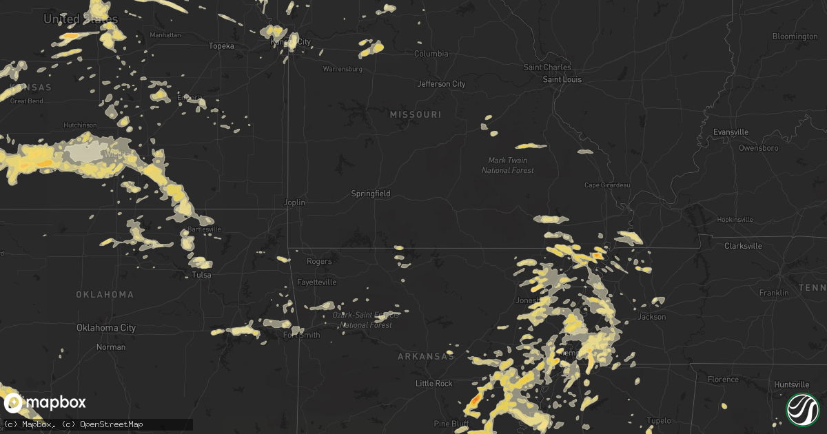
Hail Map in Kansas on June 16, 2011
Get this storm
June 16 map
$229
one time, instant access
Download today. No call, no setup
Keep the $229
Bought the map and want the full workflow? Apply the entire $229 to a subscription within 7 days. None of it is wasted.
Every map, not just this one
This buys you this map. Subscription and you get every map we run, in the markets you choose from a few cities to whole states to nationwide. Plus real-time alerts the moment a storm fires.
Contact data
Name, contact info, occupancy, even credit band for addresses in the footprint. You go from where it hit to who to call.
Become the source they trust
Unlimited branding weather history reports on demand. You already have the documented answer ready for the property owner, and you are the one who showed up with it.
Property data and RoofTrace estimates
Pull up any address you have got, its value and the exact code rules for that jurisdiction, straight from One Click Code. Then RoofTrace estimates the squares, pitch, and roof value, priced the way you price.
Storm reports in Kansas
Kansas
| Date | Description |
|---|---|
| 06/16/20116:59 PM CDT | A local report indicates 70 MPH wind near 6 NNE ISABEL |
| 06/16/20116:57 PM CDT | Winds were estimated at 60 to 70 mph. |
| 06/16/20116:52 PM CDT | A local report indicates 1.50 inch wind near 5 N COATS |
| 06/16/20116:45 PM CDT | A local report indicates 60 MPH wind near 1 NNW BURDETT |
| 06/16/20116:44 PM CDT | A local report indicates 1.75 inch wind near 2 WNW COATS |
| 06/16/20116:43 PM CDT | A local report indicates 1.50 inch wind near 5 SSE KINSLEY |
| 06/16/20116:40 PM CDT | A local report indicates 68 MPH wind near 3 NNW ISABEL |
| 06/16/20116:38 PM CDT | A local report indicates 1.00 inch wind near 5 NW COATS |
| 06/16/20116:27 PM CDT | A local report indicates 1.00 inch wind near 3 SE BAZINE |
| 06/16/20116:10 PM CDT | A local report indicates 1.00 inch wind near 2 NW CULLISON |
| 06/16/20116:10 PM CDT | A local report indicates 60 MPH wind near 2 NW CULLISON |
| 06/16/20116:00 PM CDT | A local report indicates 60 MPH wind near 9 S DIGHTON |
| 06/16/20115:55 PM CDT | A local report indicates 61 MPH wind near 2 NNE DODGE CITY |
| 06/16/20115:52 PM CDT | The tornado ended at 555pm cdt. At 38.349n and 100.055w. Minor damage was done to a residential house and moderate damage to a large metal outbuilding. |
| 06/16/20115:45 PM CDT | A local report indicates 1.00 inch wind near MULLINVILLE |
| 06/16/20115:20 PM CDT | A local report indicates 70 MPH wind near 3 N HOWELL |
| 06/16/20115:01 PM CDT | A local report indicates 61 MPH wind near GARDEN CITY |
| 06/16/20111:20 PM CDT | 5 inch tree limbs were downed in the town of chautauqua. Wind gusts were estimated over 60 mph. |
| 06/16/201112:51 PM CDT | Several street signs blown down. 4 to 5 inch diameter tree limbs snapped off. |
| 06/16/201112:38 PM CDT | A local report indicates 60 MPH wind near 5 SE CEDAR VALE |
| 06/16/201112:38 PM CDT | About 50 percent of the roof blown off a house. Estimated wind speed 80 mph. |
| 06/16/201112:21 PM CDT | Power pole down |
| 06/16/201112:21 PM CDT | Power pole down |
| 06/16/201111:42 AM CDT | Power pole down. |
| 06/16/20118:59 AM CDT | A local report indicates 1.75 inch wind near BARNARD |
| 06/15/201110:50 PM CDT | Delayed report. |
| 06/15/201110:45 PM CDT | A local report indicates 64 MPH wind near MAYFIELD |
| 06/15/201110:45 PM CDT | A local report indicates 62 MPH wind near 4 ESE MARQUETTE |
| 06/15/201110:43 PM CDT | Emergency manager reports 2 to 8 inch limbs down which has blocked the roadway. Several powerlines are down and several transformers have blown. |
| 06/15/201110:30 PM CDT | Emergency manager reported several signs blown over at the national guard armory. An air conditioning unit of unknown size was blown off the roof at k-state salina. Est |
| 06/15/201110:30 PM CDT | Emergency manager reported an 18 to 20 inch tree went through a roof with time estimate based on radar. |
| 06/15/201110:28 PM CDT | Trained spotter measured 59 mph wind gust. |
| 06/15/201110:27 PM CDT | Salina airport asos measures 77 mph wind gust. |
| 06/15/201110:11 PM CDT | Trained spotter reports golfball sized hail. |
| 06/15/201110:05 PM CDT | Trained spotter estimates 70 mph winds on highway 54 just 1 mile inside the county line. |
| 06/15/201110:05 PM CDT | Irrigation system blown over at sw 70th ave and 90th street. |
| 06/15/201110:03 PM CDT | Salina airport asos measures 61 mph winds. |
| 06/15/201110:00 PM CDT | Trained spotter reports golfball sized hail. |
| 06/15/20119:55 PM CDT | Emergency manager reports power pole snapped in half at the intersection of yoder and pleasant valley roads. |
| 06/15/20119:46 PM CDT | Kake storm chaser estimates 65 mph winds. |
| 06/15/20119:46 PM CDT | Trained spotter measures winds to be 60 to 64 mph. |
| 06/15/20119:45 PM CDT | Trained spotter estimates 60 mph winds along city limits of kingman. |
| 06/15/20119:38 PM CDT | A local report indicates 80 MPH wind near 4 N COATS |
| 06/15/20119:36 PM CDT | Ksn weatherlab at windom elementary school measures 60 mph winds. |
| 06/15/20119:35 PM CDT | A local report indicates 60 MPH wind near BEVERLY |
| 06/15/20119:33 PM CDT | Trees 1-2 feet in diameter...along with several smaller limbs...were knocked down across town. Two metal buildings were also damaged...one had a door and wall blown out |
| 06/15/20119:32 PM CDT | A local report indicates 65 MPH wind near 5 WSW KINSLEY |
| 06/15/20119:31 PM CDT | Spotter reporting several 4 inch tree branches knocked down on street. |
| 06/15/20119:30 PM CDT | 3 to 4 inch diameter tree limbs down. Delayed report. |
| 06/15/20119:28 PM CDT | Blew vehicle off the road...light poles knocked down. |
| 06/15/20119:24 PM CDT | Ellsworth airport awos measures 62 mph winds. |
| 06/15/20119:15 PM CDT | Awos at ellsworth airport measures 58 mph wind gust. |
| 06/15/20119:13 PM CDT | A local report indicates 70 MPH wind near 3 ENE CROFT |
| 06/15/20119:13 PM CDT | A local report indicates 60 MPH wind near 7 ENE ELLSWORTH |
| 06/15/20119:09 PM CDT | A local report indicates 1.00 inch wind near HAVILAND |
| 06/15/20119:04 PM CDT | A local report indicates 70 MPH wind near 3 SSW HAVILAND |
| 06/15/20119:04 PM CDT | A local report indicates 1.00 inch wind near 3 SSW HAVILAND |
| 06/15/20119:03 PM CDT | A local report indicates 59 MPH wind near BIRD CITY |
| 06/15/20119:03 PM CDT | A ten to twelve inch diameter tree was blown down. Four to five inch diameter tree limbs were blown down. A hotel sign was blown down. This damage occurred in the west |
| 06/15/20119:02 PM CDT | A local report indicates 1.75 inch wind near PRESTON |
| 06/15/20119:02 PM CDT | A local report indicates 70 MPH wind near PRESTON |
| 06/15/20119:02 PM CDT | Trained spotter reports 30 to 45 minutes of winds from 60 to 70 mph. |
| 06/15/20119:02 PM CDT | A local report indicates 60 MPH wind near 6 W OSBORNE |
| 06/15/20118:54 PM CDT | A local report indicates 1.00 inch wind near 1 SE TURON |
| 06/15/20118:51 PM CDT | A local report indicates 60 MPH wind near 1 SW PRESTON |
| 06/15/20118:48 PM CDT | A local report indicates 64 MPH wind near 1 S CULLISON |
| 06/15/20118:47 PM CDT | A local report indicates 65 MPH wind near 2 NE PRATT |
| 06/15/20118:45 PM CDT | A local report indicates 60 MPH wind near 4 SSW DILLWYN |
| 06/15/20118:42 PM CDT | Emergency manager has multiple reports of 40 to 60 mph winds with one measured report of 62 mph across northwest portions of lincoln county. |
| 06/15/20118:37 PM CDT | A local report indicates 61 MPH wind near 5 SW ASH GROVE |
| 06/15/20118:35 PM CDT | A local report indicates 1.50 inch wind near 6 SSW CENTERVIEW |
| 06/15/20118:32 PM CDT | A local report indicates 1.00 inch wind near 1 SE TURON |
| 06/15/20118:30 PM CDT | A local report indicates 65 MPH wind near 3 S BURDETT |
| 06/15/20118:30 PM CDT | A local report indicates 60 MPH wind near E CULLISON |
| 06/15/20118:27 PM CDT | Trained spotter estimates quarter sized hail. |
| 06/15/20118:26 PM CDT | Trained spotter along lincoln and russell county lines on highway 18 estimating 60 mph winds. |
| 06/15/20118:25 PM CDT | At least 8 inch diameter tree limbs blown down. |
| 06/15/20118:17 PM CDT | A local report indicates 1.50 inch wind near 4 NNW CAIRO |
| 06/15/20118:17 PM CDT | Heavy rain and quarter sized hail was reported. |
| 06/15/20118:10 PM CDT | Emergency manager reports 60 mph winds. |
| 06/15/20118:08 PM CDT | Trained spotter estimates 50 to 60 mph winds which sustained for at least 10 minutes. |
| 06/15/20117:59 PM CDT | A local report indicates 1.75 inch wind near 6 SSE IUKA |
| 06/15/20117:57 PM CDT | A local report indicates 60 MPH wind near 4 ENE WILSON |
| 06/15/20117:44 PM CDT | A local report indicates 60 MPH wind near 8 E KINGMAN |
| 06/15/20117:37 PM CDT | Trained spotter estimates 60 to 70 mph wind gust. |
| 06/15/20117:32 PM CDT | Law enforcement reports quarter sized hail. |
| 06/15/20117:24 PM CDT | Russell airport asos measures 58 mph wind gust. |
| 06/15/20117:17 PM CDT | A local report indicates 70 MPH wind near 3 E CAIRO |
| 06/15/20117:16 PM CDT | A local report indicates 60 MPH wind near 2 E DODGE CITY |
| 06/15/20117:16 PM CDT | A local report indicates 70 MPH wind near 2 ENE CAIRO |
| 06/15/20117:02 PM CDT | A carport and flagpole were blown down in the city of cullison. |
| 06/15/20117:01 PM CDT | A local report indicates 1.00 inch wind near SPEARVILLE |
All States Impacted by Hail Map on June 16, 2011
Cities Impacted by Hail Map on June 16, 2011
- Morrison, OK
- Glencoe, OK
- Walls, MS
- Lake Cormorant, MS
- Union City, TN
- Steele, MO
- Onaga, KS
- Grandfield, OK
- Devol, OK
- Como, MS
- Sardis, MS
- Marshall, MO
- Lamar, MS
- Moscow, TN
- Alliance, NE
- Houston, MS
- West Point, MS
- Cedarbluff, MS
- Woodland, MS
- Pheba, MS
- Mantee, MS
- Frankfort, KS
- Westmoreland, KS
- Grant, NE
- Venango, NE
- Wray, GA
- Fitzgerald, GA
- Broxton, GA
- Belgrade, ME
- Augusta, ME
- Stuttgart, AR
- Willow, OK
- Moro, AR
- Coleridge, NE
- Hartington, NE
- Shuqualak, MS
- Springfield, SD
- Hollister, OK
- Loveland, OK
- Frederick, OK
- Jonesboro, AR
- Patten, ME
- Ailey, GA
- Ulm, AR
- De Witt, AR
- Holly Grove, AR
- Crocketts Bluff, AR
- Marvell, AR
- Saint Charles, AR
- Clarendon, AR
- Elba, AL
- Hunter, OK
- Louisville, MS
- McCool, MS
- Ethel, MS
- Bristol, FL
- Hosford, FL
- Vivian, SD
- Draper, SD
- Cobb, GA
- Brinkley, AR
- Crawfordsville, AR
- Stafford, KS
- Paragould, AR
- Beech Grove, AR
- Delaplaine, AR
- Harrisburg, AR
- Sedgwick, CO
- Lodgepole, NE
- Crook, CO
- Sidney, NE
- Chappell, NE
- De Valls Bluff, AR
- Mathiston, MS
- Wray, CO
- El Paso, AR
- Mendon, MO
- Keytesville, MO
- Brunswick, MO
- Lena, MS
- Fort Smith, AR
- Gideon, MO
- Holcomb, MO
- Paxton, NE
- Bayard, NE
- Hughes, AR
- Heth, AR
- Proctor, AR
- Earle, AR
- Webbers Falls, OK
- Checotah, OK
- Porum, OK
- Warner, OK
- Valentine, NE
- Eufaula, OK
- Glenwood, AL
- Van Buren, AR
- Sperry, OK
- Skiatook, OK
- Birmingham, AL
- Potter, NE
- Almyra, AR
- Evergreen, AL
- Callaway, NE
- Gothenburg, NE
- Brady, NE
- Perry, GA
- Maxwell, NE
- Burwell, NE
- Ozark, AL
- Midland City, AL
- Conehatta, MS
- Merriman, NE
- Barnard, KS
- Portageville, MO
- Peel, AR
- Lead Hill, AR
- Yellville, AR
- Sutherland, NE
- Cuba, MO
- Ashland, ME
- Pawhuska, OK
- Sedan, KS
- Oneill, NE
- Yoder, WY
- Torrington, WY
- Russellville, AL
- Phil Campbell, AL
- Jetersville, VA
- Clay Center, KS
- Ralston, OK
- Wetumpka, AL
- Eclectic, AL
- Red Level, AL
- Andalusia, AL
- Scottsbluff, NE
- Minatare, NE
- McCrory, AR
- Hyde, PA
- Curwensville, PA
- Mahaffey, PA
- Grampian, PA
- Penfield, PA
- Luthersburg, PA
- Clearfield, PA
- Rockton, PA
- Poulan, GA
- Sylvester, GA
- Morganville, KS
- Montgomery, AL
- Stony Creek, VA
- Dinwiddie, VA
- Wynne, AR
- Cherry Valley, AR
- Allen, NE
- Elk Point, SD
- Moville, IA
- Correctionville, IA
- Dakota City, NE
- Merrill, IA
- South Sioux City, NE
- Jefferson, SD
- Hinton, IA
- Bronson, IA
- Ponca, NE
- Waterbury, NE
- Homer, NE
- Washta, IA
- Sergeant Bluff, IA
- Jackson, NE
- Emerson, NE
- Sioux City, IA
- Salix, IA
- Le Mars, IA
- Lawton, IA
- Hubbard, NE
- North Sioux City, SD
- Kingsley, IA
- Pierson, IA
- Jasper, AR
- Willacoochee, GA
- Morrill, KS
- Sabetha, KS
- Hiawatha, KS
- Fairview, KS
- Kansas City, KS
- Millinocket, ME
- Gordon, NE
- Spearville, KS
- Wright, KS
- Jetmore, KS
- Peabody, KS
- Walton, KS
- Newton, KS
- Mason, TN
- Cunningham, KS
- North Platte, NE
- Wayne, NE
- Laurel, NE
- Crenshaw, MS
- Turon, KS
- Gould, AR
- Hernando, MS
- Moundridge, KS
- Hesston, KS
- Ashland, NE
- Greenwood, NE
- Goddard, KS
- Clearwater, KS
- Oakland, TN
- Eads, TN
- Arlington, TN
- Cassoday, KS
- Beloit, KS
- Dorrance, KS
- Wilson, KS
- Lincoln, KS
- Presho, SD
- Fort Pierre, SD
- Murdo, SD
- Norfolk, NE
- Pierce, NE
- Hoskins, NE
- Barnard, MO
- Maryville, MO
- Jachin, AL
- York, AL
- Ward, AL
- Lisman, AL
- Butler, AL
- Saint Francis, KS
- Olustee, OK
- Walters, OK
- Chattanooga, OK
- Duke, OK
- Altus, OK
- Tipton, OK
- Blair, OK
- Snyder, OK
- Hollis, OK
- Altus Afb, OK
- Gould, OK
- Dodson, TX
- Indiahoma, OK
- Randlett, OK
- Headrick, OK
- Mangum, OK
- Cheyenne, WY
- Widener, AR
- Sawyer, KS
- Pratt, KS
- Isabel, KS
- Coldwater, MS
- Bennington, KS
- Minneapolis, KS
- Solomon, KS
- Garber, OK
- Tonkawa, OK
- Billings, OK
- Cuthbert, GA
- Coleman, GA
- Walnut Ridge, AR
- Ambrose, GA
- Douglas, GA
- Aurora, KS
- Concordia, KS
- Galva, KS
- Canton, KS
- Marion, KS
- Bassett, NE
- Blackburn, MO
- Malta Bend, MO
- Beverly, KS
- Sylvan Grove, KS
- Hoisington, KS
- Russell, KS
- Robertsdale, AL
- Clarksdale, MS
- Hanston, KS
- Bazine, KS
- Ness City, KS
- Ogallala, NE
- Ozark, AR
- Mountainburg, AR
- Gering, NE
- Rush Center, KS
- Altus, AR
- Clarksville, AR
- Pitts, GA
- Nashville, KS
- Kingman, KS
- Haviland, KS
- Sun City, KS
- Mullinville, KS
- Lewis, KS
- Coats, KS
- Spivey, KS
- Wilmore, KS
- Iuka, KS
- Byers, KS
- Greensburg, KS
- Kinsley, KS
- Searcy, AR
- New Sharon, ME
- Oakland, ME
- Belgrade Lakes, ME
- Conway Springs, KS
- Viola, KS
- Milton, KS
- Norwich, KS
- Cheney, KS
- Mobile, AL
- Theodore, AL
- Cottondale, FL
- Chipley, FL
- Martin, TN
- Rives, TN
- Marshall, VA
- Mercer, PA
- Saint Francis, ME
- Chillicothe, MO
- Protem, MO
- Frenchmans Bayou, AR
- Luxora, AR
- Eastman, GA
- Cochran, GA
- Loxley, AL
- Dover, AR
- Griffithville, AR
- Des Arc, AR
- Assaria, KS
- Gypsum, KS
- Lindsborg, KS
- Vidalia, GA
- Westville, OK
- Verbena, AL
- Billingsley, AL
- Prattville, AL
- Genoa, CO
- Limon, CO
- Lindon, CO
- Agate, CO
- Arriba, CO
- Sparks, GA
- Adel, GA
- Leslie, GA
- Buford, WY
- Lumber City, GA
- Jacksonville, GA
- Denton, GA
- McRae Helena, GA
- Hazlehurst, GA
- Kirk, CO
- Pocahontas, AR
- Biggers, AR
- Maynard, AR
- Du Bois, PA
- Avon, SD
- Exmore, VA
- Belle Haven, VA
- Melfa, VA
- Quinby, VA
- Painter, VA
- Altamont, MO
- Cameron, MO
- Hamilton, MO
- Weatherby, MO
- Maysville, MO
- Kidder, MO
- Pattonsburg, MO
- Winston, MO
- Gallatin, MO
- Rockford, AL
- Palisade, NE
- Verdigre, NE
- Niobrara, NE
- Beeler, KS
- Fordyce, NE
- Hayti, MO
- Caruthersville, MO
- Wakefield, NE
- Germantown, TN
- Memphis, TN
- Cordova, TN
- Millington, TN
- Collierville, TN
- Olive Branch, MS
- Fairfax, MO
- Sneads, FL
- Red Rock, OK
- Albany, GA
- Leesburg, GA
- Rozel, KS
- Braman, OK
- Aubrey, AR
- Pawnee, OK
- Wellington, KS
- Ford, KS
- Belpre, KS
- Garfield, KS
- Bucklin, KS
- Zenda, KS
- Garden Plain, KS
- Dodge City, KS
- Offerle, KS
- Mulvane, KS
- Cimarron, KS
- Peck, KS
- Derby, KS
- Haysville, KS
- Murdock, KS
- Wichita, KS
- Humnoke, AR
- Hazen, AR
- Altheimer, AR
- Humphrey, AR
- Wabbaseka, AR
- Carlisle, AR
- Tallassee, AL
- Atlanta, KS
- Douglass, KS
- Bingham, NE
- Amelia, NE
- Saint Francis, SD
- Mission, SD
- Corning, AR
- Peach Orchard, AR
- Rossville, TN
- Louisville, AL
- Sharon, TN
- Burlington, CO
- Idalia, CO
- Haven, KS
- Wilsonville, AL
- Columbiana, AL
- Plainview, NE
- Caledonia, MO
- Irondale, MO
- Potosi, MO
- Belgrade, MO
- Hume, VA
- Linden, VA
- Front Royal, VA
- Chester Gap, VA
- Huntly, VA
- Carr, CO
- Brundidge, AL
- Troy, AL
- Perryville, MO
- Tulsa, OK
- Burlington, KS
- Quitman, GA
- Abbeville, GA
- Marked Tree, AR
- Caraway, AR
- Wheatley, AR
- Palestine, AR
- Cotton Plant, AR
- Blue Rapids, KS
- Rulo, NE
- Belle Plaine, KS
- Udall, KS
- Oxford, KS
- Winfield, KS
- Alexander, KS
- Everton, AR
- Saint Joe, AR
- Oneida, KS
- Table Rock, NE
- Du Bois, NE
- Humboldt, NE
- Bern, KS
- Pawnee City, NE
- Hickory Valley, TN
- Grand Junction, TN
- La Grange, TN
- Dawson, GA
- Fort Collins, CO
- Loveland, CO
- Okaton, SD
- El Dorado, KS
- Florala, AL
- Sargent, NE
- Anselmo, NE
- Broken Bow, NE
- Taylor, NE
- Laramie, WY
- Wilmer, AL
- Lucedale, MS
- Ripley, MS
- Sentinel, OK
- Carter, OK
- Lone Wolf, OK
- Granite, OK
- Muldrow, OK
- Sallisaw, OK
- Greenleaf, KS
- Linn, KS
- Barnes, KS
- Waterville, KS
- Akron, IA
- Hawarden, IA
- Chatsworth, IA
- Alcester, SD
- Senath, MO
- Arbyrd, MO
- Stanton, NE
- Pilger, NE
- Hartford, KS
- Emporia, KS
- Neosho Rapids, KS
- Concord, VA
- Lynchburg, VA
- Bonesteel, SD
- Waynesboro, MS
- Silas, AL
- Gilbertown, AL
- Needham, AL
- Milan, TN
- Medina, TN
- Bluffton, GA
- Gorham, ME
- Colony, KS
- Ainsworth, NE
- Columbia, AL
- Weir, MS
- Hemingford, NE
- Oshkosh, NE
- Vian, OK
- Sapelo Island, GA
- Bismarck, MO
- Park Hills, MO
- Tecumseh, NE
- Steinauer, NE
- Arnold, NE
- Moberly, MO
- Cairo, MO
- Auburn, AL
- Salem, AL
- Notasulga, AL
- Opelika, AL
- Luverne, AL
- Brantley, AL
- Ray City, GA
- Nashville, GA
- Lakeland, GA
- Lumberton, NC
- Ripley, TN
- Henning, TN
- Dix, NE
- White River, SD
- Trimble, MO
- Valdosta, GA
- Chauncey, GA
- Milan, GA
- Lafe, AR
- Marmaduke, AR
- Oconto, NE
- Stilwell, OK
- Shelby, AL
- Sylacauga, AL
- Lagrange, WY
- Kincaid, KS
- Ellsworth, NE
- Hay Springs, NE
- Dundee, MS
- Arcadia, FL
- Campbell, MO
- Clarkton, MO
- Malden, MO
- Paducah, KY
- Piggott, AR
- Qulin, MO
- Pollard, AR
- Saint Francis, AR
- Humboldt, TN
- Jackson, AL
- Broadwater, NE
- Neelyville, MO
- Poplar Bluff, MO
- Harviell, MO
- Jay, OK
- Karnak, IL
- Metropolis, IL
- Grand Chain, IL
- Banks, AL
- Canton, MS
- Union Springs, AL
- Hope, KS
- Padroni, CO
- Lake City, AR
- Burdett, KS
- Haigler, NE
- Tillar, AR
- Branch, AR
- Gillett, AR
- Shellman, GA
- Rock Springs, WY
- Carthage, MS
- Kosciusko, MS
- Philadelphia, MS
- Winslow, AR
- Osmond, NE
- Meadow Grove, NE
- Neligh, NE
- Hortense, GA
- Jesup, GA
- Fort Myers, FL
- Lehigh Acres, FL
- Mitchell, NE
- Bedford, VA
- Ponca City, OK
- Tallahassee, FL
- Arlington, KS
- Pretty Prairie, KS
- Partridge, KS
- Tuthill, SD
- Marianna, AR
- Deer, AR
- Hawk Springs, WY
- Punxsutawney, PA
- Summerville, PA
- Brookville, PA
- Coolspring, PA
- Knox Dale, PA
- Ringgold, PA
- Sprankle Mills, PA
- Mayport, PA
- Worthville, PA
- Timblin, PA
- Camden, MS
- Cody, NE
- Henryetta, OK
- Dothan, AL
- Cedar Vale, KS
- Ackerman, MS
- Dyess, AR
- Osceola, AR
- Wilson, AR
- Joiner, AR
- Finley, TN
- Lexa, AR
- Alapaha, GA
- Lenox, GA
- Falun, KS
- Drummonds, TN
- Munford, TN
- Glenwood, GA
- Mount Vernon, GA
- Manila, AR
- Bay, AR
- Forrest City, AR
- Grady, AR
- Lyon, MS
- Dumas, AR
- Elaine, AR
- Coahoma, MS
- Castleberry, AL
- Madrid, NE
- Dawson, NE
- Chambers, NE
- Pelham, AL
- Wynona, OK
- Barnsdall, OK
- Cullman, AL
- Nesbit, MS
- Arthur, NE
- Dyersburg, TN
- Friendship, TN
- Dinosaur, CO
- Fairmount City, PA
- Glasco, KS
- Miltonvale, KS
- Scandia, KS
- Jamestown, KS
- Belleville, KS
- Delphos, KS
- Clyde, KS
- Brunswick, GA
- Crookston, NE
- Houstonia, MO
- Sweet Springs, MO
- Augusta, AR
- Fairfax, OK
- Randolph, NE
- Marion, AR
- Julesburg, CO
- Screven, GA
- Townsend, GA
- Darien, GA
- Lagrange, GA
- Goodman, MS
- Steelville, MO
- Greenup, KY
- Grayson, KY
- Pine Bluff, AR
- Burden, KS
- Cottonwood, AL
- Leavenworth, KS
- Lansing, KS
- West Memphis, AR
- Bay Minette, AL
- Williamsville, MO
- Blue Mountain, MS
- Pine Mountain, GA
- Peetz, CO
- Dewey, OK
- Senatobia, MS
- Bassett, AR
- Somerville, TN
- Turrell, AR
- Williston, TN
- Brighton, TN
- Stanton, TN
- Atoka, TN
- Utica, KS
- Joes, CO
- New Bethlehem, PA
- Templeton, PA
- Standish, ME
- Ansley, NE
- Clarksville, OH
- Ashford, AL
- Merna, NE
- Brewster, NE
- Deer Trail, CO
- Rustburg, VA
- Gladys, VA
- Herington, KS
- Carrollton, MO
- Fowler, OH
- Kinsman, OH
- Burghill, OH
- Cherokee, OK
- Elsie, NE
- Hornbeak, TN
- Obion, TN
- White Cloud, KS
- Craig, MO
- Kenton, TN
- Pontotoc, MS
- Thaxton, MS
- Walston, PA
- Hamilton, PA
- Northpoint, PA
- Valier, PA
- Strattanville, PA
- Sigel, PA
- Corsica, PA
- Homerville, GA
- Junction City, KS
- Woodbine, KS
- Valley Falls, KS
- Greenville, PA
- Encampment, WY
- Casper, WY
- Glenrock, WY
- Gridley, KS
- Walnut Grove, MS
- Abilene, KS
- Longford, KS
- Blakely, GA
- Tyndall, SD
- Rock River, WY
- Dozier, AL
- Tryon, NE
- Weiner, AR
- Equality, AL
- Bono, AR
- Quitman, MS
- Grand Ridge, FL
- Wagner, SD
- Hershey, NE
- Dickens, NE
- Olpe, KS
- Omega, GA
- Norman Park, GA
- Moody Afb, GA
- Du Pont, GA
- Ellenton, GA
- Enigma, GA
- Tifton, GA
- Greenwood, FL
- Trimble, TN
- Ridgely, TN
- Cook, NE
- Olmitz, KS
- Cortland, OH
- Farmdale, OH
- Sharpsville, PA
- Transfer, PA
- Lenexa, KS
- Overland Park, KS
- Shawnee, KS
- Tupelo, MS
- Shannon, MS
- Okolona, MS
- Craig, CO
- Burbank, OK
- Shidler, OK
- Sledge, MS
- Wallace, NE
- Brule, NE
- Wellfleet, NE
- Helena, AR
- Kansas City, MO
- Macon, MS
- Pansey, AL
- Gordon, AL
- Kimball, NE
- Robinson, KS
- Newport, AR
- Blackshear, GA
- West Point, GA
- Augusta, KS
- Rose Hill, KS
- Andover, KS
- Victoria, VA
- New Brockton, AL
- Enterprise, AL
- Webb, AL
- Cowarts, AL
- Headland, AL
- Marquette, KS
- Bay Springs, MS
- Bruce, MS
- Marks, MS
- Buena Vista, GA
- Rupert, GA
- Ellaville, GA
- Mauk, GA
- Columbus, GA
- Morrill, NE
- Lyman, NE
- Kinston, AL
- Opp, AL
- Arlington, AL
- Brookland, AR
- Harrison, NE
- Melbeta, NE
- Rushville, NE
- Blytheville, AR
- Hamilton, GA
- De Lancey, PA
- Smicksburg, PA
- Oliveburg, PA
- Dayton, PA
- Nebraska City, NE
- Broseley, MO
- Bernie, MO
- Otis, KS
- Albert, KS
- Troy, KS
- Halls, TN
- Bragg City, MO
- Brockway, PA
- Rhine, GA
- Drifting, PA
- Lanse, PA
- Kylertown, PA
- Woodland, PA
- Morrisdale, PA
- Grassflat, PA
- Clark, CO
- Collinsville, OK
- Owasso, OK
- Mankato, KS
- Webber, KS
- Ledbetter, KY
- Marianna, FL
- Patterson, GA
- Biscoe, AR
- Trumann, AR
- Waldron, MO
- Platte City, MO
- Basehor, KS
- Church Creek, MD
- Cambridge, MD
- Winside, NE
- Veteran, WY
- Maben, MS
- Houlka, MS
- Cambridge, KS
- Latham, KS
- Hillsboro, KS
- Lehigh, KS
- Cleveland, OH
- Beachwood, OH
- Gates Mills, OH
- Novelty, OH
- Chagrin Falls, OH
- West Helena, AR
- Clinton, KY
- Witts Springs, AR
- Oskaloosa, KS
- French Camp, MS
- Wardell, MO
- Kennett, MO
- Cuba, KS
- Agenda, KS
- Triplett, MO
- Sterling, NE
- Coffee Springs, AL
- Samson, AL
- Ovid, CO
- Meriden, WY
- Holly Springs, MS
- Michigan City, MS
- Lewellen, NE
- Vienna, MD
- Newton, MS
- Lawrence, MS
- Bartlesville, OK
- Blountstown, FL
- Altha, FL
- Stewart, MS
- Childress, TX
- Bendena, KS
- Wathena, KS
- Rushville, MO
- Saint Joseph, MO
- Atchison, KS
- Bosler, WY
- Waycross, GA
- Hawthorn, PA
- Clarion, PA
- Sligo, PA
- Reynoldsville, PA
- Glade, KS
- Stockton, KS
- Heidelberg, MS
- Pine Mountain Valley, GA
- Shiloh, GA
- Union, MS
- Boaz, KY
- North Bloomfield, OH
- Westfield, IA
- Keota, OK
- Stigler, OK
- Saucier, MS
- Lathrop, MO
- Williamsfield, OH
- Andover, OH
- Orwell, OH
- Wheatland, WY
- Patuxent River, MD
- Crapo, MD
- Fishing Creek, MD
- Brandon, MS
- Council Grove, KS
- Wellington, CO
- Hayden, CO
- Harrisburg, MO
- Rocheport, MO
- Hutchinson, KS
- Burrton, KS
- Eucha, OK
- Hahira, GA
- Rector, AR
- Breckenridge, MO
- Martin, SD
- Hornersville, MO
- Cardwell, MO
- Watson, AR
- Maize, KS
- Vona, CO
- Larned, KS
- Great Bend, KS
- Bison, KS
- Albin, WY
- Garrett, WY
- Rochelle, GA
- Red Feather Lakes, CO
- Lepanto, AR
- Etowah, AR
- Wilsey, KS
- Strong City, KS
- Elmdale, KS
- Cottonwood Falls, KS
- Vardaman, MS
- Calhoun City, MS
- Eupora, MS
- Sturgis, MS
- Tonganoxie, KS
- Farley, MO
- Farrell, PA
- Masury, OH
- Hermitage, PA
- Sharon, PA
- Romance, AR
- Beebe, AR
- Oregon, MO
- De Kalb, MO
- Poplar Grove, AR
- Gower, MO
- Brownell, KS
- Ransom, KS
- Tescott, KS
- Pettigrew, AR
- Alford, FL
- Strang, OK
- Colcord, OK
- Immokalee, FL
- Flagler, CO
- Maitland, MO
- Sand Springs, OK
- Hamilton, CO
- Denison, KS
- Holton, KS
- Victoria, KS
- Hays, KS
- Pfeifer, KS
- Gorham, KS
- Mcpherson, KS
- Ashby, NE
- Wappapello, MO
- Ellsinore, MO
- Bells, TN
- Leon, KS
- Farmville, VA
- Prospect, VA
- La Crosse, KS
- Edison, GA
- Mellwood, AR
- Friars Point, MS
- Lambert, MS
- Goodwin, AR
- Hickman, KY
- Brickeys, AR
- Lincolnville, KS
- Welda, KS
- Madison, AL
- Maysville, AR
- Gentry, AR
- Waynesville, GA
- Perkinston, MS
- Belknap, IL
- Nicholls, GA
- Carroll, NE
- Ramona, OK
- Roland, OK
- Meridian, MS
- Naper, NE
- Goldsboro, NC
- Dudley, NC
- Linesville, PA
- Pierpont, OH
- Conneautville, PA
- McIntosh, AL
- Peru, KS
- Grenola, KS
- Chautauqua, KS
- Moline, KS
- Ochopee, FL
- Star City, AR
- Noxapater, MS
- Roe, AR
- Nowata, OK
- McCracken, KS
- Medford, OK
- Lisco, NE
- Paulding, MS
- Stratton, CO
- Fort Gaines, GA
- Imperial, NE
- Haxtun, CO
- Big Springs, NE
- Calera, AL
- Newville, AL
- Toomsuba, MS
- Evergreen, NC
- Monson, ME
- Burlington, ME
- Lincoln, ME
- Rosalia, KS
- Drake, CO
- Andale, KS
- Mount Hope, KS
- Colwich, KS
- Le Roy, KS
- Tampa, KS
- Meadville, PA
- Alamo, TN
- Iowa Falls, IA
- South Haven, KS
- Newkirk, OK
- Arkansas City, KS
- Spout Spring, VA
- Appomattox, VA
- Waverly, AL
- Eckley, CO
- Shubert, NE
- Dighton, KS
- Pierre, SD
- Maybell, CO
- Rangely, CO
- Norborne, MO
- Milton, FL
- Welling, OK
- Myrtle, MS
- Vancleave, MS
- Bridgeport, NE
- Cope, CO
- Preston, MS
- Cherryville, MO
- Parks, NE
- Brookville, KS
- Mechanicsburg, OH
- Urbana, OH
- Wauneta, NE
- Eudora, KS
- Alamo, GA
- Whitewater, KS
- Clio, AL
- Brownsville, TN
- Fisher, AR
- Courtland, KS
- La Monte, MO
- Cedar Point, KS
- Marland, OK
- Durham, KS
- Ingalls, KS
- East Prairie, MO
- Fulton, KY
- Southaven, MS
- Horn Lake, MS
- Elko, GA
- Liberty, MO
- Independence, MO
- Mission, KS
- Bates City, MO
- Oak Grove, MO
- Highland, KS
- Endicott, NE
- Higbee, MO
- Newcastle, NE
- Bunch, OK
- Bristolville, OH
- Rome, OH
- Jefferson, OH
- Clayton, AL
- Burbank, SD
- Vermillion, SD
- London, OH
- West Jefferson, OH
- Galloway, OH
- Toxey, AL
- Falkville, AL
- Vinemont, AL
- Atlantic, PA
- Edgerton, MO
- Seminole, PA
- Lavinia, TN
- Sumner, GA
- Garden City, KS
- Macksville, KS
- Hagarville, AR
- Hector, AR
- Pelsor, AR
- Jerusalem, AR
- Champion, NE
- Towanda, KS
- Robinsonville, MS
- Tunica, MS
- Sarah, MS
- Elk Creek, NE
- Mulberry, AR
- Copan, OK
- Rarden, OH
- Clifton, KS
- Lucas, KS
- Hyannis, NE
- Wood, SD
- Rosebud, SD
- Grain Valley, MO
- Blue Springs, MO
- Stapleton, AL
- Gravette, AR
- Sulphur Springs, AR
- Irwin, PA
- Trafford, PA
- Granite Canon, WY
- Anadarko, OK
- Weogufka, AL
- Morgan, GA
- Kingston, MO
- Ramona, KS
- West Decatur, PA
- Mayetta, KS
- Saint James, MO
- Bellefonte, PA
- Otis, CO
- Marbury, AL
- Lees Summit, MO
- Saint Simons Island, GA
- Platte, SD
- Marston, MO
- New Madrid, MO
- Matthews, MO
- Lynch, NE
- Amissville, VA
- Ariton, AL
- Americus, GA
- De Soto, GA
- Odessa, MO
- Blunt, SD
- Chunchula, AL
- Goessel, KS
- Morton, MS
- Pelahatchie, MS
- Chester, AR
- Byhalia, MS
- Newville, PA
- Safford, AL
- Titus, AL
- Pope, MS
- Courtland, MS
- Oakland, MS
- Chugwater, WY
- McKenzie, AL
- Yuma, CO
- Volant, PA
- Slippery Rock, PA
- Elkins, AR
- Lebo, KS
- Waverly, KS
- Copeland, KS
- Markham, VA
- Valley Center, KS
- Highland Home, AL
- Burdick, KS
- South Fulton, TN
- Gates, TN
- Monette, AR
- Covington, TN
- Knobel, AR
- Cooter, MO
- Black Oak, AR
- Gilmore, AR
- Gobler, MO
- Keiser, AR
- Burlison, TN
- Leachville, AR
- Harrisburg, NE
- Gore, OK
- Culpeper, VA
- Castleton, VA
- Rixeyville, VA
- Boston, VA
- Brandy Station, VA
- Forkland, AL
- Greenfield, TN
- Hayes Center, NE
- Skipperville, AL
- Abbeville, AL
- Mcconnell Afb, KS
- Rock, KS
- McLouth, KS
- Lock Springs, MO
- Jamesport, MO
- Jameson, MO
- Mooresville, MO
- Burchard, NE
- Spavinaw, OK
- Vinita, OK
- Fisk, MO
- Wakefield, KS
- Readfield, ME
- Sugar Grove, PA
- Saint Charles, SD
- Muskogee, OK
- Penokee, KS
- Brunswick, NE
- Belden, NE
- Leonardville, KS
- Green, KS
- Plattsburg, MO
- Ackley, IA
- Hampton, IA
- Burns, KS
- Potwin, KS
- Benkelman, NE
- Onida, SD
- Leawood, KS
- Stilwell, KS
- Wilmington, OH
- Florence, KS
- Silverhill, AL
- Orchard, NE
- Page, NE
- Inman, NE
- Troy, TN
- Grandin, MO
- Puxico, MO
- Dudley, MO
- Iola, KS
- Evington, VA
- Huddleston, VA
- Forest, VA
- Ellsworth, KS
- Cambridge Springs, PA
- Edinboro, PA
- Saint Paul, AR
- West Portsmouth, OH
- Dexter, KS
- Republic, KS
- Greenway, AR
- Mineral Springs, PA
- Polk, PA
- Bogue, KS
- Jamestown, PA
- Hartstown, PA
- Salina, KS
- Allen, KS
- Bentley, KS
- Sedgwick, KS
- Wann, OK
- Greenwich, KS
- Benton, KS
- Delaware, OK
- Kechi, KS
- Deatsville, AL
- Punta Gorda, FL
- Cordele, GA
- England, AR
- Dante, SD
- Sublette, KS
- Vernon, CO
- Morven, GA
- Melvin, AL
- Shubuta, MS
- Centennial, WY
- Glendo, WY
- Colt, AR
- Alva, FL
- North Fort Myers, FL
- Madison, AR
- Tichnor, AR
- Tyronza, AR
- Parkin, AR
- Alligator, MS
- Julian, PA
- Utica, SD
- Quincy, FL
- Pickens, MS
- Ashland, MS
- Saulsbury, TN
- Walnut, MS
- Pennington, AL
- Camp Hill, AL
- Tabor, SD
- Creola, AL
- Emelle, AL
- Jack, AL
- Tilden, NE
- Benton, KY
- Calvert City, KY
- Olsburg, KS
- Palmer, KS
- Clanton, AL
- Batesville, MS
- Holyrood, KS
- Amelia Court House, VA
- Rice, VA
- Leslie, AR
- Soldier, KS
- Havensville, KS
- Vermillion, KS
- Centralia, KS
- Scotland, SD
- Slocomb, AL
- Newton, AL
- Axis, AL
- Proctor, OK
- Angora, NE
- Jackson, TN
- Cedar Grove, TN
- Falls Creek, PA
- Brockport, PA
- Smithville, MO
- Weston, MO
- Fredericksburg, VA


