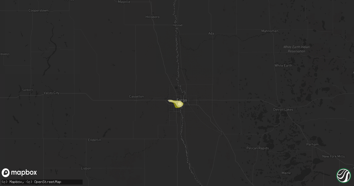
Hail Map in Fargo, ND on June 15, 2025
Get this storm
June 15 map
$229
one time, instant access
Download today. No call, no setup
Keep the $229
Bought the map and want the full workflow? Apply the entire $229 to a subscription within 7 days. None of it is wasted.
Every map, not just this one
This buys you this map. Subscription and you get every map we run, in the markets you choose from a few cities to whole states to nationwide. Plus real-time alerts the moment a storm fires.
Contact data
Name, contact info, occupancy, even credit band for addresses in the footprint. You go from where it hit to who to call.
Become the source they trust
Unlimited branding weather history reports on demand. You already have the documented answer ready for the property owner, and you are the one who showed up with it.
Property data and RoofTrace estimates
Pull up any address you have got, its value and the exact code rules for that jurisdiction, straight from One Click Code. Then RoofTrace estimates the squares, pitch, and roof value, priced the way you price.
Storm reports in Fargo, ND
Fargo, ND
| Date | Description |
|---|---|
| 06/15/20256:30 AM CDT | Public relayed through broadcast media of 1 inch hail at lewis & clark elementary school near university & i-94. |
| 06/15/20256:30 AM CDT | Public relayed through broadcast media of 1 inch hail at lewis |
| 06/15/20256:20 AM CDT | South university & i-94 with picture. |
| 06/15/20256:20 AM CDT | South university & i-94 with pic |
| 06/15/20256:19 AM CDT | University & 32nd ave s with picture. |
All States Impacted by Hail Map on June 15, 2025
All Cities Impacted by Hail Map on June 15, 2025
- Terry, MT
- Brockway, MT
- Mclean, TX
- Wellington, TX
- Burbank, SD
- Vermillion, SD
- Centerville, SD
- Roy, MT
- Beresford, SD
- Quail, TX
- Mangum, OK
- Johnson, KS
- Alcester, SD
- Cohagen, MT
- Ulysses, KS
- Altus, OK
- Olustee, OK
- Blair, OK
- Headrick, OK
- Altus Afb, OK
- Hedley, TX
- Lelia Lake, TX
- Eldorado, OK
- Sand Springs, MT
- Moscow, KS
- Hudson, SD
- Hugoton, KS
- Tipton, OK
- Elmer, OK
- Frederick, OK
- Vernon, TX
- Odell, TX
- Quanah, TX
- Hawarden, IA
- Chillicothe, TX
- Davidson, OK
- Oklaunion, TX
- Harrold, TX
- Ireton, IA
- Liberal, KS
- Le Mars, IA
- Akron, IA
- Forestburg, TX
- Sunset, TX
- Paducah, TX
- Forgan, OK
- Miller, SD
- Shamrock, TX
- Saint Lawrence, SD
- Meade, KS
- Ashton, IA
- Seymour, TX
- Benjamin, TX
- Knox City, TX
- Munday, TX
- O'Brien, TX
- Crowell, TX
- Holliday, TX
- Goree, TX
- Scotland, TX
- Archer City, TX
- Electra, TX
- Weinert, TX
- Iowa Park, TX
- Wichita Falls, TX
- Newcastle, TX
- Haskell, TX
- Rochester, TX
- Graham, TX
- Olney, TX
- Throckmorton, TX
- Loving, TX
- Windthorst, TX
- Woodson, TX
- Wessington, SD
- Memphis, TX
- Breckenridge, TX
- Albany, TX
- South Bend, TX
- Caddo, TX
- Wessington Springs, SD
- Moran, TX
- Wolsey, SD
- Huron, SD
- Baird, TX
- Cisco, TX
- Clyde, TX
- Abilene, TX
- Tuscola, TX
- Buffalo Gap, TX
- Cross Plains, TX
- Ovalo, TX
- Lawn, TX
- Willow Lake, SD
- Clark, SD
- Carpenter, SD
- Yale, SD
- Goldsboro, TX
- Burkett, TX
- Coleman, TX
- Garretson, SD
- Novice, TX
- Winters, TX
- Talpa, TX
- Santa Anna, TX
- Vienna, SD
- Hazel, SD
- Bryant, SD
- Jasper, MN
- Henry, SD
- Gustine, TX
- Whitney, TX
- Holden, LA
- Aquilla, TX
- Webster, SD
- Roslyn, SD
- Leesville, LA
- McGregor, TX
- Eden, SD
- Fort Hood, TX
- Temple, TX
- Nolanville, TX
- Belton, TX
- Woodbine, GA
- Hobson, MT
- Plantersville, TX
- Navasota, TX
- Gainesville, MO
- Georgetown, TX
- Splendora, TX
- Cleveland, TX
- Florence, TX
- New Caney, TX
- Llano, TX
- Kingsland, TX
- Porter, TX
- Spring, TX
- Smithville, TX
- Lake Park, GA
- Statenville, GA
- Horseshoe Bay, TX
- Conroe, TX
- Moore, MT
- Stanford, MT
- Rockdale, TX
- Weston, CO
- Brookings, SD
- Lexington, TX
- Caldwell, TX
- Bryan, TX
- Mayhill, NM
- Paige, TX
- Hearne, TX
- Houston, TX
- North Zulch, TX
- Normangee, TX
- Denton, MT
- Fort Benton, MT
- Boykins, VA
- Tinnie, NM
- Aurora, SD
- Branchville, VA
- Dime Box, TX
- Newsoms, VA
- Lincoln, TX
- Moccasin, MT
- Smiley, TX
- Loma, MT
- Wrightsboro, TX
- Interlachen, FL
- Gonzales, TX
- Flatonia, TX
- La Grange, TX
- Springfield, GA
- Muldoon, TX
- West Point, TX
- Wimberley, TX
- Spring Branch, TX
- Pomona, MO
- Grapeland, TX
- Canyon Lake, TX
- Blanco, TX
- Slayton, MN
- Roswell, NM
- Fairfield, MT
- Melrose, FL
- Crockett, TX
- Richmond, VA
- Artesia, NM
- Fort Shaw, MT
- Sun River, MT
- Vaughn, MT
- Florahome, FL
- West Plains, MO
- Alto, TX
- Sanborn, IA
- Paullina, IA
- Chunchula, AL
- Power, MT
- Carlsbad, NM
- Great Falls, MT
- Corona, NM
- Mountain View, MO
- Patterson, GA
- Hortense, GA
- Nahunta, GA
- Clayton, NC
- Hagerman, NM
- Black Eagle, MT
- Floweree, MT
- Birch Tree, MO
- Elizabeth, CO
- Clarion, IA
- Highwood, MT
- Wilmont, MN
- Lismore, MN
- Creston, IA
- Hartley, IA
- Freeman, VA
- Emporia, VA
- Lawrenceville, VA
- Jbsa Randolph, TX
- Converse, TX
- Kiowa, CO
- Cibolo, TX
- Richton, MS
- Fischer, TX
- Ocheyedan, IA
- Bulverde, TX
- State Line, MS
- Akron, CO
- Lockhart, TX
- New Braunfels, TX
- Geyser, MT
- Luling, TX
- Orient, IA
- Capitan, NM
- Jarratt, VA
- White Sulphur Springs, MT
- Melvin, IA
- Merriman, NE
- Remsen, IA
- Kingsley, IA
- Geraldine, MT
- Dows, IA
- Stockett, MT
- San Antonio, TX
- Big Sandy, MT
- Pearsall, TX
- Helotes, TX
- Lewistown, MT
- Fort Morgan, CO
- Marcus, IA
- Fort Sumner, NM
- Brush, CO
- Worthington, MN
- Vaughn, NM
- Louisburg, NC
- Spring Hope, NC
- Alden, IA
- Cody, NE
- Rocky Mount, NC
- Elm City, NC
- Pinetops, NC
- Millry, AL
- Chatom, AL
- Pipestone, MN
- Weldona, CO
- Harris, IA
- Whitakers, NC
- Tarboro, NC
- Battleboro, NC
- Castalia, NC
- Coffee Creek, MT
- Arcadia, FL
- Charlotte, TX
- Jourdanton, TX
- Frankville, AL
- Springer, NM
- Taiban, NM
- Enfield, NC
- Jackson, AL
- Okabena, MN
- Lakefield, MN
- Brewster, MN
- Dodson, MT
- Lake Park, IA
- Bigfoot, TX
- Malta, MT
- Forest Grove, MT
- Grass Range, MT
- Grove Hill, AL
- Wilsall, MT
- Savannah, GA
- Moore, TX
- Kimball, NE
- Elida, NM
- Livingston, MT
- Bozeman, MT
- Colorado Springs, CO
- Harrisburg, NE
- Dix, NE
- Snyder, CO
- Buffalo, MT
- Two Dot, MT
- Fortuna, ND
- Ledyard, IA
- Swea City, IA
- Lenox, IA
- Glenrock, WY
- Camden, NC
- Potter, NE
- Gillette, WY
- Cotulla, TX
- Scotland Neck, NC
- Sidney, NE
- Floyd, NM
- Melrose, NM
- Usaf Academy, CO
- Madrid, IA
- Woodward, IA
- Ambrose, ND
- Clearfield, IA
- Gurley, NE
- Diagonal, IA
- Crosby, ND
- Dalton, NE
- Winnett, MT
- Raton, NM
- Peetz, CO
- Bayard, NE
- Bedford, IA
- Richmond Hill, GA
- Peyton, CO
- Hinsdale, MT
- Judith Gap, MT
- Saco, MT
- Lovell, WY
- Cowley, WY
- Whatley, AL
- Armstrong, IA
- Beeville, TX
- Fort Peck, MT
- Hilger, MT
- Clovis, NM
- Mosby, MT
- Brusett, MT
- Calhan, CO
- Hulett, WY
- Devils Tower, WY
- Moorcroft, WY
- Fairmont, MN
- Blockton, IA
- Noonan, ND
- Columbus, ND
- Lead, SD
- Deadwood, SD
- Spearfish, SD
- Whitewood, SD
- Ryegate, MT
- Batesland, SD
- Lavina, MT
- Glasgow, MT
- Martin, SD
- Greenfield, IA
- Porcupine, SD
- Allen, SD
- McLeod, MT
- Griswold, IA
- Greenville, NC
- Redfield, IA
- Earlham, IA
- Nashua, MT
- Vandalia, MT
- Saint Marie, MT
- Vale, SD
- Nisland, SD
- Wounded Knee, SD
- Martinsdale, MT
- Red Oak, IA
- Elliott, IA
- Lewis, IA
- Sturgis, SD
- Marne, IA
- Atlantic, IA
- Clarinda, IA
- Nodaway, IA
- Corning, IA
- Adel, IA
- New Raymer, CO
- Lodgepole, NE
- Padroni, CO
- Roberts, MT
- Newell, SD
- Oshkosh, NE
- Roundup, MT
- Chappell, NE
- Lewellen, NE
- Lisco, NE
- Big Springs, NE
- Brule, NE
- Ogallala, NE
- Keystone, NE
- Lemoyne, NE
- Arthur, NE
- Wolf Point, MT
- Frazer, MT
- Forsyth, MT
- Granger, IA
- Wanblee, SD
- Big Timber, MT
- Poplar, MT
- New Underwood, SD
- Oelrichs, SD
- Nye, MT
- Absarokee, MT
- Hermosa, SD
- Scenic, SD
- Angela, MT
- Hardin, MT
- Owanka, SD
- Hays, MT
- Pine Ridge, SD
- Heber Springs, AR
- Fishtail, MT
- Caputa, SD
- Pompeys Pillar, MT
- Lodge Grass, MT
- Kyle, SD
- Hershey, NE
- Manderson, SD
- Wall, SD
- Wasta, SD
- Paxton, NE
- Brockton, MT
- Westby, MT
- Roscoe, MT
- Red Lodge, MT
- Vredenburgh, AL
- Oglala, SD
- Plentywood, MT
- Mullen, NE
- Otter, MT
- Homestead, MT
- Medicine Lake, MT
- Bighorn, MT
- Tryon, NE
- North Platte, NE
- Crow Agency, MT
- Busby, MT
- Birney, MT
- Miles City, MT
- Kinsey, MT
- Decker, MT
- Valentine, NE
- Conchas Dam, NM
- Sutherland, NE
- Maxwell, NE
- Lambert, MT
- Fairview, MT
- Culbertson, MT
- Froid, MT
- Kadoka, SD
- Interior, SD
- Philip, SD
- Quinn, SD
- Ballantine, MT
- Worden, MT
- Rosebud, MT
- Volborg, MT
- Newkirk, NM
- Lame Deer, MT
- Stapleton, NE
- Ismay, MT
- Cherry Creek, SD
- Curtis, NE
- Maywood, NE
- Colstrip, MT
- Cartwright, ND
- Moorefield, NE
- Indianola, NE
- Bartley, NE
- Buffalo, SD
- Bowman, ND
- Camp Crook, SD
- Meadow, SD
- Rhame, ND
- Ludlow, SD
- Alzada, MT
- Lemmon, SD
- New England, ND
- Timber Lake, SD
- Scranton, ND
- Glencross, SD
- Dupree, SD
- Trail City, SD
- McIntosh, SD
- Ralph, SD
- Reva, SD
- Reeder, ND
- Wakpala, SD
- Lodgepole, SD
- Amidon, ND
- Prairie City, SD
- Hettinger, ND
- Regent, ND
- McLaughlin, SD
- Selfridge, ND
- Keldron, SD
- Watford City, ND
- Agar, SD
- New Leipzig, ND
- Watauga, SD
- Mound City, SD
- Mott, ND
- Bison, SD
- Elgin, ND
- Eureka, SD
- Carson, ND
- Shields, ND
- Pollock, SD
- Herreid, SD
- Solen, ND
- Highmore, SD
- Raleigh, ND
- Fort Yates, ND
- Flasher, ND
- Ashley, ND
- Zeeland, ND
- Hague, ND
- Strasburg, ND
- Linton, ND
- Hazelton, ND
- Wishek, ND
- Mandan, ND
- Cannon Ball, ND
- Bancroft, IA
- Walker, SD
- Morristown, SD
- Saint Anthony, ND
- Ipswich, SD
- Roscoe, SD
- Kintyre, ND
- Saint Onge, SD
- Braddock, ND
- Bruce, SD
- Moffit, ND
- Estelline, SD
- Toronto, SD
- Napoleon, ND
- Saint James, MN
- Steele, ND
- Lehr, ND
- Clear Lake, SD
- Dawson, ND
- Westport, SD
- Edgeley, ND
- Kulm, ND
- Fredonia, ND
- Tappen, ND
- Streeter, ND
- Turton, SD
- Gackle, ND
- Conde, SD
- Raymond, SD
- Frederick, SD
- Minnesota Lake, MN
- Jud, ND
- Ellendale, ND
- Fullerton, ND
- Oakes, ND
- Jamestown, ND
- Montpelier, ND
- Dickey, ND
- Berlin, ND
- Britton, SD
- Waubay, SD
- Grenville, SD
- Lamoure, ND
- Cogswell, ND
- Marion, ND
- Bricelyn, MN
- Blue Earth, MN
- Litchville, ND
- Fort Ransom, ND
- Verona, ND
- Spiritwood, ND
- Havana, ND
- Stirum, ND
- Wells, MN
- Easton, MN
- Forman, ND
- Sanborn, ND
- Peever, SD
- Sisseton, SD
- Lisbon, ND
- Saint Peter, MN
- New Effington, SD
- Tower City, ND
- Milnor, ND
- Kiester, MN
- Hankinson, ND
- Wyndmere, ND
- Alden, MN
- Rosholt, SD
- Fairmount, ND
- Wahpeton, ND
- Wheaton, MN
- West Fargo, ND
- Fargo, ND
- Davenport, ND
- Horace, ND
- Moorhead, MN
- Blooming Prairie, MN
- Sabin, MN
- Rothsay, MN
- Barnesville, MN
- Pelican Rapids, MN
- Mapleton, MN
- Waltham, MN
- Brownsdale, MN
- Delavan, MN
- Austin, MN
- Emmons, MN
- Conger, MN
- Albert Lea, MN
- Hawley, MN


