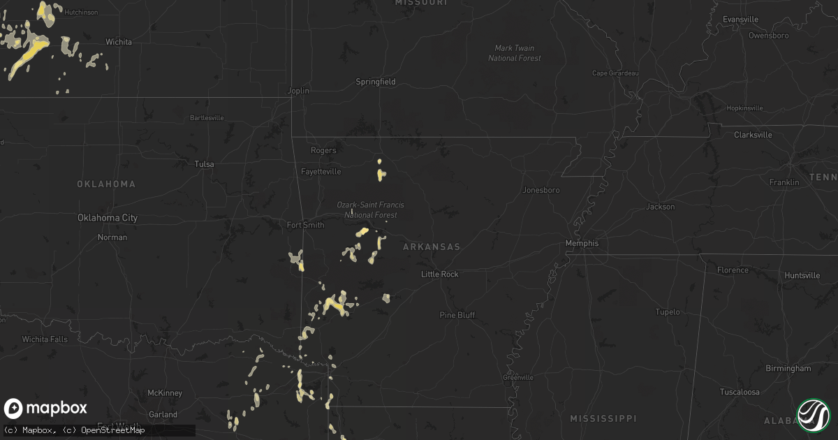
Hail Map in South Dakota on June 15, 2012
Get this storm
June 15 map
$229
one time, instant access
Download today. No call, no setup
Keep the $229
Bought the map and want the full workflow? Apply the entire $229 to a subscription within 7 days. None of it is wasted.
Every map, not just this one
This buys you this map. Subscription and you get every map we run, in the markets you choose from a few cities to whole states to nationwide. Plus real-time alerts the moment a storm fires.
Contact data
Name, contact info, occupancy, even credit band for addresses in the footprint. You go from where it hit to who to call.
Become the source they trust
Unlimited branding weather history reports on demand. You already have the documented answer ready for the property owner, and you are the one who showed up with it.
Property data and RoofTrace estimates
Pull up any address you have got, its value and the exact code rules for that jurisdiction, straight from One Click Code. Then RoofTrace estimates the squares, pitch, and roof value, priced the way you price.
Storm reports in South Dakota
South Dakota
| Date | Description |
|---|---|
| 06/15/20126:00 PM CDT | Hail lasted from 500 pm to 525 pm mdt. Did considerable crop damage. Also had 30 to 40 mph winds. |
| 06/15/20125:40 PM CDT | Hail fell from 440 pm to 450 pm mdt...and was still hailing. |
| 06/15/20125:35 PM CDT | A local report indicates 70 MPH wind near 8 SSW UNION CENTER |
| 06/15/20125:35 PM CDT | Wind gusts estimated at 60 to 70 mph. |
| 06/15/20125:35 PM CDT | Hail fell from 435 pm to 450 pm mdt. |
| 06/15/20125:18 PM CDT | Mostly dime hail with a few quarters from around 418 pm to 423 pm mdt. |
| 06/15/20125:15 PM CDT | A local report indicates 1.00 inch wind near 5 N HEREFORD |
| 06/15/20124:00 PM CDT | A few large hailstones bounced off the pickup when traveling toward oelrichs. |
| 06/15/20123:30 PM CDT | 10 inch diameter tree limbs snapped off cottonwood trees. |
All States Impacted by Hail Map on June 15, 2012
Cities Impacted by Hail Map on June 15, 2012
- Merriman, NE
- Martin, SD
- Gordon, NE
- Shreveport, LA
- Keithville, LA
- Stonewall, LA
- Elmer, OK
- Plains, TX
- Bard, NM
- San Jon, NM
- Washington, LA
- Dupree, SD
- Sulphur, LA
- Scranton, ND
- Reeder, ND
- Denver City, TX
- Seagraves, TX
- Kanorado, KS
- Ochopee, FL
- Naples, FL
- Levelland, TX
- Flagler, CO
- Seibert, CO
- Mosquero, NM
- Clayton, NM
- Roy, NM
- Simms, TX
- New Boston, TX
- Altus, OK
- Olustee, OK
- Havana, AR
- Danville, AR
- Gravelly, AR
- Booneville, AR
- Bluffton, AR
- Conchas Dam, NM
- Plainview, AR
- Ola, AR
- Muleshoe, TX
- Idalia, CO
- Lufkin, TX
- Livingston, TX
- Burlington, CO
- Mena, AR
- Waldron, AR
- Poteau, OK
- Heavener, OK
- Howe, OK
- Miami, FL
- Springview, NE
- Wilmore, KS
- Coldwater, KS
- Boca Raton, FL
- Colmesneil, TX
- Woodville, TX
- Hot Springs, SD
- Smithwick, SD
- Pine Ridge, SD
- Oral, SD
- Edgemont, SD
- Oelrichs, SD
- Slaton, TX
- Lubbock, TX
- Jasper, AR
- Ulysses, KS
- Holcomb, KS
- Lakin, KS
- Copeland, KS
- Pierceville, KS
- Ingalls, KS
- Garden City, KS
- Sublette, KS
- Crosbyton, TX
- Wolfforth, TX
- Wilson, TX
- Tatum, NM
- Karval, CO
- Hugo, CO
- Fort Davis, TX
- Pueblo, CO
- Avondale, CO
- Oil City, LA
- Mooringsport, LA
- Vivian, LA
- Sedalia, CO
- Ralls, TX
- Newell, SD
- Labelle, FL
- Portales, NM
- Parthenon, AR
- Marble Falls, AR
- Hot Springs National Park, AR
- Idalou, TX
- Ransom Canyon, TX
- Tahoka, TX
- Lorenzo, TX
- Chester, TX
- Agate, CO
- Stringtown, OK
- Kress, TX
- St John, KS
- Hudson, KS
- Stafford, KS
- Greensburg, KS
- Franklin, LA
- Wheatland, WY
- Moscow, TX
- Chadron, NE
- Salt Flat, TX
- New Blaine, AR
- Alamo, ND
- Mineola, TX
- Punta Gorda, FL
- Winner, SD
- Immokalee, FL
- Clewiston, FL
- Rockwell City, IA
- Newell, IA
- Varina, IA
- Fonda, IA
- Nemaha, IA
- Pocahontas, IA
- Jolley, IA
- Lytton, IA
- Sac City, IA
- Lake City, IA
- Auburn, IA
- Lusk, WY
- Wasta, SD
- Enning, SD
- White Owl, SD
- Wall, SD
- Sturgis, SD
- Howes, SD
- New Underwood, SD
- Pattison, MS
- Port Gibson, MS
- Brownfield, TX
- Sylvia, KS
- Turon, KS
- Plevna, KS
- Cimarron, KS
- Montezuma, KS
- Hollis, OK
- Childress, TX
- Mexico, MO
- Calhan, CO
- Apple Springs, TX
- Kingman, KS
- Kimball, NE
- Coats, KS
- Pratt, KS
- Cunningham, KS
- Sawyer, KS
- Vinson, OK
- Offerle, KS
- Jacksonville, TX
- Rusk, TX
- Meadow, TX
- Quitman, TX
- Wright, KS
- Dodge City, KS
- Yuma, CO
- Colome, SD
- Clarendon, TX
- Lakeview, TX
- Quitaque, TX
- Attica, KS
- Clinton, MS
- Jackson, MS
- Boone, CO
- Wagon Mound, NM
- Kyle, SD
- Silverton, TX
- Porcupine, SD
- Holyoke, CO
- Philip, SD
- Milesville, SD
- Moore Haven, FL
- Venus, FL
- Deville, LA
- Center Point, LA
- Jasper, TX
- Anacoco, LA
- Fort Lauderdale, FL
- Pompano Beach, FL
- Troup, TX
- Tyler, TX
- Subiaco, AR
- Ramah, CO
- Corrigan, TX
- Tulia, TX
- Wray, CO
- Wanblee, SD
- North Port, FL
- Myakka City, FL
- Arcadia, FL
- Port Charlotte, FL
- Wounded Knee, SD
- Marshall, TX
- Bucklin, KS
- Mullinville, KS
- Gould, OK
- Olton, TX
- Kountze, TX
- Arnett, OK
- Singer, LA
- Loxahatchee, FL
- Grapeland, TX
- Kennard, TX
- Harrison, AR
- Bogata, TX
- Jetmore, KS
- Spearville, KS
- Solano, NM
- Sun City, KS
- Lake City, KS
- West Palm Beach, FL
- Melrose, NM
- Littleton, CO
- Lone Tree, CO
- Englewood, CO
- Olney Springs, CO
- Ordway, CO
- Plaquemine, LA
- Sunshine, LA
- Clovis, NM
- Keystone, NE
- Milnesand, NM
- Effie, LA
- Mount Vernon, TX
- Mount Pleasant, TX
- Gering, NE
- Texarkana, AR
- Hialeah, FL
- Opa Locka, FL
- Key Biscayne, FL
- Wood, SD
- Witten, SD
- Oldsmar, FL
- Safety Harbor, FL
- Winnsboro, TX
- Atlanta, TX
- Rodessa, LA
- Bivins, TX
- Doddridge, AR
- Naples, TX
- Marietta, TX
- Buffalo Gap, SD
- Douglassville, TX
- Dix, NE
- Potter, NE
- Joes, CO
- Kirk, CO
- Gove, KS
- Brookhaven, MS
- Eckley, CO
- Union Center, SD
- Harrisburg, NE
- Sugar City, CO
- Ford, KS
- Lockney, TX
- Dalhart, TX
- Springlake, TX
- Viola, KS
- Hughes Springs, TX
- Linden, TX
- Protection, KS
- Bossier City, LA
- Bushnell, NE
- Smithville, OK
- Burlington, OK
- Homestead, FL
- Kirby, AR
- Glenwood, AR
- Newhope, AR
- Umpire, AR
- Langley, AR
- Vona, CO
- Foreman, AR
- Holly, CO
- Haviland, KS
- Dardanelle, AR
- Cumberland, IA
- Harrison, NE
- Tokio, TX
- Mills, NE
- Lewis, KS
- Conway Springs, KS
- Wellington, KS
- Genoa, CO
- Clarksville, TX
- Vernon, CO
- Winthrop, AR
- De Queen, AR
- Horatio, AR
- Minneola, KS
- Leoti, KS
- Highmore, SD
- Meade, KS
- Gloster, LA
- Frierson, LA
- Delray Beach, FL
- Hale Center, TX
- Stratton, CO
- Ropesville, TX
- Mission, SD
- Valentine, NE
- Caddo Gap, AR
- Cleveland, TX
- Coldspring, TX
- Allen, SD
- Vinton, LA
- Arp, TX
- Whitehouse, TX
- Atkinson, NE
- Grand Cane, LA
- Kenesaw, NE
- Minden, NE
- Heartwell, NE
- Holstein, NE
- Macksville, KS
- Scroggins, TX
- Oneill, NE
- Sundown, TX
- Massena, IA
- Wiota, IA
- Anita, IA
- Onalaska, TX
- Deweese, NE
- Stamford, NE
- Kiowa, CO
- Elbert, CO
- Bell City, LA
- Guernsey, WY
- Abernathy, TX
- Eads, CO
- Wells, TX
- Elida, NM
- Laramie, WY
- Waldron, KS
- Hazelton, KS
- Kit Carson, CO
- Saint Martinville, LA
- Crossroads, NM
- Roswell, NM
- Marsland, NE
- Haworth, OK
- Marathon, TX
- Floydada, TX
- Larned, KS
- Newton, TX
- Yoder, CO
- Rush, CO
- Bagwell, TX
- Torrington, WY
- Willis, TX
- New Waverly, TX
- Russellville, AR
- Dimmitt, TX
- Gilead, NE
- Alexandria, NE
- Simla, CO
- Weskan, KS
- Ashland, KS
- De Kalb, TX
- Apollo Beach, FL
- Van Horn, TX
- Arapahoe, CO
- Piedmont, SD
- Vicksburg, MS
- Pitkin, LA
- Byers, KS
- Earth, TX
- Lorman, MS
- Tucumcari, NM
- Sidney, NE
- Grannis, AR
- Gillham, AR
- Hemingford, NE
- Plainview, TX
- Roseland, NE
- Juniata, NE
- Dierks, AR
- Wickes, AR
- Ashby, NE
- Jeanerette, LA
- Baldwin, LA
- Akron, CO
- Hershey, NE
- Bridgewater, IA
- Fontanelle, IA
- Grosse Tete, LA
- Garfield, KS
- Miami Beach, FL
- Miami Gardens, FL
- Scottsbluff, NE
- Matheson, CO
- Lottie, LA
- Tipton, OK
- Mitchell, NE
- Tampa, FL
- Quanah, TX
- Orange, TX
- Iuka, KS
- Yantis, TX
- Alba, TX
- Saint Francis, KS
- Scranton, AR
- Delaware, AR
- Paris, AR
- Deweyville, TX
- Gregory, SD
- Arriba, CO
- Ashdown, AR
- Spivey, KS
- Nashville, KS
- Norman, AR
- Maringouin, LA
- Sharon Springs, KS
- Diboll, TX
- Zachary, LA
- Haswell, CO
- Ensign, KS
- Limon, CO
- Baton Rouge, LA
- Pep, NM
- Bethune, CO
- Hermanville, MS
- Dallas, SD
- Cope, CO
- Hart, TX
- Abbyville, KS
- Sterling, KS
- Fowler, KS
- Longville, LA
- Oxford, NE
- Brookeland, TX
- Spurger, TX
- Silsbee, TX
- Fred, TX
- Hillister, TX
- Warren, TX
- Seminole, TX
- Arthur, NE
- Oshkosh, NE
- Rover, AR
- Groveton, TX
- Belpre, KS
- Amherst, TX
- Enochs, TX
- Buna, TX
- Wilsonville, NE
- Adair, IA
- Norwich, KS
- Avery, TX
- Syracuse, KS
- Kinsley, KS
- Argonia, KS
- Harper, KS
- Milton, KS
- Monument, KS
- Alma, NE
- Wesson, MS
- Morton, TX
- Crowell, TX
- Rapid City, SD
- Arlington, KS
- Murdock, KS
- Dickens, TX
- Stockton, KS
- Sontag, MS
- Whiteface, TX
- Addis, LA
- Guymon, OK
- Blossom, TX
- Paris, TX
- Lebanon, NE
- Granada, CO
- Mills, NM
- Box Elder, SD
- Orleans, NE
- Malvern, AR
- Royal, AR
- Haigler, NE
- Deerfield Beach, FL
- Sarasota, FL
- Santa Fe, MO
- Lyman, NE
- Hill City, SD
- Anton, CO
- Floyd, NM
- Wellington, TX
- Cherokee, OK
- Lena, LA
- Provencal, LA
- Leesburg, TX
- Pittsburg, TX
- Sulphur Bluff, TX
- Hartman, AR
- Clarksville, AR
- Dalton, NE
- Bradenton, FL
- Dover, AR
- Arapahoe, NE
- Trementina, NM
- Saucier, MS


