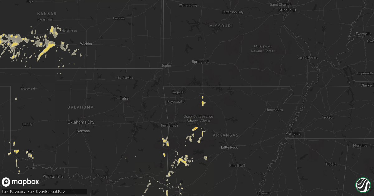
Hail Map on June 15, 2012
Get this storm
June 15 map
$229
one time, instant access
Download today. No call, no setup
Keep the $229
Bought the map and want the full workflow? Apply the entire $229 to a subscription within 7 days. None of it is wasted.
Every map, not just this one
This buys you this map. Subscription and you get every map we run, in the markets you choose from a few cities to whole states to nationwide. Plus real-time alerts the moment a storm fires.
Contact data
Name, contact info, occupancy, even credit band for addresses in the footprint. You go from where it hit to who to call.
Become the source they trust
Unlimited branding weather history reports on demand. You already have the documented answer ready for the property owner, and you are the one who showed up with it.
Property data and RoofTrace estimates
Pull up any address you have got, its value and the exact code rules for that jurisdiction, straight from One Click Code. Then RoofTrace estimates the squares, pitch, and roof value, priced the way you price.
States Impacted by Hail Map on June 15, 2012
Storm reports
Florida
| Date | Description |
|---|---|
| 06/15/20126:35 PM CDT | A local report indicates 1.00 inch wind near JEROME |
| 06/15/20125:05 PM CDT | Quarter sized hail was reported at peachland blvd and harbor blvd in port charlotte. |
| 06/15/20124:48 PM CDT | Baseball sized hail reported near sr 833 and sr 846 in hendry county. |
| 06/15/20123:35 PM CDT | Tree reported down and sign damaged along south highway 441. |
| 06/15/20123:20 PM CDT | Off-duty nws employee reported quarter size hail near brickel ave. |
| 06/15/20123:20 PM CDT | Time of the event corrected...golf ball sized hail reported at coconut grove. |
| 06/15/20123:20 PM CDT | Three inch hail reported in the coral gables area |
| 06/15/20122:42 PM CDT | Trained spotter reported quarter sized hail near i-95 and oakland park blvd. |
| 06/15/20122:40 PM CDT | Trained spotter reported a 6ft tall tree uprooted near nw 31 st. |
| 06/15/20122:20 PM CDT | Golf ball sized hail reported at coconut grove. |
| 06/15/20121:48 PM CDT | Trained spotter reported 1 1/2in hail in boca raton. |
| 06/15/20121:41 PM CDT | Quarter sized hail reported by multiple trained spotters at boca raton. |
Texas
| Date | Description |
|---|---|
| 06/15/20126:53 PM CDT | Mostly nickel size but a few quarter size. |
| 06/15/20126:43 PM CDT | Quarter size hail reported just east of simms |
| 06/15/20126:43 PM CDT | Spotter reports power lines down near the town of simms. |
| 06/15/20125:34 PM CDT | Storage shed flipped on side on county road 4191 in hartburg. Time estimated by radar. |
| 06/15/20125:30 PM CDT | A local report indicates 1.00 inch wind near MARSHALL |
| 06/15/20125:30 PM CDT | Poweline and power poles downed in the city.. |
| 06/15/20122:20 AM CDT | West texas mesonet report |
| 06/15/20121:05 AM CDT | West texas mesonet report. Gusts occured in the wake of dissipating thunderstorms. Additional wind gusts of 58 mph at 1235 and 1250 and 62 mph at 1255 am |
| 06/14/201211:05 PM CDT | West texas mesonet |
| 06/14/201210:50 PM CDT | West texas mesonet |
| 06/14/201210:44 PM CDT | A local report indicates 1.50 inch wind near 1 S DALHART |
| 06/14/201210:25 PM CDT | West texas mesonet station |
| 06/14/20129:47 PM CDT | A local report indicates 65 MPH wind near 2 SE WOLFFORTH |
| 06/14/20129:30 PM CDT | Tree reported down near highway 69. |
| 06/14/20129:13 PM CDT | Schoolnet site reported gust |
| 06/14/20129:10 PM CDT | Schoolnet site reported gust |
| 06/14/20129:00 PM CDT | Report from west texas mesonet site |
| 06/14/20127:50 PM CDT | Visibility also near zero with blowing dust. |
| 06/14/20127:45 PM CDT | A local report indicates 67 MPH wind near EL PASO |
| 06/14/20127:10 PM CDT | Report of a large tree down across highway 77 between atlanta and douglassville |
Mississippi
| Date | Description |
|---|---|
| 06/14/20127:33 PM CDT | A couple trees and a power line were blown down |
Iowa
| Date | Description |
|---|---|
| 06/15/20124:44 PM CDT | Several 6 inch limbs down across the yard. Pea size hail also observed. Time estimated from radar. |
| 06/15/20124:40 PM CDT | Tree branches down and heavy rain |
| 06/15/20124:31 PM CDT | Several large trees down across town. One tree fell on top of power lines knocking them to the ground. Time estimated from radar. |
| 06/15/20124:03 PM CDT | Several six to eight inch limbs down. Top of a large tree was sheared off. Pea size hail also observed. |
South Dakota
| Date | Description |
|---|---|
| 06/15/20126:00 PM CDT | Hail lasted from 500 pm to 525 pm mdt. Did considerable crop damage. Also had 30 to 40 mph winds. |
| 06/15/20125:40 PM CDT | Hail fell from 440 pm to 450 pm mdt...and was still hailing. |
| 06/15/20125:35 PM CDT | A local report indicates 70 MPH wind near 8 SSW UNION CENTER |
| 06/15/20125:35 PM CDT | Hail fell from 435 pm to 450 pm mdt. |
| 06/15/20125:35 PM CDT | Wind gusts estimated at 60 to 70 mph. |
| 06/15/20125:18 PM CDT | Mostly dime hail with a few quarters from around 418 pm to 423 pm mdt. |
| 06/15/20125:15 PM CDT | A local report indicates 1.00 inch wind near 5 N HEREFORD |
| 06/15/20124:00 PM CDT | A few large hailstones bounced off the pickup when traveling toward oelrichs. |
| 06/15/20123:30 PM CDT | 10 inch diameter tree limbs snapped off cottonwood trees. |
Tennessee
| Date | Description |
|---|---|
| 06/15/20126:40 PM CDT | Damage occurred to two business...one at 304 sand hill road called swap diesel and to another business named crystal clean at 306 sand hill road. |
Colorado
| Date | Description |
|---|---|
| 06/15/20123:23 PM CDT | A local report indicates 1.25 inch wind near HIGHLANDS RANCH |
| 06/15/20123:18 PM CDT | A local report indicates 1.00 inch wind near HIGHLANDS RANCH |
| 06/15/20122:58 PM CDT | Mostly pea sized |
| 06/14/20128:31 PM CDT | A local report indicates 64 MPH wind near 12 SW KARVAL |
| 06/14/20127:37 PM CDT | Near mile marker 400 along i-70. |
Kansas
| Date | Description |
|---|---|
| 06/15/20125:35 AM CDT | A local report indicates 60 MPH wind near HAVEN |
| 06/15/20125:30 AM CDT | Large tree reported down near 5th and emporia. |
| 06/15/20125:26 AM CDT | Hutchinson news reported several uprooted trees and power lines down in the block of hyde park and 20th street between jefferson and madison streets. |
| 06/15/20125:26 AM CDT | Large limbs downed in hutchinson. |
| 06/15/20125:21 AM CDT | 65-70 mph. Relayed through emergency management. |
| 06/15/20125:12 AM CDT | Relayed thru reno county emergency management. |
| 06/15/20125:05 AM CDT | Large tree downed across arlington road west of streling road. Time estimated per doppler. |
| 06/15/20124:53 AM CDT | Relayed via law enforcement. |
| 06/15/20124:20 AM CDT | A local report indicates 60 MPH wind near PRATT |
| 06/15/20123:55 AM CDT | A local report indicates 60 MPH wind near GREENSBURG |
| 06/15/20123:40 AM CDT | A local report indicates 1.00 inch wind near 6 NW COLDWATER |
Oklahoma
| Date | Description |
|---|---|
| 06/14/20128:42 PM CDT | Power pole/lines down vicinity of choctaw golf course off hwy 59 south side of poteau. |
Louisiana
| Date | Description |
|---|---|
| 06/15/20126:45 PM CDT | Large tree limb on a car near grimmet drive. |
| 06/15/20126:35 PM CDT | Golf ball sized hail at the boardwalk |
| 06/15/20126:35 PM CDT | Golf ball sized hail in the highland area |
| 06/15/20126:25 PM CDT | A local report indicates 1.75 inch wind near SHREVEPORT |
| 06/15/20126:15 PM CDT | Golf ball sized hail near byrd high school. |
| 06/15/20126:10 PM CDT | Power lines down near frierson. |
| 06/15/20126:10 PM CDT | Quarter size hail one mile west of lsus. |
Arkansas
| Date | Description |
|---|---|
| 06/15/20126:30 PM CDT | Tree limbs down |
| 06/15/20126:25 PM CDT | Trees down near foreman. |
| 06/15/20126:20 PM CDT | A local report indicates 1.00 inch wind near DE QUEEN |
| 06/15/20125:14 PM CDT | Large tree limb down near the intersection of 5th street and 5th avenue in dardanelle. |
| 06/15/20125:05 PM CDT | A resturante in the down town area had its tin roof peelled off due to strong thunderstorm winds. |
| 06/15/20125:05 PM CDT | Small limbs were reported down on ar hwy 155 between mt. Nebo state park and dardanelle. |
| 06/15/20124:50 PM CDT | Quarter size hail near genoa. |
| 06/15/20124:37 PM CDT | Quarter to golf ball sized hail fell. |
North Dakota
| Date | Description |
|---|---|
| 06/14/201210:17 PM CDT | Bismarck asos measured a peak wind gust of 61 mph with these storms. |
New Mexico
| Date | Description |
|---|---|
| 06/15/20121:30 AM CDT | A local report indicates 1.00 inch wind near 1 ESE PORTALES |
| 06/14/20127:55 PM CDT | A local report indicates 82 MPH wind near KQMG |
Cities Impacted by Hail Map on June 15, 2012
- Merriman, NE
- Martin, SD
- Gordon, NE
- Shreveport, LA
- Keithville, LA
- Stonewall, LA
- Elmer, OK
- Plains, TX
- Bard, NM
- San Jon, NM
- Washington, LA
- Dupree, SD
- Sulphur, LA
- Scranton, ND
- Reeder, ND
- Denver City, TX
- Seagraves, TX
- Kanorado, KS
- Ochopee, FL
- Naples, FL
- Levelland, TX
- Flagler, CO
- Seibert, CO
- Mosquero, NM
- Clayton, NM
- Roy, NM
- Simms, TX
- New Boston, TX
- Altus, OK
- Olustee, OK
- Havana, AR
- Danville, AR
- Gravelly, AR
- Booneville, AR
- Bluffton, AR
- Conchas Dam, NM
- Plainview, AR
- Ola, AR
- Muleshoe, TX
- Idalia, CO
- Lufkin, TX
- Livingston, TX
- Burlington, CO
- Mena, AR
- Waldron, AR
- Poteau, OK
- Heavener, OK
- Howe, OK
- Miami, FL
- Springview, NE
- Wilmore, KS
- Coldwater, KS
- Boca Raton, FL
- Colmesneil, TX
- Woodville, TX
- Hot Springs, SD
- Smithwick, SD
- Pine Ridge, SD
- Oral, SD
- Edgemont, SD
- Oelrichs, SD
- Slaton, TX
- Lubbock, TX
- Jasper, AR
- Ulysses, KS
- Holcomb, KS
- Lakin, KS
- Copeland, KS
- Pierceville, KS
- Ingalls, KS
- Garden City, KS
- Sublette, KS
- Crosbyton, TX
- Wolfforth, TX
- Wilson, TX
- Tatum, NM
- Karval, CO
- Hugo, CO
- Fort Davis, TX
- Pueblo, CO
- Avondale, CO
- Oil City, LA
- Mooringsport, LA
- Vivian, LA
- Sedalia, CO
- Ralls, TX
- Newell, SD
- Labelle, FL
- Portales, NM
- Parthenon, AR
- Marble Falls, AR
- Hot Springs National Park, AR
- Idalou, TX
- Ransom Canyon, TX
- Tahoka, TX
- Lorenzo, TX
- Chester, TX
- Agate, CO
- Stringtown, OK
- Kress, TX
- St John, KS
- Hudson, KS
- Stafford, KS
- Greensburg, KS
- Franklin, LA
- Wheatland, WY
- Moscow, TX
- Chadron, NE
- Salt Flat, TX
- New Blaine, AR
- Alamo, ND
- Mineola, TX
- Punta Gorda, FL
- Winner, SD
- Immokalee, FL
- Clewiston, FL
- Rockwell City, IA
- Newell, IA
- Varina, IA
- Fonda, IA
- Nemaha, IA
- Pocahontas, IA
- Jolley, IA
- Lytton, IA
- Sac City, IA
- Lake City, IA
- Auburn, IA
- Lusk, WY
- Wasta, SD
- Enning, SD
- White Owl, SD
- Wall, SD
- Sturgis, SD
- Howes, SD
- New Underwood, SD
- Pattison, MS
- Port Gibson, MS
- Brownfield, TX
- Sylvia, KS
- Turon, KS
- Plevna, KS
- Cimarron, KS
- Montezuma, KS
- Hollis, OK
- Childress, TX
- Mexico, MO
- Calhan, CO
- Apple Springs, TX
- Kingman, KS
- Kimball, NE
- Coats, KS
- Pratt, KS
- Cunningham, KS
- Sawyer, KS
- Vinson, OK
- Offerle, KS
- Jacksonville, TX
- Rusk, TX
- Meadow, TX
- Quitman, TX
- Wright, KS
- Dodge City, KS
- Yuma, CO
- Colome, SD
- Clarendon, TX
- Lakeview, TX
- Quitaque, TX
- Attica, KS
- Clinton, MS
- Jackson, MS
- Boone, CO
- Wagon Mound, NM
- Kyle, SD
- Silverton, TX
- Porcupine, SD
- Holyoke, CO
- Philip, SD
- Milesville, SD
- Moore Haven, FL
- Venus, FL
- Deville, LA
- Center Point, LA
- Jasper, TX
- Anacoco, LA
- Fort Lauderdale, FL
- Pompano Beach, FL
- Troup, TX
- Tyler, TX
- Subiaco, AR
- Ramah, CO
- Corrigan, TX
- Tulia, TX
- Wray, CO
- Wanblee, SD
- North Port, FL
- Myakka City, FL
- Arcadia, FL
- Port Charlotte, FL
- Wounded Knee, SD
- Marshall, TX
- Bucklin, KS
- Mullinville, KS
- Gould, OK
- Olton, TX
- Kountze, TX
- Arnett, OK
- Singer, LA
- Loxahatchee, FL
- Grapeland, TX
- Kennard, TX
- Harrison, AR
- Bogata, TX
- Jetmore, KS
- Spearville, KS
- Solano, NM
- Sun City, KS
- Lake City, KS
- West Palm Beach, FL
- Melrose, NM
- Littleton, CO
- Lone Tree, CO
- Englewood, CO
- Olney Springs, CO
- Ordway, CO
- Plaquemine, LA
- Sunshine, LA
- Clovis, NM
- Keystone, NE
- Milnesand, NM
- Effie, LA
- Mount Vernon, TX
- Mount Pleasant, TX
- Gering, NE
- Texarkana, AR
- Hialeah, FL
- Opa Locka, FL
- Key Biscayne, FL
- Wood, SD
- Witten, SD
- Oldsmar, FL
- Safety Harbor, FL
- Winnsboro, TX
- Atlanta, TX
- Rodessa, LA
- Bivins, TX
- Doddridge, AR
- Naples, TX
- Marietta, TX
- Buffalo Gap, SD
- Douglassville, TX
- Dix, NE
- Potter, NE
- Joes, CO
- Kirk, CO
- Gove, KS
- Brookhaven, MS
- Eckley, CO
- Union Center, SD
- Harrisburg, NE
- Sugar City, CO
- Ford, KS
- Lockney, TX
- Dalhart, TX
- Springlake, TX
- Viola, KS
- Hughes Springs, TX
- Linden, TX
- Protection, KS
- Bossier City, LA
- Bushnell, NE
- Smithville, OK
- Burlington, OK
- Homestead, FL
- Kirby, AR
- Glenwood, AR
- Newhope, AR
- Umpire, AR
- Langley, AR
- Vona, CO
- Foreman, AR
- Holly, CO
- Haviland, KS
- Dardanelle, AR
- Cumberland, IA
- Harrison, NE
- Tokio, TX
- Mills, NE
- Lewis, KS
- Conway Springs, KS
- Wellington, KS
- Genoa, CO
- Clarksville, TX
- Vernon, CO
- Winthrop, AR
- De Queen, AR
- Horatio, AR
- Minneola, KS
- Leoti, KS
- Highmore, SD
- Meade, KS
- Gloster, LA
- Frierson, LA
- Delray Beach, FL
- Hale Center, TX
- Stratton, CO
- Ropesville, TX
- Mission, SD
- Valentine, NE
- Caddo Gap, AR
- Cleveland, TX
- Coldspring, TX
- Allen, SD
- Vinton, LA
- Arp, TX
- Whitehouse, TX
- Atkinson, NE
- Grand Cane, LA
- Kenesaw, NE
- Minden, NE
- Heartwell, NE
- Holstein, NE
- Macksville, KS
- Scroggins, TX
- Oneill, NE
- Sundown, TX
- Massena, IA
- Wiota, IA
- Anita, IA
- Onalaska, TX
- Deweese, NE
- Stamford, NE
- Kiowa, CO
- Elbert, CO
- Bell City, LA
- Guernsey, WY
- Abernathy, TX
- Eads, CO
- Wells, TX
- Elida, NM
- Laramie, WY
- Waldron, KS
- Hazelton, KS
- Kit Carson, CO
- Saint Martinville, LA
- Crossroads, NM
- Roswell, NM
- Marsland, NE
- Haworth, OK
- Marathon, TX
- Floydada, TX
- Larned, KS
- Newton, TX
- Yoder, CO
- Rush, CO
- Bagwell, TX
- Torrington, WY
- Willis, TX
- New Waverly, TX
- Russellville, AR
- Dimmitt, TX
- Gilead, NE
- Alexandria, NE
- Simla, CO
- Weskan, KS
- Ashland, KS
- De Kalb, TX
- Apollo Beach, FL
- Van Horn, TX
- Arapahoe, CO
- Piedmont, SD
- Vicksburg, MS
- Pitkin, LA
- Byers, KS
- Earth, TX
- Lorman, MS
- Tucumcari, NM
- Sidney, NE
- Grannis, AR
- Gillham, AR
- Hemingford, NE
- Plainview, TX
- Roseland, NE
- Juniata, NE
- Dierks, AR
- Wickes, AR
- Ashby, NE
- Jeanerette, LA
- Baldwin, LA
- Akron, CO
- Hershey, NE
- Bridgewater, IA
- Fontanelle, IA
- Grosse Tete, LA
- Garfield, KS
- Miami Beach, FL
- Miami Gardens, FL
- Scottsbluff, NE
- Matheson, CO
- Lottie, LA
- Tipton, OK
- Mitchell, NE
- Tampa, FL
- Quanah, TX
- Orange, TX
- Iuka, KS
- Yantis, TX
- Alba, TX
- Saint Francis, KS
- Scranton, AR
- Delaware, AR
- Paris, AR
- Deweyville, TX
- Gregory, SD
- Arriba, CO
- Ashdown, AR
- Spivey, KS
- Nashville, KS
- Norman, AR
- Maringouin, LA
- Sharon Springs, KS
- Diboll, TX
- Zachary, LA
- Haswell, CO
- Ensign, KS
- Limon, CO
- Baton Rouge, LA
- Pep, NM
- Bethune, CO
- Hermanville, MS
- Dallas, SD
- Cope, CO
- Hart, TX
- Abbyville, KS
- Sterling, KS
- Fowler, KS
- Longville, LA
- Oxford, NE
- Brookeland, TX
- Spurger, TX
- Silsbee, TX
- Fred, TX
- Hillister, TX
- Warren, TX
- Seminole, TX
- Arthur, NE
- Oshkosh, NE
- Rover, AR
- Groveton, TX
- Belpre, KS
- Amherst, TX
- Enochs, TX
- Buna, TX
- Wilsonville, NE
- Adair, IA
- Norwich, KS
- Avery, TX
- Syracuse, KS
- Kinsley, KS
- Argonia, KS
- Harper, KS
- Milton, KS
- Monument, KS
- Alma, NE
- Wesson, MS
- Morton, TX
- Crowell, TX
- Rapid City, SD
- Arlington, KS
- Murdock, KS
- Dickens, TX
- Stockton, KS
- Sontag, MS
- Whiteface, TX
- Addis, LA
- Guymon, OK
- Blossom, TX
- Paris, TX
- Lebanon, NE
- Granada, CO
- Mills, NM
- Box Elder, SD
- Orleans, NE
- Malvern, AR
- Royal, AR
- Haigler, NE
- Deerfield Beach, FL
- Sarasota, FL
- Santa Fe, MO
- Lyman, NE
- Hill City, SD
- Anton, CO
- Floyd, NM
- Wellington, TX
- Cherokee, OK
- Lena, LA
- Provencal, LA
- Leesburg, TX
- Pittsburg, TX
- Sulphur Bluff, TX
- Hartman, AR
- Clarksville, AR
- Dalton, NE
- Bradenton, FL
- Dover, AR
- Arapahoe, NE
- Trementina, NM
- Saucier, MS