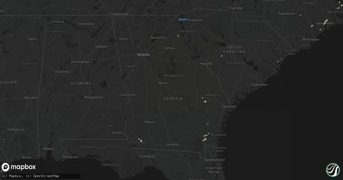
Hail Map in Georgia on June 14, 2026
Get this storm
June 14 map
$229
one time, instant access
Download today. No call, no setup
Keep the $229
Bought the map and want the full workflow? Apply the entire $229 to a subscription within 7 days. None of it is wasted.
Every map, not just this one
This buys you this map. Subscription and you get every map we run, in the markets you choose from a few cities to whole states to nationwide. Plus real-time alerts the moment a storm fires.
Contact data
Name, contact info, occupancy, even credit band for addresses in the footprint. You go from where it hit to who to call.
Become the source they trust
Unlimited branding weather history reports on demand. You already have the documented answer ready for the property owner, and you are the one who showed up with it.
Property data and RoofTrace estimates
Pull up any address you have got, its value and the exact code rules for that jurisdiction, straight from One Click Code. Then RoofTrace estimates the squares, pitch, and roof value, priced the way you price.
Storm reports in Georgia
Georgia
| Date | Description |
|---|---|
| 06/14/20266:37 PM CDT | Emergency manager reports a tree on the roadway blocking all lanes at the bridge at shearouse spur and pleasant acres road. |
| 06/14/20266:32 PM CDT | Emergency manager reports a tree fell into powerlines behind a residence... Causing arcing and a power outage. |
| 06/14/20266:30 PM CDT | Power pole downed. Time estimated from radar. |
| 06/14/20266:25 PM CDT | Emergency manager reports a tree fell onto powerlines causing power outage and fire. |
| 06/14/20266:22 PM CDT | Tree downed on coots lake road. Time estimated from radar. |
| 06/14/20266:16 PM CDT | This is a delayed report. Trees down on flowers crossing. |
| 06/14/20266:13 PM CDT | Emergency manager reports a tree over 20 inches in diameter fell onto railroad tracks blocking the railway. |
| 06/14/20266:10 PM CDT | Emergency manager reported power poles broken and power lines in roadway on long bridge road. |
| 06/14/20266:10 PM CDT | This is a delayed report. Tree down on house. |
| 06/14/20266:09 PM CDT | This is a delayed report. Trees down on powerlines. |
| 06/14/20266:08 PM CDT | This is a delayed report. Multiple trees reported down on smithdown road... Satellite blvd... And lawrenceville suwanee road. |
| 06/14/20266:06 PM CDT | This is a delayed report. Trees and powerlines down on cardinal lake circle. |
| 06/14/20266:04 PM CDT | Emergency manager reports tree in roadway blocking all directions of traffic. |
| 06/14/20265:58 PM CDT | Emergency manager reports a car collided with a tree in the roadway at hwy 17 n and griffin lake road. No injuries reported. |
| 06/14/20265:52 PM CDT | Public reported around 7 trees were blown down off of deyton road. |
| 06/14/20265:52 PM CDT | Emergency manager reports tree down on powerlines on windfield drive. |
| 06/14/20265:50 PM CDT | Emergency manager reports a tree in roadway blocking all lanes. |
| 06/14/20265:50 PM CDT | Multiple trees down on and near route 1 in folkston. Time estimated via radar. |
| 06/14/20265:49 PM CDT | Emergency manager reports a tree fell onto powerlines and into the roadway blocking all lanes of travel at south laurel street. |
| 06/14/20265:48 PM CDT | Emergency manager reports tree fell onto highway on highway 21 n. Southbound lanes blocked. |
| 06/14/20265:45 PM CDT | Emergency manager reports a tree fell onto powerlines causing power outage and fire at intersection of little mccall and hwy 119 s. |
| 06/14/20265:45 PM CDT | Public reports tree down along highway 5 near the intersection with old post road. |
| 06/14/20265:43 PM CDT | Emergency manager reports tree fell into intersection of blue jay road and midland road. All lanes blocked. |
| 06/14/20265:40 PM CDT | Effingham em reported several small to medium trees snapped off at varying heights and a small outbuilding destroyed at a farm on boaen rd. Possible tornado. |
| 06/14/20265:40 PM CDT | Emergency manager reports a tree fell into powerlines behind a residence... Causing arcing and a power outage. |
| 06/14/20265:35 PM CDT | Emergency manager reports a tree on the roadway blocking all lanes at the bridge at shearouse spur and pleasant acres road. |
| 06/14/20265:33 PM CDT | Emergency manager reports tree down at pineland drive and tower drive. Time estimated by radar. |
| 06/14/20265:28 PM CDT | Emergency manager reports a tree fell onto powerlines causing power outage and fire. |
| 06/14/20265:11 PM CDT | Tree down on road at east highway 80 and mud road. Time estimated by radar. |
| 06/14/20265:10 PM CDT | Tree downed... Time estimated from radar. |
| 06/14/20265:06 PM CDT | Tree downed... Time estimated from radar. |
| 06/14/20265:03 PM CDT | Tree down on power lines at thunder road and hampster road. Time estimated by radar. |
| 06/14/20264:40 PM CDT | Several reports of trees downed in and near the town of ringgold. |
| 06/14/20264:38 PM CDT | Corrects time on previous tstm wnd dmg report from 2 wsw boynton. Tree downed over the roadway. |
| 06/14/20264:30 PM CDT | Candler county emergency manager reports tree on home on hwy 46 between turner rd and st. Matthews church rd. |
| 06/14/20264:30 PM CDT | Several reports of trees downed in the town of chickamauga. Time estimated from radar. |
| 06/14/20264:28 PM CDT | Tree downed over roadway. Time estimated from radar. |
| 06/14/20263:38 PM CDT | Tree downed over the roadway. |
| 06/14/20263:25 PM CDT | Power lines down along old thomasville rd. |
| 06/14/20263:24 PM CDT | Power lines fell onto three vehicles traveling on highway 111 south near broome circle... Blocking the roadway. Live lines on vehicles were reported but not injuries. |
| 06/14/20263:22 PM CDT | Power lines down near highway 93 and blueberry rd. |
| 06/14/20263:17 PM CDT | Several trees and power lines down in grady county. |
| 06/14/20263:13 PM CDT | A tree fell on a house near 11th ave ne in cairo. It partially blocked the roadway. |
| 06/14/20263:13 PM CDT | Several trees and power lines down in decatur county. |
| 06/14/20263:00 PM CDT | Several trees and power lines down in decatur county. |
| 06/14/20262:47 PM CDT | 911 dispatch reported tree in intersection of robin's branch rd and white hill rd. Time estimated by radar. |
| 06/14/20262:45 PM CDT | 911 dispatch reported tree on roadway on huckleberry rd. Time estimated by radar. |
| 06/14/20262:42 PM CDT | 911 dispatch reported tree on roadway on old ogeechee rd. Time estimated by radar. |
| 06/14/20262:40 PM CDT | 911 dispatch reported tree on roadway at old ogeechee rd and douglas branch rd. Time estimated by radar. |
| 06/14/20262:40 PM CDT | 911 dispatch reported tree down on jarrell pond rd. Time estimated by radar. |
| 06/14/20262:34 PM CDT | Cable line down along causton bluff road. |
| 06/14/20262:31 PM CDT | Tree down on power line at price street and east waldburg lane. |
| 06/14/20262:31 PM CDT | Tree down on road at intersection of old ogeechee road and douglas branch road. |
| 06/14/20261:30 PM CDT | Georgia dept of transportation reported fallen trees on sr-91 nb at middle rd. All lanes closed. |
| 06/14/202612:58 PM CDT | This is a delayed report. Trees down on powerlines off hwy 186. |
| 06/14/202612:57 PM CDT | This is a delayed report. Trees down on powerlines off emmett harper road and jones woods road. |
| 06/14/202612:50 PM CDT | This is a delayed report. Tree down across hd atha road and county line rd. |
| 06/14/202612:45 PM CDT | This is a delayed report. Tree reported down off hwy 78 and edmondson road. |
| 06/14/202612:42 PM CDT | This is a delayed report. Downed trees blocking part of broach spur road. |
| 06/14/202612:41 PM CDT | This is a delayed report. Trees down on powerlines off cedar ridge road. |
| 06/14/202612:40 PM CDT | This is a delayed report. Trees down on powerlines off tipperary cir. |
| 06/14/202612:36 PM CDT | This is a delayed report. Tree reported down on powerlines off fannie thompson road. |
| 06/14/202612:26 PM CDT | Tree down on beatenbough road. |
| 06/14/202612:24 PM CDT | This is delayed report. Trees down partially blocking hwy 81. |
| 06/13/20267:36 PM CDT | This is delayed report. Trees down near springdale road and bouldercreek road. |
| 06/13/20267:35 PM CDT | This is a delayed report. Trees down over arden way and bethany church road. |
| 06/13/20267:35 PM CDT | This is a delayed report. Powerlines down due to storms on new london place. |
| 06/13/20267:33 PM CDT | This is a delayed report. Trees and power lines down on telida trail. |
| 06/13/20267:21 PM CDT | This is a delayed report. Trees down on a house near manning street. |
| 06/13/20267:20 PM CDT | This is a delayed report. Trees down on powerlines near winters chapel road. |
| 06/13/20267:10 PM CDT | Mulitple trees down on i-75 near collier road. |
All States Impacted by Hail Map on June 14, 2026
Cities Impacted by Hail Map on June 14, 2026
- Ann Arbor, MI
- Ypsilanti, MI
- Dearborn, MI
- Detroit, MI
- Dundee, MI
- Milan, MI
- Maybee, MI
- Carleton, MI
- South Rockwood, MI
- Newport, MI
- Rockwood, MI
- Wayne, MI
- Westland, MI
- Walhalla, SC
- Tamassee, SC
- Salem, SC
- Six Mile, SC
- Sunset, SC
- Pickens, SC
- Canton, MI
- Inkster, MI
- Garden City, MI
- Galivants Ferry, SC
- Millbury, OH
- Curtice, OH
- Northwood, OH
- Genoa, OH
- Clay Center, OH
- Graytown, OH
- Martin, OH
- Woodville, OH
- Elmore, OH
- Jacksonville, NC
- Jesup, GA
- Maysville, NC
- Georgetown, SC
- Murrells Inlet, SC
- Myrtle Beach, SC
- Bucyrus, OH
- Van Horn, TX
- Bowersville, GA
- Canon, GA
- Geneva, OH
- Sedona, AZ
- Mansfield, OH
- Ashland, OH
- Holly Ridge, NC
- Ashtabula, OH
- Austinburg, OH
- Jefferson, OH
- Bainbridge, GA
- Climax, GA
- Belhaven, NC
- Aurora, NC
- Wooster, OH
- Whigham, GA
- Scranton, NC
- Blounts Creek, NC
- Montville, OH
- Chardon, OH
- Madison, OH
- Orrville, OH
- Sterling, OH
- Burbank, OH
- Smithville, OH
- Creswell, NC
- Windsor, OH
- Rome, OH
- Bath, NC
- Conneaut, OH
- Kingsville, OH
- Springboro, PA
- Albion, PA
- Pierpont, OH
- West Springfield, PA
- Live Oak, FL
- Columbia, NC
- Edinboro, PA
- Conneautville, PA
- Clinton, OH
- Pinetown, NC
- Willard, NC
- Burgaw, NC
- Andover, OH
- Dorset, OH
- Ringgold, PA
- Timblin, PA
- Punxsutawney, PA
- Goldsmith, TX
- Notrees, TX
- Clinton, NC
- Cambridge Springs, PA
- Venango, PA
- Linesville, PA
- Saegertown, PA
- Dillwyn, VA
- Melbourne, FL
- Anita, PA
- Reynoldsville, PA
- Meadville, PA
- Waterford, PA
- Conneaut Lake, PA
- Winslow, AZ
- Union City, PA
- Kenansville, FL
- Du Bois, PA
- Centerville, PA
- Williams, AZ
- Guys Mills, PA
- Sykesville, PA
- Spartansburg, PA
- Wagener, SC
- Enon Valley, PA
- New Castle, PA
- Bessemer, PA
- New Wilmington, PA
- Volant, PA
- Odessa, TX
- Mercer, PA
- Grove City, PA
- Clearfield, PA
- Claxton, GA
- Collins, GA
- Rio Rancho, NM
- Metter, GA
- Cobbtown, GA
- Rootstown, OH
- North Lima, OH
- Lake Milton, OH
- Newton Falls, OH
- Wilmot, OH
- Amsterdam, OH
- Wellsville, OH
- New Philadelphia, OH
- Beloit, OH
- Mineral City, OH
- Magnolia, OH
- Navarre, OH
- Alliance, OH
- Millersburg, OH
- Hanoverton, OH
- Waynesburg, OH
- Stone Creek, OH
- Baltic, OH
- Lowellville, OH
- Sebring, OH
- Newcomerstown, OH
- Bolivar, OH
- Canton, OH
- East Sparta, OH
- Beaver, PA
- Bloomingdale, OH
- Fresno, OH
- Negley, OH
- Somerdale, OH
- Stratton, OH
- Brewster, OH
- Salem, OH
- Strasburg, OH
- Minerva, OH
- Scio, OH
- Hopedale, OH
- Mechanicstown, OH
- Dover, OH
- East Liverpool, OH
- Louisville, OH
- Leetonia, OH
- East Springfield, OH
- West Lafayette, OH
- Kensington, OH
- Struthers, OH
- Gnadenhutten, OH
- Freeport, OH
- Salineville, OH
- Jewett, OH
- North Benton, OH
- Lisbon, OH
- Beach City, OH
- Homeworth, OH
- North Jackson, OH
- Tuscarawas, OH
- Sandyville, OH
- Youngstown, OH
- Hammondsville, OH
- Wampum, PA
- Dundee, OH
- East Rochester, OH
- Coshocton, OH
- New Manchester, WV
- Diamond, OH
- Warsaw, OH
- Beaver Falls, PA
- Damascus, OH
- East Canton, OH
- Washingtonville, OH
- Georgetown, PA
- Midland, PA
- Malvern, OH
- New Springfield, OH
- Bowerston, OH
- Deerfield, OH
- Massillon, OH
- Paris, OH
- Petersburg, OH
- Hartville, OH
- Cadiz, OH
- Leesville, OH
- Chester, WV
- Richmond, OH
- Limaville, OH
- Warren, OH
- Zoar, OH
- Robertsville, OH
- Uhrichsville, OH
- Berlin Center, OH
- Carrollton, OH
- Canfield, OH
- Irondale, OH
- Middlebranch, OH
- New Middletown, OH
- Dennison, OH
- Newell, WV
- New Cumberland, WV
- Sherrodsville, OH
- Summitville, OH
- Toronto, OH
- Sugarcreek, OH
- Dellroy, OH
- Empire, OH
- Bergholz, OH
- North Canton, OH
- Industry, PA
- East Palestine, OH
- New Galilee, PA
- Tippecanoe, OH
- New Waterford, OH
- Steubenville, OH
- Port Washington, OH
- New Brighton, PA
- Columbiana, OH
- Darlington, PA
- Rochester, PA
- Rogers, OH
- Atwater, OH
- Midvale, OH
- Appomattox, VA
- Frenchville, PA
- Farmville, VA
- Lorida, FL
- Buckingham, VA
- Gladstone, VA
- Clear Spring, MD
- Hedgesville, WV
- Big Pool, MD
- Partlow, VA
- Ambridge, PA
- Aliquippa, PA
- Greencastle, PA
- Mercersburg, PA
- Spotsylvania, VA
- Venus, FL
- Lake Placid, FL
- Ruther Glen, VA
- Woodford, VA
- Suffolk, VA
- Clarington, OH
- Woodsfield, OH
- Sardis, OH
- Las Cruces, NM
- Carrollton, VA
- Hampton, VA
- Yorktown, VA
- Newport News, VA
- Folkston, GA
- Tubac, AZ
- Nahunta, GA
- Henrico, VA
- Richmond, VA
- Carlisle, PA
- Mechanicsburg, PA
- Poquoson, VA
- Welcome, MD
- Nanjemoy, MD
- La Plata, MD
- Port Tobacco, MD
- Sandston, VA
- Nashville, NC
- West Point, VA
- Barhamsville, VA
- Battleboro, NC
- Rocky Mount, NC
- Harrisburg, PA
- Marysville, PA
- Dauphin, PA
- Enola, PA
- Duncannon, PA
- Pomfret, MD
- King George, VA
- Karthaus, PA
- Saluda, VA
- Mascot, VA
- Mattaponi, VA
- Church View, VA
- Shacklefords, VA
- Quinton, VA
- Providence Forge, VA
- Charles City, VA
- Water View, VA
- Jamaica, VA
- Urbanna, VA
- Whitakers, NC
- White Plains, MD
- Waldorf, MD
- Castalia, NC
- Spring Hope, NC
- Lancaster, VA
- La Mesa, NM
- Anthony, NM
- Chamberino, NM
- Santa Teresa, NM
- Anthony, TX
- El Paso, TX
- Sunland Park, NM
- Canutillo, TX
- Grafton, WV
- Fairmont, WV
- Independence, WV
- Thornton, WV
- Moatsville, WV
- Newburg, WV
- Tunnelton, WV
- Terra Alta, WV
- Aurora, WV
- Rowlesburg, WV
- Glen Rock, PA
- Glenville, PA
- Spring Grove, PA
- Frederick, MD
- Walkersville, MD
- Woodsboro, MD
- Union Bridge, MD
- New Freedom, PA
- Red Lion, PA
- Stewartstown, PA
- Felton, PA
- Seven Valleys, PA
- Deming, NM
- Dallastown, PA
- Airville, PA
- Brogue, PA
- Beech Creek, PA
- Lock Haven, PA
- Jersey Shore, PA
- Avis, PA
- Mill Hall, PA
- New Park, PA
- Cockeysville, MD
- Reisterstown, MD
- Fort Bliss, TX
- Mount Holly Springs, PA
- Newville, PA
- West Mifflin, PA
- Bethel Park, PA
- Carnegie, PA
- Bridgeville, PA
- Presto, PA
- Oakdale, PA
- Pittsburgh, PA
- McKees Rocks, PA
- Townville, PA
- Titusville, PA
- Kimbolton, OH
- Flushing, OH
- Kirkwood, PA


