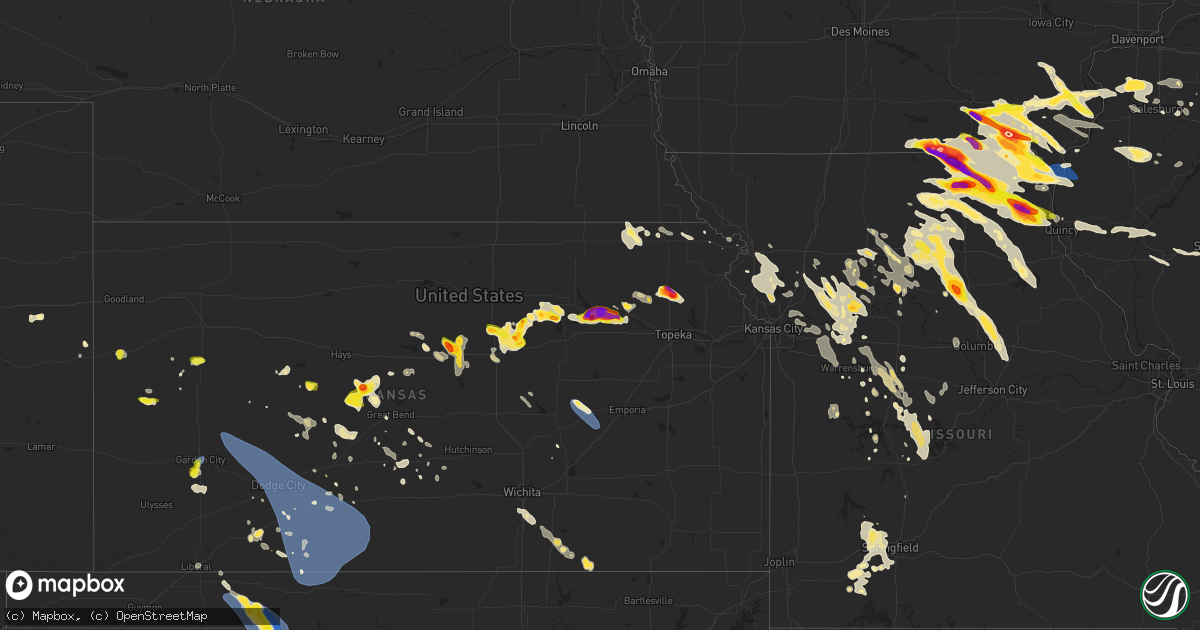
Hail Map on June 13, 2024
Get this storm
June 13 map
$229
one time, instant access
Download today. No call, no setup
Keep the $229
Bought the map and want the full workflow? Apply the entire $229 to a subscription within 7 days. None of it is wasted.
Every map, not just this one
This buys you this map. Subscription and you get every map we run, in the markets you choose from a few cities to whole states to nationwide. Plus real-time alerts the moment a storm fires.
Contact data
Name, contact info, occupancy, even credit band for addresses in the footprint. You go from where it hit to who to call.
Become the source they trust
Unlimited branding weather history reports on demand. You already have the documented answer ready for the property owner, and you are the one who showed up with it.
Property data and RoofTrace estimates
Pull up any address you have got, its value and the exact code rules for that jurisdiction, straight from One Click Code. Then RoofTrace estimates the squares, pitch, and roof value, priced the way you price.
States Impacted by Hail Map on June 13, 2024
Storm reports
New York
| Date | Description |
|---|---|
| 06/12/202411:40 PM CDT | Outflow produced damaging wind gusts that knocked tree down on 683 and w church street. Time estimated by radar. |
| 06/12/202411:38 PM CDT | Outfloow produced damaging wind gusts that knocked tree down on mcbride and angelville rd. |
| 06/12/202411:31 PM CDT | Trees and wires down on chazy lake road in saranac... New york. Time estimated by radar. |
| 06/12/202411:19 PM CDT | Tree reported down on oregon plains rd just over a mile south of county route 60 south of onchiota. Time estimated by radar. |
| 06/12/202411:07 PM CDT | Tree down blocking road at cassidy road at sancomb road. |
| 06/12/202411:05 PM CDT | Multiple trees down across east road near burke... New york. Time estimated by radar. |
| 06/12/202411:02 PM CDT | Two trees down partially blocking goodman road beyond sugar bush rd |
| 06/12/202410:53 PM CDT | Tree down and blocking north woods rd |
| 06/12/202410:49 PM CDT | Downed powerline on duane st near kidney ave |
| 06/12/202410:47 PM CDT | Trees and powerlines reported down near state route 37 and foster rd |
| 06/12/202410:20 PM CDT | Trees down in the town of oxbow. |
| 06/12/202410:15 PM CDT | Trees down in the town of theresa. |
| 06/12/202410:05 PM CDT | Trees down in the town of redwood. |
| 06/12/202410:00 PM CDT | Trees down in the town of alexandria bay. |
New Mexico
| Date | Description |
|---|---|
| 06/13/20246:00 PM CDT | Wsmr mesonet site. |
Indiana
| Date | Description |
|---|---|
| 06/13/20244:54 PM CDT | Spotter estimates 60 mph wind gusts. |
| 06/13/20244:49 PM CDT | Large tree uprooted |
| 06/13/20244:48 PM CDT | Large tree down onto a home between elkhart and granger. Time estimated from radar. Photo relayed by broadcast media. |
| 06/13/20244:42 PM CDT | Localized swath of wind damage. Numerous small branches 4-8 inches in diameter down along adamsville rd. Also a large tree |
| 06/13/20244:42 PM CDT | Several large trees snapped and uprooted in the simonton lake area where estimated 50 to 60 mph wind gusts went through. Time estimated from radar. |
| 06/13/20244:40 PM CDT | Wakeside marine lost siding on their building from estimated 50 to 60 mph wind gusts. Time estimated from radar. |
| 06/13/20244:40 PM CDT | Tree down on adams road. Time estimated from radar. |
| 06/13/20244:38 PM CDT | Large tree down near county road 19 and state road 4. Time estimated from radar. |
| 06/13/20244:37 PM CDT | Tree down and blocking the road at 54000 block of elm road. Time estimated by radar. |
| 06/13/20244:36 PM CDT | Video on facebook of a tree falling |
| 06/13/20244:35 PM CDT | Numerous reports on facebook of power outages near the i-80/i-90 toll rd on the north side of elkhart. Time estimated by radar. |
| 06/13/20244:35 PM CDT | Siding lost on a home north of elkhart where estimated 50 to 60 mph gusts occurred. Time estimated by radar. |
| 06/13/20244:35 PM CDT | Large tree limbs down |
| 06/13/20244:34 PM CDT | Tree down |
| 06/13/20244:33 PM CDT | Building damaged... Powerlines down... And a large tree down on lake drive in simonton lake. Wakeside marina has damage to the north side of their building. |
| 06/13/20244:32 PM CDT | Photo relayed by broadcast media of a few large branches down along elms rd and adams rd. Unsure of tree limb size. Time estimated by radar. |
| 06/13/20244:32 PM CDT | Corrects previous non-tstm wnd gst report from 3 nw elkhart. Awos station kekm elkhart municipal airport. |
| 06/13/20244:32 PM CDT | Public report with photos on facebook of several large trees and tree limbs down... Including one tree that was struck by lightning. Time estimated via radar. |
| 06/13/20244:30 PM CDT | Report of powerlines down and power out in georgetown. Happened at 530 pm edt. |
| 06/13/20244:30 PM CDT | Large tree limbs down on the indiana-michigan state line. Time estimated from radar. |
| 06/13/20244:30 PM CDT | At the intersection of kenilworth rd and elizabeth street... There is a large tree down and a car then struck the fallen tree. Unknown injuries. Time estimated by radar |
| 06/13/20244:30 PM CDT | Large tree limbs |
| 06/13/20244:27 PM CDT | Several trees down |
| 06/13/20244:25 PM CDT | Report of a tree down |
| 06/13/20244:25 PM CDT | Power poles snapped and power out near evergreen rd and sr 23 in granger. |
| 06/13/20244:25 PM CDT | Report of a tree down |
| 06/13/20244:24 PM CDT | Time estimated via radar. Tree down on timer line trace. |
| 06/13/20244:24 PM CDT | Time estimated via radar. Powerlines down on heathfield drive. |
| 06/13/20244:24 PM CDT | Powerlines down on birch rd just north of the intersection with tecumseh rd. Time estimated via radar. |
| 06/13/20244:24 PM CDT | Report of powerlines down and on fire in granger at the intersection of ash and brummitt roads. Time estimated from radar. |
| 06/13/20244:24 PM CDT | Report of powerlines down and on fire in granger at the intersection of adams and ironwood roads. Time estimated from radar. |
| 06/13/20244:23 PM CDT | Large tree |
| 06/13/20244:21 PM CDT | Report of a tree down |
| 06/13/20244:20 PM CDT | Report of a tree down |
| 06/13/20244:20 PM CDT | Powerlines down onto trees and on fire. At the intersection of brick rd and gumwood rd in granger. Time estimated from radar. |
| 06/13/20244:18 PM CDT | Report of a tree down |
| 06/13/20244:18 PM CDT | Large tree down |
| 06/13/20244:16 PM CDT | Large tree |
| 06/13/20244:15 PM CDT | Powerlines down at 700 altgeld street. Time estimated via radar. |
| 06/13/20244:13 PM CDT | Tree down onto 18000 block of wellworth avenue near notre dame. |
| 06/12/202410:40 PM CDT | Measured with an ambient weather station. Pea sized hail also reported. |
Idaho
| Date | Description |
|---|---|
| 06/13/20242:50 AM CDT | Mesonet station sum big southern butte. |
| 06/13/20242:25 AM CDT | Mesonet station min 6 nw minidoka. |
| 06/13/20242:00 AM CDT | Mesonet station ahti 3 ssw ashton. |
| 06/13/20241:50 AM CDT | Mesonet station tab 3 w taber. |
| 06/13/20241:05 AM CDT | Mesonet station sug 2 nne sugar city. |
| 06/13/20241:02 AM CDT | Mesonet station crii1 cotton ridge. |
| 06/13/202412:57 AM CDT | A local report indicates 67 MPH wind near Rexburg |
| 06/13/202412:30 AM CDT | Power pole down along with trees and multiple large tree limbs. Time estimated based on radar and area observations. |
| 06/13/202412:30 AM CDT | Osgood itd site. |
| 06/13/202412:05 AM CDT | Mesonet station ket kettle butte. |
Arizona
| Date | Description |
|---|---|
| 06/12/202411:28 PM CDT | Several trees and large tree branches down across northern lake havasu city due to thunderstorm related wind gusts. Time estimated by radar. |
Oklahoma
| Date | Description |
|---|---|
| 06/12/202410:00 PM CDT | A local report indicates 79 MPH wind near Slapout |
| 06/12/20249:10 PM CDT | A local report indicates 59 MPH wind near 6 W Woodward |
| 06/12/20248:40 PM CDT | Delayed report from the 13th. May ranch |
| 06/12/20248:35 PM CDT | A local report indicates 59 MPH wind near 1 SW Buffalo |
Kansas
| Date | Description |
|---|---|
| 06/13/20246:50 PM CDT | Report from son of trained spotter. |
| 06/13/20246:43 PM CDT | A local report indicates 1.50 inch wind near 4 NNW Wakefield |
| 06/13/20246:43 PM CDT | A local report indicates 1.50 inch wind near 1 S Longford |
| 06/13/20246:39 PM CDT | Report from mping: quarter |
| 06/13/20246:37 PM CDT | A local report indicates 1.50 inch wind near 4 W Talmage |
| 06/13/20246:34 PM CDT | A local report indicates 1.25 inch wind near 1 SSW Longford |
| 06/13/20246:32 PM CDT | Kddc asos. |
| 06/13/20246:31 PM CDT | Visibility was reported to be one-quarter mile in blowing dust with the high wind. Report was relayed by em. |
| 06/13/20246:17 PM CDT | A local report indicates 60 MPH wind near 2 E Ash Valley |
| 06/13/20246:10 PM CDT | Mesonet station k5sct 1 ese scott state lake. |
| 06/13/20245:37 PM CDT | Time estimated from radar. |
| 06/13/20245:37 PM CDT | Time estimated from radar. |
| 06/13/20245:34 PM CDT | Measured peak wind gust from personal weather station. |
| 06/13/20245:29 PM CDT | A local report indicates 61 MPH wind near 10 W Kalvesta |
| 06/13/20245:27 PM CDT | Reported alongside penny-size hail. |
| 06/13/20245:17 PM CDT | Time estimated from radar. |
| 06/13/20245:16 PM CDT | A local report indicates 59 MPH wind near 1 SW Garden City |
| 06/13/20245:06 PM CDT | Mesonet station up840 9.0 w winona |
| 06/13/20244:44 PM CDT | Mesonet station cw6099 9 sse sharon springs. |
| 06/13/20244:40 PM CDT | [landspout] report received from social media with pictures. |
| 06/13/20244:35 PM CDT | [landspout] report received from social media with pictures. |
| 06/13/20244:30 PM CDT | [landspout] report received from social media with pictures. |
| 06/13/20244:15 PM CDT | Delayed report of three utility poles blown over. |
| 06/13/20244:10 PM CDT | [landspout] report received from social media with a picture. |
| 06/13/20243:46 PM CDT | Dispatch in town. |
| 06/13/20243:05 PM CDT | [landspout] trained spotter reported a landspout in the area that lasted about 10-15 min. |
| 06/13/20243:04 PM CDT | Kksmarie11 reported gust of 66 mph. |
| 06/13/20242:52 PM CDT | Kksleoti31 reported 66 mph gust. |
| 06/12/202411:00 PM CDT | Reported with tree damage. |
| 06/12/20249:07 PM CDT | Fire dept reported a heavy anchored shed was flipped. Time estimated via radar. |
| 06/12/20248:54 PM CDT | Delayed report. Kemp. |
| 06/12/20248:50 PM CDT | Winds 60 to 65 mph. |
| 06/12/20248:49 PM CDT | Peak wind gust measured from a personal weather station. |
| 06/12/20248:49 PM CDT | Corrects previous non-tstm wnd gst report from 5 nnw olpe. Kemp. |
| 06/12/20248:48 PM CDT | Estimated from social media picture. |
| 06/12/20248:48 PM CDT | Report from mping: golf ball |
| 06/12/20248:47 PM CDT | Social media report. |
| 06/12/20248:46 PM CDT | A local report indicates 60 MPH wind near Spivey |
| 06/12/20248:45 PM CDT | A local report indicates 80 MPH wind near Nashville |
| 06/12/20248:45 PM CDT | Delayed report of large tree limbs down some were up to 5 inches in diameter. |
| 06/12/20248:42 PM CDT | A local report indicates 60 MPH wind near 5 SSW Zenda |
| 06/12/20248:39 PM CDT | Social media report. |
| 06/12/20248:38 PM CDT | A local report indicates 60 MPH wind near 1 NNW Kingman |
| 06/12/20248:34 PM CDT | Asos station kp28 medicine lodge. |
| 06/12/20248:30 PM CDT | Pictures submitted via social media show one large tree and limbs |
| 06/12/20248:25 PM CDT | A local report indicates 60 MPH wind near Peabody |
| 06/12/20248:20 PM CDT | Reported from kansas mesonet. |
| 06/12/20248:15 PM CDT | Delayed report. From kansas mesonet. |
| 06/12/20248:15 PM CDT | Peak wind gust measured by personal weather station. |
| 06/12/20248:12 PM CDT | Report from mping: quarter |
| 06/12/20248:09 PM CDT | A local report indicates 1.00 inch wind near Minneapolis |
| 06/12/20248:06 PM CDT | A local report indicates 1.50 inch wind near Minneapolis |
| 06/12/20248:03 PM CDT | Report received through mping. |
| 06/12/20248:03 PM CDT | A local report indicates 1.00 inch wind near Minneapolis |
| 06/12/20248:00 PM CDT | Report from mping. Time estimated based on radar data. |
| 06/12/20247:55 PM CDT | A local report indicates 60 MPH wind near Coldwater |
| 06/12/20247:54 PM CDT | A local report indicates 75 MPH wind near Coats |
| 06/12/20247:53 PM CDT | Report from mping: ping pong ball |
| 06/12/20247:52 PM CDT | A local report indicates 1.50 inch wind near Wamego |
| 06/12/20247:51 PM CDT | A local report indicates 1.00 inch wind near 4 N Niles |
| 06/12/20247:50 PM CDT | Social media report. Time estimated from radar. |
| 06/12/20247:50 PM CDT | Delayed report from wamego. Social media. |
| 06/12/20247:49 PM CDT | Mesonet station up430 1.8 w wellsford |
| 06/12/20247:46 PM CDT | A local report indicates 1.75 inch wind near Louisville |
| 06/12/20247:46 PM CDT | A local report indicates 1.75 inch wind near Wamego |
| 06/12/20247:46 PM CDT | Corrects previous hail report from wamego. |
| 06/12/20247:45 PM CDT | Report from mping: hen egg |
| 06/12/20247:41 PM CDT | Report from mping: half dollar |
| 06/12/20247:39 PM CDT | A local report indicates 1.75 inch wind near 3 W Wamego |
| 06/12/20247:38 PM CDT | A local report indicates 1.25 inch wind near 2 ENE Saint George |
| 06/12/20247:31 PM CDT | Around 55-60 mph reported. |
| 06/12/20247:30 PM CDT | Delayed report from social media. |
| 06/12/20247:30 PM CDT | A local report indicates 2.75 inch wind near 6 NNW Saint George |
| 06/12/20247:28 PM CDT | A local report indicates 1.25 inch wind near 1 ENE Manhattan |
| 06/12/20247:25 PM CDT | 50 mph wind gusts with the hail. Tree limbs down closer to bennington. |
| 06/12/20247:24 PM CDT | Time estimated from radar. Social media report. |
| 06/12/20247:24 PM CDT | Report from mping: golf ball |
| 06/12/20247:20 PM CDT | Report from mping: golf ball |
| 06/12/20247:18 PM CDT | Report from mping: half dollar |
| 06/12/20247:17 PM CDT | Spotter network. Quarter to tennis ball size hail. |
| 06/12/20247:16 PM CDT | A local report indicates 1.50 inch wind near 4 NNE Niles |
| 06/12/20247:16 PM CDT | A local report indicates 1.75 inch wind near 1 ENE Manhattan |
| 06/12/20247:16 PM CDT | Social media picture. |
| 06/12/20247:15 PM CDT | Report from mping: quarter |
| 06/12/20247:15 PM CDT | Delayed report. 2 inch hail in north manhattan. |
| 06/12/20247:13 PM CDT | Report from mping: half dollar |
| 06/12/20247:13 PM CDT | Report from mping: quarter |
| 06/12/20247:12 PM CDT | Report from mping: half dollar |
| 06/12/20247:12 PM CDT | Report from mping: quarter |
| 06/12/20247:10 PM CDT | A local report indicates 1.00 inch wind near 2 NNW Manchester |
| 06/12/20247:10 PM CDT | A local report indicates 1.00 inch wind near 2 WNW Manhattan |
| 06/12/20247:09 PM CDT | Delayed report via social media showing a hailstone measuring 3.5 inches in diameter. |
| 06/12/20247:08 PM CDT | Report from mping: quarter |
| 06/12/20247:00 PM CDT | Measured peak wind gust from a personal weather station. |
Michigan
| Date | Description |
|---|---|
| 06/13/20245:48 PM CDT | A few tree limbs 6 to 12 inches in diameter down. Time estimated from radar. |
| 06/13/20245:24 PM CDT | Large down in union |
| 06/13/20244:41 PM CDT | Broadcast media relays report of trees and tree limbs |
| 06/13/20244:40 PM CDT | Large tree limbs |
| 06/13/20244:40 PM CDT | Corrects time of previous tstm wnd dmg report from union. Large down in union |
| 06/13/20244:30 PM CDT | Medium sized tree limb |
| 06/13/20244:05 PM CDT | Calhoun co dispatch reports several trees and wires down across the marshall area. Time estimated via radar. |
| 06/13/20243:49 PM CDT | Several limbs and wires down in pennfield... Twp. Time estimated via radar. |
| 06/13/20243:48 PM CDT | Tree down |
| 06/13/20243:44 PM CDT | Large tree down at island and stewart. Time estimated via radar. |
| 06/13/20243:33 PM CDT | Large tree limb down at bolock and wheaton. |
| 06/13/20243:17 PM CDT | Numerous trees down across the southern part of eaton co. Between vermontville... And eaton rapids. Time estimated via radar. |
| 06/13/20243:09 PM CDT | Numerous reports of wires and several trees/large limbs down near the hastings area. Time estimated via radar. |
| 06/13/20242:04 PM CDT | A local report indicates 1.00 inch wind near 4 NNW Eckerman |
| 06/13/202412:46 PM CDT | Several large trees uprooted and snapped. Also half dollar sized hail. |
| 06/13/202412:41 PM CDT | Estimated golf ball size hail along national forest road 13 on the alger and schoolcraft county line. |
| 06/13/202412:41 PM CDT | Observer sent photo of hailstone with ruler about 30-45 minutes after they fell so some melting occurred. Time estimated by radar. |
| 06/13/202412:30 PM CDT | Between dime and quarter-sized hail reported with 0.59 inch of rain. Time of the report estimated from radar. Reported received via facebook. |
| 06/13/202412:25 PM CDT | Dispatch reports a downed power line that was smoking along hayward rd. Near sixteen mile lake in alger county. |
| 06/13/202412:20 PM CDT | Image of hail in chatham from social media. |
| 06/13/202411:50 AM CDT | Report from mping: quarter |
| 06/13/202411:46 AM CDT | Dime to quarter size hail observed near mcclellan ave. And grove streets in marquette. |
| 06/13/202411:46 AM CDT | Observed and measured dime to quarter size hail at wfo marquette in negaunee township. |
| 06/13/202411:43 AM CDT | Quarter sized hail reported near west washington street and south mcclellan ave. In marquette. |
Colorado
| Date | Description |
|---|---|
| 06/13/20246:36 PM CDT | Spotter said that a few quarter size hail fell. |
| 06/13/20244:02 PM CDT | Up694 reported a 58 mph gust. |
| 06/13/20243:40 PM CDT | Delayed report via social media. Irrigation pivot overturned. Time is radar estimated. |
Texas
| Date | Description |
|---|---|
| 06/13/20245:58 PM CDT | A local report indicates 60 MPH wind near 3 SW Dalhart |
| 06/12/20247:02 PM CDT | Sunray mesonet measured 58 mph gust with lightning in the area. |
Missouri
| Date | Description |
|---|---|
| 06/13/20246:56 PM CDT | A local report indicates 1.50 inch wind near 3 W Charlie Heath Memor |
| 06/13/20246:47 PM CDT | Downed power lines and power outages near south gifford. Time estimated from radar. |
| 06/13/20246:30 PM CDT | Via twitter with photo of measurement: mostly quarters to golf balls in lewistown... But person found at least one 2.5 inches in diameter... The one pictured. |
| 06/13/20246:26 PM CDT | Facebook report. Time estimated from radar. |
| 06/13/20246:10 PM CDT | Downed wires and power outages near burk trail. Time estimated from radar. |
| 06/13/20246:02 PM CDT | Removal of roofs from multiple farm outbuildings in ewing. Estimated wind speed of around 90 mph. Time estimated from radar. |
| 06/13/20245:54 PM CDT | Downed wires and power outages near oriole trail. Time estimated from radar. |
| 06/13/20245:48 PM CDT | Report from mping: large tree branches down. |
| 06/13/20245:47 PM CDT | Report from mping: tree limbs broken. |
| 06/13/20245:45 PM CDT | Marion co necomm receiving multiple reports of trees and power lines down in la grange. |
| 06/13/20245:45 PM CDT | Report from mping: small tree limbs broken. |
| 06/13/20245:45 PM CDT | Report from mping: quarter |
| 06/13/20245:41 PM CDT | Multiple trees uprooted... Farm outbuilding walls collapsed... And grain silos damaged. Estimated wind speeds around 95 mph. Time estimated from radar. |
| 06/13/20245:40 PM CDT | Via slack. A large portion of a healthy tree snapped lengthwise from its base. |
| 06/13/20245:40 PM CDT | Marion co necomm receiving multiple reports of trees and power lines down in canton. |
| 06/13/20245:38 PM CDT | Report from mping: small tree limbs broken. |
| 06/13/20245:38 PM CDT | Via slack. Numerous large tree branches down across ewing. Photos show a snapped power pole... Medium sized healthy snapped branch... Large tree snapped near base... An |
| 06/13/20245:36 PM CDT | Corrects previous tstm wnd dmg report from ewing. Removal of roofs from multiple farm outbuildings in ewing. Estimated wind speed of around 90 mph. Time estimated from |
| 06/13/20245:36 PM CDT | Report from mping: ping pong ball |
| 06/13/20245:36 PM CDT | Via slack. Lewis co. Em reporting 50 to 60 mph winds at highland high school. Putting 60 from radar estimate. |
| 06/13/20245:34 PM CDT | Via facebook with photo. Sized estimated relative to photographers palm. |
| 06/13/20245:34 PM CDT | Report from mping: half dollar |
| 06/13/20245:19 PM CDT | Facebook report. Time estimated from radar. |
| 06/13/20245:14 PM CDT | Public reported golf ball-sized hail. |
| 06/13/20245:14 PM CDT | Corrects previous tstm wnd dmg report from la belle. Western lewis co fpd reports a 6 inch diameter |
| 06/13/20245:14 PM CDT | Report from mping: small tree limbs down. |
| 06/13/20245:14 PM CDT | Corrects previous tstm wnd dmg report from la belle. Western lewis co fpd reports a 6 inch diameter green tree limb down in a front yard. Photo shows healthy... Leaved |
| 06/13/20245:14 PM CDT | Western lewis co fpd reports a 6 inch diameter green tree limb down in a front yard. |
| 06/13/20244:36 PM CDT | Occurring right now. |
| 06/13/20244:36 PM CDT | Corrects previous hail report from 5 e bible grove. Occurring right now at intersection of highway 15 and county t. |
| 06/13/20244:34 PM CDT | Report from mping: hen egg |
| 06/13/20244:28 PM CDT | Quarter-sized hail reported by law enforcement. |
| 06/13/20244:23 PM CDT | 2 inch hail reported by the public. |
| 06/13/20244:18 PM CDT | Public reported ping pong sized hail. |
| 06/13/20244:17 PM CDT | Social media video of baseball sized hail falling in lancaster. Time estimated from radar. |
| 06/13/20244:15 PM CDT | Public reported baseball-sized hail on social media. |
| 06/13/20243:55 PM CDT | Public reported ping pong-sized hail. |
| 06/13/20243:52 PM CDT | Broadcast media reported 3 inch hail in queen city. |
| 06/13/20243:45 PM CDT | A local report indicates 1.75 inch wind near Lancaster |
| 06/13/20243:45 PM CDT | Public reported golf ball-sized hail. |
| 06/13/20243:40 PM CDT | 4 inch hail reported by the public on social media. |
| 06/13/20243:40 PM CDT | Softball-sized hail reported by the public on social media |
| 06/13/20243:40 PM CDT | Photo of 4 inch diameter stone. |
| 06/13/20243:34 PM CDT | Tennis ball sized hail on ground. |
| 06/13/20243:33 PM CDT | Tennis ball size hail reported by dept of conservation at rebel cove conservation area. Smashed windshield of vehicle. Time estimated from radar. |
| 06/13/20243:29 PM CDT | A local report indicates 2.75 inch wind near 5 NNW Livonia |
| 06/13/20242:00 AM CDT | Mping report of tree limbs down in yard. |
| 06/13/20241:37 AM CDT | Large tree snapped at base... Damage to glass window of structure. |
| 06/13/20241:37 AM CDT | Photos from facebook showing large uprooted trees fallen onto a house. |
| 06/13/20241:31 AM CDT | Multiple large trees uprooted and large branches down... Reports of power outages... Reports via photos in lake area storm spotters facebook group... Time estimated fro |
| 06/13/20241:00 AM CDT | Corrects previous tstm wnd dmg report from bolivar. Mping report of tree limbs down in yard. |
| 06/13/202412:57 AM CDT | Photo forwarded from broadcast media via email of two medium-to-large trees uprooted in windyville. Time estimated via keax radar. |
| 06/13/202412:37 AM CDT | Corrects previous tstm wnd dmg report from branch. Photos from facebook showing large uprooted trees fallen onto a house. |
| 06/13/202412:37 AM CDT | Corrects previous tstm wnd dmg report from 1 nw camdenton. Large tree snapped at base... Damage to glass window of structure. |
| 06/13/202412:31 AM CDT | Corrects previous tstm wnd dmg report from 2 sw macks creek. Multiple large trees uprooted and large branches down... Reports of power outages... Reports via photos in |
| 06/13/202412:30 AM CDT | Multiple reports of uprooted trees in and around osceola with the town without power. Time estimated via radar. |
| 06/13/202412:20 AM CDT | Multiple reports of uprooted trees in and around lowry city with the town without power. |
| 06/13/202412:00 AM CDT | Multiple reports of trees and power lines down in the city of warsaw and throughout benton county. |
| 06/12/202411:32 PM CDT | Downed power lines and power outages near highway oo. Time estimated from radar. |
| 06/12/202411:30 PM CDT | Downed power lines and power outages near willa lane. Time estimated from radar. |
| 06/12/202411:30 PM CDT | Downed power lines and power outages near 701 road. Time estimated from radar. |
| 06/12/202411:25 PM CDT | Downed power lines and power outages near route 2. Time estimated from radar. |
| 06/12/202411:21 PM CDT | Downed power lines and power outages near 1150th road. Time estimated from radar. |
| 06/12/202411:14 PM CDT | Downed power lines and power outages between lone jack and pittsville. Time estimated from radar. |
| 06/12/202411:14 PM CDT | Downed wires and power outages near 12th street. Time estimated from radar. |
| 06/12/202411:11 PM CDT | Downed power lines and power outages near 500th road. Time estimated from radar. |
| 06/12/202411:09 PM CDT | Downed power lines and power outages near 400th road. Time estimated from radar. |
| 06/12/202411:04 PM CDT | Downed tree limbs and wires near laurel drive. Time estimated from radar. |
| 06/12/202411:04 PM CDT | Downed tree limbs and wires near tyler avenue. Time estimated from radar. |
| 06/12/202411:01 PM CDT | Downed power lines and power outages near bates city. Time estimated from radar. |
| 06/12/202411:00 PM CDT | Downed power lines and power outages near union school road. Time estimated from radar. |
| 06/12/202410:53 PM CDT | Downed power lines and power outages near trickum road. Time estimated from radar. |
| 06/12/202410:50 PM CDT | Reported at county line road and hwy 13. |
| 06/12/202410:37 PM CDT | Several reports of downed power lines and power outages near aulville. Time estimated from radar. |
| 06/12/202410:32 PM CDT | A local report indicates 1.25 inch wind near 1 SSE Smithville |
| 06/12/202410:28 PM CDT | Several reports of downed power lines and power outages near and east of lexington. Time estimated from radar. |
| 06/12/202410:19 PM CDT | Downed wires and power outages near highway t. Time estimated from radar. |
| 06/12/202410:13 PM CDT | Downed power lines and power outages near 5th street. Time estimated from radar. |
| 06/12/202410:13 PM CDT | Downed power lines and power outages near 260th road. Time estimated from radar. |
| 06/12/20249:57 PM CDT | Downed wires and power outages near highway cc. Time estimated from radar. |
| 06/12/20249:46 PM CDT | Downed power lines and power outages near truman avenue. Time estimated from radar. |
| 06/12/20249:40 PM CDT | Large tree limbs snapped and power outages in pockets of the city utility district. |
| 06/12/20249:39 PM CDT | Report from mping: medium sized tree limbs down. |
| 06/12/20249:36 PM CDT | Via slack: large tree with large primary branches snapped from base. |
| 06/12/20249:36 PM CDT | Fire dept reports trees down and power out in hallsville. A tree fell on a house. The occupants are trapped and fire personnel are on the scene. |
| 06/12/20249:36 PM CDT | A tree fell on a moving vehicle on route b near highway oo. |
| 06/12/20249:22 PM CDT | Several reports of power lines down and power outages in northern howard county... From armstrong to areas south of higbee. Time estimated from radar. |
| 06/12/20249:18 PM CDT | Downed power lines and power outages near 3rd street. Time estimated from radar. |
| 06/12/20249:17 PM CDT | Downed trees and wires between triplett and brunswick. Time estimated from radar. |
| 06/12/20249:16 PM CDT | Downed power lines and power outages near fort orle |
| 06/12/20249:16 PM CDT | Downed power lines and power outages near fort orleans avenue. Time estimated from radar. |
| 06/12/20249:11 PM CDT | Downed trees and wires in clark. Utility company reports power lines down near county road 2790. Time estimated from radar. |
| 06/12/20249:06 PM CDT | Multiple trees down on houses in higbee. Time estimated from radar. |
| 06/12/20249:03 PM CDT | Multiple reports of power lines down and power outages in the renick area. Time estimated from radar. |
| 06/12/20249:03 PM CDT | Minor damage to residential property. Swing set dislodged and moved over 25 feet. Several tree limbs down. Report via social media. Time estimated from radar. |
| 06/12/20248:54 PM CDT | Downed wires and power outages near fair oaks road. Time estimated from radar. |
| 06/12/20248:50 PM CDT | A local report indicates 1.75 inch wind near Huntsville |
| 06/12/20248:49 PM CDT | Downed power lines and power outages near huntsville avenue. Time estimated from radar. |
| 06/12/20248:47 PM CDT | Downed wires and power outages near highway dd. Time estimated from radar. |
| 06/12/20248:20 PM CDT | 2 inch tree limbs broken. |
| 06/12/20248:06 PM CDT | Report from mping: small tree limbs down. |
| 06/12/20248:04 PM CDT | Downed power lines and power outages near jade drive. Time estimated from radar. |
| 06/12/20248:02 PM CDT | Tree uprooted on the north side of marceline. Time estimated from radar. |
| 06/12/20247:57 PM CDT | A local report indicates 1.00 inch wind near 2 SE Bucklin |
| 06/12/20247:46 PM CDT | Downed power lines and power outages near flamingo road. Time estimated from radar. |
| 06/12/20247:38 PM CDT | Via slack: a large tree snapped near its base north of shelbina on hwy 15 near shelbina lake. Another tree is down behind ayerco in shelbina. Power is out in shelbina a |
| 06/12/20247:36 PM CDT | Corrects previous tstm wnd dmg report from shelbina. Report from mping: small tree limbs down. |
| 06/12/20247:34 PM CDT | Downed power lines and power outages reported near new cambria. Time estimated from radar. |
| 06/12/20247:25 PM CDT | Photo of hail larger than a quarter relayed via social media. Time estimated by radar. |
| 06/12/20247:11 PM CDT | Delayed report... Time estimated from radar. |
Iowa
| Date | Description |
|---|---|
| 06/13/20246:55 PM CDT | Vb73. |
| 06/13/20246:24 PM CDT | Report from mping: quarter |
| 06/13/20246:22 PM CDT | Reported via mping. Time estimated by radar. |
| 06/13/20246:15 PM CDT | Report was relayed by broadcast media. 12 inch tree broken off about a foot above the base. Open farm outbuilding destroyed. Pictures shared and show damage in one dire |
| 06/13/20246:13 PM CDT | Roof blown off an unused hog shed. Suspected microburst winds. Time estimated from radar. |
| 06/13/20245:46 PM CDT | A local report indicates 70 MPH wind near Keokuk Airport |
| 06/13/20245:39 PM CDT | Estimated 60 to 70 mph wind gusts. |
| 06/13/20244:54 PM CDT | Vb38 reported ping pong hail. |
| 06/13/20244:53 PM CDT | Updated report via mping near downtown keosauqua. |
| 06/13/20244:48 PM CDT | Photo from county em of 3 inch hail in keosauqua. |
| 06/13/20244:48 PM CDT | A few golf ball size hail stones found. Time estimated by radar. |
| 06/13/20244:46 PM CDT | Report from mping. Estimated time on radar of 3:41 pm. |
| 06/13/20244:45 PM CDT | Reported via mping. |
| 06/13/20244:39 PM CDT | A local report indicates 1.00 inch wind near 4 NE Lebanon |
| 06/13/20244:19 PM CDT | Photo from social media taken at 4:08 pm. |
| 06/13/20244:19 PM CDT | Corrects previous hail report from floris. Photo from social media taken at 4:08 pm. |
| 06/13/20244:00 PM CDT | Photo and report from social media. Estimated time from radar was 4:00 pm. |
| 06/13/20243:48 PM CDT | Report from mping: hen egg |
| 06/13/20243:20 PM CDT | Storm chaser report baseball sized hail along with a broken windshield. Time estimated by radar. |
| 06/12/20247:20 PM CDT | A local report indicates 1.50 inch wind near 3 W Mount Sterling |
| 06/12/20247:12 PM CDT | Vb46. |
| 06/12/20247:09 PM CDT | A local report indicates 1.00 inch wind near 1 SE Dodgeville |
| 06/12/20247:01 PM CDT | Delayed report. Relayed via social media. |
Illinois
| Date | Description |
|---|---|
| 06/13/20246:56 PM CDT | A brief tornado touchdown was observed by a chaser northeast of the macomb municipal airport. This tornado occurred in an open field and no damage was observed. Therefo |
| 06/13/20246:56 PM CDT | Power pole knocked down from thunderstorm winds. Time estimated from radar. |
| 06/13/20246:53 PM CDT | Sheriff office reported serval structures damaged... Powerline down. |
| 06/13/20246:51 PM CDT | Ethan schisler trained spotter. Tornado on ground. |
| 06/13/20246:41 PM CDT | Relayed from ilx: trained spotter reported quarter sized hail near hersman on rte 99. |
| 06/13/20246:40 PM CDT | Small limbs down and some large branches snapped from trees. |
| 06/13/20246:30 PM CDT | Picture of a large branch broken off of a hickory tree. |
| 06/13/20246:02 PM CDT | Multiple large trees down near 24th street and boy scout road. Some roof damage to some farm outbuildings as well. |
| 06/13/20246:01 PM CDT | Trained spotter reported 60 mph winds at boy scout road and north hwy 24... North quincy. |
| 06/13/20246:01 PM CDT | Via slack. Large trees snapped near base and power pole snapped on north side of quincy near hwy 96 and hwy 24. |
| 06/13/20246:00 PM CDT | Via twitter with photo. Snapped power pole with lines lying in street. Highway 96 at highway 24. |
| 06/13/20246:00 PM CDT | Corrects previous tstm wnd dmg report from 4 s ursa. Via twitt |
| 06/13/20246:00 PM CDT | Adams county em reported farm structures down and trees uprooted near hwy 96 and hwy 24. |
| 06/13/20246:00 PM CDT | Corrects previous tstm wnd dmg report from 4 s ursa. Via twitter with photo. Snapped power pole with lines lying in street. Highway 96 at highway 24. Emergency manager |
| 06/13/20247:58 AM CDT | Trained weather spotter measured a peak gust of 70 mph. Patio furniture was damaged during the thunderstorm. Time estimated by radar. |
| 06/13/20247:55 AM CDT | Tree limbs around 6 inches in diameter were downed... And a fence was damaged. Time estimated by radar. |
| 06/13/202412:08 AM CDT | Irrigation pivot overturned and large trees broken. Time estimated from radar. |
| 06/12/202410:10 PM CDT | Time estimated from radar. |
| 06/12/20249:53 PM CDT | Report from mping: 1-inch tree limbs broken; shingles blown off. |
| 06/12/20249:45 PM CDT | Tree fell on a house... Causing damage to the roof. Time estimated from radar. |
| 06/12/20249:30 PM CDT | Large tree broken. Chimney blown off a farmhouse. Time estimated from radar. |
| 06/12/20249:25 PM CDT | Two 50 foot trees snapped. Time estimated from radar. |
| 06/12/20249:20 PM CDT | Large tree branch down. Time estimated from radar. |
| 06/12/20249:20 PM CDT | Power pole down on county road 2200n between 1000e and 1100e. Time estimated from radar. |
| 06/12/20249:18 PM CDT | Two cars crushed by falling trees near the intersection of maple and center. |
| 06/12/20249:18 PM CDT | Trees down in paxton... At least one large one with a snapped trunk. |
| 06/12/20249:15 PM CDT | Trees down. Time estimated from radar. |
| 06/12/20249:11 PM CDT | Large trees down and power poles down. Time estimated from radar. |
| 06/12/20249:10 PM CDT | Tree blown down. Time estimated from radar. |
| 06/12/20249:08 PM CDT | Barn door blown off along route 47 north of town. Large tree branch broken off. Time estimated from radar. |
| 06/12/20249:05 PM CDT | Numerous power lines/poles downed near melvin. Time estimated from radar. |
| 06/12/20249:00 PM CDT | Tree down on powerlines. Time estimated from radar. |
| 06/12/20248:59 PM CDT | Reports of widespread wind damage including downed trees and powerlines in gibson city. Time estimated based on radar. |
| 06/12/20248:59 PM CDT | Trees downed in sibley... Including one onto a house. Time estimated from radar. |
| 06/12/20248:59 PM CDT | Trees were downed onto state routes 47 and 54 south/southwest of gibson city. Time estimated from radar. |
| 06/12/20248:59 PM CDT | Updates previous tstm wnd dmg report from gibson city. Widespread wind damage across gibson city. Numerous trees and power lines downed with some trees snapped at their |
| 06/12/20248:59 PM CDT | Reports of widespread wind damage incl |
| 06/12/20248:58 PM CDT | Photos were sent in of a wooden shed whose side and roof were ripped off and strewn across the yard. In addition... A childrens playset was blown over... The top shed o |
| 06/12/20248:58 PM CDT | Tree down on power lines. Shed blown across road. Time estimated from radar. |
| 06/12/20248:57 PM CDT | Measured with an ambient weather station. |
| 06/12/20248:50 PM CDT | Trees and powerlines down. Time estimated from radar. |
| 06/12/20248:45 PM CDT | Numerous trees damaged... With one large tree down. Time estimated by radar. |
| 06/12/20248:45 PM CDT | Numerous trees down. Time estimated. |
| 06/12/20248:44 PM CDT | (ilx |
| 06/12/20248:44 PM CDT | A local report indicates 60 MPH wind near Anchor |
| 06/12/20248:40 PM CDT | Tree down across route 9 near the cooksville-ellsworth blacktop. |
| 06/12/20248:40 PM CDT | Shingle and siding damage to a house. Time estimated by radar. |
| 06/12/20248:40 PM CDT | A local report indicates 65 MPH wind near 2 SSW Deer Creek |
| 06/12/20248:40 PM CDT | 911 dispatch reported power lines down and damage to trees. |
| 06/12/20248:39 PM CDT | Personal weather station kilcooks5. |
| 06/12/20248:36 PM CDT | A personal weather station measured a 71 mph wind gust 2 miles south of weston. |
| 06/12/20248:35 PM CDT | Large whole trees down on power lines. |
| 06/12/20248:35 PM CDT | Corrects previous tstm wnd dmg report from pontiac. 911 dispatch reported power lines down... Damage to trees... As well as a street lamp that was knocked over. |
| 06/12/20248:33 PM CDT | Numerous large tree limbs down. |
| 06/12/20248:30 PM CDT | A local report indicates 60 MPH wind near Washington |
| 06/12/20248:30 PM CDT | Semi trailer turned over on interstate 55 just south of chenoa. |
| 06/12/20248:30 PM CDT | Corrects previous non-tstm wnd dmg report from streator. 911 dispatch reported power lines down and damage to trees. |
| 06/12/20248:25 PM CDT | Tree down on home. |
| 06/12/20248:25 PM CDT | Downed power lines north lexington. |
| 06/12/20248:20 PM CDT | A local report indicates 60 MPH wind near 3 WNW Benson |
| 06/12/20248:20 PM CDT | A local report indicates 60 MPH wind near 3 S Minonk |
| 06/12/20248:05 PM CDT | House fire due to power lines down. |
| 06/12/20248:05 PM CDT | 3 inch tree limbs down. |
| 06/12/20248:03 PM CDT | Delayed report. Time estimated by radar. Large carport torn away and wrapped around utility pole. |
| 06/12/20247:56 PM CDT | Power line down south of curran. |
| 06/12/20247:43 PM CDT | Power line down near interchange of e muller rd and springfield rd. |
| 06/12/20247:08 PM CDT | Delayed report... Several large tree branches over hwy 17 blocking the road. Time estimated from radar. |
| 06/12/20247:08 PM CDT | Report from mping: 1-inch tree limbs broken; shingles blown off. |
| 06/12/20247:03 PM CDT | Ethan schisler tornado on ground 3.7 miles sw bushnell il. |
| 06/12/20247:01 PM CDT | A brief tornado was observed in an open field between bushnell and bardolph. There was no observed damage with the tornado... And therefore has been assigned an ef-unkn |
Montana
| Date | Description |
|---|---|
| 06/13/20245:00 AM CDT | Mesonet station mtm98 ruby creek. |
Cities Impacted by Hail Map on June 13, 2024
- Hays, KS
- Ellis, KS
- Brownell, KS
- South Elgin, IL
- Saint Charles, IL
- Elgin, IL
- Wayne, IL
- Bartlett, IL
- Hanover Park, IL
- Carol Stream, IL
- West Chicago, IL
- Marquette, MI
- Negaunee, MI
- Skandia, MI
- Deerton, MI
- Eben Junction, MI
- Chatham, MI
- Trenary, MI
- Rumely, MI
- Munising, MI
- Wetmore, MI
- Seney, MI
- Manistique, MI
- McMillan, MI
- Newberry, MI
- Germfask, MI
- Rapid River, MI
- Gulliver, MI
- Panama City, FL
- Eckerman, MI
- Mims, FL
- Kinross, MI
- Brimley, MI
- Vona, CO
- Cincinnati, IA
- Centerville, IA
- Exline, IA
- Seymour, IA
- Stratton, CO
- Moulton, IA
- Unionville, MO
- Coatsville, MO
- Livonia, MO
- Glenwood, MO
- Queen City, MO
- Lancaster, MO
- Leoti, KS
- Bloomfield, IA
- Ottumwa, IA
- Eldon, IA
- Manteno, IL
- Floris, IA
- Green Castle, MO
- Novinger, MO
- Downing, MO
- Selma, IA
- Batavia, IA
- Libertyville, IA
- Fairfield, IA
- Douds, IA
- Grant Park, IL
- Momence, IL
- Arapahoe, CO
- Memphis, MO
- Greentop, MO
- Baring, MO
- Kirksville, MO
- Lake Village, IN
- Lowell, IN
- Schneider, IN
- Beecher, IL
- Sharon Springs, KS
- Rutledge, MO
- Edina, MO
- Wallace, KS
- Cantril, IA
- Birmingham, IA
- Keosauqua, IA
- Milton, IA
- Brashear, MO
- Russell, KS
- Scott City, KS
- Pulaski, IA
- Oakley, KS
- Hurdland, MO
- Mishawaka, IN
- South Bend, IN
- Granger, IN
- Elkhart, IN
- Osceola, IN
- Bristol, IN
- Middlebury, IN
- Goshen, IN
- Bonaparte, IA
- Bison, KS
- Otis, KS
- Hoisington, KS
- Mount Sterling, IA
- Demotte, IN
- Fair Oaks, IN
- Knox City, MO
- Arbela, MO
- Farmington, IA
- Luray, MO
- Kahoka, MO
- Olmitz, KS
- Stockport, IA
- Hillsboro, IA
- Garden City, KS
- Hebron, IN
- Dorrance, KS
- Bunker Hill, KS
- Donnellson, IA
- Lockridge, IA
- La Belle, MO
- Wayland, MO
- Revere, MO
- Ewing, MO
- Lewistown, MO
- Wheatfield, IN
- Winona, KS
- Beverly, KS
- Monticello, MO
- Maywood, MO
- Durham, MO
- Argyle, IA
- Montrose, IA
- Keokuk, IA
- Nauvoo, IL
- Hamilton, IL
- Warsaw, IL
- Basco, IL
- Alexandria, MO
- Carthage, IL
- Elvaston, IL
- Lincoln, KS
- Green City, MO
- Rensselaer, IN
- Mount Pleasant, IA
- Newark, MO
- Wilson, KS
- La Grange, MO
- Rush Center, KS
- Solomon, KS
- Minneapolis, KS
- Bennington, KS
- Ulysses, KS
- Limon, CO
- La Crosse, KS
- Mount Union, IA
- Carman, IL
- West Burlington, IA
- Burlington, IA
- Wyaconda, MO
- Gorin, MO
- Clay Center, KS
- Longford, KS
- New London, IA
- Albert, KS
- Nekoma, KS
- Alexander, KS
- Great Bend, KS
- Sublette, KS
- Ness City, KS
- Wakefield, KS
- Brookville, KS
- New Cambria, KS
- Salina, KS
- Ellsworth, KS
- Genoa, CO
- Burdett, KS
- Cimarron, KS
- Jetmore, KS
- Ingalls, KS
- Wright, KS
- Dodge City, KS
- Ensign, KS
- Abilene, KS
- Rozel, KS
- Larned, KS
- Milford, KS
- Hanston, KS
- West Point, IA
- Morning Sun, IA
- Yarmouth, IA
- Saint Patrick, MO
- Ellinwood, KS
- Hudson, KS
- Riley, KS
- Danville, IA
- Lindon, CO
- Middletown, IA
- Gladstone, IL
- Bronson, MI
- Winfield, IA
- Canton, MO
- Good Hope, IL
- Bushnell, IL
- Garfield, KS
- Kinsley, KS
- St John, KS
- Pawnee Rock, KS
- Milan, MO
- Gibbs, MO
- Offerle, KS
- Sperry, IA
- Mediapolis, IA
- Manhattan, KS
- La Plata, MO
- Nara Visa, NM
- Ford, KS
- Bucklin, KS
- Spearville, KS
- Minneola, KS
- Mullinville, KS
- Quincy, IL
- Ursa, IL
- Sylvia, KS
- Oakville, IA
- Wapello, IA
- Saint George, KS
- Wamego, KS
- Gypsum, KS
- Greensburg, KS
- Meade, KS
- Ransom, KS
- Utica, KS
- Clayton, IL
- Fowler, IL
- Liberty, IL
- Camp Point, IL
- Sylvan Grove, KS
- Yerington, NV
- Fowler, KS
- Prairie City, IL
- Lewis, KS
- Williamstown, MO
- Englewood, KS
- Ashland, KS
- Haviland, KS
- Sun City, KS
- Wilmore, KS
- Coldwater, KS
- Protection, KS
- Stronghurst, IL
- Novelty, MO
- Tampa, KS
- Wakeeney, KS
- New Boston, MO
- Winigan, MO
- Browning, MO
- Timewell, IL
- Mount Sterling, IL
- Elmer, MO
- Versailles, IL
- Brookfield, MO
- Belvue, KS
- Durham, KS
- Ainsworth, IA
- Ethel, MO
- Onaga, KS
- Strong City, KS
- Elmdale, KS
- Cuba, IL
- Francesville, IN
- Keithsburg, IL
- Seaton, IL
- Blandinsville, IL
- Sciota, IL
- Washington, IA
- Crawfordsville, IA
- Paxico, KS
- Cottonwood Falls, KS
- Rosston, OK
- Buffalo, OK
- Havensville, KS
- Soldier, KS
- Delia, KS
- Emmett, KS
- Avon, IL
- Smithfield, IL
- Aledo, IL
- Viola, IL
- Alexis, IL
- Macomb, IL
- Liberal, KS
- Arenzville, IL
- Beardstown, IL
- Adrian, TX
- Saint Marys, KS
- Fort Madison, IA
- Plevna, KS
- Turon, KS
- Salem, IA
- New Cambria, MO
- Bucklin, MO
- Atlanta, MO
- Leonard, MO
- Shelbyville, MO
- Bethel, MO
- Stafford, KS
- Holton, KS
- Mayetta, KS
- Lucas, KS
- Amarillo, TX
- Marietta, IL
- Forgan, OK
- Callao, MO
- Linneus, MO
- Bevier, MO
- Purdin, MO
- Columbus Junction, IA
- Lyndon, KS
- Lenexa, KS
- Richmond, MO
- Quenemo, KS
- Hale, MO
- Eudora, KS
- Dumas, TX
- Olathe, KS
- Norborne, MO
- Kansas City, MO
- Reading, KS
- Shawnee, KS
- Burns, KS
- Osage City, KS
- Independence, MO
- Perryton, TX
- Emporia, KS
- Newton, KS
- Mission, KS
- Laverne, OK
- Vassar, KS
- Lake City, KS
- Mount Hope, KS
- Spivey, KS
- Spearman, TX
- Sibley, MO
- Sedgwick, KS
- Balko, OK
- De Soto, KS
- Colwich, KS
- Cheney, KS
- Murdock, KS
- Isabel, KS
- Kingman, KS
- Overbrook, KS
- Kansas City, KS
- Channing, TX
- Baldwin City, KS
- Huntsville, MO
- New Windsor, IL
- North Henderson, IL
- Ludlow, MO
- Kingston, MO
- Hillsboro, KS
- Lehigh, KS
- Denison, KS
- Marceline, MO
- Macon, MO
- Winchester, IL
- Monmouth, IL
- Arlington, KS
- Pekin, IL
- Hunnewell, MO
- Shelbina, MO
- Emden, MO
- Freedom, OK
- Valley Falls, KS
- Hoyt, KS
- Jacksonville, IL
- Alexander, IL
- Dawn, MO
- Breckenridge, MO
- Braymer, MO
- Bogard, MO
- Carrollton, MO
- Higbee, MO
- Moberly, MO
- Clifton Hill, MO
- Tremont, IL
- Clark, MO
- Galesburg, IL
- Gerlaw, IL
- Rio, IL
- Monticello, IN
- Buffalo, IN
- Winamac, IN
- Wheeling, MO
- Chula, MO
- Paris, MO
- Salisbury, MO
- Laclede, MO
- East Peoria, IL
- Rothville, MO
- Beaver, OK
- Galva, IL
- Altona, IL
- Alpha, IL
- Oneida, IL
- Woodhull, IL
- Litchfield, IL
- Raymond, IL
- Groveland, IL
- Monroe City, MO
- Stoutsville, MO
- Crown Point, IN
- Meadville, MO
- Sturgeon, MO
- Centralia, MO
- Hallsville, MO
- Gower, MO
- Agency, MO
- New Berlin, IL
- Springfield, IL
- Dahinda, IL
- Williamsfield, IL
- Deer Creek, IL
- Morton, IL
- Fowler, IN
- Speer, IL
- Princeville, IL
- Edelstein, IL
- Chillicothe, IL
- Edgerton, MO
- Gilson, IL
- Minonk, IL
- Dearborn, MO
- Cowgill, MO
- Hardin, MO
- Trimble, MO
- Victoria, IL
- Mackinaw, IL
- Toulon, IL
- Mulvane, KS
- Wataga, IL
- Henderson, IL
- Chillicothe, MO
- Sumner, MO
- Knoxville, IL
- Utica, MO
- El Paso, IL
- Flanagan, IL
- Dunlap, IL
- Camden Point, MO
- Smithville, MO
- Excello, MO
- Mendon, MO
- Perry, MO
- Bradford, IL
- Follett, TX
- Rushville, MO
- De Kalb, MO
- Faucett, MO
- Carlock, IL
- Cairo, MO
- Triplett, MO
- Pembroke Township, IL
- Belle Plaine, KS
- Lexington, MO
- Baileyville, KS
- Mazon, IL
- Gardner, IL
- Platte City, MO
- Wyoming, IL
- Sparland, IL
- Boswell, IN
- Shattuck, OK
- Darrouzett, TX
- Higgins, TX
- Lipscomb, TX
- Arnett, OK
- Higginsville, MO
- Braceville, IL
- Dover, MO
- Udall, KS
- Wilmington, IL
- Essex, IL
- Braidwood, IL
- Bonfield, IL
- Gridley, IL
- Derby, KS
- Haysville, KS
- Peck, KS
- Lexington, IL
- Colfax, IL
- Liberty, MO
- Loveland, CO
- Winfield, KS
- Mayview, MO
- Centralia, KS
- Drake, CO
- De Witt, MO
- Corder, MO
- Bosworth, MO
- Brunswick, MO
- Kankakee, IL
- Bradley, IL
- Bourbonnais, IL
- Keytesville, MO
- Goodfield, IL
- Congerville, IL
- Seneca, KS
- Axtell, KS
- Dexter, KS
- Trenton, MO
- Lyons, CO
- Chatsworth, IL
- Columbia, MO
- Cameron, MO
- Benson, IL
- Cedar Vale, KS
- Clarksdale, MO
- Roseville, IL
- Cedar Lake, IN
- Hiawatha, KS
- Anchor, IL
- Plattsburg, MO
- Paxton, IL
- Melvin, IL
- Gibson City, IL
- Buckner, MO
- Streator, IL
- Concordia, MO
- Ambia, IN
- Ransom, IL
- New Franklin, MO
- Rocheport, MO
- Bates City, MO
- Holden, MO
- Odessa, MO
- Sabetha, KS
- Williamsport, IN
- Hoopeston, IL
- Miami, MO
- Oak Grove, MO
- Napoleon, MO
- Polo, MO
- Saint Joseph, MO
- Easton, MO
- Oneida, KS
- Fulton, MO
- Auxvasse, MO
- Kingdom City, MO
- Lawson, MO
- Rayville, MO
- Morris, IL
- Verona, IL
- Canadian, TX
- Bern, KS
- Dwight, IL
- Kinsman, IL
- Glasgow, MO
- Waverly, MO
- Centerview, MO
- Marshall, MO
- Morrill, KS
- Edwards, MO
- Stover, MO
- Climax Springs, MO
- Clinton, MO
- Oregon, MO
- Troy, KS
- Urich, MO
- Montrose, MO
- Missouri City, MO
- Henrietta, MO
- Boonville, MO
- Roach, MO
- Gravois Mills, MO
- White Cloud, KS
- Canton, IL
- Holt, MO
- Kearney, MO
- Macks Creek, MO
- Coldwater, MI
- Brooksville, FL
- Arkansas City, KS
- Pine Village, IN
- Lathrop, MO
- Grain Valley, MO
- Hughesville, MO
- Sedalia, MO
- Wathena, KS
- Whiteman Air Force Base, MO
- La Monte, MO
- Knob Noster, MO
- Green Ridge, MO
- Windsor, MO
- Warrensburg, MO
- Robinson, KS
- Leeton, MO
- Kingsville, MO
- Green Valley, IL
- Lincoln, MO
- Versailles, MO
- Bluffs, IL
- Cole Camp, MO
- Wellington, MO
- Calhoun, MO
- Monon, IN
- Delavan, IL
- Tina, MO
- Camdenton, MO
- Preston, MO
- Quincy, MO
- Warsaw, MO
- La Fayette, IL
- Osceola, MO
- Cross Timbers, MO
- Laura, IL
- Attica, IN
- Walnut Grove, MO
- Secor, IL
- Ash Grove, MO
- Willard, MO
- Clarksburg, MO
- Fortuna, MO
- Pleasant Plains, IL
- Springfield, MO
- Hudson, IL
- Sheffield, IL
- Wyanet, IL
- Manlius, IL
- Princeton, IL
- Bois D Arc, MO
- Rossville, IL
- Saint Anne, IL
- Buffalo, MO
- Tipton, MO
- Latham, MO
- California, MO
- Peotone, IL
- Mora, MO
- Smithton, MO
- Sweet Springs, MO
- Republic, MO
- Brookline, MO
- Nixa, MO
- Aurora, MO
- Billings, MO
- Marionville, MO
- Ionia, MO
- Clever, MO
- Ozark, MO
- Verona, MO
- Logansport, IN
- Crane, MO
- Wenona, IL
- Saint David, IL
- Galena, MO
- Eureka, IL
- Danvers, IL
- Roanoke, IL
- Reddick, IL
- Coal City, IL
- Chenoa, IL
- Coatsburg, IL
- Champaign, IL
- Urbana, IL
- Minier, IL
- Atlanta, IL
- Lincoln, IL
- Crawfordsville, IN
- Nunn, CO
- Niota, IL