Hail Map in Florida on June 13, 2011
Get this storm
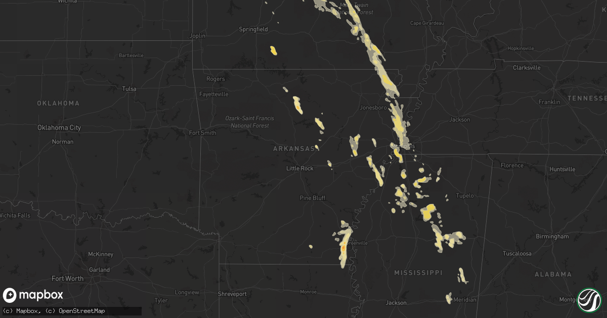
June 13 map
$229
one time, instant access
Download today. No call, no setup
Keep the $229
Bought the map and want the full workflow? Apply the entire $229 to a subscription within 7 days. None of it is wasted.
Every map, not just this one
This buys you this map. Subscription and you get every map we run, in the markets you choose from a few cities to whole states to nationwide. Plus real-time alerts the moment a storm fires.
Contact data
Name, contact info, occupancy, even credit band for addresses in the footprint. You go from where it hit to who to call.
Become the source they trust
Unlimited branding weather history reports on demand. You already have the documented answer ready for the property owner, and you are the one who showed up with it.
Property data and RoofTrace estimates
Pull up any address you have got, its value and the exact code rules for that jurisdiction, straight from One Click Code. Then RoofTrace estimates the squares, pitch, and roof value, priced the way you price.
Storm reports in Florida
Florida
| Date | Description |
|---|---|
| 06/13/20116:50 PM CDT | A downburst wind gust of 57 mph was measured at the jacksonville international airport. The downburst dropped directly over the airport complex. |
| 06/13/20116:39 PM CDT | Public report of quarter size hail in bagdad. |
| 06/13/20116:15 PM CDT | Quarter size hail on bee line rd south of 706/indian town rd. Exact location was unknown so location has been updated after a close analysis of radar data. |
| 06/13/20116:15 PM CDT | Quarter size hail on bee line rd south of 706/indian town rd |
| 06/13/20116:11 PM CDT | Winds est to be 60 mph or higher at 127 drive north in jupiter farms |
| 06/13/20114:45 PM CDT | Large hail was reported on interstate 75 near the high springs us 441 exit. |
| 06/13/20114:30 PM CDT | Oak tree blown over on bunkerview drive in palm coast. |
| 06/13/20114:20 PM CDT | Damage to the mcdonalds drive thru on southside boulevard just north of gate parkway caused by large tree limbs. Trees damage also in thorton park arartments. |
| 06/13/20114:10 PM CDT | Trees are down on homes on anniston road. |
| 06/13/20114:10 PM CDT | Skywarn spotter reports a large oak tree is down on anniston road near beach boulevard. Pea to penny size hail was occurring along anniston road. He estimated winds of |
| 06/13/20114:09 PM CDT | Nickle to quarter size hail reported at burning bush dr |
| 06/13/20114:09 PM CDT | Wind gust to 60 mphkarge trees down at burning bush dr |
| 06/13/20114:08 PM CDT | Power was knocked out for a large area of southwestern union county. |
| 06/13/20114:05 PM CDT | A large window was blown out at tom bush mazda on 9850 atlantic boulevard. |
| 06/13/20114:05 PM CDT | A local report indicates 1.00 inch wind near N PALM COAST |
| 06/13/20114:05 PM CDT | Large limbs and damage to signs reported near beach blvd and kernan rd. |
| 06/13/20113:55 PM CDT | Dime to quarter size hail lasted for fifteen minutes at brenmar lane. |
| 06/13/20113:52 PM CDT | Power lines are down on arlington road at lillian road. |
| 06/13/20113:45 PM CDT | Tree fell down on a car on arlington road near cesery boulevard. |
| 06/13/20113:45 PM CDT | Pool awning on bassett lane was heavily damaged by winds. |
| 06/13/20113:36 PM CDT | Stong wind gust 40 to 45 mph and pea size hail near regency square |
| 06/13/20113:25 PM CDT | Several small trees down on the north side of perry and spotter estimated 65 mph wind gust. |
| 06/13/20113:00 PM CDT | A few quarter sized hail stones with more dime sized hail. |
| 06/13/20112:52 PM CDT | Dime to quarter size hail fell in the northern part of the county west of highway 77. A carport also sustained damamge. |
| 06/13/20112:30 PM CDT | Canopy on gas station blown over. |
| 06/12/20117:45 PM CDT | Top of barn blown off and on top of a vehicle at 6088 chumuckla hwy. |
All States Impacted by Hail Map on June 13, 2011
Cities Impacted by Hail Map on June 13, 2011
- Tunica, MS
- Oslo, MN
- Manvel, ND
- Minto, ND
- Akron, CO
- Brush, CO
- Woodrow, CO
- Casey, IA
- Menlo, IA
- Diagonal, IA
- Shannon City, IA
- Kinderhook, IL
- Barry, IL
- Rockport, IL
- Pittsfield, IL
- New Canton, IL
- Silver Springs, FL
- Anthony, FL
- Fayette, MO
- New Franklin, MO
- Bunker, MO
- Jadwin, MO
- Salem, MO
- Long Lane, MO
- Blackwell, MO
- De Soto, MO
- Tutwiler, MS
- Sumter, SC
- Lodgepole, NE
- Martin, SD
- Alachua, FL
- High Springs, FL
- Lake City, FL
- Beebe, AR
- Nemo, SD
- Deadwood, SD
- Higginsville, MO
- Concordia, MO
- Corder, MO
- Lexington, MO
- Mayview, MO
- Pella, IA
- Sidney, NE
- Thayer, IA
- Ellston, IA
- Osceola, IA
- Grand River, IA
- Lenox, IA
- Murray, IA
- Afton, IA
- Perry, FL
- Anton, CO
- Van Meter, IA
- Winterset, IA
- Urbandale, IA
- Earlham, IA
- Dexter, IA
- West Des Moines, IA
- Clive, IA
- Adel, IA
- Windsor Heights, IA
- De Soto, IA
- Des Moines, IA
- Waukee, IA
- Burrton, KS
- Owanka, SD
- Wasta, SD
- Pulaski, IA
- Orrick, MO
- Sibley, MO
- Levasy, MO
- Buckner, MO
- Wellington, MO
- Napoleon, MO
- Harrison, NE
- Oak Grove, LA
- Marianna, AR
- Forrest City, AR
- Haynes, AR
- Rocky Mount, MO
- Lake Ozark, MO
- Sunrise Beach, MO
- Mora, MO
- Gravois Mills, MO
- Versailles, MO
- Lincoln, MO
- Kaiser, MO
- Osage Beach, MO
- Camdenton, MO
- Climax Springs, MO
- Linn Creek, MO
- Eldon, MO
- Edwards, MO
- Cole Camp, MO
- Stover, MO
- Eugene, MO
- Henley, MO
- Tuscumbia, MO
- Middletown, MO
- Macon, MO
- Callao, MO
- Ethel, MO
- New Cambria, MO
- Bevier, MO
- Hickory Ridge, AR
- McCrory, AR
- Wynne, AR
- Novinger, MO
- Letcher, SD
- White Lake, SD
- Mitchell, SD
- Platte, SD
- Plankinton, SD
- Mount Vernon, SD
- Stickney, SD
- Columbia, MO
- Boonville, MO
- New Bloomfield, MO
- Wooldridge, MO
- Prairie Home, MO
- Ashland, MO
- Jamestown, MO
- Fulton, MO
- Hartsburg, MO
- Genoa, CO
- Princeton, MO
- Lucerne, MO
- Newtown, MO
- Centerville, IA
- Moulton, IA
- Drakesville, IA
- Bloomfield, IA
- Melrose, IA
- Unionville, IA
- Moravia, IA
- Udell, IA
- Syracuse, MO
- Tipton, MO
- Palmyra, MO
- Sanborn, ND
- Pleasant Hill, IL
- Maxwell, IA
- Monroe, IA
- Otley, IA
- Concord, AR
- Drasco, AR
- Tumbling Shoals, AR
- Wilburn, AR
- Ida, AR
- Elgin, ND
- New Leipzig, ND
- Cantonment, FL
- Pensacola, FL
- Green Castle, MO
- Payson, IL
- Cedarbluff, MS
- Starkville, MS
- Collins, IA
- Cambridge, IA
- Rector, AR
- Marmaduke, AR
- Corning, AR
- Lafe, AR
- Hilliard, FL
- Cunningham, KS
- Meadville, MO
- Linneus, MO
- Slater, IA
- Bennett, CO
- Clark, SD
- Loose Creek, MO
- Linn, MO
- Bonnots Mill, MO
- Defiance, MO
- Lake Saint Louis, MO
- Wentzville, MO
- Waterloo, IL
- Bingham, NE
- Stapleton, NE
- Ellsworth, NE
- Mobile, AL
- Grand Bay, AL
- De Kalb, MS
- Timbo, AR
- Fox, AR
- Onia, AR
- Leslie, AR
- Shirley, AR
- Mountain View, AR
- Cuba, MO
- Owensville, MO
- Aurora, CO
- Halstead, KS
- Indianola, IA
- Ackworth, IA
- Paxton, NE
- Sutherland, NE
- Whitman, NE
- Milton, FL
- Enid, MS
- Crenshaw, MS
- Sardis, MS
- Sledge, MS
- Batesville, MS
- Marks, MS
- Pope, MS
- Courtland, MS
- Hazen, AR
- Knob Noster, MO
- Warrensburg, MO
- Lacona, IA
- Carson, ND
- Pangburn, AR
- Floral, AR
- Sedalia, MO
- Edgar Springs, MO
- Dixon, MO
- Green Ridge, MO
- Saint James, MO
- Duke, MO
- Vienna, MO
- Lenox, MO
- Barnett, MO
- Beulah, MO
- Brumley, MO
- Montreal, MO
- Jerome, MO
- Newburg, MO
- Crocker, MO
- Ulman, MO
- Russellville, MO
- Warsaw, MO
- Iberia, MO
- Saint Elizabeth, MO
- Licking, MO
- Windsor, MO
- Rolla, MO
- Olean, MO
- Roach, MO
- Brinktown, MO
- Meta, MO
- Ionia, MO
- Devils Elbow, MO
- Kingman, KS
- Cadet, MO
- Potosi, MO
- Bonne Terre, MO
- Richwoods, MO
- Drayton, ND
- Gilby, ND
- Purvis, MS
- New Zion, SC
- Salters, SC
- Lane, SC
- Baylis, IL
- Liberty, IL
- Perry, IL
- Chambersburg, IL
- Clayton, IL
- Plainville, IL
- New Salem, IL
- Griggsville, IL
- Sullivan, MO
- Bourbon, MO
- Folkston, GA
- Bussey, IA
- Hamilton, IA
- Portland, AR
- Lake Village, AR
- Jacksonville, FL
- Marsland, NE
- Crawford, NE
- Hemingford, NE
- Lindon, CO
- Valentine, NE
- Lugoff, SC
- Manning, SC
- Derby, IA
- Chariton, IA
- Memphis, TN
- Fort Morgan, CO
- Log Lane Village, CO
- Live Oak, FL
- McAlpin, FL
- Cherryville, MO
- Wesco, MO
- Centerville, MO
- Redford, MO
- Ellington, MO
- Cook Sta, MO
- Steelville, MO
- Boss, MO
- Coffeeville, MS
- Niangua, MO
- Conway, MO
- Bruce, MS
- Banner, MS
- Water Valley, MS
- Mount Sterling, IL
- Ottumwa, IA
- Blakesburg, IA
- Livonia, MO
- Carrabelle, FL
- New Raymer, CO
- Union, IA
- Marshalltown, IA
- Conrad, IA
- State Center, IA
- Saint Anthony, IA
- Liscomb, IA
- Albion, IA
- Clemons, IA
- Arriba, CO
- Montgomery City, MO
- Lambert, MS
- Paragould, AR
- Peetz, CO
- Crook, CO
- Greenfield, IA
- Fontanelle, IA
- Alma, MO
- Bland, MO
- Harrisburg, NE
- Parkersburg, IA
- Austinville, IA
- Ackley, IA
- Aplington, IA
- Woodlawn, IL
- Mount Vernon, IL
- Belle, MO
- Leasburg, MO
- Summerton, SC
- Pinewood, SC
- Granger, IA
- Huxley, IA
- Macksburg, IA
- Elkhart, IA
- Colo, IA
- Ankeny, IA
- Milo, IA
- Johnston, IA
- Beaman, IA
- Bouton, IA
- Stuart, IA
- Carlisle, IA
- Grimes, IA
- Orient, IA
- Woodward, IA
- Minburn, IA
- Nevada, IA
- Cumming, IA
- Norwalk, IA
- Kelley, IA
- Dallas Center, IA
- Pleasant Hill, IA
- Ames, IA
- Gladbrook, IA
- Martensdale, IA
- Prole, IA
- Bondurant, IA
- Madrid, IA
- Sheldahl, IA
- Mitchellville, IA
- Redfield, IA
- Alleman, IA
- Altoona, IA
- Polk City, IA
- Zearing, IA
- Mingo, IA
- Berwick, IA
- Dyess, AR
- Saint Thomas, MO
- Jefferson City, MO
- Westphalia, MO
- Humeston, IA
- Corydon, IA
- Rocheport, MO
- Cotton Plant, AR
- Wheatley, AR
- Hunter, AR
- Edwardsville, IL
- Dorsey, IL
- Bethalto, IL
- Moro, IL
- Hamel, IL
- Worden, IL
- Alton, IL
- Alhambra, IL
- Irvington, AL
- Theodore, AL
- Bowen, IL
- Martinsburg, MO
- Benton City, MO
- Auxvasse, MO
- Mexico, MO
- Luray, MO
- Como, MS
- Dermott, AR
- Seymour, IA
- Promise City, IA
- Hooper, NE
- Carpenter, SD
- Raymond, SD
- Clear Lake, IA
- Rockwell, IA
- Mason City, IA
- Oxford, MS
- Kirksville, MO
- Greentop, MO
- Steinhatchee, FL
- Timewell, IL
- Versailles, IL
- Custer, SD
- Potts Camp, MS
- Hermitage, AR
- Marceline, MO
- Templeton, IA
- Dedham, IA
- Lake Butler, FL
- Walls, MS
- Lake Cormorant, MS
- Williamstown, MO
- Bunceton, MO
- Clarksburg, MO
- California, MO
- Centertown, MO
- Panama City, FL
- Waterford, MS
- Holly Springs, MS
- Williston, FL
- Morriston, FL
- Saint Charles, MO
- Portage Des Sioux, MO
- Hill City, SD
- Rapid City, SD
- Oskaloosa, IA
- Knoxville, IA
- Harvey, IA
- Tracy, IA
- Cody, NE
- Merriman, NE
- Ashby, NE
- Maben, MS
- Mathiston, MS
- Laclede, MO
- Wheeling, MO
- Brookfield, MO
- Chula, MO
- Laredo, MO
- Wellsville, MO
- Laddonia, MO
- Rush Hill, MO
- Oshkosh, NE
- Lewellen, NE
- Gurley, NE
- Proctor, AR
- Crawfordsville, AR
- Eudora, AR
- Rohwer, AR
- Benoit, MS
- Arkansas City, AR
- Vardaman, MS
- Calhoun City, MS
- Derma, MS
- Big Creek, MS
- Arvilla, ND
- Panora, IA
- Helena, AR
- West Helena, AR
- Dundee, MS
- Hillsboro, MO
- Wedgefield, SC
- Bunnell, FL
- Palm Coast, FL
- Bucklin, MO
- Lawtey, FL
- Eupora, MS
- Ackerman, MS
- Weir, MS
- Burlington, CO
- Mendon, IL
- Canton, MO
- Warsaw, IL
- Ursa, IL
- Kimball, NE
- Lisco, NE
- Newton, MS
- Decatur, MS
- Hickory, MS
- Ava, MO
- Guthrie Center, IA
- Byhalia, MS
- Deep River, IA
- Green Cove Springs, FL
- Palatka, FL
- Andrews, SC
- Lake Park, GA
- Miami, MO
- Fairdealing, MO
- Hornersville, MO
- Arbyrd, MO
- Poplar Bluff, MO
- Knobel, AR
- Grandin, MO
- Piggott, AR
- Harviell, MO
- Naylor, MO
- Neelyville, MO
- Doniphan, MO
- Oxly, MO
- Ellsinore, MO
- Senath, MO
- Artesian, SD
- Dix, NE
- Olive Branch, MS
- Coldwater, MS
- Senatobia, MS
- Bradleyville, MO
- Van Buren, MO
- Foristell, MO
- Memphis, MO
- Sturgis, MS
- Nashville, GA
- Alapaha, GA
- Mott, ND
- Preston, MS
- Audubon, IA
- O'Brien, FL
- West Point, IL
- Sutter, IL
- Arthur, NE
- Shubuta, MS
- Heidelberg, MS
- Laurel, MS
- Hermosa, SD
- Chadwick, MO
- Oldfield, MO
- Cascilla, MS
- Charleston, MS
- Tillatoba, MS
- Doland, SD
- Byers, CO
- Golden Eagle, IL
- Winfield, MO
- Old Monroe, MO
- O'Fallon, MO
- Brussels, IL
- Wilson, AR
- Frenchmans Bayou, AR
- Joiner, AR
- San Mateo, FL
- Alexandria, MO
- Gore Springs, MS
- Littleton, CO
- Englewood, CO
- Ethan, SD
- Alexandria, SD
- Yellville, AR
- Lorimor, IA
- Big Springs, NE
- Crawfordville, FL
- Malta Bend, MO
- Saint George, GA
- Lake Worth, FL
- West Palm Beach, FL
- Ashley, IL
- Sigourney, IA
- Grafton, ND
- Creston, IA
- Padroni, CO
- Potter, NE
- What Cheer, IA
- Gibson, IA
- Keswick, IA
- New Sharon, IA
- Barnes City, IA
- Onawa, IA
- McGehee, AR
- Tillar, AR
- La Belle, MO
- Monticello, MO
- Lewistown, MO
- Bush, LA
- Melcher Dallas, IA
- Beacon, IA
- Lovilia, IA
- Swan, IA
- South English, IA
- Leighton, IA
- North English, IA
- Webster, IA
- Albia, IA
- Pleasantville, IA
- Eddyville, IA
- Columbia, IA
- Lancaster, MO
- Glenwood, MO
- Scribner, NE
- Douds, IA
- Milton, IA
- Eldora, IA
- Whitten, IA
- Arbela, MO
- Kahoka, MO
- Lake City, AR
- West Point, NE
- Hyannis, NE
- Vale, SD
- Oakland, NE
- Beemer, NE
- Elsah, IL
- Grafton, IL
- Hope, ND
- Tingley, IA
- Fort White, FL
- Wellborn, FL
- Branford, FL
- Troy, MO
- Moscow Mills, MO
- Wright City, MO
- Millington, TN
- Salisbury, MO
- Alcolu, SC
- Eastover, SC
- Hebron, ND
- Alliance, NE
- Atlantic, IA
- Anita, IA
- Florissant, MO
- Parkdale, AR
- Holt, FL
- Horseshoe Beach, FL
- Whiteman Air Force Base, MO
- Gordon, NE
- Batesland, SD
- Gulf Breeze, FL
- Sweet Springs, MO
- Houstonia, MO
- Irwin, IA
- Marshall, MO
- Walthall, MS
- McCool, MS
- Bellefontaine, MS
- Watkins, CO
- Denver, CO
- Commerce City, CO
- Greenville, FL
- Lamont, FL
- Black Oak, AR
- Dell, AR
- Manila, AR
- Keiser, AR
- Gilmore, AR
- Etowah, AR
- Marion, AR
- Bassett, AR
- Osceola, AR
- Turrell, AR
- Caraway, AR
- Drummonds, TN
- Monette, AR
- Leachville, AR
- West Memphis, AR
- Lepanto, AR
- Queen City, MO
- Powersville, MO
- Santa Fe, MO
- Brinkley, AR
- Bell, FL
- Trenton, FL
- Chiefland, FL
- Rembert, SC
- Hernando, MS
- Horn Lake, MS
- Nesbit, MS
- Gadsden, SC
- Archer, FL
- Strasburg, CO
- Mekinock, ND
- Festus, MO
- Bloomsdale, MO
- Pender, NE
- Bancroft, NE
- Scenic, SD
- Mondamin, IA
- Little Sioux, IA
- Tekamah, NE
- Cardwell, MO
- Linden, IA
- Gorin, MO
- Loraine, IL
- Wyaconda, MO
- Floris, IA
- Mount Sterling, IA
- Revere, MO
- Wayland, MO
- Keokuk, IA
- Rutledge, MO
- Basco, IL
- La Grange, MO
- Saint Patrick, MO
- Cantril, IA
- Big Flat, AR
- Pontotoc, MS
- Reddick, FL
- Jupiter, FL
- Downing, MO
- Hubbard, IA
- New Providence, IA
- Camden, MO
- Blackburn, MO
- Henrietta, MO
- Camp Point, IL
- Quincy, IL
- Fowler, IL
- Sully, IA
- Dalton, NE
- Montezuma, IA
- Odessa, MO
- Ute, IA
- Cottonwood Falls, KS
- Elmdale, KS
- Ashland, MS
- Hickory Flat, MS
- Craig, NE
- Brickeys, AR
- Flagler Beach, FL
- Hopkins, SC
- Breese, IL
- Carlyle, IL
- Oakland, MS
- Modale, IA
- Ocala, FL
- Citra, FL
- Colfax, IA
- Virginia, IL
- Beardstown, IL
- Wisner, NE
- Glasgow, MO
- Youngstown, FL
- Russell, IA
- Success, AR
- Winona, MO
- Williamsville, MO
- Richmond, MO
- Hardin, MO
- Upton, WY
- Bushnell, NE
- Centralia, MO
- Williamsburg, IA
- Hemingway, SC
- Nesmith, SC
- Georgetown, SC
- Libertyville, IA
- Fairfield, IA
- Waverly, MO
- Norborne, MO
- Carrollton, MO
- Valdosta, GA
- Emporia, KS
- Little Rock, MS
- Coon Rapids, IA
- Stanton, NE
- Pilger, NE
- Kyle, SD
- Louisiana, MO
- Jennings, FL
- Peru, IA
- Taylor, MS
- Inman, KS
- Buhler, KS
- Harriet, AR
- Marshall, AR
- Edgemont, AR
- Purdum, NE
- Yale, IA
- Slater, MO
- Herman, NE
- McCallsburg, IA
- La Monte, MO
- Vandalia, MO
- Iliff, CO
- Kampsville, IL
- Nebo, IL
- Jerseyville, IL
- Tebbetts, MO
- Saint Mary, MO
- Easley, SC
- Hay Springs, NE
- Tryon, NE
- Brashear, MO
- Baring, MO
- Aviston, IL
- Bunker Hill, IL
- Pocahontas, IL
- Marine, IL
- Staunton, IL
- Beckemeyer, IL
- Piasa, IL
- Godfrey, IL
- Highland, IL
- Brighton, IL
- New Douglas, IL
- Umatilla, FL
- Spickard, MO
- Trenton, MO
- Galt, MO
- Mercer, MO
- Fort Leonard Wood, MO
- Waynesville, MO
- Laquey, MO
- Frankford, MO
- Coahoma, MS
- Mayo, FL
- Cumberland, IA
- Massena, IA
- Keystone Heights, FL
- Melrose, FL
- Fleming, CO
- Saint Augustine, FL
- Woonsocket, SD
- Germantown, TN
- Isabel, KS
- Burwell, NE
- Soldier, IA
- Unionville, MO
- Searcy, AR
- Letona, AR
- Wall, SD
- Searsboro, IA
- Kane, IL
- Pilot Grove, MO
- Richview, IL
- Irvington, IL
- Dix, IL
- Centralia, IL
- Old Town, FL
- Broadwater, NE
- Woodbine, IA
- Logan, IA
- Valmeyer, IL
- Hawthorne, FL
- Curryville, MO
- Leesburg, FL
- Locust Grove, AR
- Robinsonville, MS
- Wewahitchka, FL
- Augusta, IL
- Huntsville, IL
- Mystic, IA
- Bluffs, IL
- Ewing, MO
- Taylor, MO
- Coatsburg, IL
- Edina, MO
- Hurdland, MO
- Maywood, MO
- Farmington, IA
- Paloma, IL
- Golden, IL
- Chillicothe, IA
- Hull, IL
- Plano, IA
- Bonaparte, IA
- Knox City, MO
- Keosauqua, IA
- Fort McCoy, FL
- Jefferson, IA
- Luverne, ND
- Woodburn, IA
- Weldon, IA
- Smithton, MO
- Hughes, AR
- Allerton, IA
- Coatsville, MO
- Chapin, IL
- Arlington, KS
- Hartford, IA
- Franklin, MO
- Marshfield, MO
- Abbeville, MS
- Centerview, MO
- Perryville, MO
- Navarre, FL
- Bagdad, FL
- Eglin Afb, FL
- Holts Summit, MO
- Flippin, AR
- Stoneham, CO
- Koeltztown, MO
- Argyle, MO
- Snyder, CO
- Yuma, CO
- Lyons, NE
- Newell, SD
- Chappell, NE
- Pine Ridge, SD
- Pollock, MO
- Bridgewater, IA
- Exline, IA
- Cincinnati, IA
- Mullen, NE
- Callahan, FL
- Reasnor, IA
- Vance, MS
- West Alton, MO
- Dow, IL
- Decatur, NE
- New Virginia, IA
- Duck Hill, MS
- Pheba, MS
- Hoyleton, IL
- Black, MO
- Prairie City, IA
- Runnells, IA
- Daleville, MS
- Loxahatchee, FL
- Palm Beach Gardens, FL
- Fulton, SD


