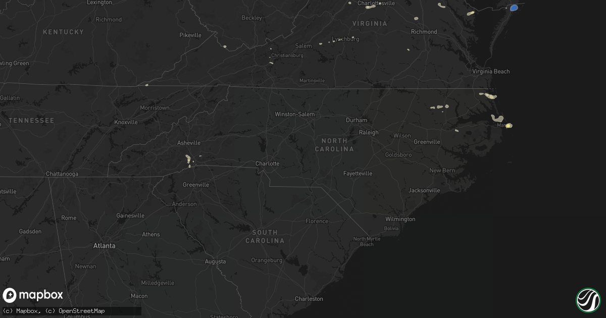
Hail Map in North Carolina on June 12, 2026
Get this storm
June 12 map
$229
one time, instant access
Download today. No call, no setup
Keep the $229
Bought the map and want the full workflow? Apply the entire $229 to a subscription within 7 days. None of it is wasted.
Every map, not just this one
This buys you this map. Subscription and you get every map we run, in the markets you choose from a few cities to whole states to nationwide. Plus real-time alerts the moment a storm fires.
Contact data
Name, contact info, occupancy, even credit band for addresses in the footprint. You go from where it hit to who to call.
Become the source they trust
Unlimited branding weather history reports on demand. You already have the documented answer ready for the property owner, and you are the one who showed up with it.
Property data and RoofTrace estimates
Pull up any address you have got, its value and the exact code rules for that jurisdiction, straight from One Click Code. Then RoofTrace estimates the squares, pitch, and roof value, priced the way you price.
Storm reports in North Carolina
North Carolina
| Date | Description |
|---|---|
| 06/12/20266:45 PM CDT | Tree fell near the railroad tracks in pilot mountain... Nc. Time is estimated from radar. |
| 06/12/20266:24 PM CDT | Corrects time of previous tstm wnd dmg report from 2 e white plains. Thunderstorm winds blew a tree down between the 1500 and 1600 blocks of sheep farm road. Tree block |
| 06/12/20266:17 PM CDT | Thunderstorm winds blew a tree down in the 3100 block of westfield road. The tree blocked both lanes. |
| 06/12/20266:17 PM CDT | Thunderstorm winds blew a tree down in the 100 block of gilda drive. |
| 06/12/20266:16 PM CDT | Tree down near end of ashley bend trail. |
| 06/12/20266:15 PM CDT | Thunderstorm winds blew a tree down near the intersection of massey road and st marie trail. The tree fell on a powerline and a truck with occupants. None of the occupa |
| 06/12/20266:15 PM CDT | At least 20 separate reports of a tree down across the city of mt. Airy. |
| 06/12/20266:14 PM CDT | Tree downed by thunderstorm winds and landed on a power line. |
| 06/12/20266:13 PM CDT | Tree down on riding gate rd. Time estimated. |
| 06/12/20266:12 PM CDT | Two separate reports of a tree down along perry taylor road... Near mt. Airy... Nc. Time is estimated from radar. |
| 06/12/20266:12 PM CDT | Thunderstorm winds blew a tree down in the 100 block of bridgeport road. |
| 06/12/20266:12 PM CDT | Tree downed by thunderstorm winds on a power line... And the tree caught fire and is blocking the roadway. |
| 06/12/20266:12 PM CDT | Tree downed by thunderstorm winds and landed in the roadway on arlington street. |
| 06/12/20266:09 PM CDT | Tree downed by thunderstorm winds and landed on a car near the walmart in mount airy. |
| 06/12/20266:09 PM CDT | Several trees downed by thunderstorm winds on s andy griffith parkway... Near the railroad crossing. |
| 06/12/20266:09 PM CDT | Tree and power lines down along welch road... In mt. Airy... Nc. Time is estimated from radar. |
| 06/12/20266:07 PM CDT | Tree down near the intersection of mckinney road and old hwy 601... Near mt. Airy... Nc. Time is estimated from radar. |
| 06/12/20266:07 PM CDT | Thunderstorm winds blew a tree down in the 600 block of south andy griffith parkway. |
| 06/12/20266:07 PM CDT | Thunderstorm winds blew a tree down in the 1500 block of edgewood drive. |
| 06/12/20266:06 PM CDT | Thunderstorm winds blew a tree down in the 100 block of mountain view road. |
| 06/12/20266:05 PM CDT | Two separate reports of a tree down along mckinney road... Near mt. Airy... Nc. Time is estimated from radar. |
| 06/12/20266:02 PM CDT | A local report indicates 1.25 inch wind near 3 SSW Mountain Home |
| 06/12/20265:56 PM CDT | Multiple trees down on road. |
| 06/12/20265:54 PM CDT | Two trees down in separate locations near horse shoe. Time estimated. |
| 06/12/20265:39 PM CDT | Multiple trees on road and powerlines down. |
| 06/12/20265:24 PM CDT | Thunderstorm winds blew a tree down between the 1500 and 1600 blocks of sheep farm road. The tree blocked both lanes of travel. |
| 06/11/202610:48 PM CDT | Delayed report. Washington county reported a tree down near the intersection of hwy 32 and hwy 99. |
All States Impacted by Hail Map on June 12, 2026
Cities Impacted by Hail Map on June 12, 2026
- Kenton, TN
- Trimble, TN
- Friendship, TN
- Booker, TX
- Perryton, TX
- Follett, TX
- Laverne, OK
- Balko, OK
- Lexington, TN
- Brighton, TN
- Covington, TN
- May, OK
- Buffalo, OK
- Lamar, OK
- Mcalester, OK
- Green Pond, SC
- Yemassee, SC
- Nellis, WV
- Ridgeview, WV
- Costa, WV
- Peytona, WV
- Ashford, WV
- Winifrede, WV
- Cabin Creek, WV
- Hernshaw, WV
- Julian, WV
- Comfort, WV
- Round O, SC
- Harrogate, TN
- Eskdale, WV
- Ewing, VA
- Mount Nebo, WV
- Summersville, WV
- Tazewell, TN
- Cloudcroft, NM
- Madison, VA
- Banco, VA
- Reva, VA
- Ludowici, GA
- Summerville, SC
- Ladson, SC
- Mount Hope, WV
- Haywood, VA
- Van Horn, TX
- Fairfield, MT
- Renick, WV
- Arcadia, FL
- Fredericksburg, VA
- Scarbro, WV
- Meadow Bridge, WV
- Grassy Meadows, WV
- Richardsville, VA
- Huger, SC
- Frenchtown, NJ
- Flemington, NJ
- Pittstown, NJ
- Haymarket, VA
- Broad Run, VA
- Spring Dale, WV
- Fort Stockton, TX
- Fort Shaw, MT
- Swiss, WV
- Belva, WV
- The Plains, VA
- Jewell Ridge, VA
- Raysal, WV
- Spotsylvania, VA
- Alpine, TX
- Ronceverte, WV
- Lewisburg, WV
- Caldwell, WV
- Alderson, WV
- Poplar Grove, AR
- Gainesville, VA
- Catharpin, VA
- Moro, AR
- Weed, NM
- Deerfield, VA
- Manassas, VA
- Centreville, VA
- Chantilly, VA
- Vaughn, MT
- Middleburg, VA
- Stanardsville, VA
- West Cornwall, CT
- Sharon, CT
- Locust Grove, VA
- Stafford, VA
- Sun River, MT
- Power, MT
- Great Falls, MT
- Punta Gorda, FL
- Sebring, FL
- Welch, WV
- Hillsboro, WV
- Sacramento, NM
- Zolfo Springs, FL
- Marvell, AR
- Nassau, NY
- Old Chatham, NY
- Malden Bridge, NY
- Nanjemoy, MD
- West Augusta, VA
- Lake Wales, FL
- Dundee, FL
- Culpeper, VA
- Hood, VA
- Oakpark, VA
- Brightwood, VA
- Pratts, VA
- Aroda, VA
- Fayette, AL
- Brainard, NY
- Greenville, VA
- Stuarts Draft, VA
- Milford, VA
- Hustle, VA
- Elkton, VA
- Dyke, VA
- Northport, AL
- Orange, VA
- Radiant, VA
- Locust Dale, VA
- Haines City, FL
- Kissimmee, FL
- Manahawkin, NJ
- Staffordsville, VA
- Ruckersville, VA
- Barboursville, VA
- Rochelle, VA
- Marathon, TX
- Alamogordo, NM
- Brooklet, GA
- Champlain, VA
- South Kent, CT
- Kent, CT
- Wingdale, NY
- Charlottesville, VA
- Jesup, GA
- Lakeville, CT
- Bedford, VA
- Raton, NM
- Somerset, VA
- Trinidad, CO
- Statesboro, GA
- Thaxton, VA
- North Garden, VA
- Belt, MT
- Upperville, VA
- Hiwassee, VA
- Draper, VA
- Tappahannock, VA
- Salisbury, CT
- Falls Village, CT
- Keswick, VA
- Pulaski, VA
- Marshall, VA
- Franklin Lakes, NJ
- Oakland, NJ
- Maywood, NJ
- Lodi, NJ
- Paramus, NJ
- Saddle Brook, NJ
- Fair Lawn, NJ
- Rochelle Park, NJ
- Gaylordsville, CT
- New Milford, CT
- Woodbury, CT
- Bethlehem, CT
- Nutley, NJ
- Glen Ridge, NJ
- Bloomfield, NJ
- Montclair, NJ
- Horse Shoe, NC
- Mills River, NC
- Harmony, ME
- Lowry, VA
- Goode, VA
- Montpelier, VA
- Thomaston, CT
- Watertown, CT
- Madison Heights, VA
- Amherst, VA
- Cottondale, AL
- Tuscaloosa, AL
- Forest, VA
- Ashland, VA
- Secaucus, NJ
- East Rutherford, NJ
- North Bergen, NJ
- Lyndhurst, NJ
- West New York, NJ
- Weehawken, NJ
- Carlstadt, NJ
- Union City, NJ
- Clifton, NJ
- Moneta, VA
- Vinton, VA
- Herndon, VA
- Leesburg, VA
- Aldie, VA
- Sterling, VA
- Reston, VA
- Ashburn, VA
- Bluemont, VA
- Oakton, VA
- Fairfax, VA
- Round Hill, VA
- Hendersonville, NC
- Middlebury, CT
- Waterbury, CT
- Oakville, CT
- Ocate, NM
- Lynchburg, VA
- Vienna, VA
- Springfield, VA
- Falls Church, VA
- Annandale, VA
- Alexandria, VA
- Arlington, VA
- Mill Spring, NC
- Sylvania, GA
- Lancaster, VA
- Heathsville, VA
- Concord, VA
- Baxley, GA
- Wagon Mound, NM
- Glen Allen, VA
- Rockville, VA
- La Plata, MD
- Fort Washington, MD
- Brandywine, MD
- Clinton, MD
- Accokeek, MD
- Waldorf, MD
- White Plains, MD
- Pomfret, MD
- Stanford, MT
- Geyser, MT
- Burgess, VA
- Capulin, NM
- Flat Rock, NC
- Saluda, NC
- Etowah, NC
- Pisgah Forest, NC
- Marietta, SC
- Zirconia, NC
- Des Moines, NM
- Annapolis, MD
- Crownsville, MD
- Arnold, MD
- Solano, NM
- Grenville, NM
- Boise City, OK
- Ruston, LA
- Amelia Court House, VA
- Ford, VA
- Roy, NM
- Severna Park, MD
- Edgewater, MD
- Davidsonville, MD
- Grambling, LA
- Campo, CO
- Temperanceville, VA
- Stevensville, MD
- Gambrills, MD
- Elkhart, KS
- Chester, MD
- Clayton, NM
- Keyes, OK
- Wallops Island, VA
- Horntown, VA
- Oak Hall, VA
- Atlantic, VA
- New Church, VA
- Tribune, KS
- Goodwell, OK
- Texhoma, OK
- Richfield, KS
- Walsh, CO
- Dalhart, TX
- Moriarty, NM
- Roxobel, NC
- Scotland Neck, NC
- Rolla, KS
- Guymon, OK
- Stratford, TX
- Mosquero, NM
- Aulander, NC
- Kelford, NC
- Edgewood, NM
- Hooker, OK
- Gruver, TX
- Texhoma, TX
- Amistad, NM
- Sedan, NM
- Texline, TX
- Tijeras, NM
- Stanley, NM
- Rich Square, NC
- Colerain, NC
- Ahoskie, NC
- Weskan, KS
- Sharon Springs, KS
- Spearman, TX
- Hardesty, OK
- Conchas Dam, NM
- South Mills, NC
- Nara Visa, NM
- Turpin, OK
- Sunray, TX
- Beaver, OK
- Moyock, NC
- Stinnett, TX
- Morse, TX
- Hartley, TX
- Logan, NM
- Channing, TX
- Las Vegas, NM
- Maple, NC
- Currituck, NC
- Trementina, NM
- Shawboro, NC
- Barco, NC
- Wallace, KS
- Winona, KS
- Edson, KS
- Coinjock, NC
- Plymouth, NC
- Vega, TX
- Adrian, TX
- Plains, KS
- Colby, KS
- Monument, KS
- Levant, KS
- Vaughn, NM
- Nags Head, NC
- Manteo, NC
- Manns Harbor, NC
- Kitty Hawk, NC
- Miami, TX
- Dumas, TX
- Gate, OK
- Meade, KS
- Oakley, KS
- Kill Devil Hills, NC
- Scott City, KS
- Forgan, OK
- Grinnell, KS
- Masterson, TX
- Amarillo, TX
- Rosston, OK
- Healy, KS
- Canadian, TX
- Wanchese, NC
- Dodge City, KS
- Protection, KS
- Fowler, KS
- Ashland, KS
- Coldwater, KS
- Spearville, KS
- Ensign, KS
- Englewood, KS
- Minneola, KS
- Ford, KS
- Wright, KS
- Higgins, TX
- Fritch, TX
- Panhandle, TX
- Borger, TX
- Skellytown, TX
- Grainfield, KS
- Gove, KS
- Park, KS
- Freedom, OK
- Mooreland, OK
- Lake City, KS
- Alva, OK
- Wilmore, KS
- Pampa, TX
- White Deer, TX
- Waynoka, OK
- Hardtner, KS
- Tucumcari, NM
- Burlington, OK
- Cherokee, OK
- Chester, OK
- Dacoma, OK
- Leedey, OK
- Butler, OK
- Aline, OK
- Fairview, OK
- Cleo Springs, OK
- Carmen, OK
- Helena, OK
- Jet, OK
- Amorita, OK
- Goltry, OK
- Wakita, OK
- Pond Creek, OK
- Manchester, OK
- Nash, OK
- Medford, OK
- Ringwood, OK
- Lees Summit, MO
- Grain Valley, MO
- Carrier, OK
- Enid, OK
- Kremlin, OK
- Meno, OK
- Ames, OK
- Bates City, MO
- Oak Grove, MO
- Garber, OK
- Kingsville, MO
- Strasburg, MO
- Pleasant Hill, MO
- Hunter, OK
- Wellington, KS
- Belle Plaine, KS
- Oxford, KS
- Udall, KS
- Douglas, OK
- Holden, MO
- Waukomis, OK
- Marshall, OK
- Fairmont, OK
- Anselmo, NE
- Covington, OK
- Billings, OK
- Hennessey, OK
- Burwell, NE
- Centerview, MO
- Eustis, NE
- Cozad, NE
- Lucien, OK
- Taylor, NE
- Sargent, NE
- Alma, MO
- Corder, MO
- Lone Jack, MO
- Brewster, NE
- Dunning, NE
- Warrensburg, MO
- Lexington, NE
- Elwood, NE
- Farnam, NE
- Callaway, NE
- Ericson, NE
- Purdum, NE
- El Dorado Springs, MO
- Gothenburg, NE
- Knob Noster, MO
- Bartlett, NE
- Spalding, NE
- Leeton, MO
- Windsor, MO
- Odessa, MO
- Elyria, NE
- Ord, NE
- Eddyville, NE
- Petersburg, NE
- Albion, NE
- Green Ridge, MO
- Stapleton, NE
- Perry, OK
- Lamont, OK
- Tonkawa, OK
- Sumner, NE
- Scotia, NE
- Curtis, NE
- Overton, NE
- Halsey, NE
- Stockville, NE
- Greeley, NE
- Primrose, NE
- Elgin, NE
- Broken Bow, NE
- Tilden, NE
- Meadow Grove, NE
- Oakdale, NE
- Moorefield, NE
- Madison, NE
- Battle Creek, NE
- Cedar Rapids, NE
- Comstock, NE
- Walters, OK
- Centerville, KS
- Norfolk, NE
- North Loup, NE
- Saint Edward, NE
- Palmer, NE
- Archer, NE
- Westerville, NE
- Genoa, NE
- Ansley, NE
- Temple, OK
- Bristow, OK
- Okemah, OK
- Stanton, NE
- Petrolia, TX
- Byers, TX
- Wolbach, NE
- Pilger, NE
- Platte Center, NE
- Humphrey, NE
- Monroe, NE
- Lindsay, NE
- Fullerton, NE
- Clarks, NE
- Central City, NE
- Belgrade, NE
- Hastings, OK
- Waurika, OK
- Garden City, MO


