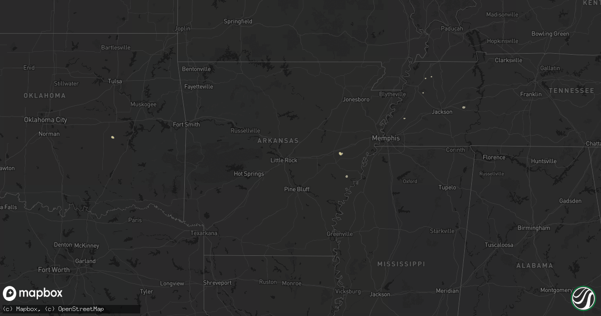
Hail Map in Arkansas on June 12, 2026
Get this storm
June 12 map
$229
one time, instant access
Download today. No call, no setup
Keep the $229
Bought the map and want the full workflow? Apply the entire $229 to a subscription within 7 days. None of it is wasted.
Every map, not just this one
This buys you this map. Subscription and you get every map we run, in the markets you choose from a few cities to whole states to nationwide. Plus real-time alerts the moment a storm fires.
Contact data
Name, contact info, occupancy, even credit band for addresses in the footprint. You go from where it hit to who to call.
Become the source they trust
Unlimited branding weather history reports on demand. You already have the documented answer ready for the property owner, and you are the one who showed up with it.
Property data and RoofTrace estimates
Pull up any address you have got, its value and the exact code rules for that jurisdiction, straight from One Click Code. Then RoofTrace estimates the squares, pitch, and roof value, priced the way you price.
Storm reports in Arkansas
Arkansas
| Date | Description |
|---|---|
| 06/12/20265:58 PM CDT | Large limb blown down onto the roof of a home. |
| 06/12/20265:37 PM CDT | [landspout] broadcast media shared picture of possible landspout. Time estimated from radar. |
| 06/12/20267:31 AM CDT | Department of transportation reported 1 downed tree blocking us 278 in howard county 2 miles southeast of dierks. Winds estimated 50 mph. |
| 06/12/20267:25 AM CDT | Department of transportation reported 1 downed tree blocking ar 24 in sevier county 1 mile west if lockesburg. Winds estimated 50 mph. |
| 06/12/20267:15 AM CDT | Department of transportation reported 1 downed tree blocking us 70 in sevier county 2 miles west of dequeen. Winds estimated 50 mph. |
All States Impacted by Hail Map on June 12, 2026
Cities Impacted by Hail Map on June 12, 2026
- Kenton, TN
- Trimble, TN
- Friendship, TN
- Booker, TX
- Perryton, TX
- Follett, TX
- Laverne, OK
- Balko, OK
- Lexington, TN
- Brighton, TN
- Covington, TN
- May, OK
- Buffalo, OK
- Lamar, OK
- Mcalester, OK
- Green Pond, SC
- Yemassee, SC
- Nellis, WV
- Ridgeview, WV
- Costa, WV
- Peytona, WV
- Ashford, WV
- Winifrede, WV
- Cabin Creek, WV
- Hernshaw, WV
- Julian, WV
- Comfort, WV
- Round O, SC
- Harrogate, TN
- Eskdale, WV
- Ewing, VA
- Mount Nebo, WV
- Summersville, WV
- Tazewell, TN
- Cloudcroft, NM
- Madison, VA
- Banco, VA
- Reva, VA
- Ludowici, GA
- Summerville, SC
- Ladson, SC
- Mount Hope, WV
- Haywood, VA
- Van Horn, TX
- Fairfield, MT
- Renick, WV
- Arcadia, FL
- Fredericksburg, VA
- Scarbro, WV
- Meadow Bridge, WV
- Grassy Meadows, WV
- Richardsville, VA
- Huger, SC
- Frenchtown, NJ
- Flemington, NJ
- Pittstown, NJ
- Haymarket, VA
- Broad Run, VA
- Spring Dale, WV
- Fort Stockton, TX
- Fort Shaw, MT
- Swiss, WV
- Belva, WV
- The Plains, VA
- Jewell Ridge, VA
- Raysal, WV
- Spotsylvania, VA
- Alpine, TX
- Ronceverte, WV
- Lewisburg, WV
- Caldwell, WV
- Alderson, WV
- Poplar Grove, AR
- Gainesville, VA
- Catharpin, VA
- Moro, AR
- Weed, NM
- Deerfield, VA
- Manassas, VA
- Centreville, VA
- Chantilly, VA
- Vaughn, MT
- Middleburg, VA
- Stanardsville, VA
- West Cornwall, CT
- Sharon, CT
- Locust Grove, VA
- Stafford, VA
- Sun River, MT
- Power, MT
- Great Falls, MT
- Punta Gorda, FL
- Sebring, FL
- Welch, WV
- Hillsboro, WV
- Sacramento, NM
- Zolfo Springs, FL
- Marvell, AR
- Nassau, NY
- Old Chatham, NY
- Malden Bridge, NY
- Nanjemoy, MD
- West Augusta, VA
- Lake Wales, FL
- Dundee, FL
- Culpeper, VA
- Hood, VA
- Oakpark, VA
- Brightwood, VA
- Pratts, VA
- Aroda, VA
- Fayette, AL
- Brainard, NY
- Greenville, VA
- Stuarts Draft, VA
- Milford, VA
- Hustle, VA
- Elkton, VA
- Dyke, VA
- Northport, AL
- Orange, VA
- Radiant, VA
- Locust Dale, VA
- Haines City, FL
- Kissimmee, FL
- Manahawkin, NJ
- Staffordsville, VA
- Ruckersville, VA
- Barboursville, VA
- Rochelle, VA
- Marathon, TX
- Alamogordo, NM
- Brooklet, GA
- Champlain, VA
- South Kent, CT
- Kent, CT
- Wingdale, NY
- Charlottesville, VA
- Jesup, GA
- Lakeville, CT
- Bedford, VA
- Raton, NM
- Somerset, VA
- Trinidad, CO
- Statesboro, GA
- Thaxton, VA
- North Garden, VA
- Belt, MT
- Upperville, VA
- Hiwassee, VA
- Draper, VA
- Tappahannock, VA
- Salisbury, CT
- Falls Village, CT
- Keswick, VA
- Pulaski, VA
- Marshall, VA
- Franklin Lakes, NJ
- Oakland, NJ
- Maywood, NJ
- Lodi, NJ
- Paramus, NJ
- Saddle Brook, NJ
- Fair Lawn, NJ
- Rochelle Park, NJ
- Gaylordsville, CT
- New Milford, CT
- Woodbury, CT
- Bethlehem, CT
- Nutley, NJ
- Glen Ridge, NJ
- Bloomfield, NJ
- Montclair, NJ
- Horse Shoe, NC
- Mills River, NC
- Harmony, ME
- Lowry, VA
- Goode, VA
- Montpelier, VA
- Thomaston, CT
- Watertown, CT
- Madison Heights, VA
- Amherst, VA
- Cottondale, AL
- Tuscaloosa, AL
- Forest, VA
- Ashland, VA
- Secaucus, NJ
- East Rutherford, NJ
- North Bergen, NJ
- Lyndhurst, NJ
- West New York, NJ
- Weehawken, NJ
- Carlstadt, NJ
- Union City, NJ
- Clifton, NJ
- Moneta, VA
- Vinton, VA
- Herndon, VA
- Leesburg, VA
- Aldie, VA
- Sterling, VA
- Reston, VA
- Ashburn, VA
- Bluemont, VA
- Oakton, VA
- Fairfax, VA
- Round Hill, VA
- Hendersonville, NC
- Middlebury, CT
- Waterbury, CT
- Oakville, CT
- Ocate, NM
- Lynchburg, VA
- Vienna, VA
- Springfield, VA
- Falls Church, VA
- Annandale, VA
- Alexandria, VA
- Arlington, VA
- Mill Spring, NC
- Sylvania, GA
- Lancaster, VA
- Heathsville, VA
- Concord, VA
- Baxley, GA
- Wagon Mound, NM
- Glen Allen, VA
- Rockville, VA
- La Plata, MD
- Fort Washington, MD
- Brandywine, MD
- Clinton, MD
- Accokeek, MD
- Waldorf, MD
- White Plains, MD
- Pomfret, MD
- Stanford, MT
- Geyser, MT
- Burgess, VA
- Capulin, NM
- Flat Rock, NC
- Saluda, NC
- Etowah, NC
- Pisgah Forest, NC
- Marietta, SC
- Zirconia, NC
- Des Moines, NM
- Annapolis, MD
- Crownsville, MD
- Arnold, MD
- Solano, NM
- Grenville, NM
- Boise City, OK
- Ruston, LA
- Amelia Court House, VA
- Ford, VA
- Roy, NM
- Severna Park, MD
- Edgewater, MD
- Davidsonville, MD
- Grambling, LA
- Campo, CO
- Temperanceville, VA
- Stevensville, MD
- Gambrills, MD
- Elkhart, KS
- Chester, MD
- Clayton, NM
- Keyes, OK
- Wallops Island, VA
- Horntown, VA
- Oak Hall, VA
- Atlantic, VA
- New Church, VA
- Tribune, KS
- Goodwell, OK
- Texhoma, OK
- Richfield, KS
- Walsh, CO
- Dalhart, TX
- Moriarty, NM
- Roxobel, NC
- Scotland Neck, NC
- Rolla, KS
- Guymon, OK
- Stratford, TX
- Mosquero, NM
- Aulander, NC
- Kelford, NC
- Edgewood, NM
- Hooker, OK
- Gruver, TX
- Texhoma, TX
- Amistad, NM
- Sedan, NM
- Texline, TX
- Tijeras, NM
- Stanley, NM
- Rich Square, NC
- Colerain, NC
- Ahoskie, NC
- Weskan, KS
- Sharon Springs, KS
- Spearman, TX
- Hardesty, OK
- Conchas Dam, NM
- South Mills, NC
- Nara Visa, NM
- Turpin, OK
- Sunray, TX
- Beaver, OK
- Moyock, NC
- Stinnett, TX
- Morse, TX
- Hartley, TX
- Logan, NM
- Channing, TX
- Las Vegas, NM
- Maple, NC
- Currituck, NC
- Trementina, NM
- Shawboro, NC
- Barco, NC
- Wallace, KS
- Winona, KS
- Edson, KS
- Coinjock, NC
- Plymouth, NC
- Vega, TX
- Adrian, TX
- Plains, KS
- Colby, KS
- Monument, KS
- Levant, KS
- Vaughn, NM
- Nags Head, NC
- Manteo, NC
- Manns Harbor, NC
- Kitty Hawk, NC
- Miami, TX
- Dumas, TX
- Gate, OK
- Meade, KS
- Oakley, KS
- Kill Devil Hills, NC
- Scott City, KS
- Forgan, OK
- Grinnell, KS
- Masterson, TX
- Amarillo, TX
- Rosston, OK
- Healy, KS
- Canadian, TX
- Wanchese, NC
- Dodge City, KS
- Protection, KS
- Fowler, KS
- Ashland, KS
- Coldwater, KS
- Spearville, KS
- Ensign, KS
- Englewood, KS
- Minneola, KS
- Ford, KS
- Wright, KS
- Higgins, TX
- Fritch, TX
- Panhandle, TX
- Borger, TX
- Skellytown, TX
- Grainfield, KS
- Gove, KS
- Park, KS
- Freedom, OK
- Mooreland, OK
- Lake City, KS
- Alva, OK
- Wilmore, KS
- Pampa, TX
- White Deer, TX
- Waynoka, OK
- Hardtner, KS
- Tucumcari, NM
- Burlington, OK
- Cherokee, OK
- Chester, OK
- Dacoma, OK
- Leedey, OK
- Butler, OK
- Aline, OK
- Fairview, OK
- Cleo Springs, OK
- Carmen, OK
- Helena, OK
- Jet, OK
- Amorita, OK
- Goltry, OK
- Wakita, OK
- Pond Creek, OK
- Manchester, OK
- Nash, OK
- Medford, OK
- Ringwood, OK
- Lees Summit, MO
- Grain Valley, MO
- Carrier, OK
- Enid, OK
- Kremlin, OK
- Meno, OK
- Ames, OK
- Bates City, MO
- Oak Grove, MO
- Garber, OK
- Kingsville, MO
- Strasburg, MO
- Pleasant Hill, MO
- Hunter, OK
- Wellington, KS
- Belle Plaine, KS
- Oxford, KS
- Udall, KS
- Douglas, OK
- Holden, MO
- Waukomis, OK
- Marshall, OK
- Fairmont, OK
- Anselmo, NE
- Covington, OK
- Billings, OK
- Hennessey, OK
- Burwell, NE
- Centerview, MO
- Eustis, NE
- Cozad, NE
- Lucien, OK
- Taylor, NE
- Sargent, NE
- Alma, MO
- Corder, MO
- Lone Jack, MO
- Brewster, NE
- Dunning, NE
- Warrensburg, MO
- Lexington, NE
- Elwood, NE
- Farnam, NE
- Callaway, NE
- Ericson, NE
- Purdum, NE
- El Dorado Springs, MO
- Gothenburg, NE
- Knob Noster, MO
- Bartlett, NE
- Spalding, NE
- Leeton, MO
- Windsor, MO
- Odessa, MO
- Elyria, NE
- Ord, NE
- Eddyville, NE
- Petersburg, NE
- Albion, NE
- Green Ridge, MO
- Stapleton, NE
- Perry, OK
- Lamont, OK
- Tonkawa, OK
- Sumner, NE
- Scotia, NE
- Curtis, NE
- Overton, NE
- Halsey, NE
- Stockville, NE
- Greeley, NE
- Primrose, NE
- Elgin, NE
- Broken Bow, NE
- Tilden, NE
- Meadow Grove, NE
- Oakdale, NE
- Moorefield, NE
- Madison, NE
- Battle Creek, NE
- Cedar Rapids, NE
- Comstock, NE
- Walters, OK
- Centerville, KS
- Norfolk, NE
- North Loup, NE
- Saint Edward, NE
- Palmer, NE
- Archer, NE
- Westerville, NE
- Genoa, NE
- Ansley, NE
- Temple, OK
- Bristow, OK
- Okemah, OK
- Stanton, NE
- Petrolia, TX
- Byers, TX
- Wolbach, NE
- Pilger, NE
- Platte Center, NE
- Humphrey, NE
- Monroe, NE
- Lindsay, NE
- Fullerton, NE
- Clarks, NE
- Central City, NE
- Belgrade, NE
- Hastings, OK
- Waurika, OK
- Garden City, MO


