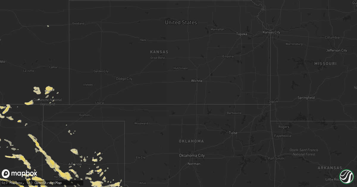
Hail Map in Texas on June 12, 2012
Get this storm
June 12 map
$229
one time, instant access
Download today. No call, no setup
Keep the $229
Bought the map and want the full workflow? Apply the entire $229 to a subscription within 7 days. None of it is wasted.
Every map, not just this one
This buys you this map. Subscription and you get every map we run, in the markets you choose from a few cities to whole states to nationwide. Plus real-time alerts the moment a storm fires.
Contact data
Name, contact info, occupancy, even credit band for addresses in the footprint. You go from where it hit to who to call.
Become the source they trust
Unlimited branding weather history reports on demand. You already have the documented answer ready for the property owner, and you are the one who showed up with it.
Property data and RoofTrace estimates
Pull up any address you have got, its value and the exact code rules for that jurisdiction, straight from One Click Code. Then RoofTrace estimates the squares, pitch, and roof value, priced the way you price.
Storm reports in Texas
Texas
| Date | Description |
|---|---|
| 06/12/20126:40 PM CDT | Several large oak trees blown down some blocking fm448 at fm2239 |
| 06/12/20126:35 PM CDT | Tree limbs over 2 inch broken est. 30 mph winds |
| 06/12/20126:10 PM CDT | Trees down on fm 22 and along other county roads |
| 06/12/20126:00 PM CDT | Several 1-3 inch tree limbs down near the intersection of waco and brown road in the town of mcdade |
| 06/12/20125:51 PM CDT | 50 kt wind gust reported by kt35 awos north of cameron |
| 06/12/20125:50 PM CDT | Large trees down. Trees with branches up to 6 inch diameter broken |
| 06/12/20125:45 PM CDT | Trees down on county road 268 near snook. |
| 06/12/20125:45 PM CDT | Trees and power lines down. |
| 06/12/20125:30 PM CDT | Quarter sized hail reported in rusk |
| 06/12/20125:12 PM CDT | Trees blown down at cypresswood and i-45 |
| 06/12/20125:10 PM CDT | At iah |
| 06/12/20125:08 PM CDT | At fm 1960 and aldine westfield |
| 06/12/20125:07 PM CDT | Trees and powerlines down near rusk |
| 06/12/20124:55 PM CDT | Trees blown down and a few outbuildings damaged near the intersection of sh53 and sh320 |
| 06/12/20124:54 PM CDT | Street sign damage at richey rd and i-45 |
| 06/12/20124:48 PM CDT | 5-6 inch diameter tree blown down through a brick wall of a residence. Location 2 miles west of i-45 near spring stuebner |
| 06/12/20124:48 PM CDT | Business sign blown down and onto a car |
| 06/12/20124:42 PM CDT | Trees blown down just south of the dam |
| 06/12/20124:40 PM CDT | Large tree limbs down and pea size hail at i-45 rayford/sawdust |
| 06/12/20124:37 PM CDT | Trees down across road at forestgate and woodlands pkwy |
| 06/12/20124:18 PM CDT | Trees and street signs blown down. Traffic lights damaged. Newspaper reports some trees blown onto homes. |
| 06/12/20124:05 PM CDT | Numerous large tree limbs blown down. A few large trees blown down as well. Estimated 60 mph winds. |
| 06/12/20122:42 PM CDT | Trees down along fm 1725 and fm 2025. |
| 06/12/20122:15 PM CDT | Powerlines and large tree limbs down throughout town |
| 06/12/20122:10 PM CDT | Measured at kmkn |
| 06/12/20121:08 PM CDT | A local report indicates 60 MPH wind near RISING STAR |
| 06/12/20121:05 PM CDT | Coop observer reports several trees down in wildwood with diameters between eight and ten inches. Observer also reported a tree struck by lightning. |
| 06/12/20121:00 PM CDT | Public reports trees down on powerlines. Power out til almost 8 pm. |
| 06/12/201212:38 PM CDT | Sheriff dept reports trees down near kirkland spring off route 287. |
| 06/12/201212:09 PM CDT | Quarter to golfball hail began around 1209 pm and still falling |
| 06/12/20122:35 AM CDT | Measured by the west texas mesonet |
| 06/12/20121:55 AM CDT | Measured by the west texas mesonet |
| 06/12/20121:30 AM CDT | West texas mesonet report |
| 06/12/20121:25 AM CDT | Measured by the west texas mesonet |
| 06/12/201212:35 AM CDT | 58kt gust |
| 06/12/201212:25 AM CDT | West texas mesonet report |
| 06/12/201212:15 AM CDT | Hail up to the size of quarters. Winds estimated 45-50 mph. Zero visibility in very heavy rain. |
| 06/12/201212:13 AM CDT | A local report indicates 1.25 inch wind near HASKELL |
| 06/12/201212:10 AM CDT | Measured by the texas tech mesonet |
| 06/12/201212:03 AM CDT | Estimated wind gusts of 55 to 60 mph. Also had very heavy rain will near zero visibility |
| 06/11/201211:35 PM CDT | Measured by the west texas mesonet |
| 06/11/201211:35 PM CDT | A local report indicates 61 MPH wind near 5 NNW PAMPA |
| 06/11/201211:20 PM CDT | Measured by the west texas mesonet |
| 06/11/201211:10 PM CDT | A local report indicates 76 MPH wind near 2 WNW HEREFORD |
| 06/11/201210:39 PM CDT | A local report indicates 60 MPH wind near ADRIAN |
| 06/11/201210:36 PM CDT | Hail has accumulated to 3 to 4 inches deep. Largest stones were quarter size. Two semi trucks in the ditch off of interstate 40. Time of hail occurrence estimated from |
| 06/11/201210:33 PM CDT | A local report indicates 62 MPH wind near 2 ENE GOLDSMITH |
| 06/11/201210:32 PM CDT | Hail ranging in diameter from pea to quarter size has accumulated into drifts 3 to 4 inches deep |
| 06/11/201210:30 PM CDT | 40 to 60 foot trees uprooted. Trees were mature and healthy with 3 foot wide trunks. |
| 06/11/201210:30 PM CDT | Car port lifted from ground and landed on roof of house. Home was damaged by car port. |
| 06/11/201210:30 PM CDT | 5 inch tree branch snapped. Gate forced off hinges. 81st and andrews highway. |
| 06/11/201210:16 PM CDT | A local report indicates 62 MPH wind near 2 ENE GOLDSMITH |
| 06/11/20129:28 PM CDT | Telephone poles down 1/4 e frankel city. |
| 06/11/20129:00 PM CDT | A local report indicates 2.75 inch wind near WHITEFACE |
| 06/11/20128:59 PM CDT | Only hail falling....no rain |
| 06/11/20128:58 PM CDT | Two power poles leaning sse and a third one snapped .125 mi e of frankel city on fm 1967 |
| 06/11/20128:54 PM CDT | A local report indicates 2.50 inch wind near WHITEFACE |
| 06/11/20128:45 PM CDT | Brief tornado observed |
| 06/11/20128:36 PM CDT | A local report indicates 1.25 inch wind near 15 W SUNDOWN |
| 06/11/20128:25 PM CDT | A local report indicates 1.00 inch wind near 7 N PLAINS |
| 06/11/20128:00 PM CDT | Hail covered the yard |
All States Impacted by Hail Map on June 12, 2012
Cities Impacted by Hail Map on June 12, 2012
- Weston, CO
- Franklin, TX
- Floyd, NM
- House, NM
- Caputa, SD
- Rapid City, SD
- Rising Star, TX
- Cisco, TX
- Quanah, TX
- Dimmitt, TX
- Nazareth, TX
- Thorndale, TX
- Lexington, TX
- Rockdale, TX
- Mill Spring, NC
- Friona, TX
- Kingsbury, TX
- Seguin, TX
- Trementina, NM
- Odessa, TX
- Ridgeland, SC
- Florien, LA
- Breckenridge, TX
- Graham, TX
- Newcastle, TX
- Pritchett, CO
- Springfield, CO
- Palestine, TX
- Jacksonville, TX
- Tulia, TX
- Raton, NM
- McDade, TX
- Elgin, TX
- Quitaque, TX
- Silverton, TX
- Hayes Center, NE
- Jal, NM
- Albany, TX
- Childress, TX
- Memphis, TX
- San Jon, NM
- Miles, TX
- Canyon, TX
- Seymour, TX
- Campo, CO
- Clovis, NM
- Pampa, TX
- Haskell, TX
- Throckmorton, TX
- Plains, TX
- Whiteface, TX
- Goldsmith, TX
- Mcalister, NM
- Ogallala, NE
- Hereford, TX
- Kountze, TX
- Willacoochee, GA
- Pearson, GA
- Nicholls, GA
- Ambrose, GA
- Douglas, GA
- Tennessee Colony, TX
- Montalba, TX
- Belle Fourche, SD
- Dublin, TX
- Olton, TX
- Springlake, TX
- Oakwood, TX
- Happy, TX
- Alto, TX
- Rusk, TX
- Cleburne, TX
- Grandview, TX
- Portales, NM
- Melrose, NM
- Goodrich, TX
- Livingston, TX
- Midland, TX
- Amistad, NM
- Masterson, TX
- Vale, SD
- Rogers, NM
- Causey, NM
- Ralls, TX
- Baxley, GA
- Logan, NM
- Vega, TX
- Adrian, TX
- Nara Visa, NM
- Gonzales, TX
- Benkelman, NE
- Blooming Grove, TX
- Branson, CO
- Kim, CO
- Grady, NM
- Cannon Afb, NM
- Texico, NM
- Broadview, NM
- Farwell, TX
- Muleshoe, TX
- Bovina, TX
- Sudan, TX
- Andrews, TX
- Morton, TX
- Levelland, TX
- Conchas Dam, NM
- Midkiff, TX
- Big Lake, TX
- Conroe, TX
- Montgomery, TX
- Des Moines, NM
- Paxton, NE
- Woodville, TX
- Hillister, TX
- Cross Plains, TX
- Pine Ridge, SD
- Manderson, SD
- Sturgis, SD
- Milano, TX
- Caldwell, TX
- Rule, TX
- San Angelo, TX
- Trenton, NE
- Clarendon, TX
- Hazlehurst, GA
- Alma, GA
- Crowell, TX
- Waelder, TX
- Lovington, NM
- Hobbs, NM
- Lueders, TX
- Cleveland, TX
- Splendora, TX
- Stratton, NE
- Monahans, TX
- Kermit, TX
- Rochester, TX
- O'Brien, TX
- Comanche, TX
- Mullin, TX
- Zephyr, TX
- Jasper, TX
- Coldspring, TX
- Santa Rosa, NM
- Jonesboro, TX
- Hamilton, TX
- Max, NE
- Palisade, NE
- San Augustine, TX
- Lipan, TX
- Santo, TX
- Whitman, NE
- Hyannis, NE
- Strawn, TX
- Gordon, TX
- Wanblee, SD
- Scenic, SD
- Wall, SD
- Interior, SD
- Kadoka, SD
- Turkey, TX
- Lakeview, TX
- Stratford, TX
- Flomot, TX
- Matador, TX
- Seminole, TX
- Barstow, TX
- Groveton, TX
- Thrall, TX
- Big Spring, TX
- Knott, TX
- New Underwood, SD
- Custer, SD
- Elsie, NE
- Wauneta, NE
- Ranger, TX
- Mingus, TX
- Bryan, TX
- College Station, TX
- Marquez, TX
- Panhandle, TX
- Shepherd, TX
- New Waverly, TX
- Eunice, NM
- Monument, NM
- Groom, TX
- Bedias, TX
- Normangee, TX
- Leona, TX
- Ocate, NM
- Wagon Mound, NM
- Lovelady, TX
- Trinity, TX
- Coyanosa, TX
- Richards, TX
- Enders, NE
- White Deer, TX
- Gause, TX
- Amarillo, TX
- Saint Augustine, FL
- Harwood, TX
- Live Oak, FL
- Wellborn, FL
- Crane, TX
- Maljamar, NM
- Anderson, TX
- Willis, TX
- Italy, TX
- Lapwai, ID
- Culdesac, ID
- Carson, NM
- Paducah, TX
- Petersburg, TX
- Abernathy, TX
- Flatonia, TX
- Monticello, FL
- Tolar, TX
- Lockney, TX
- White Springs, FL
- Jasper, FL
- Maywood, NE
- Centerville, TX
- Jewett, TX
- Baird, TX
- Hermosa, SD
- Sidney, TX
- Blanket, TX
- Wallace, NE
- Imperial, NE
- Whitewood, SD
- Nisland, SD
- Greenville, FL
- Olney, TX
- Sunray, TX
- Fort Sumner, NM
- Fairfield, TX
- Spring, TX
- Magnolia, TX
- Tucumcari, NM
- Weinert, TX
- Kress, TX
- Plainview, TX
- Denver City, TX
- Coleman, TX
- East Palatka, FL
- Mullen, NE
- Ashby, NE
- Rutherfordton, NC
- Claude, TX
- Rustburg, VA
- Lynchburg, VA
- Concord, VA
- Timpson, TX
- Teague, TX
- Elkton, FL
- Culbertson, NE
- Iola, TX
- Colmesneil, TX
- Brookhaven, MS
- Dawson, TX
- Grapeland, TX
- Elkhart, TX
- Boncarbo, CO
- Trinidad, CO
- Reidsville, GA
- Coupland, TX
- Lenorah, TX
- Munday, TX
- Broaddus, TX
- Tryon, NE
- Stapleton, NE
- Seneca, NE
- Buffalo, TX
- Stamford, TX
- Hedley, TX
- Lelia Lake, TX
- Lincoln, TX
- Stephenville, TX
- Giddings, TX
- Roy, NM
- Solano, NM
- Crockett, TX
- Kennard, TX
- Pennington, TX
- Odonnell, TX
- Union Center, SD
- Holliday, TX
- Madrid, NE
- Cameron, TX
- New Caney, TX
- Pecos, TX
- Leesville, LA
- Draper, SD
- Granbury, TX
- Orlando, FL
- Winter Garden, FL
- Carbon, TX
- Gardendale, TX
- Pointblank, TX
- Folsom, NM
- Goree, TX
- Moran, TX
- Avoca, TX
- Dodson, TX
- Huntsville, TX
- Gatesville, TX
- Green Cove Springs, FL
- Wiergate, TX
- Windermere, FL
- Warren, TX
- Chester, TX
- Mount Airy, NC
- Dobson, NC
- Gustine, TX
- Westminster, SC
- Idalou, TX
- Brownwood, TX
- Burkett, TX
- De Leon, TX
- White River, SD
- Corsicana, TX
- Caddo, TX
- Littlefield, TX
- Grenville, NM
- Gorman, TX
- Thedford, NE
- Nixon, TX
- Leesville, TX
- Barry, TX
- Imperial, TX
- Yadkinville, NC
- Clayton, NM
- Hulett, WY
- Madison, FL
- Piedmont, SD
- Bluff Dale, TX
- Iowa Park, TX
- Electra, TX
- Purmela, TX
- Cushing, TX
- Gretna, VA
- Dickens, NE
- Vona, CO
- Tell, TX
- Grant, NE
- Carlton, TX
- Pep, TX
- East Bend, NC
- Boonville, NC
- Weatherford, TX
- Moscow, TX
- Long Valley, SD
- Garden City, TX
- Notrees, TX
- Smithville, TX
- Godley, TX
- Garita, NM
- New Smyrna Beach, FL
- Mims, FL
- Wortham, TX
- Deridder, LA
- Merryville, LA
- Athens, TX
- Denton, GA
- Lohn, TX
- Streetman, TX
- Buena Vista, NM
- Asotin, WA
- Anatone, WA
- Center, TX
- Cee Vee, TX
- Fairburn, SD
- Venango, NE
- Bastrop, TX
- Itasca, TX
- May, TX
- Woodson, TX
- Taylor, TX


