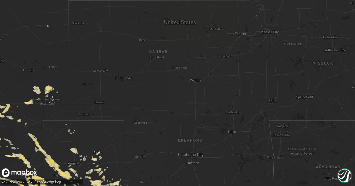
Hail Map in New Mexico on June 12, 2012
Get this storm
June 12 map
$229
one time, instant access
Download today. No call, no setup
Keep the $229
Bought the map and want the full workflow? Apply the entire $229 to a subscription within 7 days. None of it is wasted.
Every map, not just this one
This buys you this map. Subscription and you get every map we run, in the markets you choose from a few cities to whole states to nationwide. Plus real-time alerts the moment a storm fires.
Contact data
Name, contact info, occupancy, even credit band for addresses in the footprint. You go from where it hit to who to call.
Become the source they trust
Unlimited branding weather history reports on demand. You already have the documented answer ready for the property owner, and you are the one who showed up with it.
Property data and RoofTrace estimates
Pull up any address you have got, its value and the exact code rules for that jurisdiction, straight from One Click Code. Then RoofTrace estimates the squares, pitch, and roof value, priced the way you price.
Storm reports in New Mexico
New Mexico
| Date | Description |
|---|---|
| 06/12/20123:37 PM CDT | A local report indicates 1.00 inch wind near 3 NNE RATON |
| 06/12/20123:37 PM CDT | A local report indicates 1.00 inch wind near 3 NNE RATON CREWS AIRPO |
| 06/12/20123:37 PM CDT | A local report indicates 1.00 inch wind near 3 NNE RATON CREWS AIRPO |
| 06/12/20121:11 AM CDT | A local report indicates 1.00 inch wind near 4 S CLOVIS |
| 06/11/201211:15 PM CDT | A local report indicates 2.75 inch wind near 1 N DORA |
| 06/11/201211:03 PM CDT | Multiple reports of a brief rain wrapped tornado. Time estimated. |
| 06/11/201210:15 PM CDT | A local report indicates 1.00 inch wind near 2 SE PORTALES |
| 06/11/201210:15 PM CDT | A local report indicates 2.75 inch wind near 6 E FLOYD |
| 06/11/201210:10 PM CDT | Broke skylights out of the roof |
| 06/11/201210:08 PM CDT | A local report indicates 2.50 inch wind near 13 NW PORTALES |
| 06/11/20129:50 PM CDT | A local report indicates 1.75 inch wind near 1 W PORTALES |
| 06/11/20129:50 PM CDT | A local report indicates 1.75 inch wind near MELROSE |
| 06/11/20129:40 PM CDT | A local report indicates 4.50 inch wind near MELROSE |
| 06/11/20129:39 PM CDT | A local report indicates a tornado near CLOVIS |
| 06/11/20129:35 PM CDT | A local report indicates 1.75 inch wind near MELROSE |
| 06/11/20129:31 PM CDT | A local report indicates 1.75 inch wind near MELROSE |
| 06/11/20129:29 PM CDT | A local report indicates 1.75 inch wind near CLOVIS |
| 06/11/20129:20 PM CDT | A local report indicates 1.75 inch wind near 10 SSW CARLSBAD |
| 06/11/20128:51 PM CDT | A local report indicates 1.00 inch wind near 12 SW CARLSBAD |
| 06/11/20128:24 PM CDT | A local report indicates 1.50 inch wind near 2 S OIL CENTER |
| 06/11/20128:10 PM CDT | A local report indicates 1.25 inch wind near HOBBS |
| 06/11/20128:10 PM CDT | A local report indicates 1.00 inch wind near 7 W HOUSE |
| 06/11/20127:55 PM CDT | A local report indicates 1.00 inch wind near 16 ENE SUMNER LAKE |
| 06/11/20127:50 PM CDT | A local report indicates 1.00 inch wind near 22 W CARLSBAD |
| 06/11/20127:25 PM CDT | A local report indicates 1.00 inch wind near WAGON MOUND |
| 06/11/20127:23 PM CDT | Hail drifts cover u.s. Highway 84 |
| 06/11/20127:21 PM CDT | A local report indicates 1.00 inch wind near HOBBS |
| 06/11/20127:20 PM CDT | A local report indicates 1.00 inch wind near WAGON MOUND |
| 06/11/20127:08 PM CDT | 658-708 pm cdt |
| 06/11/20127:00 PM CDT | A local report indicates 1.75 inch wind near LOVINGTON |
All States Impacted by Hail Map on June 12, 2012
Cities Impacted by Hail Map on June 12, 2012
- Weston, CO
- Franklin, TX
- Floyd, NM
- House, NM
- Caputa, SD
- Rapid City, SD
- Rising Star, TX
- Cisco, TX
- Quanah, TX
- Dimmitt, TX
- Nazareth, TX
- Thorndale, TX
- Lexington, TX
- Rockdale, TX
- Mill Spring, NC
- Friona, TX
- Kingsbury, TX
- Seguin, TX
- Trementina, NM
- Odessa, TX
- Ridgeland, SC
- Florien, LA
- Breckenridge, TX
- Graham, TX
- Newcastle, TX
- Pritchett, CO
- Springfield, CO
- Palestine, TX
- Jacksonville, TX
- Tulia, TX
- Raton, NM
- McDade, TX
- Elgin, TX
- Quitaque, TX
- Silverton, TX
- Hayes Center, NE
- Jal, NM
- Albany, TX
- Childress, TX
- Memphis, TX
- San Jon, NM
- Miles, TX
- Canyon, TX
- Seymour, TX
- Campo, CO
- Clovis, NM
- Pampa, TX
- Haskell, TX
- Throckmorton, TX
- Plains, TX
- Whiteface, TX
- Goldsmith, TX
- Mcalister, NM
- Ogallala, NE
- Hereford, TX
- Kountze, TX
- Willacoochee, GA
- Pearson, GA
- Nicholls, GA
- Ambrose, GA
- Douglas, GA
- Tennessee Colony, TX
- Montalba, TX
- Belle Fourche, SD
- Dublin, TX
- Olton, TX
- Springlake, TX
- Oakwood, TX
- Happy, TX
- Alto, TX
- Rusk, TX
- Cleburne, TX
- Grandview, TX
- Portales, NM
- Melrose, NM
- Goodrich, TX
- Livingston, TX
- Midland, TX
- Amistad, NM
- Masterson, TX
- Vale, SD
- Rogers, NM
- Causey, NM
- Ralls, TX
- Baxley, GA
- Logan, NM
- Vega, TX
- Adrian, TX
- Nara Visa, NM
- Gonzales, TX
- Benkelman, NE
- Blooming Grove, TX
- Branson, CO
- Kim, CO
- Grady, NM
- Cannon Afb, NM
- Texico, NM
- Broadview, NM
- Farwell, TX
- Muleshoe, TX
- Bovina, TX
- Sudan, TX
- Andrews, TX
- Morton, TX
- Levelland, TX
- Conchas Dam, NM
- Midkiff, TX
- Big Lake, TX
- Conroe, TX
- Montgomery, TX
- Des Moines, NM
- Paxton, NE
- Woodville, TX
- Hillister, TX
- Cross Plains, TX
- Pine Ridge, SD
- Manderson, SD
- Sturgis, SD
- Milano, TX
- Caldwell, TX
- Rule, TX
- San Angelo, TX
- Trenton, NE
- Clarendon, TX
- Hazlehurst, GA
- Alma, GA
- Crowell, TX
- Waelder, TX
- Lovington, NM
- Hobbs, NM
- Lueders, TX
- Cleveland, TX
- Splendora, TX
- Stratton, NE
- Monahans, TX
- Kermit, TX
- Rochester, TX
- O'Brien, TX
- Comanche, TX
- Mullin, TX
- Zephyr, TX
- Jasper, TX
- Coldspring, TX
- Santa Rosa, NM
- Jonesboro, TX
- Hamilton, TX
- Max, NE
- Palisade, NE
- San Augustine, TX
- Lipan, TX
- Santo, TX
- Whitman, NE
- Hyannis, NE
- Strawn, TX
- Gordon, TX
- Wanblee, SD
- Scenic, SD
- Wall, SD
- Interior, SD
- Kadoka, SD
- Turkey, TX
- Lakeview, TX
- Stratford, TX
- Flomot, TX
- Matador, TX
- Seminole, TX
- Barstow, TX
- Groveton, TX
- Thrall, TX
- Big Spring, TX
- Knott, TX
- New Underwood, SD
- Custer, SD
- Elsie, NE
- Wauneta, NE
- Ranger, TX
- Mingus, TX
- Bryan, TX
- College Station, TX
- Marquez, TX
- Panhandle, TX
- Shepherd, TX
- New Waverly, TX
- Eunice, NM
- Monument, NM
- Groom, TX
- Bedias, TX
- Normangee, TX
- Leona, TX
- Ocate, NM
- Wagon Mound, NM
- Lovelady, TX
- Trinity, TX
- Coyanosa, TX
- Richards, TX
- Enders, NE
- White Deer, TX
- Gause, TX
- Amarillo, TX
- Saint Augustine, FL
- Harwood, TX
- Live Oak, FL
- Wellborn, FL
- Crane, TX
- Maljamar, NM
- Anderson, TX
- Willis, TX
- Italy, TX
- Lapwai, ID
- Culdesac, ID
- Carson, NM
- Paducah, TX
- Petersburg, TX
- Abernathy, TX
- Flatonia, TX
- Monticello, FL
- Tolar, TX
- Lockney, TX
- White Springs, FL
- Jasper, FL
- Maywood, NE
- Centerville, TX
- Jewett, TX
- Baird, TX
- Hermosa, SD
- Sidney, TX
- Blanket, TX
- Wallace, NE
- Imperial, NE
- Whitewood, SD
- Nisland, SD
- Greenville, FL
- Olney, TX
- Sunray, TX
- Fort Sumner, NM
- Fairfield, TX
- Spring, TX
- Magnolia, TX
- Tucumcari, NM
- Weinert, TX
- Kress, TX
- Plainview, TX
- Denver City, TX
- Coleman, TX
- East Palatka, FL
- Mullen, NE
- Ashby, NE
- Rutherfordton, NC
- Claude, TX
- Rustburg, VA
- Lynchburg, VA
- Concord, VA
- Timpson, TX
- Teague, TX
- Elkton, FL
- Culbertson, NE
- Iola, TX
- Colmesneil, TX
- Brookhaven, MS
- Dawson, TX
- Grapeland, TX
- Elkhart, TX
- Boncarbo, CO
- Trinidad, CO
- Reidsville, GA
- Coupland, TX
- Lenorah, TX
- Munday, TX
- Broaddus, TX
- Tryon, NE
- Stapleton, NE
- Seneca, NE
- Buffalo, TX
- Stamford, TX
- Hedley, TX
- Lelia Lake, TX
- Lincoln, TX
- Stephenville, TX
- Giddings, TX
- Roy, NM
- Solano, NM
- Crockett, TX
- Kennard, TX
- Pennington, TX
- Odonnell, TX
- Union Center, SD
- Holliday, TX
- Madrid, NE
- Cameron, TX
- New Caney, TX
- Pecos, TX
- Leesville, LA
- Draper, SD
- Granbury, TX
- Orlando, FL
- Winter Garden, FL
- Carbon, TX
- Gardendale, TX
- Pointblank, TX
- Folsom, NM
- Goree, TX
- Moran, TX
- Avoca, TX
- Dodson, TX
- Huntsville, TX
- Gatesville, TX
- Green Cove Springs, FL
- Wiergate, TX
- Windermere, FL
- Warren, TX
- Chester, TX
- Mount Airy, NC
- Dobson, NC
- Gustine, TX
- Westminster, SC
- Idalou, TX
- Brownwood, TX
- Burkett, TX
- De Leon, TX
- White River, SD
- Corsicana, TX
- Caddo, TX
- Littlefield, TX
- Grenville, NM
- Gorman, TX
- Thedford, NE
- Nixon, TX
- Leesville, TX
- Barry, TX
- Imperial, TX
- Yadkinville, NC
- Clayton, NM
- Hulett, WY
- Madison, FL
- Piedmont, SD
- Bluff Dale, TX
- Iowa Park, TX
- Electra, TX
- Purmela, TX
- Cushing, TX
- Gretna, VA
- Dickens, NE
- Vona, CO
- Tell, TX
- Grant, NE
- Carlton, TX
- Pep, TX
- East Bend, NC
- Boonville, NC
- Weatherford, TX
- Moscow, TX
- Long Valley, SD
- Garden City, TX
- Notrees, TX
- Smithville, TX
- Godley, TX
- Garita, NM
- New Smyrna Beach, FL
- Mims, FL
- Wortham, TX
- Deridder, LA
- Merryville, LA
- Athens, TX
- Denton, GA
- Lohn, TX
- Streetman, TX
- Buena Vista, NM
- Asotin, WA
- Anatone, WA
- Center, TX
- Cee Vee, TX
- Fairburn, SD
- Venango, NE
- Bastrop, TX
- Itasca, TX
- May, TX
- Woodson, TX
- Taylor, TX


