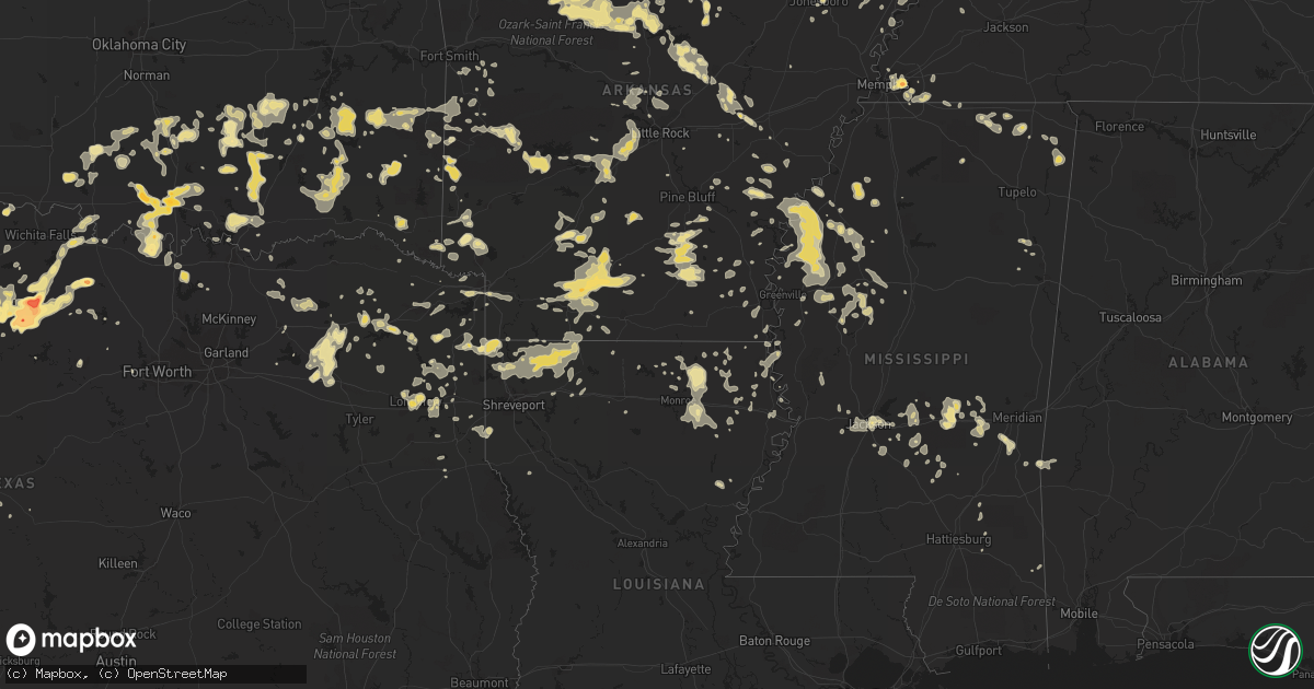
Hail Map in Kentucky on June 11, 2012
Get this storm
June 11 map
$229
one time, instant access
Download today. No call, no setup
Keep the $229
Bought the map and want the full workflow? Apply the entire $229 to a subscription within 7 days. None of it is wasted.
Every map, not just this one
This buys you this map. Subscription and you get every map we run, in the markets you choose from a few cities to whole states to nationwide. Plus real-time alerts the moment a storm fires.
Contact data
Name, contact info, occupancy, even credit band for addresses in the footprint. You go from where it hit to who to call.
Become the source they trust
Unlimited branding weather history reports on demand. You already have the documented answer ready for the property owner, and you are the one who showed up with it.
Property data and RoofTrace estimates
Pull up any address you have got, its value and the exact code rules for that jurisdiction, straight from One Click Code. Then RoofTrace estimates the squares, pitch, and roof value, priced the way you price.
Storm reports in Kentucky
Kentucky
| Date | Description |
|---|---|
| 06/11/20126:33 PM CDT | Two trees down and shingles blown off a roof near highway 31w and patton road. |
| 06/11/20126:31 PM CDT | Tree down on power line on pepper street |
| 06/11/20125:15 PM CDT | A local report indicates 60 MPH wind near HOPKINSVILLE |
| 06/11/20125:05 PM CDT | Just west of hopkinsville |
| 06/11/20124:12 PM CDT | Several trees down |
| 06/11/20124:10 PM CDT | A tree fell on a vehicle with subject inside. Minor injuries reported at kentucky dam village |
| 06/11/20124:08 PM CDT | North end of the land between the lakes |
| 06/11/20123:35 PM CDT | A local report indicates 60 MPH wind near REIDLAND |
| 06/11/20123:15 PM CDT | Highway 1129 and highway 45 north closed briefly due to trees and debris over the roadway. |
All States Impacted by Hail Map on June 11, 2012
Cities Impacted by Hail Map on June 11, 2012
- Bucyrus, MO
- Huggins, MO
- Graff, MO
- Mountain Grove, MO
- Plato, MO
- Santa Rosa, NM
- Grove Hill, AL
- Brinkley, AR
- Biscoe, AR
- Sulphur Springs, TX
- Niangua, MO
- Heber Springs, AR
- Seymour, TX
- Poulan, GA
- Timpson, TX
- Marshall, AR
- Pittsburg, OK
- Kiowa, OK
- Itta Bena, MS
- Sidon, MS
- Tchula, MS
- Lexington, MS
- Moorhead, MS
- Belzoni, MS
- Cruger, MS
- Hampton, AR
- Sicily Island, LA
- Shell Knob, MO
- Raymond, MS
- Hartville, MO
- San Jon, NM
- Bard, NM
- Hereford, TX
- Broadview, NM
- Townsend, GA
- Tunas, MO
- Garden City, TX
- Sainte Genevieve, MO
- Beecher City, IL
- Wynnewood, OK
- Quitman, MS
- Booneville, MS
- Tishomingo, MS
- Collierville, TN
- Olive Branch, MS
- Memphis, TN
- Rossville, TN
- Byhalia, MS
- Talco, TX
- Monroe, LA
- Collinston, LA
- Bastrop, LA
- Mountain View, AR
- Millersview, TX
- Eden, TX
- Menard, TX
- Cabool, MO
- Louann, AR
- Stonewall, MS
- Enterprise, MS
- Timbo, AR
- Onia, AR
- Exeter, MO
- Cassville, MO
- Big Lake, TX
- Seligman, MO
- Washburn, MO
- Fairview, MO
- Wheaton, MO
- Rocky Comfort, MO
- Butterfield, MO
- Eagle Rock, MO
- Purdy, MO
- Saint Augustine, FL
- East Palatka, FL
- Green Cove Springs, FL
- Elkton, FL
- Palatka, FL
- Sterling City, TX
- Farmington, MO
- Floyd, NM
- Conchas Dam, NM
- Pittsburg, TX
- Elkland, MO
- Grady, AR
- Pine Bluff, AR
- Hatfield, AR
- Cove, AR
- Vandervoort, AR
- Hodgen, OK
- Bivins, TX
- Rodessa, LA
- Bunnell, FL
- Brunswick, GA
- Hortense, GA
- Shelby, MS
- Mound Bayou, MS
- Sylacauga, AL
- Wilsonville, AL
- Shelby, AL
- Columbiana, AL
- Jacksonville, FL
- Mcalester, OK
- Stuart, OK
- Calvin, OK
- Hastings, FL
- Springfield, AR
- Center Ridge, AR
- Solgohachia, AR
- Flowood, MS
- Throckmorton, TX
- Bethel, OK
- Broken Bow, OK
- Rattan, OK
- Sapelo Island, GA
- Nevada, MO
- Seymour, MO
- Marshfield, MO
- Jerico Springs, MO
- Big Spring, TX
- Happy, TX
- Hot Springs National Park, AR
- Kimberling City, MO
- Reeds Spring, MO
- Haworth, OK
- Foreman, AR
- Minter City, MS
- Charleston, MS
- Dora, MO
- Aurora, MO
- Newcastle, TX
- Olney, TX
- Coalgate, OK
- Coleman, OK
- Atoka, OK
- Centrahoma, OK
- Tupelo, OK
- Caddo, OK
- Wapanucka, OK
- Kenefic, OK
- Walnut, MS
- Tiplersville, MS
- Corinth, MS
- Commerce, TX
- Yellville, AR
- Everton, AR
- Valley Springs, AR
- Harrison, AR
- Leslie, AR
- Lead Hill, AR
- Pyatt, AR
- Blue Eye, MO
- Green Forest, AR
- Pindall, AR
- Gilbert, AR
- Saint Joe, AR
- Hollister, MO
- Omaha, AR
- Ridgedale, MO
- Alpena, AR
- Oak Grove, AR
- Duncan, OK
- Marlow, OK
- Melrose, NM
- Mansfield, MO
- Ava, MO
- Macomb, MO
- Bigelow, AR
- Vanzant, MO
- Drury, MO
- Norwood, MO
- Muenster, TX
- Burneyville, OK
- Leon, OK
- Lockwood, MO
- Greenfield, MO
- Yulee, FL
- Callahan, FL
- Morton, MS
- Raleigh, MS
- Bellevue, TX
- Bowie, TX
- Lake Village, AR
- Portland, AR
- Henrietta, TX
- Ovett, MS
- Dexter, MO
- Imboden, AR
- Westbrook, TX
- Aspermont, TX
- Benton, KY
- Hardin, KY
- Midway, GA
- Hinesville, GA
- Riceboro, GA
- Mount Pleasant, TX
- Yantis, TX
- Hallsville, TX
- White Oak, TX
- Gilmer, TX
- Kilgore, TX
- Longview, TX
- Gladewater, TX
- Marathon, TX
- Dryden, TX
- Grand Saline, TX
- Mineola, TX
- Vivian, LA
- Ida, LA
- Moultrie, GA
- Pierce City, MO
- Star City, AR
- Fordland, MO
- Rogersville, MO
- Jonesboro, AR
- Norman, AR
- Tucumcari, NM
- Waterloo, IL
- Red Bud, IL
- Fults, IL
- Walnut Grove, MO
- Delhi, LA
- Moyers, OK
- Boswell, OK
- Soper, OK
- Finley, OK
- Antlers, OK
- Snow, OK
- Clayton, OK
- Hugo, OK
- Gurdon, AR
- Clinton, AR
- Scotland, AR
- Eminence, MO
- Carthage, AR
- Stratford, OK
- Mount Judea, AR
- Vendor, AR
- Parthenon, AR
- Deer, AR
- Searcy, AR
- Texarkana, TX
- Hooks, TX
- Ridgely, TN
- Bay, AR
- Ocala, FL
- Carthage, MO
- Reeds, MO
- Camden, AR
- Stonewall, OK
- Ada, OK
- Fitzhugh, OK
- Allen, OK
- Pittsburg, KS
- Hartshorne, OK
- Blanco, OK
- Batesville, AR
- Booneville, AR
- Germantown, TN
- Cordova, TN
- Richmond Hill, GA
- Holdenville, OK
- Darien, GA
- Stockton, MO
- Leland, MS
- Hermitage, AR
- Wilmar, AR
- Warren, AR
- Horatio, AR
- Keatchie, LA
- Keithville, LA
- Mena, AR
- Denison, TX
- Cartwright, OK
- Harleton, TX
- Tutwiler, MS
- Bradleyville, MO
- Taneyville, MO
- Zalma, MO
- Sturdivant, MO
- Marble Hill, MO
- Oran, MO
- Advance, MO
- Melvin, AL
- Loving, TX
- Graham, TX
- Deerfield, MO
- Bronaugh, MO
- Fort Scott, KS
- Baird, TX
- Fair Grove, MO
- Half Way, MO
- Buffalo, MO
- Winona, MS
- Silverton, TX
- Sturgis, KY
- Healdton, OK
- Dermott, AR
- Tillar, AR
- Monticello, AR
- Heavener, OK
- Watson, AR
- Marks, MS
- Lambert, MS
- Monett, MO
- Stark City, MO
- Sasakwa, OK
- Prescott, AR
- Red Oak, OK
- Wister, OK
- Alba, TX
- Winfield, TX
- Ardmore, OK
- Harpersville, AL
- Childersburg, AL
- Sterrett, AL
- Golden City, MO
- Drew, MS
- Parchman, MS
- Des Arc, AR
- Tioga, TX
- Jermyn, TX
- Fort Smith, AR
- Greenwood, AR
- Vincent, AL
- Hazlehurst, GA
- Sparks, GA
- Adel, GA
- Griffithville, AR
- Enid, MS
- Batesville, MS
- Benton, AR
- Brownwood, TX
- Springfield, MO
- Holliday, TX
- Everton, MO
- Essex, MO
- Sikeston, MO
- Fouke, AR
- Texarkana, AR
- Mendenhall, MS
- Durant, OK
- Kingston, OK
- Madill, OK
- Mead, OK
- Calera, OK
- Colorado City, TX
- Thomasville, GA
- Wardville, OK
- Squires, MO
- Ash Grove, MO
- Dyersburg, TN
- Lenox, TN
- Stephens, AR
- De Witt, AR
- Woodson, TX
- Maysville, OK
- Pauls Valley, OK
- Paoli, OK
- Stella, MO
- Huntsville, AR
- Berryville, AR
- Shaw, MS
- Clarksville, TX
- Rincon, GA
- Springfield, GA
- Rienzi, MS
- Sarepta, LA
- Benton, LA
- Cotton Valley, LA
- Linden, TX
- Winthrop, AR
- Bardwell, KY
- Theodosia, MO
- Barlow, KY
- Gainesville, TX
- Tiptonville, TN
- Union City, TN
- Comanche, OK
- Patton, MO
- Glenallen, MO
- Leopold, MO
- Inverness, MS
- Indianola, MS
- Lucedale, MS
- Leakesville, MS
- Arkadelphia, AR
- Sparkman, AR
- Idabel, OK
- Moundville, MO
- Wilburton, OK
- Mindenmines, MO
- Mulberry, KS
- Robert Lee, TX
- Walters, OK
- Temple, OK
- Saint Jo, TX
- Lone Grove, OK
- Loco, OK
- Overbrook, OK
- Springer, OK
- Wilson, OK
- Mount Holly, AR
- Magnolia, AR
- Chidester, AR
- Rosston, AR
- Waldo, AR
- McNeil, AR
- Moran, TX
- Stamps, AR
- Buckner, AR
- Hot Springs Village, AR
- Lonsdale, AR
- Lake Creek, TX
- Holcomb, MO
- Electra, TX
- Mineral Wells, TX
- Locust Grove, AR
- Drasco, AR
- Concord, AR
- Pleasant Grove, AR
- Clinton, KY
- Bolivar, MO
- Long Lane, MO
- Oldfield, MO
- Pleasant Hope, MO
- Conway, MO
- Strafford, MO
- Bonnerdale, AR
- Story, AR
- Mount Ida, AR
- Phillipsburg, MO
- Lebanon, MO
- Blytheville, AR
- Duncan, MS
- Snow Lake, AR
- Gunnison, MS
- Crumrod, AR
- Boyle, MS
- Merigold, MS
- Cleveland, MS
- Alligator, MS
- Clarksdale, MS
- De Berry, TX
- Marshall, TX
- Waldron, AR
- Queen City, TX
- El Dorado Springs, MO
- Sheldon, MO
- Prairie Du Rocher, IL
- Parma, MO
- Bell City, MO
- Russellville, AL
- Red Bay, AL
- Talihina, OK
- Howe, OK
- Tallahassee, FL
- Crossett, AR
- Hamburg, AR
- Tuskahoma, OK
- Oden, AR
- Sims, AR
- Parks, AR
- Pencil Bluff, AR
- Fernandina Beach, FL
- Friona, TX
- Arlington, KY
- Greenway, AR
- Piggott, AR
- Senath, MO
- Kennett, MO
- Rector, AR
- Jacksboro, TX
- Oak Grove, LA
- Hornersville, MO
- Tulia, TX
- Garita, NM
- Aberdeen, MS
- Conway, AR
- Citronelle, AL
- Ripley, MS
- Ashland, MS
- Falkner, MS
- Charleston, MO
- Evansville, IL
- Hughes Springs, TX
- Eudora, AR
- Willard, MO
- Clyde, TX
- Ovalo, TX
- Hector, AR
- Hagarville, AR
- Pelsor, AR
- Witts Springs, AR
- Miles, TX
- Loraine, TX
- State University, AR
- Lenox, GA
- McRae, AR
- Norman Park, GA
- Protem, MO
- Atwood, OK
- Tatum, TX
- Jackson, AL
- Windthorst, TX
- Newkirk, NM
- Sharon, TN
- Rives, TN
- Curtis, MI
- Engadine, MI
- Little Rock, MS
- Union, MS
- Decatur, MS
- Elmore City, OK
- Stringer, MS
- Pomona, MO
- Manila, AR
- Belcher, LA
- Oil City, LA
- Terrell, TX
- Cape Girardeau, MO
- Davis, OK
- Wayne, OK
- Byars, OK
- Hennepin, OK
- Thornfield, MO
- Isabella, MO
- Houston, AR
- Mayflower, AR
- Roland, AR
- Greenville, TX
- Homer, LA
- Minden, LA
- Boston, GA
- Pavo, GA
- Shirley, AR
- Rose Bud, AR
- Quitman, AR
- House, NM
- Mcalister, NM
- Ponce De Leon, MO
- Galena, MO
- Crane, MO
- Spokane, MO
- Highlandville, MO
- Breckenridge, TX
- Brandon, MS
- Atlanta, TX
- Coleman, TX
- Cairo, IL
- Malvern, AR
- Alexander, AR
- Bryant, AR
- Paron, AR
- Donaldson, AR
- Little Rock, AR
- Lockesburg, AR
- Wilton, AR
- Mount Vernon, TX
- Cuervo, NM
- Leary, GA
- Arlington, GA
- Lake Providence, LA
- Royal, AR
- Oronogo, MO
- Webb City, MO
- Humphrey, AR
- Wabbaseka, AR
- Hopkinsville, KY
- Pembroke, KY
- Trenton, TN
- Jasper, AR
- Marble Falls, AR
- Tilly, AR
- Jerusalem, AR
- Nocona, TX
- Ringgold, TX
- Burkett, TX
- Belmont, MS
- Dennis, MS
- Charleston, AR
- Snyder, TX
- Post, TX
- Justiceburg, TX
- Tallulah, LA
- Sherwood, AR
- Vilonia, AR
- Jacksonville, AR
- Early, TX
- Newton, MS
- Lake, MS
- Lawrence, MS
- Rich Hill, MO
- Lamont, FL
- Bruner, MO
- Sparta, MO
- Diana, TX
- Big Sandy, TX
- Emory, TX
- Fort Stewart, GA
- Stuttgart, AR
- Casscoe, AR
- Roe, AR
- Hickory, MS
- Melbourne, AR
- Gainesville, MO
- Saint Simons Island, GA
- Caddo Gap, AR
- Osceola, AR
- Stamford, TX
- Emerson, AR
- Vicksburg, MS
- Romance, AR
- Haileyville, OK
- Dixie, GA
- Jasper, MO
- Miller, MO
- South Greenfield, MO
- La Russell, MO
- Success, MO
- Fox, AR
- Tishomingo, OK
- Milburn, OK
- Avinger, TX
- Compton, AR
- Branson, MO
- Walnut Shade, MO
- Billings, MO
- Republic, MO
- Marionville, MO
- Mount Vernon, MO
- Asbury, MO
- Eureka Springs, AR
- Haughton, LA
- Shreveport, LA
- Plain Dealing, LA
- Springhill, LA
- Mooringsport, LA
- Haynesville, LA
- Gilliam, LA
- Shongaloo, LA
- Jefferson, TX
- Sterlington, LA
- Daingerfield, TX
- Isola, MS
- Naylor, GA
- Lakeland, GA
- Hazen, AR
- Simsboro, LA
- Hermitage, MO
- Fruitvale, TX
- Doddridge, AR
- Bernice, LA
- Windyville, MO
- Greenbrier, AR
- Crocketts Bluff, AR
- Walnut Grove, MS
- Forest, MS
- Conehatta, MS
- Arma, KS
- Franklin, KS
- Rush Springs, OK
- Lindsay, OK
- Marquand, MO
- West Plains, MO
- Lynchburg, MO
- Mer Rouge, LA
- Epps, LA
- Rayville, LA
- Pioneer, LA
- Monticello, FL
- Ozark, MO
- Nixa, MO
- Transylvania, LA
- Rison, AR
- Rochelle, TX
- Rockwood, TX
- Willow Springs, MO
- Hornbeak, TN
- Sunflower, MS
- Rosedale, MS
- Doddsville, MS
- Mellwood, AR
- Benoit, MS
- Beulah, MS
- Ruston, LA
- Springfield, TN
- Williamsville, MO
- Wappapello, MO
- Hendrix, OK
- Samson, AL
- England, AR
- Hollandale, MS
- Stringtown, OK
- Pearl, MS
- Jackson, MS
- Bryson, TX
- Karnack, TX
- El Dorado, AR
- Junction City, AR
- Chunchula, AL
- Axis, AL
- Taylorsville, MS
- Mangham, LA
- Avery, TX
- Ryan, OK
- Houston, AL
- Mullin, TX
- Bolton, MS
- Clinton, MS
- Farmerville, LA
- Ringling, OK
- Mill Creek, OK
- Sulphur, OK
- Athens, LA
- Forsyth, MO
- Chadwick, MO
- Garrison, MO
- Moscow, TN
- Lamar, MS
- Clarendon, AR
- Konawa, OK
- Roff, OK
- Eads, TN
- Coila, MS
- Adrian, TX
- Foster, OK
- Rueter, MO
- Dadeville, MO
- Pickton, TX
- Quitman, TX
- Como, TX
- Winnsboro, TX
- Deer Park, AL
- Bear Creek, AL
- Friendship, TN
- Goldsboro, TX
- Lawn, TX
- New Edinburg, AR
- Okolona, AR
- Harwood, MO
- Walker, MO
- Hume, MO
- Atmore, AL
- Schell City, MO
- Clever, MO
- Bono, AR
- Mayersville, MS
- Higden, AR
- De Queen, AR
- Mize, MS
- Lithia, FL
- Garnett, SC
- Clyo, GA
- Potts Camp, MS
- Myrtle, MS
- Richland, MS
- Ponca, AR
- Ruleville, MS
- Schlater, MS
- Poolville, TX
- Beebe, AR
- Salem, MO
- Ellington, MO
- Winona, MO
- Greenville, MS
- Bertrand, MO
- Dennard, AR
- Point, TX
- Fairfield Bay, AR
- Daisy, OK
- Pelahatchie, MS
- Bois D Arc, MO
- Bonita, LA
- Falcon, MO
- McIntosh, AL
- Klondike, TX
- Damascus, GA
- Jacksonville Beach, FL
- Ponte Vedra, FL
- Saint Johns, FL
- Ponte Vedra Beach, FL
- Saltillo, TX
- Gibsland, LA
- Clovis, NM
- Collinsville, TX
- Valley View, TX
- West Point, MS
- Jefferson, AR
- Lowry City, MO
- Osceola, MO
- Appleton City, MO
- Hosston, LA
- Bogata, TX
- Deport, TX
- Cotton Plant, AR
- Luxora, AR
- Quinton, OK
- Florence, MS
- Verona, MO
- Smithville, OK
- Honobia, OK
- Graford, TX
- Strawn, TX
- Watson, OK
- Naples, TX
- Marietta, TX
- Simms, TX
- Martin, TN
- Golden, MS
- New Site, MS
- Winters, TX
- Cumby, TX
- Pecan Gap, TX
- Wolfe City, TX
- Cooper, TX
- Ladonia, TX
- De Kalb, TX
- Lenzburg, IL
- Greenwood, MS
- Greenville, MO
- Glenwood, AR
- Wagarville, AL
- Tibbie, AL
- Big Flat, AR
- Perryville, AR
- Bay Minette, AL
- Kirbyville, MO
- Pelican, LA
- Rockville, MO
- Crenshaw, MS
- Sledge, MS
- Wheatland, MO
- McClure, IL
- Dexter, KY
- Murray, KY
- Winnsboro, LA
- Diamond, MO
- Brownsville, TN
- Valliant, OK
- Lindsay, TX
- Sedgewickville, MO
- Lena, MS
- Glendora, MS
- Philipp, MS
- Canyon, TX
- Newbern, TN
- Uriah, AL
- Oakland, TN
- Thomasville, AL
- Guyton, GA
- Courtland, MS
- Pope, MS
- Higginson, AR
- Waynesville, GA
- Jesup, GA
- Beckville, TX
- Statesboro, GA
- Mansfield, AR
- Hartford, AR
- Shubuta, MS
- Harrisburg, AR
- Weiner, AR
- New Boston, TX
- Braxton, MS
- Bee Branch, AR
- Yukon, MO
- Aldrich, MO
- Omega, GA
- Hawthorne, FL
- Creal Springs, IL
- McGehee, AR
- Grovespring, MO
- Bloomfield, MO
- Amarillo, TX
- Hasty, AR
- Western Grove, AR
- Wentworth, MO
- Golden, MO
- Granby, MO
- Rose Hill, MS
- Brookport, IL
- Paducah, KY
- Gilbertsville, KY
- Clayton, LA
- Berlin, GA
- Barney, GA
- Hahira, GA
- Cedarcreek, MO
- Mount Pleasant, MI
- Houston, MO
- Elk Creek, MO
- Ravenna, TX
- Bonham, TX
- Ivanhoe, TX
- Bridgeport, TX
- Boles, AR
- Gary, TX
- Long Branch, TX
- Troy, TN
- Brewton, AL
- Obion, TN
- Alpine, AL
- Kissee Mills, MO
- Satartia, MS
- Holly Grove, AR
- Aubrey, AR
- Vina, AL
- Fredericktown, MO
- Fittstown, OK
- Oak Ridge, LA
- Urbana, MO
- Clarksville, TN
- Eastman, GA
- Ore City, TX
- Baskin, LA
- Marion, LA
- Mannsville, OK
- Albany, TX
- Walnut Ridge, AR
- Alicia, AR
- Goreville, IL
- Liberal, MO
- Lamar, MO
- Leeds, AL
- Chelsea, AL
- Birmingham, AL
- Montrose, AR
- Windom, TX
- Portageville, MO
- Aledo, TX
- Branch, AR
- Peel, AR
- Louin, MS
- Chunky, MS
- Perryville, MO
- Chester, IL
- Brashear, TX
- Edgewood, TX
- Leachville, AR
- Midland, TX
- Banks, AR
- Gillett, AR
- Magee, MS
- Black Rock, AR
- Carterville, MO
- Joplin, MO
- Paradise, TX
- Ashdown, AR
- Chestnutridge, MO
- Coahoma, TX
- Grannis, AR
- Wickes, AR
- Wynne, AR
- Michigan City, MS
- Scroggins, TX
- Leesburg, TX
- Cascilla, MS
- Altheimer, AR
- Richton, MS
- New Augusta, MS
- Laurel, MS
- Gillham, AR
- Desha, AR
- Little River, AL
- Ethel, AR
- Norfork, AR
- Leonard, TX
- Celeste, TX
- Bluff City, AR
- Gilbertown, AL
- Needham, AL
- Butler, AL
- Mount Vernon, AR
- Pangburn, AR
- West Monroe, LA
- Almyra, AR
- Arcola, MO
- Halltown, MO
- Sarcoxie, MO
- Brookline, MO
- Nashville, GA
- Cape Fair, MO
- Marvell, AR
- Maumelle, AR
- Wilson, AR
- Smithville, AR
- Rhine, GA
- Palm Coast, FL
- Butler, MO
- Pilot Point, TX
- Gunter, TX


