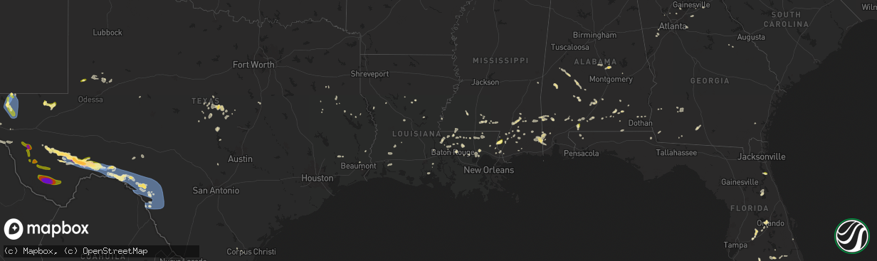
Hail Map in Louisiana on June 10, 2025
The weather event in Louisiana on June 10, 2025 includes Wind and Hail maps. 13 states and 365 cities were impacted and suffered possible damage. The total estimated number of properties impacted is 0.
Want more than just the map?
Turn this storm into a full workflow.
- Owner + property data so you know who to knock
- OnDemand branded weather history reports to win the "did we even have hail?" argument
- RoofTrace estimate so reps stop guessing numbers at the door
Bought this map? Upgrade within 7 days and we'll credit the $230. (10-15 min setup call)
Wind
Hail
0
Estimated number of impacted properties by a 1.00" hail or larger0
Estimated number of impacted properties by a 1.75" hail or larger0
Estimated number of impacted properties by a 2.50" hail or largerStorm reports in Louisiana
Louisiana
| Date | Description |
|---|---|
| 06/10/20254:52 PM CDT | Knew asos reported a gust of 58 mph. |
| 06/10/20254:33 PM CDT | Multiple trees and a few powerlines were downed by thunderstorms in madisonville. |
| 06/10/20253:49 PM CDT | Sheriffs office reported a tree down on highway 16... Near jenkins road 2. |
| 06/10/20253:45 PM CDT | Sheriffs office reported a tree down on sylvest road near highway 16. |
| 06/10/20253:42 PM CDT | Sheriffs office reported a tree down on highway 430 near franklinton. |
| 06/10/20253:23 PM CDT | Multiple trees down north of livingston. |
| 06/10/20253:23 PM CDT | Sheriffs office reported a tree down on james chapel road near highway 441. |
| 06/10/20253:21 PM CDT | Sheriffs office reported a tree down on east walker road. |
| 06/10/20253:19 PM CDT | Picture of large tree partially on a home northeast of walker shared by broadcast media. |
| 06/10/20253:03 PM CDT | Video on social media showed hail up to quarter size. |
| 06/10/20253:00 PM CDT | A comment on an emergency managers social media post showed a tree uprooted and minor roof damage to a home in st. Francisville. |
| 06/10/20252:29 PM CDT | Multiple pictures posted on social media showed several trees and large limbs downed by thunderstorm winds at hidden oaks campground... Just west of robert. |
| 06/10/20252:24 PM CDT | Sheriffs office reported a tree down on south ochsner road near robert. |
All States Impacted by Hail Map on June 10, 2025
Cities Impacted by Hail Map on June 10, 2025
- Early, TX
- Zephyr, TX
- Richland Springs, TX
- Mullin, TX
- Blanket, TX
- Comanche, TX
- Brownwood, TX
- Goldthwaite, TX
- San Saba, TX
- Hamilton, TX
- Pottsville, TX
- Priddy, TX
- Evant, TX
- Lampasas, TX
- Burnet, TX
- Purmela, TX
- Waco, TX
- West, TX
- Elm Mott, TX
- Grapeland, TX
- San Augustine, TX
- Rusk, TX
- Bronson, TX
- Boyce, LA
- Elmer, LA
- Andrews, TX
- Chireno, TX
- Many, LA
- Marathon, TX
- Ruidoso, NM
- Tarzan, TX
- Victoria, TX
- Nacogdoches, TX
- Mescalero, NM
- Alto, NM
- Zwolle, LA
- Mount Enterprise, TX
- Gulfport, MS
- Stanton, TX
- Cushing, TX
- Wilmington, NC
- Leland, NC
- Winnabow, NC
- Castle Hayne, NC
- Hampstead, NC
- Rocky Point, NC
- Holly Ridge, NC
- Fort Davis, TX
- Lenorah, TX
- Biloxi, MS
- Melbourne, FL
- Sneads Ferry, NC
- Jacksonville, NC
- Jena, LA
- Hubert, NC
- Whitesburg, GA
- Robeline, LA
- Natchitoches, LA
- Mobile, AL
- Carrollton, GA
- Ponchatoula, LA
- Robert, LA
- Loranger, LA
- Lucedale, MS
- Krotz Springs, LA
- Alpine, TX
- Pinon, NM
- Kokomo, MS
- Tylertown, MS
- Moss Point, MS
- Bush, LA
- Covington, LA
- Carrizozo, NM
- Saint Francisville, LA
- Troup, TX
- Lamesa, TX
- Wilmer, AL
- Marietta, GA
- Foxworth, MS
- Kennesaw, GA
- Vidalia, LA
- Newnan, GA
- Jay, FL
- Palmetto, GA
- Jarreau, LA
- Oscar, LA
- Lakeland, LA
- Immokalee, FL
- Picayune, MS
- Carriere, MS
- Geneva, AL
- New Roads, LA
- Erwinville, LA
- Baton Rouge, LA
- Morganza, LA
- Broaddus, TX
- Lake Wales, FL
- Hammond, LA
- Rougon, LA
- Cumming, GA
- Ethel, LA
- Columbia, MS
- Leakesville, MS
- Port Allen, LA
- Chunchula, AL
- Perkinston, MS
- Wiggins, MS
- McIntosh, AL
- Greensburg, LA
- Jackson, LA
- Donalsonville, GA
- Slaughter, LA
- Clinton, LA
- Alpharetta, GA
- Atmore, AL
- Uriah, AL
- Port Neches, TX
- Andalusia, AL
- Red Level, AL
- Iron City, GA
- Moore Haven, FL
- Georgetown, LA
- Citronelle, AL
- Little River, AL
- Forkland, AL
- Meadville, MS
- Tularosa, NM
- Flomaton, AL
- Poplarville, MS
- Amite, LA
- Fluker, LA
- Roseland, LA
- Kentwood, LA
- Elba, AL
- Richton, MS
- Beaumont, MS
- Lumberton, MS
- Wagarville, AL
- Denham Springs, LA
- Pine Grove, LA
- Walker, LA
- Saratoga, TX
- Centreville, MS
- Norwood, LA
- Port Arthur, TX
- Vinegar Bend, AL
- State Line, MS
- Mount Hermon, LA
- Brewton, AL
- Venus, FL
- Cleveland, TX
- Cloudcroft, NM
- Dell City, TX
- Valentine, TX
- Fruitdale, AL
- Vidor, TX
- Tullos, LA
- Greensboro, AL
- Gallion, AL
- Winnfield, LA
- Punta Gorda, FL
- Purvis, MS
- Hattiesburg, MS
- Brooklyn, MS
- Franklinton, LA
- Mccomb, MS
- Okeechobee, FL
- Conyers, GA
- Loganville, GA
- Marfa, TX
- Range, AL
- Repton, AL
- Oberlin, LA
- Zolfo Springs, FL
- Tibbie, AL
- Faunsdale, AL
- Livingston, LA
- Arcadia, FL
- Oxford, GA
- Summit, MS
- Greenwood, FL
- Grand Ridge, FL
- Marianna, FL
- Deer Park, AL
- Forest Home, AL
- Greenville, AL
- Reeves, LA
- Roswell, NM
- Auburn, GA
- Winder, GA
- Castleberry, AL
- Evergreen, AL
- Springfield, LA
- Fort Stockton, TX
- Dryden, TX
- Jack, AL
- Pendergrass, GA
- Lake Charles, LA
- Georgiana, AL
- Artesia, NM
- Jayess, MS
- Lake Arthur, NM
- Lenox, AL
- Midland City, AL
- Petal, MS
- Dozier, AL
- Kinder, LA
- Commerce, GA
- Bigfork, MT
- Fort Hancock, TX
- New Augusta, MS
- Avon Park, FL
- Saint Augustine, FL
- Elkton, FL
- Brantley, AL
- Headland, AL
- Hagerman, NM
- Ragley, LA
- Salt Flat, TX
- Safford, AL
- Wauchula, FL
- Dacula, GA
- Bogue Chitto, MS
- Ruth, MS
- McHenry, MS
- Cairo, GA
- Glenwood, AL
- Saint Martinville, LA
- Carlsbad, NM
- Sanderson, TX
- Call, TX
- Shorterville, AL
- Camden, AL
- Troy, AL
- Columbia, AL
- Beatrice, AL
- Vredenburgh, AL
- Brundidge, AL
- Bell City, LA
- Chatom, AL
- Coy, AL
- Maiden, NC
- Ovett, MS
- Denver, NC
- Sierra Blanca, TX
- Lakeland, FL
- Auburndale, FL
- Orrville, AL
- Abita Springs, LA
- Pearl River, LA
- Iowa, LA
- New Iberia, LA
- Van Horn, TX
- Davidson, NC
- Mooresville, NC
- Cornelius, NC
- Polk City, FL
- Pennington, AL
- Stennis Space Center, MS
- Winston, GA
- New Brockton, AL
- Opp, AL
- Gantt, AL
- Minter, AL
- Vero Beach, FL
- Bluffton, GA
- Edison, GA
- Douglasville, GA
- Orlando, FL
- Sweet Water, AL
- Moultrie, GA
- Pavo, GA
- Berlin, GA
- Meridian, MS
- Huntersville, NC
- Comstock, TX
- Maljamar, NM
- Semmes, AL
- Gotha, FL
- Windermere, FL
- Ocoee, FL
- Winter Garden, FL
- Mentone, TX
- Pecos, TX
- Deatsville, AL
- Titus, AL
- Adel, GA
- Marbury, AL
- Termo, CA
- Concord, NC
- Mount Pleasant, NC
- Jal, NM
- Madeline, CA
- Albany, GA
- Wetumpka, AL
- Montague, CA
- Zachary, LA
- Albemarle, NC
- Verbena, AL
- New London, NC
- Locust, NC
- Fort McCoy, FL
- Del Rio, TX
- Clanton, AL
- Billingsley, AL
- Astor, FL
- Crescent City, FL
- Georgetown, FL
- McCall Creek, MS
- Park City, MT
- Rocksprings, TX
- Dairy, OR
- Klamath Falls, OR
- Gibson, GA
- Mitchell, GA
- Smithdale, MS
- Holden, LA
- Ozona, TX
- Leesburg, GA
- Richfield, NC
- Avera, GA
- Stapleton, GA
- Sonora, TX
- Brackettville, TX
- Tallassee, AL
- Kissimmee, FL
- Browning, MT
- Laughlin Afb, TX
- Chiloquin, OR
- Moore, MT
- Buffalo, MT
- Lavina, MT
- Roundup, MT
- Waynesville, GA
- Loving, NM
- Lewistown, MT
- Hobson, MT
- Valier, MT
- Quemado, TX
- Christoval, TX
- Sterling City, TX
- Uvalde, TX
- La Pryor, TX
- Broken Arrow, OK
- Tulsa, OK
- Bixby, OK
- Tulelake, CA
- Blanco, TX
- Sprague River, OR
- Gatesville, TX
- Lometa, TX
- San Ygnacio, TX
- Zapata, TX
- Mirando City, TX
- Roma, TX
- West Point, IA
- Batavia, IA
- Libertyville, IA
- Fairfield, IA
- Hillsboro, IA
- Salem, IA
- Donnellson, IA
- Fort Madison, IA
- Ottumwa, IA
- Robstown, TX


