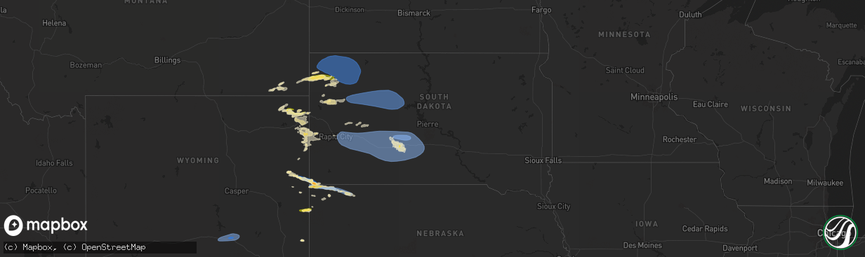
Hail Map in South Dakota on June 10, 2024
The weather event in South Dakota on June 10, 2024 includes Hail, Wind, and Tornado maps. 12 states and 300 cities were impacted and suffered possible damage. The total estimated number of properties impacted is 133.
Want more than just the map?
Turn this storm into a full workflow.
- Owner + property data so you know who to knock
- OnDemand branded weather history reports to win the "did we even have hail?" argument
- RoofTrace estimate so reps stop guessing numbers at the door
Bought this map? Upgrade within 7 days and we'll credit the $230. (10-15 min setup call)
Hail
Wind
Tornado
133
Estimated number of impacted properties by a 1.00" hail or larger0
Estimated number of impacted properties by a 1.75" hail or larger0
Estimated number of impacted properties by a 2.50" hail or largerStorm reports in South Dakota
South Dakota
| Date | Description |
|---|---|
| 06/10/20246:50 PM CDT | A local report indicates 60 MPH wind near 5 ESE Norris |
| 06/10/20246:40 PM CDT | A local report indicates 60 MPH wind near 5 NW Okaton |
| 06/10/20246:15 PM CDT | A local report indicates 65 MPH wind near 3 ENE Midland |
| 06/10/20246:11 PM CDT | A local report indicates 62 MPH wind near 7 E Wanblee |
| 06/10/20246:09 PM CDT | A local report indicates 74 MPH wind near 1 NE Midland |
| 06/10/20246:06 PM CDT | (unr |
| 06/10/20246:06 PM CDT | A local report indicates 59 MPH wind near 7 E Wanblee |
| 06/10/20245:51 PM CDT | A local report indicates 59 MPH wind near 3 E Philip |
| 06/10/20245:45 PM CDT | A local report indicates 58 MPH wind near 4 E Cactus Flat |
| 06/10/20245:30 PM CDT | A local report indicates 66 MPH wind near 4 E Cactus Flat |
| 06/10/20245:16 PM CDT | A local report indicates 66 MPH wind near 6 W Cottonwood |
| 06/10/20245:15 PM CDT | Estimated 60-70 mph winds |
| 06/10/20245:09 PM CDT | A local report indicates 60 MPH wind near 3 NNW Scenic |
| 06/10/20244:54 PM CDT | A local report indicates 64 MPH wind near 3 NNW Scenic |
| 06/10/20244:50 PM CDT | A local report indicates 68 MPH wind near 3 NW Wasta |
| 06/10/20244:41 PM CDT | A local report indicates 64 MPH wind near 1 NNE Faith |
| 06/10/20244:40 PM CDT | A local report indicates 70 MPH wind near 3 NW Wasta |
| 06/10/20244:40 PM CDT | A local report indicates 60 MPH wind near 9 WSW Red Elm |
| 06/10/20244:35 PM CDT | A local report indicates 58 MPH wind near 3 NW Wasta |
| 06/10/20244:16 PM CDT | A local report indicates 70 MPH wind near 3 SE Deerfield |
| 06/10/20244:15 PM CDT | A local report indicates 74 MPH wind near 2 W Opal |
| 06/10/20244:15 PM CDT | A local report indicates 74 MPH wind near 6 WSW Opal |
| 06/10/20244:14 PM CDT | A local report indicates 58 MPH wind near Rapid City Arpt |
| 06/10/20244:13 PM CDT | A local report indicates 59 MPH wind near 7 NNE Ellsworth AFB |
| 06/10/20244:12 PM CDT | Tstm wind gusts estimated 60 to 70 mph. |
| 06/10/20244:12 PM CDT | Tstm wind gusts estimated 60 to 70 mph. |
| 06/10/20243:45 PM CDT | Tstm wind gusts estimated 60 to 70 mph. |
| 06/10/20243:45 PM CDT | Tstm wind gusts estimated 60 to 70 mph. |
| 06/10/20243:35 PM CDT | Estimated 60-70 mph |
| 06/10/20243:35 PM CDT | Estimated 60-70 mph... Half inch of rain |
| 06/10/20242:40 PM CDT | A local report indicates 65 MPH wind near 10 W Reva |
| 06/10/20242:26 PM CDT | A local report indicates 66 MPH wind near 4 N Ludlow |
| 06/10/20242:10 PM CDT | A local report indicates 1.25 inch wind near 3 SSE Harding |
| 06/10/20242:10 PM CDT | A local report indicates 60 MPH wind near 3 SSE Harding |
All States Impacted by Hail Map on June 10, 2024
Cities Impacted by Hail Map on June 10, 2024
- Aiken, SC
- Windsor, SC
- Springfield, SC
- Williston, SC
- Neeses, SC
- Salley, SC
- Norway, SC
- Orangeburg, SC
- Cameron, SC
- Elloree, SC
- Santee, SC
- Vance, SC
- Alzada, MT
- Hammond, MT
- Boyes, MT
- Broadus, MT
- Leesburg, GA
- Devils Tower, WY
- Milan, GA
- Rhine, GA
- Moorcroft, WY
- Uvalda, GA
- Lyons, GA
- Hulett, WY
- Oglethorpe, GA
- Ideal, GA
- Oakfield, GA
- Mount Vernon, GA
- Warwick, GA
- Buffalo, SD
- De Soto, GA
- Marshallville, GA
- Vidalia, GA
- Capitol, MT
- Bowman, SC
- Camp Crook, SD
- Sundance, WY
- Reidsville, GA
- Opp, AL
- Lance Creek, WY
- Andalusia, AL
- Montezuma, GA
- Cordele, GA
- Cobb, GA
- Elko, GA
- Elkhart, TX
- Elba, AL
- Kinston, AL
- Vienna, GA
- Alva, WY
- Glennville, GA
- Abbeville, GA
- Fitzgerald, GA
- Unadilla, GA
- Belle Fourche, SD
- Ludowici, GA
- Aladdin, WY
- Rochelle, GA
- Pitts, GA
- Ludlow, SD
- Reva, SD
- Ralph, SD
- Prairie City, SD
- Lodgepole, SD
- Pineview, GA
- Newell, SD
- Corsicana, TX
- Beulah, WY
- Hawkinsville, GA
- Eastman, GA
- Lusk, WY
- Midway, GA
- Hinesville, GA
- Smithville, GA
- Broxton, GA
- Wray, GA
- Mud Butte, SD
- Bison, SD
- Lemmon, SD
- Meadow, SD
- Lagrange, WY
- Chauncey, GA
- Riceboro, GA
- Eden, TX
- McRae Helena, GA
- Hawk Springs, WY
- Fleming, GA
- Richmond Hill, GA
- Newcastle, WY
- Edgemont, SD
- Cadwell, GA
- Sweetwater, TX
- Blackwell, TX
- Harrison, NE
- Mullin, TX
- Hill City, SD
- Lead, SD
- Midland City, AL
- Headland, AL
- Carlsbad, NM
- Townsend, GA
- Alamo, GA
- Nolan, TX
- West, TX
- Newville, AL
- Abbott, TX
- Columbia, AL
- Ashford, AL
- Webb, AL
- Tennessee Colony, TX
- Union Center, SD
- Faith, SD
- Milford, TX
- Rochelle, TX
- Muleshoe, TX
- Sudan, TX
- Hillsdale, WY
- Burns, WY
- Cheyenne, WY
- Tuscola, TX
- Athens, TX
- Carpenter, WY
- Crawford, NE
- Whitney, NE
- Chadron, NE
- Wingate, TX
- Rincon, GA
- Hillsboro, TX
- Penelope, TX
- Soperton, GA
- Adrian, GA
- Port Wentworth, GA
- Malone, TX
- Loving, NM
- Rapid City, SD
- Ellsworth Afb, SD
- Box Elder, SD
- Caputa, SD
- New Underwood, SD
- Owanka, SD
- Wasta, SD
- Wall, SD
- Hardeeville, SC
- Rogers, NM
- Bynum, TX
- Sapelo Island, GA
- Eaton, CO
- Osage, WY
- Grover, CO
- Brantley, AL
- Upton, WY
- Scenic, SD
- Hermosa, SD
- Quinn, SD
- Dupree, SD
- Circle, MT
- Maple, TX
- Pinehurst, GA
- Morton, TX
- Amherst, TX
- Ridgeland, SC
- Guyton, GA
- Seabrook, SC
- Marathon, TX
- Littlefield, TX
- Swainsboro, GA
- East Dublin, GA
- Byromville, GA
- Beaufort, SC
- Hay Springs, NE
- Philip, SD
- Interior, SD
- Kadoka, SD
- Eagle Butte, SD
- Lantry, SD
- Cherry Creek, SD
- Midland, SD
- Milesville, SD
- Winters, TX
- Gill, CO
- Greeley, CO
- Briggsdale, CO
- Canon City, CO
- Ballinger, TX
- Bushnell, NE
- Pecos, TX
- Salt Flat, TX
- Cotopaxi, CO
- Westcliffe, CO
- Hobbs, NM
- Seminole, TX
- Green Pond, SC
- Yemassee, SC
- Kimball, NE
- Titusville, FL
- Belvidere, SD
- Orchard, CO
- Zephyr, TX
- Saratoga, WY
- Hanna, WY
- Elk Mountain, WY
- Wanblee, SD
- Okaton, SD
- Long Valley, SD
- Fort Pierre, SD
- Denver City, TX
- Holly Hill, SC
- Blackville, SC
- Ridgeville, SC
- Adams Run, SC
- Ravenel, SC
- Kersey, CO
- Bamberg, SC
- Cope, SC
- Penrose, CO
- Glenwood, GA
- Round O, SC
- Jacksonboro, SC
- Summerville, SC
- Ladson, SC
- Cuthbert, GA
- Roggen, CO
- White River, SD
- Mentone, TX
- Whiteface, TX
- Brooklet, GA
- Jonesboro, TX
- Padroni, CO
- Wiggins, CO
- Mosca, CO
- Weldona, CO
- Charleston, SC
- Goose Creek, SC
- Moncks Corner, SC
- Andrews, TX
- North Charleston, SC
- Levelland, TX
- Sundown, TX
- Gatesville, TX
- Brownfield, TX
- Stoneham, CO
- Snyder, CO
- Girard, GA
- Waynesboro, GA
- Fort Stockton, TX
- Cordesville, SC
- Springfield, GA
- Torrington, WY
- Murdo, SD
- Draper, SD
- Norris, SD
- Wood, SD
- Jay Em, WY
- Mission, TX
- Seagraves, TX
- Meadow, TX
- Baxley, GA
- Goldsmith, TX
- Early Branch, SC
- Varnville, SC
- Odessa, TX
- Gardendale, TX
- Sturgis, SD
- Merino, CO
- Howes, SD
- Hillrose, CO
- Welch, TX
- Lamesa, TX
- Midland, TX
- Twin City, GA
- Fort Morgan, CO
- Akron, CO
- Tahoka, TX
- Midkiff, TX
- McCamey, TX
- Tillman, SC
- Pineland, SC
- Garnett, SC
- Monahans, TX
- Dryden, TX
- Grandfalls, TX
- Odum, GA
- Ozona, TX
- Big Lake, TX
- Jesup, GA
- Houston, TX
- Lucedale, MS
- Imperial, TX
- Crane, TX
- Ralls, TX
- Lorenzo, TX
- Wilson, TX
- Post, TX
- Odonnell, TX
- Gail, TX
- Iraan, TX
- Sheffield, TX
- Fluvanna, TX
- Ira, TX
- Coahoma, TX


