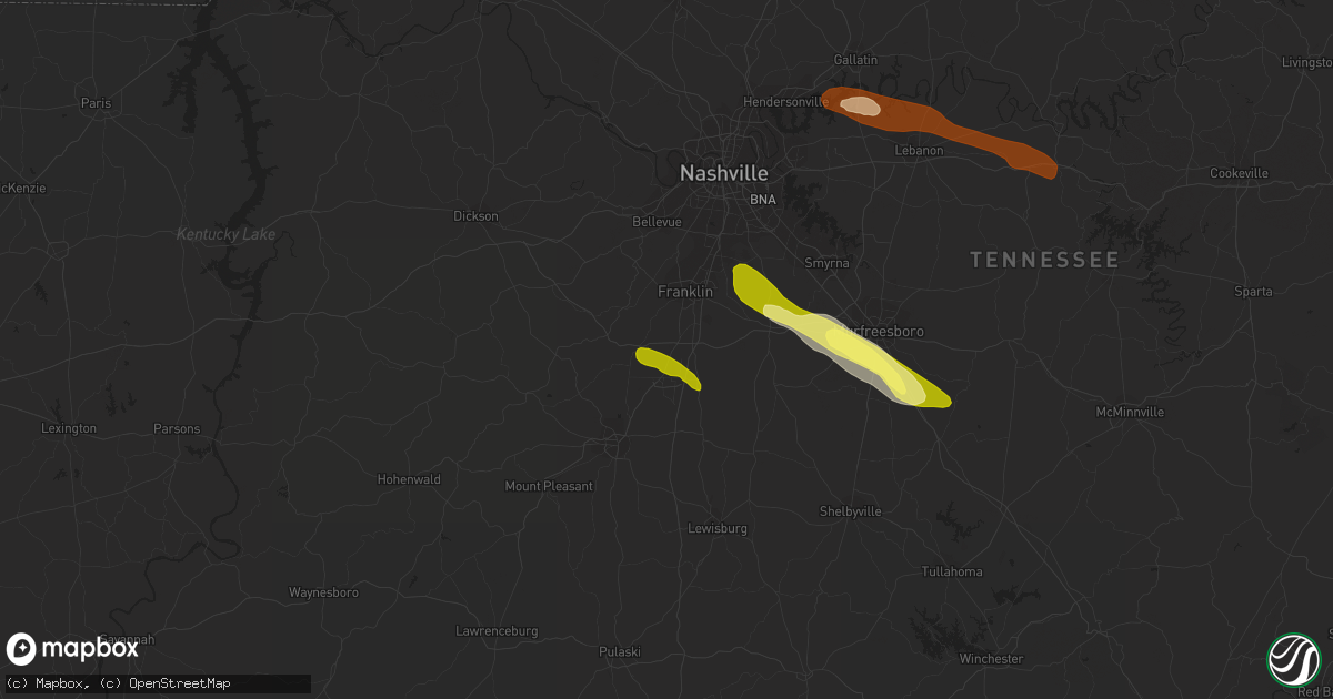
Hail Map in Thompsons Station, TN on June 10, 2013
Get this storm
June 10 map
$229
one time, instant access
Download today. No call, no setup
Keep the $229
Bought the map and want the full workflow? Apply the entire $229 to a subscription within 7 days. None of it is wasted.
Every map, not just this one
This buys you this map. Subscription and you get every map we run, in the markets you choose from a few cities to whole states to nationwide. Plus real-time alerts the moment a storm fires.
Contact data
Name, contact info, occupancy, even credit band for addresses in the footprint. You go from where it hit to who to call.
Become the source they trust
Unlimited branding weather history reports on demand. You already have the documented answer ready for the property owner, and you are the one who showed up with it.
Property data and RoofTrace estimates
Pull up any address you have got, its value and the exact code rules for that jurisdiction, straight from One Click Code. Then RoofTrace estimates the squares, pitch, and roof value, priced the way you price.
Storm reports in Thompsons Station, TN
Thompsons Station, TN
| Date | Description |
|---|---|
| 06/10/20133:10 PM CDT | An nws storm survey team determined that damage in far southern williamson county was a result of intense straight line wind damage from a microburst. Many large trees |
| 06/10/20133:00 PM CDT | Tspotter report of two trees down in the thompson station area. Cherry grove subdivision on buckner road and aston creek subdivision on hansford and lafayette roads. |
All Cities Impacted by Hail Map on June 10, 2013
- Franklin, KY
- Westmoreland, TN
- Portland, TN
- Lebanon, TN
- Mount Juliet, TN
- Christiana, TN
- Arrington, TN
- Nolensville, TN
- College Grove, TN
- Rockvale, TN
- Smyrna, TN
- Murfreesboro, TN
- Adairville, KY
- Adolphus, KY
- Russellville, KY
- Columbia, KY
- Campbellsville, KY
- Knifley, KY
- Empire, NV
- Manter, KS
- Russell Springs, KY
- Greensburg, KY
- Dunnville, KY
- Gallatin, TN
- Gordonsville, TN
- Brush Creek, TN
- Carthage, TN
- Hickman, TN
- Watertown, TN
- Readyville, TN
- Beechgrove, TN
- Franklin, TN
- Brentwood, TN
- Thompsons Station, TN
- Spring Hill, TN
- Oak Ridge, TN
- Knoxville, TN


