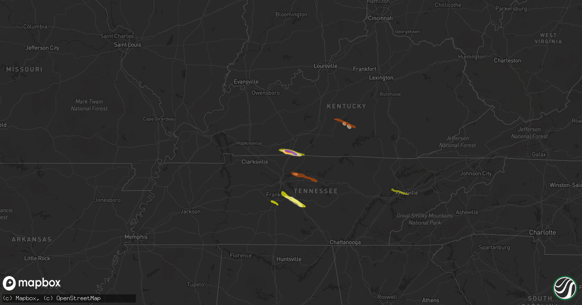
Hail Map on June 10, 2013
Get this storm
June 10 map
$229
one time, instant access
Download today. No call, no setup
Keep the $229
Bought the map and want the full workflow? Apply the entire $229 to a subscription within 7 days. None of it is wasted.
Every map, not just this one
This buys you this map. Subscription and you get every map we run, in the markets you choose from a few cities to whole states to nationwide. Plus real-time alerts the moment a storm fires.
Contact data
Name, contact info, occupancy, even credit band for addresses in the footprint. You go from where it hit to who to call.
Become the source they trust
Unlimited branding weather history reports on demand. You already have the documented answer ready for the property owner, and you are the one who showed up with it.
Property data and RoofTrace estimates
Pull up any address you have got, its value and the exact code rules for that jurisdiction, straight from One Click Code. Then RoofTrace estimates the squares, pitch, and roof value, priced the way you price.
Storm reports
Georgia
| Date | Description |
|---|---|
| 06/10/20136:22 PM CDT | Media relayed report of tree down in rincon. |
| 06/10/20136:20 PM CDT | Public reported down power lines on 2300 block of noel c conaway road. |
| 06/10/20136:20 PM CDT | Media reported down power lines near the intersection of highway 30 and pecan lane. |
| 06/10/20136:20 PM CDT | Public reported down power lines on 2300 block of noel c conaway road. |
| 06/10/20136:15 PM CDT | An emergency manager reported 2 trees and power lines down near the intersection of highway 30 and kelly drive. |
| 06/10/20136:10 PM CDT | Media reports two trees down in pooler. |
| 06/10/20136:09 PM CDT | Public reported wind gusts between 60 to 65 mph. |
| 06/10/20136:09 PM CDT | *** 7 inj *** an emergency manager reported 7 injuries due to one or multiple motor vehicles running into a tree on bloomingdale road. |
| 06/10/20136:09 PM CDT | Spotter reported 8 foot diameter tree down across mesa avenue. Small outbuildings destroyed and roof damage also reported. |
| 06/10/20136:09 PM CDT | Spotter reported wind gusts between 50 and 70 miles per hour. |
| 06/10/20136:09 PM CDT | Public reported tree down on 400 block of adams road. |
| 06/10/20135:41 PM CDT | Public reported wind gusts between 60 to 65 mph. |
| 06/10/20135:41 PM CDT | Public reported power lines down at the intersection of highway 84 and veterans parkway. |
Nebraska
| Date | Description |
|---|---|
| 06/10/20134:14 AM CDT | A local report indicates 61 MPH wind near BROKEN BOW |
| 06/10/20134:05 AM CDT | This gust was associated with a heat burst. Actual air temp increased to 102f and the dwpt dropped to 46f or an rh of 15 pct. |
| 06/10/20134:00 AM CDT | Building under construction blown down due to winds associated with heat burst. Time estimated based on local wind observations. |
| 06/10/20132:34 AM CDT | This wind gust occurred due to a heat burst. |
Tennessee
| Date | Description |
|---|---|
| 06/10/20136:45 PM CDT | Trees down across county. |
| 06/10/20136:25 PM CDT | Several trees and power lines down on byington solway rd. |
| 06/10/20136:22 PM CDT | A local report indicates 1.00 inch wind near KARNS |
| 06/10/20134:20 PM CDT | Tree blown down in poplar grove community |
| 06/10/20134:15 PM CDT | Several barns and outbuildings damaged in summitville with numerous trees blown down. |
| 06/10/20134:10 PM CDT | Nws storm survey concluded that damage along minkslide rd and hwy 82 was due to a microburst. Dozens of large trees uprooted with smaller limbs snapped and small trees |
| 06/10/20134:06 PM CDT | Quarter sized hail at exit 276 off of interstate 40 west of cookeville |
| 06/10/20134:06 PM CDT | Trees down along hwy 53 |
| 06/10/20133:45 PM CDT | Several trees down and snapped along opossum paw rd. In beechgrove... Tn |
| 06/10/20133:41 PM CDT | Gainesboro city police reported that the roof of the old city hall building collapsed and trees are down on rooftops and out buildings. |
| 06/10/20133:40 PM CDT | Trees down and phone lines down county wide. Numerous trees down across roadways. |
| 06/10/20133:28 PM CDT | Trees and power lines down. Minor barn damage in same area. |
| 06/10/20133:25 PM CDT | One inch hail reported at blackman farms in murfreesboro |
| 06/10/20133:24 PM CDT | Tree down in barfield. |
| 06/10/20133:19 PM CDT | Trees down on cason lane |
| 06/10/20133:19 PM CDT | Multiple trees down near hwy 96 and veterans pike west of murfreesboro |
| 06/10/20133:16 PM CDT | Person trapped in car with tree on it near hwy 96 and royal glenn road. |
| 06/10/20133:13 PM CDT | Quarter sized hail reported south of nolensville |
| 06/10/20133:10 PM CDT | An nws storm survey team determined that damage in far southern williamson county was a result of intense straight line wind damage from a microburst. Many large trees |
| 06/10/20133:10 PM CDT | Siding blown off of a house. |
| 06/10/20133:10 PM CDT | Trees down in spring hill |
| 06/10/20133:05 PM CDT | Trees down on ramsey lane near tuckers crossroads area |
| 06/10/20133:00 PM CDT | Tspotter report of two trees down in the thompson station area. Cherry grove subdivision on buckner road and aston creek subdivision on hansford and lafayette roads. |
| 06/10/20133:00 PM CDT | Several trees and powerlines down on spanntown road in triune |
| 06/10/20132:57 PM CDT | Tree down on a glass company. Homes in same area with minor wind damage and some power lines down. |
| 06/10/20132:57 PM CDT | Tree on power line on big springs road. |
| 06/10/20132:51 PM CDT | Trees down in the coles ferry area in wilson county |
| 06/10/20132:46 PM CDT | Downed trees reported in antioch around i-24 and blue hole road |
| 06/10/20132:42 PM CDT | Trees and power lines down on split log road and tuscany way |
| 06/10/20132:37 PM CDT | Fallen tree on a structure in the grassland community |
| 06/10/20132:23 PM CDT | Tree blown down in downtown nashville. |
South Dakota
| Date | Description |
|---|---|
| 06/10/20133:45 AM CDT | 100 by 75 foot storage building flattened. Tractors planters and other equipment in the building were damaged. |
| 06/10/20131:30 AM CDT | Cabin destroyed by wind gust |
Virginia
| Date | Description |
|---|---|
| 06/10/20135:40 PM CDT | Trees down along river road. |
| 06/10/20135:35 PM CDT | Trees down along ferncliff and kent store rd. |
| 06/10/20135:25 PM CDT | Trees down along highway 45 near cartersville. |
| 06/10/20135:15 PM CDT | Tornado spotted near this location |
| 06/10/20135:13 PM CDT | Storm spotter video confirms very brief touchdown. Path length around 100 yards...path width approx. 25 yards. No damage. |
| 06/10/20135:10 PM CDT | Trees down along the amelia and nottoway county line. |
| 06/10/20134:25 PM CDT | Two trees down on abilene road |
| 06/10/20133:02 PM CDT | One tree down on rock cliff road. |
| 06/10/20132:53 PM CDT | One large tree blown down across route 122 near moneta. |
| 06/10/20132:35 PM CDT | Tree down on peters pike road near jubal early highway |
West Virginia
| Date | Description |
|---|---|
| 06/10/20134:38 PM CDT | 4 inch in diameter tree limb down near intersection of s. George st. And hunter st. |
Wyoming
| Date | Description |
|---|---|
| 06/10/20134:20 PM CDT | Measured gusts of 61 to 65 mph |
| 06/10/20134:11 PM CDT | A local report indicates 61 MPH wind near 2 SE TORRINGTON |
| 06/10/20134:08 PM CDT | A local report indicates 60 MPH wind near WARREN AF BASE |
| 06/10/20133:30 PM CDT | A local report indicates 60 MPH wind near 7 NE CHEYENNE |
Maryland
| Date | Description |
|---|---|
| 06/10/20136:00 PM CDT | Structure and tree damage near starting gate court. |
| 06/10/20132:44 PM CDT | Ef0. Max wind 80 mph. Path length 0.2 miles. Max width 75 yards. Metal roof damaged at locust point marine terminal. Trailer demolished. Ac unit blown in. |
| 06/10/20132:44 PM CDT | Waterspout came onshore on port administration property...causing roof damage to a structure on e. Mccomas st. |
| 06/10/20132:30 PM CDT | Tree and structural damage near fork methodist church per eyewitness. |
| 06/10/20132:30 PM CDT | Several large pine trees uprooted rt 147 and glen arm road. |
| 06/10/20132:28 PM CDT | Ef0. Max wind 80 mph. Path length 0.5. Max path width 100 yards. Six trees uprooted. Swirling debris reported by eywitnesses. Tree damage and fence damage near methodis |
| 06/10/20132:28 PM CDT | Ef0. Max wind 80 mph. Path length 0.5. Max path width 100 yards. Six trees uprooted. Swirling debris reported by eywitnesses. Tree damage and fence damage near methodis |
| 06/10/20132:26 PM CDT | Funnel cloud sighted as well as branches and trees down |
| 06/09/20138:20 PM CDT | Tree and structural damage down breeze road and beach road |
| 06/09/20138:18 PM CDT | Large branches down |
| 06/09/20138:01 PM CDT | Brief ef-0 tornado confirmed...wind speed 65 mph...path width 50 yards...length 0.25 mi...est time 901pm to 901 pm edt... |
Nevada
| Date | Description |
|---|---|
| 06/10/20136:40 PM CDT | Juniper springs raws |
| 06/10/20135:49 PM CDT | Ndot sensor reported wind gusts 45-60 mph between 2 pm and 5 pm. |
Colorado
| Date | Description |
|---|---|
| 06/10/20134:20 PM CDT | A local report indicates 80 MPH wind near 10 E PARKER |
Kentucky
| Date | Description |
|---|---|
| 06/10/20134:15 PM CDT | Trees reported down. |
| 06/10/20133:30 PM CDT | Several trees reported down across the area...including one 8 inch diameter tree that fell across the roof of a porch on a nearby house. No major damage. Spotter also r |
| 06/10/20132:44 PM CDT | Some large tree limbs down. |
| 06/10/20132:10 PM CDT | Hail is covering the ground. |
| 06/10/20132:09 PM CDT | Tornado did ef0 damage to a barn along gallatin-russellville road before lifting. |
| 06/10/20132:06 PM CDT | A local report indicates 1.75 inch wind near 2 W FRANKLIN |
| 06/10/20132:00 PM CDT | Tornado crossed the logan/simpson county line. |
| 06/10/20132:00 PM CDT | Tornado. One house destroyed. |
| 06/10/20131:51 PM CDT | At least five houses damaged and trees down. |
| 06/10/20131:45 PM CDT | *** 4 inj *** preliminary results from an nws storm survey team shows an ef-2 tornado...with wind speeds estimated at 135 mph...touched down northwest of adairville in |
| 06/10/20131:41 PM CDT | Tornado touched down just west of highway 96 and vick road. The roof of a barn was damaged and another outbuilding destroyed near this location. The tornado continued e |
South Carolina
| Date | Description |
|---|---|
| 06/10/20136:59 PM CDT | One tree reported down near the intersection of parkers ferry road and charleston highway. |
| 06/10/20136:46 PM CDT | Colleton county reported a tree down on rehoboth road. Time estimated by radar. |
| 06/10/20136:42 PM CDT | One tree was reported down near the intersection of bluffton parkway and red cedar street. |
| 06/10/20136:32 PM CDT | Colleton county reported a tree down on a powerline at milestone lane. Time estimated by radar. |
| 06/10/20136:30 PM CDT | Spotter reported tree down on new riverside drive. |
| 06/10/20136:30 PM CDT | Tree down reported at intersection of independence boulevard and interstate 95. |
| 06/10/20136:29 PM CDT | One tree down near the intersection of bees creek road and coosaw scenic drive. |
| 06/10/20136:29 PM CDT | 3 trees were reported down near the intersection of purrysburg road and church road and purrysburg road and honey hill road. |
| 06/10/20136:28 PM CDT | One tree down on hardee blvd near the intersection of main street and boyd street. |
| 06/10/20136:27 PM CDT | Colleton county reported a tree down at the 4000 block of mount carmel road. Time estimated by radar. |
| 06/10/20136:27 PM CDT | Colleton county reported a tree down at the 600 block of green pond road. Time estimated by radar. |
| 06/10/20136:25 PM CDT | Tree down reported on highway 17 near the napa store. |
| 06/10/20136:18 PM CDT | One tree was reported down near mile marker 26 north bound on interstate 95. |
| 06/10/20136:12 PM CDT | One tree was reported down near the intersection of us 21 and sc 63. |
| 06/10/20135:59 PM CDT | One tree down on grays highway near pine level baptist church. |
| 06/10/20135:58 PM CDT | South carolina highway patrol reported trees down along highway 261 from scales road to horatio hagood road. |
| 06/10/20134:17 PM CDT | Tree in roadway on long branch swamp road btw hwy 19 and mt olive church road - time estimated based on radar |
| 06/10/20133:51 PM CDT | South carolina highway patrol reported trees down at one oak lane and charleston highway. |
| 06/10/20133:15 PM CDT | Tree down reported at the intersection of black creek road and hendersonville highway. |
| 06/10/20132:58 PM CDT | Public reported trees down off goodman road near bill lane. |
| 06/10/20132:45 PM CDT | Tree down reported on the 500 block of knights avenue. |
| 06/10/20131:51 PM CDT | A few trees were blown down by the storm near lake wylie. At least one tree was reported down closer to clover but most trees fell associated with the greatest radar ve |
| 06/10/20131:50 PM CDT | Aiken dispatch reported trees down at the intersection of windsor rd. And hwy 4. Time estimated by radar. |
| 06/10/20131:25 PM CDT | 1 tree down on south cedar creek road. Report from congaree national park. |
| 06/10/20131:08 PM CDT | Tree and limbs down on power line at valley ridge road and highway 176. |
| 06/10/201312:54 PM CDT | Trees down on mountainview rd |
| 06/10/201312:43 PM CDT | Tree and wires down |
| 06/10/201312:39 PM CDT | Trees down at the highways 76 and 178 interchange |
| 06/10/201312:32 PM CDT | Lines down neely ferry rd/west georgia road |
| 06/10/201312:30 PM CDT | Nws gsp damage survey team determined that wind damage along emily lane was the result of a tornado. The estimated maximum wind speed was 90 mph...rated on the er-scale |
| 06/10/201312:24 PM CDT | Trees down on amity rd |
| 06/10/201312:21 PM CDT | Trees down on belton-honea path hwy |
| 06/10/201312:20 PM CDT | Nws survey team found a 1.5 mile long...80 yard wide ef1 tornado path in the emily lane area of piedmont. See caepnsgsp for details. |
| 06/10/201312:18 PM CDT | Trees downn on saluda dr. |
| 06/10/201312:15 PM CDT | Trees down at state park and jennifer ct rds |
| 06/10/201312:05 PM CDT | Trees down on hwy 414 |
| 06/10/201312:05 PM CDT | Trees down at hwys 276 and 414 |
| 06/09/20138:00 PM CDT | Large tree down on rivertowne country club drive. Time estimated by radar. |
| 06/09/20137:42 PM CDT | Tree down reported at 1300 block of white drive. |
| 06/09/20137:40 PM CDT | One tree down near the intersection of savannah highway and orleans road. |
| 06/09/20137:30 PM CDT | Tree down reported near intersection of main road and patton avenue. |
| 06/09/20137:10 PM CDT | The dorchester county 911 call center reported a tree down near the intersection of mallard road and orangeburg road. |
| 06/09/20137:10 PM CDT | One tree was reported down near the intersection of highway 78 and jedburg road. |
| 06/09/20137:04 PM CDT | Tree down reported on 100 block of cinnamon road. |
Delaware
| Date | Description |
|---|---|
| 06/10/20134:20 PM CDT | Large trees down on houses with 10-20 homes heavily damaged between glasgow and newark along routes 72 and 4. |
| 06/10/20133:47 PM CDT | Ef0 tornado confirmed with maximum winds of 80 mph. Length of 0.4 miles and width of 150 yards. |
| 06/10/20133:45 PM CDT | Several reports of damage from 911 call center. Wires down as well at 40th and frenchtown.rd |
Florida
| Date | Description |
|---|---|
| 06/10/20133:29 PM CDT | Tree knocked down on country road 235 and nw 22nd ave. |
North Carolina
| Date | Description |
|---|---|
| 06/10/20135:18 PM CDT | Media reported a possible tornado with damage near firetower road and hwy 561. |
| 06/10/20135:12 PM CDT | Police officer reported possible tornado on highway 56 headed east |
| 06/10/20134:38 PM CDT | Trees down at peacock rd and us hwy 701 - time estimated based on radar |
| 06/10/20134:30 PM CDT | Large tree down on home on moore street |
| 06/10/20134:20 PM CDT | Trees down at princess ann rd and five point dr |
| 06/10/20134:08 PM CDT | Trees down at peacock rd and us hwy 701 - time estimated based on radar |
| 06/10/20133:55 PM CDT | Powerlines and multiple trees down near intersection of nc hwy 210w and melvins bridge rd. Time estimated by radar. |
| 06/10/20133:40 PM CDT | Trees down on hunting lodge road. |
| 06/10/20133:33 PM CDT | Report of tree blocking roadway. |
| 06/10/20133:13 PM CDT | Tree down near hollow church road and linwood road |
| 06/10/20133:08 PM CDT | Trees down on dolley madison rd at tower rd |
| 06/10/20133:08 PM CDT | Trees down near the intersection of highway 109 and us 64 |
| 06/10/20133:05 PM CDT | Tree down on dolley madison road near guida drive. |
| 06/10/20133:04 PM CDT | Trees down on flat swamp road... Time estimated by radar |
| 06/10/20133:03 PM CDT | Power lines down on halloway road... Time estimated by radar |
| 06/10/20133:02 PM CDT | Tree down on house located on partridge drive with significant damage to structure. |
| 06/10/20133:01 PM CDT | Trees and power lines down on abbotts creek church road... Time estimated by radar |
| 06/10/20133:00 PM CDT | Public reports trees and power lines down across highway 66 in kernersville. |
| 06/10/20132:59 PM CDT | Tree on a house on lakeshore drive |
| 06/10/20132:58 PM CDT | Boat destroyed by falling tree along high rock lake. |
| 06/10/20132:54 PM CDT | Newspaper in salisbury called to say trees down on flowering tree lane. At least 2 residents in the area had trees down from the storm. |
| 06/10/20132:45 PM CDT | Trees down in the denton area near mount vista health care |
| 06/10/20132:17 PM CDT | Numerous trees down along pool road and grasshopper street in east raleigh. |
| 06/10/20132:12 PM CDT | Multiple powerlines down at 5200 block of randolph road. |
| 06/10/20132:10 PM CDT | A smattering of trees and power lines down across greater charlotte...reported between 302 and 316 pm. |
| 06/10/201312:35 PM CDT | Tree down on whitehead road. |
| 06/10/201312:30 PM CDT | Single tree down |
| 06/09/20137:08 PM CDT | Onslow county 911 reported trees down on ramsey road and drummer kellum road. |
| 06/09/20137:05 PM CDT | Nws confirms ef1 tornado in carolina forest subdivision. Winds estimated at 80 to 90 mph. Trees snapped and minor structural damage. |
Cities Impacted by Hail Map on June 10, 2013
- Franklin, KY
- Westmoreland, TN
- Portland, TN
- Lebanon, TN
- Mount Juliet, TN
- Christiana, TN
- Arrington, TN
- Nolensville, TN
- College Grove, TN
- Rockvale, TN
- Smyrna, TN
- Murfreesboro, TN
- Adairville, KY
- Adolphus, KY
- Russellville, KY
- Columbia, KY
- Campbellsville, KY
- Knifley, KY
- Empire, NV
- Manter, KS
- Russell Springs, KY
- Greensburg, KY
- Dunnville, KY
- Gallatin, TN
- Gordonsville, TN
- Brush Creek, TN
- Carthage, TN
- Hickman, TN
- Watertown, TN
- Readyville, TN
- Beechgrove, TN
- Franklin, TN
- Brentwood, TN
- Thompsons Station, TN
- Spring Hill, TN
- Oak Ridge, TN
- Knoxville, TN