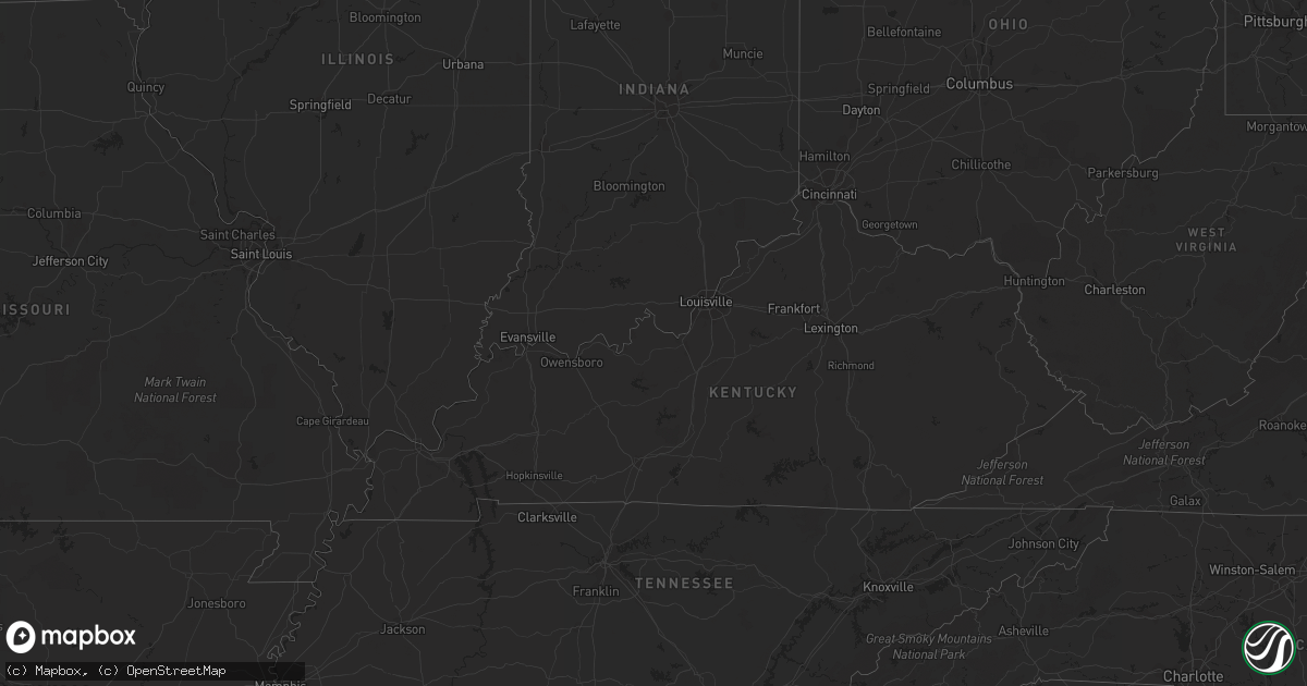
Hail Map in Minnesota on June 10, 2012
Get this storm
June 10 map
$229
one time, instant access
Download today. No call, no setup
Keep the $229
Bought the map and want the full workflow? Apply the entire $229 to a subscription within 7 days. None of it is wasted.
Every map, not just this one
This buys you this map. Subscription and you get every map we run, in the markets you choose from a few cities to whole states to nationwide. Plus real-time alerts the moment a storm fires.
Contact data
Name, contact info, occupancy, even credit band for addresses in the footprint. You go from where it hit to who to call.
Become the source they trust
Unlimited branding weather history reports on demand. You already have the documented answer ready for the property owner, and you are the one who showed up with it.
Property data and RoofTrace estimates
Pull up any address you have got, its value and the exact code rules for that jurisdiction, straight from One Click Code. Then RoofTrace estimates the squares, pitch, and roof value, priced the way you price.
Storm reports in Minnesota
Minnesota
| Date | Description |
|---|---|
| 06/10/20126:37 PM CDT | Multiple trees down at kathio state park. |
| 06/10/20126:35 PM CDT | 1 foot diameter trees blown over |
| 06/10/20126:28 PM CDT | 6 inch diameter tree blocking hwy 6 |
| 06/10/20126:19 PM CDT | Heavy metal table turned over |
| 06/10/20126:15 PM CDT | 14 inch diameter white cedar blown down. |
| 06/10/20126:10 PM CDT | Tree down on vehicle. Dugout and fence at a baseball field blown over. Pine trees of 2 feet in diameter blown over. |
| 06/10/20126:06 PM CDT | Power lines down at shamineau lake. |
| 06/10/20126:03 PM CDT | 1 ft diameter tree down blocking south bound lane of hwy 6 |
| 06/10/20126:03 PM CDT | 10 inch diameter tree down blocking intersection of hwy 6 and hwy 200 |
| 06/10/20125:54 PM CDT | Just north of hwy 10. |
| 06/10/20125:52 PM CDT | 12 to 18 inch diameter trees snapped off at the intersection of highway 15 and county road 47. |
| 06/10/20125:18 PM CDT | A local report indicates 1.00 inch wind near AVON |
| 06/10/20124:52 PM CDT | A local report indicates 59 MPH wind near OLIVIA |
| 06/10/20124:05 PM CDT | Several largetree branches were broken down as well. |
| 06/10/20129:00 AM CDT | Hail ranged from peas to quarters in size. |
| 06/10/20127:24 AM CDT | A local report indicates 1.00 inch wind near 10 S WARROAD |
| 06/09/20129:27 PM CDT | Trees down with power outages reported in the area. |
| 06/09/20129:13 PM CDT | Trees down with home damaged by one felled tree... Tranformers blown with associated power outages. Uprooted tree ripped up a gas main. |
| 06/09/20129:00 PM CDT | Scattered trees down...mostly across central and eastern sections of the highland park neighborhood. Some trees fell on vehicles. |
| 06/09/20128:51 PM CDT | 12 inch diameter tree down. |
| 06/09/20128:38 PM CDT | Roof blown off shed as well. |
| 06/09/20128:27 PM CDT | A local report indicates 58 MPH wind near NEW PRAGUE |
| 06/09/20128:21 PM CDT | One foot diameter tree down. |
| 06/09/20128:17 PM CDT | Power lines down. |
| 06/09/20128:16 PM CDT | Tree and power line down on a road. |
| 06/09/20128:15 PM CDT | Roof blown off a large shed. Another shed down and a 48 foot grain bin blown into a field. Scattered trees were also toppled or broken. The tornado began in le sueur co |
| 06/09/20128:15 PM CDT | Power line and tree down on the road at fernbrook lane and 129th ave. |
| 06/09/20128:04 PM CDT | Delayed report. Trees and large branches down. |
| 06/09/20127:52 PM CDT | Large branches down. |
| 06/09/20127:45 PM CDT | A local report indicates 63 MPH wind near 1 W KABETOGAMA |
All States Impacted by Hail Map on June 10, 2012
Cities Impacted by Hail Map on June 10, 2012
- Citra, FL
- Abbeville, GA
- Atwater, MN
- Grove City, MN
- Clermont, FL
- Orlando, FL
- Winter Garden, FL
- Davenport, FL
- Sauk Centre, MN
- Grey Eagle, MN
- Long Prairie, MN
- Henderson, MN
- Belle Plaine, MN
- Le Sueur, MN
- Pearson, GA
- Pine River, MN
- Pillager, MN
- Motley, MN
- Staples, MN
- Pequot Lakes, MN
- Hackensack, MN
- Hanover, KS
- Randolph, KS
- Green, KS
- Linn, KS
- Morrowville, KS
- Barnes, KS
- Washington, KS
- Frankfort, KS
- Olsburg, KS
- Greenleaf, KS
- Leonardville, KS
- Palmer, KS
- Westmoreland, KS
- Blue Rapids, KS
- Waterville, KS
- Glenwood, MN
- Benson, MN
- Starbuck, MN
- Montevideo, MN
- Maynard, MN
- Twin City, GA
- Portal, GA
- Metter, GA
- Crookston, MN
- Buhler, KS
- Hutchinson, KS
- Gary, MN
- Eustis, FL
- Altoona, FL
- Paisley, FL
- Umatilla, FL
- Richmond, MN
- Tifton, GA
- Chula, GA
- Burrton, KS
- Reddick, FL
- Mascotte, FL
- Groveland, FL
- Mount Hope, KS
- Haven, KS
- Silver Springs, FL
- Anthony, FL
- Lees Summit, MO
- Plant City, FL
- Foley, MN
- Sauk Rapids, MN
- Inman, KS
- Mekinock, ND
- Howard Lake, MN
- Annandale, MN
- Cokato, MN
- Lakeland, FL
- Alpha, MN
- Jackson, MN
- Spencer, IA
- Watkins, MN
- Parrish, FL
- Milnor, ND
- Belgrade, MN
- Lewisville, MN
- Vernon Center, MN
- Truman, MN
- Madelia, MN
- Borup, MN
- Perry, KS
- Oskaloosa, KS
- Saint Cloud, MN
- Sartell, MN
- Rice, MN
- Odin, MN
- Mountain Lake, MN
- Salol, MN
- Warroad, MN
- Fort Madison, IA
- Wever, IA
- Palatka, FL
- Lawrence, KS
- Swanville, MN
- Sleepy Eye, MN
- McRae Helena, GA
- Pleasanton, KS
- Hume, MO
- Statesboro, GA
- Sioux Rapids, IA
- Linn Grove, IA
- Osakis, MN
- Deltona, FL
- Havelock, IA
- Pocahontas, IA
- Laurens, IA
- Fonda, IA
- Pierz, MN
- Fort Ripley, MN
- Fargo, GA
- Mcpherson, KS
- Cologne, MN
- Carver, MN
- Waconia, MN
- Chaska, MN
- Young America, MN
- Saint Johns, FL
- Saint Augustine, FL
- Parkers Prairie, MN
- Cosmos, MN
- Lake Lillian, MN
- East Palatka, FL
- Willacoochee, GA
- Lakeland, GA
- Nashville, GA
- Interlachen, FL
- Backus, MN
- Lithia, FL
- Sebeka, MN
- Stewart, MN
- Brownton, MN
- Gibbon, MN
- Freeport, MN
- Kansas City, MO
- Mission, KS
- Prairie Village, KS
- Kansas City, KS
- Shawnee, KS
- Webster, FL
- Kimball, MN
- Thompson, ND
- Sumner, GA
- Warrensburg, MO
- Leeton, MO
- Climax, MN
- Buxton, ND
- Kissimmee, FL
- Sturgeon Lake, MN
- Jordan, MN
- Lisbon, ND
- Paola, KS
- Villard, MN
- Ona, FL
- Cromwell, MN
- Tamarack, MN
- Kettle River, MN
- Hastings, FL
- Waycross, GA
- Ocklawaha, FL
- Enderlin, ND
- Milan, GA
- Rhine, GA
- Jacksonville, GA
- Orange Park, FL
- Middleburg, FL
- Jacksonville, FL
- Centerville, KS
- Blue Mound, KS
- Mound City, KS
- Akeley, MN
- Melrose, MN
- Keosauqua, IA
- Holdingford, MN
- Avon, MN
- Rockaway, NJ
- Wharton, NJ
- Dover, NJ
- Randolph, NJ
- Spirit Lake, IA
- Du Pont, GA
- Homerville, GA
- Dade City, FL
- Dunnellon, FL
- Ocala, FL
- Randall, MN
- Burtrum, MN
- Longville, MN
- Walker, MN
- Saint Peter, MN
- Apopka, FL
- Sorrento, FL
- Albany, MN
- Douglas, GA
- Axson, GA
- Paynesville, MN
- Saint Martin, MN
- Twin Valley, MN
- Greenville, IA
- Tavares, FL
- Mount Dora, FL
- Birmingham, IA
- Verndale, MN
- Mine Hill, NJ
- Oak Ridge, NJ
- Grygla, MN
- Roseau, MN
- Fingal, ND
- Wheatland, ND
- Brooten, MN
- Williams, MN
- Ty Ty, GA
- Kincaid, KS
- Monticello, MN
- Becker, MN
- Bovey, MN
- Arvilla, ND
- Emerado, ND
- Leesburg, FL
- Saint Joseph, MN
- Shakopee, MN
- Glenwood, GA
- Soperton, GA
- Arcadia, FL
- Norman Park, GA
- Moultrie, GA
- Browerville, MN
- Pomona Park, FL
- Denville, NJ
- Lake Hopatcong, NJ
- Morristown, NJ
- Satsuma, FL
- Peterson, IA
- Bunnell, FL
- Ormond Beach, FL
- Roosevelt, MN
- Minto, ND
- Forest River, ND
- Gilby, ND
- Manvel, ND
- Royal, IA
- Felton, MN
- Lake Crystal, MN
- Oakland, FL
- Ocoee, FL
- Montverde, FL
- Little Falls, MN
- Saint Cloud, FL
- Blomkest, MN
- Center Hill, FL
- Deepwater, MO
- Osceola, MO
- Prescott, KS
- Brainerd, MN
- Cold Spring, MN
- Storm Lake, IA
- Nemaha, IA
- Newell, IA
- Punta Gorda, FL
- Goodridge, MN
- Nahunta, GA
- Waite Park, MN
- Upsala, MN
- Saint Stephen, MN
- Rockville, MN
- Eden Valley, MN
- Flensburg, MN
- Royalton, MN
- Bowlus, MN
- Kandiyohi, MN
- Mankato, MN
- Nicollet, MN
- Myakka City, FL
- Wellsville, KS
- Fertile, MN
- Parker, KS
- Sneads, FL
- Donalsonville, GA
- Varina, IA
- Ulen, MN
- Glyndon, MN
- Ada, MN
- Moorhead, MN
- Fort McCoy, FL
- Ottawa, KS
- Rantoul, KS
- Northwood, ND
- Daytona Beach, FL
- New Ulm, MN
- Fairfax, MN
- Hoboken, GA
- Murdock, MN
- Nalcrest, FL
- Lake Wales, FL
- Clear Lake, MN
- Grand Forks Afb, ND
- Sanderson, FL
- Colquitt, GA
- Walnut, KS
- Rolfe, IA
- Galva, IA
- Aurelia, IA
- Holstein, IA
- Louisville, GA
- Remer, MN
- Jesup, GA
- Cherokee, IA
- Quimby, IA
- Federal Dam, MN
- Lehigh, IA
- Burnside, IA
- Fort Dodge, IA
- Tonganoxie, KS
- Fleming Island, FL
- Green Cove Springs, FL
- Saint Hilaire, MN
- Red Lake Falls, MN
- Register, GA
- Cedar Falls, IA
- Callahan, FL
- Hilliard, FL
- Isle, MN
- South Haven, MN
- Park Rapids, MN
- Fitzgerald, GA
- Bode, IA
- Alamo, GA
- Bonner Springs, KS
- Sheldon, ND
- Garnett, KS
- Miltona, MN
- Nielsville, MN
- Otho, IA
- Willmar, MN
- Duncombe, IA
- Menahga, MN
- Schaller, IA
- Alta, IA
- Norwood Young America, MN
- Bertha, MN
- Hewitt, MN
- Waverly, GA
- Waynesville, GA
- Deer River, MN
- Bena, MN
- Frostproof, FL
- Elkton, FL
- Marshall, MO
- Cleghorn, IA
- Washta, IA
- Bainbridge, GA
- Clinton, MO
- Dickens, IA
- Ruthven, IA
- New London, MN
- Spicer, MN
- Ludowici, GA
- Danube, MN
- Olivia, MN
- Renville, MN
- Windermere, FL
- Hillsboro, ND
- Woden, IA
- West Union, MN
- Omega, GA
- Wildwood, FL
- The Villages, FL
- Arthur, ND
- Hunter, ND
- Weirsdale, FL
- Okahumpka, FL
- Ocilla, GA
- Nevis, MN
- Palm Coast, FL
- Mayer, MN
- Berryton, KS
- Lecompton, KS
- Linwood, KS
- South Hutchinson, KS


