Hail Map in Iowa on June 10, 2012
Get this storm
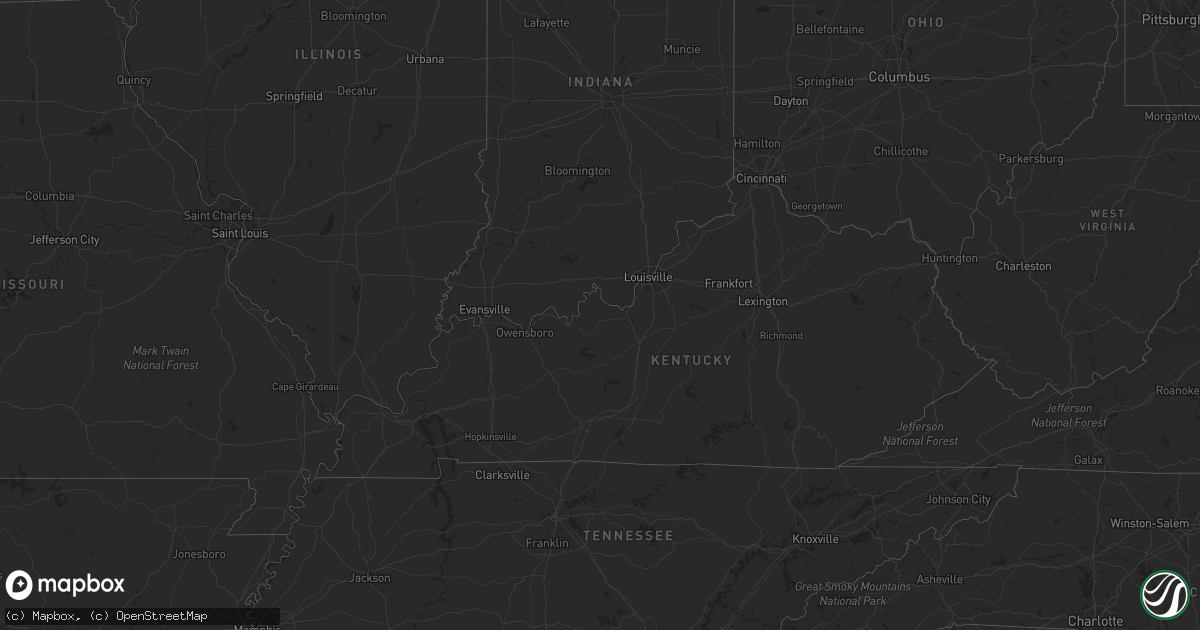
June 10 map
$229
one time, instant access
Download today. No call, no setup
Keep the $229
Bought the map and want the full workflow? Apply the entire $229 to a subscription within 7 days. None of it is wasted.
Every map, not just this one
This buys you this map. Subscription and you get every map we run, in the markets you choose from a few cities to whole states to nationwide. Plus real-time alerts the moment a storm fires.
Contact data
Name, contact info, occupancy, even credit band for addresses in the footprint. You go from where it hit to who to call.
Become the source they trust
Unlimited branding weather history reports on demand. You already have the documented answer ready for the property owner, and you are the one who showed up with it.
Property data and RoofTrace estimates
Pull up any address you have got, its value and the exact code rules for that jurisdiction, straight from One Click Code. Then RoofTrace estimates the squares, pitch, and roof value, priced the way you price.
Storm reports in Iowa
Iowa
| Date | Description |
|---|---|
| 06/10/20126:24 PM CDT | 2 foot diameter tree knocked over. An old and small garage sustained minor structural damage. Winds estimated near 50 mph. |
| 06/10/20126:14 PM CDT | Large branches and a tree reported down |
| 06/10/20121:54 AM CDT | Numerous mature trees down. |
| 06/10/20121:47 AM CDT | Tree down on dug road. Time estimated. |
| 06/10/20121:40 AM CDT | Tree down on old stage road. Time estimated. |
| 06/10/20121:37 AM CDT | 2 foot diameter tree and power lines down in frankville. Time estimated. |
| 06/09/20128:06 PM CDT | Large tree toppled over power lines along olive street south of interstate 80. |
All States Impacted by Hail Map on June 10, 2012
Cities Impacted by Hail Map on June 10, 2012
- Citra, FL
- Abbeville, GA
- Atwater, MN
- Grove City, MN
- Clermont, FL
- Orlando, FL
- Winter Garden, FL
- Davenport, FL
- Sauk Centre, MN
- Grey Eagle, MN
- Long Prairie, MN
- Henderson, MN
- Belle Plaine, MN
- Le Sueur, MN
- Pearson, GA
- Pine River, MN
- Pillager, MN
- Motley, MN
- Staples, MN
- Pequot Lakes, MN
- Hackensack, MN
- Hanover, KS
- Randolph, KS
- Green, KS
- Linn, KS
- Morrowville, KS
- Barnes, KS
- Washington, KS
- Frankfort, KS
- Olsburg, KS
- Greenleaf, KS
- Leonardville, KS
- Palmer, KS
- Westmoreland, KS
- Blue Rapids, KS
- Waterville, KS
- Glenwood, MN
- Benson, MN
- Starbuck, MN
- Montevideo, MN
- Maynard, MN
- Twin City, GA
- Portal, GA
- Metter, GA
- Crookston, MN
- Buhler, KS
- Hutchinson, KS
- Gary, MN
- Eustis, FL
- Altoona, FL
- Paisley, FL
- Umatilla, FL
- Richmond, MN
- Tifton, GA
- Chula, GA
- Burrton, KS
- Reddick, FL
- Mascotte, FL
- Groveland, FL
- Mount Hope, KS
- Haven, KS
- Silver Springs, FL
- Anthony, FL
- Lees Summit, MO
- Plant City, FL
- Foley, MN
- Sauk Rapids, MN
- Inman, KS
- Mekinock, ND
- Howard Lake, MN
- Annandale, MN
- Cokato, MN
- Lakeland, FL
- Alpha, MN
- Jackson, MN
- Spencer, IA
- Watkins, MN
- Parrish, FL
- Milnor, ND
- Belgrade, MN
- Lewisville, MN
- Vernon Center, MN
- Truman, MN
- Madelia, MN
- Borup, MN
- Perry, KS
- Oskaloosa, KS
- Saint Cloud, MN
- Sartell, MN
- Rice, MN
- Odin, MN
- Mountain Lake, MN
- Salol, MN
- Warroad, MN
- Fort Madison, IA
- Wever, IA
- Palatka, FL
- Lawrence, KS
- Swanville, MN
- Sleepy Eye, MN
- McRae Helena, GA
- Pleasanton, KS
- Hume, MO
- Statesboro, GA
- Sioux Rapids, IA
- Linn Grove, IA
- Osakis, MN
- Deltona, FL
- Havelock, IA
- Pocahontas, IA
- Laurens, IA
- Fonda, IA
- Pierz, MN
- Fort Ripley, MN
- Fargo, GA
- Mcpherson, KS
- Cologne, MN
- Carver, MN
- Waconia, MN
- Chaska, MN
- Young America, MN
- Saint Johns, FL
- Saint Augustine, FL
- Parkers Prairie, MN
- Cosmos, MN
- Lake Lillian, MN
- East Palatka, FL
- Willacoochee, GA
- Lakeland, GA
- Nashville, GA
- Interlachen, FL
- Backus, MN
- Lithia, FL
- Sebeka, MN
- Stewart, MN
- Brownton, MN
- Gibbon, MN
- Freeport, MN
- Kansas City, MO
- Mission, KS
- Prairie Village, KS
- Kansas City, KS
- Shawnee, KS
- Webster, FL
- Kimball, MN
- Thompson, ND
- Sumner, GA
- Warrensburg, MO
- Leeton, MO
- Climax, MN
- Buxton, ND
- Kissimmee, FL
- Sturgeon Lake, MN
- Jordan, MN
- Lisbon, ND
- Paola, KS
- Villard, MN
- Ona, FL
- Cromwell, MN
- Tamarack, MN
- Kettle River, MN
- Hastings, FL
- Waycross, GA
- Ocklawaha, FL
- Enderlin, ND
- Milan, GA
- Rhine, GA
- Jacksonville, GA
- Orange Park, FL
- Middleburg, FL
- Jacksonville, FL
- Centerville, KS
- Blue Mound, KS
- Mound City, KS
- Akeley, MN
- Melrose, MN
- Keosauqua, IA
- Holdingford, MN
- Avon, MN
- Rockaway, NJ
- Wharton, NJ
- Dover, NJ
- Randolph, NJ
- Spirit Lake, IA
- Du Pont, GA
- Homerville, GA
- Dade City, FL
- Dunnellon, FL
- Ocala, FL
- Randall, MN
- Burtrum, MN
- Longville, MN
- Walker, MN
- Saint Peter, MN
- Apopka, FL
- Sorrento, FL
- Albany, MN
- Douglas, GA
- Axson, GA
- Paynesville, MN
- Saint Martin, MN
- Twin Valley, MN
- Greenville, IA
- Tavares, FL
- Mount Dora, FL
- Birmingham, IA
- Verndale, MN
- Mine Hill, NJ
- Oak Ridge, NJ
- Grygla, MN
- Roseau, MN
- Fingal, ND
- Wheatland, ND
- Brooten, MN
- Williams, MN
- Ty Ty, GA
- Kincaid, KS
- Monticello, MN
- Becker, MN
- Bovey, MN
- Arvilla, ND
- Emerado, ND
- Leesburg, FL
- Saint Joseph, MN
- Shakopee, MN
- Glenwood, GA
- Soperton, GA
- Arcadia, FL
- Norman Park, GA
- Moultrie, GA
- Browerville, MN
- Pomona Park, FL
- Denville, NJ
- Lake Hopatcong, NJ
- Morristown, NJ
- Satsuma, FL
- Peterson, IA
- Bunnell, FL
- Ormond Beach, FL
- Roosevelt, MN
- Minto, ND
- Forest River, ND
- Gilby, ND
- Manvel, ND
- Royal, IA
- Felton, MN
- Lake Crystal, MN
- Oakland, FL
- Ocoee, FL
- Montverde, FL
- Little Falls, MN
- Saint Cloud, FL
- Blomkest, MN
- Center Hill, FL
- Deepwater, MO
- Osceola, MO
- Prescott, KS
- Brainerd, MN
- Cold Spring, MN
- Storm Lake, IA
- Nemaha, IA
- Newell, IA
- Punta Gorda, FL
- Goodridge, MN
- Nahunta, GA
- Waite Park, MN
- Upsala, MN
- Saint Stephen, MN
- Rockville, MN
- Eden Valley, MN
- Flensburg, MN
- Royalton, MN
- Bowlus, MN
- Kandiyohi, MN
- Mankato, MN
- Nicollet, MN
- Myakka City, FL
- Wellsville, KS
- Fertile, MN
- Parker, KS
- Sneads, FL
- Donalsonville, GA
- Varina, IA
- Ulen, MN
- Glyndon, MN
- Ada, MN
- Moorhead, MN
- Fort McCoy, FL
- Ottawa, KS
- Rantoul, KS
- Northwood, ND
- Daytona Beach, FL
- New Ulm, MN
- Fairfax, MN
- Hoboken, GA
- Murdock, MN
- Nalcrest, FL
- Lake Wales, FL
- Clear Lake, MN
- Grand Forks Afb, ND
- Sanderson, FL
- Colquitt, GA
- Walnut, KS
- Rolfe, IA
- Galva, IA
- Aurelia, IA
- Holstein, IA
- Louisville, GA
- Remer, MN
- Jesup, GA
- Cherokee, IA
- Quimby, IA
- Federal Dam, MN
- Lehigh, IA
- Burnside, IA
- Fort Dodge, IA
- Tonganoxie, KS
- Fleming Island, FL
- Green Cove Springs, FL
- Saint Hilaire, MN
- Red Lake Falls, MN
- Register, GA
- Cedar Falls, IA
- Callahan, FL
- Hilliard, FL
- Isle, MN
- South Haven, MN
- Park Rapids, MN
- Fitzgerald, GA
- Bode, IA
- Alamo, GA
- Bonner Springs, KS
- Sheldon, ND
- Garnett, KS
- Miltona, MN
- Nielsville, MN
- Otho, IA
- Willmar, MN
- Duncombe, IA
- Menahga, MN
- Schaller, IA
- Alta, IA
- Norwood Young America, MN
- Bertha, MN
- Hewitt, MN
- Waverly, GA
- Waynesville, GA
- Deer River, MN
- Bena, MN
- Frostproof, FL
- Elkton, FL
- Marshall, MO
- Cleghorn, IA
- Washta, IA
- Bainbridge, GA
- Clinton, MO
- Dickens, IA
- Ruthven, IA
- New London, MN
- Spicer, MN
- Ludowici, GA
- Danube, MN
- Olivia, MN
- Renville, MN
- Windermere, FL
- Hillsboro, ND
- Woden, IA
- West Union, MN
- Omega, GA
- Wildwood, FL
- The Villages, FL
- Arthur, ND
- Hunter, ND
- Weirsdale, FL
- Okahumpka, FL
- Ocilla, GA
- Nevis, MN
- Palm Coast, FL
- Mayer, MN
- Berryton, KS
- Lecompton, KS
- Linwood, KS
- South Hutchinson, KS


