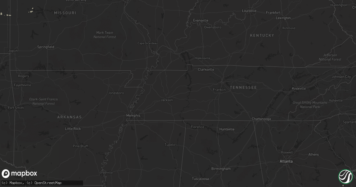
Hail Map on June 10, 2012
Get this storm
June 10 map
$229
one time, instant access
Download today. No call, no setup
Keep the $229
Bought the map and want the full workflow? Apply the entire $229 to a subscription within 7 days. None of it is wasted.
Every map, not just this one
This buys you this map. Subscription and you get every map we run, in the markets you choose from a few cities to whole states to nationwide. Plus real-time alerts the moment a storm fires.
Contact data
Name, contact info, occupancy, even credit band for addresses in the footprint. You go from where it hit to who to call.
Become the source they trust
Unlimited branding weather history reports on demand. You already have the documented answer ready for the property owner, and you are the one who showed up with it.
Property data and RoofTrace estimates
Pull up any address you have got, its value and the exact code rules for that jurisdiction, straight from One Click Code. Then RoofTrace estimates the squares, pitch, and roof value, priced the way you price.
States Impacted by Hail Map on June 10, 2012
Storm reports
Iowa
| Date | Description |
|---|---|
| 06/10/20126:24 PM CDT | 2 foot diameter tree knocked over. An old and small garage sustained minor structural damage. Winds estimated near 50 mph. |
| 06/10/20126:14 PM CDT | Large branches and a tree reported down |
| 06/10/20121:54 AM CDT | Numerous mature trees down. |
| 06/10/20121:47 AM CDT | Tree down on dug road. Time estimated. |
| 06/10/20121:40 AM CDT | Tree down on old stage road. Time estimated. |
| 06/10/20121:37 AM CDT | 2 foot diameter tree and power lines down in frankville. Time estimated. |
| 06/09/20128:06 PM CDT | Large tree toppled over power lines along olive street south of interstate 80. |
South Carolina
| Date | Description |
|---|---|
| 06/09/201211:30 PM CDT | Charleston county 911 dispatch reports a tree down on maybank highway on wadmalaw island. |
| 06/09/20128:45 PM CDT | Tree down on glenn st. |
New Jersey
| Date | Description |
|---|---|
| 06/10/20125:08 PM CDT | Trees and wires down. |
| 06/10/20124:30 PM CDT | Widespread trees and wires down from east of hopatcong southward beginning at 530 pm |
| 06/10/20124:29 PM CDT | Limbs down |
Kansas
| Date | Description |
|---|---|
| 06/09/20128:47 PM CDT | A local report indicates 1.75 inch wind near 3 S YODER |
| 06/09/20128:42 PM CDT | A local report indicates 1.00 inch wind near 6 SSE BARNES |
| 06/09/20128:38 PM CDT | A local report indicates 1.00 inch wind near 4 SSW BARNES |
| 06/09/20128:35 PM CDT | A local report indicates 1.00 inch wind near 9 SE HUTCHINSON |
| 06/09/20128:35 PM CDT | A local report indicates 1.75 inch wind near 7 S BARNES |
| 06/09/20128:20 PM CDT | Tree down reported near 14th and spring road in town. |
| 06/09/20128:15 PM CDT | Nickel to quarter size hail covering the ground. Winds gusting to 31 mph. |
| 06/09/20128:06 PM CDT | A local report indicates 1.25 inch wind near HUTCHINSON |
| 06/09/20128:01 PM CDT | A local report indicates 1.00 inch wind near HUTCHINSON |
| 06/09/20128:01 PM CDT | Golf ball hail near 30th avenue and plum street. |
| 06/09/20127:47 PM CDT | A local report indicates 1.25 inch wind near LINN |
| 06/09/20127:41 PM CDT | A local report indicates 1.00 inch wind near LINN |
| 06/09/20127:38 PM CDT | A local report indicates 1.00 inch wind near 1 SW LINN |
Georgia
| Date | Description |
|---|---|
| 06/10/20126:50 PM CDT | 911 center reported 2 trees down along ga hwy 231 in riddleville. |
| 06/10/20126:47 PM CDT | Law enforecement reported a tree down near highway 1. |
| 06/10/20125:26 PM CDT | Public reported 4 trees down in their yard on bear lake road. |
| 06/10/20125:00 PM CDT | Peach county 911 relayed reports of a few downed trees. Radar estimated time of 1800 edt. |
| 06/10/20124:41 PM CDT | 911 dispatch reported multiple trees down on ga hwy 77 south in union point. |
| 06/10/20124:26 PM CDT | 911 dispatch reported power lines down in greensboro. |
| 06/10/20124:07 PM CDT | Public reported dime to quarter size hail. |
| 06/10/20123:55 PM CDT | Putnam county 911 relayed a report of 2 trees downed onto lines. Radar estimated time of 1655 edt. |
| 06/10/20123:46 PM CDT | 911 dispatch reported 1 tree down in the northwest part of the county. |
| 06/10/20123:25 PM CDT | 911 dispatch reported 7 trees down across the county. |
| 06/10/20123:19 PM CDT | Trees down on wiley st and south morris st in donaldsonville. |
| 06/10/20123:00 PM CDT | Amateur radio relayed a report from fire rescue of 2 trees down just north of the i16 and 175 split just off the interstate. |
| 06/10/20122:42 PM CDT | Emergency manager reported that three trees fell on a house along westeria drive. The trees caused moderate damage to the house including the roof to partially collapse |
| 06/10/20122:40 PM CDT | The public reported several tree limbs broken by thunderstorm winds in the warner robins area. |
| 06/10/20122:30 PM CDT | Tree down on sains hatchery rd. |
| 06/10/20122:15 PM CDT | Emergency manager reported 10 trees down county wide. |
| 06/10/20122:15 PM CDT | 911 center reports three to five trees down across the southwest portion of the county in various locations. |
| 06/09/20128:07 PM CDT | A sheriff reported trees down on woodrow williams road. |
| 06/09/20127:10 PM CDT | Emanuel county 911 relayed a report of a downed tree and washed out dirt roads. Radar estimated time 2010 edt. |
| 06/09/20127:05 PM CDT | Jefferson county 911 reported a couple of downed trees along old us 1 in louisville. Radar estimated time of 2005 edt. |
Alabama
| Date | Description |
|---|---|
| 06/10/20123:00 PM CDT | Approximately 15 trees down and some powerlines down along hwy 51 in the beauregard community. |
| 06/10/20122:12 PM CDT | One tree reported down on county road 57 near richards crossroads. Estimated 50 mph wind gusts. |
| 06/10/20121:35 PM CDT | Trees down county wide. |
| 06/10/20121:20 PM CDT | Tree and fence damage reported. |
| 06/10/20121:10 PM CDT | Trees down in the town of enterprise |
| 06/10/201211:35 AM CDT | Spotter reports trees down and structural damage on neva drive in road just north of geneva |
| 06/10/201211:30 AM CDT | Tree down near intersection of highway 27 south and county road 723. |
| 06/10/201211:15 AM CDT | Trees uprooted on tom fain rd |
| 06/10/201211:15 AM CDT | Trees uprooted on tom fain rd |
Missouri
| Date | Description |
|---|---|
| 06/10/20124:15 AM CDT | A local report indicates 58 MPH wind near KCI AIRPORT |
Florida
| Date | Description |
|---|---|
| 06/10/20126:16 PM CDT | A local report indicates 1.00 inch wind near 4 SE PLANT CITY |
| 06/10/20126:05 PM CDT | Emergency management relayed report of a tree down on powerlines in east bunnell. Time is estimated from radar. |
| 06/10/20126:00 PM CDT | Emergency management relayed a report of a tree blocking state route 11 south of bunnell. Time is estimated from radar. |
| 06/10/20125:34 PM CDT | 911 call center reported several trees down in the crescent city area. |
| 06/10/20124:18 PM CDT | Numerous pine trees and powerlines down. |
| 06/10/20123:55 PM CDT | Quarter sized hail. In addition...several eight to ten foot trees down. |
| 06/10/20123:40 PM CDT | Trained spotter reported downed trees and power lines near 6281 old dixie drive in st augustine. |
| 06/10/20123:40 PM CDT | 911 call center reported several trees down in palatka. |
| 06/10/20122:35 PM CDT | Central dispatch relayed a report of a tree down on state road 13 north. |
| 06/10/20122:09 PM CDT | Emergency management reported quarter size hail in north central palm coast. |
| 06/10/20121:45 PM CDT | Florida power and light utility company reported several trees down. |
| 06/10/20121:06 PM CDT | Numerous trees down across western side of county. |
| 06/09/20127:05 PM CDT | Two trees down. Time estimated by radar. |
Wisconsin
| Date | Description |
|---|---|
| 06/09/20129:45 PM CDT | Power poles down. |
Minnesota
| Date | Description |
|---|---|
| 06/10/20126:37 PM CDT | Multiple trees down at kathio state park. |
| 06/10/20126:35 PM CDT | 1 foot diameter trees blown over |
| 06/10/20126:28 PM CDT | 6 inch diameter tree blocking hwy 6 |
| 06/10/20126:19 PM CDT | Heavy metal table turned over |
| 06/10/20126:15 PM CDT | 14 inch diameter white cedar blown down. |
| 06/10/20126:10 PM CDT | Tree down on vehicle. Dugout and fence at a baseball field blown over. Pine trees of 2 feet in diameter blown over. |
| 06/10/20126:06 PM CDT | Power lines down at shamineau lake. |
| 06/10/20126:03 PM CDT | 1 ft diameter tree down blocking south bound lane of hwy 6 |
| 06/10/20126:03 PM CDT | 10 inch diameter tree down blocking intersection of hwy 6 and hwy 200 |
| 06/10/20125:54 PM CDT | Just north of hwy 10. |
| 06/10/20125:52 PM CDT | 12 to 18 inch diameter trees snapped off at the intersection of highway 15 and county road 47. |
| 06/10/20125:18 PM CDT | A local report indicates 1.00 inch wind near AVON |
| 06/10/20124:52 PM CDT | A local report indicates 59 MPH wind near OLIVIA |
| 06/10/20124:05 PM CDT | Several largetree branches were broken down as well. |
| 06/10/20129:00 AM CDT | Hail ranged from peas to quarters in size. |
| 06/10/20127:24 AM CDT | A local report indicates 1.00 inch wind near 10 S WARROAD |
| 06/09/20129:27 PM CDT | Trees down with power outages reported in the area. |
| 06/09/20129:13 PM CDT | Trees down with home damaged by one felled tree... Tranformers blown with associated power outages. Uprooted tree ripped up a gas main. |
| 06/09/20129:00 PM CDT | Scattered trees down...mostly across central and eastern sections of the highland park neighborhood. Some trees fell on vehicles. |
| 06/09/20128:51 PM CDT | 12 inch diameter tree down. |
| 06/09/20128:38 PM CDT | Roof blown off shed as well. |
| 06/09/20128:27 PM CDT | A local report indicates 58 MPH wind near NEW PRAGUE |
| 06/09/20128:21 PM CDT | One foot diameter tree down. |
| 06/09/20128:17 PM CDT | Power lines down. |
| 06/09/20128:16 PM CDT | Tree and power line down on a road. |
| 06/09/20128:15 PM CDT | Roof blown off a large shed. Another shed down and a 48 foot grain bin blown into a field. Scattered trees were also toppled or broken. The tornado began in le sueur co |
| 06/09/20128:15 PM CDT | Power line and tree down on the road at fernbrook lane and 129th ave. |
| 06/09/20128:04 PM CDT | Delayed report. Trees and large branches down. |
| 06/09/20127:52 PM CDT | Large branches down. |
| 06/09/20127:45 PM CDT | A local report indicates 63 MPH wind near 1 W KABETOGAMA |
Cities Impacted by Hail Map on June 10, 2012
- Citra, FL
- Abbeville, GA
- Atwater, MN
- Grove City, MN
- Clermont, FL
- Orlando, FL
- Winter Garden, FL
- Davenport, FL
- Sauk Centre, MN
- Grey Eagle, MN
- Long Prairie, MN
- Henderson, MN
- Belle Plaine, MN
- Le Sueur, MN
- Pearson, GA
- Pine River, MN
- Pillager, MN
- Motley, MN
- Staples, MN
- Pequot Lakes, MN
- Hackensack, MN
- Hanover, KS
- Randolph, KS
- Green, KS
- Linn, KS
- Morrowville, KS
- Barnes, KS
- Washington, KS
- Frankfort, KS
- Olsburg, KS
- Greenleaf, KS
- Leonardville, KS
- Palmer, KS
- Westmoreland, KS
- Blue Rapids, KS
- Waterville, KS
- Glenwood, MN
- Benson, MN
- Starbuck, MN
- Montevideo, MN
- Maynard, MN
- Twin City, GA
- Portal, GA
- Metter, GA
- Crookston, MN
- Buhler, KS
- Hutchinson, KS
- Gary, MN
- Eustis, FL
- Altoona, FL
- Paisley, FL
- Umatilla, FL
- Richmond, MN
- Tifton, GA
- Chula, GA
- Burrton, KS
- Reddick, FL
- Mascotte, FL
- Groveland, FL
- Mount Hope, KS
- Haven, KS
- Silver Springs, FL
- Anthony, FL
- Lees Summit, MO
- Plant City, FL
- Foley, MN
- Sauk Rapids, MN
- Inman, KS
- Mekinock, ND
- Howard Lake, MN
- Annandale, MN
- Cokato, MN
- Lakeland, FL
- Alpha, MN
- Jackson, MN
- Spencer, IA
- Watkins, MN
- Parrish, FL
- Milnor, ND
- Belgrade, MN
- Lewisville, MN
- Vernon Center, MN
- Truman, MN
- Madelia, MN
- Borup, MN
- Perry, KS
- Oskaloosa, KS
- Saint Cloud, MN
- Sartell, MN
- Rice, MN
- Odin, MN
- Mountain Lake, MN
- Salol, MN
- Warroad, MN
- Fort Madison, IA
- Wever, IA
- Palatka, FL
- Lawrence, KS
- Swanville, MN
- Sleepy Eye, MN
- McRae Helena, GA
- Pleasanton, KS
- Hume, MO
- Statesboro, GA
- Sioux Rapids, IA
- Linn Grove, IA
- Osakis, MN
- Deltona, FL
- Havelock, IA
- Pocahontas, IA
- Laurens, IA
- Fonda, IA
- Pierz, MN
- Fort Ripley, MN
- Fargo, GA
- Mcpherson, KS
- Cologne, MN
- Carver, MN
- Waconia, MN
- Chaska, MN
- Young America, MN
- Saint Johns, FL
- Saint Augustine, FL
- Parkers Prairie, MN
- Cosmos, MN
- Lake Lillian, MN
- East Palatka, FL
- Willacoochee, GA
- Lakeland, GA
- Nashville, GA
- Interlachen, FL
- Backus, MN
- Lithia, FL
- Sebeka, MN
- Stewart, MN
- Brownton, MN
- Gibbon, MN
- Freeport, MN
- Kansas City, MO
- Mission, KS
- Prairie Village, KS
- Kansas City, KS
- Shawnee, KS
- Webster, FL
- Kimball, MN
- Thompson, ND
- Sumner, GA
- Warrensburg, MO
- Leeton, MO
- Climax, MN
- Buxton, ND
- Kissimmee, FL
- Sturgeon Lake, MN
- Jordan, MN
- Lisbon, ND
- Paola, KS
- Villard, MN
- Ona, FL
- Cromwell, MN
- Tamarack, MN
- Kettle River, MN
- Hastings, FL
- Waycross, GA
- Ocklawaha, FL
- Enderlin, ND
- Milan, GA
- Rhine, GA
- Jacksonville, GA
- Orange Park, FL
- Middleburg, FL
- Jacksonville, FL
- Centerville, KS
- Blue Mound, KS
- Mound City, KS
- Akeley, MN
- Melrose, MN
- Keosauqua, IA
- Holdingford, MN
- Avon, MN
- Rockaway, NJ
- Wharton, NJ
- Dover, NJ
- Randolph, NJ
- Spirit Lake, IA
- Du Pont, GA
- Homerville, GA
- Dade City, FL
- Dunnellon, FL
- Ocala, FL
- Randall, MN
- Burtrum, MN
- Longville, MN
- Walker, MN
- Saint Peter, MN
- Apopka, FL
- Sorrento, FL
- Albany, MN
- Douglas, GA
- Axson, GA
- Paynesville, MN
- Saint Martin, MN
- Twin Valley, MN
- Greenville, IA
- Tavares, FL
- Mount Dora, FL
- Birmingham, IA
- Verndale, MN
- Mine Hill, NJ
- Oak Ridge, NJ
- Grygla, MN
- Roseau, MN
- Fingal, ND
- Wheatland, ND
- Brooten, MN
- Williams, MN
- Ty Ty, GA
- Kincaid, KS
- Monticello, MN
- Becker, MN
- Bovey, MN
- Arvilla, ND
- Emerado, ND
- Leesburg, FL
- Saint Joseph, MN
- Shakopee, MN
- Glenwood, GA
- Soperton, GA
- Arcadia, FL
- Norman Park, GA
- Moultrie, GA
- Browerville, MN
- Pomona Park, FL
- Denville, NJ
- Lake Hopatcong, NJ
- Morristown, NJ
- Satsuma, FL
- Peterson, IA
- Bunnell, FL
- Ormond Beach, FL
- Roosevelt, MN
- Minto, ND
- Forest River, ND
- Gilby, ND
- Manvel, ND
- Royal, IA
- Felton, MN
- Lake Crystal, MN
- Oakland, FL
- Ocoee, FL
- Montverde, FL
- Little Falls, MN
- Saint Cloud, FL
- Blomkest, MN
- Center Hill, FL
- Deepwater, MO
- Osceola, MO
- Prescott, KS
- Brainerd, MN
- Cold Spring, MN
- Storm Lake, IA
- Nemaha, IA
- Newell, IA
- Punta Gorda, FL
- Goodridge, MN
- Nahunta, GA
- Waite Park, MN
- Upsala, MN
- Saint Stephen, MN
- Rockville, MN
- Eden Valley, MN
- Flensburg, MN
- Royalton, MN
- Bowlus, MN
- Kandiyohi, MN
- Mankato, MN
- Nicollet, MN
- Myakka City, FL
- Wellsville, KS
- Fertile, MN
- Parker, KS
- Sneads, FL
- Donalsonville, GA
- Varina, IA
- Ulen, MN
- Glyndon, MN
- Ada, MN
- Moorhead, MN
- Fort McCoy, FL
- Ottawa, KS
- Rantoul, KS
- Northwood, ND
- Daytona Beach, FL
- New Ulm, MN
- Fairfax, MN
- Hoboken, GA
- Murdock, MN
- Nalcrest, FL
- Lake Wales, FL
- Clear Lake, MN
- Grand Forks Afb, ND
- Sanderson, FL
- Colquitt, GA
- Walnut, KS
- Rolfe, IA
- Galva, IA
- Aurelia, IA
- Holstein, IA
- Louisville, GA
- Remer, MN
- Jesup, GA
- Cherokee, IA
- Quimby, IA
- Federal Dam, MN
- Lehigh, IA
- Burnside, IA
- Fort Dodge, IA
- Tonganoxie, KS
- Fleming Island, FL
- Green Cove Springs, FL
- Saint Hilaire, MN
- Red Lake Falls, MN
- Register, GA
- Cedar Falls, IA
- Callahan, FL
- Hilliard, FL
- Isle, MN
- South Haven, MN
- Park Rapids, MN
- Fitzgerald, GA
- Bode, IA
- Alamo, GA
- Bonner Springs, KS
- Sheldon, ND
- Garnett, KS
- Miltona, MN
- Nielsville, MN
- Otho, IA
- Willmar, MN
- Duncombe, IA
- Menahga, MN
- Schaller, IA
- Alta, IA
- Norwood Young America, MN
- Bertha, MN
- Hewitt, MN
- Waverly, GA
- Waynesville, GA
- Deer River, MN
- Bena, MN
- Frostproof, FL
- Elkton, FL
- Marshall, MO
- Cleghorn, IA
- Washta, IA
- Bainbridge, GA
- Clinton, MO
- Dickens, IA
- Ruthven, IA
- New London, MN
- Spicer, MN
- Ludowici, GA
- Danube, MN
- Olivia, MN
- Renville, MN
- Windermere, FL
- Hillsboro, ND
- Woden, IA
- West Union, MN
- Omega, GA
- Wildwood, FL
- The Villages, FL
- Arthur, ND
- Hunter, ND
- Weirsdale, FL
- Okahumpka, FL
- Ocilla, GA
- Nevis, MN
- Palm Coast, FL
- Mayer, MN
- Berryton, KS
- Lecompton, KS
- Linwood, KS
- South Hutchinson, KS