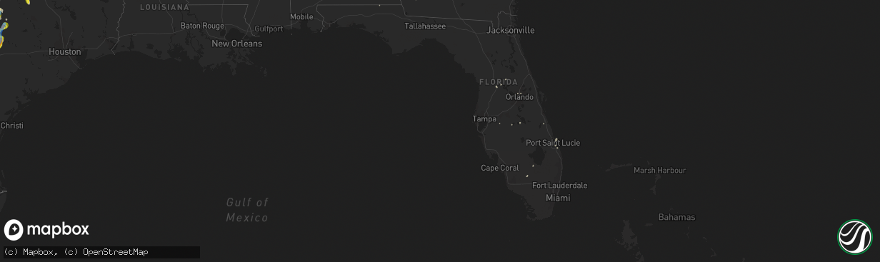
Hail Map in Florida on June 9, 2019
The weather event in Florida on June 9, 2019 includes Wind and Hail maps. 5 states and 349 cities were impacted and suffered possible damage. The total estimated number of properties impacted is 0.
Want more than just the map?
Turn this storm into a full workflow.
- Owner + property data so you know who to knock
- OnDemand branded weather history reports to win the "did we even have hail?" argument
- RoofTrace estimate so reps stop guessing numbers at the door
Bought this map? Upgrade within 7 days and we'll credit the $230. (10-15 min setup call)
Wind
Hail
0
Estimated number of impacted properties by a 1.00" hail or larger0
Estimated number of impacted properties by a 1.75" hail or larger0
Estimated number of impacted properties by a 2.50" hail or largerStorm reports in Florida
Florida
| Date | Description |
|---|---|
| 06/09/20192:30 PM CDT | Report from june 9th...national park service reported several trees blown down across the ocala national forest from a severe storm yesterday afternoon. The time of dam |
| 06/09/20192:13 PM CDT | Delayed report. Skywarn spotter relayed photos of a section of bleachers near a baseball field blown vertically into the fence surrounding the field. Time estimated fro |
| 06/09/20191:44 PM CDT | Tree across ballard street near intersection of ballard and maitland ave. Report relayed by altamonte springs pd. Time estimated by radar. |
| 06/09/20191:42 PM CDT | Trees on cars near spring valley and wymore in altamonte springs. Report relayed from altamonte springs pd. Time estimated by radar. |
| 06/09/201912:34 PM CDT | Mesonet station ar664 frostproof. |
| 06/09/201911:30 AM CDT | Tree down near i-95 and near 289 milepost. |
| 06/09/201911:30 AM CDT | Tree down near st johns ave. |
| 06/09/201911:20 AM CDT | Tree down in power lines near main st and otis stone hunter rd. |
| 06/09/20192:25 AM CDT | At 725 PM EDT, a severe thunderstorm was located over Largo, moving east at 45 mph. HAZARD...60 mph wind gusts. SOURCE...Radar indicated. IMPACT...Expect damage to roofs, siding, and trees. Locations impacted include... Tampa, Clearwater, Largo, Pinellas Park, St. Petersburg, South Highpoint, Feather Sound, Harbor Bluffs, Ridgecrest, Gandy, Safety Harbor, Oldsmar, Belleair, Belleair Bluffs, Belleair Beach, Belleair Shore, Saint Pete Clearwater Airport, Belleair Shores and Highpoint. |
| 06/08/201910:18 PM CDT | At 318 PM EDT, a severe thunderstorm was located over Azalea Park, moving north at 30 mph. HAZARD...60 mph wind gusts. SOURCE...Radar indicated. IMPACT...Expect damage to roofs, siding, and trees. Locations impacted include... Orlando, Altamonte Springs, Oviedo, Winter Springs and Winter Park. |
| 06/08/201910:08 PM CDT | At 308 PM EDT, a severe thunderstorm was located near Emeralda, moving northeast at 25 mph. HAZARD...60 mph wind gusts. SOURCE...Radar indicated. IMPACT...Expect damage to roofs, siding, and trees. This severe thunderstorm will remain over mainly rural areas of southeastern Marion County. |
| 06/08/20199:44 PM CDT | At 244 PM EDT, a severe thunderstorm was located near Wildwood, moving northeast at 40 mph. HAZARD...60 mph wind gusts and penny size hail. SOURCE...Radar indicated. IMPACT...Expect damage to roofs, siding, and trees. Locations impacted include... Wildwood, Coleman, Adamsville and Oxford. |
| 06/08/20198:44 PM CDT | At 143 PM EDT, a severe thunderstorm was located 7 miles northwest of Fellsmere, moving north at 20 mph. HAZARD...60 mph wind gusts and nickel size hail. SOURCE...Radar indicated. IMPACT...Expect damage to roofs, siding, and trees. Locations impacted include... Palm Bay, Melbourne, Malabar, Indialantic and Barefoot Bay. |
| 06/08/20198:38 PM CDT | At 137 PM EDT, severe thunderstorms were located along a line extending from near Avon Park to near Sebring Regional Airport to 5 miles north of Venus, moving northeast at 35 mph. HAZARD...60 mph wind gusts and penny size hail. SOURCE...Radar indicated. IMPACT...Expect damage to roofs, siding, and trees. Locations impacted include... Sebring, Avon Park, Lake Placid, Sebring Regional Airport, Sylvan Shores, Lake Istokpoga, Frostproof, Hillcrest Heights, Indian Lake Estates, River Ranch, Cornwell, Sebring Shores, Babson Park, Placid Lakes, Lorida, Avon Park Executive Airport and Avon Park Air Force Range. |
Cities Impacted by Hail Map on June 9, 2019
- Luling, TX
- Healdton, OK
- Wilson, OK
- Lone Grove, OK
- Copperas Cove, TX
- Taylor, TX
- Hutto, TX
- Lometa, TX
- Lampasas, TX
- Bremond, TX
- Franklin, TX
- Kosse, TX
- Tuttle, OK
- Amber, OK
- Rocksprings, TX
- Wynnewood, OK
- Pauls Valley, OK
- Dripping Springs, TX
- Kempner, TX
- Junction, TX
- Boerne, TX
- Lexington, OK
- Wayne, OK
- Hondo, TX
- Llano, TX
- Marlow, OK
- Ferris, TX
- Waxahachie, TX
- Red Oak, TX
- Palmer, TX
- Ennis, TX
- Wimberley, TX
- Killeen, TX
- Oklahoma City, OK
- Comstock, TX
- Ozona, TX
- Del Rio, TX
- Fredericksburg, TX
- El Reno, OK
- Hamilton, TX
- Sulphur, OK
- Davis, OK
- Marathon, TX
- Bradley, OK
- Streetman, TX
- Rice, TX
- Fairfield, TX
- Chatfield, TX
- Kerens, TX
- Corsicana, TX
- Powell, TX
- Bertram, TX
- Liberty Hill, TX
- Prairie Hill, TX
- Groesbeck, TX
- Coolidge, TX
- Gainesville, TX
- Muenster, TX
- Bend, TX
- San Saba, TX
- Plano, TX
- Allen, TX
- Dawson, TX
- Purdon, TX
- Dallas, TX
- Richardson, TX
- Little Elm, TX
- Frisco, TX
- Rush Springs, OK
- Thornton, TX
- Ada, OK
- Brackettville, TX
- Stephenville, TX
- Ariton, AL
- Wrightsboro, TX
- Gonzales, TX
- Smiley, TX
- Dale, TX
- Harwood, TX
- Cost, TX
- Lockhart, TX
- Norman, OK
- Noble, OK
- Helotes, TX
- Quemado, TX
- Hico, TX
- Dublin, TX
- Evant, TX
- Purmela, TX
- Granger, TX
- Bartlett, TX
- Thrall, TX
- Belton, TX
- Georgetown, TX
- D Hanis, TX
- Burnet, TX
- Fischer, TX
- Choctaw, OK
- Carrollton, TX
- Addison, TX
- Ardmore, OK
- Overbrook, OK
- Marietta, OK
- Bluff Dale, TX
- Kerrville, TX
- Fellsmere, FL
- Lindsay, OK
- Purcell, OK
- Blanchard, OK
- Cashion, OK
- Edmond, OK
- Piedmont, OK
- Frost, TX
- Laughlin Afb, TX
- Ingram, TX
- Harper, TX
- Blanco, TX
- Canyon Lake, TX
- Spring Branch, TX
- Smithville, TX
- Rosanky, TX
- Red Rock, TX
- Pocasset, OK
- Maysville, OK
- Wilmer, TX
- Okarche, OK
- Bethany, OK
- Buchanan Dam, TX
- Mico, TX
- Rio Medina, TX
- Willow City, TX
- Cedar Creek, TX
- Bastrop, TX
- Elgin, TX
- Castroville, TX
- Marble Falls, TX
- Austin, TX
- Moody, TX
- Temple, TX
- Jonesboro, TX
- Binger, OK
- Jensen Beach, FL
- Collinsville, TX
- Dryden, TX
- Kingfisher, OK
- Sachse, TX
- Mustang, OK
- Briggs, TX
- Hennessey, OK
- Immokalee, FL
- Clewiston, FL
- Frostproof, FL
- Lake Wales, FL
- Mason, TX
- Doss, TX
- Kingston, OK
- Lebanon, OK
- Madill, OK
- Spicewood, TX
- Tow, TX
- Cherokee, TX
- Florence, TX
- Duncan, OK
- Ratliff City, OK
- Tussy, OK
- Stuart, FL
- Graham, OK
- Springer, OK
- Rio Frio, TX
- Holland, TX
- Umatilla, FL
- Mead, OK
- Durant, OK
- Thorndale, TX
- Bandera, TX
- San Antonio, TX
- Paoli, OK
- Leakey, TX
- Iredell, TX
- Fort Hood, TX
- Gordon, TX
- Carlton, TX
- Gatesville, TX
- Palm City, FL
- Pontotoc, TX
- Valley Spring, TX
- Art, TX
- Bluffton, TX
- McDade, TX
- Lexington, TX
- Buckholts, TX
- Manor, TX
- Coupland, TX
- Pflugerville, TX
- Newalla, OK
- New Braunfels, TX
- Johnson City, TX
- Ninnekah, OK
- Mannsville, OK
- Dougherty, OK
- Mill Creek, OK
- Tishomingo, OK
- Uvalde, TX
- Sonora, TX
- Maitland, FL
- Casselberry, FL
- Winter Park, FL
- Dover, OK
- Nixon, TX
- The Villages, FL
- Fruitland Park, FL
- Buda, TX
- Kyle, TX
- Concan, TX
- Macomb, OK
- Stratford, OK
- Mcloud, OK
- Elmore City, OK
- Yukon, OK
- Tecumseh, OK
- Byars, OK
- Harrah, OK
- Wanette, OK
- Spencer, OK
- Comfort, TX
- Bonifay, FL
- Drummond, OK
- Era, TX
- Rosston, TX
- Trinidad, TX
- Hunt, TX
- Maxwell, TX
- Martindale, TX
- Round Mountain, TX
- Kingsland, TX
- Castell, TX
- Mountain Home, TX
- Banks, AL
- Forestburg, TX
- Decatur, TX
- Waukomis, OK
- The Colony, TX
- Hennepin, OK
- Indian Lake Estates, FL
- Aubrey, TX
- Celina, TX
- Orlando, FL
- Calera, OK
- Santo, TX
- Wildwood, FL
- Coleman, FL
- Sumterville, FL
- Salado, TX
- Washington, OK
- Seguin, TX
- Kingsbury, TX
- Mexia, TX
- San Marcos, TX
- Valley View, TX
- Ravenna, TX
- Camp Wood, TX
- Colquitt, GA
- Hinton, OK
- Minco, OK
- Garland, TX
- Mesquite, TX
- Sanger, TX
- Morgan, TX
- Alex, OK
- Foster, OK
- Forney, TX
- Sunnyvale, TX
- Rockwall, TX
- Mabank, TX
- Bradley, FL
- Kenefic, OK
- Atoka, OK
- Coleman, OK
- Leander, TX
- Seagoville, TX
- Hutchins, TX
- Balch Springs, TX
- Lancaster, TX
- Bison, OK
- Ames, OK
- Chickasha, OK
- Fort Stockton, TX
- Clayton, AL
- Howe, TX
- Fort Worth, TX
- Pilot Point, TX
- Whitesboro, TX
- Gunter, TX
- Colleyville, TX
- Krum, TX
- Coppell, TX
- Prosper, TX
- Gordonville, TX
- Southlake, TX
- Arlington, TX
- Bedford, TX
- Grand Prairie, TX
- Flower Mound, TX
- Justin, TX
- Argyle, TX
- Scurry, TX
- Tioga, TX
- Lindsay, TX
- Thackerville, OK
- Burneyville, OK
- Irving, TX
- Mckinney, TX
- Lewisville, TX
- Grapevine, TX
- North Richland Hills, TX
- Euless, TX
- Sadler, TX
- Wheatland, OK
- Ponder, TX
- Desoto, TX
- Pottsboro, TX
- Hurst, TX
- Lake Dallas, TX
- Denton, TX
- Duncanville, TX
- Keller, TX
- Sherman, TX
- Roanoke, TX
- Medina, TX
- Pipe Creek, TX
- McQueeney, TX
- Gillett, TX
- Marion, TX
- Leesville, TX
- Horseshoe Bay, TX
- Cibolo, TX
- Del Valle, TX
- Stonewall, TX
- Cedar Park, TX
- Westhoff, TX
- Cuero, TX
- Hye, TX
- Yorktown, TX
- Manchaca, TX
- Round Rock, TX
- Jarrell, TX
- Driftwood, TX
- Stockdale, TX
- Guthrie, OK


