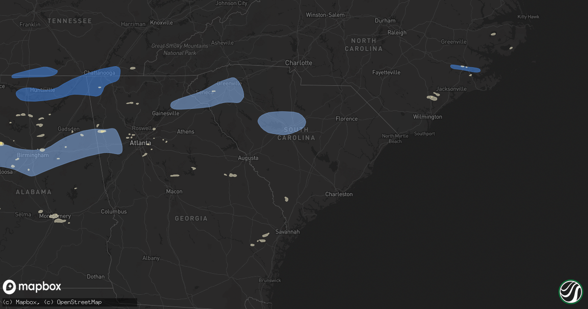
Hail Map in South Carolina on June 7, 2025
Get this storm
June 7 map
$229
one time, instant access
Download today. No call, no setup
Keep the $229
Bought the map and want the full workflow? Apply the entire $229 to a subscription within 7 days. None of it is wasted.
Every map, not just this one
This buys you this map. Subscription and you get every map we run, in the markets you choose from a few cities to whole states to nationwide. Plus real-time alerts the moment a storm fires.
Contact data
Name, contact info, occupancy, even credit band for addresses in the footprint. You go from where it hit to who to call.
Become the source they trust
Unlimited branding weather history reports on demand. You already have the documented answer ready for the property owner, and you are the one who showed up with it.
Property data and RoofTrace estimates
Pull up any address you have got, its value and the exact code rules for that jurisdiction, straight from One Click Code. Then RoofTrace estimates the squares, pitch, and roof value, priced the way you price.
Storm reports in South Carolina
South Carolina
| Date | Description |
|---|---|
| 06/07/20256:59 PM CDT | Mccormick county dispatch reported trees down throughout the county. Time estimated by radar. |
| 06/07/20256:59 PM CDT | Tree down across bennett street near east park avenue. |
| 06/07/20256:56 PM CDT | Fallen trees or limbs on powerlines. |
| 06/07/20256:55 PM CDT | Tree down on powerline in berea. |
| 06/07/20256:51 PM CDT | Several trees downed in the piedmont area. |
| 06/07/20256:50 PM CDT | Several trees down around pelzer... Including at least one on powerlines. |
| 06/07/20256:50 PM CDT | Multiple tress down around powdersville. |
| 06/07/20256:50 PM CDT | Several social media reports of trees downed in the abbeville area. |
| 06/07/20256:50 PM CDT | Mccormick county dispatch reported trees down throughout the county. Time estimated by radar. |
| 06/07/20256:46 PM CDT | Tree down across brushy creek rd. |
| 06/07/20256:46 PM CDT | Several trees down in honea path. |
| 06/07/20256:42 PM CDT | Tree down on powerline in belton. |
| 06/07/20256:41 PM CDT | Mccormick county dispatch reported trees down throughout the county. Time estimated by radar. |
| 06/07/20256:39 PM CDT | Several trees down in the antreville area. |
| 06/07/20256:36 PM CDT | Trees and powerlines down in liberty. |
| 06/07/20256:35 PM CDT | Several trees down along hwy 81 between i-85 and anderson. |
| 06/07/20256:30 PM CDT | Numerous large limbs downed in the centerville area. |
| 06/07/20256:30 PM CDT | Tree down in la france. |
| 06/07/20256:30 PM CDT | Trees and powerlines downed in the lowndesville area. |
| 06/07/20256:29 PM CDT | Several trees downed at shores of asbury rv park. |
| 06/07/20256:26 PM CDT | A local report indicates 64 MPH wind near 1 WNW Clemson |
| 06/07/20256:26 PM CDT | Trees and powerlines down in the iva area. |
| 06/07/20256:26 PM CDT | A local report indicates 60 MPH wind near 8 S Sedalia |
| 06/07/20256:26 PM CDT | A local report indicates 60 MPH wind near 4 WSW Anderson |
| 06/07/20256:24 PM CDT | Trees and powerlines down in the salem area. |
| 06/07/20256:21 PM CDT | Trees down on the southern end of lake keowee. |
| 06/07/20256:20 PM CDT | Multiple trees down in seneca. |
| 06/07/20256:19 PM CDT | Multiple trees and large limbs down in the west union area. |
| 06/07/20256:17 PM CDT | Several trees downed at springfield campground. |
| 06/07/20256:14 PM CDT | Several trees down along highway 11 between westminster and i-85. |
| 06/07/20256:11 PM CDT | Social media report of several trees down in the fair play area. |
| 06/06/20259:06 PM CDT | Sumter fire reported a tree on power line at guignard pkwy and poc |
| 06/06/20259:06 PM CDT | Sumter fire reported a tree on power line at guignard pkwy and pocalla rd. |
| 06/06/20258:57 PM CDT | Orangeburg county em reported tree down along vance rd. Time estimated based on radar. |
| 06/06/20258:53 PM CDT | Sumter fire dept reported a tree on power lines at the intersection of hwy 261 and mine hill rd. Time estimated by radar. |
| 06/06/20258:50 PM CDT | Orangeburg county em reports trees down at 3791 belleville road. Time estimated by radar. |
| 06/06/20258:48 PM CDT | Orangeburg county em reported trees down in the town of rowesville. Time estimated based on radar. |
| 06/06/20258:43 PM CDT | Bamberg county dispatch reported trees down on powerlines along heritage hwy in bamberg county. Time estimated by radar. |
| 06/06/20258:37 PM CDT | Orangeburg county em reported tree down at the intersection of sabb rd and shillings bridge rd. Time estimated based on radar. |
| 06/06/20258:37 PM CDT | Sc highway patrol reports trees blocking the roadway at the intersection of us 601 and mccord ferry rd. Time estimated by radar. |
| 06/06/20258:37 PM CDT | Orangeburg county em reports trees down at 299 beason rd. Time estimated by radar. |
| 06/06/20258:35 PM CDT | Orangeburg county em reported trees down at 7099 north rd. Time estimated based on radar. |
| 06/06/20258:30 PM CDT | Social media report of large trees limbs snapped in hopkins. |
| 06/06/20258:26 PM CDT | Orangeburg county em reported trees down at 5967 savannah highway. Time estimated based on radar. |
| 06/06/20258:19 PM CDT | Sc highway patrol reported trees down in the road along running fox rd. Time estimated by radar. |
| 06/06/20258:17 PM CDT | Nws employee estimated wind gusts to 60 mph in blythewood. |
| 06/06/20258:15 PM CDT | Sc highway patrol reports a tree down blocking the roadway on i77 and sc48. Time estimated by radar. |
| 06/06/20258:15 PM CDT | Barnwell dispatch reported numerous trees and power lines down across the county. |
| 06/06/20258:15 PM CDT | Orangeburg county em reported trees down at 1400 springfield rd. Time estimated based on radar. |
| 06/06/20258:11 PM CDT | Kcae recorded a peak wind gust of 60 mph at 9:11 pm. |
| 06/06/20258:08 PM CDT | Video posted on social media of numerous trees down along i20 near the broad river bridge on the richland county side. Trees were blocking the right two lanes of traffi |
| 06/06/20258:06 PM CDT | Sc highway patrol reports a tree down in the roadway at romain dr and cambout st. Time estimated by radar. |
| 06/06/20258:03 PM CDT | Sc highway patrol reports a tree down in the roadway at i20 and sunset blvd. Time estimated by radar. |
| 06/06/20257:57 PM CDT | Sc highway patrol reports powerlines down blocking the roadway along north lake dr. Time estimated by radar. |
| 06/06/20257:57 PM CDT | Fairfield county dispatch reported numerous trees down throughout the county. Time estimated by radar. |
| 06/06/20257:55 PM CDT | Multiple trees down. |
| 06/06/20257:55 PM CDT | Trained spotter estimated wind gusts near 60 mph in the persimmon grove neighborhood in lexington. Time estimated by radar. |
| 06/06/20257:53 PM CDT | Sc highway patrol reports a tree down along pet sites rd. Time estimated by radar. |
| 06/06/20257:51 PM CDT | Multiple trees down on powerlines. |
| 06/06/20257:50 PM CDT | Multiple trees d |
| 06/06/20257:50 PM CDT | Multiple trees down on powerlines. |
| 06/06/20257:50 PM CDT | Aiken county em office reported a tree down at the intersection of nazarene rd and wire rd. Time estimated by radar. |
| 06/06/20257:47 PM CDT | Sc highway patrol reports a tree down at the intersection of amicks ferry rd and lake tide dr. Time estimated by radar. |
| 06/06/20257:45 PM CDT | Multiple trees down on powerlines. |
| 06/06/20257:40 PM CDT | Multiple trees and powerlines down. |
| 06/06/20257:39 PM CDT | Aiken county em reported numerous trees and powerlines in the graniteville area of aiken county. Time estimated by radar. |
| 06/06/20257:36 PM CDT | Sc highway patrol reports a tree down at the intersection of us 378 and spann rd. Time estimated by radar. |
| 06/06/20257:36 PM CDT | Sc highway patrol reports a tree down along i20. Time estimated by radar. |
| 06/06/20257:36 PM CDT | Trees down. |
| 06/06/20257:35 PM CDT | Multiple trees and powerlines down. |
| 06/06/20257:34 PM CDT | Sc highway patrol reports a tree down along i20. Time estimated by radar. |
| 06/06/20257:34 PM CDT | Aiken county em reported numerous trees and powerlines in the clearwater are of aiken county. Time estimated by radar. |
| 06/06/20257:32 PM CDT | Public reports widespread tree and powerline damage throughout newberry county. Time estimated by radar. |
| 06/06/20257:29 PM CDT | Aiken county em office reports trees down at the intersection of hammond dr and woodlawn avenue. Time estimated by radar. |
| 06/06/20257:25 PM CDT | Multiple trees down in joanna. |
| 06/06/20257:25 PM CDT | Edgefield county dispatch reported trees down along hwy 25 north. Time estimated by radar. |
| 06/06/20257:22 PM CDT | Public reports widespread trees and powerlines down across saluda county. Time estimated based on radar. |
| 06/06/20257:16 PM CDT | Sc highway patrol reported trees down at the intersection of sc 39 and sc 34. Time estimated by radar. |
| 06/06/20257:15 PM CDT | Multiple trees and limbs down on multiple roads including highway 76. |
| 06/06/20257:10 PM CDT | Edgefield county dispatch reports trees down along hwy 378 in edgefield county. Time estimated by radar. |
| 06/06/20257:10 PM CDT | Edgefield county dispatch reported trees down along republican rd. Time estimated by radar. |
| 06/06/20257:08 PM CDT | Several trees downed in the ninety six area. |
| 06/06/20257:07 PM CDT | Edgefield county dispatch reported trees down along red hill rd. Time estimated by radar. |
| 06/06/20257:06 PM CDT | Trees and powerlines down in the lake greenwood area. |
| 06/06/20257:00 PM CDT | Multiple trees and tree limbs down on road. |
| 06/06/20257:00 PM CDT | Trees... Large limbs and powerlines downed around the greenwood area. |
All States Impacted by Hail Map on June 7, 2025
Cities Impacted by Hail Map on June 7, 2025
- Bradford, AR
- Bald Knob, AR
- Russell, AR
- Hackett, AR
- Cameron, OK
- White Deer, TX
- Augusta, AR
- Clarksville, AR
- Heavener, OK
- Huntington, AR
- Hartford, AR
- Greenwood, AR
- Midland, AR
- Lamar, AR
- Groom, TX
- Knoxville, AR
- London, AR
- McCrory, AR
- Mena, AR
- Hatfield, AR
- Hickory Ridge, AR
- Wynne, AR
- Pampa, TX
- Colt, AR
- Fisher, AR
- Harrisburg, AR
- Cherry Valley, AR
- Lonoke, AR
- Scott, AR
- North Little Rock, AR
- Memphis, TN
- Millington, TN
- Walls, MS
- Horn Lake, MS
- Arlington, TN
- Bolivar, TN
- Whiteville, TN
- Houlka, MS
- Pontotoc, MS
- Randolph, MS
- Oxford, MS
- Thaxton, MS
- Houston, MS
- Okolona, MS
- Aberdeen, MS
- Prairie, MS
- Sulligent, AL
- Amory, MS
- Senatobia, MS
- Coldwater, MS
- Holly Springs, MS
- Sardis, MS
- Como, MS
- Waterford, MS
- Abbeville, MS
- Potts Camp, MS
- Hickory Flat, MS
- Batesville, MS
- Myrtle, MS
- New Albany, MS
- Blue Mountain, MS
- Blue Springs, MS
- Guntown, MS
- Etta, MS
- Ecru, MS
- Shannon, MS
- Belden, MS
- University, MS
- Taylor, MS
- Tupelo, MS
- Paris, MS
- Banner, MS
- Vardaman, MS
- Water Valley, MS
- Bruce, MS
- Pittsboro, MS
- Nettleton, MS
- Smithville, MS
- Plantersville, MS
- Greenwood Springs, MS
- Gattman, MS
- Detroit, AL
- Caledonia, MS
- Hamilton, MS
- Beaverton, AL
- Columbus, MS
- Guin, AL
- Vernon, AL
- Millport, AL
- West Point, MS
- Kilmichael, MS
- Winfield, AL
- Fayette, AL
- Reform, AL
- Kennedy, AL
- Steens, MS
- Bankston, AL
- Carbon Hill, AL
- Berry, AL
- Gordo, AL
- Northport, AL
- Elrod, AL
- Echola, AL
- Double Springs, AL
- Addison, AL
- Houston, AL
- Vinemont, AL
- Parrish, AL
- Oakman, AL
- Cullman, AL
- Blountsville, AL
- Hayden, AL
- Guntersville, AL
- Hanceville, AL
- Cordova, AL
- Townley, AL
- Tanner, AL
- Athens, AL
- Decatur, AL
- Hillsboro, AL
- Trinity, AL
- Madison, AL
- Huntsville, AL
- Harvest, AL
- Laceys Spring, AL
- Somerville, AL
- Union Grove, AL
- Valhermoso Springs, AL
- Anderson, AL
- Lester, AL
- Minor Hill, TN
- Lexington, AL
- Five Points, TN
- Taft, TN
- Ardmore, TN
- Fayetteville, TN
- Prospect, TN
- Dellrose, TN
- Elkmont, AL
- Toney, AL
- Hazel Green, AL
- Ardmore, AL
- Trafford, AL
- Remlap, AL
- Locust Fork, AL
- Bessemer, AL
- Adger, AL
- Holly Pond, AL
- Quinton, AL
- Coker, AL
- Buhl, AL
- McCalla, AL
- Brookwood, AL
- Tuscaloosa, AL
- Woodstock, AL
- Vance, AL
- West Blocton, AL
- Cottondale, AL
- Pleasant Grove, AL
- Adamsville, AL
- Birmingham, AL
- Docena, AL
- Dolomite, AL
- Mulga, AL
- Fairfield, AL
- Mount Olive, AL
- Fultondale, AL
- Graysville, AL
- Elora, TN
- Flintville, TN
- Kelso, TN
- Huntland, TN
- New Market, AL
- Cleveland, AL
- Oneonta, AL
- Owens Cross Roads, AL
- Gurley, AL
- Paint Rock, AL
- Woodville, AL
- New Hope, AL
- Brownsboro, AL
- Grant, AL
- Scottsboro, AL
- Leeds, AL
- Moody, AL
- Trussville, AL
- Montevallo, AL
- Brierfield, AL
- Columbiana, AL
- Sterrett, AL
- Alabaster, AL
- Chelsea, AL
- Vandiver, AL
- Pelham, AL
- Calera, AL
- Wilsonville, AL
- Pell City, AL
- Helena, AL
- Hollywood, AL
- Dutton, AL
- Harpersville, AL
- Vincent, AL
- Ohatchee, AL
- Raton, NM
- Gadsden, AL
- Cedartown, GA
- Talladega, AL
- Lincoln, AL
- Chickamauga, GA
- Jacksonville, AL
- Piedmont, AL
- Valley Head, AL
- Mentone, AL
- Henagar, AL
- Pisgah, AL
- Menlo, GA
- Guild, TN
- Chattanooga, TN
- Trenton, GA
- Wildwood, GA
- Ider, AL
- Bryant, AL
- Flat Rock, AL
- Stevenson, AL
- Higdon, AL
- Whitwell, TN
- Lookout Mountain, GA
- Rising Fawn, GA
- South Pittsburg, TN
- Fackler, AL
- Jasper, TN
- Bridgeport, AL
- Trenton, AL
- Hollytree, AL
- Cave Spring, GA
- Engelhard, NC
- La Fayette, GA
- Hixson, TN
- Rossville, GA
- Lookout Mountain, TN
- Flintstone, GA
- Whiteside, TN
- Lupton City, TN
- Rock Spring, GA
- Ringgold, GA
- Fort Oglethorpe, GA
- Trion, GA
- Eastaboga, AL
- Riverside, AL
- Bowdon, GA
- Ranburne, AL
- Alpine, AL
- Tallapoosa, GA
- Waco, GA
- Bremen, GA
- Oxford, AL
- Carrollton, GA
- Delta, AL
- Heflin, AL
- Childersburg, AL
- Munford, AL
- Muscadine, AL
- Cropwell, AL
- Anniston, AL
- Rockmart, GA
- Weaver, AL
- Ragland, AL
- Buchanan, GA
- Alexandria, AL
- Fruithurst, AL
- Odenville, AL
- Wellington, AL
- Ashville, AL
- Springville, AL
- Lineville, AL
- Jonesboro, GA
- Jamestown, ND
- Ooltewah, TN
- Harrison, TN
- McDonald, TN
- Dalton, GA
- Tunnel Hill, GA
- Apison, TN
- Cohutta, GA
- Cleveland, TN
- Temple, GA
- Dallas, GA
- Villa Rica, GA
- Courtenay, ND
- Wimbledon, ND
- Des Moines, NM
- Capulin, NM
- Stockbridge, GA
- Hiram, GA
- Douglasville, GA
- Powder Springs, GA
- Whitesburg, GA
- Winston, GA
- Cove City, NC
- Trenton, NC
- Cooperstown, ND
- Finley, ND
- Sharon, ND
- Spiritwood, ND
- Jasper, GA
- Ranger, GA
- Talking Rock, GA
- Palmetto, GA
- New Bern, NC
- Hope, ND
- Portland, ND
- Edgeley, ND
- Smyrna, GA
- Grantsboro, NC
- Austell, GA
- Clarkdale, GA
- Maple Hill, NC
- Mableton, GA
- Burgaw, NC
- Marietta, GA
- Duluth, GA
- Willard, NC
- Loganville, GA
- Lilburn, GA
- Snellville, GA
- Marathon, TX
- Grenville, NM
- Lawrenceville, GA
- Suwanee, GA
- Creswell, NC
- Eatonton, GA
- Sparta, GA
- Rocky Point, NC
- Hillsboro, ND
- Shelly, MN
- Caledonia, ND
- Halstad, MN
- Ada, MN
- Clayton, NM
- Wrens, GA
- Avera, GA
- Louisville, GA
- Stapleton, GA
- Springer, NM
- Lula, GA
- Baldwin, GA
- Homer, GA
- Cornelia, GA
- Alto, GA
- Demorest, GA
- Mount Airy, GA
- Maysville, GA
- Gillsville, GA
- Cleveland, GA
- Eastanollee, GA
- Toccoa, GA
- Westminster, SC
- Martin, GA
- Carnesville, GA
- Seneca, SC
- Townville, SC
- Canon, GA
- Anderson, SC
- Lavonia, GA
- Bowersville, GA
- Hartwell, GA
- Fair Play, SC
- Liberty, SC
- Central, SC
- Clemson, SC
- Pendleton, SC
- Six Mile, SC
- Norris, SC
- Piedmont, SC
- Pelzer, SC
- Belton, SC
- Williamston, SC
- Easley, SC
- Keysville, GA
- Pickens, SC
- Greenville, SC
- Simpsonville, SC
- Honea Path, SC
- Ware Shoals, SC
- Fountain Inn, SC
- Sedan, NM
- Stuttgart, AR
- Ludowici, GA
- Waynesboro, GA
- Taylors, SC
- Gray Court, SC
- Mauldin, SC
- Greer, SC
- Laurens, SC
- De Soto, MO
- Pinecrest, CA
- Hinesville, GA
- Fletcher, MO
- Umpire, AR
- Dierks, AR
- Delight, AR
- Broken Bow, OK
- Glennville, GA
- Dittmer, MO
- Richwoods, MO
- Gladstone, NM
- De Valls Bluff, AR
- Roe, AR
- Holly Grove, AR
- Clarendon, AR
- Valmeyer, IL
- Fort Stewart, GA
- Waterloo, IL
- Fults, IL
- Amistad, NM
- Malvern, AR
- Woodruff, SC
- Hernando, MS
- Lexa, AR
- Marianna, AR
- Tunica, MS
- Robinsonville, MS
- Lake Cormorant, MS
- West Helena, AR
- Poplar Grove, AR
- Long Barn, CA
- Prattsville, AR
- Lexington, SC
- West Columbia, SC
- Saluda, SC
- Gilbert, SC
- Leesville, SC
- Chapin, SC
- Prosperity, SC
- Newberry, SC
- Silverstreet, SC
- Cayce, SC
- Pomaria, SC
- Little Mountain, SC
- Columbia, SC
- Batesburg, SC
- Gaston, SC
- Blythewood, SC
- Winnsboro, SC
- Jenkinsville, SC
- Irmo, SC
- Ridgeway, SC
- Mosquero, NM
- De Queen, AR
- Elgin, SC
- Lugoff, SC
- Hopkins, SC
- Lockesburg, AR
- Widener, AR
- Forrest City, AR
- Sledge, MS
- Heth, AR
- Dundee, MS
- Madison, AR
- Maxwell, NM
- Varnville, SC
- Estill, SC
- Pineland, SC
- Nara Visa, NM
- Crenshaw, MS
- Proctor, AR
- Hughes, AR
- Dalhart, TX
- Channing, TX
- Adrian, TX
- Marion, AR
- West Memphis, AR
- Nashville, AR
- Mineral Springs, AR
- Edmondson, AR
- Eagletown, OK
- Ozan, AR
- Columbus, AR
- Washington, AR
- Somerville, TN
- Vega, TX
- Fulton, AR
- Marietta, OK
- Coahoma, MS
- Helena, AR
- Rule, TX
- Stamford, TX
- Haskell, TX
- Hope, AR
- Marks, MS
- Whitesboro, TX
- Winthrop, AR
- Kingston, OK
- Lebanon, OK
- Fordyce, AR
- Avoca, TX
- Buckner, AR
- Rosston, AR
- Emmet, AR
- Albany, TX
- Lueders, TX
- Sadler, TX
- Courtland, MS
- Enid, MS
- Pope, MS
- Sherman, TX
- Waldo, AR
- Wilton, AR
- Ashdown, AR
- Oakland, MS
- Coffeeville, MS
- Banks, AR
- Warren, AR
- Thornton, AR
- Howe, TX
- Throckmorton, TX
- Horatio, AR
- McNeil, AR
- Hillsboro, GA
- Texarkana, AR
- Whitewright, TX
- Tom Bean, TX
- Bells, TX
- Newcastle, TX
- Moran, TX
- Van Alstyne, TX
- Lewisville, AR
- Baird, TX
- Trenton, TX
- Blue Ridge, TX
- Leonard, TX
- Stamps, AR
- Anna, TX
- Magnolia, AR
- Logan, NM
- Hartley, TX
- Taylor, AR
- Celeste, TX
- Emerson, AR
- Woodland, MS
- Shongaloo, LA
- Pottsboro, TX
- Haynesville, LA
- Stinnett, TX
- Tillatoba, MS
- Cedarbluff, MS
- Maben, MS
- Amarillo, TX
- Wildorado, TX
- Pheba, MS
- Mantee, MS
- Canyon, TX
- Lisbon, LA
- Eupora, MS
- Bellefontaine, MS
- Bernice, LA
- Happy, TX
- Crawford, MS
- Starkville, MS
- Hendrix, OK
- Ravenna, TX
- Hereford, TX
- Bennington, OK
- Wayside, TX
- Tulia, TX
- Claude, TX
- Silverton, TX
- Boswell, OK
- Reliance, TN
- Brooksville, MS
- Macon, MS
- Aliceville, AL
- Hugo, OK
- Boligee, AL
- Autaugaville, AL
- Prattville, AL
- Eutaw, AL
- Stewart, MS
- Soper, OK
- Alexander City, AL
- Jacksons Gap, AL
- Livingston, AL
- Forkland, AL
- Akron, AL
- Sawyerville, AL
- Louisville, MS
- Montgomery, AL
- Greensboro, AL
- Stone Mountain, GA
- Abernathy, TX
- Emporia, VA
- Idalou, TX
- Gallion, AL
- Floydada, TX
- Jarratt, VA
- Freeman, VA
- Newbern, AL
- Uniontown, AL
- Faunsdale, AL
- Drewryville, VA
- Capron, VA
- Pike Road, AL
- Crosbyton, TX
- Lorenzo, TX
- Ralls, TX
- Spur, TX
- Post, TX
- Mathews, AL
- Lithonia, GA
- Saratoga, AR
- Seymour, TX
- Knox City, TX
- Ellenwood, GA
- Decatur, GA
- Monroe, GA
- Covington, GA
- O'Brien, TX
- Snyder, TX
- Fitzpatrick, AL
- Justiceburg, TX
- Girard, TX
- Weinert, TX


