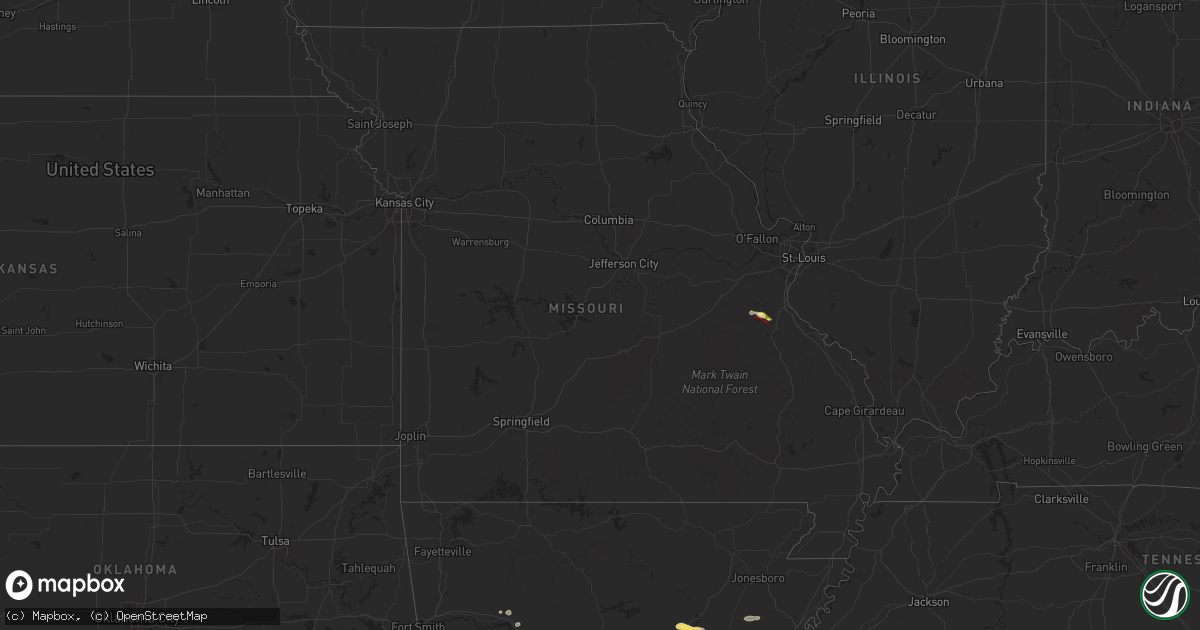
Hail Map in Missouri on June 7, 2025
Get this storm
June 7 map
$229
one time, instant access
Download today. No call, no setup
Keep the $229
Bought the map and want the full workflow? Apply the entire $229 to a subscription within 7 days. None of it is wasted.
Every map, not just this one
This buys you this map. Subscription and you get every map we run, in the markets you choose from a few cities to whole states to nationwide. Plus real-time alerts the moment a storm fires.
Contact data
Name, contact info, occupancy, even credit band for addresses in the footprint. You go from where it hit to who to call.
Become the source they trust
Unlimited branding weather history reports on demand. You already have the documented answer ready for the property owner, and you are the one who showed up with it.
Property data and RoofTrace estimates
Pull up any address you have got, its value and the exact code rules for that jurisdiction, straight from One Click Code. Then RoofTrace estimates the squares, pitch, and roof value, priced the way you price.
Storm reports in Missouri
Missouri
| Date | Description |
|---|---|
| 06/06/202510:31 PM CDT | Significant tree damage near the intersection of hwy y and hwy w. Multiple trees down across roadways and powerlines. |
| 06/06/202510:30 PM CDT | Tree reported down on power lines and on fire just near fruitland. Residential gas leak reported just west of fruitland. Times estimated via radar. |
| 06/06/202510:23 PM CDT | An ef-1 tornado with estimated peak winds of 107 mph did considerable tree damage along a west to east path along state highway y east of jackson... Mo. Several trees w |
| 06/06/20259:53 PM CDT | In this area along county road 510 there are two pole barns with roofs removed... An older barn completely destroyed... And a mobile home moved off its foundation... An |
| 06/06/20259:52 PM CDT | An ef-1 tornado with peak winds of 100 mph damaged two pole barns... Destroyed a large barn... And shifted a manufactured home several feet off its foundation along an |
| 06/06/20257:14 PM CDT | A local report indicates 1.00 inch wind near 3 SW De Soto |
| 06/06/20257:10 PM CDT | Minor damage to homes reported. Possible tornado damage... Survey will be planned. |
| 06/06/20257:08 PM CDT | Nws storm survey concluded an ef-1 tornado touched down in southern jefferson county. The tornado had max winds of 105mph... Was 4.9 miles long... And had a maximum wid |
All States Impacted by Hail Map on June 7, 2025
Cities Impacted by Hail Map on June 7, 2025
- Bradford, AR
- Bald Knob, AR
- Russell, AR
- Hackett, AR
- Cameron, OK
- White Deer, TX
- Augusta, AR
- Clarksville, AR
- Heavener, OK
- Huntington, AR
- Hartford, AR
- Greenwood, AR
- Midland, AR
- Lamar, AR
- Groom, TX
- Knoxville, AR
- London, AR
- McCrory, AR
- Mena, AR
- Hatfield, AR
- Hickory Ridge, AR
- Wynne, AR
- Pampa, TX
- Colt, AR
- Fisher, AR
- Harrisburg, AR
- Cherry Valley, AR
- Lonoke, AR
- Scott, AR
- North Little Rock, AR
- Memphis, TN
- Millington, TN
- Walls, MS
- Horn Lake, MS
- Arlington, TN
- Bolivar, TN
- Whiteville, TN
- Houlka, MS
- Pontotoc, MS
- Randolph, MS
- Oxford, MS
- Thaxton, MS
- Houston, MS
- Okolona, MS
- Aberdeen, MS
- Prairie, MS
- Sulligent, AL
- Amory, MS
- Senatobia, MS
- Coldwater, MS
- Holly Springs, MS
- Sardis, MS
- Como, MS
- Waterford, MS
- Abbeville, MS
- Potts Camp, MS
- Hickory Flat, MS
- Batesville, MS
- Myrtle, MS
- New Albany, MS
- Blue Mountain, MS
- Blue Springs, MS
- Guntown, MS
- Etta, MS
- Ecru, MS
- Shannon, MS
- Belden, MS
- University, MS
- Taylor, MS
- Tupelo, MS
- Paris, MS
- Banner, MS
- Vardaman, MS
- Water Valley, MS
- Bruce, MS
- Pittsboro, MS
- Nettleton, MS
- Smithville, MS
- Plantersville, MS
- Greenwood Springs, MS
- Gattman, MS
- Detroit, AL
- Caledonia, MS
- Hamilton, MS
- Beaverton, AL
- Columbus, MS
- Guin, AL
- Vernon, AL
- Millport, AL
- West Point, MS
- Kilmichael, MS
- Winfield, AL
- Fayette, AL
- Reform, AL
- Kennedy, AL
- Steens, MS
- Bankston, AL
- Carbon Hill, AL
- Berry, AL
- Gordo, AL
- Northport, AL
- Elrod, AL
- Echola, AL
- Double Springs, AL
- Addison, AL
- Houston, AL
- Vinemont, AL
- Parrish, AL
- Oakman, AL
- Cullman, AL
- Blountsville, AL
- Hayden, AL
- Guntersville, AL
- Hanceville, AL
- Cordova, AL
- Townley, AL
- Tanner, AL
- Athens, AL
- Decatur, AL
- Hillsboro, AL
- Trinity, AL
- Madison, AL
- Huntsville, AL
- Harvest, AL
- Laceys Spring, AL
- Somerville, AL
- Union Grove, AL
- Valhermoso Springs, AL
- Anderson, AL
- Lester, AL
- Minor Hill, TN
- Lexington, AL
- Five Points, TN
- Taft, TN
- Ardmore, TN
- Fayetteville, TN
- Prospect, TN
- Dellrose, TN
- Elkmont, AL
- Toney, AL
- Hazel Green, AL
- Ardmore, AL
- Trafford, AL
- Remlap, AL
- Locust Fork, AL
- Bessemer, AL
- Adger, AL
- Holly Pond, AL
- Quinton, AL
- Coker, AL
- Buhl, AL
- McCalla, AL
- Brookwood, AL
- Tuscaloosa, AL
- Woodstock, AL
- Vance, AL
- West Blocton, AL
- Cottondale, AL
- Pleasant Grove, AL
- Adamsville, AL
- Birmingham, AL
- Docena, AL
- Dolomite, AL
- Mulga, AL
- Fairfield, AL
- Mount Olive, AL
- Fultondale, AL
- Graysville, AL
- Elora, TN
- Flintville, TN
- Kelso, TN
- Huntland, TN
- New Market, AL
- Cleveland, AL
- Oneonta, AL
- Owens Cross Roads, AL
- Gurley, AL
- Paint Rock, AL
- Woodville, AL
- New Hope, AL
- Brownsboro, AL
- Grant, AL
- Scottsboro, AL
- Leeds, AL
- Moody, AL
- Trussville, AL
- Montevallo, AL
- Brierfield, AL
- Columbiana, AL
- Sterrett, AL
- Alabaster, AL
- Chelsea, AL
- Vandiver, AL
- Pelham, AL
- Calera, AL
- Wilsonville, AL
- Pell City, AL
- Helena, AL
- Hollywood, AL
- Dutton, AL
- Harpersville, AL
- Vincent, AL
- Ohatchee, AL
- Raton, NM
- Gadsden, AL
- Cedartown, GA
- Talladega, AL
- Lincoln, AL
- Chickamauga, GA
- Jacksonville, AL
- Piedmont, AL
- Valley Head, AL
- Mentone, AL
- Henagar, AL
- Pisgah, AL
- Menlo, GA
- Guild, TN
- Chattanooga, TN
- Trenton, GA
- Wildwood, GA
- Ider, AL
- Bryant, AL
- Flat Rock, AL
- Stevenson, AL
- Higdon, AL
- Whitwell, TN
- Lookout Mountain, GA
- Rising Fawn, GA
- South Pittsburg, TN
- Fackler, AL
- Jasper, TN
- Bridgeport, AL
- Trenton, AL
- Hollytree, AL
- Cave Spring, GA
- Engelhard, NC
- La Fayette, GA
- Hixson, TN
- Rossville, GA
- Lookout Mountain, TN
- Flintstone, GA
- Whiteside, TN
- Lupton City, TN
- Rock Spring, GA
- Ringgold, GA
- Fort Oglethorpe, GA
- Trion, GA
- Eastaboga, AL
- Riverside, AL
- Bowdon, GA
- Ranburne, AL
- Alpine, AL
- Tallapoosa, GA
- Waco, GA
- Bremen, GA
- Oxford, AL
- Carrollton, GA
- Delta, AL
- Heflin, AL
- Childersburg, AL
- Munford, AL
- Muscadine, AL
- Cropwell, AL
- Anniston, AL
- Rockmart, GA
- Weaver, AL
- Ragland, AL
- Buchanan, GA
- Alexandria, AL
- Fruithurst, AL
- Odenville, AL
- Wellington, AL
- Ashville, AL
- Springville, AL
- Lineville, AL
- Jonesboro, GA
- Jamestown, ND
- Ooltewah, TN
- Harrison, TN
- McDonald, TN
- Dalton, GA
- Tunnel Hill, GA
- Apison, TN
- Cohutta, GA
- Cleveland, TN
- Temple, GA
- Dallas, GA
- Villa Rica, GA
- Courtenay, ND
- Wimbledon, ND
- Des Moines, NM
- Capulin, NM
- Stockbridge, GA
- Hiram, GA
- Douglasville, GA
- Powder Springs, GA
- Whitesburg, GA
- Winston, GA
- Cove City, NC
- Trenton, NC
- Cooperstown, ND
- Finley, ND
- Sharon, ND
- Spiritwood, ND
- Jasper, GA
- Ranger, GA
- Talking Rock, GA
- Palmetto, GA
- New Bern, NC
- Hope, ND
- Portland, ND
- Edgeley, ND
- Smyrna, GA
- Grantsboro, NC
- Austell, GA
- Clarkdale, GA
- Maple Hill, NC
- Mableton, GA
- Burgaw, NC
- Marietta, GA
- Duluth, GA
- Willard, NC
- Loganville, GA
- Lilburn, GA
- Snellville, GA
- Marathon, TX
- Grenville, NM
- Lawrenceville, GA
- Suwanee, GA
- Creswell, NC
- Eatonton, GA
- Sparta, GA
- Rocky Point, NC
- Hillsboro, ND
- Shelly, MN
- Caledonia, ND
- Halstad, MN
- Ada, MN
- Clayton, NM
- Wrens, GA
- Avera, GA
- Louisville, GA
- Stapleton, GA
- Springer, NM
- Lula, GA
- Baldwin, GA
- Homer, GA
- Cornelia, GA
- Alto, GA
- Demorest, GA
- Mount Airy, GA
- Maysville, GA
- Gillsville, GA
- Cleveland, GA
- Eastanollee, GA
- Toccoa, GA
- Westminster, SC
- Martin, GA
- Carnesville, GA
- Seneca, SC
- Townville, SC
- Canon, GA
- Anderson, SC
- Lavonia, GA
- Bowersville, GA
- Hartwell, GA
- Fair Play, SC
- Liberty, SC
- Central, SC
- Clemson, SC
- Pendleton, SC
- Six Mile, SC
- Norris, SC
- Piedmont, SC
- Pelzer, SC
- Belton, SC
- Williamston, SC
- Easley, SC
- Keysville, GA
- Pickens, SC
- Greenville, SC
- Simpsonville, SC
- Honea Path, SC
- Ware Shoals, SC
- Fountain Inn, SC
- Sedan, NM
- Stuttgart, AR
- Ludowici, GA
- Waynesboro, GA
- Taylors, SC
- Gray Court, SC
- Mauldin, SC
- Greer, SC
- Laurens, SC
- De Soto, MO
- Pinecrest, CA
- Hinesville, GA
- Fletcher, MO
- Umpire, AR
- Dierks, AR
- Delight, AR
- Broken Bow, OK
- Glennville, GA
- Dittmer, MO
- Richwoods, MO
- Gladstone, NM
- De Valls Bluff, AR
- Roe, AR
- Holly Grove, AR
- Clarendon, AR
- Valmeyer, IL
- Fort Stewart, GA
- Waterloo, IL
- Fults, IL
- Amistad, NM
- Malvern, AR
- Woodruff, SC
- Hernando, MS
- Lexa, AR
- Marianna, AR
- Tunica, MS
- Robinsonville, MS
- Lake Cormorant, MS
- West Helena, AR
- Poplar Grove, AR
- Long Barn, CA
- Prattsville, AR
- Lexington, SC
- West Columbia, SC
- Saluda, SC
- Gilbert, SC
- Leesville, SC
- Chapin, SC
- Prosperity, SC
- Newberry, SC
- Silverstreet, SC
- Cayce, SC
- Pomaria, SC
- Little Mountain, SC
- Columbia, SC
- Batesburg, SC
- Gaston, SC
- Blythewood, SC
- Winnsboro, SC
- Jenkinsville, SC
- Irmo, SC
- Ridgeway, SC
- Mosquero, NM
- De Queen, AR
- Elgin, SC
- Lugoff, SC
- Hopkins, SC
- Lockesburg, AR
- Widener, AR
- Forrest City, AR
- Sledge, MS
- Heth, AR
- Dundee, MS
- Madison, AR
- Maxwell, NM
- Varnville, SC
- Estill, SC
- Pineland, SC
- Nara Visa, NM
- Crenshaw, MS
- Proctor, AR
- Hughes, AR
- Dalhart, TX
- Channing, TX
- Adrian, TX
- Marion, AR
- West Memphis, AR
- Nashville, AR
- Mineral Springs, AR
- Edmondson, AR
- Eagletown, OK
- Ozan, AR
- Columbus, AR
- Washington, AR
- Somerville, TN
- Vega, TX
- Fulton, AR
- Marietta, OK
- Coahoma, MS
- Helena, AR
- Rule, TX
- Stamford, TX
- Haskell, TX
- Hope, AR
- Marks, MS
- Whitesboro, TX
- Winthrop, AR
- Kingston, OK
- Lebanon, OK
- Fordyce, AR
- Avoca, TX
- Buckner, AR
- Rosston, AR
- Emmet, AR
- Albany, TX
- Lueders, TX
- Sadler, TX
- Courtland, MS
- Enid, MS
- Pope, MS
- Sherman, TX
- Waldo, AR
- Wilton, AR
- Ashdown, AR
- Oakland, MS
- Coffeeville, MS
- Banks, AR
- Warren, AR
- Thornton, AR
- Howe, TX
- Throckmorton, TX
- Horatio, AR
- McNeil, AR
- Hillsboro, GA
- Texarkana, AR
- Whitewright, TX
- Tom Bean, TX
- Bells, TX
- Newcastle, TX
- Moran, TX
- Van Alstyne, TX
- Lewisville, AR
- Baird, TX
- Trenton, TX
- Blue Ridge, TX
- Leonard, TX
- Stamps, AR
- Anna, TX
- Magnolia, AR
- Logan, NM
- Hartley, TX
- Taylor, AR
- Celeste, TX
- Emerson, AR
- Woodland, MS
- Shongaloo, LA
- Pottsboro, TX
- Haynesville, LA
- Stinnett, TX
- Tillatoba, MS
- Cedarbluff, MS
- Maben, MS
- Amarillo, TX
- Wildorado, TX
- Pheba, MS
- Mantee, MS
- Canyon, TX
- Lisbon, LA
- Eupora, MS
- Bellefontaine, MS
- Bernice, LA
- Happy, TX
- Crawford, MS
- Starkville, MS
- Hendrix, OK
- Ravenna, TX
- Hereford, TX
- Bennington, OK
- Wayside, TX
- Tulia, TX
- Claude, TX
- Silverton, TX
- Boswell, OK
- Reliance, TN
- Brooksville, MS
- Macon, MS
- Aliceville, AL
- Hugo, OK
- Boligee, AL
- Autaugaville, AL
- Prattville, AL
- Eutaw, AL
- Stewart, MS
- Soper, OK
- Alexander City, AL
- Jacksons Gap, AL
- Livingston, AL
- Forkland, AL
- Akron, AL
- Sawyerville, AL
- Louisville, MS
- Montgomery, AL
- Greensboro, AL
- Stone Mountain, GA
- Abernathy, TX
- Emporia, VA
- Idalou, TX
- Gallion, AL
- Floydada, TX
- Jarratt, VA
- Freeman, VA
- Newbern, AL
- Uniontown, AL
- Faunsdale, AL
- Drewryville, VA
- Capron, VA
- Pike Road, AL
- Crosbyton, TX
- Lorenzo, TX
- Ralls, TX
- Spur, TX
- Post, TX
- Mathews, AL
- Lithonia, GA
- Saratoga, AR
- Seymour, TX
- Knox City, TX
- Ellenwood, GA
- Decatur, GA
- Monroe, GA
- Covington, GA
- O'Brien, TX
- Snyder, TX
- Fitzpatrick, AL
- Justiceburg, TX
- Girard, TX
- Weinert, TX


