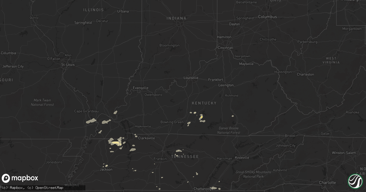
Hail Map in Kentucky on June 6, 2025
Get this storm
June 6 map
$229
one time, instant access
Download today. No call, no setup
Keep the $229
Bought the map and want the full workflow? Apply the entire $229 to a subscription within 7 days. None of it is wasted.
Every map, not just this one
This buys you this map. Subscription and you get every map we run, in the markets you choose from a few cities to whole states to nationwide. Plus real-time alerts the moment a storm fires.
Contact data
Name, contact info, occupancy, even credit band for addresses in the footprint. You go from where it hit to who to call.
Become the source they trust
Unlimited branding weather history reports on demand. You already have the documented answer ready for the property owner, and you are the one who showed up with it.
Property data and RoofTrace estimates
Pull up any address you have got, its value and the exact code rules for that jurisdiction, straight from One Click Code. Then RoofTrace estimates the squares, pitch, and roof value, priced the way you price.
Storm reports in Kentucky
Kentucky
| Date | Description |
|---|---|
| 06/06/20252:54 PM CDT | A laurel county deputy reported a downed tree along school street in east bernstadt to the county 911 dispatch. Time estimated via radar. |
| 06/06/20252:28 PM CDT | Pulaski county 911 reports trees down along white lily church road. Time estimated via radar. |
| 06/06/20252:14 PM CDT | Pulaski county 911 reports downed trees in the 1800 block of ky 192. Time estimated via radar. |
| 06/06/20252:06 PM CDT | Rockcastle county dispatch reports downed trees along sinking valley springs road. Time estimated via radar. |
| 06/06/20252:03 PM CDT | Rockcastle county dispatch reports trees down along chestnut grove road. Time estimated via radar. |
| 06/06/20252:03 PM CDT | Rockcastle county dispatch reports downed trees along buffalo hollow road. Time estimated via radar. |
| 06/06/20251:52 PM CDT | Large branches snapped at 300 turner ridge rd. Time estimated from radar. |
| 06/06/20251:50 PM CDT | Large tree limb was blocking one lane of us-127. |
| 06/06/20251:42 PM CDT | Report tree down blocking gilberts creek rd. |
| 06/06/20251:39 PM CDT | Corrects previous non-tstm wnd dmg report from 1 s glens fork. Report of tree down. |
| 06/06/20251:37 PM CDT | Report of power lines down around the danville ave and lee dr. |
| 06/06/20251:30 PM CDT | 61 mph gust measured at the adair county ky mesonet site. |
| 06/06/20251:18 PM CDT | Reports of trees down. |
| 06/06/20251:07 PM CDT | Reports of multiple trees down along ebenezer rd. |
| 06/06/202512:32 PM CDT | Tree down around main st. And preston hwy. |
| 06/06/202512:23 PM CDT | Tree down around wilson creek rd/pine tavern rd. |
| 06/06/202512:23 PM CDT | Corrects previous tstm wnd dmg report from lebanon junction. Tree down around main st. And preston hwy. |
| 06/06/202512:02 PM CDT | Tree fell on power lines. |
| 06/06/202512:00 PM CDT | Corrects previous non-tstm wnd dmg report from 1 se flaherty. Tree blown down... Blocking coleman road with powerlines down. |
| 06/06/202511:27 AM CDT | Several trees reported down across hardinsburg. |
All States Impacted by Hail Map on June 6, 2025
Cities Impacted by Hail Map on June 6, 2025
- Vian, OK
- Sallisaw, OK
- Ewing, IL
- Muldrow, OK
- Gans, OK
- Roland, OK
- Spiro, OK
- Belle Rive, IL
- Ina, IL
- Bonnie, IL
- Dahlgren, IL
- Van Buren, AR
- Macedonia, IL
- Rudy, AR
- Fort Smith, AR
- Arkoma, OK
- Alma, AR
- Mountainburg, AR
- Mulberry, AR
- Lavaca, AR
- Dyer, AR
- Barling, AR
- Pocola, OK
- Charleston, AR
- Cecil, AR
- Heavener, OK
- Hodgen, OK
- Salem, MO
- Ellington, MO
- Centerville, MO
- Redford, MO
- Black, MO
- Lesterville, MO
- Fredericktown, MO
- Waterford, OH
- Vincent, OH
- Fleming, OH
- Marietta, OH
- Lebanon, TN
- Watertown, TN
- Hardyville, KY
- Horse Cave, KY
- Alton, UT
- Greensburg, KY
- Sikeston, MO
- Canmer, KY
- Glasgow, KY
- Charleston, MO
- Gradyville, KY
- Columbia, KY
- Eighty Eight, KY
- Jackson, TN
- Oakfield, TN
- Humboldt, TN
- Maidsville, WV
- Big Rock, TN
- Norwood, CO
- Ridgway, CO
- Cairo, IL
- Dover, TN
- Campbellsville, KY
- Wickliffe, KY
- Indian Mound, TN
- Glens Fork, KY
- Clinton, KY
- Kevil, KY
- Paducah, KY
- La Center, KY
- West Paducah, KY
- Hillsborough, NH
- Henniker, NH
- Linden, TN
- Haywood, VA
- Madison, VA
- Reva, VA
- Miller City, IL
- Thebes, IL
- Olive Branch, IL
- Oakpark, VA
- Locust Dale, VA
- Radiant, VA
- Hampton, KY
- Smithland, KY
- Golconda, IL
- Orange, VA
- Brightwood, VA
- Rapidan, VA
- Culpeper, VA
- Bokoshe, OK
- Shady Point, OK
- Keota, OK
- Wister, OK
- Howe, OK
- Poteau, OK
- Greenwood, AR
- Cameron, OK
- Hackett, AR
- Huntington, AR
- Midland, AR
- Hartford, AR
- Columbia, TN
- Shelburne Falls, MA
- Charlemont, MA
- Contoocook, NH
- Colrain, MA
- East Prairie, MO
- Oakham, MA
- London, KY
- Athens, AL
- Bertrand, MO
- Barlow, KY
- Unionville, VA
- Warner, NH
- Bradford, NH
- Rutland, MA
- Lascassas, TN
- Antrim, NH
- Opdyke, IL
- Mount Vernon, IL
- Northfield, MA
- Mount Pleasant, TN
- Huntington, MA
- Chester, MA
- Concord, NH
- Melber, KY
- Milton, TN
- Louisa, VA
- Mineral, VA
- North Sutton, NH
- Wilmot, NH
- New London, NH
- Ashburnham, MA
- Alexandria, TN
- Pulaski, TN
- Worthington, MA
- Francestown, NH
- Warwick, MA
- Auburntown, TN
- Chesterfield, MA
- West Chesterfield, MA
- Prospect, TN
- Ardmore, TN
- Trenton, AL
- Paint Rock, AL
- Gurley, AL
- Deer Trail, CO
- Byers, CO
- Troy, VA
- Keswick, VA
- Cummington, MA
- Palmyra, VA
- Liberty, TN
- Greenfield, MA
- Williamsburg, MA
- Haydenville, MA
- West Hatfield, MA
- Easthampton, MA
- Cornersville, TN
- Lewisburg, TN
- Weare, NH
- Kim, CO
- Springer, NM
- Paris, TN
- Wendell, MA
- Orange, MA
- Palmersville, TN
- Sedalia, KY
- Dukedom, TN
- Dresden, TN
- South Deerfield, MA
- Conway, MA
- Calhan, CO
- Yoder, CO
- Granite Canon, WY
- Cheyenne, WY
- Fe Warren Afb, WY
- Burns, WY
- Hillsdale, WY
- Dillwyn, VA
- Cottage Grove, TN
- McKenzie, TN
- Fork Union, VA
- Columbia, VA
- Kents Store, VA
- Decherd, TN
- Monteagle, TN
- Goshen, MA
- New Salem, MA
- Dunbarton, NH
- Trezevant, TN
- Augusta, WV
- Limon, CO
- Florence, MA
- Leeds, MA
- Northampton, MA
- East Carbon, UT
- Pritchett, CO
- Buchanan, TN
- Springville, TN
- Puryear, TN
- Farmville, VA
- Gordonsville, TN
- Poughkeepsie, NY
- Pleasant Valley, NY
- Millbrook, NY
- Helper, UT
- Gleason, TN
- Capon Bridge, WV
- Martin, TN
- Larkspur, CO
- Wassaic, NY
- Dover Plains, NY
- Sharon, CT
- Athol, MA
- Sewanee, TN
- Gruetli Laager, TN
- Amenia, NY
- Genoa, CO
- Tatum, NM
- Crossroads, NM
- Milnesand, NM
- New Concord, KY
- Hazel, KY
- Murray, KY
- Blandford, MA
- West Cornwall, CT
- Goshen, CT
- Rice, VA
- Green Bay, VA
- Mansfield, TN
- Cleveland, TN
- McDonald, TN
- North Hatfield, MA
- Leeds, AL
- Moody, AL
- Campo, CO
- Westfield, MA
- Arriba, CO
- Lubbock, TX
- New Ipswich, NH
- Ashby, MA
- Burkeville, VA
- Beulah, CO
- Twin Bridges, CA
- Middletown, VA
- Dunlap, TN
- Ooltewah, TN
- Calhoun, TN
- Charleston, TN
- Falls Village, CT
- Norfolk, CT
- Pueblo, CO
- Odenville, AL
- Pell City, AL
- Idalou, TX
- Front Royal, VA
- Granville, MA
- Winsted, CT
- Southampton, MA
- Shallowater, TX
- Penrose, CO
- Holyoke, MA
- South Hadley, MA
- Old Fort, TN
- Cornwall Bridge, CT
- Ragland, AL
- Kenton, OK
- Boise City, OK
- Hugo, CO
- Lincoln, AL
- Southwick, MA
- Salt Flat, TX
- Apison, TN
- Ransom Canyon, TX
- Slaton, TX
- Lorenzo, TX
- Morton, TX
- Whiteface, TX
- Flagler, CO
- Attalla, AL
- Gadsden, AL
- Crewe, VA
- Blackstone, VA
- Kenbridge, VA
- Dundas, VA
- Alberta, VA
- Ohatchee, AL
- Steele, AL
- Rainbow City, AL
- Petersburg, TX
- Avondale, CO
- Fowler, CO
- Trinchera, CO
- Seibert, CO
- Vona, CO
- Waverly, TN
- Eva, TN
- Floydada, TX
- Butlerville, IN
- Holton, IN
- North Vernon, IN
- Green River, UT
- Lawrenceville, VA
- Tennessee Ridge, TN
- Stewart, TN
- Crandall, GA
- Mack, CO
- Loma, CO
- Fruita, CO
- Grand Junction, CO
- Ralls, TX
- Sugar City, CO
- Karval, CO
- Muleshoe, TX
- Sudan, TX
- Pecos, TX
- Colorado Springs, CO
- Elbert, CO
- Portales, NM
- Dolphin, VA
- Levelland, TX
- Stratton, CO
- Keyes, OK
- Model, CO
- Mentone, TX
- Maljamar, NM
- Counce, TN
- Michie, TN
- Lockney, TX
- Crosbyton, TX
- McEwen, TN
- Whitewater, CO
- Palisade, CO
- Clifton, CO
- Lovington, NM
- Dickson, TN
- Waterloo, AL
- Iuka, MS
- Savannah, TN
- Brookwood, AL
- Sundown, TX
- Post, TX
- Hobbs, NM
- La Junta, CO
- Bethune, CO
- Cheyenne Wells, CO
- Burlington, CO
- Goodwell, OK
- Rocky Ford, CO
- Texhoma, OK
- Grenville, NM
- Trinidad, CO
- Spur, TX
- Justiceburg, TX
- Snyder, TX
- Amherst, TX
- Gladstone, NM
- Lawrenceburg, TN
- Silverton, TX
- Ropesville, TX
- Burns, TN
- Quitaque, TX
- Wolfforth, TX
- Littlefield, TX
- Seminole, TX
- Arapahoe, CO
- Meadow, TX
- Bon Aqua, TN
- Las Animas, CO
- Tahoka, TX
- Wilson, TX
- Girard, TX
- Weskan, KS
- Rome, GA
- Armuchee, GA
- Anton, TX
- Jal, NM
- Guymon, OK
- Gruver, TX
- Abernathy, TX
- Jayton, TX
- Kermit, TX
- Childress, TX
- Tell, TX
- Brush Creek, TN
- Turkey, TX
- Plainville, GA
- Aspermont, TX
- Franklin, TN
- Hale Center, TX
- Roswell, NM
- Crawford, CO
- Dodson, TX
- Texhoma, TX
- New Deal, TX
- Springfield, CO
- Wetumpka, AL
- Quanah, TX
- Sharon Springs, KS
- Thompsons Station, TN
- Spearman, TX
- Hollis, OK
- Spring Hill, TN
- Tribune, KS
- Wellington, TX
- Gould, OK
- Vinson, OK
- Walsh, CO
- Tallassee, AL
- Erick, OK
- Willow, OK
- Miami, TX
- Perryton, TX
- Elida, NM
- Olustee, OK
- Duke, OK
- Mangum, OK
- Old Glory, TX
- Rotan, TX
- Belfast, TN
- Petersburg, TN
- Marion, KS
- Petersham, MA
- Templeton, MA
- Altus, OK
- Sayre, OK
- Montague, MA
- Leverett, MA
- Erving, MA
- Wendell Depot, MA
- Smyer, TX
- Royalston, MA
- Carter, OK
- Elk City, OK
- Wild Horse, CO
- Kit Carson, CO
- Hamlin, TX
- Rule, TX
- Andrews, TX
- Ulysses, KS
- Johnson, KS
- Elkhart, KS
- Fayetteville, TN
- Eads, CO
- Stamford, TX
- Haskell, TX
- Weinert, TX
- Rochester, TX
- Stratford, TX
- Mulberry, TN
- Rolla, KS
- Hammon, OK
- Butler, OK
- Canadian, TX
- Ingalls, KS
- Stinnett, TX
- Pampa, TX
- Canute, OK
- Dill City, OK
- Clinton, OK
- Custer City, OK
- Briscoe, TX
- Mobeetie, TX
- Carnegie, OK
- Cordell, OK
- Causey, NM
- Rogers, NM
- Earth, TX
- Richfield, KS
- Binger, OK
- Fort Cobb, OK
- Hydro, OK
- Avoca, TX
- Lueders, TX
- Cheyenne, OK
- Wheeler, TX
- Booker, TX
- Gunnison, CO
- Crawford, OK
- Westcliffe, CO
- Higgins, TX
- Hardesty, OK
- Rye, CO
- Paonia, CO
- Arnett, OK
- Parlin, CO
- Hotchkiss, CO
- Cedaredge, CO
- Walsenburg, CO
- Leedey, OK
- Montezuma, KS
- Dimmitt, TX
- Colony, OK
- Goldsmith, TX
- Hugoton, KS
- Olton, TX
- Hart, TX
- Fieldton, TX
- Plainview, TX
- Minco, OK
- Lookeba, OK
- Hinton, OK
- Larned, KS
- Burdett, KS
- Kress, TX
- Munday, TX
- Afton, TX
- Hooker, OK
- Dalhart, TX
- Reydon, OK
- Gracemont, OK
- Sweetwater, OK
- Meade, KS
- Clovis, NM
- Cannon Afb, NM
- Odessa, TX
- Paducah, TX
- Eclectic, AL
- Plains, KS
- Calumet, OK
- Geary, OK
- Seymour, TX
- Okarche, OK
- El Reno, OK
- Bristow, OK
- Kellyville, OK
- Texico, NM
- Beggs, OK
- Mounds, OK
- Anadarko, OK
- Union City, OK
- Yukon, OK
- Oklahoma City, OK
- Bethany, OK
- Mustang, OK
- Edmond, OK
- Piedmont, OK
- Sunray, TX
- Hennessey, OK
- Kingfisher, OK
- Farwell, TX
- Wagoner, OK
- Balko, OK
- Morse, TX
- Marshall, OK
- Inola, OK
- Chouteau, OK
- Guthrie, OK
- Arapaho, OK
- Lipscomb, TX
- Forgan, OK
- Gate, OK
- Rosston, OK
- Ashland, KS
- Buffalo, OK
- Englewood, KS
- May, OK
- Fort Supply, OK
- Woodward, OK
- Laverne, OK
- Mooreland, OK
- Alva, OK
- Coldwater, KS
- Chester, OK
- Protection, KS
- Freedom, OK
- Waynoka, OK
- Perry, OK
- Lucien, OK
- Covington, OK
- Orlando, OK
- Eufaula, OK
- Locust Grove, OK
- Salina, OK
- Cherokee, OK
- Dacoma, OK
- Burlington, OK
- Hulbert, OK
- Morrison, OK
- Red Rock, OK
- Pawnee, OK
- Tahlequah, OK
- Shamrock, TX
- Caney, KS
- Fairfax, OK
- Ralston, OK
- Ponca City, OK
- Kansas, OK
- Dickens, TX
- Crowell, TX
- Shidler, OK
- Ozark, AR
- Tyro, KS
- Coffeyville, KS
- Independence, KS
- Proctor, OK
- Burbank, OK
- Kaw City, OK
- Hereford, TX
- Sedan, KS
- Amorita, OK
- Hazelton, KS
- Kiowa, KS
- Waldron, KS
- Anthony, KS
- Manchester, OK
- Kremlin, OK
- Jet, OK
- Carrier, OK
- Wakita, OK
- Goltry, OK
- Lahoma, OK
- Pond Creek, OK
- Cleo Springs, OK
- Meno, OK
- Helena, OK
- Drummond, OK
- Ringwood, OK
- Carmen, OK
- Aline, OK
- Nash, OK
- Bison, OK
- Waukomis, OK
- Enid, OK
- Douglas, OK
- Tonkawa, OK
- Garber, OK
- Medford, OK
- Lamont, OK
- Billings, OK
- Fairmont, OK
- Bluff City, KS
- Hunter, OK
- Geuda Springs, KS
- South Haven, KS
- Freeport, KS
- Nardin, OK
- Newkirk, OK
- Braman, OK
- Marland, OK
- Oxford, KS
- Blackwell, OK
- Milan, KS
- Caldwell, KS
- Wellington, KS
- Mayfield, KS
- Deer Creek, OK
- Arkansas City, KS
- Winfield, KS
- Fairview, OK
- Lanagan, MO
- Noel, MO
- Dearing, KS
- Anderson, MO
- Mulhall, OK
- S Coffeyville, OK
- Wyandotte, OK
- Pineville, MO
- Goodman, MO
- Adrian, TX
- Stella, MO
- Neosho, MO
- Clearwater, KS
- Belle Plaine, KS
- Peck, KS
- Argonia, KS
- Viola, KS
- Conway Springs, KS
- Goddard, KS
- Spivey, KS
- Attica, KS
- Harper, KS
- Danville, KS
- Kingman, KS
- Norwich, KS
- Milton, KS
- Garden Plain, KS
- Cheney, KS
- Murdock, KS
- Sharon, KS
- Zenda, KS
- Hardtner, KS
- Medicine Lodge, KS
- Lake City, KS
- Atlanta, KS
- Mulvane, KS
- Douglass, KS
- Udall, KS
- Rock, KS
- Mcconnell Afb, KS
- Leon, KS
- Augusta, KS
- Wichita, KS
- Derby, KS
- Haysville, KS
- Rose Hill, KS
- Burden, KS
- Cambridge, KS
- Latham, KS
- Grenola, KS
- Hominy, OK
- Glencoe, OK
- Osage, OK
- Wynona, OK
- Cleveland, OK
- Prue, OK
- Maple City, KS
- Cedar Vale, KS
- Dexter, KS
- Pawhuska, OK
- Seneca, MO
- Welch, OK
- Bartlett, KS
- Edna, KS
- Siloam Springs, AR
- Watts, OK
- Summers, AR
- Knoxville, AR
- London, AR
- Mcadoo, TX
- Granby, MO
- Powell, MO
- Salisbury, NH
- Dover, AR
- Buckland, MA
- Washington, NH
- Kent, CT
- Fayetteville, AR
- Salt Point, NY
- Russell, MA
- Stoddard, NH
- Russellville, AR
- Vega, TX
- Shutesbury, MA
- Sentinel, OK
- Electra, TX
- Vernon, TX
- Ramona, OK
- Peru, KS
- Bartlesville, OK
- Skiatook, OK
- Ochelata, OK
- Barnsdall, OK
- Chautauqua, KS
- Dewey, OK
- Copan, OK
- Collinsville, OK
- Hector, AR
- Wildorado, TX
- Amarillo, TX
- Cleveland, AR
- Tecumseh, OK
- Center Ridge, AR
- Clinton, AR
- Bee Branch, AR
- Damascus, AR
- Fort Gibson, OK
- Park Hill, OK
- Welling, OK
- Cookson, OK
- Bunch, OK
- Stilwell, OK
- Maud, OK
- Konawa, OK
- Quitman, AR
- Claude, TX
- Seminole, OK
- Oark, AR
- Jerusalem, AR
- Scotland, AR
- Heber Springs, AR
- Westville, OK
- Rose Bud, AR
- Ashfield, MA
- Mcalester, OK
- Natural Dam, AR
- Chester, AR
- Prairie Grove, AR
- West Fork, AR
- Canadian, OK
- Uniontown, AR
- Hartshorne, OK
- Elkins, AR
- Winslow, AR
- Pangburn, AR
- Searcy, AR
- Letona, AR
- Wilburn, AR
- Cedarville, AR
- Krebs, OK
- Red Oak, OK
- Wilburton, OK
- Wesley, AR
- Combs, AR
- Greenbrier, AR
- Judsonia, AR
- Bald Knob, AR
- Russell, AR
- Bradford, AR


