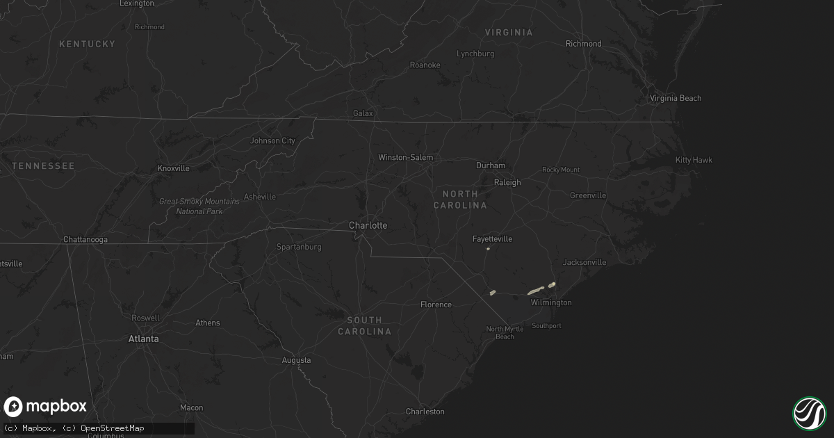
Hail Map in North Carolina on June 6, 2024
Get this storm
June 6 map
$229
one time, instant access
Download today. No call, no setup
Keep the $229
Bought the map and want the full workflow? Apply the entire $229 to a subscription within 7 days. None of it is wasted.
Every map, not just this one
This buys you this map. Subscription and you get every map we run, in the markets you choose from a few cities to whole states to nationwide. Plus real-time alerts the moment a storm fires.
Contact data
Name, contact info, occupancy, even credit band for addresses in the footprint. You go from where it hit to who to call.
Become the source they trust
Unlimited branding weather history reports on demand. You already have the documented answer ready for the property owner, and you are the one who showed up with it.
Property data and RoofTrace estimates
Pull up any address you have got, its value and the exact code rules for that jurisdiction, straight from One Click Code. Then RoofTrace estimates the squares, pitch, and roof value, priced the way you price.
Storm reports in North Carolina
North Carolina
| Date | Description |
|---|---|
| 06/06/20246:53 PM CDT | Several trees down in the mount olive area... Including one down on a house. |
| 06/06/20245:37 PM CDT | Power outages reported by jones-onslow electric coop. |
| 06/06/20245:13 PM CDT | A few tree limbs down up to ~2 inch diameter. Dime sized hail also reported. |
| 06/06/20244:13 PM CDT | Tree down at oxford rd near john moore rd and thomas store rd. |
| 06/06/20244:02 PM CDT | Tree down at lucy garrett rd and moss creek dr. |
| 06/06/20244:02 PM CDT | Tree down at leasburg rd and dee long rd. |
| 06/06/20243:53 PM CDT | Tree down at preston george rd and ormond rd. |
| 06/05/20248:59 PM CDT | Nearly 1000 power outages were reported due to fallen trees on power lines near the town of pilot. |
| 06/05/20248:58 PM CDT | Several trees down across the pantego and belhaven area... Including swindell rd... Sydney rd... And us 264. Time estimated based on radar data. |
| 06/05/20248:58 PM CDT | Several trees |
| 06/05/20248:55 PM CDT | A tree was reported down near the intersection of nc highway 98 west and curtis rd in bunn. |
| 06/05/20248:34 PM CDT | Several trees down across the roadway near washington... Including highland dr. And corsica rd. |
| 06/05/20247:35 PM CDT | Lenoir county em called to report power lines down and trees down on hwy 55... Near moss hill elementary school... Hwy 903... And liddell road. |
Cities Impacted by Hail Map on June 6, 2024
- Ona, FL
- Myakka City, FL
- Parrish, FL
- Pampa, TX
- Rochelle, GA
- Abbeville, GA
- White Deer, TX
- Zolfo Springs, FL
- Sebring, FL
- Lake Placid, FL
- Chadbourn, NC
- Cerro Gordo, NC
- Fort Meade, FL
- Groom, TX
- Milan, GA
- Bartow, FL
- Rhine, GA
- Mulberry, FL
- Ochopee, FL
- Kenansville, FL
- Lakeland, FL
- Bolton, NC
- Hastings, FL
- Elkton, FL
- Stinnett, TX
- Frostproof, FL
- Labelle, FL
- Eaton Park, FL
- Punta Gorda, FL
- Riegelwood, NC
- Currie, NC
- Panhandle, TX
- Astor, FL
- Polk City, FL
- Lake Wales, FL
- Borger, TX
- Perryton, TX
- River Ranch, FL
- Deltona, FL
- Altoona, FL
- Burgaw, NC
- Rocky Point, NC
- Arcadia, FL
- Higgins, TX
- Debary, FL
- Miami, TX
- Clermont, FL
- Canadian, TX
- Fritch, TX
- Orange City, FL
- Winter Garden, FL
- Saint Cloud, FL
- Oviedo, FL
- Parkton, NC
- Hope Mills, NC
- Masterson, TX
- Winter Park, FL
- Maitland, FL
- Kissimmee, FL
- Orlando, FL
- Clewiston, FL
- Taloga, OK
- Sanford, FL
- Seiling, OK
- Longwood, FL
- Winter Springs, FL
- Lake Mary, FL
- Arnett, OK
- Casselberry, FL
- Okeechobee, FL
- Altamonte Springs, FL
- Elko, NV
- Shattuck, OK
- Sharon, OK
- Gage, OK
- Amarillo, TX
- Vega, TX
- Vici, OK
- Fargo, OK
- Sayre, OK
- Camargo, OK
- Elk City, OK
- Summerfield, TX
- Wellington, TX
- Quail, TX
- Immokalee, FL
- Shamrock, TX
- Hereford, TX
- Meadow, TX
- Tahoka, TX
- Wolfforth, TX
- Lubbock, TX
- Wilson, TX
- Slaton, TX
- Post, TX
- Sunray, TX
- Happy, TX
- Wayside, TX
- Claude, TX
- Canyon, TX
- Dimmitt, TX
- Nazareth, TX
- Tulia, TX
- Springlake, TX
- Hart, TX
- Olton, TX
- Kress, TX
- Plainview, TX
- Hale Center, TX
- Silverton, TX


