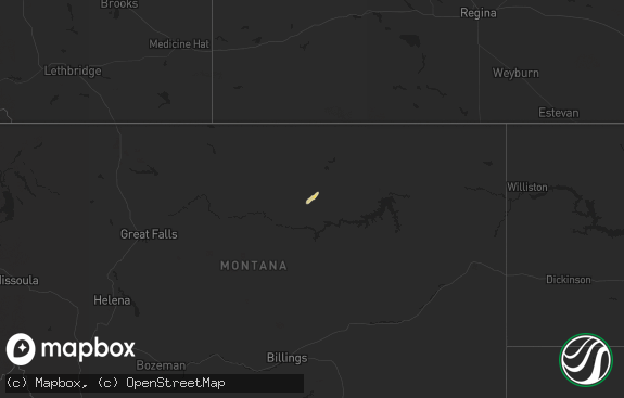
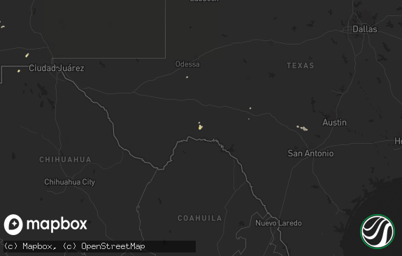
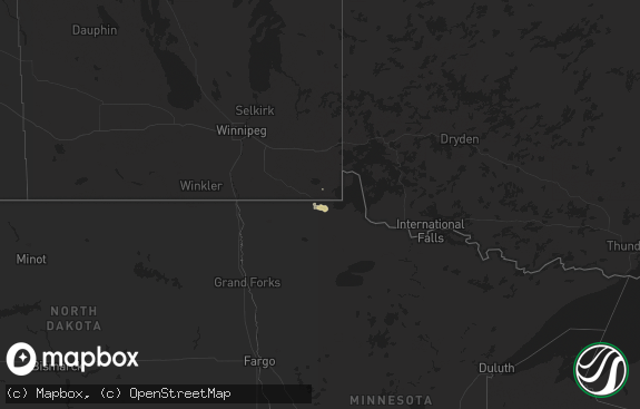
Hail Map in Montana on June 6, 2011
The weather event in Montana on June 6, 2011 includes Hail map. 21 states and 657 cities were impacted and suffered possible damage. The total estimated number of properties impacted is 0.

Hail
0
Estimated number of impacted properties by a 1.00" hail or larger0
Estimated number of impacted properties by a 1.75" hail or larger0
Estimated number of impacted properties by a 2.50" hail or largerStorm reports in Montana
Montana
| Date | Description |
|---|---|
| 06/06/20115:55 PM CDT | A local report indicates 1.50 inch wind near 2 WNW LOGAN |
| 06/06/20115:53 PM CDT | A local report indicates 1.50 inch wind near 8 E GREAT FALLS |
| 06/06/20115:49 PM CDT | A local report indicates 1.00 inch wind near 12 N MAUDLOW |
| 06/06/20114:12 AM CDT | Measured 65 mph wind speed gust at 312 am. 0.46 inches of precip. |
| 06/06/20113:08 AM CDT | Quarter sized hail. Heavy rain. |
| 06/05/201111:46 PM CDT | A local report indicates 1.00 inch wind near 14 N POMPEYS PILLAR |
| 06/05/201111:45 PM CDT | A local report indicates 1.75 inch wind near 6 SE MELSTONE |
| 06/05/201111:30 PM CDT | A local report indicates 1.00 inch wind near 8 SW FLATWILLOW |
| 06/05/201111:20 PM CDT | A local report indicates 1.75 inch wind near SW COLUMBUS |
| 06/05/201111:04 PM CDT | Local law enforcement reported a tornado 9 miles north of worden |
| 06/05/201111:00 PM CDT | A local report indicates 1.00 inch wind near 11 NNE ROUNDUP |
| 06/05/201110:40 PM CDT | Local law enforcement reported a tornado 8 miles west of worden |
| 06/05/201110:30 PM CDT | A local report indicates 1.00 inch wind near 5 W ROUNDUP |
| 06/05/201110:20 PM CDT | A local report indicates 1.00 inch wind near 10 SW ROUNDUP |
| 06/05/201110:13 PM CDT | Local law enforcement reported a tornado 6 miles northwest of billings heights |
| 06/05/201110:03 PM CDT | A local report indicates a tornado near 11 NNW LAUREL |
| 06/05/20119:42 PM CDT | Tornado reported by county official on buffalo trail road. |
| 06/05/20119:20 PM CDT | A local report indicates 1.75 inch wind near 1 WNW COLUMBUS |
| 06/05/20119:20 PM CDT | Rancher reported hail from 730-820 pm. Lost 180 head of cattle which ran off 200ft cliff to escape hail. 5.00 rainfall with washed out roads and flash flooding. |
| 06/05/20119:15 PM CDT | A local report indicates 1.50 inch wind near 4 SW HAILSTONE WILDLIFE |
| 06/05/20119:10 PM CDT | A local report indicates 2.00 inch wind near 3 W COLUMBUS |
| 06/05/20119:03 PM CDT | A local report indicates 1.00 inch wind near 5 ENE COLUMBUS |
| 06/05/20118:45 PM CDT | A local report indicates 1.50 inch wind near 11 NNE COLUMBUS |
| 06/05/20118:45 PM CDT | A local report indicates 1.25 inch wind near 2 N COLUMBUS |
| 06/05/20118:40 PM CDT | A local report indicates 2.00 inch wind near 3 NNW COLUMBUS |
| 06/05/20118:30 PM CDT | 2.50 rainfall total |
| 06/05/20118:30 PM CDT | Heavy damage to windshield. |
| 06/05/20118:28 PM CDT | A local report indicates 1.75 inch wind near 3 WSW COLUMBUS |
| 06/05/20118:25 PM CDT | A local report indicates 1.00 inch wind near 5 SE BIG TIMBER |
| 06/05/20118:25 PM CDT | A local report indicates 1.00 inch wind near 3 WSW COLUMBUS |
| 06/05/20118:25 PM CDT | 0.95 precip as well |
| 06/05/20118:20 PM CDT | A local report indicates 1.00 inch wind near SE NYE |
| 06/05/20118:18 PM CDT | A local report indicates 1.00 inch wind near 6 SW COLUMBUS |
| 06/05/20118:18 PM CDT | A local report indicates 1.50 inch wind near ESE BIG TIMBER |
| 06/05/20118:15 PM CDT | A local report indicates 1.00 inch wind near ESE BIG TIMBER |
| 06/05/20118:15 PM CDT | A local report indicates 1.00 inch wind near 8 SE BIG TIMBER |
| 06/05/20118:10 PM CDT | Also 0.45 precip |
| 06/05/20118:07 PM CDT | Half dollar sized hail |
| 06/05/20118:02 PM CDT | A local report indicates 1.50 inch wind near 12 WNW RAPELJE |
| 06/05/20118:01 PM CDT | At least quarter sized |
All States Impacted by Hail Map on June 6, 2011
Cities Impacted by Hail Map on June 6, 2011
- Maple, WI
- Frenchtown, MT
- Huson, MT
- West Green, GA
- Nicholls, GA
- Pensacola, FL
- Bell, FL
- Stockett, MT
- Enning, SD
- White Owl, SD
- Live Oak, FL
- Saint Francis, SD
- Mission, SD
- Crookston, NE
- Power, MT
- Buna, TX
- Canyon, MN
- Alborn, MN
- Saginaw, MN
- Grand Rapids, MN
- Cohasset, MN
- Port Allen, LA
- Greenville, FL
- Granville, ND
- Towner, ND
- Bantry, ND
- Dawsonville, GA
- Talking Rock, GA
- Fairmount, GA
- Suches, GA
- Jasper, GA
- Blairsville, GA
- Ellijay, GA
- Frazer, MT
- Fort Peck, MT
- Guyton, GA
- Saint James, LA
- Remer, MN
- Deer River, MN
- Fort McCoy, FL
- Citra, FL
- Reddick, FL
- Ocala, FL
- Anthony, FL
- Sulphur, LA
- Waycross, GA
- McAlpin, FL
- Milwaukee, WI
- Saint Francis, WI
- Astor, FL
- Pierson, FL
- O'Brien, FL
- Bozeman, MT
- Dade City, FL
- Brooksville, FL
- Baton Rouge, LA
- Picayune, MS
- Lake Charles, LA
- Edna, TX
- Big Timber, MT
- Melville, MT
- Wewahitchka, FL
- Columbus, MT
- Antelope, MT
- Reserve, MT
- Scott, LA
- Duson, LA
- Lyons, GA
- Reidsville, GA
- Foley, AL
- Summerdale, AL
- Inverness, FL
- Ambrose, GA
- Wray, GA
- Fitzgerald, GA
- Gonzales, LA
- Sorrento, LA
- Saint Amant, LA
- Willow City, ND
- Dayton, TX
- Elberta, AL
- Sanderson, FL
- Saint George, GA
- Reed Point, MT
- Florence, WI
- Homosassa, FL
- Vaughn, MT
- Fort Shaw, MT
- Sun River, MT
- Pearland, TX
- Houston, TX
- White Springs, FL
- New Iberia, LA
- Bemidji, MN
- Cass Lake, MN
- Ashland, WI
- Washburn, WI
- Ashtabula, OH
- Burnett, WI
- Ryegate, MT
- Shawmut, MT
- Lumberton, TX
- Rio, WI
- Poynette, WI
- Columbus, WI
- Arlington, WI
- Sycamore, GA
- Sweeny, TX
- Bay City, TX
- Van Vleck, TX
- Perry, FL
- Otter, MT
- Alma, GA
- Blue Ridge, GA
- Epworth, GA
- Rome, OH
- Rock Creek, OH
- Ludowici, GA
- Floweree, MT
- Coloma, WI
- Hancock, WI
- Berlin, WI
- Neshkoro, WI
- Redgranite, WI
- Wautoma, WI
- Damon, TX
- Toston, MT
- Lafayette, LA
- Carencro, LA
- Juneau, WI
- Murtaugh, ID
- Bloomingdale, GA
- Pooler, GA
- Fort Stewart, GA
- Poplar, MT
- Federal Dam, MN
- Bena, MN
- Lavina, MT
- Roundup, MT
- Broadview, MT
- Winnett, MT
- Rapelje, MT
- Kingsland, GA
- King Hill, ID
- Beaumont, TX
- Adel, GA
- Bay Minette, AL
- Lake City, FL
- Hinckley, MN
- Sandstone, MN
- Foster City, MI
- Perronville, MI
- Felch, MI
- Geyser, MT
- Marquette, MI
- Deerton, MI
- Skandia, MI
- Westby, MT
- Dagmar, MT
- Butternut, WI
- Hearne, TX
- Musselshell, MT
- Molt, MT
- Winnie, TX
- Silsbee, TX
- Iron Mountain, MI
- Leeds, ND
- Three Forks, MT
- Baker, LA
- Orange, TX
- Helena, MT
- Alamo, ND
- Fresno, TX
- Rosharon, TX
- Missouri City, TX
- Valentine, NE
- Horseshoe Beach, FL
- Vidor, TX
- Karlstad, MN
- Great Falls, MT
- Sand Coulee, MT
- Madison, OH
- Geneva, OH
- Stennis Space Center, MS
- Bay Saint Louis, MS
- Belt, MT
- Ripon, WI
- Pickett, WI
- Oshkosh, WI
- Baytown, TX
- Ingomar, MT
- Martinsdale, MT
- White Sulphur Springs, MT
- Orwell, OH
- Morgan City, LA
- Jeanerette, LA
- Franklin, LA
- Baldwin, LA
- Abbeville, LA
- Cullowhee, NC
- Vinton, LA
- Eastpoint, FL
- Emily, MN
- Fifty Lakes, MN
- Mayo, FL
- Ragley, LA
- Reeves, LA
- Brooklyn, MS
- Glennville, GA
- Marathon, WI
- Wausau, WI
- Edgar, WI
- Livingston, LA
- Holden, LA
- Hope, NM
- Mayhill, NM
- Claxton, GA
- Collins, GA
- Eustis, FL
- Umatilla, FL
- Luling, LA
- Hahnville, LA
- Boutte, LA
- High Springs, FL
- Newberry, FL
- Alachua, FL
- Trenton, FL
- Grayling, MI
- Hermansville, MI
- Nahunta, GA
- Patterson, GA
- Danbury, WI
- Hardeeville, SC
- Shepherd, MT
- Franklinton, LA
- Wolf Point, MT
- Box Elder, SD
- Piedmont, SD
- Folsom, LA
- Breaux Bridge, LA
- Inez, TX
- Fort White, FL
- Devers, TX
- Wallisville, TX
- Hankamer, TX
- Liberty, TX
- Belleview, FL
- Kinde, MI
- Hartford, WI
- Slinger, WI
- Rubicon, WI
- Deweyville, TX
- Grenora, ND
- Eunice, LA
- Sour Lake, TX
- Kountze, TX
- El Campo, TX
- Hampton, FL
- Gainesville, FL
- Lockport, LA
- Raceland, LA
- Des Allemands, LA
- Branford, FL
- Old Town, FL
- Wiggins, MS
- Backus, MN
- Pine River, MN
- Hackensack, MN
- Bristol, FL
- Folkston, GA
- White Oak, GA
- Louise, TX
- Medicine Lake, MT
- Homestead, MT
- Saint Martinville, LA
- Broussard, LA
- Lutz, FL
- Dayton, WY
- Youngsville, LA
- Lolita, TX
- Opelousas, LA
- Church Point, LA
- Huntley, MT
- Custer, MT
- Sand Springs, MT
- Melstone, MT
- Absarokee, MT
- Worden, MT
- Park City, MT
- Forsyth, MT
- Hilliard, FL
- Riceboro, GA
- Midway, GA
- Perkinston, MS
- Kiln, MS
- Starke, FL
- Keystone Heights, FL
- Youngstown, FL
- Panama City, FL
- Lakeland, GA
- Gibson, LA
- Dunnellon, FL
- Chipley, FL
- Alford, FL
- Carriere, MS
- Hackberry, LA
- Cameron, LA
- Chiefland, FL
- Arlee, MT
- Bogalusa, LA
- Blountstown, FL
- Windsor, OH
- Perry, OH
- Thompson, OH
- Jefferson, OH
- Austinburg, OH
- Woodbine, GA
- Manvel, TX
- Tickfaw, LA
- Independence, LA
- La Place, LA
- Bluffton, SC
- Okatie, SC
- Ishpeming, MI
- Little Lake, MI
- Rock, MI
- Gwinn, MI
- Miller, SD
- Ridgeland, SC
- Lodgepole, SD
- Silverhill, AL
- Blackshear, GA
- Nashua, MT
- Glasgow, MT
- Brook Park, MN
- Wharton, TX
- East Bernard, TX
- Colgate, WI
- Lannon, WI
- Menomonee Falls, WI
- Sussex, WI
- Erath, LA
- Odum, GA
- Screven, GA
- Bagley, MN
- Parmelee, SD
- Young Harris, GA
- Quincy, FL
- Chardon, OH
- Painesville, OH
- Maringouin, LA
- Lottie, LA
- Wisconsin Rapids, WI
- Pittsville, WI
- Loranger, LA
- Covington, LA
- Purvis, MS
- Hattiesburg, MS
- Lumberton, MS
- Greenbush, MI
- Mikado, MI
- Richmond Hill, GA
- Fleming, GA
- Savannah, GA
- Chattahoochee, FL
- Tampa, FL
- Floodwood, MN
- Swan River, MN
- Goodland, MN
- Hibbing, MN
- Meadowlands, MN
- Butler, WI
- Brookfield, WI
- Pierre Part, LA
- Belle Rose, LA
- Napoleonville, LA
- White Castle, LA
- Port Hope, MI
- Brockton, MT
- Summerfield, FL
- Loxley, AL
- Madison, FL
- Lee, FL
- Marrero, LA
- Westwego, LA
- Duluth, MN
- Port Neches, TX
- Glidden, WI
- Monarch, MT
- Spooner, WI
- Woodville, MS
- Crosby, ND
- Luzerne, MI
- Roscommon, MI
- Starks, LA
- Hampden, ND
- Sturgis, SD
- Broxton, GA
- Denton, GA
- Grafton, ND
- Charlo, MT
- Gueydan, LA
- Kaplan, LA
- Morse, LA
- Westlake, LA
- Rugby, ND
- Thibodaux, LA
- Minnewaukan, ND
- Glennie, MI
- Port Arthur, TX
- Nederland, TX
- Bridge City, TX
- Groves, TX
- Centreville, MS
- Slidell, LA
- Hernando, FL
- Wildwood, FL
- Oxford, FL
- Lake Panasoffkee, FL
- Bushnell, FL
- Sumterville, FL
- Birnamwood, WI
- Bryan, TX
- Fred, TX
- Warren, TX
- Callahan, FL
- Argyle, MN
- Stephen, MN
- New Orleans, LA
- Ray City, GA
- Nashville, GA
- Coleraine, MN
- Warba, MN
- Bovey, MN
- Surrency, GA
- Gulfport, MS
- Saucier, MS
- Hustisford, WI
- Neosho, WI
- Morriston, FL
- Ironwood, MI
- Hinesville, GA
- Greycliff, MT
- Belgrade, MT
- Bristol, GA
- Norway, MI
- Vulcan, MI
- Fargo, GA
- Donaldsonville, LA
- Convent, LA
- Reserve, LA
- Edgard, LA
- Churchs Ferry, ND
- Rosenberg, TX
- Beasley, TX
- Plaquemine, LA
- Walker, LA
- Webster, FL
- Floral City, FL
- Ocklawaha, FL
- Silver Springs, FL
- Coleman, FL
- Cambria, WI
- Jacksonville, FL
- Wyola, MT
- McGrath, MN
- Bruneau, ID
- Panama City Beach, FL
- Brusett, MT
- Pardeeville, WI
- Dalton, WI
- Clearbrook, MN
- Crystal Falls, MI
- Harbor Beach, MI
- Saint Augustine, FL
- Elkton, FL
- Highlands, TX
- Hazlehurst, GA
- Denham Springs, LA
- Lansford, ND
- Sugar Land, TX
- Plainfield, WI
- Eldorado, WI
- Bancroft, WI
- Outing, MN
- Sneads, FL
- Greenwood, FL
- Marianna, FL
- Grand Ridge, FL
- Bascom, FL
- Donalsonville, GA
- Lamont, FL
- Wild Rose, WI
- Palestine, TX
- Ventress, LA
- New Roads, LA
- Mccomb, MS
- Summit, MS
- Salem, FL
- Green Cove Springs, FL
- China, TX
- Strandquist, MN
- Stanley, ND
- Powers Lake, ND
- Starkweather, ND
- Almond, WI
- Jesup, GA
- Hortense, GA
- Hoboken, GA
- Schriever, LA
- Ganado, TX
- Micanopy, FL
- Lynn Haven, FL
- Palatka, FL
- McLeod, MT
- Omro, WI
- Oscoda, MI
- Archer, FL
- Bronson, FL
- Graceville, FL
- Campbellton, FL
- Smiley, TX
- Iron Ridge, WI
- Lake City, PA
- Hawthorne, FL
- Rebecca, GA
- Hammond, LA
- Ponchatoula, LA
- Springfield, LA
- Walker, MN
- Filion, MI
- Kirbyville, TX
- Caldwell, TX
- Van Dyne, WI
- Nekoosa, WI
- Green Lake, WI
- Gray, LA
- Oconomowoc, WI
- Alvin, TX
- Champion, MI
- Harrison, MT
- Boling, TX
- Sparks, GA
- Brazoria, TX
- Maurice, LA
- Amite, LA
- Poplarville, MS
- Laporte, MN
- Williston, ND
- Crosby, TX
- Ringle, WI
- Baxley, GA
- Lewiston, MI
- Brooklet, GA
- Athens, WI
- Bunnell, FL
- Two Dot, MT
- Yoder, WY
- Penn, ND
- Tylertown, MS
- Douglas, GA
- Humble, TX
- Hubertus, WI
- Guy, TX
- Richards, TX
- Saint Gabriel, LA
- Prairieville, LA
- Lodi, WI
- Floresville, TX
- Hull, TX
- Saint Francisville, LA
- Jackson, LA
- New Underwood, SD
- Mershon, GA
- Mellen, WI
- Merriman, NE
- Robertsdale, AL
- Lengby, MN
- Nye, MT
- Fishtail, MT
- Longville, MN
- Pearl River, LA
- Wolford, ND
- Anahuac, TX
- Hardin, MT
- Liberty, MS
- Smithdale, MS
- Grand Bay, AL
- Abbeville, GA
- Interlachen, FL
- Ravalli, MT
- Moreauville, LA
- Kilgore, NE
- Big Falls, MN
- Mabton, WA
- Pasadena, TX
- Hobson, MT
- Acton, MT
- Hysham, MT
- Port Wing, WI
- Shevlin, MN
- Yulee, FL
- Vernon, FL
- Trego, WI
- Lance Creek, WY
- Adams, ND
- Irvington, AL
- Foxworth, MS
- Kokomo, MS
- Arpin, WI
- Solway, MN
- Prairie City, SD
- Monticello, FL
- Cottondale, FL
- Missoula, MT
- Lake Butler, FL
- Richfield, WI
- Watertown, WI
- Hahira, GA
- Angie, LA
- Houma, LA
- Lufkin, TX
- Lucedale, MS
- Call, TX
- Cando, ND
- Bessemer, MI
- Richmond, TX
- Waleska, GA
- Middleburg, FL
- Webster, ND
- Schofield, WI
- Crowley, LA
- Chula, GA
- Pass Christian, MS
- Posen, MI
- Bainbridge, GA
- Needville, TX
- Fountain, FL
- Rayne, LA
- Monterey, LA
- Garyville, LA
- Grass Range, MT
- Pennington, MN
- Uvalda, GA
- Kenmare, ND
- Plattenville, LA
- Paulina, LA
- Townsend, GA
- Ellabell, GA
- Rincon, GA
- Pembroke, GA
- Williston, FL
- Gause, TX
- Powers, MI
- Spalding, MI
- Groveton, TX
- Lovelady, TX


