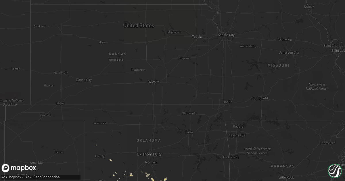
Hail Map in Georgia on June 5, 2012
Get this storm
June 5 map
$229
one time, instant access
Download today. No call, no setup
Keep the $229
Bought the map and want the full workflow? Apply the entire $229 to a subscription within 7 days. None of it is wasted.
Every map, not just this one
This buys you this map. Subscription and you get every map we run, in the markets you choose from a few cities to whole states to nationwide. Plus real-time alerts the moment a storm fires.
Contact data
Name, contact info, occupancy, even credit band for addresses in the footprint. You go from where it hit to who to call.
Become the source they trust
Unlimited branding weather history reports on demand. You already have the documented answer ready for the property owner, and you are the one who showed up with it.
Property data and RoofTrace estimates
Pull up any address you have got, its value and the exact code rules for that jurisdiction, straight from One Click Code. Then RoofTrace estimates the squares, pitch, and roof value, priced the way you price.
Storm reports in Georgia
Georgia
| Date | Description |
|---|---|
| 06/05/20125:30 PM CDT | Trees down all over colquitt county |
| 06/05/20125:06 PM CDT | Trees down all over the hahira area |
| 06/05/20124:48 PM CDT | Trees and powerlines down |
| 06/05/20124:36 PM CDT | Large pine tree down over roadway. Estimated 50-60mph wind gust. |
| 06/05/20124:12 PM CDT | Trees and powerlines down near pavo |
| 06/05/20124:08 PM CDT | Multiple trees and powerlines down around thomas county. Lightning struck a gas station generating a fire. |
| 06/05/20124:05 PM CDT | Tree down across ozell road near vinson road intersection. Power lines down in that area as well. |
| 06/05/20123:55 PM CDT | Shingles blown off the foor of a home on centennial road. |
| 06/05/20123:55 PM CDT | Airport weather sensor reported 64 mph wind gust |
| 06/05/20123:12 PM CDT | Multiple trees and powerlines down around thomas county. Lightning struck a gas station generating a fire. |
| 06/05/20122:34 PM CDT | Quarter size hail reported on parkwood drive in brunswick. |
| 06/05/20122:13 PM CDT | The public reported a large 1 foot diameter branch down due to lightning near the intersection of highway 17 and chatham parkway. |
| 06/05/20122:05 PM CDT | 911 relayed a report a tree down in byron. Time is estimated from radar |
| 06/05/20121:35 PM CDT | A local report indicates 1.75 inch wind near RICEBORO |
| 06/05/20121:31 PM CDT | Hail between quarter and half dollar size falling along interstate 95 between mile markers 66 and 76. |
| 06/05/20121:11 PM CDT | Quarter size hail and wind gusts to 40 mph. |
| 06/05/20121:08 PM CDT | A local report indicates 1.00 inch wind near GUM BRANCH |
| 06/05/20121:00 PM CDT | Tree down in americus. Wind gust to 38 mph also measured at sumter co airport awos. |
| 06/05/201212:52 PM CDT | Several trees down |
| 06/05/201212:50 PM CDT | The ema reported nickle to quarter sized hail in baxley. There was also a report of a tree down. |
| 06/05/201212:45 PM CDT | Baseball size hail covering the ground. |
| 06/05/201212:40 PM CDT | A local report indicates 1.75 inch wind near MENDES |
| 06/05/201212:32 PM CDT | A local report indicates 1.00 inch wind near 1 SSW MENDES |
| 06/05/201212:28 PM CDT | A local report indicates 1.00 inch wind near 3 E REIDSVILLE |
| 06/05/201212:20 PM CDT | Several trees down. |
| 06/05/201212:10 PM CDT | A local report indicates 1.00 inch wind near DEXTER |
| 06/05/201211:57 AM CDT | A local report indicates 1.75 inch wind near 2 NE CENTER |
| 06/05/201211:40 AM CDT | Near 1100 block of third street in perry |
| 06/05/201211:40 AM CDT | A local report indicates 1.75 inch wind near VIDALIA |
| 06/05/201211:35 AM CDT | A local report indicates 1.75 inch wind near AILEY |
| 06/05/201211:34 AM CDT | A local report indicates 1.75 inch wind near 4 NE MOUNT VERNON |
| 06/05/201211:30 AM CDT | Golf ball size hail occurred near hwy 358 and prospect church rd area not far from i-16. |
| 06/05/201211:30 AM CDT | Golf ball size hail occurred near hwy 358 and prospect church rd area not far from i-16. |
All States Impacted by Hail Map on June 5, 2012
Cities Impacted by Hail Map on June 5, 2012
- Junction, TX
- Coffee Creek, MT
- Denton, MT
- Neihart, MT
- Monarch, MT
- Geraldine, MT
- Hale Center, TX
- Abernathy, TX
- Cordele, GA
- Danville, GA
- Jeffersonville, GA
- Cochran, GA
- Logansport, LA
- Colorado City, TX
- Loraine, TX
- Fargo, GA
- Lake City, FL
- Forest Hill, LA
- Roff, OK
- Sulphur, OK
- Orlando, FL
- Windermere, FL
- Hobson, MT
- Marshall, TX
- Richmond Hill, GA
- Townsend, MT
- Toston, MT
- Sonora, TX
- Chester, MT
- Clarksville, TX
- Quincy, FL
- Valdosta, GA
- Moody Afb, GA
- Lakeland, GA
- Ray City, GA
- Naylor, GA
- Hahira, GA
- Stockton, GA
- Homerville, GA
- Du Pont, GA
- Wolf Creek, MT
- Ringling, MT
- Dexter, GA
- Rentz, GA
- Cadwell, GA
- Petersburg, TX
- Idalou, TX
- Loma, MT
- Big Sandy, MT
- Hermleigh, TX
- Sweetwater, TX
- Roscoe, TX
- Stanford, MT
- Moccasin, MT
- Laredo, TX
- Pitts, GA
- Vienna, GA
- Sterling City, TX
- Glennville, GA
- Soperton, GA
- Gail, TX
- Chauncey, GA
- McRae Helena, GA
- Eastman, GA
- Falfurrias, TX
- Post, TX
- Pelican, LA
- Big Spring, TX
- Hawley, TX
- Plainview, TX
- Lubbock, TX
- Lorenzo, TX
- Slaton, TX
- Martinsdale, MT
- Rhine, GA
- Geyser, MT
- Raynesford, MT
- Belt, MT
- Floydada, TX
- Jefferson, GA
- Minden, LA
- Bristol, GA
- Mershon, GA
- Bagwell, TX
- Valliant, OK
- Augusta, MT
- Grand Cane, LA
- Mansfield, LA
- White Sulphur Springs, MT
- Collinsville, TX
- Whitesboro, TX
- Howe, TX
- Montrose, GA
- Statham, GA
- Winder, GA
- Ville Platte, LA
- Oakdale, LA
- Lindsay, OK
- Fletcher, OK
- Thomasville, GA
- Ralls, TX
- Broxton, GA
- West Green, GA
- Guerra, TX
- Hebbronville, TX
- Patterson, GA
- Alma, GA
- Screven, GA
- Jena, LA
- Trout, LA
- Riceboro, GA
- Midway, GA
- Strasburg, ND
- Vidalia, GA
- Ailey, GA
- Pineville, LA
- Alexandria, LA
- Wichita Falls, TX
- Milton, FL
- Justin, TX
- Fort Worth, TX
- Crosbyton, TX
- Plaucheville, LA
- Texarkana, AR
- Bunkie, LA
- Homestead, FL
- Groveland, FL
- Brunswick, GA
- Tulia, TX
- Two Dot, MT
- Choteau, MT
- Muenster, TX
- Saint Jo, TX
- Nocona, TX
- Hilliard, FL
- Loxley, AL
- Robertsdale, AL
- Stapleton, AL
- Bay Minette, AL
- Sulphur Springs, TX
- Callahan, FL
- Jacksonville, FL
- Coahoma, TX
- Maysville, OK
- Pauls Valley, OK
- Belgrade, MT
- Uvalda, GA
- Lumber City, GA
- Odum, GA
- Surrency, GA
- Hazlehurst, GA
- Baxley, GA
- Wright City, OK
- Idabel, OK
- Broken Bow, OK
- Avery, TX
- Garvin, OK
- Valier, MT
- Belle Rose, LA
- Westbrook, TX
- Clermont, FL
- Reidsville, GA
- Blackwell, TX
- Rudyard, MT
- Inverness, MT
- Fort Benton, MT
- Highwood, MT
- Hennepin, OK
- Encino, TX
- Concepcion, TX
- Marksville, LA
- Macon, GA
- Elgin, OK
- Fairfield, MT
- Homer, LA
- Daphne, AL
- Valley Spring, TX
- Abbeville, GA
- Rochelle, GA
- Shreveport, LA
- Coushatta, LA
- Gainesville, TX
- Sanger, TX
- Maitland, FL
- Winter Park, FL
- Casselberry, FL
- Brady, TX
- Lohn, TX
- Pavo, GA
- Dry Branch, GA
- Marshallville, GA
- Reynolds, GA
- Boston, GA
- Barney, GA
- Floweree, MT
- Carter, MT
- Webster, FL
- Ozona, TX
- Winter Garden, FL
- Gillette, WY
- Carthage, TX
- Ludowici, GA
- Buffalo, MT
- Fort Davis, TX
- Odonnell, TX
- Perry, GA
- Chester, GA
- Dudley, GA
- Dublin, GA
- Wynnewood, OK
- Marathon, TX
- Rocksprings, TX
- Fort Valley, GA
- Whitlash, MT
- Joplin, MT
- Maryneal, TX
- Mountain View, OK
- Cumby, TX
- Brashear, TX
- Fort Stockton, TX
- Elmore City, OK
- Jayton, TX
- Aspermont, TX
- Jacksonville, GA
- Ada, OK
- Stratford, OK
- Indiahoma, OK
- Naples, FL
- Ochopee, FL
- Haughton, LA
- Doyline, LA
- Wakpala, SD
- Rochelle, TX
- Converse, LA
- Wilson, TX
- Butler, GA
- Ball, LA
- Realitos, TX
- Benton, LA
- Belcher, LA
- Jesup, GA
- Sapelo Island, GA
- Darien, GA
- Hammon, OK
- Brady, MT
- Lyons, GA
- Glenwood, GA
- Alamo, GA
- Tallahassee, FL
- Pollock, LA
- Evergreen, LA
- Hortense, GA
- Waynesville, GA
- Defuniak Springs, FL
- Fitzgerald, GA
- Tchula, MS
- Edinburg, TX
- Hingham, MT
- Saint Simons Island, GA
- Boyce, LA
- Ringling, OK
- Snyder, TX
- Fluvanna, TX
- Cordell, OK
- Roosevelt, OK
- Pittsview, AL
- Foster, OK
- Bossier City, LA
- Richland, GA
- Fairhope, AL
- Silverhill, AL
- Milan, GA
- Denton, GA
- Rebecca, GA
- Spur, TX
- Byromville, GA
- Montezuma, GA
- Florala, AL
- Ringold, OK
- Dubberly, LA
- Sibley, LA
- Townsend, GA
- Detroit, TX
- Cyril, OK
- Titusville, FL
- Christoval, TX
- Jefferson, TX
- Vivian, LA
- West Point, GA
- Glenmora, LA
- Mount Vernon, GA
- Frierson, LA
- Troy, AL
- Morven, GA
- Quitman, GA
- Collins, GA
- Junction City, GA
- Gildford, MT
- Campo, CO
- London, TX
- Mobile, AL
- Ponce De Leon, FL
- Molino, FL
- McDavid, FL
- Hinesville, GA
- Tarrytown, GA
- Roby, TX
- Merkel, TX
- Jonesville, LA
- Wilson, OK
- Grant, OK
- Tahoka, TX
- Douglas, GA
- Big Timber, MT
- Jay, FL
- Baker, FL
- Pollock, SD
- Menard, TX
- Montverde, FL
- Apache, OK
- Era, TX
- Marianna, FL
- Greenwood, FL
- Monterey, LA
- Apopka, FL
- Bentley, LA
- Elmer, LA
- Gloster, LA
- Stonewall, LA
- Keatchie, LA
- Davis, OK
- Durant, OK
- Caddo, OK
- Elm Grove, LA
- Omaha, GA
- Adel, GA
- Tishomingo, OK
- Stonewall, OK
- Zellwood, FL
- Dixie, GA
- Barwick, GA
- Lecompte, LA
- Lockney, TX
- Bozeman, MT
- Mauk, GA
- Box Springs, GA
- Oviedo, FL
- Lumpkin, GA
- Ninnekah, OK
- Bradley, OK
- Alex, OK
- Pitkin, LA
- Elizabeth, LA
- Jekyll Island, GA
- Claxton, GA
- Allenhurst, GA
- Irwinton, GA
- Lady Lake, FL
- Fruitland Park, FL
- Donalsonville, GA
- Iron City, GA
- Nahunta, GA
- Pontotoc, TX
- Llano, TX
- Leslie, GA
- De Soto, GA
- Fort Mitchell, AL
- Effie, LA
- Grand Ridge, FL
- Sneads, FL
- Voca, TX
- Broadus, MT
- Pleasant Hill, LA
- Immokalee, FL
- Bronte, TX
- Olton, TX
- Byron, GA
- Waverly Hall, GA
- Woodland, GA
- Houma, LA
- Hawkinsville, GA
- Pineview, GA
- Drake, CO
- Cobb, GA
- Lawton, OK


