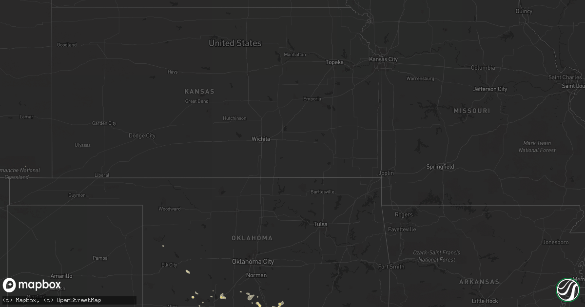
Hail Map in Florida on June 5, 2012
Get this storm
June 5 map
$229
one time, instant access
Download today. No call, no setup
Keep the $229
Bought the map and want the full workflow? Apply the entire $229 to a subscription within 7 days. None of it is wasted.
Every map, not just this one
This buys you this map. Subscription and you get every map we run, in the markets you choose from a few cities to whole states to nationwide. Plus real-time alerts the moment a storm fires.
Contact data
Name, contact info, occupancy, even credit band for addresses in the footprint. You go from where it hit to who to call.
Become the source they trust
Unlimited branding weather history reports on demand. You already have the documented answer ready for the property owner, and you are the one who showed up with it.
Property data and RoofTrace estimates
Pull up any address you have got, its value and the exact code rules for that jurisdiction, straight from One Click Code. Then RoofTrace estimates the squares, pitch, and roof value, priced the way you price.
Storm reports in Florida
Florida
| Date | Description |
|---|---|
| 06/05/20124:12 PM CDT | Trees and powerlines down near pavo |
| 06/05/20123:36 PM CDT | Tree on the roadway on moccasin gap road just east of bradleys country store. |
| 06/05/20123:36 PM CDT | Several trees were broken near old chemonie road and starhawk drive including a healthy 30 foot pine snapped in half and the crown of a hickory broken off. |
| 06/05/20123:35 PM CDT | A railroad crossing arm was snapped along state road 710 6 miles west northwest of riviera beach as a thunderstorm moved through the region. |
| 06/05/20123:35 PM CDT | Trees down on roadway near intersection of miccosukee road and crump road. |
| 06/05/20123:35 PM CDT | Several powerlines down on state road 189. |
| 06/05/20123:12 PM CDT | Two trees down in backyard avondale subdivision. |
| 06/05/20123:12 PM CDT | Trees down around the dempsy mayo road area. |
| 06/05/20123:12 PM CDT | Trees down around the fleishmann road and miccosukee road area. |
| 06/05/20123:10 PM CDT | Large tree snapped across road in apartment complex |
| 06/05/20123:10 PM CDT | Trees down northeast of marianna near the georgia state line. |
| 06/05/20123:03 PM CDT | Tree down capital circle ne in front of capital lanes |
| 06/05/20122:58 PM CDT | A local report indicates 60 MPH wind near MARIANNA MUNICIPAL A/P |
| 06/05/20122:58 PM CDT | A local report indicates 60 MPH wind near MARIANNA |
| 06/05/20124:30 AM CDT | A mesonet site located near the center of lake okeechobee reported a wind gust of 54 kts...or 62 mph...at 530 am edt. |
| 06/05/20124:17 AM CDT | A mesonet site located in the southern portion of lake okeechobee reported a wind gust of 56 kts...or 64 mph...at 517 am edt. |
All States Impacted by Hail Map on June 5, 2012
Cities Impacted by Hail Map on June 5, 2012
- Junction, TX
- Coffee Creek, MT
- Denton, MT
- Neihart, MT
- Monarch, MT
- Geraldine, MT
- Hale Center, TX
- Abernathy, TX
- Cordele, GA
- Danville, GA
- Jeffersonville, GA
- Cochran, GA
- Logansport, LA
- Colorado City, TX
- Loraine, TX
- Fargo, GA
- Lake City, FL
- Forest Hill, LA
- Roff, OK
- Sulphur, OK
- Orlando, FL
- Windermere, FL
- Hobson, MT
- Marshall, TX
- Richmond Hill, GA
- Townsend, MT
- Toston, MT
- Sonora, TX
- Chester, MT
- Clarksville, TX
- Quincy, FL
- Valdosta, GA
- Moody Afb, GA
- Lakeland, GA
- Ray City, GA
- Naylor, GA
- Hahira, GA
- Stockton, GA
- Homerville, GA
- Du Pont, GA
- Wolf Creek, MT
- Ringling, MT
- Dexter, GA
- Rentz, GA
- Cadwell, GA
- Petersburg, TX
- Idalou, TX
- Loma, MT
- Big Sandy, MT
- Hermleigh, TX
- Sweetwater, TX
- Roscoe, TX
- Stanford, MT
- Moccasin, MT
- Laredo, TX
- Pitts, GA
- Vienna, GA
- Sterling City, TX
- Glennville, GA
- Soperton, GA
- Gail, TX
- Chauncey, GA
- McRae Helena, GA
- Eastman, GA
- Falfurrias, TX
- Post, TX
- Pelican, LA
- Big Spring, TX
- Hawley, TX
- Plainview, TX
- Lubbock, TX
- Lorenzo, TX
- Slaton, TX
- Martinsdale, MT
- Rhine, GA
- Geyser, MT
- Raynesford, MT
- Belt, MT
- Floydada, TX
- Jefferson, GA
- Minden, LA
- Bristol, GA
- Mershon, GA
- Bagwell, TX
- Valliant, OK
- Augusta, MT
- Grand Cane, LA
- Mansfield, LA
- White Sulphur Springs, MT
- Collinsville, TX
- Whitesboro, TX
- Howe, TX
- Montrose, GA
- Statham, GA
- Winder, GA
- Ville Platte, LA
- Oakdale, LA
- Lindsay, OK
- Fletcher, OK
- Thomasville, GA
- Ralls, TX
- Broxton, GA
- West Green, GA
- Guerra, TX
- Hebbronville, TX
- Patterson, GA
- Alma, GA
- Screven, GA
- Jena, LA
- Trout, LA
- Riceboro, GA
- Midway, GA
- Strasburg, ND
- Vidalia, GA
- Ailey, GA
- Pineville, LA
- Alexandria, LA
- Wichita Falls, TX
- Milton, FL
- Justin, TX
- Fort Worth, TX
- Crosbyton, TX
- Plaucheville, LA
- Texarkana, AR
- Bunkie, LA
- Homestead, FL
- Groveland, FL
- Brunswick, GA
- Tulia, TX
- Two Dot, MT
- Choteau, MT
- Muenster, TX
- Saint Jo, TX
- Nocona, TX
- Hilliard, FL
- Loxley, AL
- Robertsdale, AL
- Stapleton, AL
- Bay Minette, AL
- Sulphur Springs, TX
- Callahan, FL
- Jacksonville, FL
- Coahoma, TX
- Maysville, OK
- Pauls Valley, OK
- Belgrade, MT
- Uvalda, GA
- Lumber City, GA
- Odum, GA
- Surrency, GA
- Hazlehurst, GA
- Baxley, GA
- Wright City, OK
- Idabel, OK
- Broken Bow, OK
- Avery, TX
- Garvin, OK
- Valier, MT
- Belle Rose, LA
- Westbrook, TX
- Clermont, FL
- Reidsville, GA
- Blackwell, TX
- Rudyard, MT
- Inverness, MT
- Fort Benton, MT
- Highwood, MT
- Hennepin, OK
- Encino, TX
- Concepcion, TX
- Marksville, LA
- Macon, GA
- Elgin, OK
- Fairfield, MT
- Homer, LA
- Daphne, AL
- Valley Spring, TX
- Abbeville, GA
- Rochelle, GA
- Shreveport, LA
- Coushatta, LA
- Gainesville, TX
- Sanger, TX
- Maitland, FL
- Winter Park, FL
- Casselberry, FL
- Brady, TX
- Lohn, TX
- Pavo, GA
- Dry Branch, GA
- Marshallville, GA
- Reynolds, GA
- Boston, GA
- Barney, GA
- Floweree, MT
- Carter, MT
- Webster, FL
- Ozona, TX
- Winter Garden, FL
- Gillette, WY
- Carthage, TX
- Ludowici, GA
- Buffalo, MT
- Fort Davis, TX
- Odonnell, TX
- Perry, GA
- Chester, GA
- Dudley, GA
- Dublin, GA
- Wynnewood, OK
- Marathon, TX
- Rocksprings, TX
- Fort Valley, GA
- Whitlash, MT
- Joplin, MT
- Maryneal, TX
- Mountain View, OK
- Cumby, TX
- Brashear, TX
- Fort Stockton, TX
- Elmore City, OK
- Jayton, TX
- Aspermont, TX
- Jacksonville, GA
- Ada, OK
- Stratford, OK
- Indiahoma, OK
- Naples, FL
- Ochopee, FL
- Haughton, LA
- Doyline, LA
- Wakpala, SD
- Rochelle, TX
- Converse, LA
- Wilson, TX
- Butler, GA
- Ball, LA
- Realitos, TX
- Benton, LA
- Belcher, LA
- Jesup, GA
- Sapelo Island, GA
- Darien, GA
- Hammon, OK
- Brady, MT
- Lyons, GA
- Glenwood, GA
- Alamo, GA
- Tallahassee, FL
- Pollock, LA
- Evergreen, LA
- Hortense, GA
- Waynesville, GA
- Defuniak Springs, FL
- Fitzgerald, GA
- Tchula, MS
- Edinburg, TX
- Hingham, MT
- Saint Simons Island, GA
- Boyce, LA
- Ringling, OK
- Snyder, TX
- Fluvanna, TX
- Cordell, OK
- Roosevelt, OK
- Pittsview, AL
- Foster, OK
- Bossier City, LA
- Richland, GA
- Fairhope, AL
- Silverhill, AL
- Milan, GA
- Denton, GA
- Rebecca, GA
- Spur, TX
- Byromville, GA
- Montezuma, GA
- Florala, AL
- Ringold, OK
- Dubberly, LA
- Sibley, LA
- Townsend, GA
- Detroit, TX
- Cyril, OK
- Titusville, FL
- Christoval, TX
- Jefferson, TX
- Vivian, LA
- West Point, GA
- Glenmora, LA
- Mount Vernon, GA
- Frierson, LA
- Troy, AL
- Morven, GA
- Quitman, GA
- Collins, GA
- Junction City, GA
- Gildford, MT
- Campo, CO
- London, TX
- Mobile, AL
- Ponce De Leon, FL
- Molino, FL
- McDavid, FL
- Hinesville, GA
- Tarrytown, GA
- Roby, TX
- Merkel, TX
- Jonesville, LA
- Wilson, OK
- Grant, OK
- Tahoka, TX
- Douglas, GA
- Big Timber, MT
- Jay, FL
- Baker, FL
- Pollock, SD
- Menard, TX
- Montverde, FL
- Apache, OK
- Era, TX
- Marianna, FL
- Greenwood, FL
- Monterey, LA
- Apopka, FL
- Bentley, LA
- Elmer, LA
- Gloster, LA
- Stonewall, LA
- Keatchie, LA
- Davis, OK
- Durant, OK
- Caddo, OK
- Elm Grove, LA
- Omaha, GA
- Adel, GA
- Tishomingo, OK
- Stonewall, OK
- Zellwood, FL
- Dixie, GA
- Barwick, GA
- Lecompte, LA
- Lockney, TX
- Bozeman, MT
- Mauk, GA
- Box Springs, GA
- Oviedo, FL
- Lumpkin, GA
- Ninnekah, OK
- Bradley, OK
- Alex, OK
- Pitkin, LA
- Elizabeth, LA
- Jekyll Island, GA
- Claxton, GA
- Allenhurst, GA
- Irwinton, GA
- Lady Lake, FL
- Fruitland Park, FL
- Donalsonville, GA
- Iron City, GA
- Nahunta, GA
- Pontotoc, TX
- Llano, TX
- Leslie, GA
- De Soto, GA
- Fort Mitchell, AL
- Effie, LA
- Grand Ridge, FL
- Sneads, FL
- Voca, TX
- Broadus, MT
- Pleasant Hill, LA
- Immokalee, FL
- Bronte, TX
- Olton, TX
- Byron, GA
- Waverly Hall, GA
- Woodland, GA
- Houma, LA
- Hawkinsville, GA
- Pineview, GA
- Drake, CO
- Cobb, GA
- Lawton, OK


