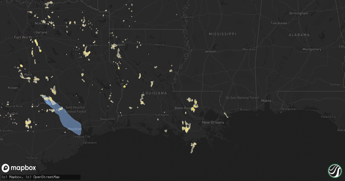
Hail Map in Louisiana on June 3, 2023
Get this storm
June 3 map
$229
one time, instant access
Download today. No call, no setup
Keep the $229
Bought the map and want the full workflow? Apply the entire $229 to a subscription within 7 days. None of it is wasted.
Every map, not just this one
This buys you this map. Subscription and you get every map we run, in the markets you choose from a few cities to whole states to nationwide. Plus real-time alerts the moment a storm fires.
Contact data
Name, contact info, occupancy, even credit band for addresses in the footprint. You go from where it hit to who to call.
Become the source they trust
Unlimited branding weather history reports on demand. You already have the documented answer ready for the property owner, and you are the one who showed up with it.
Property data and RoofTrace estimates
Pull up any address you have got, its value and the exact code rules for that jurisdiction, straight from One Click Code. Then RoofTrace estimates the squares, pitch, and roof value, priced the way you price.
Storm reports in Louisiana
Louisiana
| Date | Description |
|---|---|
| 06/03/20236:42 PM CDT | Report and photo of quarter size hail |
| 06/03/20235:59 PM CDT | A tree was downed on riverfront road in coushatta. |
| 06/03/20235:20 PM CDT | Large limbs blown down in and around the converse and noble communities in northern sabine parish. |
| 06/03/20235:11 PM CDT | Powerlines down in the vicinity of fairfield and e. 76th streets in shreveport. |
| 06/03/20235:10 PM CDT | Powerlines downed in the vicinity of georgia and dee streets in shreveport. |
| 06/03/20235:10 PM CDT | Large tree uprooted near stratford and broadmoor blvd near querbes golf course in shreveport. |
| 06/03/20235:05 PM CDT | Powerlines downed in the vicinity of wilkinson and gilbert drives in shreveport. |
| 06/03/20235:00 PM CDT | Powerlines downed at the vicinity of fairfield... Ockley and avery streets in shreveport. |
| 06/03/20234:54 PM CDT | Corrects previous tstm wnd gst report from 3 wsw shreveport. 58 mph wind gust measured at the shreveport regional airport at 454 pm. |
| 06/03/20234:52 PM CDT | Powerlines downed on walker road between green terrace road and bert kouns industrial loop. |
| 06/03/20234:50 PM CDT | Powerlines downed near avalon and mackey lane in southwest shreveport. |
| 06/03/20234:42 PM CDT | A tree was downed on waterwood drive and bea lane in greenwood. |
| 06/03/20234:29 PM CDT | Reports of several trees and power lines downed in the vicinity of the calumet plant in shreveport. |
All States Impacted by Hail Map on June 3, 2023
Cities Impacted by Hail Map on June 3, 2023
- Bradford, NH
- Hillsborough, NH
- Hollywood, FL
- Dania, FL
- Fort Lauderdale, FL
- Lake Worth, FL
- Boynton Beach, FL
- Lake Worth Beach, FL
- Apple Springs, TX
- Accident, MD
- Grantsville, MD
- Booneville, AR
- Siloam Springs, AR
- Watts, OK
- Miami, FL
- Waldron, AR
- Oakland, MD
- Vinita, OK
- Miami Gardens, FL
- Paris, AR
- West Jordan, UT
- Salt Lake City, UT
- Midvale, UT
- Lake Ariel, PA
- Lakeville, PA
- Greentown, PA
- Newfoundland, PA
- Sterling, PA
- Moscow, PA
- Ada, OK
- South Sterling, PA
- Gouldsboro, PA
- Rochelle, TX
- Portales, NM
- Pickerel, WI
- Pearson, WI
- Brady, TX
- Milton, PA
- Northumberland, PA
- Winfield, PA
- Selinsgrove, PA
- Shamokin Dam, PA
- Sunbury, PA
- Middleburg, PA
- Mount Pleasant Mills, PA
- Freeburg, PA
- Richfield, PA
- Canonsburg, PA
- Washington, PA
- Marshall, MI
- Albion, MI
- Millerstown, PA
- McAlisterville, PA
- Thompsontown, PA
- San Saba, TX
- Nemacolin, PA
- Carmichaels, PA
- Greensboro, PA
- Rogers, NM
- Homer, MI
- Newport, PA
- Voca, TX
- Pontotoc, TX
- Menard, TX
- Roswell, NM
- Valley Spring, TX
- Castell, TX
- Llano, TX
- Melvin, TX
- Shamokin, PA
- Pitman, PA
- Leck Kill, PA
- Hegins, PA
- Valley View, PA
- Klingerstown, PA
- Sacramento, PA
- Lykens, PA
- Wiconisco, PA
- Spring Glen, PA
- Williamstown, PA
- Halifax, PA
- Williamsburg, PA
- Alexandria, PA
- Hollidaysburg, PA
- Hereford, TX
- Morgan City, LA
- Livingston, LA
- Tower City, PA
- Grantville, PA
- Harrisburg, PA
- Eldorado, TX
- Plymouth, IN
- New Salem, PA
- Loysville, PA
- Landisburg, PA
- Funk, NE
- Axtell, NE
- Shawano, WI
- Gibbon, NE
- Vulcan, MI
- Altamont, KS
- Parsons, KS
- Omaha, TX
- Cookville, TX
- Maxwell, NE
- Hooks, TX
- Commodore, PA
- Cherry Tree, PA
- Magnolia, AR
- Minden, LA
- Summers, AR
- Lincoln, AR
- Fayetteville, AR
- Sedan, KS
- Pittsburg, OK
- Stringtown, OK
- Glenville, WV
- Redbird, OK
- Porter, OK
- Ashdown, AR
- Fayetteville, WV
- Beavertown, PA
- Pennsboro, WV
- Fort Smith, AR
- Greenwood, AR
- West Fork, AR
- Dalmatia, PA
- Markleysburg, PA
- Canada, KY
- Elida, NM
- Bingham Canyon, UT
- Winslow, AR
- Naples, TX
- Hatfield, AR
- Virgil, KS
- Belcher, LA
- Lewisburg, PA
- Mifflinburg, PA
- New Berlin, PA
- Pocola, OK
- Shreveport, LA
- Greenwood, LA
- Linden, TX
- Simsboro, LA
- Tatum, NM
- Jonesboro, LA
- Mansfield, LA
- Frierson, LA
- Grand Cane, LA
- Hughes Springs, TX
- Tupelo, OK
- Hackett, AR
- Leonard, TX
- Trenton, TX
- Keithville, LA
- Montandon, PA
- Caddo Gap, AR
- Okemah, OK
- Natural Dam, AR
- Tyler, TX
- Whitehouse, TX
- Troup, TX
- Anacoco, LA
- Leesville, LA
- Vivian, LA
- Madill, OK
- Laneville, TX
- Huntington, IN
- Warren, IN
- Xenia, OH
- Wickes, AR
- Abilene, KS
- Greenville, TX
- Gainesville, TX
- Converse, LA
- Gladewater, TX
- Clay Center, KS
- Caddo, OK
- Alexandria, LA
- Pineville, LA
- Lecompte, LA
- Kenefic, OK
- Oswego, KS
- Adair, OK
- Big Cabin, OK
- Lansing, WV
- Victor, WV
- Yantis, TX
- Emory, TX
- Foster City, MI
- Mount Pleasant, TX
- Winfield, TX
- Lena, LA
- Cloutierville, LA
- Call, TX
- Kirbyville, TX
- Middlebourne, WV
- Friendly, WV
- Saint Marys, WV
- Sistersville, WV
- New Matamoras, OH
- Mcalester, OK
- Clearfield, PA
- Crystal Falls, MI
- Dierks, AR
- Durant, OK
- Bokchito, OK
- Mineral Point, PA
- Johnstown, PA
- Lufkin, TX
- Weleetka, OK
- Price, TX
- Arp, TX
- Overton, TX
- Henderson, TX
- Selman City, TX
- Kilgore, TX
- Oberlin, LA
- Kinder, LA
- Elizabeth, WV
- Muldrow, OK
- Colbert, OK
- Calera, OK
- Hendrix, OK
- Denison, TX
- Liverpool, PA
- Alto, TX
- Wells, TX
- Delaware, OK
- Swanton, MD
- McHenry, MD
- Wilson, KS
- Buna, TX
- Proctor, OK
- Elkins, AR
- Clymer, PA
- Starford, PA
- Rosston, AR
- Ozark, AR
- Hallsville, TX
- West Union, WV
- Pompano Beach, FL
- Avinger, TX
- Sulphur Springs, TX
- Dike, TX
- Arcadia, LA
- Dulac, LA
- Lavaca, AR
- Saint Gabriel, LA
- Sunshine, LA
- Phyllis, KY
- Kimper, KY
- Prescott, AR
- Princeton, LA
- Dixonville, PA
- Oakdale, LA
- Waldo, KS
- Russell, KS
- Dorrance, KS
- Bunker Hill, KS
- Jasper, TX
- Buckner, AR
- Stamps, AR
- Dustin, OK
- Stonewall, OK
- Caney, OK
- Milburn, OK
- Coleman, OK
- Ragley, LA
- East Waterford, PA
- Blairs Mills, PA
- Bluejacket, OK
- Arkoma, OK
- Spiro, OK
- Roland, OK
- Cameron, OK
- Edon, OH
- Hamilton, IN
- Ardmore, OK
- Harlem, MT
- Hays, MT
- Dequincy, LA
- Cedar Valley, UT
- Bonham, TX
- Vinton, LA
- Eighty Four, PA
- Savoy, TX
- Bells, TX
- Alma, WV
- Salem, WV
- Jefferson, TX
- Daisy, OK
- Tishomingo, OK
- Hallandale, FL
- Starks, LA
- Rose, OK
- Amherstdale, WV
- Kearney, NE
- Combs, AR
- Saint Paul, AR
- Waynesburg, PA
- Jefferson, PA
- Daingerfield, TX
- Farmington, AR
- Petroleum, WV
- Cairo, WV
- Athens, LA
- Bienville, LA
- Gibsland, LA
- Woodston, KS
- Lohn, TX
- Richland Springs, TX
- Saltillo, TX
- Sulphur Bluff, TX
- Fort Stockton, TX
- Amity, PA
- Chapman, KS
- Chester, AR
- Tahlequah, OK
- Mannsville, OK
- Mill Creek, OK
- Alma, AR
- Rudy, AR
- Pittsford, MI
- Osseo, MI
- Strang, OK
- Smithville, OK
- Mena, AR
- Talco, TX
- Webster Springs, WV
- Pickens, WV
- Wapanucka, OK
- Grannis, AR
- Roff, OK
- Wolfe City, TX
- McNeil, AR
- Brady, NE
- Pineland, TX
- Karnack, TX
- Mooringsport, LA
- Marion Center, PA
- Madison, KS
- Toronto, KS
- Leesburg, TX
- Pittsburg, TX
- Spavinaw, OK
- Barling, AR
- Charleston, AR
- Majestic, KY
- Matewan, WV
- Kirby, AR
- Kennard, TX
- Sherman, TX
- Benton, LA
- Colmesneil, TX
- Marathon, TX
- Kaplan, LA
- Maurice, LA
- Baton Rouge, LA
- Plaquemine, LA
- West Salisbury, PA
- Springs, PA
- Salisbury, PA
- Westover, PA
- La Jose, PA
- Emerson, AR
- Williamson, WV
- Belfry, KY
- Ebensburg, PA
- Bluffton, IN
- Theriot, LA
- Lookout, WV
- Edmond, WV
- Hawkins, TX
- West Valley City, UT
- Wharncliffe, WV
- Sycamore, PA
- Moran, KS
- Elton, LA
- Pitkin, LA
- Elizabeth, LA
- Prosperity, PA
- Hosston, LA
- Ida, LA
- Robeline, LA
- Marthaville, LA
- Terry, MS
- Enterprise, KS
- Olpe, KS
- Clarksville, TX
- Delray Beach, FL
- Bethel Park, PA
- Pittsburgh, PA
- Scroggins, TX
- Haughton, LA
- Dallas, TX
- Desoto, TX
- Lancaster, TX
- Willow City, TX
- Fredericksburg, TX
- Round Mountain, TX
- Johnson City, TX
- Friona, TX
- Summerfield, TX
- Clovis, NM
- Texico, NM
- Farwell, TX
- Bovina, TX
- Lemoyne, PA
- New Cumberland, PA
- Camp Hill, PA
- Mechanicsburg, PA
- Lewisberry, PA
- Dillsburg, PA
- Panhandle, TX
- Wildorado, TX
- Red Oak, TX
- Hye, TX
- Rio Grande City, TX
- Roma, TX
- Blanco, TX
- Clifton, TX
- Valley Mills, TX
- Ozona, TX
- Amarillo, TX
- Ennis, TX
- Italy, TX
- Milford, TX
- Grandview, TX
- Pyote, TX
- Barstow, TX
- Pecos, TX
- Coyanosa, TX
- Bryan, TX
- Hearne, TX
- College Station, TX
- Navasota, TX
- Iola, TX
- Anderson, TX
- Midlothian, TX
- New Holland, OH
- Mount Sterling, OH
- Waco, TX
- Walker, WV
- Axton, VA
- Eden, NC
- Cascade, VA
- Farmersville, TX
- Elkhart, IN
- Crawford, TX
- McGregor, TX
- Henderson, WV
- Gallipolis Ferry, WV
- Point Pleasant, WV
- Liberty, WV
- Given, WV
- Leon, WV
- Waxahachie, TX
- Denham Springs, LA
- Pine Grove, LA
- Greenwell Springs, LA
- Clinton, LA
- Broken Arrow, OK
- Tulsa, OK
- Tioga, TX
- Pilot Point, TX
- Anna, TX
- Big Lake, TX
- Doylesburg, PA
- Lilly, PA
- Maypearl, TX
- Monahans, TX
- Garden City, TX
- Stanton, TX
- Grand Prairie, TX
- Amherst, TX
- Portage, PA
- Sidman, PA
- Lovington, NM
- Mishawaka, IN
- Osceola, IN
- Encino, NM
- Malone, TX
- Mertens, TX
- Hubbard, TX
- Imperial, TX
- Princeton, TX
- Mckinney, TX
- Melissa, TX
- Raymond, MS
- Tyrone, PA
- Midland, TX
- South Webster, OH
- Crane, TX
- Celeste, TX
- Coal Township, PA
- Elysburg, PA
- Paxinos, PA
- Rebuck, PA
- Dornsife, PA
- Sicily Island, LA
- Ferriday, LA
- Smithville, TX
- Pride, LA
- Slaughter, LA
- Zachary, LA
- Roxie, MS
- Natchez, MS
- Spicewood, TX
- Amite, LA
- Walker, LA
- Holden, LA
- Man, WV
- Gallipolis, OH
- Napoleonville, LA
- Belle Rose, LA
- Garards Fort, PA
- Bay Saint Louis, MS
- Huntsville, TX
- Oakhurst, TX
- Newport, OH
- Leander, TX
- Perkinston, MS
- Riesel, TX
- Marlin, TX
- McCamey, TX
- McHenry, MS
- Breaux Bridge, LA
- Southside, WV
- Lorena, TX
- Hewitt, TX
- Artesia, NM
- Trevorton, PA
- Art, TX
- Pine Grove, PA
- Bloomsburg, PA
- Meyersdale, PA
- Celina, TX
- Liberty Center, IN
- Markle, IN
- Friendsville, MD
- Austin, TX
- Thornton, TX
- Groesbeck, TX
- Midkiff, TX
- Enola, PA
- Jonestown, PA
- Danville, VA
- Mason, TX
- Stonewall, TX
- Wink, TX
- Tekonsha, MI
- Nappanee, IN
- Guyton, GA
- High Point, NC
- Melrose, NM
- Pierre Part, LA
- Pelican, LA
- Loving, NM
- Carlsbad, NM
- Gresham, WI
- Green, KS
- Jal, NM
- Stokesdale, NC
- Tobyhanna, PA
- Stoneville, NC
- Clarklake, MI
- Jerome, MI
- Cement City, MI
- Horton, MI
- Herndon, PA
- Pampa, TX
- Hagerman, NM
- Duncanville, TX
- Dry Fork, VA
- Dermott, AR
- Cedar Hill, TX
- Tullos, LA
- Jeanerette, LA
- Florien, LA
- Crystal Springs, MS
- Palmer, TX
- Saucier, MS
- Donie, TX
- Addison, MI
- Driftwood, TX
- Caddo Mills, TX
- Zapata, TX
- San Angelo, TX
- Liberty Hill, TX
- Marble Falls, TX
- Blue Ridge, TX
- Pearlington, MS
- Hornbeck, LA
- Dripping Springs, TX
- Eden, TX
- Hext, TX
- Valley View, TX
- Gratz, PA
- Horseshoe Bay, TX
- Larue, TX
- Collinsville, TX
- Prairieville, LA
- Palmer, KS
- Manchaca, TX
- Plantersville, TX
- Waller, TX
- Montgomery, TX
- Magnolia, TX
- Hockley, TX
- Hempstead, TX
- Cypress, TX
- Tomball, TX
- Pinehurst, TX
- Katy, TX
- Houston, TX
- Bellaire, TX
- Spring, TX
- Friendswood, TX
- Webster, TX
- South Houston, TX
- Pasadena, TX
- Pearland, TX
- Galena Park, TX
- Deer Park, TX
- La Porte, TX
- Humble, TX
- Channelview, TX
- Porter, TX
- Conroe, TX
- Glenshaw, PA
- Big Spring, TX
- Petersburg, PA
- Buda, TX
- Colorado City, TX
- Summerhill, PA
- Pearsall, TX
- Caldwell, TX
- Tulia, TX
- Shubuta, MS
- Loretto, PA
- Roscoe, TX
- Sterling City, TX
- Muldoon, TX
- La Grange, TX
- Happy, TX
- Masontown, PA
- Ronco, PA
- Laredo, TX
- Sudan, TX
- Dryden, TX
- Labadieville, LA
- Independence, LA
- French Settlement, LA
- Uvalde, TX
- Kiln, MS
- Picayune, MS
- Marietta, OH
- Mcalister, NM
- Richmond, TX
- Chilton, TX
- Schulenburg, TX
- Cabins, WV
- Petersburg, WV
- Lexington, TX
- Ira, TX
- Coahoma, TX
- Lockhart, TX
- Franklin, LA
- Groom, TX
- Flatonia, TX
- San Ygnacio, TX
- West Point, TX
- Von Ormy, TX
- Canyon, TX
- Cat Spring, TX
- New Ulm, TX
- Washington, TX
- Brenham, TX
- Loraine, TX
- Claude, TX
- Rotan, TX
- Kosse, TX
- Robert Lee, TX
- Mirando City, TX
- Somerville, TX
- Bastrop, TX
- Giddings, TX
- House, NM
- Waveland, MS
- Falfurrias, TX
- Abbeville, LA
- Gibson, LA
- Thibodaux, LA
- Berwick, LA
- Patterson, LA
- Normangee, TX
- North Zulch, TX
- Westbrook, TX
- Aspermont, TX
- Opa Locka, FL
- Dale, TX
- Realitos, TX
- Madisonville, TX
- Marquez, TX
- Franklin, TX
- Coldspring, TX
- Pass Christian, MS
- Rockdale, TX
- Abilene, TX
- Cross Plains, TX
- Rising Star, TX
- Brownwood, TX
- Baird, TX
- Clyde, TX
- Gorman, TX
- De Leon, TX
- Garita, NM
- Cuervo, NM
- Conchas Dam, NM
- Old Glory, TX
- Gustine, TX
- Carlton, TX
- Miles, TX
- Bronte, TX
- Merkel, TX
- May, TX
- Blanket, TX
- Sidney, TX
- Vaughn, NM
- Blackwell, TX
- Grady, NM
- Eastland, TX
- Muleshoe, TX
- Trent, TX
- Garciasville, TX
- Fredonia, TX
- Wingate, TX
- Coleman, TX
- Burkett, TX
- Cisco, TX
- Carbon, TX
- Home, PA
- Spruce Creek, PA
- Altoona, PA
- Ernest, PA


