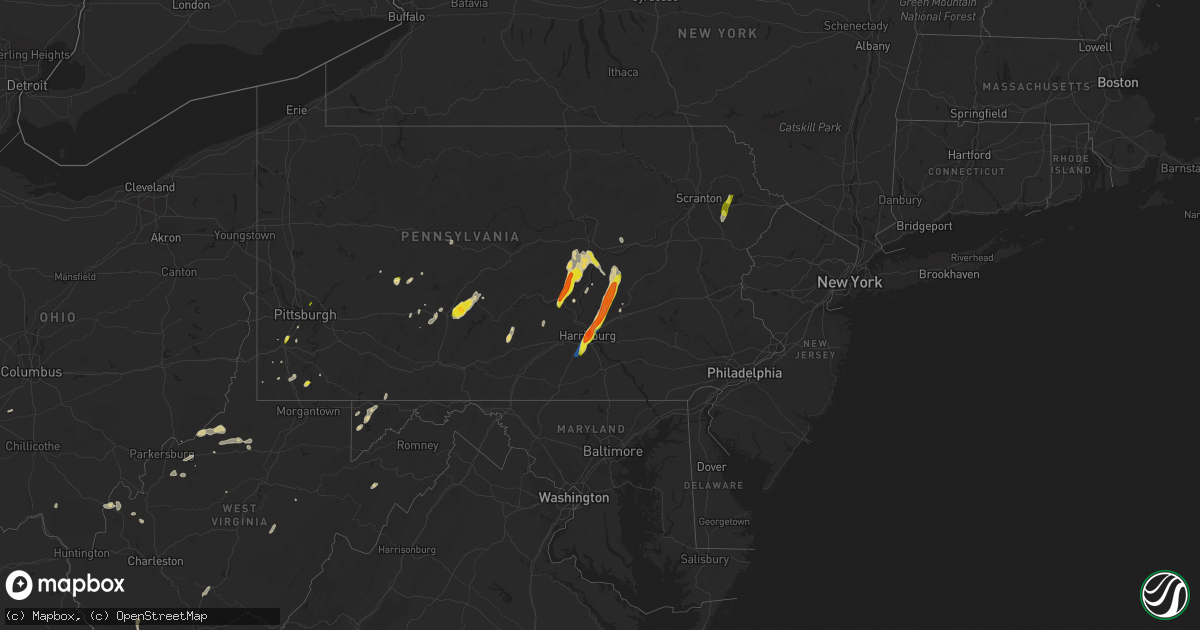
Hail Map on June 3, 2023
Get this storm
June 3 map
$229
one time, instant access
Download today. No call, no setup
Keep the $229
Bought the map and want the full workflow? Apply the entire $229 to a subscription within 7 days. None of it is wasted.
Every map, not just this one
This buys you this map. Subscription and you get every map we run, in the markets you choose from a few cities to whole states to nationwide. Plus real-time alerts the moment a storm fires.
Contact data
Name, contact info, occupancy, even credit band for addresses in the footprint. You go from where it hit to who to call.
Become the source they trust
Unlimited branding weather history reports on demand. You already have the documented answer ready for the property owner, and you are the one who showed up with it.
Property data and RoofTrace estimates
Pull up any address you have got, its value and the exact code rules for that jurisdiction, straight from One Click Code. Then RoofTrace estimates the squares, pitch, and roof value, priced the way you price.
States Impacted by Hail Map on June 3, 2023
Storm reports
Kansas
| Date | Description |
|---|---|
| 06/03/20232:23 PM CDT | Report via facebook. Trees snapped. |
| 06/03/20232:22 PM CDT | A local report indicates 60 MPH wind near Coffeyville Airport |
Florida
| Date | Description |
|---|---|
| 06/03/20231:25 PM CDT | Quarter sized hail was reported at the intersection of congress blvd and woolbright rd with widespread street flooding. |
| 06/03/20231:00 PM CDT | Nickel to quarter sized hail was reported along wright drive just west of i-95 in lake worth. |
| 06/03/202312:30 PM CDT | Marina mile and 9th ave. Half dollar sized hail. |
| 06/03/202312:30 PM CDT | A thunderstorm produced a wind gust of 72 mph at mesonet station 1694w fswn ft. Lauderdale. |
| 06/03/202312:20 PM CDT | A thunderstorm produced a wind gust of 83 mph at mesonet station 1694w ft lauderdale. |
| 06/03/202312:19 PM CDT | A thunderstorm produced a wind gust at asos station kfll fort lauderdale/hollywood intl airport. |
| 06/03/202312:07 PM CDT | City of hollywood emergency management reported quarter-sized hail in the hollywood hills area. Time estimated from radar. |
| 06/03/202312:00 PM CDT | A partial roof collapse of a duplex apartment building was reported shortly after a thunderstorm moved through the region producing wind gusts in excess of 70 mph. |
Wisconsin
| Date | Description |
|---|---|
| 06/03/20234:01 PM CDT | (gr |
| 06/03/20234:01 PM CDT | A local report indicates 1.00 inch wind near 3 NE Pearson |
Utah
| Date | Description |
|---|---|
| 06/03/20232:03 PM CDT | Received via social media. |
| 06/03/20231:40 PM CDT | Estimated quarter sized hail in west jordan. |
Ohio
| Date | Description |
|---|---|
| 06/03/20235:23 PM CDT | Tree down near intersection of fishinger rd and dublin rd. Time estimated from radar data. |
| 06/03/20235:23 PM CDT | Large tree branch blown down at the intersectin of mccoy rd and camborne rd in upper arlington. |
| 06/03/20235:23 PM CDT | Large tree branch over fishinger rd just south of riverside dr. Time estimated from radar data. |
| 06/03/20235:20 PM CDT | Multiple trees down... Including one onto a home... Causing roof damage. |
| 06/03/20235:20 PM CDT | Multiple trees down... Including one onto a home... Causing roof damage. |
| 06/03/20235:18 PM CDT | Large hackberry tree knocked down |
| 06/02/20237:12 PM CDT | Tree limbs down. Also pea-sized hail... And localized street flooding within the city. Part of the city lost power. |
Kentucky
| Date | Description |
|---|---|
| 06/03/20235:22 PM CDT | Large limbs blown down onto us 460 near the greasy creek road intersection and bridge per a social media post. The event time is radar estimated. |
| 06/03/20235:16 PM CDT | A tree was reported to have been blown down at 1250 fishtrap road. The event time is radar estimated. |
| 06/03/20235:01 PM CDT | A tree was reported to have been blown down at 1612 old ferrells creek road. |
| 06/03/20234:35 PM CDT | A tree was reported to have been blown down at 7705 marrowbone creek road/ky 195. The event time is radar estimated. |
Indiana
| Date | Description |
|---|---|
| 06/03/20235:09 PM CDT | Delayed report of tree downed and roof damage at a residence. |
| 06/03/20235:05 PM CDT | Picture on twitter of 1 partially rotten tree limb down. |
| 06/03/20235:05 PM CDT | Mainly pea to penny size hail... With picture shared of 1 quarter size hail stone near the elkhart and st joseph county line. |
| 06/03/20234:37 PM CDT | Likely wet microburst blew the side of a barn in... Several large diameter trees damaged up to 48 inches in diameter... Peeled roofing materials. Time estimated from ra |
Louisiana
| Date | Description |
|---|---|
| 06/03/20236:42 PM CDT | Report and photo of quarter size hail |
| 06/03/20235:59 PM CDT | A tree was downed on riverfront road in coushatta. |
| 06/03/20235:20 PM CDT | Large limbs blown down in and around the converse and noble communities in northern sabine parish. |
| 06/03/20235:11 PM CDT | Powerlines down in the vicinity of fairfield and e. 76th streets in shreveport. |
| 06/03/20235:10 PM CDT | Large tree uprooted near stratford and broadmoor blvd near querbes golf course in shreveport. |
| 06/03/20235:10 PM CDT | Powerlines downed in the vicinity of georgia and dee streets in shreveport. |
| 06/03/20235:05 PM CDT | Powerlines downed in the vicinity of wilkinson and gilbert drives in shreveport. |
| 06/03/20235:00 PM CDT | Powerlines downed at the vicinity of fairfield... Ockley and avery streets in shreveport. |
| 06/03/20234:54 PM CDT | Corrects previous tstm wnd gst report from 3 wsw shreveport. 58 mph wind gust measured at the shreveport regional airport at 454 pm. |
| 06/03/20234:52 PM CDT | Powerlines downed on walker road between green terrace road and bert kouns industrial loop. |
| 06/03/20234:50 PM CDT | Powerlines downed near avalon and mackey lane in southwest shreveport. |
| 06/03/20234:42 PM CDT | A tree was downed on waterwood drive and bea lane in greenwood. |
| 06/03/20234:29 PM CDT | Reports of several trees and power lines downed in the vicinity of the calumet plant in shreveport. |
Texas
| Date | Description |
|---|---|
| 06/03/20236:59 PM CDT | A local report indicates 1.00 inch wind near Bovina |
| 06/03/20236:14 PM CDT | A local report indicates 1.00 inch wind near 10 NW Eldorado |
| 06/03/20236:05 PM CDT | A few trees down... Limbs... Etc. Largest hail ping pong sized along highway 29 north of castell. Time estimated via radar. |
| 06/03/20236:05 PM CDT | A few trees down... Limbs... Etc. Largest hail ping pong sized along highway 29 north of castell. Time estimated via radar. |
| 06/03/20235:35 PM CDT | A local report indicates 2.00 inch wind near 4 WNW Pontotoc |
| 06/03/20234:02 PM CDT | 52kt or 60 mph wind gust measured at the gregg county airport in longview... Texas. |
| 06/03/20234:01 PM CDT | 50kt or 58 mph wind gust measured at the gregg county airport in longview... Texas. |
| 06/03/20233:50 PM CDT | Numerous trees downed across the northern half of rusk county or between kilgore and henderson... Texas. |
| 06/03/20233:49 PM CDT | A tree was downed across cr 1601 near avinger. |
| 06/03/20233:49 PM CDT | A tree was downed across highway 8 south of douglassville. |
| 06/03/20233:45 PM CDT | A local report indicates 1.00 inch wind near 0.25 W Placid |
| 06/03/20233:40 PM CDT | Corrects previous hail report from 2 wsw placid. |
| 06/03/20231:28 PM CDT | Several trees snapped and uprooted south of alto... Texas along cr 2707. |
| 06/03/202311:30 AM CDT | Gas station awning knocked down. |
| 06/03/20231:45 AM CDT | Brick facade of the mlk center in the third ward was blown off due to winds. |
| 06/03/20231:40 AM CDT | Multiple large trees uprooted and fallen branches along allen parkway between studemont st and sabine st. |
| 06/03/20231:37 AM CDT | Asos station kiah houston intnl. |
| 06/03/20231:37 AM CDT | Bush intercontinental airport asos station measured 62 mph wind gust. |
| 06/03/20231:35 AM CDT | Houston dunn asos station measured 59 mph wind gust. |
| 06/03/20231:20 AM CDT | A local report indicates 60 MPH wind near 2 NNE San Angelo |
| 06/03/202312:45 AM CDT | Numerous large branches downed across the city of magnolia. |
| 06/03/202312:23 AM CDT | Law enforcement dispatch reported multiple downed trees throughout the county. |
| 06/03/202312:06 AM CDT | Ew4261 mesonet site measured 69 mph wind gust. |
| 06/02/202311:50 PM CDT | Large tree limbs downed and blocking the street on ennis street. |
| 06/02/202311:50 PM CDT | Large tree limbs downed and blocking the street on ennis street. |
| 06/02/202311:50 PM CDT | Corrects previous tstm wnd gst report from 1 ese bryan. Large tree limbs downed and blocking the street on ennis street. |
| 06/02/202311:45 PM CDT | Large tree knocked down due to winds onto a mobile home. |
| 06/02/202311:40 PM CDT | Dispatch reports trees down near iola due to thunderstorm winds. |
| 06/02/202311:40 PM CDT | Brick facade of an apartment complex was taken off due to winds. |
| 06/02/202311:40 PM CDT | Kyle field mesonet site measured 85 mph wind gust. |
| 06/02/202311:30 PM CDT | Corrects previous tstm wnd dmg report from 2 ne up429. Gas station awning knocked down. |
| 06/02/202311:30 PM CDT | Corrects time from previous tstm wnd dmg report from 2 ne up429. Gas station awning knocked down. Several trees blown down in the college station area. |
| 06/02/202311:30 PM CDT | Gas station awning knocked down. Several trees blown down in the college station area. |
| 06/02/202311:20 PM CDT | Asos station kcll easterwood field airport. |
| 06/02/202311:20 PM CDT | Asos station kcll eas |
| 06/02/202311:20 PM CDT | Mesonet station 1757w texas a&m kyle field. |
| 06/02/202310:52 PM CDT | Tree down blocking the westbound lane on state highway 159 before it becomes state highway 237 around 5 miles to the east-northeast of la grange. |
| 06/02/20239:43 PM CDT | West texas mesonet |
| 06/02/20239:09 PM CDT | 59 mph thunderstorm wind gusts measured at austin bergstrom international airport. |
| 06/02/20238:58 PM CDT | Gas station canopy partially destroyed. Time estimated from radar. |
| 06/02/20238:54 PM CDT | A local report indicates 2.50 inch wind near 22 NW Ozona |
| 06/02/20238:41 PM CDT | Report from mping: ping pong ball |
| 06/02/20238:30 PM CDT | Report of quarter |
| 06/02/20238:29 PM CDT | Report from mping: half dollar |
| 06/02/20238:22 PM CDT | Tree damage with 6-foot branch breaking off an oak tree. Small tree also was snapped in half. Near the intersection of duck lake dr. And palos verdes drive. Time estima |
| 06/02/20238:17 PM CDT | Golf ball sized hail reported near fm2575 east of amarillo. |
| 06/02/20238:17 PM CDT | Co-op observer sent pictures of power pole down and large tree blown over on property. Approximate time given by observer and matched with radar. |
| 06/02/20238:15 PM CDT | Report from mping: half dollar |
| 06/02/20238:12 PM CDT | Half dollar sized hail observed near highland park via social media. |
| 06/02/20237:45 PM CDT | Public reported estimated ping pong size hail on fm 3167 in rio grande city with picture on social media. Time estimated from radar. |
| 06/02/20237:44 PM CDT | Trained spotter reported pea to nickel size hail with a few quarters mixed in 2 s of laguna park. |
| 06/02/20237:07 PM CDT | Reports of marble to quarter size hail in northern desoto. |
| 06/02/20237:04 PM CDT | Quarter size hail reported approx 8 miles south of wildorado relayed by local media. |
| 06/02/20237:00 PM CDT | Quarter sized hail reported southwest of hereford. |
Arkansas
| Date | Description |
|---|---|
| 06/03/20236:30 PM CDT | At 1167 hwy 208 west several trees were uprooted. |
| 06/03/20236:30 PM CDT | At 995 hwy 165 south trees downed including one downed onto a house. Roof damage was also noted in the area. |
| 06/03/20232:15 PM CDT | Estimated wind gust of 60 mph. Sheet metal peeled off of a roof. |
| 06/03/20232:07 PM CDT | Fire department responding to several power lines down in fort smith with arching electrical equipment. |
| 06/03/20231:45 PM CDT | Fire department reporting power line down on adams st. In lavaca. Report relayed via ham radio. |
| 06/03/20231:42 PM CDT | Kfyv asos. |
North Carolina
| Date | Description |
|---|---|
| 06/03/20236:28 PM CDT | Multiple trees down on pine hall road between belews lake and pine hall. |
| 06/03/20236:21 PM CDT | Tree down at gumtree rd and friendship-ledford rd. |
| 06/03/20236:12 PM CDT | Tree down at old us highway 52 and welcome-bethesda rd. |
| 06/03/20236:12 PM CDT | Tree down with power lines down at pepper rd and pepper ridge ct. |
| 06/03/20236:12 PM CDT | Numerous trees and power lines down throughout forsyth county. |
| 06/03/20236:07 PM CDT | A local report indicates 1.00 inch wind near 2 ESE Denver |
| 06/03/20235:58 PM CDT | Trees down in the area. |
| 06/03/20235:54 PM CDT | Power lines down west of i77. |
| 06/03/20235:47 PM CDT | A local report indicates 1.00 inch wind near 1 WSW Eden |
| 06/03/20235:47 PM CDT | Widespread trees downed across eden... Some on houses. Along with numerous powerlines also down. |
| 06/03/20235:46 PM CDT | Multiple large trees down in the ellett ave and church st area of eden. |
| 06/03/20235:45 PM CDT | Multiple trees uprooted and powerlines down. |
| 06/03/20235:40 PM CDT | Trees down 1 mile south of 150 bridge. |
| 06/02/20237:11 PM CDT | Multiple trees down. Time estimated. |
West Virginia
| Date | Description |
|---|---|
| 06/03/20235:56 PM CDT | Tree down on route 2. Also small hail around the same time. Time range given fine-tuned from radar. |
| 06/03/20235:48 PM CDT | Tree down on maple st. Report time 704 pm. Event time estimated from radar. |
| 06/03/20235:35 PM CDT | Trees down at the commission on age parking lot on stweart st. A few cars there were hit. Report time 733 pm. Event time estimated from radar. |
| 06/03/20235:33 PM CDT | Tree down at indian creek rd. And rena mae dr. Blocking northbound lane. |
| 06/03/20235:08 PM CDT | Tree down on myles ave.... The main drag through town. It took down power and phone lines and was blocking the road. Utility crews were still there at time of call... 9 |
| 06/03/20235:05 PM CDT | Large amount of hail in the pennsboro area. Also several trees and lines down as well. Fire department currently out assessing damages. |
| 06/03/20235:05 PM CDT | Several trees and lines down in the pennsboro area. Large amount of hail as well. Fire department currently out assessing damages. |
| 06/03/20233:52 PM CDT | Large tree just fell on south rd. Before linger chair factory. |
| 06/03/20233:01 PM CDT | Tree down blocking northbound lane of south rd. In french creek. |
| 06/03/20232:42 PM CDT | Tree down on getout run rd. Reported at 4:48 pm. Event time estiamted from radar. |
| 06/03/20232:42 PM CDT | Tree down completely blocking waterlom rd. In a sharp turn in french creek. Reported at 4:35 pm. Event time estimated from radar. |
| 06/03/20232:42 PM CDT | Tree fell across power lines on beeechtown rd. In french creek partially blocking road... And power is out in the area. |
| 06/03/20232:42 PM CDT | Tree hanging low over centerville rd.... Likely too low for taller trucks to pass safely underneath. Reported 732 pm. Event time estimated from radar. |
| 06/03/20232:42 PM CDT | Power lines down across both lanes at parkway st. And virginia ave. Power poles still up. Reported at 4:23 pm. Event time estiemated from radar. |
| 06/03/20232:31 PM CDT | Tree down on phillips dairy rd. All the way across road... Closer to heavner grove side. No lines involved. Tree came off the bank. |
| 06/03/20231:25 PM CDT | Tree branch down along route 26 |
| 06/03/20231:14 PM CDT | Tree down along frog hollow rd |
| 06/03/20231:10 PM CDT | Tree down on 72 outside of rowlesburg |
| 06/03/20231:05 PM CDT | Tree down along route 72/river rd |
| 06/02/202311:10 PM CDT | Delayed report. Grant county 911 reports downed tree along smoke hole road. |
| 06/02/202311:10 PM CDT | Delayed report. Grant county 911 reports downed tree along smoke hole road. |
| 06/02/202311:05 PM CDT | Delayed report. Grant county 911 reported several trees downed along wildcat road. Time estimated from radar. |
Virginia
| Date | Description |
|---|---|
| 06/03/20235:00 PM CDT | Scattered trees downed by thunderstorm winds in martinsville and eastern henry county. |
| 06/03/20234:23 PM CDT | Tree down blocking one lane of breaks park rd. Reported at 547 pm. Event time estimated from radar. |
Oklahoma
| Date | Description |
|---|---|
| 06/03/20235:32 PM CDT | Minor damage to car wash. Several large tree limbs down in that general area. |
| 06/03/20233:57 PM CDT | Large tree limb down west of vian. |
| 06/03/20232:08 PM CDT | Fire department responding to downed power line with arching on the ground in arkoma at 108 nelle road. |
| 06/03/20231:52 PM CDT | Measured with handheld anemometer. Quarter size hail also observed. |
| 06/03/20231:50 PM CDT | 6-12 inch diameter branch snapped. Report relayed via social media. Time estimated via radar. |
| 06/03/20231:49 PM CDT | A local report indicates 1.00 inch wind near 1 NNW Ada |
| 06/03/20231:47 PM CDT | A local report indicates 1.00 inch wind near 2 S Ada |
| 06/03/20231:46 PM CDT | A local report indicates 1.00 inch wind near 2 S Ada |
New Mexico
| Date | Description |
|---|---|
| 06/03/20236:30 PM CDT | A local report indicates 1.75 inch wind near Ned Houk Park |
| 06/03/20234:30 PM CDT | Report from twitter. |
| 06/03/20234:15 PM CDT | Awos station kats artesia. |
| 06/02/20238:01 PM CDT | Report from mping: quarter |
Pennsylvania
| Date | Description |
|---|---|
| 06/03/20236:53 PM CDT | Traffic light blown down and blocking the roadway. Time estimated by radar. |
| 06/03/20236:52 PM CDT | A local report indicates 1.50 inch wind near Linglestown |
| 06/03/20236:42 PM CDT | Spotter reports quarter sized hail in holidaysburg. |
| 06/03/20236:37 PM CDT | Power lines down. |
| 06/03/20236:20 PM CDT | A local report indicates 1.50 inch wind near 2 E Canoe Creek State P |
| 06/03/20236:17 PM CDT | Tree down across west-bound lane. |
| 06/03/20236:10 PM CDT | Tree fell down... Struck and knocked over a power line. Time estimated by radar. |
| 06/03/20235:45 PM CDT | Utility lines and trees down across the road. |
| 06/03/20235:06 PM CDT | Corrects previous tstm wnd dmg report from centerport. Metal roof covering partially blown off a residence on maple street in centerport. Time estimated from radar and |
| 06/03/20235:06 PM CDT | Report of roof material blown off a residence on maple street in centerport. Time estimated from radar and nearby spotter report. |
| 06/03/20235:03 PM CDT | A local report indicates 60 MPH wind near Hamburg |
| 06/03/20235:03 PM CDT | Small tree split in half due to winds. Corrects previous tstm wnd gst report from hamburg. |
| 06/03/20234:55 PM CDT | Some reports of wires and trees down in centre township and windsor township. Time estimated from radar and from nearby spotter report. |
| 06/03/20234:55 PM CDT | Ping pong sized hail reported along route 35 between richfield and mt. Pleasant mills. |
| 06/03/20234:47 PM CDT | Trees down near orndorff rd and route 218 |
| 06/03/20234:45 PM CDT | Multiple trees down. |
| 06/03/20234:32 PM CDT | Trees down near braden run rd and route 188 |
| 06/03/20234:29 PM CDT | Trees down on wires along creek rd |
| 06/03/20234:28 PM CDT | Along i-79 near racetrack rd and fischer rd |
| 06/03/20234:28 PM CDT | Along route 21 |
| 06/03/20234:19 PM CDT | Sr 19 closed due to fallen trees and wires |
| 06/03/20234:14 PM CDT | Tree down on a car in canonsburg on n central ave |
| 06/03/20233:47 PM CDT | Multiple trees down... Tree limbs on power lines also reported near east buffalo township. Time estimated by radar. |
| 06/03/20233:35 PM CDT | Picture provided |
| 06/03/20233:12 PM CDT | Tree down in shamokin township. |
| 06/03/20232:15 PM CDT | A local report indicates 1.00 inch wind near 2 W Purchase Line |
| 06/03/20232:10 PM CDT | Quarter sized hail along with winds strong enough to cause power outage at restaurant. Radar-estimated time. |
| 06/03/20231:34 PM CDT | Tree down on power lines along us 422 |
| 06/02/20237:12 PM CDT | Tree knocked down. |
| 06/02/20237:09 PM CDT | Report from mping: quarter |
| 06/02/20237:08 PM CDT | Multiple trees down throughout the county along with reports of trees on wires. |
| 06/02/20237:07 PM CDT | Wind and hail damaged door and glass front of a business. Time estimated by radar. |
| 06/02/20237:06 PM CDT | A local report indicates 1.75 inch wind near 1 S Harrisburg |
| 06/02/20237:03 PM CDT | Report from mping: half dollar |
| 06/02/20237:02 PM CDT | 1.5 inch hail reported north of 81 in harrisburg. |
Maryland
| Date | Description |
|---|---|
| 06/03/202312:31 PM CDT | Tree down on the 2000 block of oakland sang run road |
| 06/03/202312:05 PM CDT | Broadcast meteorologist relayed public report of quarter-sized hail near accident. |
Cities Impacted by Hail Map on June 3, 2023
- Bradford, NH
- Hillsborough, NH
- Hollywood, FL
- Dania, FL
- Fort Lauderdale, FL
- Lake Worth, FL
- Boynton Beach, FL
- Lake Worth Beach, FL
- Apple Springs, TX
- Accident, MD
- Grantsville, MD
- Booneville, AR
- Siloam Springs, AR
- Watts, OK
- Miami, FL
- Waldron, AR
- Oakland, MD
- Vinita, OK
- Miami Gardens, FL
- Paris, AR
- West Jordan, UT
- Salt Lake City, UT
- Midvale, UT
- Lake Ariel, PA
- Lakeville, PA
- Greentown, PA
- Newfoundland, PA
- Sterling, PA
- Moscow, PA
- Ada, OK
- South Sterling, PA
- Gouldsboro, PA
- Rochelle, TX
- Portales, NM
- Pickerel, WI
- Pearson, WI
- Brady, TX
- Milton, PA
- Northumberland, PA
- Winfield, PA
- Selinsgrove, PA
- Shamokin Dam, PA
- Sunbury, PA
- Middleburg, PA
- Mount Pleasant Mills, PA
- Freeburg, PA
- Richfield, PA
- Canonsburg, PA
- Washington, PA
- Marshall, MI
- Albion, MI
- Millerstown, PA
- McAlisterville, PA
- Thompsontown, PA
- San Saba, TX
- Nemacolin, PA
- Carmichaels, PA
- Greensboro, PA
- Rogers, NM
- Homer, MI
- Newport, PA
- Voca, TX
- Pontotoc, TX
- Menard, TX
- Roswell, NM
- Valley Spring, TX
- Castell, TX
- Llano, TX
- Melvin, TX
- Shamokin, PA
- Pitman, PA
- Leck Kill, PA
- Hegins, PA
- Valley View, PA
- Klingerstown, PA
- Sacramento, PA
- Lykens, PA
- Wiconisco, PA
- Spring Glen, PA
- Williamstown, PA
- Halifax, PA
- Williamsburg, PA
- Alexandria, PA
- Hollidaysburg, PA
- Hereford, TX
- Morgan City, LA
- Livingston, LA
- Tower City, PA
- Grantville, PA
- Harrisburg, PA
- Eldorado, TX
- Plymouth, IN
- New Salem, PA
- Loysville, PA
- Landisburg, PA
- Funk, NE
- Axtell, NE
- Shawano, WI
- Gibbon, NE
- Vulcan, MI
- Altamont, KS
- Parsons, KS
- Omaha, TX
- Cookville, TX
- Maxwell, NE
- Hooks, TX
- Commodore, PA
- Cherry Tree, PA
- Magnolia, AR
- Minden, LA
- Summers, AR
- Lincoln, AR
- Fayetteville, AR
- Sedan, KS
- Pittsburg, OK
- Stringtown, OK
- Glenville, WV
- Redbird, OK
- Porter, OK
- Ashdown, AR
- Fayetteville, WV
- Beavertown, PA
- Pennsboro, WV
- Fort Smith, AR
- Greenwood, AR
- West Fork, AR
- Dalmatia, PA
- Markleysburg, PA
- Canada, KY
- Elida, NM
- Bingham Canyon, UT
- Winslow, AR
- Naples, TX
- Hatfield, AR
- Virgil, KS
- Belcher, LA
- Lewisburg, PA
- Mifflinburg, PA
- New Berlin, PA
- Pocola, OK
- Shreveport, LA
- Greenwood, LA
- Linden, TX
- Simsboro, LA
- Tatum, NM
- Jonesboro, LA
- Mansfield, LA
- Frierson, LA
- Grand Cane, LA
- Hughes Springs, TX
- Tupelo, OK
- Hackett, AR
- Leonard, TX
- Trenton, TX
- Keithville, LA
- Montandon, PA
- Caddo Gap, AR
- Okemah, OK
- Natural Dam, AR
- Tyler, TX
- Whitehouse, TX
- Troup, TX
- Anacoco, LA
- Leesville, LA
- Vivian, LA
- Madill, OK
- Laneville, TX
- Huntington, IN
- Warren, IN
- Xenia, OH
- Wickes, AR
- Abilene, KS
- Greenville, TX
- Gainesville, TX
- Converse, LA
- Gladewater, TX
- Clay Center, KS
- Caddo, OK
- Alexandria, LA
- Pineville, LA
- Lecompte, LA
- Kenefic, OK
- Oswego, KS
- Adair, OK
- Big Cabin, OK
- Lansing, WV
- Victor, WV
- Yantis, TX
- Emory, TX
- Foster City, MI
- Mount Pleasant, TX
- Winfield, TX
- Lena, LA
- Cloutierville, LA
- Call, TX
- Kirbyville, TX
- Middlebourne, WV
- Friendly, WV
- Saint Marys, WV
- Sistersville, WV
- New Matamoras, OH
- Mcalester, OK
- Clearfield, PA
- Crystal Falls, MI
- Dierks, AR
- Durant, OK
- Bokchito, OK
- Mineral Point, PA
- Johnstown, PA
- Lufkin, TX
- Weleetka, OK
- Price, TX
- Arp, TX
- Overton, TX
- Henderson, TX
- Selman City, TX
- Kilgore, TX
- Oberlin, LA
- Kinder, LA
- Elizabeth, WV
- Muldrow, OK
- Colbert, OK
- Calera, OK
- Hendrix, OK
- Denison, TX
- Liverpool, PA
- Alto, TX
- Wells, TX
- Delaware, OK
- Swanton, MD
- McHenry, MD
- Wilson, KS
- Buna, TX
- Proctor, OK
- Elkins, AR
- Clymer, PA
- Starford, PA
- Rosston, AR
- Ozark, AR
- Hallsville, TX
- West Union, WV
- Pompano Beach, FL
- Avinger, TX
- Sulphur Springs, TX
- Dike, TX
- Arcadia, LA
- Dulac, LA
- Lavaca, AR
- Saint Gabriel, LA
- Sunshine, LA
- Phyllis, KY
- Kimper, KY
- Prescott, AR
- Princeton, LA
- Dixonville, PA
- Oakdale, LA
- Waldo, KS
- Russell, KS
- Dorrance, KS
- Bunker Hill, KS
- Jasper, TX
- Buckner, AR
- Stamps, AR
- Dustin, OK
- Stonewall, OK
- Caney, OK
- Milburn, OK
- Coleman, OK
- Ragley, LA
- East Waterford, PA
- Blairs Mills, PA
- Bluejacket, OK
- Arkoma, OK
- Spiro, OK
- Roland, OK
- Cameron, OK
- Edon, OH
- Hamilton, IN
- Ardmore, OK
- Harlem, MT
- Hays, MT
- Dequincy, LA
- Cedar Valley, UT
- Bonham, TX
- Vinton, LA
- Eighty Four, PA
- Savoy, TX
- Bells, TX
- Alma, WV
- Salem, WV
- Jefferson, TX
- Daisy, OK
- Tishomingo, OK
- Hallandale, FL
- Starks, LA
- Rose, OK
- Amherstdale, WV
- Kearney, NE
- Combs, AR
- Saint Paul, AR
- Waynesburg, PA
- Jefferson, PA
- Daingerfield, TX
- Farmington, AR
- Petroleum, WV
- Cairo, WV
- Athens, LA
- Bienville, LA
- Gibsland, LA
- Woodston, KS
- Lohn, TX
- Richland Springs, TX
- Saltillo, TX
- Sulphur Bluff, TX
- Fort Stockton, TX
- Amity, PA
- Chapman, KS
- Chester, AR
- Tahlequah, OK
- Mannsville, OK
- Mill Creek, OK
- Alma, AR
- Rudy, AR
- Pittsford, MI
- Osseo, MI
- Strang, OK
- Smithville, OK
- Mena, AR
- Talco, TX
- Webster Springs, WV
- Pickens, WV
- Wapanucka, OK
- Grannis, AR
- Roff, OK
- Wolfe City, TX
- McNeil, AR
- Brady, NE
- Pineland, TX
- Karnack, TX
- Mooringsport, LA
- Marion Center, PA
- Madison, KS
- Toronto, KS
- Leesburg, TX
- Pittsburg, TX
- Spavinaw, OK
- Barling, AR
- Charleston, AR
- Majestic, KY
- Matewan, WV
- Kirby, AR
- Kennard, TX
- Sherman, TX
- Benton, LA
- Colmesneil, TX
- Marathon, TX
- Kaplan, LA
- Maurice, LA
- Baton Rouge, LA
- Plaquemine, LA
- West Salisbury, PA
- Springs, PA
- Salisbury, PA
- Westover, PA
- La Jose, PA
- Emerson, AR
- Williamson, WV
- Belfry, KY
- Ebensburg, PA
- Bluffton, IN
- Theriot, LA
- Lookout, WV
- Edmond, WV
- Hawkins, TX
- West Valley City, UT
- Wharncliffe, WV
- Sycamore, PA
- Moran, KS
- Elton, LA
- Pitkin, LA
- Elizabeth, LA
- Prosperity, PA
- Hosston, LA
- Ida, LA
- Robeline, LA
- Marthaville, LA
- Terry, MS
- Enterprise, KS
- Olpe, KS
- Clarksville, TX
- Delray Beach, FL
- Bethel Park, PA
- Pittsburgh, PA
- Scroggins, TX
- Haughton, LA
- Dallas, TX
- Desoto, TX
- Lancaster, TX
- Willow City, TX
- Fredericksburg, TX
- Round Mountain, TX
- Johnson City, TX
- Friona, TX
- Summerfield, TX
- Clovis, NM
- Texico, NM
- Farwell, TX
- Bovina, TX
- Lemoyne, PA
- New Cumberland, PA
- Camp Hill, PA
- Mechanicsburg, PA
- Lewisberry, PA
- Dillsburg, PA
- Panhandle, TX
- Wildorado, TX
- Red Oak, TX
- Hye, TX
- Rio Grande City, TX
- Roma, TX
- Blanco, TX
- Clifton, TX
- Valley Mills, TX
- Ozona, TX
- Amarillo, TX
- Ennis, TX
- Italy, TX
- Milford, TX
- Grandview, TX
- Pyote, TX
- Barstow, TX
- Pecos, TX
- Coyanosa, TX
- Bryan, TX
- Hearne, TX
- College Station, TX
- Navasota, TX
- Iola, TX
- Anderson, TX
- Midlothian, TX
- New Holland, OH
- Mount Sterling, OH
- Waco, TX
- Walker, WV
- Axton, VA
- Eden, NC
- Cascade, VA
- Farmersville, TX
- Elkhart, IN
- Crawford, TX
- McGregor, TX
- Henderson, WV
- Gallipolis Ferry, WV
- Point Pleasant, WV
- Liberty, WV
- Given, WV
- Leon, WV
- Waxahachie, TX
- Denham Springs, LA
- Pine Grove, LA
- Greenwell Springs, LA
- Clinton, LA
- Broken Arrow, OK
- Tulsa, OK
- Tioga, TX
- Pilot Point, TX
- Anna, TX
- Big Lake, TX
- Doylesburg, PA
- Lilly, PA
- Maypearl, TX
- Monahans, TX
- Garden City, TX
- Stanton, TX
- Grand Prairie, TX
- Amherst, TX
- Portage, PA
- Sidman, PA
- Lovington, NM
- Mishawaka, IN
- Osceola, IN
- Encino, NM
- Malone, TX
- Mertens, TX
- Hubbard, TX
- Imperial, TX
- Princeton, TX
- Mckinney, TX
- Melissa, TX
- Raymond, MS
- Tyrone, PA
- Midland, TX
- South Webster, OH
- Crane, TX
- Celeste, TX
- Coal Township, PA
- Elysburg, PA
- Paxinos, PA
- Rebuck, PA
- Dornsife, PA
- Sicily Island, LA
- Ferriday, LA
- Smithville, TX
- Pride, LA
- Slaughter, LA
- Zachary, LA
- Roxie, MS
- Natchez, MS
- Spicewood, TX
- Amite, LA
- Walker, LA
- Holden, LA
- Man, WV
- Gallipolis, OH
- Napoleonville, LA
- Belle Rose, LA
- Garards Fort, PA
- Bay Saint Louis, MS
- Huntsville, TX
- Oakhurst, TX
- Newport, OH
- Leander, TX
- Perkinston, MS
- Riesel, TX
- Marlin, TX
- McCamey, TX
- McHenry, MS
- Breaux Bridge, LA
- Southside, WV
- Lorena, TX
- Hewitt, TX
- Artesia, NM
- Trevorton, PA
- Art, TX
- Pine Grove, PA
- Bloomsburg, PA
- Meyersdale, PA
- Celina, TX
- Liberty Center, IN
- Markle, IN
- Friendsville, MD
- Austin, TX
- Thornton, TX
- Groesbeck, TX
- Midkiff, TX
- Enola, PA
- Jonestown, PA
- Danville, VA
- Mason, TX
- Stonewall, TX
- Wink, TX
- Tekonsha, MI
- Nappanee, IN
- Guyton, GA
- High Point, NC
- Melrose, NM
- Pierre Part, LA
- Pelican, LA
- Loving, NM
- Carlsbad, NM
- Gresham, WI
- Green, KS
- Jal, NM
- Stokesdale, NC
- Tobyhanna, PA
- Stoneville, NC
- Clarklake, MI
- Jerome, MI
- Cement City, MI
- Horton, MI
- Herndon, PA
- Pampa, TX
- Hagerman, NM
- Duncanville, TX
- Dry Fork, VA
- Dermott, AR
- Cedar Hill, TX
- Tullos, LA
- Jeanerette, LA
- Florien, LA
- Crystal Springs, MS
- Palmer, TX
- Saucier, MS
- Donie, TX
- Addison, MI
- Driftwood, TX
- Caddo Mills, TX
- Zapata, TX
- San Angelo, TX
- Liberty Hill, TX
- Marble Falls, TX
- Blue Ridge, TX
- Pearlington, MS
- Hornbeck, LA
- Dripping Springs, TX
- Eden, TX
- Hext, TX
- Valley View, TX
- Gratz, PA
- Horseshoe Bay, TX
- Larue, TX
- Collinsville, TX
- Prairieville, LA
- Palmer, KS
- Manchaca, TX
- Plantersville, TX
- Waller, TX
- Montgomery, TX
- Magnolia, TX
- Hockley, TX
- Hempstead, TX
- Cypress, TX
- Tomball, TX
- Pinehurst, TX
- Katy, TX
- Houston, TX
- Bellaire, TX
- Spring, TX
- Friendswood, TX
- Webster, TX
- South Houston, TX
- Pasadena, TX
- Pearland, TX
- Galena Park, TX
- Deer Park, TX
- La Porte, TX
- Humble, TX
- Channelview, TX
- Porter, TX
- Conroe, TX
- Glenshaw, PA
- Big Spring, TX
- Petersburg, PA
- Buda, TX
- Colorado City, TX
- Summerhill, PA
- Pearsall, TX
- Caldwell, TX
- Tulia, TX
- Shubuta, MS
- Loretto, PA
- Roscoe, TX
- Sterling City, TX
- Muldoon, TX
- La Grange, TX
- Happy, TX
- Masontown, PA
- Ronco, PA
- Laredo, TX
- Sudan, TX
- Dryden, TX
- Labadieville, LA
- Independence, LA
- French Settlement, LA
- Uvalde, TX
- Kiln, MS
- Picayune, MS
- Marietta, OH
- Mcalister, NM
- Richmond, TX
- Chilton, TX
- Schulenburg, TX
- Cabins, WV
- Petersburg, WV
- Lexington, TX
- Ira, TX
- Coahoma, TX
- Lockhart, TX
- Franklin, LA
- Groom, TX
- Flatonia, TX
- San Ygnacio, TX
- West Point, TX
- Von Ormy, TX
- Canyon, TX
- Cat Spring, TX
- New Ulm, TX
- Washington, TX
- Brenham, TX
- Loraine, TX
- Claude, TX
- Rotan, TX
- Kosse, TX
- Robert Lee, TX
- Mirando City, TX
- Somerville, TX
- Bastrop, TX
- Giddings, TX
- House, NM
- Waveland, MS
- Falfurrias, TX
- Abbeville, LA
- Gibson, LA
- Thibodaux, LA
- Berwick, LA
- Patterson, LA
- Normangee, TX
- North Zulch, TX
- Westbrook, TX
- Aspermont, TX
- Opa Locka, FL
- Dale, TX
- Realitos, TX
- Madisonville, TX
- Marquez, TX
- Franklin, TX
- Coldspring, TX
- Pass Christian, MS
- Rockdale, TX
- Abilene, TX
- Cross Plains, TX
- Rising Star, TX
- Brownwood, TX
- Baird, TX
- Clyde, TX
- Gorman, TX
- De Leon, TX
- Garita, NM
- Cuervo, NM
- Conchas Dam, NM
- Old Glory, TX
- Gustine, TX
- Carlton, TX
- Miles, TX
- Bronte, TX
- Merkel, TX
- May, TX
- Blanket, TX
- Sidney, TX
- Vaughn, NM
- Blackwell, TX
- Grady, NM
- Eastland, TX
- Muleshoe, TX
- Trent, TX
- Garciasville, TX
- Fredonia, TX
- Wingate, TX
- Coleman, TX
- Burkett, TX
- Cisco, TX
- Carbon, TX
- Home, PA
- Spruce Creek, PA
- Altoona, PA
- Ernest, PA