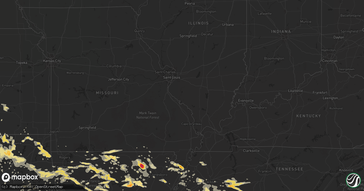
Hail Map in Tennessee on June 3, 2012
Get this storm
June 3 map
$229
one time, instant access
Download today. No call, no setup
Keep the $229
Bought the map and want the full workflow? Apply the entire $229 to a subscription within 7 days. None of it is wasted.
Every map, not just this one
This buys you this map. Subscription and you get every map we run, in the markets you choose from a few cities to whole states to nationwide. Plus real-time alerts the moment a storm fires.
Contact data
Name, contact info, occupancy, even credit band for addresses in the footprint. You go from where it hit to who to call.
Become the source they trust
Unlimited branding weather history reports on demand. You already have the documented answer ready for the property owner, and you are the one who showed up with it.
Property data and RoofTrace estimates
Pull up any address you have got, its value and the exact code rules for that jurisdiction, straight from One Click Code. Then RoofTrace estimates the squares, pitch, and roof value, priced the way you price.
Storm reports in Tennessee
Tennessee
| Date | Description |
|---|---|
| 06/03/20126:50 PM CDT | Wind gust 55 to 60 mph on hwy 142 just south of selmer. |
| 06/03/20126:50 PM CDT | Penny to quarter sized hail on highway 45 just south of selmer |
| 06/03/20122:39 AM CDT | Quarter size hail covering the ground. |
| 06/03/201212:09 AM CDT | Multiple trees/powerlines down at intersection of route 224 and hwy 57 and on tulu and michie road. |
| 06/02/201211:10 PM CDT | Roof blown off home at 1220 post office rd. |
| 06/02/201211:10 PM CDT | Quarter size hail near shiloh. Time estimated from radar. |
| 06/02/201211:10 PM CDT | Several trees down and a house with some minor damage to the siding near olivet. |
| 06/02/201211:10 PM CDT | Several trees down near eastview...mitchie...and stantonville. |
| 06/02/201210:40 PM CDT | Hail up to the size of golf balls reported in bolivar. Time estimated from radar. |
| 06/02/201210:40 PM CDT | A few trees down throughout the county. Time estimated from radar. |
| 06/02/201210:40 PM CDT | 60 mph wind gusts in bolivar. |
| 06/02/201210:20 PM CDT | Tree limbs and power lines down - scattered about the county. |
| 06/02/201210:16 PM CDT | Tree limbs and power lines down across the county...slightly more concentrated over southwestern fayette county. |
| 06/02/201210:15 PM CDT | A few powerlines and trees down in western madison county. |
| 06/02/201210:02 PM CDT | Large tree down near eads with others down across fayette county. Time estimated. |
| 06/02/20129:57 PM CDT | Tree down on house in arlington. Time estimated. |
| 06/02/20129:56 PM CDT | Power lines down on rabbit trail road near leoma...possibly caused by falling tree. |
| 06/02/20129:48 PM CDT | A few powerlines and trees down in western madison county. |
| 06/02/20129:43 PM CDT | 6 trees down near mason. Time is estimated from radar. |
| 06/02/20129:30 PM CDT | 15 to 18 trees down across roads in lauderdale county. Time is estimated from radar. |
| 06/02/20128:55 PM CDT | Golf ball sized hail near michie. |
| 06/02/20128:47 PM CDT | A local report indicates 1.00 inch wind near LINDEN |
| 06/02/20128:47 PM CDT | On u.s. 412 just east of linden a few trees were reported down. |
| 06/02/20128:30 PM CDT | A few trees were downed on centerville highway. |
| 06/02/20128:17 PM CDT | Hail reported on us highway 64 between waynesboro and the giles county line. |
| 06/02/20127:44 PM CDT | Golf ball sized hail in bath springs. |
| 06/02/20127:30 PM CDT | A few trees down on bible hill road. Time estimated by radar. |
| 06/02/20127:20 PM CDT | Reported in white oak community |
All States Impacted by Hail Map on June 3, 2012
Cities Impacted by Hail Map on June 3, 2012
- Pocahontas, TN
- Center Ridge, AR
- Hattieville, AR
- Cleveland, AR
- Mountain Home, AR
- Oakland, AR
- Gainesville, MO
- Clarkridge, AR
- Childress, TX
- Bradford, AR
- Oil Trough, AR
- Thida, AR
- Mclean, TX
- Pampa, TX
- Laverne, OK
- Stuart, OK
- Mcalester, OK
- Oxford, MS
- Minto, ND
- London, AR
- Lamar, AR
- Dover, AR
- Russellville, AR
- Trumann, AR
- Marked Tree, AR
- Shelby, AL
- Sylacauga, AL
- Barnsdall, OK
- Ochelata, OK
- Eufaula, OK
- Iuka, MS
- Cherokee, AL
- Hughes, AR
- Bartlesville, OK
- Dewey, OK
- Clinton, AR
- Scotland, AR
- Blytheville, AR
- Burns, WY
- Pine Bluffs, WY
- Wagoner, OK
- Hulbert, OK
- Chouteau, OK
- Locust Grove, OK
- Clarksville, AR
- Hartman, AR
- Ozark, AR
- Moline, KS
- Grenola, KS
- Shiloh, TN
- Counce, TN
- Burt, IA
- Canehill, AR
- Lincoln, AR
- Prairie Grove, AR
- Broadwater, NE
- Bridgeport, NE
- Dalton, NE
- Jerusalem, AR
- Fairfield, AL
- Birmingham, AL
- Kennett, MO
- Hornersville, MO
- Senath, MO
- Pelham, AL
- Tuscumbia, AL
- Elizabeth, AR
- Jasper, GA
- Reydon, OK
- Rector, AR
- Corinth, MS
- Canadian, TX
- Linden, TN
- Smithville, AR
- Poughkeepsie, AR
- Strawberry, AR
- Black Rock, AR
- Mason, TN
- Bigelow, AR
- Walnut, MS
- Falkner, MS
- Ripley, MS
- Saulsbury, TN
- Middleton, TN
- Grand Junction, TN
- Rienzi, MS
- Tiplersville, MS
- Glen, MS
- Booneville, MS
- Columbiana, AL
- Weogufka, AL
- Mount Judea, AR
- Western Grove, AR
- Vendor, AR
- Hasty, AR
- Jasper, AR
- Hominy, OK
- Skiatook, OK
- Michie, TN
- Ramer, TN
- Guys, TN
- Selmer, TN
- Tishomingo, MS
- Tulsa, OK
- Owasso, OK
- Catoosa, OK
- Claremore, OK
- Webbers Falls, OK
- Porum, OK
- Savannah, TN
- Hagarville, AR
- Ravenden, AR
- Williford, AR
- Evening Shade, AR
- Powhatan, AR
- Lynn, AR
- Gates, TN
- Halls, TN
- Ripley, TN
- Burnsville, MS
- Gate, OK
- Batesville, MS
- Taylor, MS
- Water Valley, MS
- Madison, AL
- Chester, AR
- Mountainburg, AR
- Tahlequah, OK
- Quitaque, TX
- Clarendon, TX
- Talala, OK
- Coldwater, MS
- Severy, KS
- Eureka, KS
- Fairfield Bay, AR
- Dennard, AR
- Pelsor, AR
- Parthenon, AR
- Hindsville, AR
- Harrison, AR
- Hector, AR
- Wesley, AR
- Edgemont, AR
- Alpena, AR
- Higden, AR
- Marble Falls, AR
- Marshall, AR
- Leslie, AR
- Kingston, AR
- Green Forest, AR
- Witts Springs, AR
- Huntsville, AR
- Elkins, AR
- Compton, AR
- Saint Joe, AR
- Tilly, AR
- Shirley, AR
- Berryville, AR
- Deer, AR
- Lester, AL
- Brilliant, AL
- Haleyville, AL
- Kenton, TN
- Trimble, TN
- Hickory Valley, TN
- Elk City, OK
- Butler, OK
- Calico Rock, AR
- Carpenter, WY
- Marmaduke, AR
- Steele, MO
- Gobler, MO
- Boyers, PA
- Eau Claire, PA
- Parker, PA
- Hilliards, PA
- Atkins, AR
- Welch, OK
- Delaware, OK
- Vinita, OK
- Lenapah, OK
- Sulligent, AL
- Greenwood Springs, MS
- Sweetwater, OK
- Alton, MO
- Hamilton, AL
- Tremont, MS
- Dennis, MS
- Hammon, OK
- Fairfax, OK
- Wynona, OK
- Collinsville, OK
- Sperry, OK
- Broken Arrow, OK
- Brickeys, AR
- Pleasant Plains, AR
- Rosie, AR
- Newport, AR
- Afton, OK
- New Site, MS
- Marietta, MS
- Eucha, OK
- Lynn, AL
- Pocahontas, AR
- Ravenden Springs, AR
- Sand Springs, OK
- Alabaster, AL
- Chelsea, AL
- Hornsby, TN
- Bethel Springs, TN
- Adamsville, TN
- Stantonville, TN
- Mercer, TN
- Henderson, TN
- Toone, TN
- Bolivar, TN
- Medon, TN
- Park Hill, OK
- Stilwell, OK
- Bunch, OK
- Welling, OK
- Evansville, AR
- Leon, KS
- Rosalia, KS
- Russellville, AL
- Leighton, AL
- Monette, AR
- Cardwell, MO
- Leachville, AR
- Arbyrd, MO
- Combs, AR
- Fayetteville, AR
- Bixby, OK
- Crump, TN
- Olivehill, TN
- Saltillo, MS
- Mooreville, MS
- Mantachie, MS
- Baldwyn, MS
- Nettleton, MS
- Fulton, MS
- Guntown, MS
- Amory, MS
- Plantersville, MS
- Tupelo, MS
- Detroit, AL
- Smithville, MS
- Sterrett, AL
- Vincent, AL
- Lu Verne, IA
- Goldfield, IA
- Corwith, IA
- Renwick, IA
- Waynesboro, TN
- Bluejacket, OK
- La Fayette, GA
- Scotts Hill, TN
- Hohenwald, TN
- Decaturville, TN
- Darden, TN
- Lexington, TN
- Parsons, TN
- Clifton, TN
- Bath Springs, TN
- Loretto, TN
- Leoma, TN
- Colony, OK
- Lookeba, OK
- Corn, OK
- Hydro, OK
- Farmington, AR
- Onia, AR
- Timbo, AR
- Newkirk, OK
- Shidler, OK
- Burbank, OK
- Kaw City, OK
- Clinton, OK
- Cheyenne, OK
- Jay, OK
- Brighton, TN
- McCrory, AR
- Floral, AR
- Everton, AR
- Cherryvale, KS
- Mound Valley, KS
- Mountain View, AR
- Drasco, AR
- Wilburn, AR
- Heber Springs, AR
- Pangburn, AR
- Batesville, AR
- Locust Grove, AR
- Concord, AR
- Judsonia, AR
- Tumbling Shoals, AR
- Marcella, AR
- Brownsville, TN
- Cleveland, OK
- Duncombe, IA
- Webster City, IA
- Stratford, IA
- Fort Dodge, IA
- Lehigh, IA
- Gassville, AR
- Midway, AR
- Melbourne, AR
- Bessemer, AL
- Reagan, TN
- Enville, TN
- Dyer, TN
- Newbern, TN
- Mounds, OK
- Beggs, OK
- Senatobia, MS
- Morrilton, AR
- Adona, AR
- Pottsville, AR
- Dardanelle, AR
- Sedan, KS
- Westville, OK
- Morrow, AR
- Rudy, AR
- Maple City, KS
- Cookson, OK
- Pawhuska, OK
- Knoxville, AR
- Sallisaw, OK
- Perry, AR
- West Fork, AR
- Inola, OK
- Ramona, OK
- Winslow, AR
- Mayflower, AR
- Houston, AR
- Mulberry, AR
- Mannford, OK
- Ponca City, OK
- Prue, OK
- Fort Gibson, OK
- Proctor, OK
- Oark, AR
- Terlton, OK
- Osage, OK
- Jennings, OK
- Roland, AR
- Copan, OK
- Spavinaw, OK
- Strang, OK
- Grove, OK
- Colcord, OK
- Drayton, ND
- Lakeview, TX
- Moulton, AL
- Warner, OK
- Burlison, TN
- Guion, AR
- Mount Pleasant, AR
- Talking Rock, GA
- Gainesville, GA
- Colt, AR
- Cotton Plant, AR
- Palestine, AR
- Brockwell, AR
- Arlington, TN
- Pulaski, TN
- Okemah, OK
- Saffell, AR
- Graysville, AL
- Adamsville, AL
- Foss, OK
- Custer City, OK
- Como, MS
- Sardis, MS
- Red Lodge, MT
- Huron, TN
- Jacks Creek, TN
- Cedar Vale, KS
- Dawsonville, GA
- Cumming, GA
- Marble Hill, GA
- Rose Bud, AR
- Jasper, AL
- Carbon Hill, AL
- Guin, AL
- Winfield, AL
- Eldridge, AL
- Nauvoo, AL
- Oak Grove, AR
- Omaha, AR
- Lockney, TX
- Cave City, AR
- Sulphur Rock, AR
- Belmont, MS
- Somerville, TN
- Whiteville, TN
- Salina, OK
- Rose, OK
- Hernando, MS
- Robinsonville, MS
- Marianna, AR
- Forrest City, AR
- Ranger, GA
- Memphis, TX
- Chickamauga, GA
- Hoxie, AR
- Walnut Ridge, AR
- El Dorado, KS
- Hillsdale, WY
- Keota, OK
- Sardis, TN
- Blue Springs, MS
- Bristow, OK
- Drumright, OK
- Hardy, AR
- Sidney, NE
- Checotah, OK
- Wood River Junction, RI
- Carolina, RI
- Wyoming, RI
- Sidney, AR
- Udall, MO
- Yellville, AR
- Bakersfield, MO
- Peel, AR
- Caulfield, MO
- Pontiac, MO
- Town Creek, AL
- Hillsboro, AL
- Courtland, AL
- Kanawha, IA
- Caledonia, MS
- Gattman, MS
- Alvarado, MN
- Oslo, MN
- Swifton, AR
- Ash Flat, AR
- Alicia, AR
- Tuckerman, AR
- Cord, AR
- Portia, AR
- Imboden, AR
- Finley, TN
- Florence, AL
- Norfork, AR
- Lafe, AR
- Ozone, AR
- Oologah, OK
- Blanco, OK
- Hartshorne, OK
- Bokoshe, OK
- Mccurtain, OK
- Ridgedale, MO
- Pineville, AR
- Gardendale, AL
- Bull Shoals, AR
- Flippin, AR
- Cotter, AR
- Lakeview, AR
- Morris Chapel, TN
- Milledgeville, TN
- Athens, AL
- Elkmont, AL
- Pinson, AL
- Hanna, OK
- Pisgah, AL
- Stigler, OK
- Bozeman, MT
- Aberdeen, MS
- Hamilton, MS
- Vernon, AL
- Thayer, MO
- Foxburg, PA
- Emlenton, PA
- Lead Hill, AR
- Summit, AR
- Cheyenne, WY
- Cavalier, ND
- Natural Dam, AR
- Uniontown, AR
- Anderson, AL
- Lexington, AL
- Rogersville, AL
- Algona, IA
- Bells, TN
- Spruce Pine, AL
- Geary, OK
- Crook, CO
- Lepanto, AR
- Amagon, AR
- Wilsonville, AL
- Harpersville, AL
- Leeds, AL
- Goodwater, AL
- Childersburg, AL
- Pleasant Grove, AL
- Munford, TN
- Henning, TN
- Covington, TN
- Killen, AL
- Mount Hope, AL
- Waterloo, AL
- Golden, MS
- Oktaha, OK
- Harrisburg, AR
- Muskogee, OK
- Council Hill, OK
- Bono, AR
- Beaverton, AL
- Franklin, AR
- Lawrenceburg, TN
- Five Points, TN
- Westpoint, TN
- Saint Joseph, TN
- Iron City, TN
- Minor Hill, TN
- Turkey, TX
- Pontotoc, MS
- Houlka, MS
- Argyle, MN
- Fort Payne, AL
- Collinsville, AL
- Ada, OK
- Big Flat, AR
- Harriet, AR
- Portales, NM
- Hollywood, AL
- Sage, AR
- Collinwood, TN
- Cypress Inn, TN
- Thaxton, MS
- Berry, AL
- Michigan City, MS
- Ashland, MS
- Hollytree, AL
- New Market, AL
- Princeton, AL
- Gurley, AL
- Sapulpa, OK
- Watts, OK
- Summers, AR
- Rutherford, TN
- Winfield, KS
- Muldrow, OK
- Alpine, TX
- Lone Rock, IA
- Bancroft, IA
- Burden, KS
- Abbeville, MS
- Centerville, TN
- Washburn, MO
- Exeter, MO
- Rocky Comfort, MO
- Couch, MO
- Durham, OK
- Denmark, TN
- Finger, TN
- Lutts, TN
- Pinson, TN
- Jackson, TN
- Hartselle, AL
- Danville, AL
- Kiowa, OK
- Magness, AR
- Newark, AR
- Scottsboro, AL
- Jonesboro, AR
- Cropwell, AL
- Arab, AL
- Quanah, TX
- Ball Ground, GA
- Hedley, TX
- Courtland, MS
- Pleasant Grove, AR
- Coffeyville, KS
- Valley Springs, AR
- Hackleburg, AL
- Paragould, AR
- S Coffeyville, OK
- Vina, AL
- Columbus, MS
- Eagle Rock, MO
- West Kingston, RI
- Beech Bluff, TN
- Briscoe, TX
- Cedarville, AR
- Luxora, AR
- Liberty, KS
- Okmulgee, OK
- Warm Springs, AR
- Gatewood, MO
- Oakland, TN
- Fifty Six, AR
- Parrish, AL
- Townley, AL
- Oakman, AL
- Bankston, AL
- Crossville, AL
- Sheffield, AL
- Muscle Shoals, AL
- Fairmount, GA
- Anderson, MO


