Hail Map in Arkansas on June 3, 2012
Get this storm
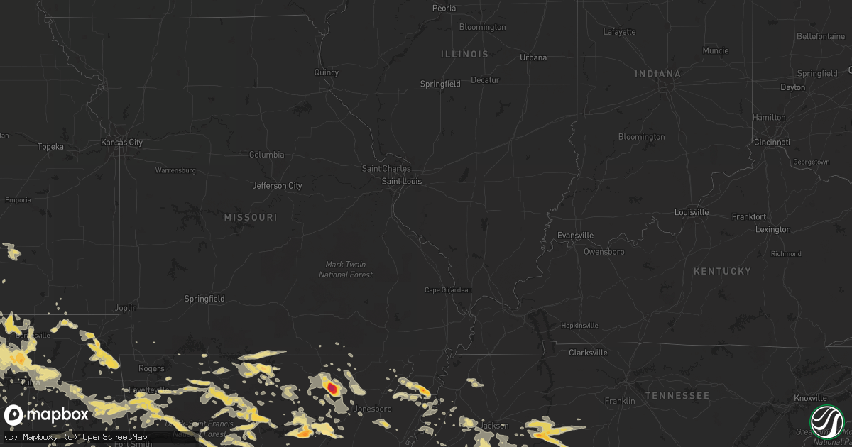
June 3 map
$229
one time, instant access
Download today. No call, no setup
Keep the $229
Bought the map and want the full workflow? Apply the entire $229 to a subscription within 7 days. None of it is wasted.
Every map, not just this one
This buys you this map. Subscription and you get every map we run, in the markets you choose from a few cities to whole states to nationwide. Plus real-time alerts the moment a storm fires.
Contact data
Name, contact info, occupancy, even credit band for addresses in the footprint. You go from where it hit to who to call.
Become the source they trust
Unlimited branding weather history reports on demand. You already have the documented answer ready for the property owner, and you are the one who showed up with it.
Property data and RoofTrace estimates
Pull up any address you have got, its value and the exact code rules for that jurisdiction, straight from One Click Code. Then RoofTrace estimates the squares, pitch, and roof value, priced the way you price.
Storm reports in Arkansas
Arkansas
| Date | Description |
|---|---|
| 06/03/20126:56 PM CDT | Trees were blown down. |
| 06/03/20126:55 PM CDT | A local report indicates 2.50 inch wind near HICKORY FLAT |
| 06/03/20126:45 PM CDT | Trees were down in the greers ferry lake area. A tree limb fell on to a power line. Trees were blown down in the devils fork recreation area. |
| 06/03/20126:44 PM CDT | Winds est. At 60 mph. Trees and structure damage reported. Also pea size hail. |
| 06/03/20126:35 PM CDT | A wind gust of 53 mph was measured at the clinton airport. |
| 06/03/20126:33 PM CDT | A local report indicates 1.00 inch wind near OARK |
| 06/03/20126:30 PM CDT | Hail reported on the franklin johnson county line |
| 06/03/20126:20 PM CDT | A local report indicates 1.50 inch wind near DENNARD |
| 06/03/20126:20 PM CDT | A local report indicates 1.75 inch wind near 3 ENE DENNARD |
| 06/03/20126:20 PM CDT | Trees were downed in clinton. |
| 06/03/20126:20 PM CDT | Correction to the report of golf ball size hail 3ene of dennard. Spotter was 3ene of botkinburg. |
| 06/03/20126:15 PM CDT | A local report indicates 1.00 inch wind near 4 N CASS |
| 06/03/20125:39 PM CDT | Hail lasted for about 3 minutes. |
| 06/03/20125:26 PM CDT | A local report indicates 1.75 inch wind near OLYPHANT |
| 06/03/20125:22 PM CDT | A 59 mph gust was measured at vendor. |
| 06/03/20125:22 PM CDT | Trees reported down. |
| 06/03/20125:12 PM CDT | Several large trees down across highway 23 |
| 06/03/20124:40 PM CDT | Several trees and large limbs down near the white river bridge on highway 16 between fayetteville and elkins. Time estimated by radar. |
| 06/03/20124:35 PM CDT | 3 inch diameter live tree limb broken near baldwin on the east side of fayetteville on highway 16. Time estimated by radar. |
| 06/03/20124:34 PM CDT | A local report indicates 1.00 inch wind near 5 NNE COMPTON |
| 06/03/20124:20 PM CDT | 1.5 foot diamter tree uprooted on mcgee st in west fork at about 420 pm. Power is out in parts of west fork also. Relayed by knwa. |
| 06/03/20123:36 AM CDT | Tree limbs down |
| 06/03/20122:50 AM CDT | Powerlines down |
| 06/03/201212:43 AM CDT | A local report indicates 1.75 inch wind near MOUNTAIN HOME |
| 06/03/201212:40 AM CDT | A local report indicates 1.25 inch wind near MOUNTAIN HOME |
| 06/03/201212:40 AM CDT | Trees down on state highway 23 |
| 06/02/20129:10 PM CDT | Tree down on winter creek road near hwy 89 west of mayflower |
| 06/02/20128:55 PM CDT | A local report indicates 1.00 inch wind near BIGELOW |
| 06/02/20128:30 PM CDT | Grain cart over turned in the middle of cr 160 and cr155. |
| 06/02/20128:23 PM CDT | Possible tornado near bay. |
| 06/02/20128:06 PM CDT | Trees down across cr 766 at us 141. |
| 06/02/20128:01 PM CDT | Possible tornado near egypt. |
| 06/02/20128:00 PM CDT | Possible tornado near gosnell. |
| 06/02/20127:54 PM CDT | Multiple tree limbs are down with some damage to a roof. |
| 06/02/20127:47 PM CDT | A local report indicates 61 MPH wind near 3 SE OIL TROUGH |
| 06/02/20127:37 PM CDT | A local report indicates 1.00 inch wind near RUSSELLVILLE |
| 06/02/20127:24 PM CDT | Trees were blown down. |
| 06/02/20127:20 PM CDT | Numerous trees and power lines were blown down...some trees fell on houses. Also there were some fires started by lightning. |
| 06/02/20127:15 PM CDT | Hail just slightly larger than half dollar size reported in smithville. |
| 06/02/20127:12 PM CDT | 4 1/2 inch sized hail reported in smithville. |
| 06/02/20127:00 PM CDT | Power line down at highway 166 and 62. |
All States Impacted by Hail Map on June 3, 2012
Cities Impacted by Hail Map on June 3, 2012
- Pocahontas, TN
- Center Ridge, AR
- Hattieville, AR
- Cleveland, AR
- Mountain Home, AR
- Oakland, AR
- Gainesville, MO
- Clarkridge, AR
- Childress, TX
- Bradford, AR
- Oil Trough, AR
- Thida, AR
- Mclean, TX
- Pampa, TX
- Laverne, OK
- Stuart, OK
- Mcalester, OK
- Oxford, MS
- Minto, ND
- London, AR
- Lamar, AR
- Dover, AR
- Russellville, AR
- Trumann, AR
- Marked Tree, AR
- Shelby, AL
- Sylacauga, AL
- Barnsdall, OK
- Ochelata, OK
- Eufaula, OK
- Iuka, MS
- Cherokee, AL
- Hughes, AR
- Bartlesville, OK
- Dewey, OK
- Clinton, AR
- Scotland, AR
- Blytheville, AR
- Burns, WY
- Pine Bluffs, WY
- Wagoner, OK
- Hulbert, OK
- Chouteau, OK
- Locust Grove, OK
- Clarksville, AR
- Hartman, AR
- Ozark, AR
- Moline, KS
- Grenola, KS
- Shiloh, TN
- Counce, TN
- Burt, IA
- Canehill, AR
- Lincoln, AR
- Prairie Grove, AR
- Broadwater, NE
- Bridgeport, NE
- Dalton, NE
- Jerusalem, AR
- Fairfield, AL
- Birmingham, AL
- Kennett, MO
- Hornersville, MO
- Senath, MO
- Pelham, AL
- Tuscumbia, AL
- Elizabeth, AR
- Jasper, GA
- Reydon, OK
- Rector, AR
- Corinth, MS
- Canadian, TX
- Linden, TN
- Smithville, AR
- Poughkeepsie, AR
- Strawberry, AR
- Black Rock, AR
- Mason, TN
- Bigelow, AR
- Walnut, MS
- Falkner, MS
- Ripley, MS
- Saulsbury, TN
- Middleton, TN
- Grand Junction, TN
- Rienzi, MS
- Tiplersville, MS
- Glen, MS
- Booneville, MS
- Columbiana, AL
- Weogufka, AL
- Mount Judea, AR
- Western Grove, AR
- Vendor, AR
- Hasty, AR
- Jasper, AR
- Hominy, OK
- Skiatook, OK
- Michie, TN
- Ramer, TN
- Guys, TN
- Selmer, TN
- Tishomingo, MS
- Tulsa, OK
- Owasso, OK
- Catoosa, OK
- Claremore, OK
- Webbers Falls, OK
- Porum, OK
- Savannah, TN
- Hagarville, AR
- Ravenden, AR
- Williford, AR
- Evening Shade, AR
- Powhatan, AR
- Lynn, AR
- Gates, TN
- Halls, TN
- Ripley, TN
- Burnsville, MS
- Gate, OK
- Batesville, MS
- Taylor, MS
- Water Valley, MS
- Madison, AL
- Chester, AR
- Mountainburg, AR
- Tahlequah, OK
- Quitaque, TX
- Clarendon, TX
- Talala, OK
- Coldwater, MS
- Severy, KS
- Eureka, KS
- Fairfield Bay, AR
- Dennard, AR
- Pelsor, AR
- Parthenon, AR
- Hindsville, AR
- Harrison, AR
- Hector, AR
- Wesley, AR
- Edgemont, AR
- Alpena, AR
- Higden, AR
- Marble Falls, AR
- Marshall, AR
- Leslie, AR
- Kingston, AR
- Green Forest, AR
- Witts Springs, AR
- Huntsville, AR
- Elkins, AR
- Compton, AR
- Saint Joe, AR
- Tilly, AR
- Shirley, AR
- Berryville, AR
- Deer, AR
- Lester, AL
- Brilliant, AL
- Haleyville, AL
- Kenton, TN
- Trimble, TN
- Hickory Valley, TN
- Elk City, OK
- Butler, OK
- Calico Rock, AR
- Carpenter, WY
- Marmaduke, AR
- Steele, MO
- Gobler, MO
- Boyers, PA
- Eau Claire, PA
- Parker, PA
- Hilliards, PA
- Atkins, AR
- Welch, OK
- Delaware, OK
- Vinita, OK
- Lenapah, OK
- Sulligent, AL
- Greenwood Springs, MS
- Sweetwater, OK
- Alton, MO
- Hamilton, AL
- Tremont, MS
- Dennis, MS
- Hammon, OK
- Fairfax, OK
- Wynona, OK
- Collinsville, OK
- Sperry, OK
- Broken Arrow, OK
- Brickeys, AR
- Pleasant Plains, AR
- Rosie, AR
- Newport, AR
- Afton, OK
- New Site, MS
- Marietta, MS
- Eucha, OK
- Lynn, AL
- Pocahontas, AR
- Ravenden Springs, AR
- Sand Springs, OK
- Alabaster, AL
- Chelsea, AL
- Hornsby, TN
- Bethel Springs, TN
- Adamsville, TN
- Stantonville, TN
- Mercer, TN
- Henderson, TN
- Toone, TN
- Bolivar, TN
- Medon, TN
- Park Hill, OK
- Stilwell, OK
- Bunch, OK
- Welling, OK
- Evansville, AR
- Leon, KS
- Rosalia, KS
- Russellville, AL
- Leighton, AL
- Monette, AR
- Cardwell, MO
- Leachville, AR
- Arbyrd, MO
- Combs, AR
- Fayetteville, AR
- Bixby, OK
- Crump, TN
- Olivehill, TN
- Saltillo, MS
- Mooreville, MS
- Mantachie, MS
- Baldwyn, MS
- Nettleton, MS
- Fulton, MS
- Guntown, MS
- Amory, MS
- Plantersville, MS
- Tupelo, MS
- Detroit, AL
- Smithville, MS
- Sterrett, AL
- Vincent, AL
- Lu Verne, IA
- Goldfield, IA
- Corwith, IA
- Renwick, IA
- Waynesboro, TN
- Bluejacket, OK
- La Fayette, GA
- Scotts Hill, TN
- Hohenwald, TN
- Decaturville, TN
- Darden, TN
- Lexington, TN
- Parsons, TN
- Clifton, TN
- Bath Springs, TN
- Loretto, TN
- Leoma, TN
- Colony, OK
- Lookeba, OK
- Corn, OK
- Hydro, OK
- Farmington, AR
- Onia, AR
- Timbo, AR
- Newkirk, OK
- Shidler, OK
- Burbank, OK
- Kaw City, OK
- Clinton, OK
- Cheyenne, OK
- Jay, OK
- Brighton, TN
- McCrory, AR
- Floral, AR
- Everton, AR
- Cherryvale, KS
- Mound Valley, KS
- Mountain View, AR
- Drasco, AR
- Wilburn, AR
- Heber Springs, AR
- Pangburn, AR
- Batesville, AR
- Locust Grove, AR
- Concord, AR
- Judsonia, AR
- Tumbling Shoals, AR
- Marcella, AR
- Brownsville, TN
- Cleveland, OK
- Duncombe, IA
- Webster City, IA
- Stratford, IA
- Fort Dodge, IA
- Lehigh, IA
- Gassville, AR
- Midway, AR
- Melbourne, AR
- Bessemer, AL
- Reagan, TN
- Enville, TN
- Dyer, TN
- Newbern, TN
- Mounds, OK
- Beggs, OK
- Senatobia, MS
- Morrilton, AR
- Adona, AR
- Pottsville, AR
- Dardanelle, AR
- Sedan, KS
- Westville, OK
- Morrow, AR
- Rudy, AR
- Maple City, KS
- Cookson, OK
- Pawhuska, OK
- Knoxville, AR
- Sallisaw, OK
- Perry, AR
- West Fork, AR
- Inola, OK
- Ramona, OK
- Winslow, AR
- Mayflower, AR
- Houston, AR
- Mulberry, AR
- Mannford, OK
- Ponca City, OK
- Prue, OK
- Fort Gibson, OK
- Proctor, OK
- Oark, AR
- Terlton, OK
- Osage, OK
- Jennings, OK
- Roland, AR
- Copan, OK
- Spavinaw, OK
- Strang, OK
- Grove, OK
- Colcord, OK
- Drayton, ND
- Lakeview, TX
- Moulton, AL
- Warner, OK
- Burlison, TN
- Guion, AR
- Mount Pleasant, AR
- Talking Rock, GA
- Gainesville, GA
- Colt, AR
- Cotton Plant, AR
- Palestine, AR
- Brockwell, AR
- Arlington, TN
- Pulaski, TN
- Okemah, OK
- Saffell, AR
- Graysville, AL
- Adamsville, AL
- Foss, OK
- Custer City, OK
- Como, MS
- Sardis, MS
- Red Lodge, MT
- Huron, TN
- Jacks Creek, TN
- Cedar Vale, KS
- Dawsonville, GA
- Cumming, GA
- Marble Hill, GA
- Rose Bud, AR
- Jasper, AL
- Carbon Hill, AL
- Guin, AL
- Winfield, AL
- Eldridge, AL
- Nauvoo, AL
- Oak Grove, AR
- Omaha, AR
- Lockney, TX
- Cave City, AR
- Sulphur Rock, AR
- Belmont, MS
- Somerville, TN
- Whiteville, TN
- Salina, OK
- Rose, OK
- Hernando, MS
- Robinsonville, MS
- Marianna, AR
- Forrest City, AR
- Ranger, GA
- Memphis, TX
- Chickamauga, GA
- Hoxie, AR
- Walnut Ridge, AR
- El Dorado, KS
- Hillsdale, WY
- Keota, OK
- Sardis, TN
- Blue Springs, MS
- Bristow, OK
- Drumright, OK
- Hardy, AR
- Sidney, NE
- Checotah, OK
- Wood River Junction, RI
- Carolina, RI
- Wyoming, RI
- Sidney, AR
- Udall, MO
- Yellville, AR
- Bakersfield, MO
- Peel, AR
- Caulfield, MO
- Pontiac, MO
- Town Creek, AL
- Hillsboro, AL
- Courtland, AL
- Kanawha, IA
- Caledonia, MS
- Gattman, MS
- Alvarado, MN
- Oslo, MN
- Swifton, AR
- Ash Flat, AR
- Alicia, AR
- Tuckerman, AR
- Cord, AR
- Portia, AR
- Imboden, AR
- Finley, TN
- Florence, AL
- Norfork, AR
- Lafe, AR
- Ozone, AR
- Oologah, OK
- Blanco, OK
- Hartshorne, OK
- Bokoshe, OK
- Mccurtain, OK
- Ridgedale, MO
- Pineville, AR
- Gardendale, AL
- Bull Shoals, AR
- Flippin, AR
- Cotter, AR
- Lakeview, AR
- Morris Chapel, TN
- Milledgeville, TN
- Athens, AL
- Elkmont, AL
- Pinson, AL
- Hanna, OK
- Pisgah, AL
- Stigler, OK
- Bozeman, MT
- Aberdeen, MS
- Hamilton, MS
- Vernon, AL
- Thayer, MO
- Foxburg, PA
- Emlenton, PA
- Lead Hill, AR
- Summit, AR
- Cheyenne, WY
- Cavalier, ND
- Natural Dam, AR
- Uniontown, AR
- Anderson, AL
- Lexington, AL
- Rogersville, AL
- Algona, IA
- Bells, TN
- Spruce Pine, AL
- Geary, OK
- Crook, CO
- Lepanto, AR
- Amagon, AR
- Wilsonville, AL
- Harpersville, AL
- Leeds, AL
- Goodwater, AL
- Childersburg, AL
- Pleasant Grove, AL
- Munford, TN
- Henning, TN
- Covington, TN
- Killen, AL
- Mount Hope, AL
- Waterloo, AL
- Golden, MS
- Oktaha, OK
- Harrisburg, AR
- Muskogee, OK
- Council Hill, OK
- Bono, AR
- Beaverton, AL
- Franklin, AR
- Lawrenceburg, TN
- Five Points, TN
- Westpoint, TN
- Saint Joseph, TN
- Iron City, TN
- Minor Hill, TN
- Turkey, TX
- Pontotoc, MS
- Houlka, MS
- Argyle, MN
- Fort Payne, AL
- Collinsville, AL
- Ada, OK
- Big Flat, AR
- Harriet, AR
- Portales, NM
- Hollywood, AL
- Sage, AR
- Collinwood, TN
- Cypress Inn, TN
- Thaxton, MS
- Berry, AL
- Michigan City, MS
- Ashland, MS
- Hollytree, AL
- New Market, AL
- Princeton, AL
- Gurley, AL
- Sapulpa, OK
- Watts, OK
- Summers, AR
- Rutherford, TN
- Winfield, KS
- Muldrow, OK
- Alpine, TX
- Lone Rock, IA
- Bancroft, IA
- Burden, KS
- Abbeville, MS
- Centerville, TN
- Washburn, MO
- Exeter, MO
- Rocky Comfort, MO
- Couch, MO
- Durham, OK
- Denmark, TN
- Finger, TN
- Lutts, TN
- Pinson, TN
- Jackson, TN
- Hartselle, AL
- Danville, AL
- Kiowa, OK
- Magness, AR
- Newark, AR
- Scottsboro, AL
- Jonesboro, AR
- Cropwell, AL
- Arab, AL
- Quanah, TX
- Ball Ground, GA
- Hedley, TX
- Courtland, MS
- Pleasant Grove, AR
- Coffeyville, KS
- Valley Springs, AR
- Hackleburg, AL
- Paragould, AR
- S Coffeyville, OK
- Vina, AL
- Columbus, MS
- Eagle Rock, MO
- West Kingston, RI
- Beech Bluff, TN
- Briscoe, TX
- Cedarville, AR
- Luxora, AR
- Liberty, KS
- Okmulgee, OK
- Warm Springs, AR
- Gatewood, MO
- Oakland, TN
- Fifty Six, AR
- Parrish, AL
- Townley, AL
- Oakman, AL
- Bankston, AL
- Crossville, AL
- Sheffield, AL
- Muscle Shoals, AL
- Fairmount, GA
- Anderson, MO


