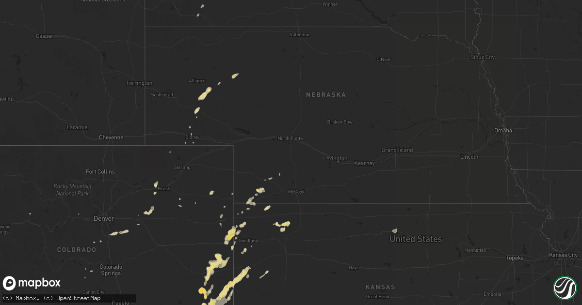
Hail Map in Montana on June 2, 2012
Get this storm
June 2 map
$229
one time, instant access
Download today. No call, no setup
Keep the $229
Bought the map and want the full workflow? Apply the entire $229 to a subscription within 7 days. None of it is wasted.
Every map, not just this one
This buys you this map. Subscription and you get every map we run, in the markets you choose from a few cities to whole states to nationwide. Plus real-time alerts the moment a storm fires.
Contact data
Name, contact info, occupancy, even credit band for addresses in the footprint. You go from where it hit to who to call.
Become the source they trust
Unlimited branding weather history reports on demand. You already have the documented answer ready for the property owner, and you are the one who showed up with it.
Property data and RoofTrace estimates
Pull up any address you have got, its value and the exact code rules for that jurisdiction, straight from One Click Code. Then RoofTrace estimates the squares, pitch, and roof value, priced the way you price.
Storm reports in Montana
Montana
| Date | Description |
|---|---|
| 06/02/20126:00 PM CDT | Full size aspen tree blown down into roadway by thunderstorm winds estimated at 60 mph. |
| 06/02/20125:36 PM CDT | Hail up to quarter size just ending. |
| 06/02/20125:34 PM CDT | Estimated hail up to quater size. |
| 06/02/20123:45 PM CDT | Beaverhead sheriff reports that a power line is down in the dillon area due to a thunderstorm. Local des confirms one power line down...that now has been fixed. No othe |
| 06/01/20127:00 PM CDT | Lindsay divide automated station reported a 61 mph gust at 559 pm and 600 pm. |
All States Impacted by Hail Map on June 2, 2012
Cities Impacted by Hail Map on June 2, 2012
- Brusett, MT
- Perryton, TX
- Cheney, KS
- Garden Plain, KS
- Colcord, OK
- Decatur, AR
- Jay, OK
- Gentry, AR
- Maysville, AR
- Gravette, AR
- Laverne, OK
- Gate, OK
- Rosston, OK
- Buffalo, OK
- Kanorado, KS
- Saint Francis, KS
- Burlington, CO
- Idalia, CO
- Roy, MT
- Chester, OK
- Clinton, OK
- Corn, OK
- Foss, OK
- Goodwell, OK
- Texhoma, OK
- Spearman, TX
- Gruver, TX
- Gould, OK
- Eldorado, OK
- Duke, OK
- Big Sandy, MT
- Wichita, KS
- Anadarko, OK
- Freedom, OK
- Chickasha, OK
- Verden, OK
- El Dorado, KS
- Rosalia, KS
- Eads, CO
- Seiling, OK
- Walters, OK
- Lawton, OK
- Cache, OK
- Faxon, OK
- Parsons, KS
- Galesburg, KS
- Erie, KS
- Alva, OK
- Walsh, CO
- Butler, OK
- Sedalia, CO
- Claremore, OK
- Pampa, TX
- Atwood, KS
- Broadwater, NE
- Fowler, CO
- Boone, CO
- Leedey, OK
- Custer City, OK
- Taloga, OK
- Wheeler, TX
- Parks, NE
- Benkelman, NE
- South West City, MO
- Noel, MO
- Anderson, MO
- Lanagan, MO
- Chelsea, OK
- Wiley, CO
- Canyon, TX
- Ringwood, OK
- Lamar, MO
- Wray, CO
- Cheyenne Wells, CO
- Kit Carson, CO
- Bethune, CO
- Anthony, KS
- Canadian, TX
- Effingham, IL
- Teutopolis, IL
- Stilwell, OK
- Bunch, OK
- Aline, OK
- Arapahoe, CO
- Muleshoe, TX
- Las Animas, CO
- Proctor, OK
- Westville, OK
- Richfield, KS
- Rolla, KS
- Hugoton, KS
- Augusta, KS
- Douglass, KS
- Byers, CO
- Sharon Springs, KS
- Tribune, KS
- Weskan, KS
- Sheridan Lake, CO
- Lamar, CO
- Holly, CO
- Waynoka, OK
- Carmen, OK
- Helena, OK
- Dacoma, OK
- Cherokee, OK
- Sayre, OK
- Carter, OK
- Oshkosh, NE
- Bridgeport, NE
- Argonia, KS
- Mangum, OK
- Medicine Lodge, KS
- Stratford, TX
- Isabella, OK
- Fairview, OK
- Cheyenne, OK
- Hammon, OK
- McCune, KS
- Fritch, TX
- Borger, TX
- Stinnett, TX
- Shattuck, OK
- Winona, KS
- Fall River, KS
- Weatherford, OK
- Fort Morgan, CO
- Caldwell, KS
- Tahlequah, OK
- Guthrie, OK
- Erick, OK
- Thomas, OK
- Kansas, OK
- Folsom, NM
- Oologah, OK
- Walsenburg, CO
- McDonald, KS
- Collinsville, OK
- Big Cabin, OK
- Vinita, OK
- Adair, OK
- Sudan, TX
- Kingfisher, OK
- Okarche, OK
- Cordell, OK
- Mountain View, OK
- Clarendon, TX
- Elizabeth, CO
- Parker, CO
- Bennett, CO
- Kiowa, CO
- Pawhuska, OK
- Barnsdall, OK
- Wynona, OK
- Amherst, TX
- Dillon, MT
- Boncarbo, CO
- Trinidad, CO
- Benton, KS
- Goodland, KS
- Dill City, OK
- Sentinel, OK
- Fredonia, KS
- Booker, TX
- Welling, OK
- Hitchcock, OK
- Watonga, OK
- Geraldine, MT
- Harper, KS
- Stewardson, IL
- Sigel, IL
- Shumway, IL
- Dieterich, IL
- Prairie Grove, AR
- Canehill, AR
- Coldwater, KS
- Bartlesville, OK
- Shamrock, TX
- Cripple Creek, CO
- Florissant, CO
- Nara Visa, NM
- Logan, NM
- Eckley, CO
- Yuma, CO
- Delaware, OK
- Nowata, OK
- Willow, OK
- Coffee Creek, MT
- Central City, CO
- Minco, OK
- Geary, OK
- Arapaho, OK
- Siloam Springs, AR
- Snyder, OK
- Circle, MT
- Salina, OK
- Miami, TX
- Castle Rock, CO
- Melrose, NM
- Mcalister, NM
- House, NM
- Severy, KS
- Presho, SD
- Kim, CO
- Clayton, NM
- Colby, KS
- Talala, OK
- Guymon, OK
- Pine Ridge, SD
- Longton, KS
- Stanford, MT
- Calumet, OK
- Sunray, TX
- Arnett, OK
- Benedict, KS
- Ashby, NE
- Ellsworth, NE
- Dardanelle, AR
- Akron, CO
- Colony, OK
- Sharon, OK
- Woodward, OK
- Chanute, KS
- Carnegie, OK
- Lewistown, MT
- Grenola, KS
- Watts, OK
- Bond, CO
- Roosevelt, UT
- Sidney, NE
- Kingman, KS
- Murdock, KS
- Fort Supply, OK
- Palisade, NE
- Mcconnell Afb, KS
- Derby, KS
- Okeene, OK
- Rose Hill, KS
- Enid, OK
- Taiban, NM
- Cherokee, KS
- Hasty, CO
- Greenwich, KS
- Kechi, KS
- Valley Center, KS
- Mclean, TX
- Goddard, KS
- Hereford, TX
- Andale, KS
- Weston, CO
- Cherryvale, KS
- Nazareth, TX
- Dimmitt, TX
- Colwich, KS
- Fallon, MT
- Frederick, OK
- Pryor, OK
- Altoona, KS
- Wellington, TX
- Wallace, KS
- Granada, CO
- Canute, OK
- Briscoe, TX
- Oswego, KS
- Haven, KS
- Mount Hope, KS
- Pringle, SD
- Edgemont, SD
- Custer, SD
- Hot Springs, SD
- Gurley, NE
- Hinton, OK
- Dalhart, TX
- Sweetwater, OK
- Dumas, TX
- Channing, TX
- Humboldt, KS
- Lindsay, MT
- Brockway, MT
- Parthenon, AR
- Grass Range, MT
- Lakeview, TX
- Ramona, OK
- Russellville, AR
- Apache, OK
- Binger, OK
- Hennessey, OK
- Roosevelt, OK
- Happy, TX
- Fairburn, SD
- Saint Paul, KS
- Cunningham, KS
- Cleo Springs, OK
- Max, NE
- Hollis, OK
- Fletcher, OK
- Elgin, OK
- Floyd, NM
- Nash, OK
- Goltry, OK
- Pocasset, OK
- Towanda, KS
- Southard, OK
- Omega, OK
- Cactus, TX
- Pueblo, CO
- Olustee, OK
- Altus, OK
- Thayer, KS
- Buffalo, KS
- McClave, CO
- Bird City, KS
- Sharon, KS
- Durham, OK
- Vici, OK
- Beulah, CO
- Fay, OK
- Texola, OK
- Blair, OK
- Hayes Center, NE
- Hammond, MT
- Leoti, KS
- Andover, KS
- Rose, OK
- Pittsburg, KS
- Girard, KS
- Ashland, KS
- Mooreland, OK
- Lakeside, NE
- Isabel, KS
- Fayetteville, AR
- South Greenfield, MO
- Lockwood, MO
- Ames, OK
- Fort Cobb, OK
- Canon City, CO
- West Fork, AR
- Davidson, OK
- Cawker City, KS
- Padroni, CO
- Zenda, KS
- Beaver, OK
- Freeport, KS
- Crawford, OK
- Farmington, AR
- Balko, OK
- Cohagen, MT
- Tipton, OK
- Lookeba, OK
- Conifer, CO
- Aguilar, CO
- Leon, KS
- Glen Elder, KS
- Meno, OK


