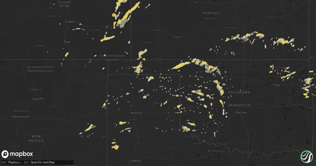
Hail Map on June 2, 2012
Get this storm
June 2 map
$229
one time, instant access
Download today. No call, no setup
Keep the $229
Bought the map and want the full workflow? Apply the entire $229 to a subscription within 7 days. None of it is wasted.
Every map, not just this one
This buys you this map. Subscription and you get every map we run, in the markets you choose from a few cities to whole states to nationwide. Plus real-time alerts the moment a storm fires.
Contact data
Name, contact info, occupancy, even credit band for addresses in the footprint. You go from where it hit to who to call.
Become the source they trust
Unlimited branding weather history reports on demand. You already have the documented answer ready for the property owner, and you are the one who showed up with it.
Property data and RoofTrace estimates
Pull up any address you have got, its value and the exact code rules for that jurisdiction, straight from One Click Code. Then RoofTrace estimates the squares, pitch, and roof value, priced the way you price.
States Impacted by Hail Map on June 2, 2012
Storm reports
Arkansas
| Date | Description |
|---|---|
| 06/02/20126:45 AM CDT | Trees were down in the greers ferry lake area. A tree limb fell on to a power line. Trees were blown down in the devils fork recreation area. |
Kansas
| Date | Description |
|---|---|
| 06/02/20126:55 PM CDT | A local report indicates 60 MPH wind near 19 NW SYRACUSE |
| 06/02/20122:33 AM CDT | A local report indicates 1.00 inch wind near 12 ENE KINGMAN |
| 06/01/20129:15 PM CDT | 50 mph to 60 mph wind gusts. |
| 06/01/20128:19 PM CDT | A local report indicates 63 MPH wind near COLBY |
| 06/01/20128:09 PM CDT | A local report indicates 1.25 inch wind near 10 W HUGOTON |
| 06/01/20127:34 PM CDT | A local report indicates 63 MPH wind near TRIBUNE |
| 06/01/20127:32 PM CDT | 6 inch diameter russion olive tree was taken down by thunderstorm winds. |
| 06/01/20127:19 PM CDT | A local report indicates 1.00 inch wind near 10 S SHARON SPRINGS |
| 06/01/20127:17 PM CDT | A local report indicates 61 MPH wind near TRIBUNE |
| 06/01/20127:11 PM CDT | Numerous fruit and chinese elm trees damaged. Time estimated. |
Nebraska
| Date | Description |
|---|---|
| 06/01/20128:02 PM CDT | A local report indicates 68 MPH wind near BENKELMAN |
Michigan
| Date | Description |
|---|---|
| 06/02/20126:10 PM CDT | Several small branches down. Less than three inches in diameter. |
Colorado
| Date | Description |
|---|---|
| 06/02/20126:38 PM CDT | Power pole snapped hwy 96 mile marker 182 |
| 06/02/20126:28 PM CDT | A local report indicates a tornado near 4 SW FIRSTVIEW |
| 06/02/20126:12 PM CDT | Zero visibility due to blowing dust in thunderstorm outflow winds |
| 06/02/20126:10 PM CDT | A local report indicates 1.50 inch wind near 10 NE SHERIDAN LAKE |
| 06/02/20126:10 PM CDT | A local report indicates 1.25 inch wind near 4 E SHERIDAN LAKE |
| 06/02/20126:08 PM CDT | Relayed by em from deputies in field |
| 06/02/20126:05 PM CDT | A local report indicates 1.00 inch wind near EADS |
| 06/02/20126:05 PM CDT | A local report indicates 1.75 inch wind near 3 SE EADS |
| 06/02/20126:00 PM CDT | A local report indicates 66 MPH wind near 4 W LAMAR |
| 06/02/20125:55 PM CDT | Collapsed awning at phillips 66 at main and lee streets |
| 06/02/20125:52 PM CDT | A local report indicates 1.00 inch wind near SHERIDAN LAKE |
| 06/02/20125:52 PM CDT | Correction for spotter location. |
| 06/02/20125:50 PM CDT | A local report indicates 58 MPH wind near STERLING |
| 06/02/20125:48 PM CDT | A 60 foot tall 24 inch diameter pine tree toppled. Tree estimated at 80 years old. A large 12 inch diameter tree branch was blown into home. Large cottonwood tree blown |
| 06/02/20125:30 PM CDT | A local report indicates 1.50 inch wind near WILEY |
| 06/02/20125:22 PM CDT | A local report indicates 1.00 inch wind near BRISTOL |
| 06/02/20125:15 PM CDT | A local report indicates 60 MPH wind near 4 N ADENA |
| 06/02/20125:04 PM CDT | A local report indicates 65 MPH wind near 2 W BRUSH |
| 06/02/20125:00 PM CDT | A local report indicates 59 MPH wind near LAST CHANCE |
| 06/02/20124:57 PM CDT | 5 inch diameter tree snapped. Numerous branches of 3-5 inches snapped. |
| 06/02/20124:53 PM CDT | Tree branches of 5 inch diameter snapped |
| 06/02/20124:52 PM CDT | A local report indicates 59 MPH wind near WOODROW |
| 06/02/20124:40 PM CDT | A local report indicates 60 MPH wind near 1 S CEDAR POINT |
| 06/02/20124:40 PM CDT | A local report indicates 1.00 inch wind near 7 NW LAST CHANCE |
| 06/02/20124:18 PM CDT | A local report indicates 60 MPH wind near 12 NE DEER TRAIL |
| 06/02/20124:15 PM CDT | Considerable roof damage to home. |
| 06/02/20124:02 PM CDT | A local report indicates 82 MPH wind near 1 N STRASBURG |
| 06/02/20123:51 PM CDT | Front range airport |
| 06/02/20123:43 PM CDT | A local report indicates 67 MPH wind near DENVER INTL AIRPORT |
| 06/02/20123:35 PM CDT | A local report indicates 61 MPH wind near BUCKLEY AFB |
| 06/02/20123:33 PM CDT | A local report indicates 1.00 inch wind near 9 SW KIM |
| 06/02/20123:29 PM CDT | Tree branches 2-4 inch diameter snapped |
| 06/02/20123:27 PM CDT | A local report indicates 1.00 inch wind near 3 E PARKER |
| 06/02/20122:38 PM CDT | Mesonet site c5171 |
| 06/01/20127:10 PM CDT | 8 power poles blown down near co rd 39 and kk. |
Wyoming
| Date | Description |
|---|---|
| 06/01/201210:28 PM CDT | South big horn county airport |
New Mexico
| Date | Description |
|---|---|
| 06/02/20126:30 PM CDT | House with roof damage reported. |
| 06/02/20126:24 PM CDT | Ktcc asos. |
| 06/01/20127:04 PM CDT | Dime to nickel size hail and heavy rain |
Montana
| Date | Description |
|---|---|
| 06/02/20126:00 PM CDT | Full size aspen tree blown down into roadway by thunderstorm winds estimated at 60 mph. |
| 06/02/20125:36 PM CDT | Hail up to quarter size just ending. |
| 06/02/20125:34 PM CDT | Estimated hail up to quater size. |
| 06/02/20123:45 PM CDT | Beaverhead sheriff reports that a power line is down in the dillon area due to a thunderstorm. Local des confirms one power line down...that now has been fixed. No othe |
| 06/01/20127:00 PM CDT | Lindsay divide automated station reported a 61 mph gust at 559 pm and 600 pm. |
Oklahoma
| Date | Description |
|---|---|
| 06/02/20122:00 AM CDT | Quarter to half dollar size hail reported. Relayed by kjrh. Time estimated by radar. |
| 06/02/20121:45 AM CDT | Weather radio technician reported 60 mph wind and pea size hail at the enid weather radio. |
| 06/02/201212:30 AM CDT | A local report indicates 60 MPH wind near 7 WNW SEILING |
| 06/02/201212:00 AM CDT | Pea size hail also |
| 06/01/201211:39 PM CDT | A power line was blown down. |
Texas
| Date | Description |
|---|---|
| 06/02/20126:44 PM CDT | A local report indicates 1.25 inch wind near 4 E NEEDMORE |
| 06/02/20126:38 PM CDT | A local report indicates 1.75 inch wind near NEEDMORE |
| 06/01/201210:57 PM CDT | 4 inch diameter tree limbs downed. Trained spotter estimated winds at 60 mph. |
| 06/01/201210:42 PM CDT | Trees blown down |
| 06/01/201210:23 PM CDT | Schoolnet report |
| 06/01/201210:23 PM CDT | Schoolnet report |
| 06/01/20129:55 PM CDT | A local report indicates 58 MPH wind near 26 NW MIAMI |
| 06/01/20128:55 PM CDT | Measured by the texas tech university west texas mesonet |
| 06/01/20128:45 PM CDT | Tree branches around 6 to 12 inches in diameter were blown down. A live tree around 12 to 14 inches in diameter was split in half with half the tree lying on the ground |
| 06/01/20128:21 PM CDT | Hail occurred from 821pm to 824pm |
| 06/01/20128:03 PM CDT | A local report indicates 61 MPH wind near 3 SW DALHART |
| 06/01/20127:28 PM CDT | A local report indicates 1.25 inch wind near 2 N HEREFORD |
Cities Impacted by Hail Map on June 2, 2012
- Brusett, MT
- Perryton, TX
- Cheney, KS
- Garden Plain, KS
- Colcord, OK
- Decatur, AR
- Jay, OK
- Gentry, AR
- Maysville, AR
- Gravette, AR
- Laverne, OK
- Gate, OK
- Rosston, OK
- Buffalo, OK
- Kanorado, KS
- Saint Francis, KS
- Burlington, CO
- Idalia, CO
- Roy, MT
- Chester, OK
- Clinton, OK
- Corn, OK
- Foss, OK
- Goodwell, OK
- Texhoma, OK
- Spearman, TX
- Gruver, TX
- Gould, OK
- Eldorado, OK
- Duke, OK
- Big Sandy, MT
- Wichita, KS
- Anadarko, OK
- Freedom, OK
- Chickasha, OK
- Verden, OK
- El Dorado, KS
- Rosalia, KS
- Eads, CO
- Seiling, OK
- Walters, OK
- Lawton, OK
- Cache, OK
- Faxon, OK
- Parsons, KS
- Galesburg, KS
- Erie, KS
- Alva, OK
- Walsh, CO
- Butler, OK
- Sedalia, CO
- Claremore, OK
- Pampa, TX
- Atwood, KS
- Broadwater, NE
- Fowler, CO
- Boone, CO
- Leedey, OK
- Custer City, OK
- Taloga, OK
- Wheeler, TX
- Parks, NE
- Benkelman, NE
- South West City, MO
- Noel, MO
- Anderson, MO
- Lanagan, MO
- Chelsea, OK
- Wiley, CO
- Canyon, TX
- Ringwood, OK
- Lamar, MO
- Wray, CO
- Cheyenne Wells, CO
- Kit Carson, CO
- Bethune, CO
- Anthony, KS
- Canadian, TX
- Effingham, IL
- Teutopolis, IL
- Stilwell, OK
- Bunch, OK
- Aline, OK
- Arapahoe, CO
- Muleshoe, TX
- Las Animas, CO
- Proctor, OK
- Westville, OK
- Richfield, KS
- Rolla, KS
- Hugoton, KS
- Augusta, KS
- Douglass, KS
- Byers, CO
- Sharon Springs, KS
- Tribune, KS
- Weskan, KS
- Sheridan Lake, CO
- Lamar, CO
- Holly, CO
- Waynoka, OK
- Carmen, OK
- Helena, OK
- Dacoma, OK
- Cherokee, OK
- Sayre, OK
- Carter, OK
- Oshkosh, NE
- Bridgeport, NE
- Argonia, KS
- Mangum, OK
- Medicine Lodge, KS
- Stratford, TX
- Isabella, OK
- Fairview, OK
- Cheyenne, OK
- Hammon, OK
- McCune, KS
- Fritch, TX
- Borger, TX
- Stinnett, TX
- Shattuck, OK
- Winona, KS
- Fall River, KS
- Weatherford, OK
- Fort Morgan, CO
- Caldwell, KS
- Tahlequah, OK
- Guthrie, OK
- Erick, OK
- Thomas, OK
- Kansas, OK
- Folsom, NM
- Oologah, OK
- Walsenburg, CO
- McDonald, KS
- Collinsville, OK
- Big Cabin, OK
- Vinita, OK
- Adair, OK
- Sudan, TX
- Kingfisher, OK
- Okarche, OK
- Cordell, OK
- Mountain View, OK
- Clarendon, TX
- Elizabeth, CO
- Parker, CO
- Bennett, CO
- Kiowa, CO
- Pawhuska, OK
- Barnsdall, OK
- Wynona, OK
- Amherst, TX
- Dillon, MT
- Boncarbo, CO
- Trinidad, CO
- Benton, KS
- Goodland, KS
- Dill City, OK
- Sentinel, OK
- Fredonia, KS
- Booker, TX
- Welling, OK
- Hitchcock, OK
- Watonga, OK
- Geraldine, MT
- Harper, KS
- Stewardson, IL
- Sigel, IL
- Shumway, IL
- Dieterich, IL
- Prairie Grove, AR
- Canehill, AR
- Coldwater, KS
- Bartlesville, OK
- Shamrock, TX
- Cripple Creek, CO
- Florissant, CO
- Nara Visa, NM
- Logan, NM
- Eckley, CO
- Yuma, CO
- Delaware, OK
- Nowata, OK
- Willow, OK
- Coffee Creek, MT
- Central City, CO
- Minco, OK
- Geary, OK
- Arapaho, OK
- Siloam Springs, AR
- Snyder, OK
- Circle, MT
- Salina, OK
- Miami, TX
- Castle Rock, CO
- Melrose, NM
- Mcalister, NM
- House, NM
- Severy, KS
- Presho, SD
- Kim, CO
- Clayton, NM
- Colby, KS
- Talala, OK
- Guymon, OK
- Pine Ridge, SD
- Longton, KS
- Stanford, MT
- Calumet, OK
- Sunray, TX
- Arnett, OK
- Benedict, KS
- Ashby, NE
- Ellsworth, NE
- Dardanelle, AR
- Akron, CO
- Colony, OK
- Sharon, OK
- Woodward, OK
- Chanute, KS
- Carnegie, OK
- Lewistown, MT
- Grenola, KS
- Watts, OK
- Bond, CO
- Roosevelt, UT
- Sidney, NE
- Kingman, KS
- Murdock, KS
- Fort Supply, OK
- Palisade, NE
- Mcconnell Afb, KS
- Derby, KS
- Okeene, OK
- Rose Hill, KS
- Enid, OK
- Taiban, NM
- Cherokee, KS
- Hasty, CO
- Greenwich, KS
- Kechi, KS
- Valley Center, KS
- Mclean, TX
- Goddard, KS
- Hereford, TX
- Andale, KS
- Weston, CO
- Cherryvale, KS
- Nazareth, TX
- Dimmitt, TX
- Colwich, KS
- Fallon, MT
- Frederick, OK
- Pryor, OK
- Altoona, KS
- Wellington, TX
- Wallace, KS
- Granada, CO
- Canute, OK
- Briscoe, TX
- Oswego, KS
- Haven, KS
- Mount Hope, KS
- Pringle, SD
- Edgemont, SD
- Custer, SD
- Hot Springs, SD
- Gurley, NE
- Hinton, OK
- Dalhart, TX
- Sweetwater, OK
- Dumas, TX
- Channing, TX
- Humboldt, KS
- Lindsay, MT
- Brockway, MT
- Parthenon, AR
- Grass Range, MT
- Lakeview, TX
- Ramona, OK
- Russellville, AR
- Apache, OK
- Binger, OK
- Hennessey, OK
- Roosevelt, OK
- Happy, TX
- Fairburn, SD
- Saint Paul, KS
- Cunningham, KS
- Cleo Springs, OK
- Max, NE
- Hollis, OK
- Fletcher, OK
- Elgin, OK
- Floyd, NM
- Nash, OK
- Goltry, OK
- Pocasset, OK
- Towanda, KS
- Southard, OK
- Omega, OK
- Cactus, TX
- Pueblo, CO
- Olustee, OK
- Altus, OK
- Thayer, KS
- Buffalo, KS
- McClave, CO
- Bird City, KS
- Sharon, KS
- Durham, OK
- Vici, OK
- Beulah, CO
- Fay, OK
- Texola, OK
- Blair, OK
- Hayes Center, NE
- Hammond, MT
- Leoti, KS
- Andover, KS
- Rose, OK
- Pittsburg, KS
- Girard, KS
- Ashland, KS
- Mooreland, OK
- Lakeside, NE
- Isabel, KS
- Fayetteville, AR
- South Greenfield, MO
- Lockwood, MO
- Ames, OK
- Fort Cobb, OK
- Canon City, CO
- West Fork, AR
- Davidson, OK
- Cawker City, KS
- Padroni, CO
- Zenda, KS
- Beaver, OK
- Freeport, KS
- Crawford, OK
- Farmington, AR
- Balko, OK
- Cohagen, MT
- Tipton, OK
- Lookeba, OK
- Conifer, CO
- Aguilar, CO
- Leon, KS
- Glen Elder, KS
- Meno, OK