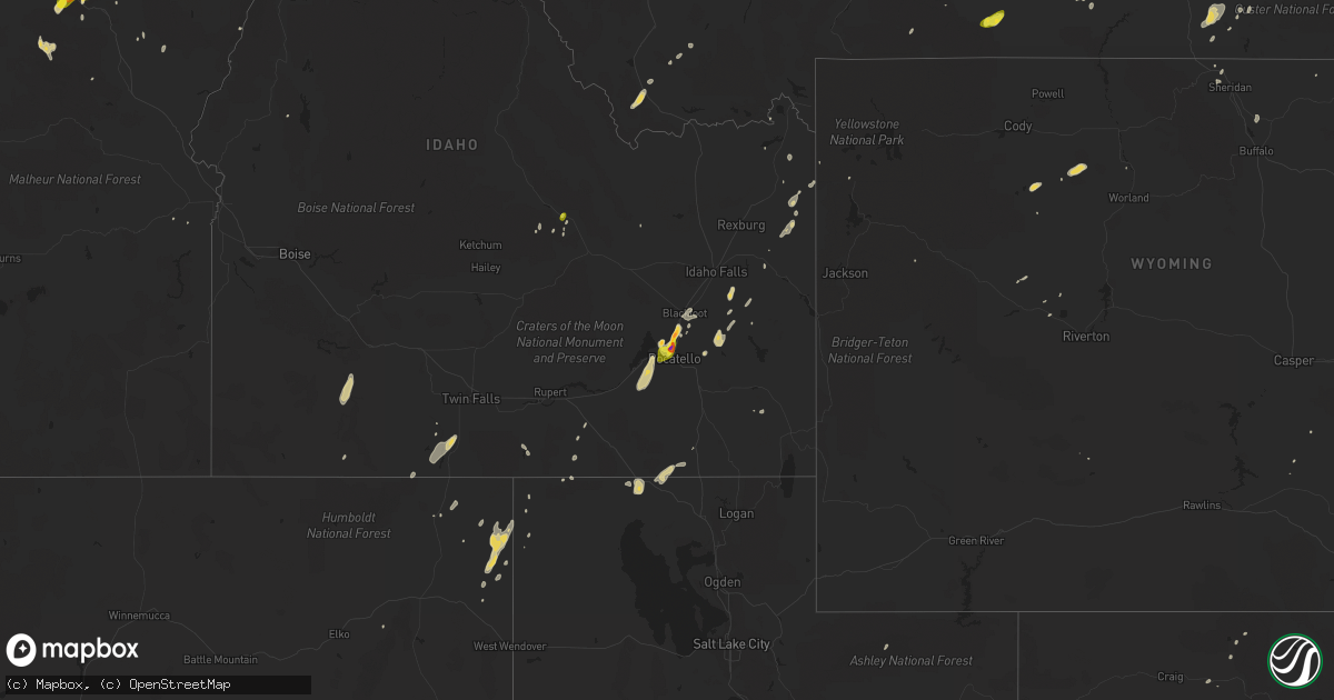
Hail Map on June 1, 2015
Get this storm
June 1 map
$229
one time, instant access
Download today. No call, no setup
Keep the $229
Bought the map and want the full workflow? Apply the entire $229 to a subscription within 7 days. None of it is wasted.
Every map, not just this one
This buys you this map. Subscription and you get every map we run, in the markets you choose from a few cities to whole states to nationwide. Plus real-time alerts the moment a storm fires.
Contact data
Name, contact info, occupancy, even credit band for addresses in the footprint. You go from where it hit to who to call.
Become the source they trust
Unlimited branding weather history reports on demand. You already have the documented answer ready for the property owner, and you are the one who showed up with it.
Property data and RoofTrace estimates
Pull up any address you have got, its value and the exact code rules for that jurisdiction, straight from One Click Code. Then RoofTrace estimates the squares, pitch, and roof value, priced the way you price.
States Impacted by Hail Map on June 1, 2015
Storm reports
Texas
| Date | Description |
|---|---|
| 05/31/20157:50 PM CDT | A local report indicates 1.75 inch wind near 3 ESE DALHART |
| 05/31/20157:48 PM CDT | A local report indicates 1.75 inch wind near 4 SE DALHART |
Pennsylvania
| Date | Description |
|---|---|
| 06/01/20152:35 PM CDT | Trees down on wires in providence twp. |
Wyoming
| Date | Description |
|---|---|
| 06/01/20155:05 PM CDT | Reported by facebook. |
| 05/31/20157:53 PM CDT | Yellowstone national park employee reported approximately 50 trees down between lake and sylvan pass near the east entrance to the park. |
Idaho
| Date | Description |
|---|---|
| 06/01/20156:54 PM CDT | Power poles are down. 4-6 inch trees are down. Power lines over houses and roads. Efforts underway to close roads until power lines are removed. |
| 06/01/20156:47 PM CDT | Reported that a neighbor's bathroom window was blown out. Based on other report and radar. |
| 06/01/20156:28 PM CDT | 1ft diameter tree broken as thunderstorm moved through. This is a correction from june 1st event. |
| 06/01/20156:20 PM CDT | Reported via social media to channel 3. Hail stones of various sizes covering the ground. Time based on radar. |
| 06/01/20156:00 PM CDT | Weston and preston experienced 45 to 50 mph wind gusts. Several power poles are down. No hail reported. |
| 06/01/20155:30 PM CDT | Spotter returned today to find some shingles ripped off home... A flipped fuel tank... Several downed trees and a mailbox that was ripped out. Time estimated from radar. (pih |
| 06/01/20155:15 PM CDT | 40 plus mph wind gusts. Three inch tree limbs are broken from trees. Vinyl fence has damage due to broken slats torn free of posts. |
| 06/01/20155:08 PM CDT | 50 to 60 mph winds removed limbs from trees and siding blown off of houses in mooreland. |
| 06/01/20155:00 PM CDT | Power was out as of 4pm. Part of larger power outages in blackfoot and nearby areas. 1350 people affected at one point. |
| 06/01/20155:00 PM CDT | Measured hail stone in chubbuck. |
| 06/01/20154:50 PM CDT | Submitted to idaho state journal via social media. Reported several large tree limbs down as well as some powerlines and road signs. Time based from radar. |
| 06/01/20154:45 PM CDT | Reported via the idaho state journal facebook page. |
| 06/01/20154:45 PM CDT | Reported via the office facebook page of quarter to ping pong ball sized hail falling. Biggest stones were just under golf ball size. |
| 06/01/20154:45 PM CDT | Reported to the office fb page. Time based off radar and other reports. |
| 06/01/20154:45 PM CDT | Reported to channel 6 via social media. Sized based from picture submitted. Tiem based on radar. |
| 06/01/20154:45 PM CDT | Video submitted to the office fb page of quarter to ping pong ball sized hail falling. Biggest stones were just under golf ball size. |
| 06/01/20154:43 PM CDT | Hail in chubbuck to include west chubbuck and ok ward park |
| 06/01/20154:30 PM CDT | 50mph winds along with 8in by 8ft branch blown down. |
| 06/01/20153:56 PM CDT | Gusts estimated. Visibility on hwy 20 from inl to arco reduced to 5 feet due to blowing dust. Highway patrol on higway controlling traffic. |
| 06/01/20153:25 PM CDT | A local report indicates 62 MPH wind near HOWE |
| 06/01/20152:50 PM CDT | Near leslie...idaho. |
| 06/01/20152:40 PM CDT | Started as 1 inch hail...then quickly decreased to 1/2 inch hail. |
| 05/31/201510:28 PM CDT | Trees damaged and metal roof damage |
| 05/31/20159:50 PM CDT | Reported via the office facebook page. Estimated to be the size of an older silver dollar coin. |
| 05/31/20159:30 PM CDT | Reported that a neighbor's bathroom window was blown out. Based on other report and radar. |
| 05/31/20159:05 PM CDT | 1ft diameter tree was broken as thunderstorm moved through. |
| 05/31/20158:40 PM CDT | Trees blown down on us 12 at mile marker 21 |
| 05/31/20158:40 PM CDT | Trees down on hwy 395. |
| 05/31/20158:40 PM CDT | Trees down on hwy 395 at mission creek road. |
Virginia
| Date | Description |
|---|---|
| 06/01/20156:02 PM CDT | Dime to quarter size hail on camp jaycee rd. Time estimated by radar |
| 06/01/20155:57 PM CDT | Time estimated by radar |
| 06/01/20155:51 PM CDT | A local report indicates 1.50 inch wind near 2 E COUNTRYSIDE |
| 06/01/20155:45 PM CDT | Quarter size hail |
| 06/01/20155:35 PM CDT | Quarter size hail |
| 06/01/20155:31 PM CDT | A large tree limb was snapped on sanford street at west del ray avenue. |
| 06/01/20155:28 PM CDT | A tree was reported down in the 400 block of south washington street. |
| 06/01/20155:23 PM CDT | A tree fell on a house on upper belmont place. |
| 06/01/20155:23 PM CDT | A tree was reported down on riverpoint drive. |
| 06/01/20155:22 PM CDT | A tree was down blocking duke street near arell court. |
| 06/01/20155:20 PM CDT | Quarter size hail |
| 06/01/20154:40 PM CDT | Tree down on battery road |
| 06/01/20154:35 PM CDT | Tree down on indian neck road and newtown |
| 06/01/20154:31 PM CDT | 4 trees down along bethel rd. |
| 06/01/20154:29 PM CDT | Tree down along lee burke road. Tree was 3 inches in diameter. |
| 06/01/20154:27 PM CDT | Quarter size hail |
| 06/01/20154:25 PM CDT | Ping pong ball size hail |
| 06/01/20154:22 PM CDT | Ping pong ball size hail |
| 06/01/20154:18 PM CDT | Golf ball size hail |
| 06/01/20154:17 PM CDT | Half dollar size hail |
| 06/01/20154:13 PM CDT | Golf ball size hail |
| 06/01/20153:54 PM CDT | Quarter size hail |
| 06/01/20153:49 PM CDT | Quarter size hail |
| 06/01/20153:45 PM CDT | Several trees down blocking us-60 |
| 06/01/20153:45 PM CDT | Half dollar size hail |
| 06/01/20153:30 PM CDT | Tree down near science museum |
| 06/01/20153:26 PM CDT | A tree was reported down at stoney creek road and route 42. |
| 06/01/20153:26 PM CDT | Multiple trees were reported down on senedo road at ridge hollow road. |
| 06/01/20153:26 PM CDT | A barn roof was blown off and several large tree limbs snapped on earl sine road. |
| 06/01/20153:05 PM CDT | Several trees down within bolar mountain campground |
| 06/01/20153:05 PM CDT | A local report indicates 1.00 inch wind near 4 W CALLISON |
| 06/01/20151:20 PM CDT | Pitzer road |
| 06/01/20151:20 PM CDT | Tree down near 800 block crozet ave |
| 06/01/20151:20 PM CDT | Tree down near 1200 block of blue ridge ave |
| 06/01/20151:20 PM CDT | Tree down near 5900 block of jarmans gap rd |
| 06/01/20151:20 PM CDT | Tree down near 100 block of miller school rd |
| 06/01/201511:45 AM CDT | Sheriffs office reports trees down on powerlines at route 72 and alf lane. |
| 05/31/20159:09 PM CDT | Multiple trees down near buck mountain road. |
Nebraska
| Date | Description |
|---|---|
| 06/01/20156:40 PM CDT | A local report indicates 1.00 inch wind near 10 NE POTTER |
| 05/31/20158:35 PM CDT | 6 to 8 foot tree branches knocked down. |
| 05/31/20158:10 PM CDT | A local report indicates 1.50 inch wind near 10 SE SIDNEY |
| 05/31/20157:33 PM CDT | A local report indicates 1.00 inch wind near 7 S SIDNEY |
West Virginia
| Date | Description |
|---|---|
| 06/01/20153:30 PM CDT | A local report indicates 1.00 inch wind near 2 WNW MATEWAN |
| 06/01/20152:18 PM CDT | Tree down on a power line |
| 06/01/20151:59 PM CDT | Multiple trees down along rt 3 and rt 219 near union. |
Oregon
| Date | Description |
|---|---|
| 06/01/20155:36 PM CDT | Quarter size hail. |
| 06/01/20154:25 PM CDT | Public reported dime sized hail at 245 pm... But had 1 inch hail 20 minutes prior. |
| 06/01/20153:28 PM CDT | Public reported ping pong ball size hail on i-84 se of meacham. |
North Dakota
| Date | Description |
|---|---|
| 06/01/20156:34 PM CDT | Lasted approximately 10-15 minutes. |
| 05/31/201510:41 PM CDT | Thunderstorm wind gust |
| 05/31/201510:30 PM CDT | Also had hail a little larger than pea size. Too dark to determine if there was any damage. Caller will call back tuesday if there is damage. |
| 05/31/20159:25 PM CDT | Time estimated by radar. |
| 05/31/20158:05 PM CDT | Mostly pea size hail with a couple of quarter size hail mixed in. Lasted approximately 5-7 mins. |
| 05/31/20158:01 PM CDT | A local report indicates 1.00 inch wind near BOTTINEAU |
South Carolina
| Date | Description |
|---|---|
| 06/01/20156:17 PM CDT | A tree was blown down along bufords bridge highway. Time was estimated from radar data. |
| 06/01/20156:07 PM CDT | A tree was blown down along revolutionary trail near the concord church road intersection. Time was estimated from radar data. |
| 06/01/20152:00 PM CDT | Public reported quarter sized hail along cedar creek road. |
| 06/01/20151:35 PM CDT | Dot reported several trees down in mitford along highway 200. |
| 06/01/20151:35 PM CDT | Kershaw county dispatch reported a large limb blocking medfield road in lugoff. |
| 06/01/20151:32 PM CDT | Public reported large limbs down and nickel sized hail covering the ground near lugoff. |
| 06/01/20151:25 PM CDT | Public reported nickel to quarter sized hail from little cedar creek road to cowhorn road. |
| 06/01/20151:19 PM CDT | Sc highway patrol reported several trees down on bradley drive south of us highway 1. |
Kentucky
| Date | Description |
|---|---|
| 06/01/20153:30 PM CDT | Trees down near the town of matewan. Time estimated based on radar. |
South Dakota
| Date | Description |
|---|---|
| 06/01/20156:50 PM CDT | A local report indicates 1.25 inch wind near 1 NW PIEDMONT |
| 06/01/20156:20 PM CDT | A local report indicates 1.75 inch wind near 2 S TILFORD |
| 06/01/20156:10 PM CDT | A local report indicates 1.25 inch wind near TILFORD |
| 05/31/201511:00 PM CDT | A local report indicates 65 MPH wind near 2 NNW SAINT ONGE |
| 05/31/201510:43 PM CDT | A local report indicates 1.00 inch wind near 7 E CREIGHTON |
| 05/31/201510:22 PM CDT | A local report indicates 1.00 inch wind near 3 N DOWNTOWN BELLE FOUR |
| 05/31/20159:00 PM CDT | A local report indicates 60 MPH wind near 9 N BOX ELDER |
| 05/31/20158:35 PM CDT | A local report indicates 1.75 inch wind near 1 ESE PIEDMONT |
| 05/31/20158:17 PM CDT | A local report indicates 1.75 inch wind near BLACK HAWK |
| 05/31/20158:17 PM CDT | A local report indicates 1.75 inch wind near BLACK HAWK |
| 05/31/20158:12 PM CDT | A local report indicates 2.50 inch wind near 1 NW PIEDMONT |
| 05/31/20157:55 PM CDT | Mile marker 44 on i90 |
| 05/31/20157:26 PM CDT | Exit 44 and i-90 lots of hail |
| 05/31/20157:20 PM CDT | A local report indicates 2.00 inch wind near 1 NW PIEDMONT |
| 05/31/20157:19 PM CDT | Heavy rain... Some streets overflowing water ponding into grassy areas |
| 05/31/20157:13 PM CDT | A local report indicates 1.50 inch wind near 1 NW PIEDMONT |
District of Columbia
| Date | Description |
|---|---|
| 06/01/20155:35 PM CDT | A large tree limb was reported down on hobart street northwest. |
| 06/01/20155:33 PM CDT | A tree fell onto a bus on k street northwest near 15th street northwest. |
Colorado
| Date | Description |
|---|---|
| 06/01/20156:46 PM CDT | A local report indicates 1.50 inch wind near 11 E KIM |
| 05/31/201511:36 PM CDT | Received 0.83 rainfall in 30 minutes |
| 05/31/20158:15 PM CDT | A local report indicates 1.00 inch wind near 5 S SEDGWICK |
| 05/31/20157:00 PM CDT | A local report indicates 1.75 inch wind near 13 E KIM |
Florida
| Date | Description |
|---|---|
| 06/01/20154:59 PM CDT | A tree was blown down at the intersection of county road 250 and county road 229. |
| 06/01/20154:45 PM CDT | Local broadcast media relayed pictures of a large tree down in lakeland. |
| 06/01/20154:43 PM CDT | Broadcast media relayed photos of golf ball sized hail in oakland. |
| 06/01/20154:40 PM CDT | Public reported quarter sized hail near the intersection of oakland road and tubb street in oakland. |
| 06/01/20154:02 PM CDT | A local report indicates 1.75 inch wind near 4 SE ALACHUA |
| 06/01/20153:20 PM CDT | Corrected storm report. Skywarn spotter reported nickel to quarter sized hail in wekiva springs. |
| 06/01/20153:15 PM CDT | Broadcast media relayed photo of a fallen large tree on markham woods rd south of lake mary blvd. Time estimated by radar. |
| 06/01/20153:03 PM CDT | Storm spotter reports quarter-sized hail near the intersection of lake emma road and lake mary boulevard in lake mary. Also estimated wind gusts of 45 to 50 mph. |
| 06/01/20153:00 PM CDT | Live oaks snapped about 25 ft above ground level due to strong thunderstorm winds. |
| 06/01/20152:50 PM CDT | Public reported via social media quarter sized hail near the intersection of i-4 and sr-46 in sanford. |
| 06/01/20152:30 PM CDT | Tree down at highway 150 and highway 145. |
| 06/01/20152:25 PM CDT | Tree down on cherry lake circle |
| 06/01/20152:15 PM CDT | Broadcast media relayed several pictures of large tree branches down in orange city and deltona. Cfnews-13 reported a large tree branch fell on a powerline outside of a |
| 06/01/20152:10 PM CDT | A roof was damaged by thunderstorm winds at 5431 ne 35th street in ocala. Unconfirmed report of a rope funnel cloud in the area around that time. |
| 06/01/20152:00 PM CDT | Large tree down in downtown greenville. |
| 06/01/20152:00 PM CDT | A local report indicates 1.00 inch wind near 9 SW BUNNELL |
| 06/01/20152:00 PM CDT | Tree down near i-10 at mile marker 246 |
| 06/01/20151:35 PM CDT | A tree was blown down in flagler estates. The time of damage was based on radar. |
| 06/01/20151:25 PM CDT | Viewer report of 10 trees down just north of monticello |
North Carolina
| Date | Description |
|---|---|
| 06/01/20153:57 PM CDT | Tree down us hwy 220 |
| 06/01/20153:55 PM CDT | Tree down on midway acres rd |
| 06/01/20153:40 PM CDT | Tree down at lions rest rd and old cox rd |
| 06/01/20152:49 PM CDT | Trees down on planck rd in the ansonville area. Radar estimated time |
Montana
| Date | Description |
|---|---|
| 06/01/20156:20 PM CDT | Quarter hail reported at koa campground. |
| 06/01/20156:20 PM CDT | Public reported hail slightly larger than quarters. |
| 06/01/20156:00 PM CDT | A local report indicates 62 MPH wind near 4 N WILSALL |
| 06/01/20156:00 PM CDT | 64 mph wind gust at the deep creek raws location on highway 12. |
| 06/01/20155:11 PM CDT | 58 mph wind gust at the ennis fish hatchery. |
| 06/01/20155:06 PM CDT | Estimated quarter size hail near church hill. Time and exact location of event is estimated. |
| 06/01/201512:59 PM CDT | Also with heavy rain and nickel hail. |
| 06/01/201512:59 AM CDT | Also with heavy rain and nickel hail. |
| 05/31/201510:48 PM CDT | Some quarter size hail with most dime size hail. |
| 05/31/201510:27 PM CDT | A local report indicates 61 MPH wind near 7 NNE OTTER |
| 05/31/20159:30 PM CDT | A local report indicates 60 MPH wind near HYSHAM |
| 05/31/20159:30 PM CDT | Winds estimated. |
| 05/31/20157:58 PM CDT | A local report indicates 60 MPH wind near JUDITH GAP |
| 05/31/20157:19 PM CDT | Ground covered with small hail. |
Georgia
| Date | Description |
|---|---|
| 06/01/20154:44 PM CDT | Widespread reports of trees blown down across warecross proper. |
| 06/01/20154:05 PM CDT | Public reported quarter size hail along hwy 80 outside statesboro. Also very gusty winds. |
| 06/01/20153:05 PM CDT | Tree down at george rd and hickory grove rd. |
| 06/01/20153:05 PM CDT | Tree down at 219 and west martin luther king jr. Drive |
| 06/01/20152:45 PM CDT | Tree down at briggston rd and scottwood drive. |
| 06/01/20152:40 PM CDT | Trees down in clyattville |
Delaware
| Date | Description |
|---|---|
| 06/01/20153:40 PM CDT | Hail up to half dollar size reported in new castle. |
| 06/01/20153:40 PM CDT | Traffic signals knocked down on portions of kirkwood highway. Some trees were also down onto power lines in the area. Numerous power outages reported. Time estimated ba |
New Jersey
| Date | Description |
|---|---|
| 06/01/20152:48 PM CDT | Few limbs and wires down in hamilton twp |
Maryland
| Date | Description |
|---|---|
| 06/01/20155:45 PM CDT | Tree down onto a fence in massey. |
| 06/01/20155:30 PM CDT | Some trees down. Time estimated by radar data. |
| 06/01/20152:22 PM CDT | A tree was reported down on quatman road near great mills road. |
| 06/01/20152:14 PM CDT | A tree was reported down at the intersection of spruce drive and chestnut road. |
Tennessee
| Date | Description |
|---|---|
| 06/01/20156:15 PM CDT | Several trees and branches down across western know county. |
| 05/31/20159:40 PM CDT | A roof was blown off a barn at this location. In addition... Multiple trees were blown down near i-75. |
Utah
| Date | Description |
|---|---|
| 06/01/20156:42 PM CDT | Rosebud raws |
| 06/01/20156:00 PM CDT | Sr-30 mesonet site |
| 06/01/20155:35 PM CDT | *** 1 inj *** ten homes with shingle damage and a report of a collapsed awning |
| 06/01/20155:30 PM CDT | I-84 at whites valley |
| 06/01/20154:55 PM CDT | Dugway-interstate 80 |
| 06/01/20154:00 PM CDT | West salt flats |
| 06/01/20153:30 PM CDT | Slduro mesonet site |
Cities Impacted by Hail Map on June 1, 2015
- Tioga, ND
- Mcgregor, ND
- Springer, NM
- Rogers, NM
- Hilliard, FL
- Lakeland, FL
- Hereford, TX
- Hastings, FL
- Lehr, ND
- Clermont, FL
- Oakland, FL
- Montverde, FL
- Winter Garden, FL
- Berthold, ND
- Manor, GA
- Waycross, GA
- New Castle, DE
- Manning, ND
- Belfield, ND
- Zap, ND
- Beulah, ND
- Pendleton, OR
- Tignall, GA
- Belle Fourche, SD
- Craigmont, ID
- Lapwai, ID
- Culdesac, ID
- Roberts, MT
- Red Lodge, MT
- Hanover, VA
- Aylett, VA
- Cornersville, TN
- Republican City, NE
- Dix, NE
- Annapolis, MD
- Edgewater, MD
- Bridgeton, NJ
- Elmer, NJ
- Woodstown, NJ
- Bunnell, FL
- La Grande, OR
- East Palatka, FL
- Sidney, NE
- Lodgepole, NE
- Alexandria, VA
- Wilmington, DE
- Gaylord, KS
- Monticello, FL
- Greenville, FL
- Cuervo, NM
- Santa Rosa, NM
- Winnsboro, SC
- Grant, NE
- Eustis, FL
- Wishek, ND
- Enterprise, OR
- Fairfield, ND
- Inchelium, WA
- Wall, SD
- Dalhart, TX
- Valdosta, GA
- Hazen, ND
- Garrison, ND
- Webster, FL
- Bard, NM
- Two Dot, MT
- Dodge, ND
- Halliday, ND
- Golden Valley, ND
- Dell, MT
- Pritchett, CO
- Hartley, TX
- Bottineau, ND
- Willow City, ND
- Souris, ND
- Smith Center, KS
- Bumpass, VA
- Haxtun, CO
- Holyoke, CO
- Champion, NE
- Wray, CO
- Yuma, CO
- Roanoke, VA
- Salem, VA
- Front Royal, VA
- Pocatello, ID
- American Falls, ID
- Culbertson, NE
- New Underwood, SD
- Owanka, SD
- Center, ND
- Medora, ND
- Rhame, ND
- Sentinel Butte, ND
- Franklin, NE
- Mays Landing, NJ
- Newtonville, NJ
- Landisville, NJ
- Minotola, NJ
- Hammonton, NJ
- Richland, NJ
- Egg Harbor City, NJ
- Buena, NJ
- Vineland, NJ
- Newfield, NJ
- Williamstown, NJ
- Tetonia, ID
- Firth, ID
- Poolesville, MD
- Ashburn, VA
- Sterling, VA
- Lodge Grass, MT
- Rougemont, NC
- Timberlake, NC
- Headland, AL
- Lance Creek, WY
- Naponee, NE
- Kensington, KS
- Bloomington, NE
- Riverton, NE
- Billings, MT
- Lake Mary, FL
- Sanford, FL
- Edinburg, VA
- Dundas, VA
- Blackstone, VA
- Steamboat Springs, CO
- Clark, CO
- White Sulphur Springs, MT
- Leesburg, VA
- Hockessin, DE
- Newark, DE
- Crook, CO
- Ovid, CO
- Sedgwick, CO
- Otis, CO
- Manhattan, MT
- Harrisburg, NE
- Strasburg, VA
- Maurertown, VA
- Bentonville, VA
- Fort Valley, VA
- Woodstock, VA
- Toms Brook, VA
- Logan, NM
- Tucumcari, NM
- Dillon, MT
- Lewiston, ID
- Belgrade, MT
- Covington, VA
- Curtis Bay, MD
- Pasadena, MD
- Warwick, ND
- Tolna, ND
- Pekin, ND
- Solen, ND
- Saint Anthony, ND
- Mandan, ND
- Kim, CO
- Avondale, CO
- Springdale, WA
- Coulee Dam, WA
- Herndon, KS
- Estero, FL
- Immokalee, FL
- Fort Myers, FL
- Nemo, SD
- Rapid City, SD
- Black Hawk, SD
- Deadwood, SD
- Piedmont, SD
- Sturgis, SD
- Ponchatoula, LA
- Mandeville, LA
- Pomeroy, WA
- Wilton, ND
- Wallowa, OR
- Warsaw, VA
- Callao, VA
- Farnham, VA
- Philip, SD
- Millersville, MD
- Severna Park, MD
- Friona, TX
- Potter, NE
- Hague, VA
- Kinsale, VA
- Port Royal, VA
- Spring Creek, NV
- Pilot Rock, OR
- Montello, NV
- Alma, NE
- Stamford, NE
- Orleans, NE
- Bedford, VA
- Chestertown, MD
- Millington, MD
- Kennedyville, MD
- Crumpton, MD
- Sudlersville, MD
- Galena, MD
- Parshall, ND
- Palermo, ND
- Plaza, ND
- Julesburg, CO
- Ranchester, WY
- Sheridan, WY
- Crestview, FL
- Eglin Afb, FL
- Byers, CO
- Mount Vernon, AL
- Chunchula, AL
- Citronelle, AL
- Saraland, AL
- Alachua, FL
- Gainesville, FL
- Salem, NJ
- Othello, WA
- Royal City, WA
- Driggs, ID
- Crow Agency, MT
- Hardin, MT
- Champlain, VA
- Colonial Beach, VA
- Hustle, VA
- Killdeer, ND
- Brooker, FL
- Pueblo, CO
- Grady, NM
- Elmer City, WA
- Troutville, VA
- Grover, CO
- Clovis, NM
- Shelley, ID
- Stanley, ND
- Wing, ND
- Sperryville, VA
- Washington, VA
- Longwood, FL
- Emporia, VA
- Skippers, VA
- Madison, FL
- Montvale, VA
- Blue Ridge, VA
- Ruther Glen, VA
- Tatum, NM
- Jetersville, VA
- Keller, WA
- Arthur, NE
- Ridgeway, SC
- Snowville, UT
- Malad City, ID
- Nara Visa, NM
- Arnold, MD
- Amherst, VA
- Washington, DC
- Ryder, ND
- Roseglen, ND
- Baxley, GA
- Micanopy, FL
- Archer, FL
- Kramer, ND
- Debary, FL
- Deland, FL
- Altamonte Springs, FL
- Deltona, FL
- Orange City, FL
- Winchester, ID
- Portales, NM
- Luray, VA
- Hazlehurst, GA
- Thaxton, VA
- Clearmont, WY
- Banner, WY
- Loretto, VA
- Ocate, NM
- Ulmer, SC
- Allendale, SC
- Fairfax, SC
- Bancroft, ID
- Clarksville, VA
- Boones Mill, VA
- Newkirk, NM
- Hot Springs, VA
- Summerville, OR
- Peetz, CO
- Rolette, ND
- Fort Gaines, GA
- Georgetown, GA
- Rogerson, ID
- Glen Allen, VA
- Henrico, VA
- McCarr, KY
- Delbarton, WV
- Matewan, WV
- Williamson, WV
- Elbert, CO
- Mullen, NE
- Newberry, FL
- High Springs, FL
- San Jon, NM
- Crewe, VA
- Burkeville, VA
- Amelia Court House, VA
- Bushnell, FL
- Floral City, FL
- Mcalister, NM
- Beaverdam, VA
- Colbert, WA
- Spokane, WA
- McCook, NE
- Asheboro, NC
- Honea Path, SC
- Flasher, ND
- Napoleon, ND
- Townsend, MT
- Deer Park, WA
- Colorado Springs, CO
- Ashton, ID
- Fountain Inn, SC
- Richardton, ND
- Hebron, ND
- Winter Haven, FL
- Dickinson, ND
- Gladstone, ND
- Pennsville, NJ
- Boone, CO
- Malta, ID
- Driscoll, ND
- Appomattox, VA
- Gladstone, VA
- Pryor, MT
- Matthews, GA
- Grass Range, MT
- Forest Grove, MT
- Roundup, MT
- Powhatan, VA
- Harrison, MT
- Three Forks, MT
- Cottonwood, ID
- Davidsonville, MD
- Riva, MD
- Gambrills, MD
- Crownsville, MD
- Adrian, TX
- Blackfoot, ID
- Carpenter, WY
- Auburndale, FL
- Orlando, FL
- Christmas, FL
- Great Falls, SC
- Lancaster, SC
- Statesboro, GA
- New Town, ND
- Barboursville, VA
- Gordonsville, VA
- Rice, WA
- Gifford, WA
- Jackpot, NV
- New Salem, ND
- Dunn Center, ND
- Mead, WA
- Oviedo, FL
- Geneva, FL
- Polk City, FL
- Pine Bluffs, WY
- Du Pont, GA
- Wasta, SD
- Oakley, ID
- Wetmore, CO
- Florence, CO
- Bear, DE
- Laurel, MT
- Arapahoe, CO
- Eaton Park, FL
- Arrington, VA
- Holt, FL
- Ekalaka, MT
- Blythewood, SC
- Mackay, ID
- Hillsborough, NC
- Venango, NE
- Trenton, NE
- Gladstone, NM
- Elberton, GA
- Pikeville, KY
- McRae Helena, GA
- Jacksonville, GA
- Gurley, NE
- Joliet, MT
- Meacham, OR
- Ringling, MT
- Zolfo Springs, FL
- Blackstock, SC
- Ashley, ND
- Benkelman, NE
- Decker, MT
- Martinsdale, MT
- Hardy, VA
- Milford, VA
- Montross, VA
- Tappahannock, VA
- Newtown, VA
- Bozeman, MT
- Lake Park, GA
- Steele, ND
- Soperton, GA
- Alliance, NE
- Kimball, NE
- Broxton, GA
- New Providence, PA
- Strasburg, PA
- Quarryville, PA
- Drumore, PA
- Willow Street, PA
- Blythe, GA
- Stephens City, VA
- Middletown, VA
- Bismarck, ND
- Bartow, FL
- Cove, OR
- Richmond, VA
- Stratton, NE
- Harlowton, MT
- Wauneta, NE
- Palisade, NE
- Oakton, VA
- Carthage, NC
- Nine Mile Falls, WA
- Panther, WV
- De Leon Springs, FL
- Abbeville, AL
- Apopka, FL
- Bullock, NC
- Oxford, NC
- McKenney, VA
- Howey In The Hills, FL
- Astatula, FL
- Crozet, VA
- Charlottesville, VA
- Lusk, WY
- Park Valley, UT
- Big Springs, NE
- Vinton, VA
- Goodview, VA
- Yalaha, FL
- Windermere, FL
- Tavares, FL
- Glen Burnie, MD
- Clopton, AL
- Bridgeport, NE
- Haigler, NE
- Holly, CO
- Pompeys Pillar, MT
- Lottsburg, VA
- Defuniak Springs, FL
- Ponce De Leon, FL
- Germantown, MD
- Chappell, NE
- Great Falls, VA
- Madison, AL
- Amherst, CO
- Gackle, ND
- Alamo, GA
- Bovina, TX
- Hot Springs, SD
- Kenmare, ND
- Winchester, VA
- Fredonia, ND
- Wilsons, VA
- Asotin, WA
- Sanderson, FL
- Baker, MT
- Cozad, NE
- Wake Forest, NC
- Lake Butler, FL
- Wrens, GA
- Kinnear, WY
- Athens, TN
- Cloverdale, VA
- Carson, ND
- Almont, ND
- Folkston, GA
- Wray, GA
- Hayden, CO
- Dade City, FL
- Spruce Pine, NC
- Okeechobee, FL
- Vero Beach, FL
- Clayton, AL
- Madrid, NE
- Dameron, MD
- Ridge, MD
- Washburn, ND
- Tarrytown, GA
- Ailey, GA
- Bonifay, FL
- Scotland, MD
- Dickerson, MD
- Boyds, MD
- Herndon, VA
- Twin Falls, ID
- Woodruff, SC
- Hawk Springs, WY
- Mansfield, WA
- Omar, WV
- Hawthorne, FL
- Toston, MT
- Sylvania, GA
- Labelle, FL
- Donalds, SC
- Arcadia, FL
- Jay Em, WY
- Maxbass, ND
- Ashland, VA
- Callaway, MD
- Patuxent River, MD
- California, MD
- Lexington Park, MD
- Great Mills, MD
- Heath Springs, SC
- Forest Hills, KY
- Belfry, KY
- Hardy, KY