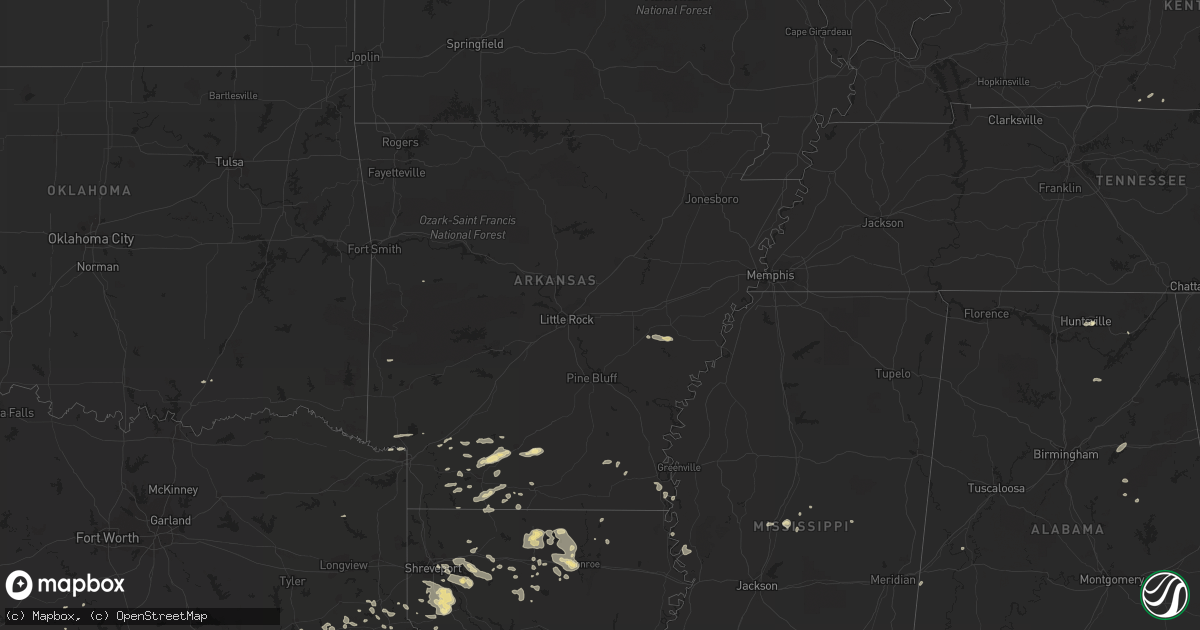
Hail Map in Arkansas on June 1, 2013
Get this storm
June 1 map
$229
one time, instant access
Download today. No call, no setup
Keep the $229
Bought the map and want the full workflow? Apply the entire $229 to a subscription within 7 days. None of it is wasted.
Every map, not just this one
This buys you this map. Subscription and you get every map we run, in the markets you choose from a few cities to whole states to nationwide. Plus real-time alerts the moment a storm fires.
Contact data
Name, contact info, occupancy, even credit band for addresses in the footprint. You go from where it hit to who to call.
Become the source they trust
Unlimited branding weather history reports on demand. You already have the documented answer ready for the property owner, and you are the one who showed up with it.
Property data and RoofTrace estimates
Pull up any address you have got, its value and the exact code rules for that jurisdiction, straight from One Click Code. Then RoofTrace estimates the squares, pitch, and roof value, priced the way you price.
Storm reports in Arkansas
Arkansas
| Date | Description |
|---|---|
| 06/01/20136:24 PM CDT | Powerlines were downed between holly grove and clarendon near east lake. People were trapped in a house but are out now. |
| 06/01/20139:30 AM CDT | Severe winds resulted in damage within the jonesboro city limits. Windows on a church van were damaged along north main street. A restaurant along e. Word street report |
| 06/01/20139:00 AM CDT | Large trees were blown down near oak grove and sunshine road. |
| 05/31/20137:50 PM CDT | Two trees bent down... And large limbs down... Power lines down... Flooding in low lying areas... Ponding on roads |
| 05/31/20137:40 PM CDT | Tree down on hwy 15 |
| 05/31/20137:24 PM CDT | Powerlines were downed between holly grove and clarendon near east lake. People were trapped in a house but are out now. |
All States Impacted by Hail Map on June 1, 2013
Cities Impacted by Hail Map on June 1, 2013
- Fountain Run, KY
- Scottsville, KY
- El Dorado, AR
- Rosston, AR
- Emmet, AR
- Prescott, AR
- Dryden, TX
- Marathon, TX
- Farmerville, LA
- Bernice, LA
- Downsville, LA
- Stephens, AR
- McKean, PA
- Waterford, PA
- Douglass, TX
- Nacogdoches, TX
- Dubach, LA
- Ashdown, AR
- Rocksprings, TX
- Junction, TX
- Junction City, AR
- Mount Hermon, KY
- Tompkinsville, KY
- Camden, AR
- McNeil, AR
- Spring Branch, TX
- Lufkin, TX
- Walnut Springs, TX
- Emerson, AR
- Haynesville, LA
- Gibsland, LA
- Sparta, TN
- Cookeville, TN
- Jonesboro, TX
- Holly Grove, AR
- Brownsboro, AL
- Roe, AR
- Clarendon, AR
- Choudrant, LA
- Homer, LA
- Carthage, TX
- Ringgold, LA
- Mason, TX
- London, TX
- Hampton, AR
- Lewisville, AR
- Stamps, AR
- Kennard, TX
- Ripley, OH
- Maysville, KY
- Aberdeen, OH
- Richton, MS
- Palestine, TX
- Mansfield, LA
- Ozona, TX
- Chireno, TX
- Elm Grove, LA
- Pell City, AL
- Riverside, AL
- Lincoln, AL
- Talladega, AL
- Oakwood, TX
- Portland, AR
- Lake Village, AR
- Eudora, AR
- Groveton, TX
- Mullin, TX
- Mena, AR
- Camden, MS
- Cushing, TX
- Kopperl, TX
- Cranfills Gap, TX
- Fulton, AR
- Iraan, TX
- Sheffield, TX
- Elkhart, TX
- Hamilton, TX
- Simsboro, LA
- Arcadia, LA
- Caney, OK
- Reklaw, TX
- Laneville, TX
- Dripping Springs, TX
- Early, TX
- Eros, LA
- Tenaha, TX
- Seymour, WI
- Pulaski, WI
- Goodwater, AL
- Mount Enterprise, TX
- Henderson, TX
- Shreveport, LA
- Grand Cane, LA
- Frierson, LA
- Brooksville, FL
- Calhoun, LA
- West Monroe, LA
- Georgetown, KY
- Booneville, AR
- Monticello, AR
- Fountain Hill, AR
- Boerne, TX
- Helotes, TX
- San Antonio, TX
- Taylor, AR
- Bandera, TX
- Medina, TX
- Tarpley, TX
- Pennington, TX
- Ruston, LA
- Fort Stockton, TX
- Leakey, TX
- Logansport, LA
- Scottsboro, AL
- Stamping Ground, KY
- Philadelphia, MS
- Santa Anna, TX
- Keatchie, LA
- Goldthwaite, TX
- Harrodsburg, KY
- Bossier City, LA
- Driftwood, TX
- Pulaski, TN
- Gatesville, TX
- Garrison, TX
- Magnolia, AR
- Gustine, TX
- Black Creek, WI
- Caddo, OK
- Buckner, AR
- Bastrop, LA
- Collinston, LA
- Hope, AR
- Comanche, TX
- Grapeland, TX
- Priddy, TX
- Minden, LA
- Iredell, TX
- Midkiff, TX
- Diboll, TX
- Jacksonville, TX
- Chatham, MS
- Montrose, AR
- Boligee, AL
- Doyline, LA
- Sibley, LA
- Heflin, LA
- Shiocton, WI
- Nichols, WI
- Bonduel, WI
- Texarkana, TX
- Jonesboro, LA
- Bienville, LA
- Pickens, MS
- Waldo, AR
- Cuba, AL
- Huntsville, AL
- Gary, TX
- Chidester, AR
- Mayersville, MS
- Rusk, TX
- Alto, TX
- Daingerfield, TX
- Lone Star, TX
- Goodman, MS
- Sallis, MS
- Quitman, LA
- Kosciusko, MS
- D Hanis, TX
- Long Branch, TX
- Pollok, TX
- Coleman, TX
- Trinity, TX
- Timpson, TX
- Johnson City, TX
- Haughton, LA
- Jamestown, LA
- Dubberly, LA
- Mayslick, KY
- Apple Springs, TX
- Blanket, TX
- Stuttgart, AR
- Valley Park, MS
- Hye, TX
- Horton, AL
- Blountsville, AL
- Blanco, TX
- Kendalia, TX
- Rolling Fork, MS
- Gloster, LA
- Keithville, LA
- Stonewall, LA
- Marion, LA
- Hooks, TX


