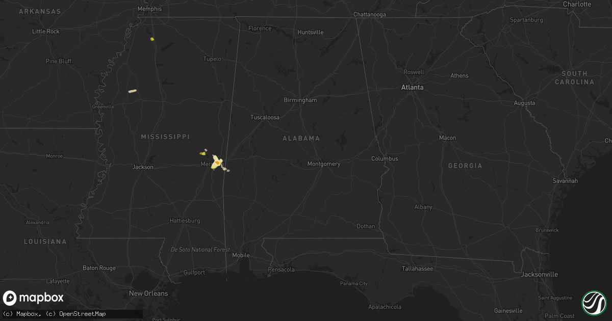
Hail Map in Alabama on May 30, 2018
Get this storm
May 30 map
$229
one time, instant access
Download today. No call, no setup
Keep the $229
Bought the map and want the full workflow? Apply the entire $229 to a subscription within 7 days. None of it is wasted.
Every map, not just this one
This buys you this map. Subscription and you get every map we run, in the markets you choose from a few cities to whole states to nationwide. Plus real-time alerts the moment a storm fires.
Contact data
Name, contact info, occupancy, even credit band for addresses in the footprint. You go from where it hit to who to call.
Become the source they trust
Unlimited branding weather history reports on demand. You already have the documented answer ready for the property owner, and you are the one who showed up with it.
Property data and RoofTrace estimates
Pull up any address you have got, its value and the exact code rules for that jurisdiction, straight from One Click Code. Then RoofTrace estimates the squares, pitch, and roof value, priced the way you price.
Storm reports in Alabama
Alabama
| Date | Description |
|---|---|
| 05/30/20186:44 PM CDT | Grape arbor that was concreted into the ground was blown over. Time estimated from radar. |
| 05/30/20186:36 PM CDT | Tree fell on a powerline on harvest road in east limestone co. |
| 05/30/20186:32 PM CDT | Tree and power pole knocked down onto colwell road at dorning road. |
| 05/30/20184:54 PM CDT | Trees down on county road 46... Time estimated from radar. |
| 05/30/20184:53 PM CDT | Large tree across hwy 172 just southeast of hodges along with numerous small branches. |
| 05/30/20184:45 PM CDT | Trees down on welch cemetery rd... Time estimated from radar. |
| 05/30/20184:45 PM CDT | Trees down on county road 36... Time estimated from radar. |
| 05/30/20181:55 AM CDT | At 655 PM CDT, a severe thunderstorm was located over northeastern Huntsville, moving east at 40 mph. HAZARD...60 mph wind gusts and penny size hail. SOURCE...Radar indicated. IMPACT...Expect damage to roofs, siding, and trees. Locations impacted include... Northern Huntsville, Moores Mill, Meridianville, Hazel Green, Gurley, Alabama A And M University, New Market, Pleasant Groves, Maysville and Princeton. |
| 05/30/20181:29 AM CDT | At 629 PM CDT, a severe thunderstorm was located near Athens, moving east at 35 mph. HAZARD...60 mph wind gusts and penny size hail. SOURCE...Radar indicated. IMPACT...Expect damage to roofs, siding, and trees. Locations impacted include... Huntsville, Madison, Athens, Moores Mill, Meridianville, Hazel Green, Alabama A And M University, University Of Alabama In Huntsville, Harvest and Tanner. |
| 05/30/20181:18 AM CDT | At 618 PM CDT, a severe thunderstorm was located near Toomsuba, or 8 miles east of Meridian, and is nearly stationary. HAZARD...60 mph wind gusts and quarter size hail. SOURCE...Radar indicated. IMPACT...Hail damage to vehicles is expected. Expect wind damage to roofs, siding, and trees. This severe thunderstorm will be near... Toomsuba, Alamucha and Kewanee around 700 PM CDT. |
| 05/29/201811:41 PM CDT | At 440 PM CDT, severe thunderstorms were located along a line extending from 7 miles southeast of Cherokee to Belgreen to near Hackleburg, moving east at 35 mph. HAZARD...60 mph wind gusts and penny size hail. SOURCE...Radar indicated. IMPACT...Expect damage to roofs, siding, and trees. Locations impacted include... Muscle Shoals, Russellville, Sheffield, Tuscumbia, Phil Campbell, Littleville, Leighton, Belgreen, Hodges and Posey Loop. |
All States Impacted by Hail Map on May 30, 2018
Cities Impacted by Hail Map on May 30, 2018
- Keyes, OK
- Larkspur, CO
- Franktown, CO
- Monument, CO
- Colorado Springs, CO
- Meridian, MS
- Toomsuba, MS
- Follett, TX
- Lisman, AL
- Boise, ID
- Garden City, ID
- Gruver, TX
- Arnett, OK
- Peyton, CO
- Elbert, CO
- Arapahoe, CO
- Boise City, OK
- Canadian, TX
- Higgins, TX
- Crawford, OK
- Perryton, TX
- Booker, TX
- Lipscomb, TX
- Matheson, CO
- Limon, CO
- Schlater, MS
- Minter City, MS
- Doddsville, MS
- Ruleville, MS
- Elizabeth, CO
- Alamo, ND
- Grenora, ND
- Zahl, ND
- Spivey, KS
- Nashville, KS
- Zenda, KS
- Texhoma, OK
- Felt, OK
- Texhoma, TX
- Stratford, TX
- Dalhart, TX
- Spearman, TX
- Boulder, CO
- Jamestown, CO
- Hardesty, OK
- Clayton, NM
- Rush, CO
- Yoder, CO
- Aneta, ND
- Durant, OK
- Woodward, OK
- Kiowa, CO
- Goodwell, OK
- Calhan, CO
- Nampa, ID
- Caldwell, ID
- Murphy, ID
- Melba, ID
- Pueblo, CO
- Camargo, OK
- Massena, IA
- Broadus, MT
- Collinsville, MS
- Fargo, OK
- Cope, CO
- Fort Morgan, CO
- Balko, OK
- Kirk, CO
- Attica, KS
- Beaver, OK
- Shattuck, OK
- Joes, CO
- Yuma, CO
- De Kalb, MS
- Bailey, MS
- Vici, OK
- Leedey, OK
- Sharon, OK
- Weskan, KS
- Cartwright, ND
- Guymon, OK
- Karlstad, MN
- Hazelton, ID
- Murtaugh, ID
- Boley, OK
- Bokchito, OK
- Hendrix, OK
- Tremonton, UT
- Vona, CO
- Gage, OK
- Paden, OK
- Okemah, OK
- Hansen, ID
- Malta, ID
- Senatobia, MS
- Marion, MS
- Quitman, MS
- Cascade, MT
- Kenton, OK
- Keenesburg, CO
- Hudson, CO
- Sand Springs, MT
- Alexander, ND
- Kingman, KS
- Daleville, MS
- Kuna, ID
- Prague, OK
- Boligee, AL
- Laverne, OK
- Tonkawa, OK
- Cunningham, KS
- Anton, CO
- Akron, CO
- Durham, OK
- Wellston, OK
- Mosby, MT
- Winnett, MT
- Brusett, MT
- Jordan, MT
- Circle, MT
- Little Rock, MS


