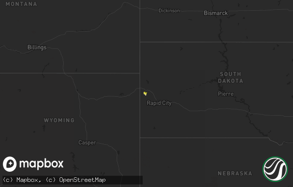
Hail Map in South Dakota on May 30, 2014
The weather event in South Dakota on May 30, 2014 includes Hail map. 21 states and 150 cities were impacted and suffered possible damage. The total estimated number of properties impacted is 179.

Hail
179
Estimated number of impacted properties by a 1.00" hail or larger0
Estimated number of impacted properties by a 1.75" hail or larger0
Estimated number of impacted properties by a 2.50" hail or largerStorm reports in South Dakota
South Dakota
| Date | Description |
|---|---|
| 05/30/20146:40 PM CDT | Peak wind gust reported from the harrod rwis dot site. |
| 05/30/20145:35 PM CDT | Slow moving tornado in open country no damage noted corrected for time of event |
| 05/30/20145:30 PM CDT | Em relayed a public report of a tornado touchdown about 6 miles northwest of ree heights. No reports of damage at this time. |
| 05/30/20143:52 PM CDT | Hail between quarter size and half dollar size and 1.6 inches of rain |
| 05/30/20143:37 PM CDT | Golf ball size hail and flooded yard |
| 05/29/20147:35 PM CDT | Slow moving tornado in open country no damage noted |
All States Impacted by Hail Map on May 30, 2014
Cities Impacted by Hail Map on May 30, 2014
- Ellsworth, NE
- Virden, IL
- Ree Heights, SD
- Miller, SD
- Owensboro, KY
- Arcadia, FL
- Sterling, CO
- Arthur, NE
- Wood, SD
- Hyannis, NE
- Byers, CO
- Strasburg, CO
- Punta Gorda, FL
- Cresbard, SD
- Ipswich, SD
- Faulkton, SD
- Newnan, GA
- Grantville, GA
- Greenville, GA
- Luthersville, GA
- Hogansville, GA
- New Haven, IL
- Akron, IA
- Winner, SD
- Texico, NM
- Clovis, NM
- Houston, TX
- Ferdinand, IN
- Merino, CO
- Merriman, NE
- Boise City, OK
- Kenton, OK
- New Hampton, MO
- Albany, MO
- Bethany, MO
- Martinsville, MO
- Merrill, IA
- Hinton, IA
- Roggen, CO
- Williston, FL
- Reddick, FL
- White River, SD
- Walthill, NE
- Freeport, TX
- Santa Fe, TX
- Liverpool, TX
- Tuthill, SD
- Cody, NE
- Snyder, CO
- Dimmitt, TX
- Hereford, TX
- Chiefland, FL
- Humble, TX
- Dyer, TN
- Atlanta, GA
- Smyrna, GA
- Kersey, CO
- Briggsdale, CO
- Roberta, GA
- Bingham, NE
- Kilgore, NE
- Ideal, SD
- Saint Francis, SD
- Crandall, GA
- Chatsworth, GA
- Rockport, IN
- Ypsilanti, ND
- Jamestown, ND
- Waterbury, NE
- Hubbard, NE
- Emerson, NE
- Fort Morgan, CO
- Orient, SD
- Presho, SD
- Muleshoe, TX
- Earth, TX
- Deer Trail, CO
- Parmelee, SD
- Mission, SD
- Eaton, CO
- Crook, CO
- Jackson, AL
- Birdseye, IN
- Reynolds, GA
- Francisco, IN
- Princeton, IN
- Witten, SD
- Summerfield, FL
- Weirsdale, FL
- West Point, MS
- Bowdon, GA
- Palmyra, IL
- Trenton, FL
- Seneca, SD
- Akron, CO
- Palmyra, MO
- Brandon, FL
- Valrico, FL
- Lithia, FL
- Riverview, FL
- Balaton, MN
- Sidney, NE
- Highmore, SD
- Philpot, KY
- Utica, KY
- Hannibal, MO
- Westfield, IA
- Friona, TX
- Meeteetse, WY
- Clewiston, FL
- Lamar, IN
- Evanston, IN
- Rock Rapids, IA
- Alvord, IA
- Iliff, CO
- Decatur, NE
- Felt, OK
- Bristow, IN
- Kennebec, SD
- Brush, CO
- Culloden, GA
- Lewellen, NE
- Hawley, MN
- Padroni, CO
- Mulberry Grove, IL
- Sioux City, IA
- Hettick, IL
- Otis, CO
- Decker, IN
- Inglis, FL
- La Salle, CO
- Blackduck, MN
- Alvin, TX
- Butler, GA
- Cherokee, AL
- Morriston, FL
- Shoshoni, WY
- Boonville, IN
- Tennyson, IN
- Roopville, GA
- Alcester, SD
- Rockham, SD
- Labelle, FL
- Holden, MA
- Rutland, MA
- Paxton, MA
- Jefferson, MA
- Fultonham, NY
- Warnerville, NY
- Middleburgh, NY


