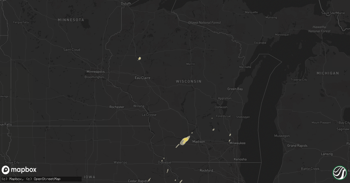
Hail Map in Wisconsin on May 28, 2016
Get this storm
May 28 map
$229
one time, instant access
Download today. No call, no setup
Keep the $229
Bought the map and want the full workflow? Apply the entire $229 to a subscription within 7 days. None of it is wasted.
Every map, not just this one
This buys you this map. Subscription and you get every map we run, in the markets you choose from a few cities to whole states to nationwide. Plus real-time alerts the moment a storm fires.
Contact data
Name, contact info, occupancy, even credit band for addresses in the footprint. You go from where it hit to who to call.
Become the source they trust
Unlimited branding weather history reports on demand. You already have the documented answer ready for the property owner, and you are the one who showed up with it.
Property data and RoofTrace estimates
Pull up any address you have got, its value and the exact code rules for that jurisdiction, straight from One Click Code. Then RoofTrace estimates the squares, pitch, and roof value, priced the way you price.
Storm reports in Wisconsin
Wisconsin
| Date | Description |
|---|---|
| 05/28/20165:49 PM CDT | A few tree branches down in the lodi area causing damage to power lines. Time estimated from radar. |
| 05/28/20165:19 PM CDT | Power lines and trees down in mazomanie. Time estimated by radar. |
| 05/28/20165:09 PM CDT | Large tree branch down on two houses. No injuries reported. |
| 05/28/20164:41 PM CDT | A local report indicates 59 MPH wind near 3 NW MINERAL POINT |
| 05/27/20168:48 PM CDT | One tree down. |
| 05/27/20168:45 PM CDT | Nws survey confirmed damage was consistent with straight-line wind with estimated wind speeds 60-80 mph.. Trees uprooted causing power outages. Shingles removed from ho |
| 05/27/20168:30 PM CDT | Few trees down |
| 05/27/20168:00 PM CDT | Trees down on west side of ripon. Power outage reported... Along with some power lines down across hwy 44. |
| 05/27/20167:45 PM CDT | Wires down in waupun. |
| 05/27/20167:25 PM CDT | Trees down throughout the county. |
All States Impacted by Hail Map on May 28, 2016
Cities Impacted by Hail Map on May 28, 2016
- Mereta, TX
- Eola, TX
- San Angelo, TX
- Paint Rock, TX
- Ryan, OK
- McCaulley, TX
- Sylvester, TX
- Ballinger, TX
- Talpa, TX
- Albany, TX
- Breckenridge, TX
- Tahoka, TX
- Stanton, TX
- Dyess Afb, TX
- Hawley, TX
- Merkel, TX
- Abilene, TX
- Anson, TX
- Sweetwater, TX
- Trent, TX
- Tye, TX
- Uvalde, TX
- Bandera, TX
- Rio Medina, TX
- Moore, TX
- Castroville, TX
- Hondo, TX
- San Antonio, TX
- Devine, TX
- D Hanis, TX
- La Coste, TX
- Yancey, TX
- Menard, TX
- Eden, TX
- Hunt, TX
- Tarpley, TX
- Leakey, TX
- Medina, TX
- Vanderpool, TX
- Utopia, TX
- Kerrville, TX
- Arena, WI
- Black Earth, WI
- Mazomanie, WI
- Blue Mounds, WI
- Barneveld, WI
- Holliday, TX
- Seymour, TX
- Moran, TX
- Baird, TX
- Clinton, IA
- Gail, TX
- Junction, TX
- Mountain Home, TX
- Graham, TX
- Atlanta, IL
- Maryneal, TX
- Brinktown, MO
- Dixon, MO
- Rotan, TX
- Snyder, TX
- Sullivan, MO
- Richwoods, MO
- Bourbon, MO
- Cuba, MO
- Lonedell, MO
- Blackwell, TX
- Colorado City, TX
- Hermleigh, TX
- Loraine, TX
- Roscoe, TX
- Fluvanna, TX
- Rushville, IL
- Sabinal, TX
- Knippa, TX
- Vienna, MO
- Camp Point, IL
- Coatsburg, IL
- Golden, IL
- Clayton, IL
- Huntsville, IL
- La Prairie, IL
- Camden, IL
- Mason City, IL
- San Jose, IL
- Easton, IL
- Delavan, IL
- Green Valley, IL
- Christoval, TX
- Walnut, IL
- Del Rio, TX
- Laughlin Afb, TX
- Shabbona, IL
- Earlville, IL
- Waterman, IL
- Mcalester, OK
- Mechanicsville, IA
- Anamosa, IA
- Olin, IA
- Morley, IA
- Sanger, TX
- Harper, TX
- Munday, TX
- O'Brien, TX
- Knox City, TX
- Rule, TX
- Rochester, TX
- Goree, TX
- Clyde, TX
- Bryson, TX
- Armington, IL
- Old Glory, TX
- Aspermont, TX
- Winters, TX
- Beardstown, IL
- Rio Frio, TX
- Concan, TX
- Meta, MO
- Galesburg, IL
- Henrietta, TX
- Barksdale, TX
- Camp Wood, TX
- Vancourt, TX
- Scotland, TX
- Wichita Falls, TX
- Olney, TX
- Ingram, TX
- Edgemont, SD
- Fulton, IL
- Dublin, TX
- Ava, MO
- Drury, MO
- Norwood, MO
- Mason, TX
- Rocksprings, TX
- London, TX
- Fredericksburg, TX
- De Soto, MO
- Fletcher, MO
- Dittmer, MO
- Midland, TX
- Licking, MO
- Success, MO
- Buffalo Gap, TX
- Cotulla, TX
- Woodson, TX
- Houlka, MS
- Jacksboro, TX
- Chetek, WI
- New Auburn, WI
- Ira, TX
- Stoutland, MO
- Richland, MO
- Hillsboro, IA
- Rolla, MO
- Potosi, MO
- Deridder, LA
- Newcastle, TX
- Roby, MO
- Bucyrus, MO
- Graford, TX
- Hamlin, TX
- Miles, TX
- Graff, MO
- Huggins, MO
- Mountain Grove, MO
- Mansfield, MO
- Squires, MO
- McLean, IL
- Comfort, TX
- Center Point, TX
- Lincoln, IL
- Hartsburg, IL
- Pearsall, TX
- Belle, MO
- Celina, OH
- Vardaman, MS
- Helotes, TX
- Loving, TX
- Browning, IL
- Bath, IL
- Havana, IL
- Topeka, IL
- Astoria, IL
- Liverpool, IL
- Lewistown, IL
- Manito, IL
- Newburg, MO
- Batesville, TX
- Stuart, OK
- Houma, LA
- Gray, LA
- Wall, TX
- Lawn, TX
- Ovalo, TX
- Randolph, MS
- Weinert, TX
- Lamesa, TX
- Nocona, TX
- Crocker, MO
- Singer, LA
- Bowie, TX
- Pewaukee, WI
- Sussex, WI
- Waukesha, WI
- Dilley, TX
- Forest City, IL
- Saint James, MO
- Bland, MO
- Vichy, MO
- Iberia, MO
- Hubertus, WI
- Germantown, WI
- Richfield, WI
- Ardmore, OK
- Lisco, NE
- Mill Creek, OK
- Berger, MO
- Stephenville, TX
- Bellevue, IA
- Boerne, TX
- Brady, TX
- Lewellen, NE
- Rock Island, IL
- Norton, TX
- Leland, IL
- Quincy, IL
- Fowler, IL
- Cameron, IL
- Otis, CO
- Juneau, WI
- Beaver Dam, WI
- Dodgeville, WI
- Mineral Point, WI
- Vanzant, MO
- Griggsville, IL
- Atascosa, TX
- Natalia, TX
- Pipe Creek, TX
- Brackettville, TX
- Lytle, TX
- Mico, TX
- Vermont, IL
- Industry, IL
- Ridgeway, WI
- Spring Green, WI
- Post, TX
- Emden, IL
- Bellevue, TX
- Geneseo, IL
- Eureka, IL
- Plato, MO
- Edgar Springs, MO
- Lueders, TX
- Atkinson, IL
- Gothenburg, NE
- Callaway, NE
- Bridgeport, TX
- Paradise, TX
- Jbsa Lackland, TX
- Von Ormy, TX
- Mount Sterling, IL
- Lodi, WI
- Sterling City, TX
- Owensville, MO
- Rosebud, MO
- Gerald, MO
- Leesville, LA
- Chandlerville, IL
- Minier, IL
- Hopedale, IL
- Stanford, IL
- Potosi, WI
- Ponder, TX
- Tuscola, TX
- Dubuque, IA
- Myrtle, MS
- Hickory Flat, MS
- Fort Leonard Wood, MO
- Brandon, WI
- Markesan, WI
- Dekalb, IL
- Ranger, TX
- Pontotoc, MS
- Sheffield, IL
- Decatur, TX
- Thomson, IL
- Sharon, TN
- Deer Grove, IL
- Lone Grove, OK
- Ipava, IL
- Cambridge, IL
- Fort Worth, TX
- Roby, TX
- Wilson, OK
- McNabb, IL
- Magnolia, IL
- Lostant, IL
- Alliance, NE
- Doss, TX


