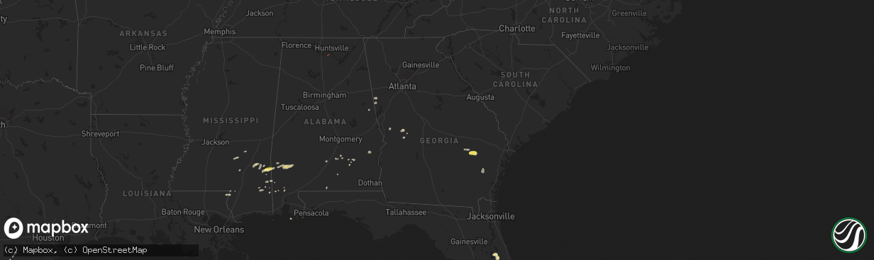
Hail Map in Georgia on May 27, 2025
The weather event in Georgia on May 27, 2025 includes Wind, Hail, and Tornado maps. 11 states and 245 cities were impacted and suffered possible damage. The total estimated number of properties impacted is 774.
Want more than just the map?
Turn this storm into a full workflow.
- Owner + property data so you know who to knock
- OnDemand branded weather history reports to win the "did we even have hail?" argument
- RoofTrace estimate so reps stop guessing numbers at the door
Bought this map? Upgrade within 7 days and we'll credit the $230. (10-15 min setup call)
Wind
Hail
Tornado
774
Estimated number of impacted properties by a 1.00" hail or larger0
Estimated number of impacted properties by a 1.75" hail or larger0
Estimated number of impacted properties by a 2.50" hail or largerStorm reports in Georgia
Georgia
| Date | Description |
|---|---|
| 05/27/20256:23 PM CDT | Tree down at the intersection of highway 178 and cecil tootle road. Time estimated by radar. |
| 05/27/20256:10 PM CDT | Emergency manager reports tree damage along hwy 147. |
| 05/27/20256:08 PM CDT | Emergency management reports numerous trees down along hwy 56. |
| 05/27/20252:42 PM CDT | Tree reported down on the 400 block of rising star rd. |
| 05/27/20252:10 PM CDT | Trees down at the intersection of dart rd and herring road. Possible brief tornadic spin up. |
| 05/27/20251:52 PM CDT | Tree reported down at the 1000 block of oak grove rd near the intersection with gardner rd. |
| 05/27/20251:50 PM CDT | Tree reported down on foggy bottom dr near the intersection with mink hollow dr. |
| 05/27/20251:38 PM CDT | Tree reported down on a power line at the 500 block of willie n st near the intersection with n alma st. |
| 05/27/20251:32 PM CDT | Trees down along roopville-veal road. A barn had its roof torn off. Tds noted on kffc radar from 1828 to 1833 utc. |
| 05/27/20251:27 PM CDT | Tree reported down on a home on the 400 block of mitchell ave. |
| 05/27/20251:23 PM CDT | Corrects previous tstm wnd dmg report from 3 ssw bowdon. Tree reported down on a power line at the intersection of fountain rd and hwy 100. |
| 05/27/20251:21 PM CDT | Tree reported down on a power line at the intersection of fountain rd and hwy 100. |
| 05/26/20257:02 PM CDT | Tree down at the intersection of loves chapel road and martin j durrence road. Time estimated by radar. |
| 05/26/20257:02 PM CDT | Tree down at the intersection of loves chapel road and martin j durrence road. A few other trees were also reported down in the same general area. Time estimated by rad |
All States Impacted by Hail Map on May 27, 2025
Cities Impacted by Hail Map on May 27, 2025
- Elk City, OK
- Hammon, OK
- Butler, OK
- Sayre, OK
- Canute, OK
- Clinton, OK
- Foss, OK
- Dill City, OK
- Cordell, OK
- Bell City, LA
- Cameron, LA
- Lake Charles, LA
- Creole, LA
- Gueydan, LA
- Lacassine, LA
- Iowa, LA
- Lake Arthur, LA
- Jennings, LA
- Crowley, LA
- Morse, LA
- Mermentau, LA
- Welsh, LA
- Estherwood, LA
- Grand Chenier, LA
- Duson, LA
- Rayne, LA
- Kaplan, LA
- Maurice, LA
- Abbeville, LA
- Erath, LA
- Youngsville, LA
- Carrizo Springs, TX
- Asherton, TX
- Big Wells, TX
- Catarina, TX
- Cotulla, TX
- Ludowici, GA
- Port Wentworth, GA
- Laredo, TX
- Rincon, GA
- Hardeeville, SC
- Greenville, AL
- Georgiana, AL
- Honoraville, AL
- Franklin, GA
- Wing, AL
- Andalusia, AL
- Roanoke, AL
- Highland Home, AL
- Lapine, AL
- Bowdon, GA
- Roopville, GA
- Grady, AL
- Luverne, AL
- Dozier, AL
- Troy, AL
- Laramie, WY
- Waverly Hall, GA
- Ellerslie, GA
- Capitan, NM
- Alpine, TX
- Cheyenne, WY
- Fort Davis, TX
- Webster, FL
- Junction City, GA
- Butler, GA
- Mauk, GA
- Rupert, GA
- Balmorhea, TX
- Labelle, FL
- Clewiston, FL
- Carr, CO
- Marathon, TX
- Big Bend National Park, TX
- Sedalia, CO
- Mize, MS
- Bay Springs, MS
- Louin, MS
- Seminary, MS
- Zephyrhills, FL
- Dade City, FL
- Seville, FL
- Taylorsville, MS
- Zolfo Springs, FL
- Pierson, FL
- Laurel, MS
- Casper, WY
- Grover, CO
- Shubuta, MS
- Waynesboro, MS
- Wesley Chapel, FL
- New Raymer, CO
- Apopka, FL
- De Leon Springs, FL
- Peyton, CO
- Angie, LA
- Genoa, CO
- Eustis, FL
- Deland, FL
- Buckatunna, MS
- Sorrento, FL
- Fort Stockton, TX
- Lyons, GA
- Poplarville, MS
- Calhan, CO
- Orange City, FL
- Vidalia, GA
- Millry, AL
- Uvalda, GA
- Reidsville, GA
- Hugo, CO
- Crane, TX
- Iraan, TX
- Lumberton, MS
- Silas, AL
- Ozona, TX
- Rush, CO
- Glennville, GA
- Yoder, CO
- Flagler, CO
- Arcadia, FL
- Karval, CO
- Odessa, TX
- Frankville, AL
- Midkiff, TX
- Leakesville, MS
- State Line, MS
- McLain, MS
- Jackson, AL
- Wiggins, MS
- Lucedale, MS
- Vinegar Bend, AL
- Jesup, GA
- McCamey, TX
- Valhermoso Springs, AL
- Laceys Spring, AL
- Grove Hill, AL
- Chatom, AL
- Medicine Bow, WY
- Deer Park, AL
- Midland, TX
- Garden City, TX
- Haswell, CO
- Chunchula, AL
- Carlsbad, NM
- Citronelle, AL
- Axis, AL
- Mount Vernon, AL
- Big Lake, TX
- Las Animas, CO
- Salt Flat, TX
- Loving, NM
- Hobbs, NM
- Lovington, NM
- Sonora, TX
- Maljamar, NM
- Sterling City, TX
- Christoval, TX
- Jal, NM
- Eldorado, TX
- Gulf Shores, AL
- San Angelo, TX
- Eunice, NM
- Roosevelt, TX
- Junction, TX
- Wall, TX
- Paint Rock, TX
- Vancourt, TX
- Eola, TX
- Mertzon, TX
- Menard, TX
- Goodfellow Afb, TX
- Mereta, TX
- Miles, TX
- Eden, TX
- Millersview, TX
- Melvin, TX
- Rocksprings, TX
- Rowena, TX
- Banks, AL
- Ballinger, TX
- Midway, AL
- Clayton, AL
- Seminole, TX
- Seagraves, TX
- Brownfield, TX
- Talpa, TX
- Coleman, TX
- Batesville, TX
- Mountain Home, TX
- Comstock, TX
- Hunt, TX
- Burkett, TX
- Del Rio, TX
- Santa Anna, TX
- Brownwood, TX
- Tahoka, TX
- Harper, TX
- Kerrville, TX
- Medina, TX
- Ingram, TX
- Rising Star, TX
- Carbon, TX
- Fredericksburg, TX
- Center Point, TX
- Post, TX
- Bandera, TX
- Gorman, TX
- Pipe Creek, TX
- Comfort, TX
- Desdemona, TX
- Justiceburg, TX
- Boerne, TX
- Ranger, TX
- San Ygnacio, TX
- De Leon, TX
- McIntosh, AL
- Fruitdale, AL
- San Antonio, TX
- Helotes, TX
- Whatley, AL
- Richton, MS
- Saint Stephens, AL
- Zapata, TX
- Stephenville, TX
- Hebbronville, TX
- Rockport, TX
- Bluff Dale, TX
- Guerra, TX
- Roma, TX
- Rio Grande City, TX
- New Braunfels, TX
- Mission, TX
- San Marcos, TX
- Maxwell, TX
- Dickens, TX
- Edinburg, TX
- Ganado, TX
- Louise, TX
- Dale, TX
- Red Rock, TX
- Smithville, TX
- Bastrop, TX
- El Campo, TX
- Rosanky, TX


