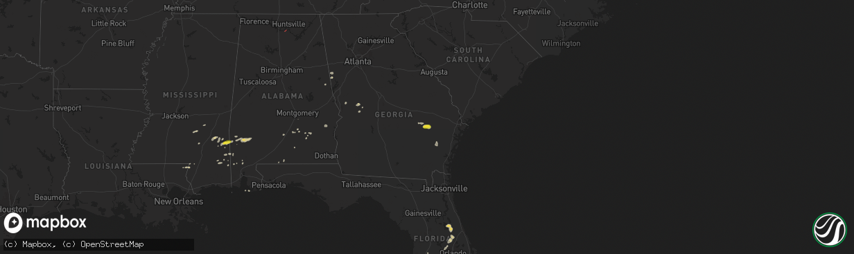
Hail Map on May 27, 2025
The weather event on May 27, 2025 includes Wind, Hail, and Tornado maps. 11 states and 245 cities were impacted and suffered possible damage. The total estimated number of properties impacted is 2,610.
Want more than just the map?
Turn this storm into a full workflow.
- Owner + property data so you know who to knock
- OnDemand branded weather history reports to win the "did we even have hail?" argument
- RoofTrace estimate so reps stop guessing numbers at the door
Bought this map? Upgrade within 7 days and we'll credit the $230. (10-15 min setup call)
Wind
Hail
Tornado
2,610
Estimated number of impacted properties by a 1.00" hail or larger32
Estimated number of impacted properties by a 1.75" hail or larger2
Estimated number of impacted properties by a 2.50" hail or largerStates Impacted by Hail Map on May 27, 2025
Storm reports
Texas
| Date | Description |
|---|---|
| 05/27/20256:38 PM CDT | Storm chaser reported half dollar size hail on us 90 west of marathon. Time was estimated by radar. |
| 05/27/20254:45 PM CDT | A local report indicates 1.75 inch wind near Chisos Basin |
| 05/26/202511:18 PM CDT | Corrected time on previous tstm wnd gst report from 2 w christoval. |
| 05/26/20259:32 PM CDT | Mesonet station 55 5sw st. Lawrence... Tx. |
Tennessee
| Date | Description |
|---|---|
| 05/27/20258:31 AM CDT | A tree was reported down on a powerline. |
| 05/26/20259:55 PM CDT | Corrects previous tstm wnd dmg report fr |
| 05/26/20259:55 PM CDT | Corrects previous tstm wnd dmg report from 7 sse sewanee. A tree was reporrted down at this location. |
| 05/26/20259:48 PM CDT | A tree was reported down at this location. |
| 05/26/20259:12 PM CDT | A tree was reported down on a powe |
| 05/26/20259:12 PM CDT | A tree was reported down on a power line. |
| 05/26/20259:06 PM CDT | A tree was reported down on a powerline at this location. |
| 05/26/20258:55 PM CDT | A tree was reporrted down at this location. |
| 05/26/20258:45 PM CDT | A tree was reported down on watercure road near believere road. |
| 05/26/20258:35 PM CDT | A tree was reported down at this location. |
| 05/26/20258:35 PM CDT | A tree was reported down at this locatoin. |
| 05/26/20258:35 PM CDT | Corrects previous tstm wnd dmg report from 8 n huntland. A tree was reported down at this locatoin. |
| 05/26/20258:31 PM CDT | Corrects previous tstm wnd dmg report from 7 nnw huntland. A tree was reported down on a powerline. |
| 05/26/20257:59 PM CDT | A tree was knocked down on hurricane creek road. Time estimated by radar. |
| 05/26/20257:59 PM CDT | A tree was knocked down on harry hill road. Time estimated by radar. |
New Mexico
| Date | Description |
|---|---|
| 05/26/20259:20 PM CDT | Asos station kcnm carlsbad. |
Georgia
| Date | Description |
|---|---|
| 05/27/20256:23 PM CDT | Tree down at the intersection of highway 178 and cecil tootle road. Time estimated by radar. |
| 05/27/20256:10 PM CDT | Emergency manager reports tree damage along hwy 147. |
| 05/27/20256:08 PM CDT | Emergency management reports numerous trees down along hwy 56. |
| 05/27/20252:42 PM CDT | Tree reported down on the 400 block of rising star rd. |
| 05/27/20252:10 PM CDT | Trees down at the intersection of dart rd and herring road. Possible brief tornadic spin up. |
| 05/27/20251:52 PM CDT | Tree reported down at the 1000 block of oak grove rd near the intersection with gardner rd. |
| 05/27/20251:50 PM CDT | Tree reported down on foggy bottom dr near the intersection with mink hollow dr. |
| 05/27/20251:38 PM CDT | Tree reported down on a power line at the 500 block of willie n st near the intersection with n alma st. |
| 05/27/20251:32 PM CDT | Trees down along roopville-veal road. A barn had its roof torn off. Tds noted on kffc radar from 1828 to 1833 utc. |
| 05/27/20251:27 PM CDT | Tree reported down on a home on the 400 block of mitchell ave. |
| 05/27/20251:23 PM CDT | Corrects previous tstm wnd dmg report from 3 ssw bowdon. Tree reported down on a power line at the intersection of fountain rd and hwy 100. |
| 05/27/20251:21 PM CDT | Tree reported down on a power line at the intersection of fountain rd and hwy 100. |
| 05/26/20257:02 PM CDT | Tree down at the intersection of loves chapel road and martin j durrence road. A few other trees were also reported down in the same general area. Time estimated by rad |
| 05/26/20257:02 PM CDT | Tree down at the intersection of loves chapel road and martin j durrence road. Time estimated by radar. |
Mississippi
| Date | Description |
|---|---|
| 05/27/20256:20 PM CDT | A local report indicates 1.00 inch wind near Buckatunna |
| 05/27/20258:33 AM CDT | Large pine tree half way down... Leaning across hwy 540... Had to be cut off the road. |
| 05/27/20258:24 AM CDT | Tree down across will stutley dr. |
| 05/27/20258:20 AM CDT | Tree down on prosperity place. |
| 05/27/20258:00 AM CDT | A few trees down on power lines along trace rd. |
| 05/27/20257:50 AM CDT | Tree down along hwy 27. |
| 05/27/20257:45 AM CDT | Tree down blocking road... Oakley-palestine rd. |
| 05/27/20257:40 AM CDT | Tree blocking broadwater rd. |
| 05/27/20257:12 AM CDT | Trees down and across roads in the ne part of the county. |
| 05/27/20257:05 AM CDT | Tree down on old mill rd. |
Colorado
| Date | Description |
|---|---|
| 05/27/20256:10 PM CDT | A local report indicates 1.00 inch wind near New Raymer |
| 05/27/20255:57 PM CDT | Damage to an outbuilding from a tornado. |
| 05/27/20255:48 PM CDT | Tornado skipping across the ground over open and open field. Dust visible some of the time. |
Alabama
| Date | Description |
|---|---|
| 05/27/20255:26 PM CDT | A tree was reported down near the intersection of danville road and stone river drive. |
| 05/27/20255:26 PM CDT | A tree limb was reported down at this location. |
| 05/27/20255:24 PM CDT | A large tree was reported down at this location on singleton road. |
| 05/27/20253:20 PM CDT | Tree down near county road 212 and highway 431. |
| 05/27/20253:06 PM CDT | Trees and powerlines were downed in eufaula... Including barbour ln... South randolph ave... And west broad at doren dr. |
| 05/27/20252:47 PM CDT | 911 dispatch reported tree down at intersection of cr 151 and 148. |
| 05/27/20252:45 PM CDT | Trees and powerlines were downed around clayton... Including highway 51... Poorhouse rd... And county shop rd. |
| 05/27/20252:30 PM CDT | 911 dispatch reported tree down at intersection of cr 248 near pea river bridge. |
| 05/27/20252:21 PM CDT | Trees down on mill creek... Grider mock... And salem church roads. Some of the trees fell on power lines. |
| 05/27/20252:20 PM CDT | 911 dispatch reported tree down at intersection of cr 290 and 200. |
| 05/27/20252:17 PM CDT | 911 dispatch reported tree down at intersection of hwy 161 and cr 201. |
| 05/27/20252:12 PM CDT | A couple trees were downed along butter and egg rd and along highway 29. |
| 05/27/20251:00 PM CDT | Several trees down across northern randolph county... Including cr 19... Cr 15... Highway 431... And cr 51 at cr 92. |
| 05/27/202512:08 PM CDT | Several trees were downed across talladega county... Including around talladega and sylacauga. |
Cities Impacted by Hail Map on May 27, 2025
- Elk City, OK
- Hammon, OK
- Butler, OK
- Sayre, OK
- Canute, OK
- Clinton, OK
- Foss, OK
- Dill City, OK
- Cordell, OK
- Bell City, LA
- Cameron, LA
- Lake Charles, LA
- Creole, LA
- Gueydan, LA
- Lacassine, LA
- Iowa, LA
- Lake Arthur, LA
- Jennings, LA
- Crowley, LA
- Morse, LA
- Mermentau, LA
- Welsh, LA
- Estherwood, LA
- Grand Chenier, LA
- Duson, LA
- Rayne, LA
- Kaplan, LA
- Maurice, LA
- Abbeville, LA
- Erath, LA
- Youngsville, LA
- Carrizo Springs, TX
- Asherton, TX
- Big Wells, TX
- Catarina, TX
- Cotulla, TX
- Ludowici, GA
- Port Wentworth, GA
- Laredo, TX
- Rincon, GA
- Hardeeville, SC
- Greenville, AL
- Georgiana, AL
- Honoraville, AL
- Franklin, GA
- Wing, AL
- Andalusia, AL
- Roanoke, AL
- Highland Home, AL
- Lapine, AL
- Bowdon, GA
- Roopville, GA
- Grady, AL
- Luverne, AL
- Dozier, AL
- Troy, AL
- Laramie, WY
- Waverly Hall, GA
- Ellerslie, GA
- Capitan, NM
- Alpine, TX
- Cheyenne, WY
- Fort Davis, TX
- Webster, FL
- Junction City, GA
- Butler, GA
- Mauk, GA
- Rupert, GA
- Balmorhea, TX
- Labelle, FL
- Clewiston, FL
- Carr, CO
- Marathon, TX
- Big Bend National Park, TX
- Sedalia, CO
- Mize, MS
- Bay Springs, MS
- Louin, MS
- Seminary, MS
- Zephyrhills, FL
- Dade City, FL
- Seville, FL
- Taylorsville, MS
- Zolfo Springs, FL
- Pierson, FL
- Laurel, MS
- Casper, WY
- Grover, CO
- Shubuta, MS
- Waynesboro, MS
- Wesley Chapel, FL
- New Raymer, CO
- Apopka, FL
- De Leon Springs, FL
- Peyton, CO
- Angie, LA
- Genoa, CO
- Eustis, FL
- Deland, FL
- Buckatunna, MS
- Sorrento, FL
- Fort Stockton, TX
- Lyons, GA
- Poplarville, MS
- Calhan, CO
- Orange City, FL
- Vidalia, GA
- Millry, AL
- Uvalda, GA
- Reidsville, GA
- Hugo, CO
- Crane, TX
- Iraan, TX
- Lumberton, MS
- Silas, AL
- Ozona, TX
- Rush, CO
- Glennville, GA
- Yoder, CO
- Flagler, CO
- Arcadia, FL
- Karval, CO
- Odessa, TX
- Frankville, AL
- Midkiff, TX
- Leakesville, MS
- State Line, MS
- McLain, MS
- Jackson, AL
- Wiggins, MS
- Lucedale, MS
- Vinegar Bend, AL
- Jesup, GA
- McCamey, TX
- Valhermoso Springs, AL
- Laceys Spring, AL
- Grove Hill, AL
- Chatom, AL
- Medicine Bow, WY
- Deer Park, AL
- Midland, TX
- Garden City, TX
- Haswell, CO
- Chunchula, AL
- Carlsbad, NM
- Citronelle, AL
- Axis, AL
- Mount Vernon, AL
- Big Lake, TX
- Las Animas, CO
- Salt Flat, TX
- Loving, NM
- Hobbs, NM
- Lovington, NM
- Sonora, TX
- Maljamar, NM
- Sterling City, TX
- Christoval, TX
- Jal, NM
- Eldorado, TX
- Gulf Shores, AL
- San Angelo, TX
- Eunice, NM
- Roosevelt, TX
- Junction, TX
- Wall, TX
- Paint Rock, TX
- Vancourt, TX
- Eola, TX
- Mertzon, TX
- Menard, TX
- Goodfellow Afb, TX
- Mereta, TX
- Miles, TX
- Eden, TX
- Millersview, TX
- Melvin, TX
- Rocksprings, TX
- Rowena, TX
- Banks, AL
- Ballinger, TX
- Midway, AL
- Clayton, AL
- Seminole, TX
- Seagraves, TX
- Brownfield, TX
- Talpa, TX
- Coleman, TX
- Batesville, TX
- Mountain Home, TX
- Comstock, TX
- Hunt, TX
- Burkett, TX
- Del Rio, TX
- Santa Anna, TX
- Brownwood, TX
- Tahoka, TX
- Harper, TX
- Kerrville, TX
- Medina, TX
- Ingram, TX
- Rising Star, TX
- Carbon, TX
- Fredericksburg, TX
- Center Point, TX
- Post, TX
- Bandera, TX
- Gorman, TX
- Pipe Creek, TX
- Comfort, TX
- Desdemona, TX
- Justiceburg, TX
- Boerne, TX
- Ranger, TX
- San Ygnacio, TX
- De Leon, TX
- McIntosh, AL
- Fruitdale, AL
- San Antonio, TX
- Helotes, TX
- Whatley, AL
- Richton, MS
- Saint Stephens, AL
- Zapata, TX
- Stephenville, TX
- Hebbronville, TX
- Rockport, TX
- Bluff Dale, TX
- Guerra, TX
- Roma, TX
- Rio Grande City, TX
- New Braunfels, TX
- Mission, TX
- San Marcos, TX
- Maxwell, TX
- Dickens, TX
- Edinburg, TX
- Ganado, TX
- Louise, TX
- Dale, TX
- Red Rock, TX
- Smithville, TX
- Bastrop, TX
- El Campo, TX
- Rosanky, TX