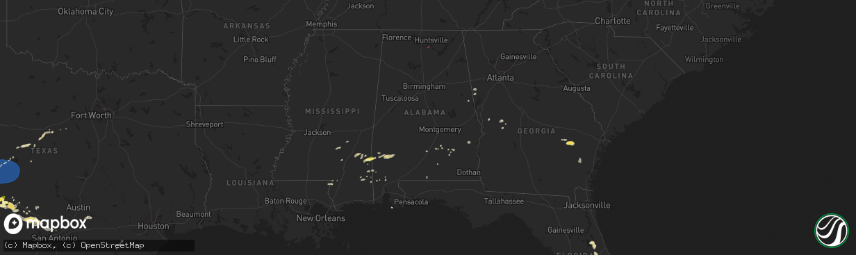
Hail Map in Alabama on May 27, 2025
The weather event in Alabama on May 27, 2025 includes Wind, Hail, and Tornado maps. 11 states and 245 cities were impacted and suffered possible damage. The total estimated number of properties impacted is 245.
Want more than just the map?
Turn this storm into a full workflow.
- Owner + property data so you know who to knock
- OnDemand branded weather history reports to win the "did we even have hail?" argument
- RoofTrace estimate so reps stop guessing numbers at the door
Bought this map? Upgrade within 7 days and we'll credit the $230. (10-15 min setup call)
Wind
Hail
Tornado
245
Estimated number of impacted properties by a 1.00" hail or larger0
Estimated number of impacted properties by a 1.75" hail or larger0
Estimated number of impacted properties by a 2.50" hail or largerStorm reports in Alabama
Alabama
| Date | Description |
|---|---|
| 05/27/20255:26 PM CDT | A tree was reported down near the intersection of danville road and stone river drive. |
| 05/27/20255:26 PM CDT | A tree limb was reported down at this location. |
| 05/27/20255:24 PM CDT | A large tree was reported down at this location on singleton road. |
| 05/27/20253:20 PM CDT | Tree down near county road 212 and highway 431. |
| 05/27/20253:06 PM CDT | Trees and powerlines were downed in eufaula... Including barbour ln... South randolph ave... And west broad at doren dr. |
| 05/27/20252:47 PM CDT | 911 dispatch reported tree down at intersection of cr 151 and 148. |
| 05/27/20252:45 PM CDT | Trees and powerlines were downed around clayton... Including highway 51... Poorhouse rd... And county shop rd. |
| 05/27/20252:30 PM CDT | 911 dispatch reported tree down at intersection of cr 248 near pea river bridge. |
| 05/27/20252:21 PM CDT | Trees down on mill creek... Grider mock... And salem church roads. Some of the trees fell on power lines. |
| 05/27/20252:20 PM CDT | 911 dispatch reported tree down at intersection of cr 290 and 200. |
| 05/27/20252:17 PM CDT | 911 dispatch reported tree down at intersection of hwy 161 and cr 201. |
| 05/27/20252:12 PM CDT | A couple trees were downed along butter and egg rd and along highway 29. |
| 05/27/20251:00 PM CDT | Several trees down across northern randolph county... Including cr 19... Cr 15... Highway 431... And cr 51 at cr 92. |
| 05/27/202512:08 PM CDT | Several trees were downed across talladega county... Including around talladega and sylacauga. |
All States Impacted by Hail Map on May 27, 2025
Cities Impacted by Hail Map on May 27, 2025
- Elk City, OK
- Hammon, OK
- Butler, OK
- Sayre, OK
- Canute, OK
- Clinton, OK
- Foss, OK
- Dill City, OK
- Cordell, OK
- Bell City, LA
- Cameron, LA
- Lake Charles, LA
- Creole, LA
- Gueydan, LA
- Lacassine, LA
- Iowa, LA
- Lake Arthur, LA
- Jennings, LA
- Crowley, LA
- Morse, LA
- Mermentau, LA
- Welsh, LA
- Estherwood, LA
- Grand Chenier, LA
- Duson, LA
- Rayne, LA
- Kaplan, LA
- Maurice, LA
- Abbeville, LA
- Erath, LA
- Youngsville, LA
- Carrizo Springs, TX
- Asherton, TX
- Big Wells, TX
- Catarina, TX
- Cotulla, TX
- Ludowici, GA
- Port Wentworth, GA
- Laredo, TX
- Rincon, GA
- Hardeeville, SC
- Greenville, AL
- Georgiana, AL
- Honoraville, AL
- Franklin, GA
- Wing, AL
- Andalusia, AL
- Roanoke, AL
- Highland Home, AL
- Lapine, AL
- Bowdon, GA
- Roopville, GA
- Grady, AL
- Luverne, AL
- Dozier, AL
- Troy, AL
- Laramie, WY
- Waverly Hall, GA
- Ellerslie, GA
- Capitan, NM
- Alpine, TX
- Cheyenne, WY
- Fort Davis, TX
- Webster, FL
- Junction City, GA
- Butler, GA
- Mauk, GA
- Rupert, GA
- Balmorhea, TX
- Labelle, FL
- Clewiston, FL
- Carr, CO
- Marathon, TX
- Big Bend National Park, TX
- Sedalia, CO
- Mize, MS
- Bay Springs, MS
- Louin, MS
- Seminary, MS
- Zephyrhills, FL
- Dade City, FL
- Seville, FL
- Taylorsville, MS
- Zolfo Springs, FL
- Pierson, FL
- Laurel, MS
- Casper, WY
- Grover, CO
- Shubuta, MS
- Waynesboro, MS
- Wesley Chapel, FL
- New Raymer, CO
- Apopka, FL
- De Leon Springs, FL
- Peyton, CO
- Angie, LA
- Genoa, CO
- Eustis, FL
- Deland, FL
- Buckatunna, MS
- Sorrento, FL
- Fort Stockton, TX
- Lyons, GA
- Poplarville, MS
- Calhan, CO
- Orange City, FL
- Vidalia, GA
- Millry, AL
- Uvalda, GA
- Reidsville, GA
- Hugo, CO
- Crane, TX
- Iraan, TX
- Lumberton, MS
- Silas, AL
- Ozona, TX
- Rush, CO
- Glennville, GA
- Yoder, CO
- Flagler, CO
- Arcadia, FL
- Karval, CO
- Odessa, TX
- Frankville, AL
- Midkiff, TX
- Leakesville, MS
- State Line, MS
- McLain, MS
- Jackson, AL
- Wiggins, MS
- Lucedale, MS
- Vinegar Bend, AL
- Jesup, GA
- McCamey, TX
- Valhermoso Springs, AL
- Laceys Spring, AL
- Grove Hill, AL
- Chatom, AL
- Medicine Bow, WY
- Deer Park, AL
- Midland, TX
- Garden City, TX
- Haswell, CO
- Chunchula, AL
- Carlsbad, NM
- Citronelle, AL
- Axis, AL
- Mount Vernon, AL
- Big Lake, TX
- Las Animas, CO
- Salt Flat, TX
- Loving, NM
- Hobbs, NM
- Lovington, NM
- Sonora, TX
- Maljamar, NM
- Sterling City, TX
- Christoval, TX
- Jal, NM
- Eldorado, TX
- Gulf Shores, AL
- San Angelo, TX
- Eunice, NM
- Roosevelt, TX
- Junction, TX
- Wall, TX
- Paint Rock, TX
- Vancourt, TX
- Eola, TX
- Mertzon, TX
- Menard, TX
- Goodfellow Afb, TX
- Mereta, TX
- Miles, TX
- Eden, TX
- Millersview, TX
- Melvin, TX
- Rocksprings, TX
- Rowena, TX
- Banks, AL
- Ballinger, TX
- Midway, AL
- Clayton, AL
- Seminole, TX
- Seagraves, TX
- Brownfield, TX
- Talpa, TX
- Coleman, TX
- Batesville, TX
- Mountain Home, TX
- Comstock, TX
- Hunt, TX
- Burkett, TX
- Del Rio, TX
- Santa Anna, TX
- Brownwood, TX
- Tahoka, TX
- Harper, TX
- Kerrville, TX
- Medina, TX
- Ingram, TX
- Rising Star, TX
- Carbon, TX
- Fredericksburg, TX
- Center Point, TX
- Post, TX
- Bandera, TX
- Gorman, TX
- Pipe Creek, TX
- Comfort, TX
- Desdemona, TX
- Justiceburg, TX
- Boerne, TX
- Ranger, TX
- San Ygnacio, TX
- De Leon, TX
- McIntosh, AL
- Fruitdale, AL
- San Antonio, TX
- Helotes, TX
- Whatley, AL
- Richton, MS
- Saint Stephens, AL
- Zapata, TX
- Stephenville, TX
- Hebbronville, TX
- Rockport, TX
- Bluff Dale, TX
- Guerra, TX
- Roma, TX
- Rio Grande City, TX
- New Braunfels, TX
- Mission, TX
- San Marcos, TX
- Maxwell, TX
- Dickens, TX
- Edinburg, TX
- Ganado, TX
- Louise, TX
- Dale, TX
- Red Rock, TX
- Smithville, TX
- Bastrop, TX
- El Campo, TX
- Rosanky, TX


