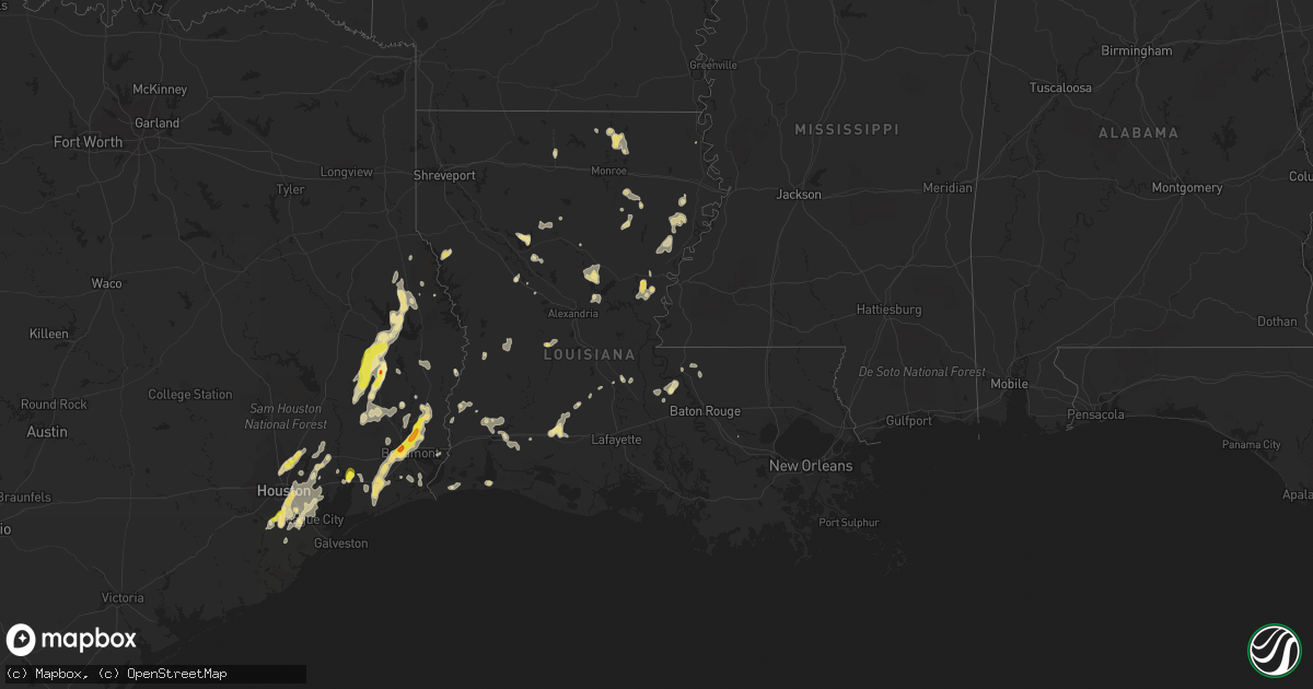
Hail Map in Louisiana on May 26, 2018
Get this storm
May 26 map
$229
one time, instant access
Download today. No call, no setup
Keep the $229
Bought the map and want the full workflow? Apply the entire $229 to a subscription within 7 days. None of it is wasted.
Every map, not just this one
This buys you this map. Subscription and you get every map we run, in the markets you choose from a few cities to whole states to nationwide. Plus real-time alerts the moment a storm fires.
Contact data
Name, contact info, occupancy, even credit band for addresses in the footprint. You go from where it hit to who to call.
Become the source they trust
Unlimited branding weather history reports on demand. You already have the documented answer ready for the property owner, and you are the one who showed up with it.
Property data and RoofTrace estimates
Pull up any address you have got, its value and the exact code rules for that jurisdiction, straight from One Click Code. Then RoofTrace estimates the squares, pitch, and roof value, priced the way you price.
Storm reports in Louisiana
Louisiana
| Date | Description |
|---|---|
| 05/26/20185:05 PM CDT | Tree down across hwy 568. |
| 05/26/20183:17 PM CDT | A local report indicates 1.00 inch wind near 9 W MANGHAM |
| 05/26/201812:57 PM CDT | Spotter reported 59 mph wind gust and tree limbs down north of jennings. |
| 05/26/201812:05 AM CDT | At 505 PM CDT, a severe thunderstorm was located 7 miles northeast of Swartz, moving east at 10 mph. HAZARD...60 mph wind gusts and quarter size hail. SOURCE...Radar indicated. IMPACT...Hail damage to vehicles is expected. Expect wind damage to roofs, siding, and trees. This severe thunderstorm will be near... Bastrop around 510 PM CDT.Other locations impacted by this severe thunderstorm includeCollinston and Mer Rouge. |
| 05/25/201811:25 PM CDT | At 425 PM CDT, a severe thunderstorm was located 7 miles southwest of Yokena, or 18 miles south of Vicksburg, moving southeast at 15 mph. HAZARD...60 mph wind gusts and quarter size hail. SOURCE...Radar indicated. IMPACT...Hail damage to vehicles is expected. Expect wind damage to roofs, siding, and trees. This severe thunderstorm will be near... Port Gibson around 455 PM CDT. |
| 05/25/201811:23 PM CDT | At 423 PM CDT, a severe thunderstorm was located 7 miles northwest of Somerset, or 13 miles southwest of Tallulah, moving southeast at 15 mph. HAZARD...60 mph wind gusts and quarter size hail. SOURCE...Radar indicated. IMPACT...Hail damage to vehicles is expected. Expect wind damage to roofs, siding, and trees. This severe thunderstorm will be near... Afton around 445 PM CDT. Somerset around 455 PM CDT. |
| 05/25/201811:00 PM CDT | At 359 PM CDT, severe thunderstorms were located along a line extending from Enterprise to Manifest to 7 miles south of Midway, moving east at 15 mph. HAZARD...60 mph wind gusts and quarter size hail. SOURCE...Radar indicated. IMPACT...Hail damage to vehicles is expected. Expect wind damage to roofs, siding, and trees. Severe thunderstorms will be near... Manifest, Enterprise and Sherwood around 405 PM CDT. Wallace Ridge around 440 PM CDT.Other locations impacted by these severe thunderstorms includeHarrisonburg. |
| 05/25/201810:56 PM CDT | At 356 PM CDT, severe thunderstorms were located along a line extending from near Mangham to near Jigger, moving southeast at 20 mph. HAZARD...60 mph wind gusts and quarter size hail. SOURCE...Radar indicated. IMPACT...Hail damage to vehicles is expected. Expect wind damage to roofs, siding, and trees. Severe thunderstorms will be near... Winnsboro and Jigger around 410 PM CDT. Crowville around 420 PM CDT. Wisner around 430 PM CDT.Other locations impacted by these severe thunderstorms includeGilbert and Baskin. |
| 05/25/201810:42 PM CDT | At 342 PM CDT, a severe thunderstorm was located near Galliano, and is nearly stationary. HAZARD...60 mph wind gusts and penny size hail. SOURCE...Radar indicated. IMPACT...Expect damage to roofs, siding, and trees. Locations impacted include... Larose, Cut Off, Galliano and Golden Meadow. |
| 05/25/201810:11 PM CDT | At 311 PM CDT, a severe thunderstorm was located over Buckner, or 8 miles west of Mangham, moving southeast at 20 mph. HAZARD...60 mph wind gusts and quarter size hail. SOURCE...Radar indicated. IMPACT...Hail damage to vehicles is expected. Expect wind damage to roofs, siding, and trees. This severe thunderstorm will be near... Mangham around 325 PM CDT. Liddieville around 340 PM CDT. Winnsboro around 355 PM CDT.Other locations impacted by this severe thunderstorm include Baskin. |
| 05/25/20189:27 PM CDT | At 226 PM CDT, a severe thunderstorm was located near New Roads, moving northwest at 5 mph. HAZARD...60 mph wind gusts and penny size hail. SOURCE...Radar indicated. IMPACT...Expect damage to roofs, siding, and trees. Locations impacted include... New Roads, Livonia and Fordoche. |
All States Impacted by Hail Map on May 26, 2018
Cities Impacted by Hail Map on May 26, 2018
- Ishpeming, MI
- Negaunee, MI
- Eunice, LA
- Mcclusky, ND
- Wausaukee, WI
- Wallace, MI
- Lame Deer, MT
- Birney, MT
- Richey, MT
- Florissant, MO
- Hazelwood, MO
- Maywood, MO
- Taylor, MO
- La Grange, MO
- Wishek, ND
- Carthage, IL
- Tennessee, IL
- Clear Spring, MD
- Falling Waters, WV
- Lindsay, MT
- Terry, MT
- Bloomfield, MT
- Circle, MT
- Seymour, IN
- Canton, MO
- Warsaw, IL
- Quincy, IL
- Monticello, MO
- Philadelphia, MO
- Ursa, IL
- Palmyra, MO
- Durham, MO
- Geyser, MT
- San Augustine, TX
- Saint Francisville, LA
- Sturgeon Bay, WI
- Shoup, ID
- Jamestown, ND
- Jud, ND
- Ferriday, LA
- Hemlock, MI
- Saint Charles, MI
- Saginaw, MI
- Midland, MI
- Buna, TX
- Gwinn, MI
- Foster City, MI
- Wilton, ND
- Wallisville, TX
- Liberty, TX
- Lodge Grass, MT
- Oberlin, OH
- Kipton, OH
- Wakeman, OH
- Amherst, OH
- Berlin Heights, OH
- Beaumont, TX
- Winnie, TX
- Jerseyville, IL
- Dow, IL
- Godfrey, IL
- Brighton, IL
- Fort Peck, MT
- Nashua, MT
- Deville, LA
- Powers, MI
- Spalding, MI
- Decker, MT
- Sears, MI
- Lake, MI
- Barryton, MI
- Danbury, TX
- Rosharon, TX
- Glendive, MT
- Baileys Harbor, WI
- Fish Creek, WI
- Egg Harbor, WI
- Jasper, TX
- Zavalla, TX
- Woodville, TX
- Colmesneil, TX
- Warren, TX
- Chester, TX
- Livingston, TX
- Fredonia, ND
- Kulm, ND
- Collinston, LA
- Weidman, MI
- Remus, MI
- Kirbyville, TX
- Newton, TX
- Kountze, TX
- Bismarck, AR
- Bronson, TX
- Lambert, MT
- Winnsboro, LA
- Mercer, ND
- Turtle Lake, ND
- Columbia, LA
- New Sharon, IA
- Bark River, MI
- Vulcan, MI
- Stephenson, MI
- Daggett, MI
- Perronville, MI
- Carney, MI
- Hermansville, MI
- Wilson, MI
- Broaddus, TX
- Plymouth, IL
- Newellton, LA
- Saint Joseph, LA
- Regan, ND
- Baldwin, ND
- Marion, LA
- Dubach, LA
- Jordan, MT
- Hollandale, MS
- Chillicothe, MO
- Sumner, MO
- Hale, MO
- Iota, LA
- Evangeline, LA
- Basile, LA
- Jennings, LA
- Grand Marais, MN
- Fullerton, ND
- Oakes, ND
- Lamoure, ND
- North Fork, ID
- Goldonna, LA
- Winnfield, LA
- Berlin, ND
- Yazoo City, MS
- Anahuac, TX
- Rushville, MO
- Pearland, TX
- Houston, TX
- Galena Park, TX
- Manvel, TX
- Big Timber, MT
- Yorktown, AR
- Star City, AR
- Palmer, MI
- Medora, IL
- Fordoche, LA
- Silsbee, TX
- Republic, MI
- Champion, MI
- Tappen, ND
- Edgeley, ND
- Powell, WY
- Manton, MI
- Plattsburg, MO
- Stewartsville, MO
- Humble, TX
- Ingalls, MI
- Jonesville, LA
- Savage, MT
- Durand, MI
- Kingwood, TX
- Porter, TX
- Ryegate, MT
- Shawmut, MT
- McBain, MI
- Neponset, IL
- Sheffield, IL
- Fort Polk, LA
- Napoleon, ND
- Crow Agency, MT
- Saint Xavier, MT
- Colts Neck, NJ
- Holmdel, NJ
- Marlboro, NJ
- Lincroft, NJ
- Eatontown, NJ
- Old Bridge, NJ
- Morganville, NJ
- Jena, LA
- Trout, LA
- Vidor, TX
- Barry, IL
- Nadeau, MI
- Menominee, MI
- Martinsdale, MT
- Two Dot, MT
- Baylis, IL
- Liberty, IL
- Saint Louis, MO
- Clayton, LA
- Michigamme, MI
- Channing, MI
- Marquette, MI
- La Porte, TX
- Pasadena, TX
- Lake City, SD
- Britton, SD
- Owosso, MI
- Corunna, MI
- Lake Charles, LA
- Iowa, LA
- Chesaning, MI
- Lake City, MI
- Falmouth, MI
- Veblen, SD
- Goodrich, ND
- Denhoff, ND
- Gladwin, MI
- Harrison, MI
- Braddock, ND
- Driscoll, ND
- Moffit, ND
- Steele, ND
- Foxworth, MS
- Kokomo, MS
- Dayton, TX
- Deep River, IA
- Atchison, KS
- Cameron, LA
- Rupert, ID
- Fallon, MT
- Covington, MI
- Comins, MI
- Medina, ND
- Cleveland, ND
- Sisseton, SD
- Peever, SD
- Hillister, TX
- Bastrop, LA
- Sterlington, LA
- Monroe, LA
- Palmetto, LA
- Alton, IL
- Wolf Point, MT
- Butte, ND
- Houghton Lake, MI
- Saratoga, TX
- Carrollton, MO
- Tina, MO
- Dawn, MO
- Dawson, ND
- Washington, LA
- Lanse, MI
- Rose Hill, IA
- Pembine, WI
- Loretto, MI
- Norway, MI
- Crystal Falls, MI
- Grenville, SD
- Morton, MS
- Woodbury, NJ
- Paulsboro, NJ
- Thorofare, NJ
- Deridder, LA
- Ventress, LA
- Livonia, LA
- Oscar, LA
- New Roads, LA
- Jarreau, LA
- Freeland, MI
- Montrose, MI
- Merrill, MI
- Brant, MI
- Converse, LA
- Crosby, TX
- Highlands, TX
- West, MS
- Vaiden, MS
- Maringouin, LA
- Glasgow, MT
- Pitkin, LA
- Bowen, IL
- Golden, IL
- Clayton, IL
- La Prairie, IL
- Huntsville, IL
- Augusta, IL
- Timewell, IL
- Camp Point, IL
- Winchester, VA
- Star Tannery, VA
- Bogard, MO
- Ludlow, MO
- Westlake, LA
- Sewell, NJ
- Wenonah, NJ
- Gibbstown, NJ
- Mantua, NJ
- Woodbury Heights, NJ
- Kintyre, ND
- Dequincy, LA
- Sulphur, LA
- Glenmora, LA
- Hamshire, TX
- Hedrick, IA
- Fremont, IA
- Mendon, IL
- Loraine, IL
- Kidder, MO
- Cameron, MO
- Moultrie, GA
- Pierpont, SD
- Mangham, LA
- Rayville, LA
- Little Lake, MI
- Lachine, MI
- Montgomery, LA
- Atlanta, LA
- Missouri City, TX
- Fresno, TX
- Cogswell, ND
- Forman, ND
- Saline, LA
- Pittsfield, IL
- Pleasant Hill, IL
- Rockport, IL
- Gaylord, MI
- Alexander, ND
- Cartwright, ND
- Claire City, SD
- Bridgeton, MO
- Saint Charles, MO
- Huffman, TX
- Columbia, MS
- Crescent Valley, NV
- Griggsville, IL
- Monterey, LA
- Bon Wier, TX
- Clearmont, WY
- Brownstown, IN
- Gwinner, ND
- Oakdale, LA
- Lumberton, MS
- Wing, ND
- Wilsall, MT
- Tallulah, LA
- Columbus, IN
- Chambersburg, IL
- Ellison Bay, WI
- Clancy, MT
- Lake Providence, LA
- Dodson, LA
- Sikes, LA
- Starks, LA
- Tullos, LA
- Alvin, TX
- Webster, TX
- Friendswood, TX
- Cardwell, MT
- Harrison, MT
- Mount Royal, NJ
- Voltaire, ND
- Ruso, ND
- Louann, AR
- Wellington, OH
- Fowler, IL
- Paloma, IL
- Banner, WY
- Sheridan, WY
- High View, WV
- Strasburg, VA
- Natchitoches, LA
- Call, TX
- League City, TX
- Merritt, MI
- Sour Lake, TX
- Augusta, MT
- Natchez, LA
- Melrose, LA
- Brussels, WI
- Oconto, WI
- Rapidan, VA
- Mitchells, VA
- Culpeper, VA
- Merryville, LA
- Milam, TX
- Sterling, ND
- Smackover, AR
- Vida, MT
- Ypsilanti, ND
- Monticello, MS
- Oak Vale, MS
- New Canton, IL
- New Salem, IL
- Reed Point, MT
- Pettibone, ND
- Center, TX
- Shelbyville, TX
- Streeter, ND
- Port Arthur, TX
- Buffalo, WY
- Otway, OH
- McDermott, OH
- Otter, MT
- Brockway, MT
- Anguilla, MS
- Springer, OK
- Wibaux, MT
- Port Gibson, MS
- Frazer, MT
- Dickinson, TX
- Seabrook, TX
- Kemah, TX
- Deer Park, TX
- Channelview, TX
- Baytown, TX
- South Houston, TX
- Sidney, MT
- Orange, TX
- Benedict, ND
- Williamstown, MO
- Verona, ND
- Welsh, LA
- Philadelphia, PA
- Clarksboro, NJ
- Amberg, WI
- Gackle, ND
- Paul, ID
- Bunkie, LA
- Poplarville, MS
- Menoken, ND
- Leesville, LA
- Livingston, MT
- Stirum, ND
- Ville Platte, LA
- Heyburn, ID
- Burley, ID
- Goodman, WI
- Pineville, LA
- Saint Amant, LA
- Prudenville, MI
- Litchfield, IL
- Cloutierville, LA
- Bell City, LA
- Havana, ND
- Rutland, ND
- Tuttle, ND
- Stanford, MT
- Ephraim, WI
- Sister Bay, WI
- Jackson, LA
- Ethel, LA
- Roscommon, MI
- New Town, ND
- Keswick, IA
- Singer, LA
- Galesburg, IL
- Knoxville, IL
- East Galesburg, IL
- Sykeston, ND
- Cody, WY
- Opelousas, LA
- Wood River, IL
- East Alton, IL
- Webster, SD
- Poplar, MT
- Mesick, MI
- Cohagen, MT
- Sutter, IL
- Belzoni, MS
- Louise, MS
- Ketchum, ID
- Silver City, MS
- Sand Springs, MT
- Felch, MI
- Freehold, NJ
- Howell, NJ
- Devers, TX
- Hankamer, TX
- White Sulphur Springs, MT
- Saint Helen, MI
- Bradley, SD
- Conde, SD
- Egan, LA
- Lena, LA
- Braymer, MO
- Fairview, MT
- Belmar, NJ
- Coatsburg, IL
- Grace, ID
- Abingdon, IL
- Maquon, IL
- Gilson, IL
- De Kalb, MO
- Frederic, MI
- West Point, IL


