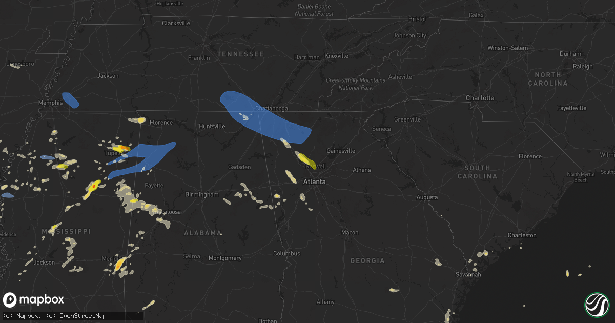
Hail Map on May 25, 2025
Get this storm
May 25 map
$229
one time, instant access
Download today. No call, no setup
Keep the $229
Bought the map and want the full workflow? Apply the entire $229 to a subscription within 7 days. None of it is wasted.
Every map, not just this one
This buys you this map. Subscription and you get every map we run, in the markets you choose from a few cities to whole states to nationwide. Plus real-time alerts the moment a storm fires.
Contact data
Name, contact info, occupancy, even credit band for addresses in the footprint. You go from where it hit to who to call.
Become the source they trust
Unlimited branding weather history reports on demand. You already have the documented answer ready for the property owner, and you are the one who showed up with it.
Property data and RoofTrace estimates
Pull up any address you have got, its value and the exact code rules for that jurisdiction, straight from One Click Code. Then RoofTrace estimates the squares, pitch, and roof value, priced the way you price.
States Impacted by Hail Map on May 25, 2025
Storm reports
Georgia
| Date | Description |
|---|---|
| 05/25/20256:50 PM CDT | Trees down at spring place road and crowe springs rd. |
| 05/25/20256:28 PM CDT | Several large trees uprooted... Trampoline flipped over. |
| 05/25/20256:22 PM CDT | Trees down blocking i-75 n two miles south of buc-ees. |
| 05/25/20256:08 PM CDT | Large tree down blocking roadway at hwy 255s and couch rd. |
| 05/25/20255:55 PM CDT | Powerlines down along 3000 block of five springs rd. |
| 05/25/20255:55 PM CDT | Tree in roadway along 2700 block of south riverbend road. |
| 05/25/20255:48 PM CDT | Emergency manager has several reports of tree across roadway near quarles rd and mill creek rd sw. |
| 05/25/20255:48 PM CDT | Several trees down along 7600 block of gore subligna rd with car trapped underneath. No injuries. |
| 05/25/20255:45 PM CDT | Tree blocking road along 100 block of apple blossom lane. |
| 05/25/20255:40 PM CDT | Tree blocking roadway near intersection of roberts st and james st. |
| 05/25/20255:40 PM CDT | Numerous reports of tree damage in and around city of trion. Sunrise circle and sunset lane... Tree down with powerlines. Davis rd with multiple trees and powerlines do |
| 05/25/20255:40 PM CDT | Multiple trees down along and near intersection of mountain view rd and spring creek rd in trion. |
| 05/25/20255:40 PM CDT | Tree down near intersection of trion teloga rd and bankey ln |
| 05/25/20255:38 PM CDT | Tree in roadway near intersection of glen kelly rd and lafayette rd just south of fort oglethorpe. |
| 05/25/20255:37 PM CDT | Tree down on ringgold road near. |
| 05/25/20255:22 PM CDT | Tree down at intersection of lafayette road and harker rd in fort oglethorpe. |
| 05/25/20255:12 PM CDT | Tree down near intersection of morganville ridge rd and hwy 11. |
| 05/25/20255:10 PM CDT | Multiple trees down along 700 block of dugan loop in dade county. |
| 05/25/20252:40 PM CDT | A cocorahs observer reported quarter size hail in brunswick near cate road. Smaller stones to dime size were also observed. The time of damage was based on radar. |
| 05/25/20251:45 PM CDT | Social media reports a tree down at waite drive near the intersection of government road. |
| 05/25/20251:17 PM CDT | Tree down at the intersection of oglethorpe avenue and drayton street. |
| 05/24/20258:22 PM CDT | Tree down at indian trail and corn crib loop. |
| 05/24/20258:22 PM CDT | Tree down at mann rd and brewer rd. |
| 05/24/20257:13 PM CDT | Tree down at cresthaven walk and wellesley crest drive. |
| 05/24/20257:13 PM CDT | Two trees down on structures off brittley park lane. |
Mississippi
| Date | Description |
|---|---|
| 05/25/20256:58 PM CDT | Trees down in the oakland area. |
| 05/25/20256:53 PM CDT | Law enforcement reported numerous trees and powerlines down in cleveland. |
| 05/25/20256:53 PM CDT | Large tree down at paul shady grove rd and tallaha rd. |
| 05/25/20256:50 PM CDT | Numerous trees down. |
| 05/25/20256:45 PM CDT | Multiple large trees and several large limbs down... With streets blocked. House fire due to lightning on n bayou. |
| 05/25/20256:43 PM CDT | A local report indicates 1.00 inch wind near 6 NW Coffeeville |
| 05/25/20256:41 PM CDT | Trees down along jeff sanders rd. |
| 05/25/20256:40 PM CDT | Trees and power lines down on maple st and gaylane dr. |
| 05/25/20256:40 PM CDT | Tree fell through a home on cypress st. |
| 05/25/20256:40 PM CDT | A local report indicates 67 MPH wind near Crowder |
| 05/25/20256:30 PM CDT | Tree down across spruill rd. |
| 05/25/20256:30 PM CDT | Trees and powerlines down. |
| 05/25/20256:30 PM CDT | Tree down on highway 25. Time estimated. |
| 05/25/20256:23 PM CDT | Law enforcement reported several trees down on stallings rd. |
| 05/25/20256:01 PM CDT | Quarter-sized hail in mooreville. |
| 05/25/20255:50 PM CDT | Quarter-sized hail on auburn rd. |
| 05/25/20255:00 PM CDT | Large tree and power lines down on cr 171 near parks baptist church. |
| 05/25/20254:57 PM CDT | Quarter to ping pong ball-sized hail. |
| 05/25/20254:57 PM CDT | Corrects previous tstm wnd dmg report from mantachie. Quarter to ping pong ball-sized hail. |
| 05/25/20254:33 PM CDT | Two powerlines reported down in pickens ms. |
| 05/25/20253:30 PM CDT | Couple trees down. |
| 05/24/202510:24 PM CDT | Social media report of a tree downed on ms hwy 496 near russell mount gilead rd. |
| 05/24/202510:06 PM CDT | Tree and multiple branches downed on the side of i-59. |
| 05/24/202510:03 PM CDT | Tree down on old marion rd. |
| 05/24/202510:00 PM CDT | Tree downed on cr 504 near the jasper county line. |
| 05/24/202510:00 PM CDT | Tree downed on power lines on 36th near 8th st. |
| 05/24/20259:57 PM CDT | Social media report of a tree downed on a house. |
| 05/24/20259:45 PM CDT | Tree downed along cr 131. |
| 05/24/20259:33 PM CDT | Tree downed along gibson rd. |
| 05/24/20259:30 PM CDT | Several trees downed in decatur. |
| 05/24/20259:30 PM CDT | Several trees down all over copiah county. |
| 05/24/20259:30 PM CDT | Trees down all over the county. |
| 05/24/20259:30 PM CDT | Tree downed across billy fields rd. |
| 05/24/20259:27 PM CDT | Trees down and property damage on decatur stratton rd. |
| 05/24/20259:27 PM CDT | Tree downed across shiloh vimville rd. |
| 05/24/20259:23 PM CDT | Law enforcement reported a tree down on robinson rd near hwy 16. |
| 05/24/20259:20 PM CDT | Multiple social media reports of golfball size hail near causeyville. |
| 05/24/20259:18 PM CDT | Trees downed across ms hwy 21 near butler rd. |
| 05/24/20259:18 PM CDT | Tree down across maclean rd near us hwy 49. |
| 05/24/20259:17 PM CDT | Emergency management reported numerous trees and powerlines down across neshoba county. |
| 05/24/20259:15 PM CDT | Report via social media. |
| 05/24/20258:59 PM CDT | Law enforcement reported numerous trees down |
| 05/24/20258:59 PM CDT | Law enforcement reported numerous trees down across lowndes county. |
| 05/24/20258:50 PM CDT | Tree downed on a house on twin pine drive. |
| 05/24/20258:45 PM CDT | Multiple trees and powerlines downed across leake county. |
| 05/24/20258:25 PM CDT | Law enforcement reported numerous trees and powerlines down across choctaw county. |
| 05/24/20258:25 PM CDT | Law enforcement reported numerous trees and powerlines down across attala county. |
| 05/24/20258:19 PM CDT | Power line down on ann dr. |
| 05/24/20258:17 PM CDT | Tree downed on ms hwy 413 near ms hwy 12. |
| 05/24/20258:05 PM CDT | Tree and power lines down at hwy 50 and tabernacle rd. |
| 05/24/20257:57 PM CDT | Law enforcement reported a tree down on black bayou rd. |
| 05/24/20257:46 PM CDT | Trees down on eastport rd; one tree fell on a home. |
| 05/24/20257:40 PM CDT | Tree down on middleton rd. |
| 05/24/20257:37 PM CDT | Law enforcement reported numerous trees down between winona and duck hill. |
| 05/24/20257:33 PM CDT | Trees down on seymore rd. |
| 05/24/20257:30 PM CDT | Trees down on highway 25. |
| 05/24/20257:30 PM CDT | Numerous trees down. |
| 05/24/20257:27 PM CDT | Numerous trees and powerlines down across leflore county. |
| 05/24/20257:20 PM CDT | Power lines down on girls scout rd and rolling oaks rd. |
| 05/24/20257:18 PM CDT | Updates the previous tstm wnd gst report from 2 nne metcalfe. Observed at the glh airport asos. |
| 05/24/20257:15 PM CDT | Tree down across highway 8. |
| 05/24/20257:15 PM CDT | Tree down at the intersection of cr 325 and 354. |
| 05/24/20257:10 PM CDT | Tree down at count |
| 05/24/20257:10 PM CDT | Observed at the glh airport asos. |
| 05/24/20257:10 PM CDT | Tree down at county road 403 and 418. |
| 05/24/20257:08 PM CDT | Trees down in okolona. |
| 05/24/20257:07 PM CDT | Tree downed on a home along us 51 near hardy. |
| 05/24/20257:07 PM CDT | Large tree uprooted along hwy 51. |
| 05/24/20257:02 PM CDT | Three trees down along county rd 436. |
New Mexico
| Date | Description |
|---|---|
| 05/25/20256:23 PM CDT | Spotter reported tornado south of floyd. |
| 05/25/20254:46 PM CDT | Minor vehicle damage. |
| 05/24/20257:11 PM CDT | A local report indicates 1.00 inch wind near 2 NE Portair |
| 05/24/20257:09 PM CDT | Report from mping: ping pong ball |
Kansas
| Date | Description |
|---|---|
| 05/25/20257:16 AM CDT | Trees were reported down along with 10-inch diameter limbs broken within the city. Delayed report. Time estimated via radar. |
Florida
| Date | Description |
|---|---|
| 05/25/20253:10 PM CDT | Video via social media of hail of nickel to quarter size near first coast high school. Time estimated via time of video and radar. |
| 05/25/20252:25 PM CDT | Lifeguard stand destroyed near butler beach. A video of a funnel cloud was also shared in the area. Time estimated. |
| 05/25/20252:00 PM CDT | St. Johns county fr reports several power lines and trees down in butler beach. No structure damage or power outages were reported. |
Texas
| Date | Description |
|---|---|
| 05/25/20256:53 PM CDT | Report from mping: quarter |
| 05/25/20256:40 PM CDT | Report from mping: ping pong ball |
| 05/25/20256:35 PM CDT | Social media picture. |
| 05/25/20256:28 PM CDT | A local report indicates 1.00 inch wind near 4 E Mackenzie Reservoir |
| 05/25/20256:21 PM CDT | Report of multiple downed powerlines. |
| 05/25/20256:19 PM CDT | Report from mping: golf ball |
| 05/25/20256:17 PM CDT | A local report indicates 1.50 inch wind near 2 SW Big Spring |
| 05/25/20256:13 PM CDT | A local report indicates 1.75 inch wind near 3 NW Elbow |
| 05/25/20256:04 PM CDT | Power poles broken along us-83. Time and location estimated from radar. |
| 05/25/20256:04 PM CDT | A local report indicates 66 MPH wind near 3 NE Aspermont |
| 05/25/20255:59 PM CDT | A local report indicates 65 MPH wind near 3 NE Aspermont |
| 05/25/20255:58 PM CDT | Social media picture. |
| 05/25/20255:24 PM CDT | Report from mping: grapefruit |
| 05/25/20255:17 PM CDT | Gr2 report. |
| 05/25/20255:12 PM CDT | Icechip report. |
| 05/25/20255:09 PM CDT | Social media picture. |
| 05/25/20255:07 PM CDT | Icechip report. |
| 05/25/20255:04 PM CDT | Icechip report. |
| 05/25/20254:56 PM CDT | Report from mping: grapefruit |
| 05/25/20254:53 PM CDT | Picture posted on social media. |
| 05/25/20254:52 PM CDT | Icechip report. Hail found on roadside after storm. Time estimated from radar. |
| 05/25/20254:52 PM CDT | Report from mping: baseball++ |
| 05/25/20254:50 PM CDT | Report from mping: baseball+ |
| 05/25/20254:49 PM CDT | Corrects time of previous hail report from 2 nne afton. Social media picture. |
| 05/25/20254:46 PM CDT | Report from mping: golf ball |
| 05/25/20254:45 PM CDT | Corrects time of previous hail report from afton. Report from mping: grapefruit |
| 05/25/20254:40 PM CDT | Icechip report. Hail found on roadside after storm. Time estimated from radar. |
| 05/25/20254:40 PM CDT | Icechip report. Hail found on roadside after storm. Time estimated from radar. |
| 05/25/20254:38 PM CDT | Partially melted hailstone about the size of a ballcap. Time estimated from radar. |
| 05/25/20254:32 PM CDT | A local report indicates 1.75 inch wind near Roaring Springs |
| 05/25/20254:26 PM CDT | Icechip report. |
| 05/25/20254:15 PM CDT | A local report indicates 1.50 inch wind near 1 NE Matador |
| 05/25/20254:09 PM CDT | Icechip report. |
| 05/25/20254:04 PM CDT | Report from mping: ping pong ball |
| 05/25/20254:02 PM CDT | Report from mping: quarter |
| 05/25/20253:49 PM CDT | Report from mping: tennis ball |
| 05/25/20253:49 PM CDT | Icechip report. |
| 05/25/20253:47 PM CDT | Report from mping: hen egg |
| 05/25/20253:43 PM CDT | Report from mping: baseball |
| 05/25/20253:24 PM CDT | Icechip report. |
| 05/25/20253:11 PM CDT | Report from mping: hen egg |
| 05/25/20253:10 PM CDT | Icechip report. |
| 05/25/20253:10 PM CDT | A local report indicates 1.00 inch wind near 7 WSW Matador |
| 05/25/20253:05 PM CDT | Report from mping: hen egg |
| 05/25/20253:04 PM CDT | Report from mping: tea cup |
| 05/25/20253:04 PM CDT | Corrects previous hail report from 6 ene dougherty. Icechip report. |
| 05/25/20252:28 PM CDT | A local report indicates 1.00 inch wind near 9 SE Flomot |
| 05/25/20252:11 PM CDT | A local report indicates 1.50 inch wind near 9 NW Matador |
| 05/25/20252:08 PM CDT | Report from mping: ping pong ball |
| 05/25/20252:07 PM CDT | Report from mping: quarter |
| 05/25/20256:43 AM CDT | Flooding near intersection of us highway 271 and loop 323. Report of car stuck in flood waters. |
| 05/25/20256:43 AM CDT | Flooding ne |
| 05/25/20256:43 AM CDT | Flooding near inters |
| 05/25/20256:29 AM CDT | Report of tree down across both lanes on old palestine rd near the gresham community. (sh |
| 05/25/20256:29 AM CDT | Report of tree down across both lanes on old palestine rd near the gresham community. |
| 05/25/20256:25 AM CDT | Widespread reports of trees and powerlines down across the county. |
| 05/25/20256:15 AM CDT | Tree across the road on county road 115 in southern smith county. |
| 05/25/20256:09 AM CDT | Delayed report. Shiloh vfd reported downed tree blocking roadway on lcr 456 just before the railroad. Time estimated via radar. |
| 05/25/20256:09 AM CDT | Delayed report. Shiloh vfd reported downed tree blocking roadway on lcr 456 just before the railroad. Time |
| 05/25/20255:25 AM CDT | Delayed report. Tree damage reported in the lake kiowa community. Time estimated via radar. |
| 05/25/20255:13 AM CDT | Multiple trees down on top of powerlines near the intersection of county road 129 and fm road 756 in the antioch community. |
| 05/25/20254:50 AM CDT | Trained spotter reports measured 62 mph wind gust near the juniper cove marina. |
| 05/25/20253:05 AM CDT | Arlington airport gusted to 58 mph. |
| 05/25/20252:45 AM CDT | Spotter reports 7 in tree limb broken in allen. |
| 05/25/20252:35 AM CDT | Estimated 60 mph gusts and large broken tree limbs. |
| 05/25/20252:29 AM CDT | Dal airport measured 60 mph wind gusts. |
| 05/25/20252:18 AM CDT | Mckinney airport gust to 68 mph. |
| 05/25/20252:13 AM CDT | Measured 59 mph gust in white settlement. |
| 05/25/20251:59 AM CDT | Cwop site in little elm gusted to 64 mph. |
| 05/25/20251:58 AM CDT | Mckinney airport gusted to 61 mph. |
| 05/25/202512:42 AM CDT | Delayed report. Several trees down in neighborhood in central mckinney. Time estimated via radar. |
| 05/25/202512:25 AM CDT | Corrects previous tstm wnd dmg report from 6 w collinsville. Delayed report. Tree damage reported in the lake kiowa community. Time estimated via radar. |
| 05/25/202512:00 AM CDT | Received picture of metal roof on home peeled up and displaced. |
| 05/24/202511:17 PM CDT | Measured 62 mph gust from the texas tech mesonet site near albany. |
| 05/24/202511:17 PM CDT | A local report indicates 1.00 inch wind near 6 SSW Abilene |
| 05/24/202511:12 PM CDT | A local report indicates 1.00 inch wind near 6 SSW Abilene |
| 05/24/20259:15 PM CDT | A local report indicates 1.25 inch wind near Anson |
| 05/24/20259:12 PM CDT | Report from mping: ping pong ball |
| 05/24/20259:04 PM CDT | Report of a powerline down in maud. |
| 05/24/20258:58 PM CDT | 76 mph wind gust recorded at the west texas mesonet near anson. |
| 05/24/20258:57 PM CDT | Reports of trees blown down south side of stamford. |
| 05/24/20258:55 PM CDT | Social media photo shows several hailstones about half the size of a dollar bill. Time estimated from radar. |
| 05/24/20258:47 PM CDT | 80+ mph winds and ping pong ball size hail reported. |
| 05/24/20258:45 PM CDT | Report of a powerline down in redwater. |
| 05/24/20258:42 PM CDT | Estimated 10 power poles broken. |
| 05/24/20258:41 PM CDT | Report from mping: golf ball |
| 05/24/20258:35 PM CDT | Report from mping: quarter |
| 05/24/20258:35 PM CDT | Report from mping: hen egg |
| 05/24/20258:35 PM CDT | Corrects location of previous hail report from 9 e olton. |
| 05/24/20258:32 PM CDT | A local report indicates 58 MPH wind near 6 S Olton |
| 05/24/20258:30 PM CDT | Viewer gave report to media. |
| 05/24/20258:23 PM CDT | A local report indicates 1.75 inch wind near 2 SE White River Lake |
| 05/24/20258:15 PM CDT | Delayed report from social media. Picture of a smashed windshield was included. |
| 05/24/20258:06 PM CDT | Report from mping: quarter |
| 05/24/20258:05 PM CDT | Brief tornado touchdown. |
| 05/24/20257:54 PM CDT | A local report indicates 1.75 inch wind near 7 N Stamford |
| 05/24/20257:47 PM CDT | Brief tornado touchdown. |
| 05/24/20257:43 PM CDT | A local report indicates 81 MPH wind near 1 NE Amherst |
| 05/24/20257:39 PM CDT | Multiple reports of 2 brief tornado touchdowns. |
| 05/24/20257:37 PM CDT | Rain wrapped tornado reported on gr2. |
| 05/24/20257:27 PM CDT | Report from mping: ping pong ball |
| 05/24/20257:18 PM CDT | Report from mping: half dollar |
| 05/24/20257:15 PM CDT | A local report indicates 1.00 inch wind near 3 SE South Haven |
| 05/24/20257:11 PM CDT | Report from mping: ping pong ball |
Oklahoma
| Date | Description |
|---|---|
| 05/25/20256:41 PM CDT | Report from mping: half dollar |
| 05/25/20256:41 PM CDT | Report from mping: half dollar |
| 05/25/20256:38 PM CDT | A local report indicates 1.50 inch wind near 3 NW Noble |
| 05/25/20256:37 PM CDT | Report from mping: half dollar |
| 05/25/20256:37 PM CDT | A local report indicates 1.25 inch wind near 3 NNW Noble |
| 05/25/20256:37 PM CDT | Report from mping: ping pong ball |
| 05/25/20256:36 PM CDT | Report from mping: half dollar |
| 05/25/20256:31 PM CDT | Report from mping: half dollar |
| 05/25/20256:29 PM CDT | Report from mping: hen egg |
| 05/25/20256:28 PM CDT | Report from mping: half dollar |
| 05/25/20256:25 PM CDT | Report from mping: hen egg |
| 05/25/20256:22 PM CDT | Report from mping: ping pong ball |
| 05/25/20256:21 PM CDT | Report from mping: quarter |
| 05/25/20256:21 PM CDT | Report from mping: ping pong ball |
| 05/25/20256:20 PM CDT | Report from mping: half dollar |
| 05/25/20256:15 PM CDT | A local report indicates 1.40 inch wind near 5 SE Newcastle |
| 05/25/20256:15 PM CDT | A local report indicates 1.00 inch wind near Goldsby |
| 05/25/20256:10 PM CDT | A local report indicates 3.00 inch wind near 2 W Goldsby |
| 05/25/20256:10 PM CDT | A local report indicates 2.75 inch wind near 3 W Norman |
| 05/25/20256:08 PM CDT | Report from mping: quarter |
| 05/25/20255:45 PM CDT | A local report indicates 1.75 inch wind near Dibble |
| 05/25/20255:21 PM CDT | A local report indicates 1.00 inch wind near 5 NE Pocasset |
| 05/25/20253:04 PM CDT | A local report indicates 1.00 inch wind near 3 N Roff |
| 05/25/20253:04 PM CDT | Corrects previous hail report from 3 n roff. |
| 05/25/202512:42 AM CDT | Tree limbs downed. Time estimated by radar. |
| 05/24/20259:20 PM CDT | Corrects previous tstm wnd gst report from 3 w grandfield. |
| 05/24/20258:43 PM CDT | A local report indicates 58 MPH wind near 4 SSE Frederick |
| 05/24/20258:40 PM CDT | Report from mping: quarter |
| 05/24/20257:29 PM CDT | A local report indicates 1.00 inch wind near Coyle |
| 05/24/20257:26 PM CDT | Report from mping: quarter |
| 05/24/20257:15 PM CDT | A local report indicates 1.00 inch wind near 6 N Carney |
Arkansas
| Date | Description |
|---|---|
| 05/25/20256:54 PM CDT | Report of a tree down on hwy 24w near wilson ln. |
| 05/25/20256:40 PM CDT | Tree down in winthrop. |
| 05/25/20256:40 PM CDT | Tree down on old millwood road near ashdown. |
| 05/25/20256:22 PM CDT | Reports of a couple trees down around center point... Ar. |
| 05/25/20255:55 PM CDT | Trees down in helena-west helena. |
| 05/25/20255:50 PM CDT | Two power poles down and several trees down. |
| 05/25/20255:44 PM CDT | Hail size estimated off a social media post. |
| 05/24/20258:11 PM CDT | Report of powerlines down along hwy 79 north of magnolia. |
| 05/24/20258:07 PM CDT | Report of a tree down on south fredrick st in magnola. |
Tennessee
| Date | Description |
|---|---|
| 05/25/20255:30 PM CDT | Report of a tree down in hamilton county. Location unknown. Time approximated by radar. |
| 05/25/20254:55 PM CDT | Reports of power outages and presumed trees down. |
| 05/25/20254:55 PM CDT | Reports of widespread trees down across the county. |
| 05/25/20254:14 PM CDT | Ema reported tree down on powerlines along little hurricane creek rd in winchester tn. |
| 05/25/20254:13 PM CDT | Ham operator reported a tree down on a house at 2394 penile hill rd in franklin county tn. |
| 05/25/20254:10 PM CDT | Tree down on woodbury highway in manchester. |
| 05/25/20254:00 PM CDT | Tree down - time estimated from radar. |
| 05/25/20253:55 PM CDT | Large tree reported down near new herman road and george reagor road. |
| 05/25/20253:55 PM CDT | Tree down - time estimated from radar. |
| 05/25/20253:55 PM CDT | Moore county ema reported a tree uprooted along main street in lynchburg tn. |
| 05/25/20253:50 PM CDT | Tree down - time estimated by radar. |
| 05/25/20253:50 PM CDT | Tree down - time estimated from radar. |
| 05/25/20253:50 PM CDT | Tree down - time estimated from radar. |
| 05/25/20253:50 PM CDT | Tree down - time estimated by radar. |
| 05/25/20253:50 PM CDT | Tree down - time estimated from radar. |
| 05/25/20253:50 PM CDT | Tspotter report of trees down near mt. Herman road and hawthorne hill road - southern bedford co. |
| 05/25/20253:35 PM CDT | Lincoln county 911 call center reported a power pole down at 307 guant st in petersburg tn. |
| 05/25/20253:24 PM CDT | A couple trees down and a few power outages reported mainly on the south and southwest outskirts of lewisburg. |
| 05/25/20253:12 PM CDT | Multiple trees reported down in the northern part of giles county. |
| 05/25/20252:55 PM CDT | Large tree uprooted near high avenue and groh street. |
| 05/25/20252:55 PM CDT | Large tree uprooted near high avenue and |
| 05/25/20252:54 PM CDT | Photo from lawrence county ema of a tree on a house. Time estimated from radar. |
| 05/25/20252:53 PM CDT | Emergency manager reports tree down on van... With occupants trapped inside. Time estimated. |
| 05/25/20252:53 PM CDT | Lawrence county emergency manager reports a tree down on tn-242 near union hill road. Time estimated. |
| 05/25/20252:21 PM CDT | Wayne county dispatch reports multiple trees down in the northern part of the county. Time estimated. |
| 05/25/20252:10 PM CDT | Trained spotter reports tree down on hwy-13 south near the linden co-op. Time estimated. |
| 05/25/20251:30 PM CDT | An entire roof was lying across highway 200 near broadway road south. Unsure of the origin of the roof. Also had trees down in lexington area. |
| 05/25/202512:58 PM CDT | Numerous trees down in somerville and to the southeast of town. |
| 05/25/202512:37 PM CDT | Trees uprooted and fences down off of perkins in southeast memphis. |
| 05/25/202512:35 PM CDT | Roof damage at arlington elementary school. |
Alabama
| Date | Description |
|---|---|
| 05/25/20256:45 PM CDT | 14 power poles down on cr 34. Time estimated from radar. |
| 05/25/20254:54 PM CDT | Ema reported a tree down across the road at 7000 hwy 35 in scottsboro al. |
| 05/25/20254:45 PM CDT | Ema reported a tree down across the road at 45549 al hwy 277 in bridgeport al. |
| 05/25/20254:26 PM CDT | Ema reported a tree down at the intersection of hwy 79 and hwy 35 in jackson county. |
| 05/25/20253:33 PM CDT | Ema reported a tree down blocking both lanes at 33041 al hwy 99. |
| 05/25/20253:12 PM CDT | Lauderdale al 911 call center reported a power pole leaning at 1457 wallace mill rd. |
| 05/24/202511:05 PM CDT | A tree was downed at highway 25 and cr 16. |
| 05/24/202510:15 PM CDT | Multiple trees were downed across sumter county. |
| 05/24/202510:07 PM CDT | Cullman county ema reported a tree down at cr 109 and cr 222. |
| 05/24/20259:58 PM CDT | Trees down along highway 171 and along tierce patton rd. |
| 05/24/20259:55 PM CDT | Two trees were downed in cuba. |
| 05/24/20259:45 PM CDT | Quarter-size hail was reported along county road 1 south of cuba. |
| 05/24/20259:45 PM CDT | Quarter-size hail was reported along county road |
| 05/24/20259:34 PM CDT | Report from mping: quarter |
| 05/24/20259:28 PM CDT | Morgan county ema reported a tree down along barely bridge rd and perry anders rd. |
| 05/24/20259:25 PM CDT | A tree was downed along us highway 278 near addison. |
| 05/24/20259:13 PM CDT | Lawrence county ema reports a tree down along cr 39 in the mount hope area. |
| 05/24/20259:10 PM CDT | Tree down - time estimated from radar. |
| 05/24/20259:10 PM CDT | Tree down - time estimated from radar. |
| 05/24/20259:04 PM CDT | Trees downed in the gordo area. |
| 05/24/20258:51 PM CDT | Several trees down around haleyville... With a couple on power lines. |
| 05/24/20258:47 PM CDT | Several trees down in the western part of haleyville in marion county. |
| 05/24/20258:45 PM CDT | Trees were downed in the reform area. |
| 05/24/20258:42 PM CDT | Numerous trees were downed in the bear creek and hackleburg areas... Resulting in power outages. |
| 05/24/20258:19 PM CDT | Trees were downed in the ethelsville area. |
| 05/24/20258:04 PM CDT | Trees were downed along county road 157 and highway 19. |
| 05/24/20257:30 PM CDT | Quarter-size hail was reported in the ethelsville area. |
| 05/24/20257:20 PM CDT | Trees blocking both lanes of northbound hwy 43. Time estimated from radar. |
| 05/24/20257:01 PM CDT | Trees down on bolen dr. Time estimated from radar. |
| 05/24/20257:01 PM CDT | Trees and power lines down near intersection of high acres dr. And shamrock dr. Time estimated from radar. |
| 05/24/20257:01 PM CDT | Trees down on west point dr. Time estimated from radar. |
| 05/24/20257:00 PM CDT | Trees and power lines down on catherine st. Time estimated from radar. |
Cities Impacted by Hail Map on May 25, 2025
- Anthony, KS
- Burrton, KS
- Buhler, KS
- Haven, KS
- Hutchinson, KS
- Sterling, KS
- South Hutchinson, KS
- Nickerson, KS
- Kingman, KS
- Arlington, KS
- Pretty Prairie, KS
- Partridge, KS
- Cheney, KS
- Murdock, KS
- Spivey, KS
- Harper, KS
- Norwich, KS
- Milton, KS
- Natural Dam, AR
- Stilwell, OK
- Danville, KS
- Conway Springs, KS
- Viola, KS
- Lincoln, AR
- Summers, AR
- Argonia, KS
- Prairie Grove, AR
- Wellington, KS
- Clearwater, KS
- Farmington, AR
- Belle Plaine, KS
- Oxford, KS
- West Fork, AR
- Udall, KS
- Winfield, KS
- Burden, KS
- Ridgeland, SC
- Edisto Island, SC
- Beaufort, SC
- Johns Island, SC
- Cedarville, AR
- Hardeeville, SC
- Coolidge, GA
- Hazlehurst, GA
- Jonesboro, AR
- Haskell, OK
- Ozark, AR
- Denton, GA
- Proctor, OK
- Pettigrew, AR
- Oark, AR
- Tahlequah, OK
- Fort Gibson, OK
- Bluffton, SC
- Park Hill, OK
- Hagarville, AR
- Mulberry, AR
- Mountainburg, AR
- Chester, AR
- Winslow, AR
- Statesboro, GA
- Brooklet, GA
- Pembroke, GA
- Deer, AR
- Leslie, AR
- Ozone, AR
- Davis, OK
- Arlington, TN
- Eads, TN
- Oakland, TN
- Rossville, TN
- Williston, TN
- Moscow, TN
- Collierville, TN
- Cordova, TN
- Memphis, TN
- Wynnewood, OK
- Savannah, GA
- Sulphur, OK
- Canal Point, FL
- Darien, GA
- Townsend, GA
- Hartshorne, OK
- Wilburton, OK
- Mobile, AL
- Matador, TX
- Saint Augustine, FL
- Hartford, AR
- Okolona, AR
- Walden, CO
- Huntington, AR
- Mansfield, AR
- Brunswick, GA
- Flomot, TX
- Red Oak, OK
- Edwards, MS
- Waldron, AR
- Roff, OK
- Floydada, TX
- Deland, FL
- Okeechobee, FL
- Bolton, MS
- Raymond, MS
- Stratford, OK
- Cash, AR
- Simmesport, LA
- De Leon Springs, FL
- Wister, OK
- Elmore City, OK
- Waverly, GA
- Lyon, MS
- Moreauville, LA
- Marks, MS
- Utica, MS
- Jefferson, CO
- Heavener, OK
- Flora, MS
- Woodbine, GA
- Mcadoo, TX
- Bigelow, AR
- Lexington, OK
- Cimarron, NM
- Pauls Valley, OK
- Rison, AR
- Mena, AR
- Kingsland, GA
- Roaring Springs, TX
- Roland, AR
- Perryville, AR
- Thornton, AR
- Saint Marys, GA
- Bentonia, MS
- Vilonia, AR
- Yulee, FL
- Walker, LA
- Livingston, LA
- Denham Springs, LA
- Raton, NM
- Afton, TX
- Dickens, TX
- Pickens, MS
- Immokalee, FL
- Old Glory, TX
- Sims, AR
- Vaughan, MS
- Plainview, AR
- Ada, OK
- Bearden, AR
- Mount Ida, AR
- Paducah, TX
- Benton, MS
- Gurdon, AR
- Aspermont, TX
- Pocasset, OK
- Guntown, MS
- Mantachie, MS
- Saltillo, MS
- Groveland, FL
- Pope, MS
- Courtland, MS
- Rociada, NM
- Sapello, NM
- Talihina, OK
- Greensburg, LA
- Goodman, MS
- Minco, OK
- Buena Vista, NM
- Lindsay, OK
- Smithville, OK
- Oden, AR
- Pencil Bluff, AR
- Blue Springs, MS
- Ecru, MS
- New Albany, MS
- White Hall, AR
- Stevenson, AL
- Labelle, FL
- Clewiston, FL
- Traskwood, AR
- Malvern, AR
- Batesville, MS
- Tupelo, MS
- Springer, NM
- Fulton, MS
- Mulberry, TN
- Lynchburg, TN
- Winchester, TN
- Tullahoma, TN
- Huntland, TN
- Belvidere, TN
- Flintville, TN
- Estill Springs, TN
- Cowan, TN
- Tracy City, TN
- Monteagle, TN
- Pelham, TN
- Decherd, TN
- Sewanee, TN
- Sequatchie, TN
- South Pittsburg, TN
- Sherwood, TN
- Bridgeport, AL
- Hollywood, AL
- Fackler, AL
- Jasper, TN
- Scottsboro, AL
- Estillfork, AL
- Tuttle, OK
- Haines City, FL
- Oklahoma City, OK
- Pine Bluff, AR
- Glenwood, AR
- Amity, AR
- Monticello, AR
- Lockney, TX
- Poyen, AR
- Mora, NM
- Star City, AR
- Sallis, MS
- Water Valley, MS
- Newcastle, OK
- Blanchard, OK
- Amber, OK
- McCall Creek, MS
- Brookhaven, MS
- England, AR
- Quitaque, TX
- Lonoke, AR
- Carlisle, AR
- Story, AR
- Crosbyton, TX
- Purcell, OK
- Vaiden, MS
- Norman, OK
- Taiban, NM
- Happy, TX
- Prattsville, AR
- Sheridan, AR
- Maxwell, NM
- Fort Sumner, NM
- Banks, AR
- Roswell, NM
- Pisgah, AL
- Mentone, AL
- Rising Fawn, GA
- Henagar, AL
- Guild, TN
- Flat Rock, AL
- Summerville, GA
- Higdon, AL
- Valley Head, AL
- La Fayette, GA
- Ider, AL
- Chickamauga, GA
- Bryant, AL
- Trenton, GA
- Menlo, GA
- Chattanooga, TN
- Whitwell, TN
- Lookout Mountain, TN
- Rossville, GA
- Tunnel Hill, GA
- Lookout Mountain, GA
- Rocky Face, GA
- Wildwood, GA
- Fort Oglethorpe, GA
- Trion, GA
- Rock Spring, GA
- Flintstone, GA
- Ringgold, GA
- Elida, NM
- Floyd, NM
- Ocate, NM
- Boynton, OK
- Council Hill, OK
- Camden, AR
- Ashdown, AR
- Holly Grove, AR
- Silverton, TX
- Clarendon, AR
- Choctaw, OK
- West, MS
- Nashoba, OK
- Morris, OK
- Bristow, OK
- French Camp, MS
- De Witt, AR
- Washington, OK
- Prescott, AR
- Felda, FL
- Grapevine, AR
- Elaine, AR
- Eudora, AR
- New Boston, TX
- Spur, TX
- Yukon, OK
- Mustang, OK
- Ethel, AR
- Mooreville, MS
- Senatobia, MS
- Stewart, MS
- Kilmichael, MS
- Okmulgee, OK
- Ethel, MS
- McCaskill, AR
- Nashville, AR
- Lake Village, AR
- Warren, AR
- Hermanville, MS
- Wilmar, AR
- Ackerman, MS
- Eupora, MS
- Anadarko, OK
- Verden, OK
- Fulton, AR
- Delight, AR
- Tulia, TX
- Dimmitt, TX
- Chickasha, OK
- Clarksdale, MS
- Greenville, MS
- Mathiston, MS
- Ozan, AR
- Armuchee, GA
- Calhoun, GA
- Rochester, TX
- O'Brien, TX
- Dundee, MS
- Taft, OK
- Murfreesboro, AR
- Bonnerdale, AR
- Sparkman, AR
- Hamilton, MS
- West Point, MS
- Columbus, MS
- De Kalb, TX
- Coldwater, MS
- Oktaha, OK
- Aberdeen, MS
- Blevins, AR
- Portales, NM
- Maben, MS
- House, NM
- Mcalister, NM
- Mantee, MS
- De Queen, AR
- Edmond, OK
- Chidester, AR
- Oakland, MS
- Lambert, MS
- Plainville, GA
- Adairsville, GA
- Foreman, AR
- Garden City, TX
- Meridian, OK
- Guthrie, OK
- Big Spring, TX
- Arcadia, OK
- Luther, OK
- Caledonia, MS
- Hooks, TX
- Walthall, MS
- Bluff City, AR
- Dierks, AR
- Noble, OK
- Crawford, MS
- Alpine, AL
- Como, MS
- Hope, AR
- Tillatoba, MS
- Wagarville, AL
- Gillham, AR
- Woodland, MS
- Dalton, GA
- Sugar Valley, GA
- Chatsworth, GA
- Resaca, GA
- Rule, TX
- Fairmount, GA
- Ranger, GA
- Talking Rock, GA
- Ellijay, GA
- Jasper, GA
- Dryden, TX
- Hampton, AR
- Nettleton, MS
- Gunnison, MS
- Duncan, MS
- Wellston, OK
- Sardis, MS
- Ethelsville, AL
- Kirby, AR
- Tillar, AR
- Arkansas City, AR
- Rohwer, AR
- Amherst, TX
- Pontotoc, MS
- Houlka, MS
- Winthrop, AR
- Tibbie, AL
- Tutwiler, MS
- McGehee, AR
- Coffeeville, MS
- Vance, MS
- Lockesburg, AR
- Des Moines, NM
- Gladstone, NM
- Clarendon, TX
- Claude, TX
- Sudan, TX
- Philipp, MS
- Shaw, MS
- Boyle, MS
- Beulah, MS
- Benoit, MS
- Houston, MS
- Prairie, MS
- Muskogee, OK
- Rosston, AR
- Emmet, AR
- Bruce, MS
- Kress, TX
- Montrose, AR
- Cartersville, GA
- White, GA
- Hermitage, AR
- Leroy, AL
- Charleston, MS
- Dermott, AR
- Porter, OK
- Schlater, MS
- Cashion, OK
- Merigold, MS
- Cleveland, MS
- Fountain Hill, AR
- Enid, MS
- Drew, MS
- Newalla, OK
- Pheba, MS
- Gail, TX
- Muleshoe, TX
- Okolona, MS
- Acworth, GA
- Grove Hill, AL
- Jackson, AL
- Talladega, AL
- Grenville, NM
- Coyle, OK
- Doddsville, MS
- Minter City, MS
- Haworth, OK
- Earth, TX
- Holcomb, MS
- Steens, MS
- Scobey, MS
- Perkins, OK
- Carney, OK
- Woodstock, GA
- Carrollton, AL
- Canton, GA
- Ruleville, MS
- Kennesaw, GA
- Clovis, NM
- Cannon Afb, NM
- Marietta, GA
- Tryon, OK
- Roswell, GA
- Columbus, AR
- Idabel, OK
- Greenwood, MS
- Anniston, AL
- Grenada, MS
- Shannon, MS
- Haskell, TX
- Atlanta, GA
- Piedmont, OK
- Baldwyn, MS
- Ogden, AR
- Hereford, TX
- Duke, OK
- Altus, OK
- Mulhall, OK
- Stamford, TX
- Crossett, AR
- Brooksville, MS
- Washington, AR
- Saratoga, AR
- Millport, AL
- Iuka, MS
- Burnsville, MS
- Glen, MS
- Tecumseh, OK
- Grannis, AR
- Fieldton, TX
- Littlefield, TX
- Springlake, TX
- Olton, TX
- Knox City, TX
- Canyon, TX
- Friona, TX
- Reform, AL
- Marion, LA
- Stillwater, OK
- Orlando, OK
- Booneville, MS
- Olustee, OK
- Geary, OK
- Calumet, OK
- Horatio, AR
- Duck Hill, MS
- Winona, MS
- Dallas, GA
- Cherokee, AL
- Pelahatchie, MS
- Huttig, AR
- Farmerville, LA
- Rockmart, GA
- Broken Bow, OK
- Mcloud, OK
- Shawnee, OK
- Apache, OK
- Plains, TX
- Post, TX
- Watonga, OK
- Hinton, OK
- Kingfisher, OK
- Clayton, NM
- Hamburg, AR
- Guin, AL
- Sulligent, AL
- Lewisville, AR
- Vega, TX
- Hart, TX
- Okarche, OK
- Oxford, AL
- Morton, MS
- Lovington, NM
- Villa Rica, GA
- Douglasville, GA
- Beaverton, AL
- Chatham, MS
- Perry, OK
- Binger, OK
- Cedarbluff, MS
- Winston, GA
- Justiceburg, TX
- Ralls, TX
- Glen Allan, MS
- Wildorado, TX
- Golden, MS
- Fluvanna, TX
- Glencoe, OK
- Atlanta, TX
- Taylor, AR
- Hale Center, TX
- Plainview, TX
- Starkville, MS
- Bellefontaine, MS
- Calhoun City, MS
- Gore Springs, MS
- Avoca, TX
- Bastrop, LA
- Macon, MS
- Rainsville, NM
- Spencer, OK
- Lookeba, OK
- Earlsboro, OK
- Pulaski, MS
- Cyril, OK
- Hamlin, TX
- Anson, TX
- Queen City, TX
- Forest, MS
- Lena, MS
- Leland, MS
- Channing, TX
- Amory, MS
- Seminole, OK
- Carthage, MS
- Mineral Springs, AR
- Frederick, OK
- Quitman, MS
- Comstock, TX
- Plantersville, MS
- Cement, OK
- Tipton, OK
- Elmer, OK
- Hollister, OK
- Harrold, TX
- Electra, TX
- Davidson, OK
- Odell, TX
- Vernon, TX
- Walters, OK
- Chattanooga, OK
- Loveland, OK
- Grandfield, OK
- Red Bay, AL
- Tremont, MS
- Greenwood Springs, MS
- Detroit, AL
- Hamilton, AL
- Brilliant, AL
- Haleyville, AL
- Bear Creek, AL
- Hackleburg, AL
- Moulton, AL
- Phil Campbell, AL
- Mount Hope, AL
- Russellville, AL
- Vina, AL
- Hodges, AL
- Farwell, TX
- Hermleigh, TX
- Gordo, AL
- Walnut Grove, MS
- Meridian, MS
- Amarillo, TX
- Delta, AL
- Spruce Pine, AL
- Lueders, TX
- Hawley, TX
- Abilene, TX
- Albany, TX
- Dalhart, TX
- Hartley, TX
- Eldorado, OK
- Odonnell, TX
- Faxon, OK
- Coahoma, TX
- Ira, TX
- Canton, MS
- McCaulley, TX
- Lorenzo, TX
- Wewoka, OK
- Okemah, OK
- Raleigh, MS
- Lamesa, TX
- Sweetwater, TX
- Simms, TX
- Sylvester, TX
- Merkel, TX
- Devol, OK
- Randlett, OK
- Burkburnett, TX
- Iowa Park, TX
- Temple, OK
- Roby, TX
- Tahoka, TX
- Newnan, GA
- Sharpsburg, GA
- Louin, MS
- Eufaula, OK
- Dustin, OK
- Weleetka, OK
- Texico, NM
- Tyrone, GA
- Palmetto, GA
- Carrollton, GA
- Bowdon, GA
- Elrod, AL
- Snyder, TX
- Echola, AL
- Eastaboga, AL
- Munford, AL
- Crescent, OK
- Buhl, AL
- Jackson, MS
- Toomsuba, MS
- York, AL
- Livingston, AL
- Trent, TX
- Peachtree City, GA
- Coker, AL
- Jacksonville, FL
- Texhoma, OK
- Roopville, GA
- Marlow, OK
- Rush Springs, OK
- Fletcher, OK
- Hanna, OK
- Rotan, TX
- Clinton, MS
- Throckmorton, TX
- Petrolia, TX
- Hastings, OK
- Waurika, OK
- Wichita Falls, TX
- Byers, TX
- Comanche, OK
- Ryan, OK
- Henrietta, TX
- Terral, OK
- Ringgold, TX
- Ringling, OK
- Stonewall, MS
- Wedowee, AL
- Lineville, AL
- Del Rio, TX
- Jayton, TX
- Goodwell, OK
- Cuba, AL
- Boligee, AL
- Fosters, AL
- Ralph, AL
- Duncan, OK
- Butler, AL
- Tuscaloosa, AL
- Coleman, OK
- Milburn, OK
- Bradley, OK
- Dyess Afb, TX
- Garvin, OK
- Atoka, OK
- Lubbock, TX
- Knoxville, AL
- Checotah, OK
- Eutaw, AL
- Saint Jo, TX
- Nocona, TX
- Gruver, TX
- Clarksville, TX
- Gainesville, AL
- Tye, TX
- Franklin, GA
- Enterprise, MS
- Alex, OK
- Maysville, OK
- Tishomingo, OK
- Moundville, AL
- Girard, TX
- Tuscola, TX
- Epes, AL
- Clyde, TX
- Woodland, AL
- Woodson, TX
- Buffalo Gap, TX
- Rocksprings, TX
- Burneyville, OK
- Nara Visa, NM
- Madill, OK
- Lisman, AL
- Marion, MS
- Overbrook, OK
- Garland City, AR
- Bellevue, TX
- Roanoke, AL
- Marietta, OK
- Moran, TX
- Honey Grove, TX
- Brackettville, TX
- Amistad, NM
- Bowie, TX
- Montague, TX
- Duncanville, AL
- Lane, OK
- Brooks, GA
- Antlers, OK
- Baird, TX
- Breckenridge, TX
- Muenster, TX
- Sunset, TX
- Sterlington, LA
- Vincent, AL
- Talco, TX
- Forestburg, TX
- Chico, TX
- Boswell, OK
- Bennington, OK
- Gainesville, TX
- Concan, TX
- Sabinal, TX
- Alvord, TX
- Telephone, TX
- Camp Wood, TX
- Valley View, TX
- Sadler, TX
- Gordonville, TX
- Kingston, OK
- Spearman, TX
- Boise City, OK
- Griffin, GA
- Petersburg, TX
- Rockford, AL
- Sherman, TX
- Denison, TX
- Mannsville, OK
- Ovalo, TX
- Hugo, OK
- Sumner, TX
- Powderly, TX
- Arthur City, TX
- Grant, OK
- Justin, TX
- Haslet, TX
- Rhome, TX
- Detroit, TX
- Paris, TX
- Blossom, TX
- Weatherford, TX
- Natchitoches, LA
- Poolville, TX
- Krum, TX
- Sanger, TX
- Pilot Point, TX
- Celina, TX
- Prosper, TX
- Melissa, TX
- Aubrey, TX
- Mckinney, TX
- Haltom City, TX
- Ponder, TX
- Keller, TX
- Frisco, TX
- Roanoke, TX
- North Richland Hills, TX
- Bedford, TX
- Southlake, TX
- Lake Dallas, TX
- Irving, TX
- Grapevine, TX
- Plano, TX
- Denton, TX
- Fort Worth, TX
- Coppell, TX
- Dallas, TX
- Flower Mound, TX
- Colleyville, TX
- Argyle, TX
- Hurst, TX
- Lewisville, TX
- The Colony, TX
- Carrollton, TX
- Little Elm, TX
- Euless, TX
- Allen, TX
- Anna, TX
- Wylie, TX
- Addison, TX
- Nevada, TX
- Princeton, TX
- Richardson, TX
- Farmersville, TX
- Arlington, TX
- Grand Prairie, TX
- Kennedale, TX
- Mansfield, TX
- Garland, TX
- Sachse, TX
- Burleson, TX
- Crowley, TX
- Aledo, TX
- Joshua, TX
- Decatur, TX
- Naval Air Station Jrb, TX
- Newark, TX
- Azle, TX
- Boyd, TX
- Lavon, TX
- Caddo Mills, TX
- Rowlett, TX
- Rockwall, TX
- Royse City, TX
- Sunnyvale, TX
- Mesquite, TX
- Red Oak, TX
- Lillian, TX
- Cedar Hill, TX
- Alvarado, TX
- Seagoville, TX
- Crandall, TX
- Venus, TX
- Midlothian, TX
- Lancaster, TX
- Forney, TX
- Desoto, TX
- Duncanville, TX
- Ferris, TX
- Wilmer, TX
- Hutchins, TX
- Terrell, TX
- Balch Springs, TX
- Brookston, TX
- Graford, TX
- Palo Pinto, TX
- Quinlan, TX
- Kemp, TX
- Kaufman, TX
- Scurry, TX
- Waxahachie, TX
- Palmer, TX
- Rosser, TX
- Ennis, TX
- Chatfield, TX
- Forreston, TX
- Rice, TX
- Corsicana, TX
- Italy, TX
- Milford, TX
- Itasca, TX
- Grandview, TX
- Maypearl, TX
- Cleburne, TX
- Keene, TX
- Godley, TX
- Santo, TX
- Gordon, TX
- Lipan, TX
- Stephenville, TX
- Millsap, TX
- Senoia, GA
- Nazareth, TX
- Slaton, TX
- Granbury, TX
- Bluff Dale, TX
- Jachin, AL
- Eustace, TX
- Caddo, TX
- Bullard, TX
- Flint, TX
- Tyler, TX
- Whitehouse, TX
- Troup, TX
- Ranger, TX
- Hillsboro, TX
- Abbott, TX
- Bynum, TX
- Covington, TX
- Blum, TX
- Rio Vista, TX
- Malone, TX
- Mertens, TX
- Blooming Grove, TX
- Barry, TX
- Frost, TX
- Longview, TX
- Hallsville, TX
- Jacksonville, TX
- Henderson, TX