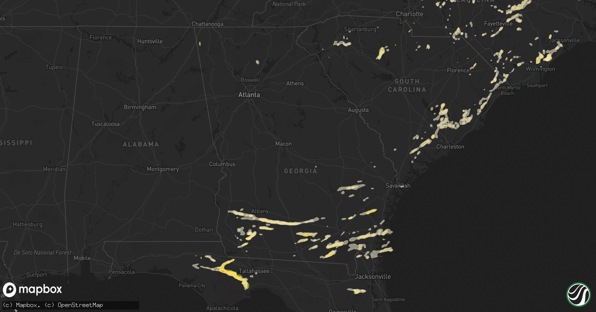
Hail Map in Georgia on May 22, 2012
Get this storm
May 22 map
$229
one time, instant access
Download today. No call, no setup
Keep the $229
Bought the map and want the full workflow? Apply the entire $229 to a subscription within 7 days. None of it is wasted.
Every map, not just this one
This buys you this map. Subscription and you get every map we run, in the markets you choose from a few cities to whole states to nationwide. Plus real-time alerts the moment a storm fires.
Contact data
Name, contact info, occupancy, even credit band for addresses in the footprint. You go from where it hit to who to call.
Become the source they trust
Unlimited branding weather history reports on demand. You already have the documented answer ready for the property owner, and you are the one who showed up with it.
Property data and RoofTrace estimates
Pull up any address you have got, its value and the exact code rules for that jurisdiction, straight from One Click Code. Then RoofTrace estimates the squares, pitch, and roof value, priced the way you price.
Storm reports in Georgia
Georgia
| Date | Description |
|---|---|
| 05/22/20126:30 PM CDT | A tree was reported down on highway 82 in willacoochee. Time of event estimated by radar. |
| 05/22/20126:10 PM CDT | Trees down around alapaha. |
| 05/22/20125:40 PM CDT | Estimated quarter size hail at the eldorado food market just east of i-75. |
| 05/22/20125:38 PM CDT | Quarter sized hail east of omega ended near time listed. |
| 05/22/20125:28 PM CDT | Quarter size hail estimated by deputy |
| 05/22/20125:28 PM CDT | Deputy estimated 70 mph winds just north of omega |
| 05/22/20125:18 PM CDT | Half dollar hail north of norman park in extreme southern worth county. |
| 05/22/20125:15 PM CDT | Hail in omega from 615 pm edt to 635 pm edt. Mainly quarter size with occasional half dollar size completely covered u.s. Highway 319. Hail also damaged watermelon fiel |
| 05/22/20125:15 PM CDT | Half dollar hail estimated in the vicinity of hartsfield. |
| 05/22/20125:04 PM CDT | Golfball hail in the vicinity of branchville. |
| 05/22/20124:49 PM CDT | Quarter to golfball sized hail fell for 15 to 20 minutes. |
| 05/22/20124:46 PM CDT | Golf ball hail estimated at county line |
| 05/22/20124:37 PM CDT | Hail slightly small than golfballs |
| 05/22/20124:30 PM CDT | Quarter size hail estimated along eddie avery road. |
| 05/22/20124:28 PM CDT | Tree down along highway 112 in northern mitchell county |
| 05/22/20124:15 PM CDT | Golfball hail in far northern mitchell county |
| 05/22/20123:55 PM CDT | Quarter size hail dented a car near the intersection of 8 mile road and leary road. |
| 05/22/20123:24 PM CDT | A local report indicates 1.00 inch wind near MORGAN |
| 05/22/20122:52 PM CDT | 1 pecan tree down. Time estimated from radar. |
| 05/22/20122:47 PM CDT | Evans county warning point reported a power pole and power lines down on state route 250. Time estimated by radar. |
| 05/22/20122:25 PM CDT | Spotter reported several trees down near reidsville with dime size hail. |
| 05/22/20122:05 PM CDT | Toombs county 911 relayed a report of 3 downed trees along highway 147 in southeastern toombs county. Radar estimated time around 1505 edt. |
| 05/22/20122:00 PM CDT | Public reported nine pine trees down and the tin roofs of shelters pulled off. |
| 05/21/201210:30 PM CDT | 911 call center relayed a report of quarter sized hail 2 miles east of soperton. |
| 05/21/20129:41 PM CDT | Public reported hail the size of quarters in rockledge. The hail had been ongoing for ten minutes at time of report. |
| 05/21/20129:18 PM CDT | Trees were blown down in woodbine. Some trees were blown into power lines which caused damage to transformers. |
| 05/21/20129:18 PM CDT | 911 dispatch reported a motor vehicle accident in the browntown area due to a tree down in the road. |
| 05/21/20129:18 PM CDT | Trees blown down in the browntown area. |
| 05/21/20129:12 PM CDT | Quarter size hail was reported on the southside of the brunswick. The time of the hail was based on radar. |
| 05/21/20128:51 PM CDT | Law enforcement estimated 65 mph wind gust at the intersection if interstate 95 and exit 29 for brunswick. |
| 05/21/20128:45 PM CDT | Quarter size hail was reported in the riverside area of southeast brantley county. |
All States Impacted by Hail Map on May 22, 2012
Cities Impacted by Hail Map on May 22, 2012
- Balmorhea, TX
- Gregory, SD
- Edgeley, ND
- Kulm, ND
- Ewing, NE
- Chambers, NE
- Inman, NE
- Forest, VA
- Morgan, GA
- Leary, GA
- Quincy, FL
- Chattahoochee, FL
- Hosford, FL
- Arrington, VA
- Amherst, VA
- Salisbury, NC
- Rockwell, NC
- Hamlet, NC
- Winston Salem, NC
- Clemmons, NC
- Lansford, ND
- Macclesfield, NC
- Pinetops, NC
- Hannaford, ND
- Benson, NC
- Four Oaks, NC
- Jamestown, SC
- Georgetown, SC
- Scotland Neck, NC
- Salemburg, NC
- Roseboro, NC
- Clinton, NC
- Simpsonville, SC
- Fountain Inn, SC
- Gray Court, SC
- Eureka, SD
- Blair, SC
- Whitmire, SC
- Carlisle, SC
- Moncks Corner, SC
- Marathon, TX
- Albany, GA
- Rocky Point, NC
- Hampstead, NC
- Chocowinity, NC
- Dublin, GA
- Bainbridge, GA
- Pelham, GA
- Camilla, GA
- Whigham, GA
- Climax, GA
- Milton, ND
- Currie, NC
- Wilmington, NC
- Burgaw, NC
- Mocksville, NC
- Cameron, LA
- Creole, LA
- Jacksonville, NC
- Ocklawaha, FL
- Bristol, FL
- Ridgeville, SC
- Summerville, SC
- Alpena, SD
- Fortuna, ND
- Keysville, VA
- Cullen, VA
- Charlotte Court House, VA
- Enderlin, ND
- Sheldon, ND
- Lisbon, ND
- Waycross, GA
- Lehr, ND
- Fredonia, ND
- Dawsonville, GA
- Cumming, GA
- Gladstone, VA
- Omega, GA
- Riegelwood, NC
- Council, NC
- Oriska, ND
- Tower City, ND
- Westby, MT
- Wishek, ND
- Bladenboro, NC
- Evergreen, NC
- Fort Pierce, FL
- Hosmer, SD
- Jeanerette, LA
- Columbus, ND
- Moultrie, GA
- Baconton, GA
- Lenox, GA
- Enigma, GA
- Sumner, GA
- Sylvester, GA
- Alapaha, GA
- Willacoochee, GA
- Ty Ty, GA
- Norman Park, GA
- Tifton, GA
- Doerun, GA
- Wilson, NC
- Stantonsburg, NC
- Gold Hill, NC
- Gackle, ND
- Ray City, GA
- Lakeland, GA
- Valdosta, GA
- Scranton, NC
- Belhaven, NC
- Millwood, GA
- Fingal, ND
- Lillington, NC
- Java, SD
- Roscoe, SD
- Nahunta, GA
- Walterboro, SC
- Round O, SC
- Pinopolis, SC
- Franklin, LA
- Woonsocket, SD
- Streeter, ND
- Jamestown, ND
- Jud, ND
- Cleveland, ND
- Chester, SC
- Fargo, GA
- Homerville, GA
- Windsor, VA
- Martinsville, VA
- White River, SD
- Folkston, GA
- White Oak, GA
- Kingsland, GA
- Wade, NC
- Stedman, NC
- Godwin, NC
- Autryville, NC
- Brunswick, GA
- Waverly, GA
- Nakina, NC
- Whiteville, NC
- Dillwyn, VA
- Arvonia, VA
- Montpelier, ND
- Ypsilanti, ND
- Spiritwood, ND
- Marion, ND
- Donnybrook, ND
- Berthold, ND
- Stanley, ND
- Huron, SD
- Hartsfield, GA
- Ridgeway, VA
- Spencer, VA
- Middleburg, FL
- Green Cove Springs, FL
- Mohall, ND
- Carpio, ND
- Souris, ND
- Westhope, ND
- Holly Ridge, NC
- Saint Stephen, SC
- Cross, SC
- Pineville, SC
- Argyle, MN
- Hawthorne, FL
- Franklinville, NC
- Asheboro, NC
- Ramseur, NC
- Sanborn, ND
- Chadbourn, NC
- Clarksville, FL
- Tallahassee, FL
- Crawfordville, FL
- Altha, FL
- Blountstown, FL
- Telogia, FL
- Sopchoppy, FL
- Fountain, FL
- Bolton, NC
- Farmville, VA
- Pamplin, VA
- Du Pont, GA
- Chinquapin, NC
- Fedora, SD
- Artesian, SD
- Pittsboro, NC
- Loris, SC
- Sea Island, GA
- Saint Simons Island, GA
- Arlington, GA
- Creedmoor, NC
- Durham, NC
- Grand Chenier, LA
- Patterson, GA
- Summerton, SC
- Manning, SC
- Matthews, NC
- Bath, NC
- Pinetown, NC
- Washington, NC
- Wyndmere, ND
- Selma, NC
- Smithfield, NC
- Dunn, NC
- Newton Grove, NC
- Princeton, NC
- Pine Level, NC
- Longs, SC
- Tabor City, NC
- Clarendon, NC
- Conway, SC
- Eden, NC
- Anderson, SC
- Clarkton, NC
- Amelia Court House, VA
- Bonneau, SC
- Buchanan, ND
- Axton, VA
- Bailey, NC
- Spring Hope, NC
- Andrews, SC
- Smithfield, VA
- Huger, SC
- Lake Waccamaw, NC
- Arlington, SD
- Brooklet, GA
- Fayetteville, NC
- Reidsville, GA
- Kenmare, ND
- Raeford, NC
- Waynesville, GA
- Colerain, NC
- Binford, ND
- Aneta, ND
- Rockingham, NC
- White Lake, SD
- Laurinburg, NC
- Wagram, NC
- Nashville, GA
- Lynchburg, VA
- Colquitt, GA
- Morganton, NC
- Cumberland, VA
- Powhatan, VA
- Tarboro, NC
- Green Sea, SC
- Yemassee, SC
- Green Pond, SC
- Piedmont, SC
- Pelzer, SC
- Ambrose, ND
- Jefferson, SC
- Kershaw, SC
- Greeleyville, SC
- Damascus, GA
- Newton, GA
- Miller, SD
- Kings Bay, GA
- Saint Marys, GA
- Yulee, FL
- Latta, SC
- Marion, SC
- Grimesland, NC
- Greenville, NC
- Orrum, NC
- Mcville, ND
- Jessie, ND
- Cooperstown, ND
- Rogers, ND
- Valley City, ND
- Wallace, SC
- Charleston, SC
- Winnie, TX
- Anahuac, TX
- Kenbridge, VA
- Victoria, VA
- Rockham, SD
- Lumberton, NC
- Cerro Gordo, NC
- Buckingham, VA
- Coats, NC
- Aynor, SC
- Lawtey, FL
- Starke, FL
- Plentywood, MT
- Bowdle, SD
- Selby, SD
- Powers Lake, ND
- Stockton, GA
- Edinburg, ND
- Hoople, ND
- Hahira, GA
- Red Springs, NC
- Wessington, SD
- Wessington Springs, SD
- Star, NC
- Chamberlain, SD
- Harrellsville, NC
- Fort Mill, SC
- Lancaster, SC
- Williston, FL
- Morriston, FL
- Troy, NC
- Crosby, ND
- Carthage, NC
- Goldston, NC
- Bear Creek, NC
- Siler City, NC
- Sanford, NC
- Robbins, NC
- South Mills, NC
- Graham, NC
- Langford, SD
- Amherst, SD
- Bunnell, FL
- Palm Coast, FL
- Cartersville, VA
- Albemarle, NC
- New London, NC
- Wood, SD
- Broadway, NC
- Jesup, GA
- Ludowici, GA
- Saint Pauls, NC
- Barney, ND
- Reidsville, NC
- Browns Summit, NC
- Sale City, GA
- Heath Springs, SC
- Hallsboro, NC
- Westport, SD
- Aberdeen, SD
- Bennettsville, SC
- Zuni, VA
- Parkton, NC
- Noonan, ND
- Bronson, FL
- Lexington, NC
- Hilliard, FL
- Marianna, FL
- Cottondale, FL
- Alford, FL
- Merry Hill, NC
- Sutton, ND
- Willow Lake, SD
- Iroquois, SD
- Jekyll Island, GA
- Courtenay, ND
- Wimbledon, ND
- Edison, GA
- Spencer, NC
- Monroe, VA
- Maxbass, ND
- Rose Hill, NC
- Teachey, NC
- Dazey, ND
- Capitol, MT
- Buffalo, SD
- Alzada, MT
- China Grove, NC
- Manor, GA
- Argyle, GA
- Antler, ND
- Hitchcock, SD
- Wolsey, SD
- Chipley, FL
- Adel, GA
- Newberry, SC
- Union, SC
- Bowbells, ND
- Blackstone, VA
- Yadkinville, NC
- Boonville, NC
- Verona, ND
- Frederick, SD
- Cordesville, SC
- Seabrook, SC
- Beaufort, SC
- Adams Run, SC
- Cottageville, SC
- Norris, SD
- Statesboro, GA
- Lewisville, NC
- Fort Stewart, GA
- Black Creek, NC
- Fremont, NC
- Hope Mills, NC
- Concord, NC
- Parmelee, SD
- Hoboken, GA
- Gann Valley, SD
- Page, ND
- Kannapolis, NC
- Dickey, ND
- Ivanhoe, NC
- Willard, NC
- Ruffin, SC
- Harmony, NC
- Advance, NC
- Erwin, NC
- Bunnlevel, NC
- Linden, NC
- Oakes, ND
- Ashley, ND
- Chapel Hill, NC
- Carrboro, NC
- Fork Union, VA
- Palmyra, VA
- Bell City, LA
- Shannon, NC
- Richlands, NC
- Beulaville, NC
- Leland, NC
- Seagrove, NC
- Darlington, SC
- Greenville, SC
- Appomattox, VA
- Hoffman, NC
- Pinebluff, NC
- Aberdeen, NC
- Columbia, VA
- Bremo Bluff, VA
- Fulton, SD
- Stephen, MN
- Gibsonville, NC
- Walstonburg, NC
- New Iberia, LA
- Darien, GA
- Hamill, SD
- Fort McCoy, FL
- Astor, FL
- Dauphin Island, AL
- Osnabrock, ND
- Mitchell, SD
- Oacoma, SD
- Harleyville, SC
- Dorchester, SC
- Gaffney, SC
- Sharon, ND
- Estill, SC
- Britton, SD
- Gibson, NC
- Laurel Hill, NC
- Claxton, GA
- Vero Beach, FL
- Cascade, VA
- Carpenter, SD
- Draper, SD
- Ivor, VA
- Litchville, ND
- Hammond, MT
- Boyes, MT
- Fairdale, ND
- Palermo, ND
- Chesapeake, VA
- Manvel, ND
- Oslo, MN
- Alvarado, MN
- Goode, VA
- Baxley, GA
- Richfield, NC
- Orlando, FL
- Eutawville, SC
- Holly Hill, SC
- Pantego, NC
- Lancaster, MN
- Nicholls, GA
- Douglas, GA
- Connelly Springs, NC
- Hickory, NC
- Drakes Branch, VA
- Roper, NC
- Plymouth, NC
- Lidgerwood, ND
- Savannah, GA
- Elizabeth City, NC
- Gwinner, ND
- Mount Gilead, NC
- Blackshear, GA
- Mershon, GA
- Cayuga, ND
- Plankinton, SD
- Prospect, VA
- Lyons, GA
- Glennville, GA
- Yale, SD
- De Smet, SD
- Kimball, SD
- Pukwana, SD
- Uvalda, GA
- Surrency, GA
- Bedford, VA
- McGrath, MN
- Dillon, SC
- Marston, NC
- Menlo, GA
- Rising Fawn, GA
- Lignite, ND
- Middlesex, NC
- Shipman, VA
- Schuyler, VA
- Meherrin, VA
- Sellers, SC
- Northwood, ND
- Saint Bernard, LA
- Crescent City, FL
- Elkton, VA
- Mauldin, SC
- Jacksonville, FL
- Hemingway, SC
- Kathryn, ND
- Wadesboro, NC
- Bristol, GA
- Screven, GA
- Abbeville, LA
- Alexandria, SD
- Leola, SD
- Mooreton, ND
- Denton, NC
- Tolley, ND
- Morven, NC
- Redfield, SD
- Ashton, SD
- Winner, SD
- Fort Ransom, ND
- Bluffton, GA
- Pearson, GA
- Maple Hill, NC
- Castle Hayne, NC
- Raiford, FL
- Wahpeton, ND
- Duncan, SC
- Greer, SC
- Hope, ND
- Pillsbury, ND


