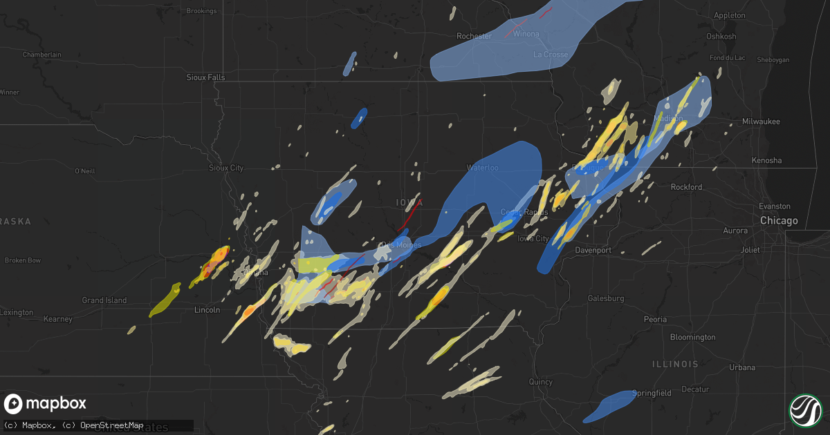
Hail Map in Iowa on May 21, 2024
Get this storm
May 21 map
$229
one time, instant access
Download today. No call, no setup
Keep the $229
Bought the map and want the full workflow? Apply the entire $229 to a subscription within 7 days. None of it is wasted.
Every map, not just this one
This buys you this map. Subscription and you get every map we run, in the markets you choose from a few cities to whole states to nationwide. Plus real-time alerts the moment a storm fires.
Contact data
Name, contact info, occupancy, even credit band for addresses in the footprint. You go from where it hit to who to call.
Become the source they trust
Unlimited branding weather history reports on demand. You already have the documented answer ready for the property owner, and you are the one who showed up with it.
Property data and RoofTrace estimates
Pull up any address you have got, its value and the exact code rules for that jurisdiction, straight from One Click Code. Then RoofTrace estimates the squares, pitch, and roof value, priced the way you price.
Storm reports in Iowa
Iowa
| Date | Description |
|---|---|
| 05/21/20246:59 PM CDT | 6-10 inch limbs down in the middle of tipton ia. |
| 05/21/20246:57 PM CDT | A local report indicates 66 MPH wind near Monona |
| 05/21/20246:56 PM CDT | A local report indicates 1.00 inch wind near 1 NNE Fairfax |
| 05/21/20246:56 PM CDT | Est 60+ mph by trained spotter ce196. Lose of power... Grill and patio furniture blown off deck. |
| 05/21/20246:55 PM CDT | Davis station recorded 100 mph gust at 657 pm. Also barn blown apart. Some roof damage to several structures. Tree branches downed and some pine trees uprooted. Photos |
| 05/21/20246:55 PM CDT | Corrects previous tstm wnd dmg report from atkins. Large 2ft diameter tree down on 2nd street in atkins. |
| 05/21/20246:53 PM CDT | Trees down and also power outage west of nichols. |
| 05/21/20246:52 PM CDT | Widespread tree damage in northwest independence. Trees uprooted and blown over. Some roof damage to sheds nearby. Leaning power poles. Time estimated from radar. |
| 05/21/20246:52 PM CDT | A local report indicates 80 MPH wind near 1 ENE Norway |
| 05/21/20246:52 PM CDT | Numerous trees and branches down across the city. Straight-line winds. |
| 05/21/20246:52 PM CDT | 70 mph winds. Debris all over highway 6 outside of atalissa. |
| 05/21/20246:52 PM CDT | A local report indicates 70 MPH wind near 1 W West Liberty |
| 05/21/20246:51 PM CDT | 4 semi trailers blown over around i-80 exit 265. Time estimated from radar. |
| 05/21/20246:46 PM CDT | A local report indicates 1.75 inch wind near 3 E Tipton |
| 05/21/20246:42 PM CDT | Trees and powerlines down... Including a tree down on a house. Also trees and powerlines down in elgin. |
| 05/21/20246:41 PM CDT | Report from mping: ping pong ball |
| 05/21/20246:41 PM CDT | Report from mping: 3-inch tree limbs broken; power poles broken. |
| 05/21/20246:39 PM CDT | Tree blown over. Estimated 75 mph. |
| 05/21/20246:38 PM CDT | 50 mph wind gusts knocked down trees near town. |
| 05/21/20246:38 PM CDT | Asos station kdbq dubuque arpt. |
| 05/21/20246:36 PM CDT | A local report indicates 60 MPH wind near 2 W Garrison |
| 05/21/20246:35 PM CDT | Large tree limb blown down. Time estimated from radar. |
| 05/21/20246:35 PM CDT | Shed destroyed. |
| 05/21/20246:30 PM CDT | Report from mping: 3-inch tree limbs broken; power poles broken. |
| 05/21/20246:28 PM CDT | Report from mping: 3-inch tree limbs broken; power poles broken. |
| 05/21/20246:23 PM CDT | . |
| 05/21/20246:23 PM CDT | A local report indicates 70 MPH wind near 2 S Oelwein |
| 05/21/20246:20 PM CDT | Corrects previous reports. Roofs blown off of multiple homes in fairbank. Time estimated by radar. |
| 05/21/20246:20 PM CDT | Report from mping: 3-inch tree limbs broken; power poles broken. |
| 05/21/20246:20 PM CDT | Roofs blown off multiple homes in fairbank. Time estimated. |
| 05/21/20246:11 PM CDT | Power pole broken and some branches down. Time estimated from radar. |
| 05/21/20246:11 PM CDT | Delayed report. 3 to 5 inch diameter branches down. Time estimated. |
| 05/21/20246:09 PM CDT | A local report indicates 1.00 inch wind near 1 NE Rochester |
| 05/21/20246:08 PM CDT | Corrects time on previous tstm wnd dmg report from wyoming. Tree limbs down. 3 inches in diameter. Estimated 60 to 70 mph gusts. |
| 05/21/20246:02 PM CDT | Jo100 spotter id called in hail report.. Sent picture to facebook. Kurt andreesen farmstead. 1 mile north center junction ia. |
| 05/21/20246:01 PM CDT | A local report indicates 68 MPH wind near Waterloo Regional Airpo |
| 05/21/20245:59 PM CDT | 4 inch diameter tree branch down. Time estimated from radar. |
| 05/21/20245:58 PM CDT | Corrects previous tstm wnd dmg report from 2 ne cambridge. Spotter reports power lines down |
| 05/21/20245:58 PM CDT | Spotter reports power lines down |
| 05/21/20245:55 PM CDT | Emergency manager reported power poles leaning in the town of sully. Time estimated with radar. |
| 05/21/20245:55 PM CDT | Damage reported in town. |
| 05/21/20245:55 PM CDT | Report from mping. 1-inch tree limbs broken. Shingles blown off. |
| 05/21/20245:53 PM CDT | 1 inch hail report by spotter. |
| 05/21/20245:52 PM CDT | Trees and power lines down in town. |
| 05/21/20245:50 PM CDT | Est 60-70 mph with pea hail. |
| 05/21/20245:49 PM CDT | Emergency manager reported power lines down near the intersection of highway 8 and qq ave near traer. Time estimated with radar. |
| 05/21/20245:46 PM CDT | Emergency management reported trees blown onto a house west of greene near the intersection of 110th st and keystone ave. Time estimated with radar. |
| 05/21/20245:46 PM CDT | Emergency manager reported some trees and powerlines down within the city of greene. Time estimated with radar. |
| 05/21/20245:42 PM CDT | Report from mping. Trees uprooted or snapped. Roof blown off. |
| 05/21/20245:41 PM CDT | Report from mping: 1-inch tree limbs broken; shingles blown off. |
| 05/21/20245:41 PM CDT | Report from mping: quarter sized hail. |
| 05/21/20245:40 PM CDT | Emergency manager reported trees and some powerlines down in within the city of allison. Time estimated from radar. |
| 05/21/20245:38 PM CDT | A local report indicates 1.50 inch wind near 2 E Melrose |
| 05/21/20245:38 PM CDT | Trees down in meskwaki. |
| 05/21/20245:37 PM CDT | Emergency manager reported a large tree uprooted in kesley. Time estimated with radar. |
| 05/21/20245:35 PM CDT | A local report indicates 1.00 inch wind near 2 S Albia |
| 05/21/20245:35 PM CDT | With the gust front. Time estimated. |
| 05/21/20245:30 PM CDT | 4-5 inch tree branches down and power lines snapped. |
| 05/21/20245:27 PM CDT | Emergency manager reported damage to farmstead outbuildings near the intersection of clay ave and 160th st near dumont. Damage included an outbuilding being blown over. |
| 05/21/20245:26 PM CDT | A local report indicates 64 MPH wind near 4 E Albion |
| 05/21/20245:23 PM CDT | Emergency manager reported damage to farm outbuildings near gilman. Time estimated with radar. |
| 05/21/20245:15 PM CDT | Power lines blown over and grain bin destroyed. |
| 05/21/20245:13 PM CDT | Emergency manager reported damage to farm outbuildings east of hubbard. Time estimated with radar. |
| 05/21/20245:12 PM CDT | A local report indicates 71 MPH wind near 2 SE Newton |
| 05/21/20245:10 PM CDT | A local report indicates 64 MPH wind near 2 SW Hampton |
| 05/21/20245:09 PM CDT | Uprooted trees seen around beaver dr. |
| 05/21/20245:09 PM CDT | Report from mping: 3-inch tree limbs broken; power poles broken. |
| 05/21/20245:09 PM CDT | A local report indicates 71 MPH wind near 2 SE Newton |
| 05/21/20245:09 PM CDT | Report from mping: 3-inch tree limbs broken; pwn. |
| 05/21/20245:07 PM CDT | Pine tree down |
| 05/21/20245:06 PM CDT | Town without power. |
| 05/21/20245:04 PM CDT | Report from mping trees uprooted or snapped... Roof blown off. |
| 05/21/20245:00 PM CDT | Corrects previous tstm wnd dmg report from 2 nw elkhart. Spotter reports major damage to homes/barns in area. Reported vicinity address 14790 ne 38th st. |
| 05/21/20245:00 PM CDT | Estimated 60 mph wind gusts. Branches down. |
| 05/21/20245:00 PM CDT | Spotter reports major damage to homes/barns in area. Reported vicinity address 14790 ne 38th st. |
| 05/21/20244:58 PM CDT | Large |
| 05/21/20244:55 PM CDT | Emergency manager reported damage to a home on 250th st. Time estimated with radar. |
| 05/21/20244:55 PM CDT | 5 miles ne of maxwell... Ia at 5ish... Tornado clipped right by us. No visual as went to basement. Some metal pieces came loose on the pole building roof and lots of br |
| 05/21/20244:55 PM CDT | Trained spotter reports widespread power lines/trees down and property damage in prairie city. Estimated wind gusts 65-70 mph. Hail up to 1 inch. Time of damage occurre |
| 05/21/20244:55 PM CDT | Corrects previous tornado report from 2 nw elkhart. Corrects previous tstm wnd dmg report from 2 nw elkhart. Spotter reports major damage to homes/barns in area. Report |
| 05/21/20244:55 PM CDT | 5 miles ne of maxwell... Ia at 5ish... Tornado clipped right by us. No visual as went to basement. Some metal pieces ca |
| 05/21/20244:52 PM CDT | Trees on multiple homes and power line. |
| 05/21/20244:52 PM CDT | Report from mping trees uprooted or snapped... Roof blown off. |
| 05/21/20244:52 PM CDT | Tree on house. |
| 05/21/20244:51 PM CDT | Report from mping: quarter. |
| 05/21/20244:50 PM CDT | Downed trees along highway 105 1 mile west of northwood. |
| 05/21/20244:49 PM CDT | Report from mping... 3-inch tree limbs broken. Power poles broken. |
| 05/21/20244:45 PM CDT | Corrects previous tornado report from 2 ne cambridge. Corrects previous tstm wnd dmg report from 2 ne cambridge. Spotter reports power lines down |
| 05/21/20244:42 PM CDT | Damage reported to grain bins and trees. |
| 05/21/20244:40 PM CDT | Damage just south of alleman. |
| 05/21/20244:40 PM CDT | Rain wrapped. |
| 05/21/20244:37 PM CDT | Power outage and limbs down. |
| 05/21/20244:34 PM CDT | Very strong winds and power outage reported. |
| 05/21/20244:33 PM CDT | Construction trailer flipped near the intersection of peckham and 70th st. Time estimated with radar. |
| 05/21/20244:32 PM CDT | Windows blown out at johnston high school. Time estimated with radar. |
| 05/21/20244:32 PM CDT | Larger trees and power lines down. |
| 05/21/20244:31 PM CDT | Report from mping: quarter size hail. |
| 05/21/20244:29 PM CDT | Report from mping. 3-inch tree limbs broken. Power poles broken. |
| 05/21/20244:29 PM CDT | Tree on top of house. Estimated 2 ft diameter tree. Time estimated from radar. |
| 05/21/20244:25 PM CDT | Big trees down just south of i80 on county line of dallas and polk. About 60th and vista. Time estimated from radar. |
| 05/21/20244:19 PM CDT | Delayed report... Time estimated. Multiple large trees down... Some on buildings. |
| 05/21/20244:18 PM CDT | Report from mping. 3-inch tree limbs broken. Power poles broken. |
| 05/21/20244:07 PM CDT | A local report indicates 1.00 inch wind near Winterset |
| 05/21/20244:07 PM CDT | A local report indicates 1.00 inch wind near Winterset |
| 05/21/20243:55 PM CDT | Awos station kaxa algona airport. |
| 05/21/20243:53 PM CDT | Raining with strong winds resulting in broken trees. |
| 05/21/20243:50 PM CDT | Trees down on power lines through town. |
| 05/21/20243:45 PM CDT | Damage in greenfield. |
| 05/21/20243:42 PM CDT | Estimated half dollar sized hail in creston. Time estimated with radar. |
| 05/21/20243:40 PM CDT | Reported by trained spotter. |
| 05/21/20243:33 PM CDT | Social media report of tornado damage... Windmill knocked down and on fire. |
| 05/21/20243:30 PM CDT | Corrects previous tstm wnd dmg report from 3 n williamson. Damage reported vehicles flipped... Windmills on ground. 1 windmill on fire. |
| 05/21/20243:30 PM CDT | Damage reported vehicles flipped... Windmills on ground. 1 windmill on fire. |
| 05/21/20243:25 PM CDT | A local report indicates a tornado near 1 NW Prescott |
| 05/21/20243:18 PM CDT | Tonado near highway 34 at the corner of 240 st and kentucky. Damage reported. |
| 05/21/20243:17 PM CDT | Confirmed tornado on the ground by storm chaser |
| 05/21/20243:17 PM CDT | Confirmed tornado on ground by storm chaser. |
| 05/21/20243:16 PM CDT | Damage from the tornados spotted in corning. Down trees. |
| 05/21/20243:15 PM CDT | A local report indicates 77 MPH wind near 3 WSW Glidden |
| 05/21/20243:15 PM CDT | Dispatch relayed wind and hail in carroll with trees and powerlines down. |
| 05/21/20243:13 PM CDT | Reports of structure damage near corning. |
| 05/21/20243:11 PM CDT | A local report indicates a tornado near Corning |
| 05/21/20243:10 PM CDT | A local report indicates 1.00 inch wind near 4 S Cumberland |
| 05/21/20243:05 PM CDT | Second one. |
| 05/21/20243:00 PM CDT | Live video of a confirmed tornado crossing highway 34 just east of highway 71. |
| 05/21/20242:37 PM CDT | Tornado on the ground near the red oak airport. Reported by the emergency manager. |
| 05/21/20242:34 PM CDT | Tree fell on house. Time estimated from radar. |
| 05/21/20242:32 PM CDT | Report from mping: half dollar |
| 05/21/20242:30 PM CDT | Leaning power poles. Time estimated from radar. |
| 05/21/20242:30 PM CDT | Damage reported near hwy 3 and 70th ave. |
| 05/21/20242:29 PM CDT | Report from mping: 1-inch tree limbs broken; shingles blown off. |
| 05/21/20242:27 PM CDT | Large tree limbs downed. Time estimated from radar. |
| 05/21/20242:26 PM CDT | Downed power lines. Time estimated from radar. |
| 05/21/20242:16 PM CDT | Report from mping: quarter |
| 05/21/20242:12 PM CDT | Report from mping: quarter |
| 05/21/20241:28 PM CDT | Report from mping: quarter |
| 05/21/202412:43 PM CDT | Report from mping: quarter |
| 05/21/202411:39 AM CDT | Golf ball hail in taintor. Time estimated from radar. |
| 05/21/202411:25 AM CDT | Report from mping. Quarter size hail. |
| 05/21/202411:20 AM CDT | Via social media. |
| 05/21/202411:20 AM CDT | A local report indicates 2.00 inch wind near 2 S Pella |
| 05/21/20249:15 AM CDT | Sustained winds estiimated45 mph gusts to 60 mph. Small branches/twigs |
| 05/21/20249:10 AM CDT | Ash tree blown over across the street. Time estimated. |
| 05/21/20249:07 AM CDT | Nickel to quarter size hail. Wind gusts estimated at 50-55 mph. |
| 05/21/20249:05 AM CDT | Large tree limb down. Time estimated from nearly kdsm wind gust observation. |
| 05/21/20248:53 AM CDT | Ema reports large tree limb down in adel. |
| 05/21/20248:42 AM CDT | Ema reports tree over powerline in redfield. |
| 05/21/20248:30 AM CDT | A local report indicates 70 MPH wind near 3 S Stuart |
| 05/21/20248:20 AM CDT | Estimated 70 mph winds and heavy rain. |
| 05/21/20247:59 AM CDT | Measured by personal weather station. |
| 05/21/20247:19 AM CDT | Numerous power poles and branches down throughout town. Time estimated. Delayed report. |
| 05/20/20248:30 PM CDT | Tree limbs down. 3 inches in diameter. Estimated 60 to 70 mph gusts. Time estimated. |
| 05/20/20248:11 PM CDT | Cl310 called report in.. Hwy61 and hwy 136 south of maquoketa. |
| 05/20/20247:59 PM CDT | Spotter li790 did not have time of damage but power lines down along amber rd and 130th st. Spotter not sure when it happened. |
| 05/20/20247:59 PM CDT | Spotter li790 did not have time of damage but power lines down along amber rd and 130th st. |
| 05/20/20247:55 PM CDT | Social media report of golf ball size hail. Time estimated by radar. |
| 05/20/20247:54 PM CDT | Emergency manager relayed reported of a 92 mph measured gust from a home weather station. Time estimated from radar. |
| 05/20/20247:45 PM CDT | Photo submitted of a power pole leaning over a gravel road. |
| 05/20/20247:45 PM CDT | A local report indicates 60 MPH wind near Preston |
| 05/20/20247:45 PM CDT | Photo sent of a power line pole leaning over a gravel road. |
| 05/20/20247:44 PM CDT | Spotter id db202 reports 40ft radio tower snapped at base near bellevue ia. Address is 21407 429th ave. Bellevue ia. |
| 05/20/20247:44 PM CDT | Spotter id db202 reports 40ft radio tower snapped at base near bellevue |
| 05/20/20247:38 PM CDT | Semi blown over with driver trapped just west of bernard. Farm buildings down on multiple farms... Mostly to outbuildings. |
| 05/20/20247:36 PM CDT | Estimated 60 mph. |
| 05/20/20247:35 PM CDT | Several branches and small trees reported down. |
| 05/20/20247:32 PM CDT | Trees down blocking road into state park and into town. Time estimated. |
| 05/20/20247:30 PM CDT | 60mph estimated wind gusts... Also some pea sized hail. Few small branches down around town. |
| 05/20/20247:30 PM CDT | Extensive damage to the eagles club in maquoketa. The roof was blown off and propped up against a nearby apartment complex and dog boarding facility. Some debris had bl |
| 05/20/20247:25 PM CDT | 80 mph winds. Large trees down. |
| 05/20/20247:25 PM CDT | 12 inch snapped. Spotter watched it happen. |
| 05/20/20247:25 PM CDT | Trees and powerlines down in delmar. |
| 05/20/20247:25 PM CDT | Rwis station near maquoketa. |
| 05/20/20247:25 PM CDT | Social media report of large tree branches broken with one shattering the back window of a parked car. |
| 05/20/20247:25 PM CDT | Numerous large trees and branches down across the city. Roof blown off a building. |
| 05/20/20247:21 PM CDT | A local report indicates 61 MPH wind near Alburnett |
| 05/20/20247:20 PM CDT | Via facebook. Picture of tree uprooted. Time estimated. |
| 05/20/20247:20 PM CDT | Large 2ft diameter tree down on 2nd street in atkins. |
| 05/20/20247:18 PM CDT | Large cattle shed... Just rebuilt... Roof blown off and damage to the sides. |
| 05/20/20247:17 PM CDT | Damage to buildings. |
| 05/20/20247:16 PM CDT | Cattle shed blown over. |
| 05/20/20247:15 PM CDT | Social media report of a snapped tree limb which broke through the deck on the house. |
| 05/20/20247:14 PM CDT | Trees down on road. |
| 05/20/20247:13 PM CDT | Significant wind damage to farm buildings... Trees... And equipement. Time estimated from radar. |
| 05/20/20247:08 PM CDT | A local report indicates 1.00 inch wind near 1 SE Coralville |
| 05/20/20247:08 PM CDT | Numerous branches of 3 to 5 inches in diameter and several twigs were downed. One large branch measuring 17 inches in diameter was snapped off near the base of the tree |
| 05/20/20247:05 PM CDT | Estimated 80 mph gusts at 705 pm. Still blowing at about 50 mph as of 711pm. |
| 05/20/20247:05 PM CDT | 86 mph winds. Numerous large trees blocking roads in town. Roof blown off country club. Lots of farm buildings damaged in the surrounding area. |
| 05/20/20247:03 PM CDT | Fallen tree on a power line. |
| 05/20/20247:02 PM CDT | Roof blown off one-story home with debris blown northward onto the other side of iowa highway 130. |
| 05/20/20247:02 PM CDT | Up to 15 tall utility poles blown down... Several snapped. Very likely at least 90 mph winds. |
| 05/20/20247:00 PM CDT | 15 trees blown down. Report relayed from social media. |
| 05/20/20247:00 PM CDT | Tree split in half and a recreational vehicle destroyed. Time estimated from radar. |
All States Impacted by Hail Map on May 21, 2024
Cities Impacted by Hail Map on May 21, 2024
- Akron, CO
- Otis, CO
- Yuma, CO
- Oakland, NE
- Lyons, NE
- Craig, NE
- Tekamah, NE
- Decatur, NE
- Onawa, IA
- Macy, NE
- Rosalie, NE
- Walthill, NE
- Sloan, IA
- Whiting, IA
- Winnebago, NE
- Kirkman, IA
- Manilla, IA
- Irwin, IA
- Harlan, IA
- Walnut, IA
- Hancock, IA
- Elk Horn, IA
- Kimballton, IA
- Oakland, IA
- Marne, IA
- Lewis, IA
- Griswold, IA
- Atlantic, IA
- Red Oak, IA
- Elliott, IA
- Essex, IA
- Emerson, IA
- Carson, IA
- Hastings, IA
- Imogene, IA
- Avoca, IA
- Henderson, IA
- Rock Port, MO
- Watson, MO
- Malvern, IA
- Brayton, IA
- Audubon, IA
- Exira, IA
- Massena, IA
- Cumberland, IA
- Anita, IA
- Stanton, IA
- Wiota, IA
- Villisca, IA
- Manning, IA
- Hamlin, IA
- Grant, IA
- Corning, IA
- Tarkio, MO
- Macedonia, IA
- Shenandoah, IA
- Fairfax, MO
- Craig, MO
- Clarinda, IA
- Skidmore, MO
- Burlington Junction, MO
- Nodaway, IA
- Adair, IA
- Bridgewater, IA
- Fontanelle, IA
- Carbon, IA
- Casey, IA
- Gravity, IA
- Prescott, IA
- Orient, IA
- Lenox, IA
- Creston, IA
- Greenfield, IA
- Menlo, IA
- Stuart, IA
- Dexter, IA
- Winterset, IA
- Earlham, IA
- De Soto, IA
- Van Meter, IA
- Adel, IA
- Cumming, IA
- Waukee, IA
- Prole, IA
- Booneville, IA
- West Des Moines, IA
- Norwalk, IA
- Indianola, IA
- Des Moines, IA
- Windsor Heights, IA
- Carlisle, IA
- Johnston, IA
- Urbandale, IA
- Clive, IA
- Pleasant Hill, IA
- Sanborn, IA
- Titonka, IA
- Larrabee, IA
- Peterson, IA
- Aurelia, IA
- Cherokee, IA
- Linn Grove, IA
- Alta, IA
- Shelby, IA
- Earling, IA
- Westphalia, IA
- Portsmouth, IA
- Panama, IA
- Sutherland, IA
- Ayrshire, IA
- Hartley, IA
- Havelock, IA
- Webb, IA
- Everly, IA
- Royal, IA
- Greenville, IA
- Dickens, IA
- Sioux Rapids, IA
- Mallard, IA
- Gillett Grove, IA
- Curlew, IA
- Laurens, IA
- Spencer, IA
- Treynor, IA
- Council Bluffs, IA
- McClelland, IA
- Minden, IA
- Primghar, IA
- Rolfe, IA
- Ruthven, IA
- Paullina, IA
- Remsen, IA
- Granville, IA
- Cleghorn, IA
- Marcus, IA
- Melvin, IA
- Herman, NE
- Hooper, NE
- Blair, NE
- Snyder, NE
- Clarkson, NE
- Dodge, NE
- Morse Bluff, NE
- Scribner, NE
- Fremont, NE
- Ames, NE
- Schuyler, NE
- Columbus, NE
- Winslow, NE
- Kennard, NE
- Linwood, NE
- Howells, NE
- Leigh, NE
- Nickerson, NE
- Arlington, NE
- Cedar Bluffs, NE
- Valley, NE
- North Bend, NE
- Rogers, NE
- Honey Creek, IA
- Bennington, NE
- Crescent, IA
- Fort Calhoun, NE
- Omaha, NE
- Missouri Valley, IA
- Defiance, IA
- Templeton, IA
- Gray, IA
- Sergeant Bluff, IA
- South Sioux City, NE
- Moville, IA
- Hornick, IA
- Bronson, IA
- Dakota City, NE
- Kingsley, IA
- Sioux City, IA
- Lawton, IA
- Salix, IA
- Hinton, IA
- Homer, NE
- Callaway, NE
- Westerville, NE
- Merna, NE
- Comstock, NE
- Ansley, NE
- Anselmo, NE
- Ord, NE
- Arcadia, NE
- Broken Bow, NE
- Eldora, IA
- Janesville, IA
- Ackley, IA
- Reinbeck, IA
- Beaman, IA
- Dike, IA
- Cedar Falls, IA
- Holland, IA
- Dewar, IA
- Iowa Falls, IA
- Tripoli, IA
- Evansdale, IA
- Morrison, IA
- Grundy Center, IA
- Sumner, IA
- Dunkerton, IA
- Aplington, IA
- Parkersburg, IA
- Hudson, IA
- Waterloo, IA
- Liscomb, IA
- New Hartford, IA
- Fairbank, IA
- Stout, IA
- Steamboat Rock, IA
- Readlyn, IA
- Conrad, IA
- Wellsburg, IA
- Denver, IA
- Waverly, IA
- Gladbrook, IA
- Marquette, NE
- Wakefield, NE
- Ithaca, NE
- Hubbard, NE
- Ulysses, NE
- Bellwood, NE
- Dunlap, IA
- Saint Paul, NE
- Bellevue, NE
- Archer, NE
- Wahoo, NE
- West Point, NE
- Central City, NE
- Battle Creek, IA
- Grand Island, NE
- Correctionville, IA
- Pierson, IA
- Milligan, NE
- Waterbury, NE
- Bruno, NE
- Wayne, NE
- Ricketts, IA
- Colon, NE
- Mead, NE
- Pisgah, IA
- Beemer, NE
- Dow City, IA
- Chapman, NE
- Saint Libory, NE
- Spalding, NE
- Silver City, IA
- Surprise, NE
- Beaver Crossing, NE
- Weston, NE
- Henderson, NE
- Bee, NE
- Dannebrog, NE
- Gretna, NE
- Wisner, NE
- Madison, NE
- Valparaiso, NE
- Pilger, NE
- Palmer, NE
- Platte Center, NE
- Hampton, NE
- Abie, NE
- Cedar Rapids, NE
- Washington, NE
- Saint Edward, NE
- Rising City, NE
- Bradshaw, NE
- Greeley, NE
- Belgrade, NE
- Albion, NE
- Mondamin, IA
- Mineola, IA
- Friend, NE
- Gresham, NE
- Papillion, NE
- Neola, IA
- Humphrey, NE
- Climbing Hill, IA
- Waco, NE
- Doniphan, NE
- Rodney, IA
- Dwight, NE
- Soldier, IA
- Boys Town, NE
- Underwood, IA
- Geneva, NE
- Waterloo, NE
- Ute, IA
- Danbury, IA
- Garland, NE
- Glenwood, IA
- Anthon, IA
- Seward, NE
- Mapleton, IA
- Creston, NE
- Duncan, NE
- Bancroft, NE
- Ceresco, NE
- Utica, NE
- Yutan, NE
- Woodbine, IA
- Giltner, NE
- Elba, NE
- Modale, IA
- York, NE
- Silver Creek, NE
- Polk, NE
- Stanton, NE
- Oto, IA
- Uehling, NE
- Goehner, NE
- McCool Junction, NE
- Charter Oak, IA
- Scotia, NE
- Pender, NE
- Little Sioux, IA
- Osceola, NE
- Prague, NE
- Clarks, NE
- La Vista, NE
- Primrose, NE
- Brainard, NE
- Staplehurst, NE
- Monroe, NE
- Aurora, NE
- Emerson, NE
- Hordville, NE
- Ashland, NE
- Benedict, NE
- North Sioux City, SD
- Moorhead, IA
- Shelby, NE
- Castana, IA
- Pacific Junction, IA
- Smithland, IA
- Denison, IA
- David City, NE
- Fairmont, NE
- Genoa, NE
- Elkhorn, NE
- Wolbach, NE
- Persia, IA
- Thurston, NE
- Arion, IA
- Logan, IA
- Alda, NE
- Malmo, NE
- Magnolia, IA
- Exeter, NE
- Jackson, NE
- Blencoe, IA
- Cordova, NE
- Carter Lake, IA
- Fullerton, NE
- Phillips, NE
- Stromsburg, NE
- Lindsay, NE
- Berwick, IA
- Altoona, IA
- Ankeny, IA
- Runnells, IA
- Woodburn, IA
- Lucas, IA
- Clay Center, NE
- Sutton, NE
- Saronville, NE
- Lacona, IA
- Osceola, IA
- Grafton, NE
- Edgar, NE
- Milo, IA
- Knoxville, IA
- Melcher Dallas, IA
- Chariton, IA
- Columbia, IA
- Pleasantville, IA
- Harvey, IA
- Pella, IA
- New Sharon, IA
- Leighton, IA
- Lynnville, IA
- Searsboro, IA
- Montezuma, IA
- Otley, IA
- Monroe, IA
- Ladora, IA
- Marengo, IA
- Victor, IA
- Guernsey, IA
- Forestburg, TX
- Amana, IA
- Norway, IA
- Williamsburg, IA
- South Amana, IA
- Homestead, IA
- North English, IA
- Muenster, TX
- Blairstown, IA
- Rosston, TX
- Raymond, NE
- Oxford, IA
- Stoughton, WI
- Oregon, WI
- Barnes City, IA
- Gainesville, TX
- Malcom, IA
- Cottage Grove, WI
- Cambridge, WI
- Deerfield, WI
- Whitesboro, TX
- Sadler, TX
- Warrensburg, NY
- Johnsburg, NY
- Athol, NY
- Adams, NE
- Sterling, NE
- Syracuse, NE
- Burr, NE
- Unadilla, NE
- Chestertown, NY
- Waverly, NE
- Alvo, NE
- Greenwood, NE
- Van Horne, IA
- Newhall, IA
- Watkins, IA
- Pottsboro, TX
- Otoe, NE
- Dunbar, NE
- Avoca, NE
- Nehawka, NE
- Weeping Water, NE
- Springfield, NE
- Elmwood, NE
- Nebraska City, NE
- Union, NE
- Murray, NE
- Plattsmouth, NE
- Hadley, NY
- Stony Creek, NY
- Diamond Point, NY
- Hamburg, IA
- Peru, NE
- Lake George, NY
- Queensbury, NY
- Murdock, NE
- Louisville, NE
- Manley, NE
- Riverton, IA
- Thurman, IA
- Farragut, IA
- Sidney, IA
- Homestead, FL
- Randolph, IA
- Hudson Falls, NY
- Tabor, IA
- Holstein, IA
- Cushing, IA
- Miami, FL
- Fort Edward, NY
- Argyle, NY
- Fort Ann, NY
- Salem, NY
- Ida Grove, IA
- Schaller, IA
- Galva, IA
- Arthur, IA
- Hartford, NY
- Catskill, NY
- Atoka, OK
- Stringtown, OK
- Granville, NY
- De Kalb, MO
- Antlers, OK
- Colony, KS
- Shushan, NY
- Cambridge, NY
- Greenwich, NY
- Carroll, IA
- Leavenworth, KS
- Storm Lake, IA
- West Concord, MN
- Fairmont, MN
- Wanamingo, MN
- Kenyon, MN
- Granada, MN
- Maryville, MO
- Clayton, OK
- Lansing, KS
- Platte City, MO
- Saint Joseph, MO
- Savannah, MO
- Muldrow, OK
- Faucett, MO
- Moyers, OK
- Gilmore City, IA
- Glidden, IA
- Arcadia, IA
- Dedham, IA
- Halbur, IA
- Coon Rapids, IA
- Scranton, IA
- Lidderdale, IA
- Lanesboro, IA
- Lake City, IA
- Churdan, IA
- Lohrville, IA
- Ralston, IA
- Rockwell City, IA
- Farnhamville, IA
- Gowrie, IA
- Snow, OK
- Parnell, MO
- Union Star, MO
- Helena, MO
- Uniontown, AR
- King City, MO
- Stanberry, MO
- Rea, MO
- Guilford, MO
- Lane, KS
- Osawatomie, KS
- Kansas City, KS
- Shawnee, KS
- Stigler, OK
- Algona, IA
- Van Buren, AR
- Alma, AR
- Fort Smith, AR
- Roland, OK
- Kansas City, MO
- Bellows Falls, VT
- Fonda, IA
- Natural Dam, AR
- Zumbrota, MN
- Waldron, MO
- West Halifax, VT
- Sheridan, MO
- Ravenwood, MO
- Epworth, IA
- Farley, IA
- Pickering, MO
- Stilwell, OK
- Olathe, KS
- Agency, MO
- Chester, AR
- Arlington, VT
- Cascade, IA
- Worthington, IA
- Nashoba, OK
- Somers, IA
- Callender, IA
- Colrain, MA
- Bernardston, MA
- Brattleboro, VT
- Alstead, NH
- Charlestown, NH
- Gardner, KS
- Afton, IA
- New Century, KS
- Grant City, MO
- Barnum, IA
- Manson, IA
- Blockton, IA
- Redding, IA
- Mountainburg, AR
- Mulberry, AR
- Iola, KS
- Cromwell, IA
- Garnett, KS
- Fontana, KS
- La Cygne, KS
- Parker, KS
- Centerville, KS
- Stewartsville, MO
- Gentry, MO
- Lenexa, KS
- Peosta, IA
- Dubuque, IA
- Durango, IA
- Meridian, TX
- Sherrill, IA
- Ozark, AR
- Dyer, AR
- Paola, KS
- Overland Park, KS
- Bucyrus, KS
- Diagonal, IA
- Greenfield, MA
- Potosi, WI
- Hazel Green, WI
- Cuba City, WI
- Dickeyville, WI
- Niota, IL
- Brookfield, MO
- Sibley, MO
- Saint Patrick, MO
- Leawood, KS
- Camden, MO
- Bogard, MO
- Tina, MO
- Rutledge, MO
- Elmer, MO
- Orrick, MO
- Edina, MO
- Dallas City, IL
- Sumner, MO
- Buckner, MO
- Independence, MO
- Galesburg, IL
- Novelty, MO
- Keokuk, IA
- Bucklin, MO
- Monmouth, IL
- Nauvoo, IL
- Knox City, MO
- La Plata, MO
- Richmond, MO
- Carrollton, MO
- Hardin, MO
- Kahoka, MO
- Hale, MO
- Hurdland, MO
- Lomax, IL
- Wayland, MO
- Norborne, MO
- Mount Ayr, IA
- La Harpe, KS
- Moran, KS
- Stilwell, KS
- Spring Hill, KS
- Benton, IA
- Kieler, WI
- Shannon City, IA
- Rush, CO
- Yoder, CO
- Dayton, IA
- Hamilton, TX
- Platteville, WI
- Lorimor, IA
- Shelburne Falls, MA
- West Bend, IA
- Whittemore, IA
- Burt, IA
- Lone Rock, IA
- Ceylon, MN
- Macksburg, IA
- Ellston, IA
- Tingley, IA
- Thayer, IA
- Jefferson, IA
- Blue Mound, KS
- Bronson, KS
- Kincaid, KS
- Westminster, VT
- Putney, VT
- Cambridgeport, VT
- Saxtons River, VT
- Hillsboro, TX
- Belmont, WI
- Rewey, WI
- Walpole, NH
- Lancaster, WI
- Marlow, NH
- South Acworth, NH
- Wells, MN
- Clarksville, AR
- Mound City, KS
- Redfield, IA
- Miami Beach, FL
- Humboldt, KS
- Truman, MN
- Martensdale, IA
- East Fairfield, VT
- Enosburg Falls, VT
- Fairfield, VT
- Sheldon, VT
- Darlington, WI
- Grand Junction, IA
- Dana, IA
- Uniontown, KS
- Mapleton, KS
- Ogden, IA
- Paton, IA
- Pleasanton, KS
- Murray, IA
- Blue Springs, MO
- Grain Valley, MO
- Hico, TX
- Bynum, TX
- East Dubuque, IL
- Saint Charles, IA
- Lenapah, OK
- Oak Grove, MO
- Lees Summit, MO
- Peru, IA
- Hindsville, AR
- Rogers, AR
- Morgan, TX
- Whitney, TX
- Clifton, TX
- Hialeah, FL
- Iredell, TX
- Alleman, IA
- Montgomery Center, VT
- Lowell, VT
- Levasy, MO
- Napoleon, MO
- Blum, TX
- Ellenburg Center, NY
- Lyon Mountain, NY
- Ellenburg Depot, NY
- Saranac, NY
- Prescott, KS
- Fort Scott, KS
- Hume, MO
- Elkhart, IA
- Cambridge, IA
- Rich Hill, MO
- Boxholm, IA
- Pilot Mound, IA
- Kopperl, TX
- Voorheesville, NY
- Fulton, KS
- Mineral Point, WI
- Foster, MO
- Malone, NY
- Butler, MO
- Redfield, KS
- Truro, IA
- New Virginia, IA
- Coffeyville, KS
- Nevada, IA
- North Walpole, NH
- Westfield, VT
- South Deerfield, MA
- Commerce, TX
- Wolfe City, TX
- Greenville, TX
- Winslow, AR
- Princeton, MO
- Cainsville, MO
- Mercer, MO
- Altamont, NY
- Tulsa, OK
- Sand Springs, OK
- Henrietta, MO
- Prue, OK
- Dodgeville, WI
- Wellington, MO
- Ackworth, IA
- Hartford, IA
- Edna, KS
- Zearing, IA
- Sunderland, MA
- Klondike, TX
- Cooper, TX
- Enloe, TX
- Bevington, IA
- Mitchellville, IA
- Prairie City, IA
- Colfax, IA
- Newton, IA
- Vinita, OK
- Waldron, AR
- Heavener, OK
- Hodgen, OK
- Girard, KS
- Bristow, OK
- Drumright, OK
- Deerfield, MA
- Cumby, TX
- Campbell, TX
- Conway, MA
- Oologah, OK
- Claremore, OK
- Ames, IA
- Sperry, OK
- Swan, IA
- Baxter, IA
- Owasso, OK
- Lineville, IA
- Kellogg, IA
- Urich, MO
- Bondurant, IA
- Grinnell, IA
- Gilman, IA
- Laurel, IA
- Catoosa, OK
- Kellyville, OK
- Sapulpa, OK
- Marshalltown, IA
- Ferguson, IA
- Haverhill, IA
- Melbourne, IA
- Wheeler, WI
- Chelsea, OK
- Mannford, OK
- Mindenmines, MO
- Franklin, KS
- Mulberry, KS
- Arma, KS
- Oark, AR
- Geneva, IA
- Radcliffe, IA
- Alden, IA
- Ridgeway, WI
- Promise City, IA
- Melrose, IA
- Plano, IA
- Russell, IA
- Lake Creek, TX
- Clio, IA
- Allerton, IA
- Paris, TX
- Witts Springs, AR
- Turners Falls, MA
- Pittsburg, KS
- Amoret, MO
- Hubbard, IA
- Roland, IA
- McCallsburg, IA
- Clinton, MO
- Ridgeway, MO
- Pelsor, AR
- Collinsville, OK
- Appleton City, MO
- Rockville, MO
- Spring Green, WI
- Richards, MO
- Schell City, MO
- Glenville, MN
- Austin, MN
- Lyle, MN
- Rose Creek, MN
- Hollandale, MN
- Albert Lea, MN
- Brownsdale, MN
- Waltham, MN
- Lansing, MN
- Blooming Prairie, MN
- Corydon, IA
- Albia, IA
- Moravia, IA
- Montour, IA
- Garwin, IA
- Le Grand, IA
- Tama, IA
- Toledo, IA
- Milan, MO
- Green City, MO
- Green Castle, MO
- Unionville, MO
- Jenks, OK
- Glenpool, OK
- Hector, AR
- Pattonville, TX
- Deport, TX
- Skiatook, OK
- Memphis, MO
- Vera, OK
- Ramona, OK
- Osceola, MO
- Lowry City, MO
- Cleveland, OK
- Blairstown, MO
- Big Cabin, OK
- Marble Rock, IA
- Dumont, IA
- Broken Arrow, OK
- Lovilia, IA
- Livonia, MO
- Worthington, MO
- Bixby, OK
- Clutier, IA
- Dysart, IA
- Traer, IA
- Buckingham, IA
- Lincoln, IA
- Anamosa, IA
- Olin, IA
- Center Junction, IA
- La Porte City, IA
- Sargeant, MN
- Harmony, MN
- Elkton, MN
- Preston, MN
- Wykoff, MN
- Grand Meadow, MN
- Taopi, MN
- Spring Valley, MN
- Ostrander, MN
- Le Roy, MN
- Adams, MN
- Dexter, MN
- Kasson, MN
- Eyota, MN
- Hayfield, MN
- Racine, MN
- Fountain, MN
- Lanesboro, MN
- Byron, MN
- Stewartville, MN
- Chatfield, MN
- Rochester, MN
- Eddyville, IA
- Mechanicsville, IA
- Morley, IA
- Stitzer, WI
- Deepwater, MO
- Cresco, IA
- Lime Springs, IA
- Reasnor, IA
- Sully, IA
- Bussey, IA
- West Liberty, IA
- Nichols, IA
- Depew, OK
- Walker, MO
- Cantril, IA
- Arbela, MO
- Mount Sterling, IA
- Keosauqua, IA
- Booneville, AR
- Derby, IA
- Lisbon, IA
- Altura, MN
- Pryor, OK
- Inola, OK
- Monticello, IA
- Oskaloosa, IA
- Dover, MN
- Saint Charles, MN
- Utica, MN
- Plainview, MN
- Atalissa, IA
- Tipton, IA
- Mabel, MN
- Rollingstone, MN
- Canton, MN
- Rushford, MN
- Lewiston, MN
- Peterson, MN
- Minnesota City, MN
- Fountain City, WI
- Fort Atkinson, IA
- Mount Vernon, IA
- Decorah, IA
- West Branch, IA
- Montfort, WI
- Fennimore, WI
- Highland, WI
- Muscoda, WI
- Warsaw, MO
- West Union, IA
- Rose Hill, IA
- Hopkinton, IA
- Beacon, IA
- University Park, IA
- Marceline, MO
- Wyoming, IA
- Onslow, IA
- Livingston, WI
- Concord, NH
- Coweta, OK
- Boscobel, WI
- Blue River, WI
- Waucoma, IA
- Saint Lucas, IA
- Calmar, IA
- Massena, NY
- Hogansburg, NY
- Bonaparte, IA
- Clarence, IA
- Lowden, IA
- Welch, OK
- Cochrane, WI
- Winona, MN
- Spring Grove, MN
- Houston, MN
- Caledonia, MN
- Hillsboro, IA
- Chilhowee, MO
- Glenwood, MO
- Chouteau, OK
- Linden, WI
- Cobb, WI
- Garrison, IA
- Raymond, IA
- Gilbertville, IA
- Jesup, IA
- Trempealeau, WI
- Dakota, MN
- Arcadia, WI
- Dodge, WI
- What Cheer, IA
- Gibson, IA
- Deep River, IA
- Bernard, IA
- Beggs, OK
- Oxford Junction, IA
- Lancaster, MO
- Bloomfield, IA
- Coatsville, MO
- Bombay, NY
- Cazenovia, WI
- Richland Center, WI
- Bow, NH
- Lincoln, MO
- Montrose, MO
- Edwards, MO
- Cole Camp, MO
- New Boston, NH
- Goffstown, NH
- Kirksville, MO
- Greentop, MO
- Lone Rock, WI
- Chelsea, IA
- Brooklyn, IA
- New Cambria, MO
- Okmulgee, OK
- Tracy, IA
- Blair, WI
- La Crescent, MN
- Brownsville, MN
- Hokah, MN
- Galesville, WI
- Ettrick, WI
- Whitehall, WI
- Onalaska, WI
- Independence, WI
- Holmen, WI
- Avoca, WI
- Monmouth, IA
- Bellevue, IA
- Maquoketa, IA
- Zwingle, IA
- Baldwin, IA
- La Motte, IA
- Scales Mound, IL
- Galena, IL
- Shullsburg, WI
- Ethel, MO
- Bevier, MO
- Callao, MO
- Atlanta, MO
- Stover, MO
- Versailles, MO
- Baring, MO
- Brashear, MO
- Vining, IA
- Elberon, IA
- Stockton, MO
- Benton, WI
- Liberal, MO
- Central City, IA
- Humansville, MO
- La Valle, WI
- Hillpoint, WI
- Downing, MO
- Wagoner, OK
- Atkins, IA
- Brandon, IA
- Vinton, IA
- Mount Auburn, IA
- Shellsburg, IA
- Columbus City, IA
- Columbus Junction, IA
- Oran, IA
- Urbana, IA
- Walker, IA
- Hazleton, IA
- Rowley, IA
- Oelwein, IA
- Center Point, IA
- Independence, IA
- Stoddard, WI
- La Crosse, WI
- Coon Valley, WI
- Chaseburg, WI
- West Salem, WI
- Black River Falls, WI
- Bangor, WI
- Melrose, WI
- Mindoro, WI
- Taylor, WI
- Hanover, IL
- Conesville, IA
- Letts, IA
- Novinger, MO
- Sheldon, MO
- Warren, IL
- Morris, OK
- Mansfield, AR
- Barnett, MO
- Climax Springs, MO
- Gravois Mills, MO
- Idabel, OK
- Clarksville, TX
- Plain, WI
- Arena, WI
- Weaubleau, MO
- Squires, MO
- Rose, OK
- Locust Grove, OK
- Gibbs, MO
- Geneseo, IL
- Peggs, OK
- Delmar, IA
- Walford, IA
- Hulbert, OK
- Moscow, IA
- Wilton, IA
- Muscatine, IA
- Lone Tree, IA
- Bennett, IA
- Elizabeth, IL
- Keystone, IA
- Cedar Rapids, IA
- Palo, IA
- Fairfax, IA
- Winthrop, IA
- Toddville, IA
- Maynard, IA
- Fayette, IA
- Stanley, IA
- Arlington, IA
- Quasqueton, IA
- Aurora, IA
- Luzerne, IA
- Middle Amana, IA
- Conroy, IA
- Swisher, IA
- Coggon, IA
- Wheatland, IA
- New Liberty, IA
- Sparta, WI
- Rockland, WI
- Lost Nation, IA
- Gratiot, WI
- Apple River, IL
- Hiawatha, IA
- Alburnett, IA
- Masonville, IA
- Lamont, IA
- Robins, IA
- Marion, IA
- Manchester, IA
- Ryan, IA
- Wadena, IA
- Volga, IA
- Greeley, IA
- Edgewood, IA
- Strawberry Point, IA
- Dundee, IA
- North Liberty, IA
- Solon, IA
- Tahlequah, OK
- Flemington, MO
- Wheatland, MO
- Iowa City, IA
- Coralville, IA
- Okemah, OK
- Boynton, OK
- Hollandale, WI
- Barneveld, WI
- Blanchardville, WI
- South Wayne, WI
- Argyle, WI
- Eldon, MO
- Rocky Mount, MO
- Lamar, AR
- New Blaine, AR
- Scranton, AR
- Andrew, IA
- Ava, MO
- Kalona, IA
- Polk, MO
- Pittsburg, MO
- Salina, OK
- Kansas, OK
- Rolla, MO
- Loganville, WI
- Sauk City, WI
- North Freedom, WI
- Norwood, MO
- Drury, MO
- Woodford, WI
- Ely, IA
- Blue Mounds, WI
- Delhi, IA
- Hermitage, MO
- Coleman, TX
- Macon, MO
- Proctor, OK
- Valera, TX
- Haworth, OK
- New Glarus, WI
- Mazomanie, WI
- Belleville, WI
- Paris, AR
- Monticello, WI
- Prairie Du Sac, WI
- Mount Horeb, WI
- Springville, IA
- Olean, MO
- London, AR
- Bolivar, MO
- Monroe, WI
- Urbana, MO
- Santa Anna, TX
- Oktaha, OK
- Merrillan, WI
- Alma Center, WI
- Willard, WI
- Humbird, WI
- Neillsville, WI
- Hixton, WI
- Fairchild, WI
- Osseo, WI
- Warrens, WI
- Tomah, WI
- Muskogee, OK
- Chili, WI
- Marshfield, WI
- Greenwood, WI
- Granton, WI
- Pittsville, WI
- Stratford, WI
- Hewitt, WI
- Arpin, WI
- Loyal, WI
- Spencer, WI
- Unity, WI
- Vesper, WI
- Verona, WI
- Madison, WI
- Middleton, WI
- Waunakee, WI
- Bagley, WI
- Cross Plains, WI
- Stockton, IA
- Glen Haven, WI
- Gays Mills, WI
- Martelle, IA
- Half Way, MO
- Leoti, KS
- Council Hill, OK
- West Plains, MO
- Pomona, MO
- Dover, AR
- Henley, MO
- Lanark, IL
- Shannon, IL
- Durant, IA
- Spragueville, IA
- Savanna, IL
- Nora, IL
- Stockton, IL
- Auburndale, WI
- Milladore, WI
- Wisconsin Rapids, WI
- Rudolph, WI
- Athens, WI
- Edgar, WI
- Medford, WI
- Junction City, WI
- Mosinee, WI
- Abbotsford, WI
- Colby, WI
- Browntown, WI
- Hillsboro, MO
- Marienthal, KS
- Deerfield, KS
- Holcomb, KS
- Leonard, MO
- Cassville, WI
- Saint Thomas, MO
- Westphalia, MO
- Meta, MO
- Koeltztown, MO
- Freeburg, MO
- Delaware, AR
- Tunas, MO
- Louisburg, MO
- Holy Cross, IA
- Guttenberg, IA
- Saint Elizabeth, MO
- New Vienna, IA
- Dyersville, IA
- Bloomington, WI
- Richwoods, MO
- Dittmer, MO
- De Soto, MO
- Grand Mound, IA
- Dixon, IA
- Calamus, IA
- Burkett, TX
- Marathon, WI
- Custer, WI
- Stevens Point, WI
- Rosholt, WI
- Merrill, WI
- Rib Lake, WI
- Schofield, WI
- Brokaw, WI
- Wausau, WI
- Rothschild, WI
- Pearl, IL
- Nebo, IL
- Charlotte, IA
- Preston, IA
- Russellville, AR
- Scott City, KS
- Garden City, KS
- Bangs, TX
- Brownwood, TX
- North Buena Vista, IA
- Arlington, WI
- Deforest, WI
- Barnhart, MO
- Checotah, OK
- Linn, MO
- Loose Creek, MO
- Newark, MO
- Belle, MO
- Lamar, MO
- Roodhouse, IL
- Patterson, IL
- Hillview, IL
- Winchester, IL
- Murrayville, IL
- Fenton, MO
- Saint Louis, MO
- Imperial, MO
- Arnold, MO
- Chapin, IL
- Jacksonville, IL
- Franklin, IL
- Alexander, IL
- Woodson, IL
- Pleasant Plains, IL
- Ashland, IL
- New Berlin, IL
- Waverly, IL
- Eland, WI
- Aniwa, WI
- Birnamwood, WI
- Wittenberg, WI
- Hatley, WI
- Tigerton, WI
- Ringle, WI
- Gleason, WI
- Deerbrook, WI
- Antigo, WI
- Irma, WI
- Miles, IA
- Lena, IL
- Kent, IL
- Winslow, IL
- Orangeville, IL
- McConnell, IL
- Albany, WI
- Columbia, IL
- East Saint Louis, IL
- East Carondelet, IL
- Dupo, IL
- Havana, AR
- Bland, MO
- Contoocook, NH
- Warner, OK
- Francestown, NH
- Eldridge, MO
- Camdenton, MO
- Macks Creek, MO
- Suncook, NH
- Atkins, AR
- Danville, AR
- Henryetta, OK
- Weleetka, OK
- Wetumka, OK
- Dane, WI
- Brooklyn, WI
- Evansville, WI
- Mcfarland, WI
- Windsor, WI
- Morrisonville, WI
- Sun Prairie, WI
- Rio, WI
- Lodi, WI
- Early, TX
- Marshall, WI
- Columbus, WI
- Zephyr, TX
- Elcho, WI
- Bryant, WI
- Pelican Lake, WI
- Summit Lake, WI
- Pearson, WI
- Crandon, WI
- Fox Lake, WI
- Waupun, WI
- Solgohachia, AR
- Hattieville, AR
- Owensville, MO
- Rosebud, MO
- Buffalo, MO
- House Springs, MO
- Mullin, TX
- Mattoon, WI
- Neopit, WI
- Pickerel, WI
- Elton, WI
- Laona, WI
- White Lake, WI
- Bowler, WI
- Townsend, WI
- Wabeno, WI
- Keshena, WI
- Mountain, WI
- Waterloo, WI
- Lake Mills, WI
- Reeseville, WI
- Watertown, WI
- Fall River, WI
- Jefferson, WI
- Fort Atkinson, WI
- Johnson Creek, WI
- Edgerton, WI
- Janesville, WI
- Brodhead, WI
- Juda, WI
- Center Ridge, AR
- Springfield, AR
- Gerald, MO
- New Haven, MO
- De Witt, IA
- Rover, AR
- Ola, AR
- Plainview, AR
- Dustin, OK
- Goose Lake, IA
- Lebanon, MO
- Iola, WI
- Amherst Junction, WI
- Embarrass, WI
- Clintonville, WI
- Marion, WI
- Ogdensburg, WI
- Shawano, WI
- Caroline, WI
- Gresham, WI
- Leopolis, WI
- Tilleda, WI
- Bear Creek, WI
- Shiocton, WI
- Bonduel, WI
- Gillett, WI
- Plover, WI
- Beaver Dam, WI
- Burnett, WI
- Juneau, WI
- Lowell, WI
- Clyman, WI
- Randolph, WI
- Poynette, WI
- Bryant, IA
- Greenbrier, AR
- Damascus, AR
- Eufaula, OK
- Clinton, IA
- Sabula, IA
- Leslie, MO
- Porum, OK
- Quitman, AR
- Guy, AR
- Goldthwaite, TX
- Mount Vernon, AR
- Rose Bud, AR
- Enola, AR
- Mount Carroll, IL
- Pearl City, IL
- Whitefield, OK
- Quinton, OK
- Kinta, OK
- Mccurtain, OK
- Evant, TX
- Freeport, IL
- Searcy, AR
- Romance, AR
- Mayville, WI
- Oakfield, WI
- Brownsville, WI
- Lomira, WI
- Winona, MO
- Eminence, MO
- Sheffield, IL
- Judsonia, AR
- Kensett, AR
- Ellington, MO
- Redford, MO
- New Bedford, IL
- Walnut, IL
- Tampico, IL
- Bald Knob, AR
- Beloit, WI
- Annapolis, MO
- Arcadia, MO
- Warrenton, MO
- Lesterville, MO
- Marquand, MO
- Alexander, AR
- Benton, AR
- Old Monroe, MO
- Fredericktown, MO
- O'Fallon, MO
- Ixonia, WI
- Harmon, IL
- Little Rock, AR
- Foristell, MO
- Wentzville, MO
- Moscow Mills, MO
- Troy, MO
- Wright City, MO
- Capron, IL
- Bryant, AR
- Mabelvale, AR
- Harvard, IL
- McCrory, AR
- Sharon, WI
- Darien, WI
- Walworth, WI
- Eagle, WI
- Golden Eagle, IL
- Dousman, WI
- Ironton, MO
- Wynne, AR
- Greenville, MO
- Pewaukee, WI
- Wales, WI
- Delafield, WI
- Waukesha, WI
- Keota, OK
- Winfield, MO
- Fletcher, MO
- Vulcan, MO
- Marthasville, MO
- Millstadt, IL
- Scott, AR
- England, AR
- Jefferson City, MO
- Patterson, MO
- Silva, MO
- Keo, AR
- Lonoke, AR
- Bokoshe, OK
- Spiro, OK
- Carlisle, AR
- Humnoke, AR
- Stuttgart, AR
- Ulm, AR
- Dixon, KY
- Morganfield, KY
- Roe, AR
- Junction, IL
- Henderson, KY
- Arcadia, MI
- Bear Lake, MI
- Reed, KY
- Spottsville, KY
- Casscoe, AR
- Birch Tree, MO
- Alton, MO
- Owensboro, KY
- Richland, IN
- Merom, IN
- Mount Ida, AR
- Sims, AR
- Pencil Bluff, AR
- Fremont, MO
- Walcott, IA
- Story, AR
- Donahue, IA
- Jessieville, AR
- Mountain Pine, AR
- Hot Springs Village, AR
- Bonnerdale, AR
- Royal, AR
- Hot Springs National Park, AR
- Pearcy, AR
- Lonsdale, AR
- Malvern, AR
- Hensley, AR
- Bauxite, AR
- Hydro, OK
- Yukon, OK
- Okarche, OK
- Hinton, OK
- Commiskey, IN
- North Vernon, IN
- Dupont, IN
- Calumet, OK
- Kingfisher, OK
- Piedmont, OK
- Butlerville, IN
- El Reno, OK
- Marshall, OK
- S Coffeyville, OK
- Oklahoma City, OK
- Edmond, OK
- Orlando, OK
- Stillwater, OK
- Mulhall, OK
- Geary, OK
- Meeker, OK
- Norwalk, WI
- Cashton, WI
- Westby, WI
- Necedah, WI
- Babcock, WI
- Nekoosa, WI
- Camp Douglas, WI
- Port Edwards, WI
- Plainfield, WI
- Bancroft, WI
- Almond, WI
- Amherst, WI
- Waupaca, WI
- Nelsonville, WI
- Weyauwega, WI
- Scandinavia, WI
- Horicon, WI
- Rosendale, WI
- Fond Du Lac, WI
- Brandon, WI
- Eldorado, WI
- Markesan, WI
- Ripon, WI
- Oshkosh, WI
- Van Dyne, WI
- Pickett, WI
- Hortonville, WI
- Manawa, WI
- New London, WI
- Menasha, WI
- Larsen, WI
- Neenah, WI
- Appleton, WI
- Kaukauna, WI
- Brillion, WI
- Sherwood, WI
- Hilbert, WI
- Combined Locks, WI
- Greenville, WI
- De Pere, WI
- Wrightstown, WI
- Little Chute, WI
- Kimberly, WI
- Greenleaf, WI
- Winneconne, WI
- Omro, WI
- Butte Des Morts, WI
- Fremont, WI
- Seymour, WI
- Oneida, WI
- Green Bay, WI
- Black Creek, WI
- Suamico, WI
- Pulaski, WI
- Sobieski, WI
- Abrams, WI
- Little Suamico, WI
- Oconto Falls, WI
- Krakow, WI
- Green Valley, WI
- Suring, WI
- Cecil, WI
- Nichols, WI
- Alma, WI
- Elgin, MN
- Lakewood, WI
- Casco, WI
- Algoma, WI
- Forestville, WI
- Luxemburg, WI
- New Franken, WI
- Brussels, WI
- Oconto, WI
- Sturgeon Bay, WI
- Egg Harbor, WI
- Baileys Harbor, WI
- Ellison Bay, WI
- Dunbar, WI
- Carney, MI
- Coleman, WI
- Norway, MI
- Wausaukee, WI
- Perronville, MI
- Hermansville, MI
- Pembine, WI
- Stephenson, MI
- Spalding, MI
- Amberg, WI
- Sister Bay, WI
- Loretto, MI
- Vulcan, MI
- Wallace, MI
- Fish Creek, WI
- Powers, MI
- Foster City, MI
- Crivitz, WI
- Nadeau, MI
- Niagara, WI
- Porterfield, WI
- Ephraim, WI
- Pound, WI
- Lena, WI
- Marinette, WI
- Ingalls, MI
- Peshtigo, WI
- Daggett, MI
- Menominee, MI
- Wilson, MI
- Iron Mountain, MI
- Athelstane, WI
- Quinnesec, MI
- Goodman, WI
- Dalton, WI
- Friesland, WI
- Poy Sippi, WI
- Endeavor, WI
- Kingston, WI
- Berlin, WI
- Wild Rose, WI
- Pardeeville, WI
- Westfield, WI
- Redgranite, WI
- Pine River, WI
- Fairwater, WI
- Montello, WI
- Oxford, WI
- Neshkoro, WI
- Marquette, WI
- Cambria, WI
- Packwaukee, WI
- Green Lake, WI
- Wautoma, WI
- Princeton, WI
- Catawba, WI
- Owen, WI
- Withee, WI
- Lublin, WI
- Boyd, WI
- Thorp, WI
- Stanley, WI
- Fall Creek, WI
- Kennan, WI
- Hawkins, WI
- Gilman, WI
- Cornell, WI
- Cadott, WI
- Holcombe, WI
- Westboro, WI
- Sheldon, WI
- Augusta, WI
- Glen Flora, WI
- Jim Falls, WI
- Dorchester, WI
- Portage, WI
- Doylestown, WI
- Florence, WI
- Crystal Falls, MI
- Kingsford, MI
- Argonne, WI
- Armstrong Creek, WI
- Long Lake, WI
- Fence, WI
- Skandia, MI
- Gwinn, MI
- Little Lake, MI
- Felch, MI
- Escanaba, MI
- Marquette, MI
- Bark River, MI
- Cornell, MI
- Rock, MI
- Gladstone, MI
- Perkins, MI
- Washington Island, WI
- Rapid River, MI
- Trenary, MI
- Wells, MI
- Chatham, MI


