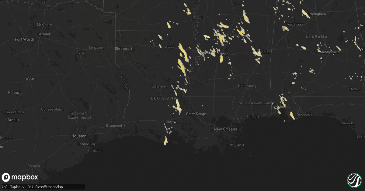
Hail Map in Louisiana on May 21, 2012
Get this storm
May 21 map
$229
one time, instant access
Download today. No call, no setup
Keep the $229
Bought the map and want the full workflow? Apply the entire $229 to a subscription within 7 days. None of it is wasted.
Every map, not just this one
This buys you this map. Subscription and you get every map we run, in the markets you choose from a few cities to whole states to nationwide. Plus real-time alerts the moment a storm fires.
Contact data
Name, contact info, occupancy, even credit band for addresses in the footprint. You go from where it hit to who to call.
Become the source they trust
Unlimited branding weather history reports on demand. You already have the documented answer ready for the property owner, and you are the one who showed up with it.
Property data and RoofTrace estimates
Pull up any address you have got, its value and the exact code rules for that jurisdiction, straight from One Click Code. Then RoofTrace estimates the squares, pitch, and roof value, priced the way you price.
Storm reports in Louisiana
Louisiana
| Date | Description |
|---|---|
| 05/21/20126:58 PM CDT | Nickel to quarter sized hail at grocery at bees bayou exit off interstate 20 |
| 05/21/20126:40 PM CDT | Power lines down |
| 05/21/20125:09 PM CDT | Nickel to quarter hail at tvr airport. |
| 05/21/20125:07 PM CDT | Trees down across road in area near wisner |
| 05/21/20124:55 PM CDT | A local report indicates 1.00 inch wind near JIGGER |
| 05/21/20123:20 PM CDT | A local report indicates 1.00 inch wind near WATERPROOF |
| 05/20/20129:08 PM CDT | Reports of powerpoles down on highway 65 and highway 566. |
| 05/20/20128:48 PM CDT | A few trees down along with a couple power poles down. |
| 05/20/20128:48 PM CDT | Crops were damaged in the area. |
| 05/20/20128:25 PM CDT | A local report indicates 1.00 inch wind near WISNER |
| 05/20/20127:30 PM CDT | Quarter size hail covered the ground on the north side of farmerville. |
| 05/20/20127:20 PM CDT | A local report indicates 1.50 inch wind near 2 NW BAKERS |
| 05/20/20127:00 PM CDT | Trees down at the area around the bees bayou exit off interstate 20...utility company also shows power lines down in this area |
All States Impacted by Hail Map on May 21, 2012
Cities Impacted by Hail Map on May 21, 2012
- Miami, NM
- Wilmer, AL
- Tallulah, LA
- Camp Hill, AL
- Foley, AL
- Elberta, AL
- Gulf Shores, AL
- Summerdale, AL
- Orange Beach, AL
- Carthage, MS
- Philadelphia, MS
- Phenix City, AL
- McGehee, AR
- Dermott, AR
- Keystone, NE
- Oakman, AL
- Stewart, MS
- Weir, MS
- Eupora, MS
- Ackerman, MS
- Fort Stockton, TX
- Marathon, TX
- Ripley, OH
- Dover, KY
- Augusta, KY
- Aberdeen, OH
- Maysville, KY
- Manchester, OH
- Georgetown, OH
- Waverly, TN
- Daphne, AL
- Conchas Dam, NM
- Hillsboro, OH
- Hickory, MS
- Chunky, MS
- Hamilton, AL
- Sulligent, AL
- Caledonia, MS
- Steens, MS
- Bay Minette, AL
- Ethel, MS
- Kosciusko, MS
- Jackson, MS
- Shorter, AL
- Tallassee, AL
- Eclectic, AL
- Slade, KY
- Campton, KY
- Rogers, KY
- Moreauville, LA
- Opelika, AL
- Logan, NM
- Jeffersonville, KY
- Mount Sterling, KY
- Mount Vernon, AL
- Dell City, TX
- Terry, MS
- Florence, MS
- Edwards, MS
- Westville, FL
- Caryville, FL
- Bonifay, FL
- Ponce De Leon, FL
- Enterprise, MS
- Bolton, MS
- Baldwin, ND
- Driscoll, ND
- Regan, ND
- Sterling, ND
- Vaughan, MS
- Bentonia, MS
- Yazoo City, MS
- Benton, MS
- Canton, MS
- Clovis, NM
- Grady, NM
- Adrian, TX
- Crossett, AR
- Mobile, AL
- Theodore, AL
- Utica, MS
- Trenton, KY
- Pembroke, KY
- Elkton, KY
- Marion, AL
- Marion Junction, AL
- Miracle, KY
- Vinton, VA
- Hamburg, AR
- Ashby, NE
- Tremont, MS
- Smithville, MS
- Fulton, MS
- Vicksburg, MS
- Eutaw, AL
- Knoxville, AL
- Ralph, AL
- Camden, MS
- Winnsboro, LA
- Wisner, LA
- Gilbert, LA
- Pickens, MS
- Carrollton, GA
- Decatur, MS
- Union, MS
- Sabina, OH
- New Vienna, OH
- Leesburg, OH
- Raton, NM
- Whatley, AL
- Folsom, NM
- Suwanee, GA
- Buford, GA
- Cumberland City, TN
- Erin, TN
- Uniontown, AL
- Newbern, AL
- Dalhart, TX
- Hermitage, AR
- Billingsley, AL
- Berry, AL
- Woodville, MS
- Hopkinsville, KY
- Prattville, AL
- Irvine, KY
- Ravenna, KY
- Vega, TX
- Franklin, AL
- Lower Peach Tree, AL
- Tucumcari, NM
- Monterey, LA
- Gainestown, AL
- Florence, AL
- Cherokee, AL
- Lafayette, AL
- Nara Visa, NM
- Brasstown, NC
- Center, ND
- Siler, KY
- Barbourville, KY
- Williamsburg, KY
- Satsuma, AL
- Creola, AL
- Saraland, AL
- Axis, AL
- Salem, AL
- Richlands, NC
- Uriah, AL
- Steele, ND
- Wilton, ND
- West Union, OH
- Simmesport, LA
- Plaucheville, LA
- Melville, LA
- Palmetto, LA
- Batchelor, LA
- Cloudcroft, NM
- Friona, TX
- Camden, AL
- Lawrenceburg, TN
- Leoma, TN
- Fort Davis, TX
- Farmerville, LA
- Mendenhall, MS
- Braxton, MS
- Lexington, MS
- Iron City, TN
- Westpoint, TN
- Ariton, AL
- McCool, MS
- Abbeville, AL
- Shorterville, AL
- Trementina, NM
- Garita, NM
- Five Points, AL
- Abbeville, LA
- Georgiana, AL
- Vidalia, LA
- Natchez, MS
- Gordo, AL
- Parrish, AL
- Quinton, AL
- Adger, AL
- Bessemer, AL
- McEwen, TN
- Baskin, LA
- Krotz Springs, LA
- Fordoche, LA
- Sicily Island, LA
- Arthur, NE
- Clayton, LA
- Cruger, MS
- Tchula, MS
- Durant, MS
- Belzoni, MS
- Ogallala, NE
- Coila, MS
- Vaughn, NM
- McKee, KY
- Holly Bluff, MS
- Hereford, TX
- Detroit, AL
- Chambers, NE
- Rayville, LA
- Delhi, LA
- Newellton, LA
- Washington, LA
- Tillar, AR
- Lake Village, AR
- Iuka, MS
- Prentiss, MS
- Wallace, NE
- Lemoyne, NE
- Lewellen, NE
- Elsie, NE
- Madrid, NE
- Paxton, NE
- Clinton, LA
- Sedan, NM
- Northport, AL
- Rolling Fork, MS
- Fort Campbell, KY
- Oak Grove, KY
- Ethridge, TN
- Dimmitt, TX
- Ferriday, LA
- Fayette, AL
- Maynardville, TN
- Washburn, TN
- Powder Springs, TN
- Grand Bay, AL
- Coosada, AL
- Elmore, AL
- Saint Martinville, LA
- Flemingsburg, KY
- Hillsboro, KY
- Owingsville, KY
- Atlanta, GA
- Coldiron, KY
- Bledsoe, KY
- Livingston, TX
- Roy, NM
- Marksville, LA
- Walnut Grove, MS
- Dallas, GA
- Dawson, ND
- Braddock, ND
- Calhoun City, MS
- San Jon, NM
- Bard, NM
- Stewart, TN
- Broadview, NM
- Amherst, TX
- Hayneville, AL
- Letohatchee, AL
- Raymond, MS
- Kilmichael, MS
- Corona, NM
- Stanton, KY
- Pachuta, MS
- Rose Hill, MS
- Johnson, KS
- Beattyville, KY
- Mayslick, KY
- Seale, AL
- Autaugaville, AL
- Wewahitchka, FL
- Saint Joseph, TN
- Killen, AL
- Lexington, AL
- Sharpsburg, KY
- Las Vegas, NM
- Marion, LA
- Weaverville, NC
- Magee, MS
- Jasper, AL
- Lynchburg, OH
- Edison, OH
- Caledonia, OH
- Galion, OH
- Skipperville, AL
- Ozark, AL
- Santa Rosa, NM
- Montgomery, AL
- Pike Road, AL
- Hardy, VA
- Sextons Creek, KY
- Booneville, KY
- Hamilton, MS
- Millport, AL
- Means, KY
- Frenchburg, KY
- Greenwood Springs, MS
- Herndon, KY
- Waterproof, LA
- Vina, AL
- Clarkdale, GA
- Lithia Springs, GA
- Powder Springs, GA
- Austell, GA
- Douglasville, GA
- Winston, GA
- Sondheimer, LA
- Erath, LA
- Amarillo, TX
- Vernon, AL
- Reform, AL
- Madison, MS
- Kountze, TX
- Kim, CO
- Rayne, LA
- Vernon, FL
- Chipley, FL
- Summertown, TN
- Oak Ridge, LA
- Nauvoo, AL
- Pine Apple, AL
- Newkirk, NM
- Lowndesboro, AL
- Silver Creek, MS
- Dubach, LA
- Saint Joseph, LA
- Fort Necessity, LA
- Helena, OH
- Newnan, GA
- Deatsville, AL
- Barnardsville, NC
- Alexander, NC
- French Camp, MS
- Waynesboro, TN
- Greenwell Springs, LA
- Flora, MS
- Silver City, MS
- Pittsview, AL
- Centerville, TN
- Clay City, KY
- Bankston, AL
- McDavid, FL
- Century, FL
- Chunchula, AL
- Townley, AL
- Carrollton, AL
- Amistad, NM
- Meridian, MS
- Bassfield, MS
- Stockton, AL
- Cimarron, NM
- Eldridge, AL
- Frisco City, AL
- Farwell, TX
- Bovina, TX
- Byram, MS
- Sardinia, OH
- Pickens, AR
- Louisville, MS
- Pineville, KY
- Sallis, MS
- New Castle, VA
- New Iberia, LA
- Youngsville, LA
- Clinton, MS
- Guin, AL
- Beaverton, AL
- Crystal Springs, MS
- Richland, MS
- Clopton, AL
- Brandon, MS
- Clarksville, TN
- Whitesburg, GA
- Forest Home, AL
- Jonesville, LA
- Greenwood, MS
- Itta Bena, MS
- Mount Pleasant, TN
- Selma, AL
- Calhoun, LA
- Choudrant, LA
- Vredenburgh, AL
- Island, KY
- Sacramento, KY
- Lottie, LA
- Kilgore, NE
- Nenzel, NE
- Cody, NE
- Crookston, NE
- Saint Francis, SD
- Roanoke, AL
- Donalsonville, GA
- Sharps Chapel, TN
- Speedwell, TN
- Loretto, TN
- Five Points, TN
- Harrisonburg, LA
- Pensacola, FL
- Coden, AL
- Quitman, MS
- Springer, NM
- Newton, MS
- Acme, LA
- Big Creek, MS
- Dadeville, AL
- Vincent, KY
- Lorman, MS
- Collinsville, MS
- Little Rock, MS
- Counce, TN
- Brewton, AL
- Winchester, KY
- Winfield, AL
- Port Gibson, MS
- Valley, AL
- Plantersville, AL
- Morganza, LA
- Port Barre, LA
- Lettsworth, LA
- Kaplan, LA
- Daviston, AL
- Alexander City, AL
- Lagrange, GA
- Franklin, GA
- Kennedy, AL
- Elrod, AL
- Mescalero, NM
- Ruidoso, NM
- Ruidoso Downs, NM
- Chappell, KY
- Pine Ridge, KY
- Tyner, KY
- Winchester, AR
- Ruston, LA
- Hamptonville, NC
- Yadkinville, NC
- Carbon Hill, AL
- Stoney Fork, KY
- West, MS
- Wagon Mound, NM
- Arnaudville, LA
- Ewing, KY
- Clayton, AL
- Villa Rica, GA
- Rogersville, AL
- Anderson, AL
- Midland City, AL


