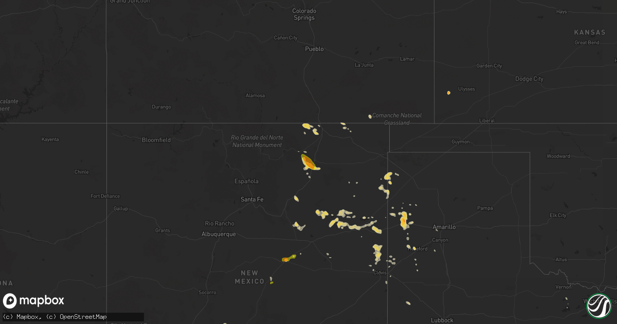
Hail Map on May 21, 2012
Get this storm
May 21 map
$229
one time, instant access
Download today. No call, no setup
Keep the $229
Bought the map and want the full workflow? Apply the entire $229 to a subscription within 7 days. None of it is wasted.
Every map, not just this one
This buys you this map. Subscription and you get every map we run, in the markets you choose from a few cities to whole states to nationwide. Plus real-time alerts the moment a storm fires.
Contact data
Name, contact info, occupancy, even credit band for addresses in the footprint. You go from where it hit to who to call.
Become the source they trust
Unlimited branding weather history reports on demand. You already have the documented answer ready for the property owner, and you are the one who showed up with it.
Property data and RoofTrace estimates
Pull up any address you have got, its value and the exact code rules for that jurisdiction, straight from One Click Code. Then RoofTrace estimates the squares, pitch, and roof value, priced the way you price.
States Impacted by Hail Map on May 21, 2012
Storm reports
Kansas
| Date | Description |
|---|---|
| 05/20/20127:57 PM CDT | A local report indicates 1.75 inch wind near JOHNSON CITY |
| 05/20/20127:50 PM CDT | A local report indicates 1.00 inch wind near JOHNSON CITY |
| 05/20/20127:50 PM CDT | A local report indicates 1.00 inch wind near JOHNSON CITY |
Florida
| Date | Description |
|---|---|
| 05/21/20126:25 PM CDT | Trees limbs and branches down greater than 2 inches in diameter. 6 inch diameter top blown off a pecan trees onto a roof. Pea size hail also reported. |
Kentucky
| Date | Description |
|---|---|
| 05/21/20125:08 PM CDT | Reported on interstate 24 at mm 89 at hwy 115. |
| 05/21/20121:36 PM CDT | A local report indicates 1.00 inch wind near 1 SE SLADE |
| 05/21/20121:34 PM CDT | Tree limbs were knocked down that were 2 to 3 inches in diameter. Time of event was estimated by radar. |
Mississippi
| Date | Description |
|---|---|
| 05/21/20126:58 PM CDT | Reports of trees down on sunny lane road. |
| 05/21/20126:45 PM CDT | Crops were damaged and stripped of their leaves...cotton and corn. |
| 05/21/20126:36 PM CDT | A local report indicates 1.00 inch wind near 2 SW EDEN |
| 05/21/20126:04 PM CDT | Several gardens were damaged |
| 05/21/20125:50 PM CDT | A few trees down and dime hail occurred. |
| 05/21/20125:41 PM CDT | Damaged a garden and downed several large limbs |
| 05/21/20125:31 PM CDT | Covered the ground |
| 05/21/20125:27 PM CDT | Along golden pine rd |
| 05/21/20125:25 PM CDT | Dime to half dollar size hail fell along highway 24. |
| 05/21/20125:20 PM CDT | Damage to vehicles occurred near highway 35. |
| 05/21/20125:00 PM CDT | A tree and a power line down off harmony rd. |
| 05/21/20124:45 PM CDT | Powerlines down along rosemary road |
| 05/21/20124:45 PM CDT | On whites road |
| 05/21/20124:36 PM CDT | In the cleary community |
| 05/21/20124:30 PM CDT | Powerlines down |
| 05/21/20124:30 PM CDT | Pea to quarter sized hail and frequent cloud to gound lightning. Reported by trained spotter. |
| 05/21/20124:26 PM CDT | Several trees down across the south part of the county...one tree down on a house. |
| 05/21/20124:11 PM CDT | In the simpson community |
| 05/21/20124:09 PM CDT | Multiple trees down between bolton and raymond |
| 05/21/20123:55 PM CDT | Multiple trees down in vicksburg...power lines down as well...one tree down on a house. |
| 05/21/20123:55 PM CDT | Reports of trees down on lake city road. |
| 05/21/20123:41 PM CDT | A few trees down around oak ridge. |
| 05/21/20123:30 PM CDT | Penny to quarter hail...reported by nssl shave project. |
| 05/21/20123:00 PM CDT | Nickel to quarter hail |
| 05/20/201210:25 PM CDT | A local report indicates 1.25 inch wind near 4 E MYRLEVILLE |
| 05/20/201210:05 PM CDT | Nickel to quarter sized hail reported just north of lexington on highway 17. Reported by law enforcement. |
| 05/20/20129:55 PM CDT | Quarter hail reported in benton by emergency management. |
| 05/20/20129:00 PM CDT | Reports of quarter size hail northwest of lexington. |
| 05/20/20127:12 PM CDT | Nickel to quarter sized hail fell for several minutes |
Louisiana
| Date | Description |
|---|---|
| 05/21/20126:58 PM CDT | Nickel to quarter sized hail at grocery at bees bayou exit off interstate 20 |
| 05/21/20126:40 PM CDT | Power lines down |
| 05/21/20125:09 PM CDT | Nickel to quarter hail at tvr airport. |
| 05/21/20125:07 PM CDT | Trees down across road in area near wisner |
| 05/21/20124:55 PM CDT | A local report indicates 1.00 inch wind near JIGGER |
| 05/21/20123:20 PM CDT | A local report indicates 1.00 inch wind near WATERPROOF |
| 05/20/20129:08 PM CDT | Reports of powerpoles down on highway 65 and highway 566. |
| 05/20/20128:48 PM CDT | Crops were damaged in the area. |
| 05/20/20128:48 PM CDT | A few trees down along with a couple power poles down. |
| 05/20/20128:25 PM CDT | A local report indicates 1.00 inch wind near WISNER |
| 05/20/20127:30 PM CDT | Quarter size hail covered the ground on the north side of farmerville. |
| 05/20/20127:20 PM CDT | A local report indicates 1.50 inch wind near 2 NW BAKERS |
| 05/20/20127:00 PM CDT | Trees down at the area around the bees bayou exit off interstate 20...utility company also shows power lines down in this area |
Nebraska
| Date | Description |
|---|---|
| 05/21/20125:50 PM CDT | Largest hail to the size of quarters...ground covered white. |
| 05/21/20125:50 PM CDT | A local report indicates 1.00 inch wind near KINGSLEY DAM |
| 05/21/20125:04 PM CDT | A few quarter size stones...but most were half inch or smaller. |
| 05/20/20127:50 PM CDT | A local report indicates 1.00 inch wind near 10 SE ROSCOE |
| 05/20/20127:50 PM CDT | A local report indicates 1.00 inch wind near SE ROSCOE |
| 05/20/20127:39 PM CDT | A local report indicates 1.00 inch wind near 7 SE ROSCOE |
| 05/20/20127:20 PM CDT | Mostly dime to nickel in size...a few stones to the size of quarters. |
Texas
| Date | Description |
|---|---|
| 05/20/201210:31 PM CDT | A local report indicates 61 MPH wind near 1 W AMARILLO |
| 05/20/20129:06 PM CDT | A local report indicates 1.75 inch wind near ADRIAN |
| 05/20/20128:51 PM CDT | Along i40 |
| 05/20/20128:50 PM CDT | A local report indicates 1.75 inch wind near ADRIAN |
| 05/20/20128:45 PM CDT | A local report indicates a tornado near 5 NW ADRIAN |
| 05/20/20128:37 PM CDT | Ef0 winds estimated 65 mph...was on the ground for 3 min moving ssw. 100 yards wide...path length 1000 yards |
| 05/20/20128:37 PM CDT | A local report indicates a tornado near 5 NW ADRIAN |
| 05/20/20128:18 PM CDT | Hail completely covering the ground. 0.64 inches of rain |
Georgia
| Date | Description |
|---|---|
| 05/21/20126:55 PM CDT | Cobb dot reported clearing 2 downed trees on thunderwood ct and buckner rd in mableton. |
| 05/21/20126:20 PM CDT | Public reported pea to quarter sized hail in the alpharetta-johns creek area. |
| 05/21/20126:19 PM CDT | There was a power outage reported in the city of suwanee. |
| 05/21/20126:10 PM CDT | Pea to quarter sized hail reported by the public |
| 05/21/20125:50 PM CDT | Public reported several trees down/snapped at his residence. |
| 05/20/20127:30 PM CDT | 911 center reported one tree down in the maysville area. |
| 05/20/20127:05 PM CDT | Jackson county emergency manager reports several downed trees and lines in and around the nicholson area. |
Arkansas
| Date | Description |
|---|---|
| 05/21/20124:40 PM CDT | Pea to golf ball sized hail near dermott. Reported by emergency management. |
| 05/21/20124:22 PM CDT | Quarter size hail did minor crop damage |
Virginia
| Date | Description |
|---|---|
| 05/21/20124:20 PM CDT | Craig creek road |
| 05/20/20127:18 PM CDT | Hail covered the ground on robin lane. Hail size ranged from dimes to quarters. |
Montana
| Date | Description |
|---|---|
| 05/21/20126:50 PM CDT | Kilo raws |
| 05/21/20126:47 PM CDT | Brenner raws site |
Tennessee
| Date | Description |
|---|---|
| 05/20/20128:30 PM CDT | Trees blown down along buffalo road and good hope road north of lawrenceburg |
South Dakota
| Date | Description |
|---|---|
| 05/20/20127:25 PM CDT | A local report indicates 1.00 inch wind near 8 SSE SAINT FRANCIS |
| 05/20/20127:25 PM CDT | A local report indicates 60 MPH wind near 8 SSE SAINT FRANCIS |
| 05/20/20127:10 PM CDT | A local report indicates 1.00 inch wind near 11 SW SAINT FRANCIS |
Alabama
| Date | Description |
|---|---|
| 05/21/20125:45 PM CDT | Tree limbs /not full trees/ were knocked down onto power lines causing power outages. Dime sized hail was also reported at the intersection of cr 68 and cr 36. |
| 05/21/20123:45 PM CDT | A local report indicates 1.00 inch wind near 2 WSW FOWLERS CROSSROAD |
| 05/21/20123:07 PM CDT | Quarter size hail reported at greers market on dauphin island parkway. Lasted about 5 minutes. |
| 05/21/20122:56 PM CDT | A local report indicates 1.00 inch wind near CRAWFORD |
| 05/21/20122:37 PM CDT | Upwards to 25 cent hail. At i85 and sr51. |
| 05/21/20122:30 PM CDT | Quarter size hail reported at west bend. |
| 05/21/20121:02 AM CDT | At hueytown rd and south parkell ave. Trees down along with power lines. |
| 05/21/20121:00 AM CDT | A local report indicates 60 MPH wind near 3 NW HUEYTOWN |
| 05/21/20121:00 AM CDT | A local report indicates 1.00 inch wind near 3 NW HUEYTOWN |
| 05/21/20121:00 AM CDT | Trees reported down in concord. |
| 05/21/20121:00 AM CDT | Tree down in hueytown on walker avenue. |
| 05/21/201212:40 AM CDT | A local report indicates 1.00 inch wind near 5 W SHORT CREEK |
| 05/21/201212:40 AM CDT | Also several tree limbs of unknown size down. |
| 05/21/201212:30 AM CDT | Tree down blocking road at hwy 269 and short drive. |
| 05/21/201212:30 AM CDT | Numerous trees and power lines down along the walker/jefferson county line. |
| 05/20/201211:18 PM CDT | Nickle to quarter size hail was observed roughly 4 miles south of cr 18 along cr 26 or 2 miles south of the fayette county lake. Time estimated from radar. |
| 05/20/201211:13 PM CDT | Along al hwy 5 nw of jasper. Relayed from trained storm spotter. |
| 05/20/201211:10 PM CDT | Quarter size hail reported at the intersection of alabama highway 102 and 13. |
| 05/20/201211:01 PM CDT | Quarter size hail reported at the intersection of county road 49 and 53. |
| 05/20/201211:00 PM CDT | A local report indicates 1.00 inch wind near 2 WSW FOWLERS CROSSROAD |
| 05/20/20127:05 PM CDT | 2 miles east of intersection of us 98 and al 59. This is a relayed report to the ema by citizen. |
New Mexico
| Date | Description |
|---|---|
| 05/21/20126:01 PM CDT | Ping pong ball size hail on interstate 25 |
| 05/21/20125:55 PM CDT | A local report indicates 1.25 inch wind near 14 NE HUECO TANKS |
| 05/21/20121:20 PM CDT | Dime to quarter size for five mins |
| 05/20/20129:50 PM CDT | State highway 209 |
| 05/20/20128:40 PM CDT | A local report indicates 60 MPH wind near 11 S AMISTAD |
| 05/20/20127:57 PM CDT | A local report indicates 60 MPH wind near LOGAN |
| 05/20/20127:50 PM CDT | Small limbs off trees with gust front |
| 05/20/20127:40 PM CDT | Ktcc asos. |
| 05/20/20127:13 PM CDT | A local report indicates 1.00 inch wind near 20 N TUCUMCARI |
Cities Impacted by Hail Map on May 21, 2012
- Miami, NM
- Wilmer, AL
- Tallulah, LA
- Camp Hill, AL
- Foley, AL
- Elberta, AL
- Gulf Shores, AL
- Summerdale, AL
- Orange Beach, AL
- Carthage, MS
- Philadelphia, MS
- Phenix City, AL
- McGehee, AR
- Dermott, AR
- Keystone, NE
- Oakman, AL
- Stewart, MS
- Weir, MS
- Eupora, MS
- Ackerman, MS
- Fort Stockton, TX
- Marathon, TX
- Ripley, OH
- Dover, KY
- Augusta, KY
- Aberdeen, OH
- Maysville, KY
- Manchester, OH
- Georgetown, OH
- Waverly, TN
- Daphne, AL
- Conchas Dam, NM
- Hillsboro, OH
- Hickory, MS
- Chunky, MS
- Hamilton, AL
- Sulligent, AL
- Caledonia, MS
- Steens, MS
- Bay Minette, AL
- Ethel, MS
- Kosciusko, MS
- Jackson, MS
- Shorter, AL
- Tallassee, AL
- Eclectic, AL
- Slade, KY
- Campton, KY
- Rogers, KY
- Moreauville, LA
- Opelika, AL
- Logan, NM
- Jeffersonville, KY
- Mount Sterling, KY
- Mount Vernon, AL
- Dell City, TX
- Terry, MS
- Florence, MS
- Edwards, MS
- Westville, FL
- Caryville, FL
- Bonifay, FL
- Ponce De Leon, FL
- Enterprise, MS
- Bolton, MS
- Baldwin, ND
- Driscoll, ND
- Regan, ND
- Sterling, ND
- Vaughan, MS
- Bentonia, MS
- Yazoo City, MS
- Benton, MS
- Canton, MS
- Clovis, NM
- Grady, NM
- Adrian, TX
- Crossett, AR
- Mobile, AL
- Theodore, AL
- Utica, MS
- Trenton, KY
- Pembroke, KY
- Elkton, KY
- Marion, AL
- Marion Junction, AL
- Miracle, KY
- Vinton, VA
- Hamburg, AR
- Ashby, NE
- Tremont, MS
- Smithville, MS
- Fulton, MS
- Vicksburg, MS
- Eutaw, AL
- Knoxville, AL
- Ralph, AL
- Camden, MS
- Winnsboro, LA
- Wisner, LA
- Gilbert, LA
- Pickens, MS
- Carrollton, GA
- Decatur, MS
- Union, MS
- Sabina, OH
- New Vienna, OH
- Leesburg, OH
- Raton, NM
- Whatley, AL
- Folsom, NM
- Suwanee, GA
- Buford, GA
- Cumberland City, TN
- Erin, TN
- Uniontown, AL
- Newbern, AL
- Dalhart, TX
- Hermitage, AR
- Billingsley, AL
- Berry, AL
- Woodville, MS
- Hopkinsville, KY
- Prattville, AL
- Irvine, KY
- Ravenna, KY
- Vega, TX
- Franklin, AL
- Lower Peach Tree, AL
- Tucumcari, NM
- Monterey, LA
- Gainestown, AL
- Florence, AL
- Cherokee, AL
- Lafayette, AL
- Nara Visa, NM
- Brasstown, NC
- Center, ND
- Siler, KY
- Barbourville, KY
- Williamsburg, KY
- Satsuma, AL
- Creola, AL
- Saraland, AL
- Axis, AL
- Salem, AL
- Richlands, NC
- Uriah, AL
- Steele, ND
- Wilton, ND
- West Union, OH
- Simmesport, LA
- Plaucheville, LA
- Melville, LA
- Palmetto, LA
- Batchelor, LA
- Cloudcroft, NM
- Friona, TX
- Camden, AL
- Lawrenceburg, TN
- Leoma, TN
- Fort Davis, TX
- Farmerville, LA
- Mendenhall, MS
- Braxton, MS
- Lexington, MS
- Iron City, TN
- Westpoint, TN
- Ariton, AL
- McCool, MS
- Abbeville, AL
- Shorterville, AL
- Trementina, NM
- Garita, NM
- Five Points, AL
- Abbeville, LA
- Georgiana, AL
- Vidalia, LA
- Natchez, MS
- Gordo, AL
- Parrish, AL
- Quinton, AL
- Adger, AL
- Bessemer, AL
- McEwen, TN
- Baskin, LA
- Krotz Springs, LA
- Fordoche, LA
- Sicily Island, LA
- Arthur, NE
- Clayton, LA
- Cruger, MS
- Tchula, MS
- Durant, MS
- Belzoni, MS
- Ogallala, NE
- Coila, MS
- Vaughn, NM
- McKee, KY
- Holly Bluff, MS
- Hereford, TX
- Detroit, AL
- Chambers, NE
- Rayville, LA
- Delhi, LA
- Newellton, LA
- Washington, LA
- Tillar, AR
- Lake Village, AR
- Iuka, MS
- Prentiss, MS
- Wallace, NE
- Lemoyne, NE
- Lewellen, NE
- Elsie, NE
- Madrid, NE
- Paxton, NE
- Clinton, LA
- Sedan, NM
- Northport, AL
- Rolling Fork, MS
- Fort Campbell, KY
- Oak Grove, KY
- Ethridge, TN
- Dimmitt, TX
- Ferriday, LA
- Fayette, AL
- Maynardville, TN
- Washburn, TN
- Powder Springs, TN
- Grand Bay, AL
- Coosada, AL
- Elmore, AL
- Saint Martinville, LA
- Flemingsburg, KY
- Hillsboro, KY
- Owingsville, KY
- Atlanta, GA
- Coldiron, KY
- Bledsoe, KY
- Livingston, TX
- Roy, NM
- Marksville, LA
- Walnut Grove, MS
- Dallas, GA
- Dawson, ND
- Braddock, ND
- Calhoun City, MS
- San Jon, NM
- Bard, NM
- Stewart, TN
- Broadview, NM
- Amherst, TX
- Hayneville, AL
- Letohatchee, AL
- Raymond, MS
- Kilmichael, MS
- Corona, NM
- Stanton, KY
- Pachuta, MS
- Rose Hill, MS
- Johnson, KS
- Beattyville, KY
- Mayslick, KY
- Seale, AL
- Autaugaville, AL
- Wewahitchka, FL
- Saint Joseph, TN
- Killen, AL
- Lexington, AL
- Sharpsburg, KY
- Las Vegas, NM
- Marion, LA
- Weaverville, NC
- Magee, MS
- Jasper, AL
- Lynchburg, OH
- Edison, OH
- Caledonia, OH
- Galion, OH
- Skipperville, AL
- Ozark, AL
- Santa Rosa, NM
- Montgomery, AL
- Pike Road, AL
- Hardy, VA
- Sextons Creek, KY
- Booneville, KY
- Hamilton, MS
- Millport, AL
- Means, KY
- Frenchburg, KY
- Greenwood Springs, MS
- Herndon, KY
- Waterproof, LA
- Vina, AL
- Clarkdale, GA
- Lithia Springs, GA
- Powder Springs, GA
- Austell, GA
- Douglasville, GA
- Winston, GA
- Sondheimer, LA
- Erath, LA
- Amarillo, TX
- Vernon, AL
- Reform, AL
- Madison, MS
- Kountze, TX
- Kim, CO
- Rayne, LA
- Vernon, FL
- Chipley, FL
- Summertown, TN
- Oak Ridge, LA
- Nauvoo, AL
- Pine Apple, AL
- Newkirk, NM
- Lowndesboro, AL
- Silver Creek, MS
- Dubach, LA
- Saint Joseph, LA
- Fort Necessity, LA
- Helena, OH
- Newnan, GA
- Deatsville, AL
- Barnardsville, NC
- Alexander, NC
- French Camp, MS
- Waynesboro, TN
- Greenwell Springs, LA
- Flora, MS
- Silver City, MS
- Pittsview, AL
- Centerville, TN
- Clay City, KY
- Bankston, AL
- McDavid, FL
- Century, FL
- Chunchula, AL
- Townley, AL
- Carrollton, AL
- Amistad, NM
- Meridian, MS
- Bassfield, MS
- Stockton, AL
- Cimarron, NM
- Eldridge, AL
- Frisco City, AL
- Farwell, TX
- Bovina, TX
- Byram, MS
- Sardinia, OH
- Pickens, AR
- Louisville, MS
- Pineville, KY
- Sallis, MS
- New Castle, VA
- New Iberia, LA
- Youngsville, LA
- Clinton, MS
- Guin, AL
- Beaverton, AL
- Crystal Springs, MS
- Richland, MS
- Clopton, AL
- Brandon, MS
- Clarksville, TN
- Whitesburg, GA
- Forest Home, AL
- Jonesville, LA
- Greenwood, MS
- Itta Bena, MS
- Mount Pleasant, TN
- Selma, AL
- Calhoun, LA
- Choudrant, LA
- Vredenburgh, AL
- Island, KY
- Sacramento, KY
- Lottie, LA
- Kilgore, NE
- Nenzel, NE
- Cody, NE
- Crookston, NE
- Saint Francis, SD
- Roanoke, AL
- Donalsonville, GA
- Sharps Chapel, TN
- Speedwell, TN
- Loretto, TN
- Five Points, TN
- Harrisonburg, LA
- Pensacola, FL
- Coden, AL
- Quitman, MS
- Springer, NM
- Newton, MS
- Acme, LA
- Big Creek, MS
- Dadeville, AL
- Vincent, KY
- Lorman, MS
- Collinsville, MS
- Little Rock, MS
- Counce, TN
- Brewton, AL
- Winchester, KY
- Winfield, AL
- Port Gibson, MS
- Valley, AL
- Plantersville, AL
- Morganza, LA
- Port Barre, LA
- Lettsworth, LA
- Kaplan, LA
- Daviston, AL
- Alexander City, AL
- Lagrange, GA
- Franklin, GA
- Kennedy, AL
- Elrod, AL
- Mescalero, NM
- Ruidoso, NM
- Ruidoso Downs, NM
- Chappell, KY
- Pine Ridge, KY
- Tyner, KY
- Winchester, AR
- Ruston, LA
- Hamptonville, NC
- Yadkinville, NC
- Carbon Hill, AL
- Stoney Fork, KY
- West, MS
- Wagon Mound, NM
- Arnaudville, LA
- Ewing, KY
- Clayton, AL
- Villa Rica, GA
- Rogersville, AL
- Anderson, AL
- Midland City, AL